Save this place and discover nearby attractions with NextOnTrip
In the app you can add it to your favorites, see what else is worth visiting nearby on the map, and earn a badge for your visit.
The app is available for iPhone and Android.
About this place
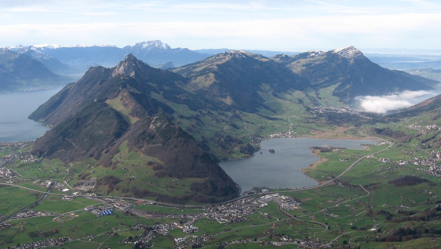
Ägerisee (Lake Aegeri) is a glacial lake in the Swiss canton of Zug, set in the Ägerital valley beside the village of Oberägeri. It sits at roughly 724 m above sea level and covers 7.3 km², about 5 km long and 2 km wide. The deepest point reaches 83 m, with an average depth near 49 m. Two municipalities share the shoreline: Oberägeri and Unterägeri.
What is the lake like?
Glacial erosion carved the basin. The Hüribach stream feeds the lake and the Lorze river drains it. Since 1992 the water has also served as a reservoir. Since 1798 the lake has belonged jointly to the two shore communities.
What can you do at Ägerisee?
Swimming is the main summer draw. The Lido in Unterägeri offers a sandy beach, water slides and diving platforms. Sailing and angling are also possible. Excursion boats have run on the lake since 1890, and a cruise pairs easily with a hike or a bike ride.
An easy walking route follows the shore for about two hours. It starts at the campsite in Unterägeri, crosses a former bog that is now a nature reserve, and ends at the Morgarten bus stop. A tougher option listed on trail portals climbs from Oberägeri to the Gottschalkenberg ridge (about 15.6 km, around 5 hours, medium difficulty). In summer much of the lakeside path lies in shade. Campsites on the shore give direct access to bathing spots.
What is the history behind the lake?
The Morgarten area at the southern end of the lake is linked to the Battle of Morgarten on 15 November 1315. Tradition says a Swiss Confederate force defeated the army of Duke Leopold I of Habsburg here. A memorial and an information centre recall the event today, and a themed trail has seven stations.
How do you get there?
Buses run from Zug to Unterägeri and Oberägeri and stop close to the water. Zurich is under an hour away, so the lake works well as a day trip. The Unterägeri campsite is a convenient starting point for the walking loop.
When should you go?
June to August is best for swimming. In spring and autumn the lake suits walkers and cyclists, and the paths around the water are quieter. Boat services follow a seasonal timetable, so check it before you travel.
Frequently asked questions
How big is Ägerisee? It covers 7.3 km², about 5 km in length and 2 km in width, with a maximum depth of 83 m.
Can you swim here? Yes. The Unterägeri Lido is the most convenient spot, and the lakeside campsites also have bathing access.
Can you walk around the lake? Yes. The easy route from Unterägeri to the Morgarten bus stop takes about two hours and crosses a protected former bog.
Do boats run on the lake? Yes. Scheduled excursion cruises operate, and tourist shipping has existed since 1890.
Nearby places

Earn badges for the places you visit
Download NextOnTrip, discover new places and check off your trails.