Save this place and discover nearby attractions with NextOnTrip
In the app you can add it to your favorites, see what else is worth visiting nearby on the map, and earn a badge for your visit.
The app is available for iPhone and Android.
About this place
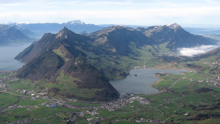
Gottertli is a lookout point at about 1,396 m above sea level, set high above Brunnen in the municipality of Ingenbohl, canton of Schwyz, central Switzerland. It offers a wide outlook over Lake Lucerne and the Alpine valleys of several cantons, and it sits a short walk from the top of the Urmiberg cable car.
Where is Gottertli?
The viewpoint rises above Brunnen, a lakeside hamlet that forms part of Ingenbohl. The municipality is made up of the village of Ingenbohl plus the hamlets of Brunnen, Wilen, Schränggigen and Unterschönenbuch, along with scattered farms. Brunnen is the economic heart of the municipality. The point lies at roughly 47.011° N, 8.578° E, on the ridge system that also carries the Urmiberg.
How do you get to Gottertli?
The easiest way up is the Brunnen–Urmiberg aerial cable car. Its valley station stands at about 436 m and the mountain station at 1,128–1,137 m, depending on the source. From the top a short hike leads to the lookout. A second approach runs via the Gätterli Pass at around 1,180 m.
A popular circuit starts and ends at the Urmiberg mountain station. It covers about 3.3 km and takes around 1 hour 22 minutes. Luzern.com rates it easy, while another listing calls it medium difficulty. A viewing platform is included along the way.
What can you see?
The main draw is the panorama: the surface of Lake Lucerne, the houses of Brunnen far below, and the valleys and peaks of several cantons. Along the routes you pass Egg (about 1,288 m), and Rigi Hochflue (1,698 m) features in descriptions of the Gätterli Pass tours. From the Urmiberg side you can also pick out Frohnalpstock, whose summit holds the highest restaurant in the canton of Schwyz.
How should you plan the trip?
- Time: the loop from the mountain station takes a little over an hour, so half a day is enough including the cable car ride.
- Longer option: the hike via Gätterli back down to the valley station is about 10.2 km and over 4 hours.
- Weather: views are best under clear skies, so check the forecast and cable car timetable before setting out.
- Gear: wear proper hiking shoes, since some stretches of the slope are steep.
Frequently asked questions
How high is Gottertli?
Several route descriptions give about 1,396 m above sea level.
Is the walk to Gottertli difficult?
No. The loop from the Urmiberg mountain station is about 3.3 km and takes just over an hour. The longer variants via Gätterli are noticeably more demanding.
How do I reach Brunnen?
Brunnen lies on Lake Lucerne in the canton of Schwyz. The Brunnen–Urmiberg cable car departs from here, and the trail to the viewpoint continues from its upper station.
What can you see from Gottertli?
Lake Lucerne, the area around Brunnen, and the valleys and mountains of several cantons.
Nearby places

Earn badges for the places you visit
Download NextOnTrip, discover new places and check off your trails.