Save this place and discover nearby attractions with NextOnTrip
In the app you can add it to your favorites, see what else is worth visiting nearby on the map, and earn a badge for your visit.
The app is available for iPhone and Android.
About this place
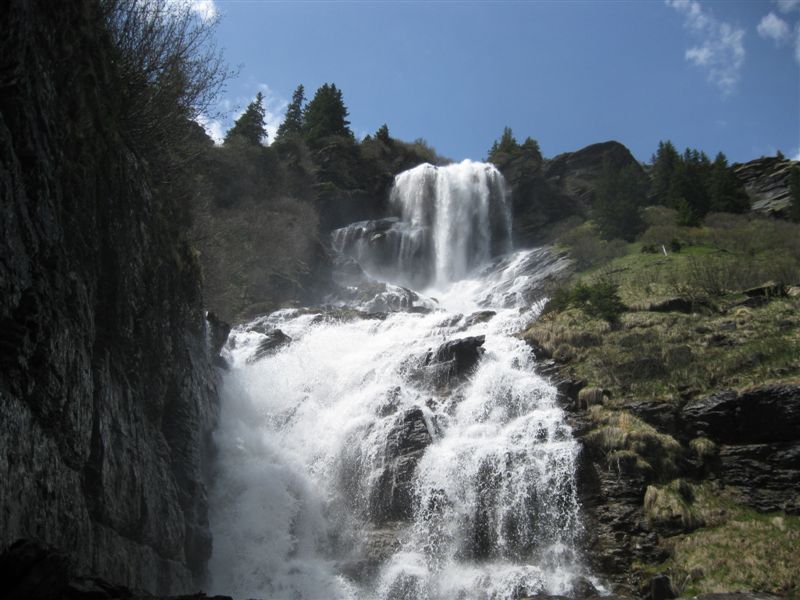
Bachlägerwasserfall is a waterfall above Grindelwald in the Bernese Oberland. It is fed by the Milibach, a stream that starts at the outlet of the Bachalpsee and eventually joins the Schwarze Lütschine in the valley. The water tumbles over several rocky steps, dropping from roughly 1,950 m to about 1,780 m above sea level. The falls sit above the small hamlet of Bachläger, on the ground between the First area and the Grindelwald valley.
What will you see there?
This is not a single sheer drop. The Milibach runs down a series of rock ledges, and smaller streams join it from the sides, so after snowmelt or rain the whole slope is loud with water. Upstream, the creek crosses a moor of national importance, and the surrounding alpine pastures are full of flowers in summer. A flower trail links the Bachalpsee with Bachläger, and hikers on Komoot single it out as one of the prettiest stretches of the route.
How do you get to the waterfall?
The shortest approach is from First, from where a trail of about 30 minutes leads to Bachläger. From Grindelwald itself, the popular option is a loop via the Bachalpsee, described on Komoot and Bergfex. It covers about 20-21 km with around 1,270 m of ascent and takes roughly 7.5 hours. Komoot rates it hard, with very good fitness required. Bergfex puts the waterfall about 6.4 km from Grindelwald. Bring hiking boots, layers for changeable weather and plenty of water.
When should you go?
Trails here are normally open in summer and early autumn, and the falls run strongest after the snow melts. On the first Sunday of July, Alp Bachläger hosts the Bachlägerchilbi, an annual yodelling festival (5 July in 2026). Check current trail conditions before setting out, as snow patches can linger higher up.
Why do locals care about this waterfall?
In 2009 the utility BKW planned a small hydropower plant here. Residents founded an association in July 2009 to protect the falls and the stream, and in February 2010 they handed the Grindelwald municipality a petition with 1,667 signatures. The project was put on hold, and the local association later had the falls assessed as worthy of protection under cantonal criteria. The site is now known as an example of local campaigning for a natural landmark.
What can you combine with the hike?
The falls fit naturally into one outing with the Bachalpsee, one of the most photographed lakes in Switzerland, famous for mirror reflections of the peaks. The First area adds more trails and viewpoints, so you can shorten or lengthen the loop to suit your legs.
Frequently asked questions
Where does the water of Bachlägerwasserfall come from? From the Milibach, a stream that leaves the Bachalpsee and flows down to the Schwarze Lütschine.
How long is the walk from First? About 30 minutes on the trail from First to Bachläger.
Is the route from Grindelwald difficult? The Bachalpsee loop is around 20 km with about 1,270 m of climbing, so it counts as a demanding full-day hike.
Was the waterfall ever under threat? Yes, from a planned small hydropower plant. Residents' protests and a petition with 1,667 signatures led to the project being suspended.
Nearby places

Earn badges for the places you visit
Download NextOnTrip, discover new places and check off your trails.