Mountains and trails in Italy
A guide to 52 Mountains and trails in Italy — with descriptions, photos and traveler visits from the NextOnTrip community. Locations spread across 49 cities and towns. Most visited by the community: Testa del Mater, Kleiner Laugen, poggio di Petto.
-
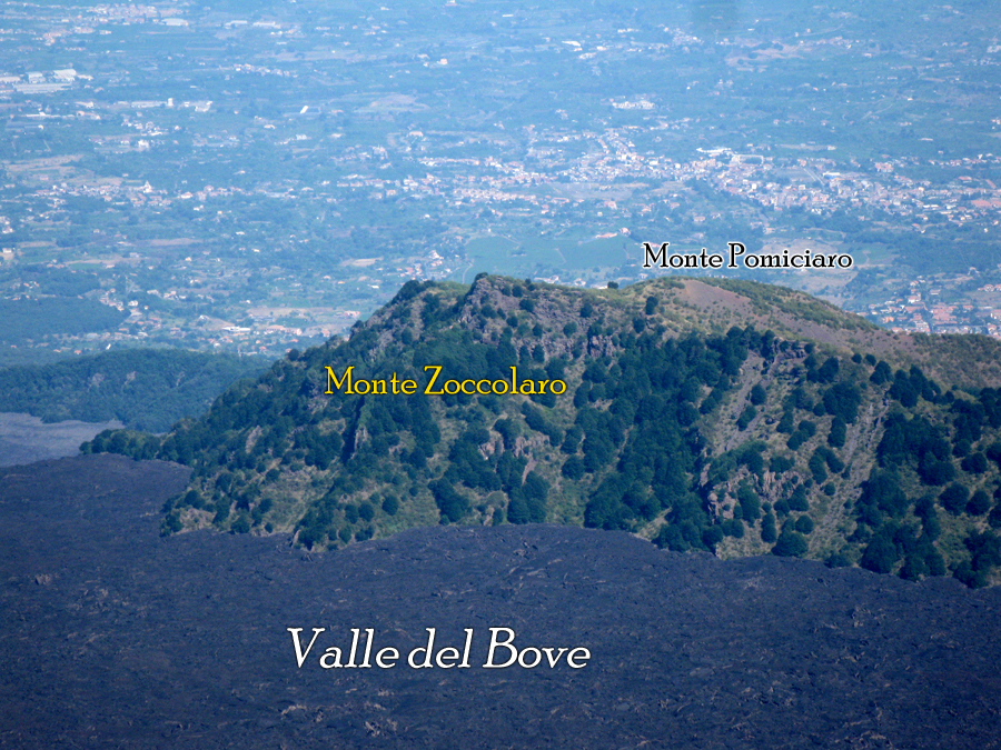
Monte Zoccolaro
Zafferana Etnea
Monte Zoccolaro is a rocky ridge on the eastern flank of Mount Etna, within the municipality of Zafferana Etnea in the province of Catania. Its summit reaches 1,739 metres above sea level and offers one of the most striking viewpoints in this part of the volcano park. Where does this peak come from? Zoccolaro isn't a volcano of its own — it's part of a wider rock formation known as Schiena dell'Asino (literally "the donkey's back"), which closes off the southeastern edge of Valle del Bove, the immense horseshoe-shaped depression carved into Etna's slope. The whole structure formed after the collapse of two older volcanic centres, Trifoglietto I and II, Etna's predecessors, roughly 64,000 years ago. What you see on the trail today are the frozen remains of that collapse: layers of lava and pyroclastic material exposed along the path. How do you get to the top? The hike starts at around 1,472 metres and follows a roughly 2-kilometre trail to the summit. It's short but steep — more of an intense climb than a long trek. Morning or late afternoon is the best time to start, when the sun isn't directly overhead and visibility tends to be at its clearest. What will you see from the summit? The top, marked by a metal cross, opens onto a full 360-degree panorama. Looking north you get Etna itself and the interior of Valle del Bove; to the east, the bay around Giardini Naxos and the outline of Taormina; to the south, the whole Ionian coastline. Few spots let you take in both the volcano and the sea in a single glance. The cross and the annual pilgrimage The cross at the summit has a story behind it. On 14 September 1948, a priest and a group of parishioners carried it up and placed it there, and the spot has been the destination of an annual pilgrimage ever since, held on the second Sunday of September. It's an unusual pairing of a hiking route with a living local religious tradition from the Etna area. When should you visit? Spring and early autumn are the best seasons: temperatures at over 1,700 metres stay comfortable and visibility is usually excellent. Summer heat makes the climb harder, while winter can bring icy patches on the trail that call for proper gear. The second Sunday of September is worth choosing if you want to combine the hike with the local pilgrimage — just expect more people on the path that day. Frequently asked questions How high is Monte Zoccolaro? The summit sits at 1,739 metres above sea level. How long does the hike to the top take? The trail is about 2 km, starting from roughly 1,472 metres — expect one to two hours depending on fitness level. Can you see the sea from the top? Yes, the summit offers views of the Ionian coast, the bay of Giardini Naxos, and Taormina. What is the cross at the summit about? It was placed there in 1948 and has marked the site of an annual pilgrimage held every second Sunday of September ever since.
-
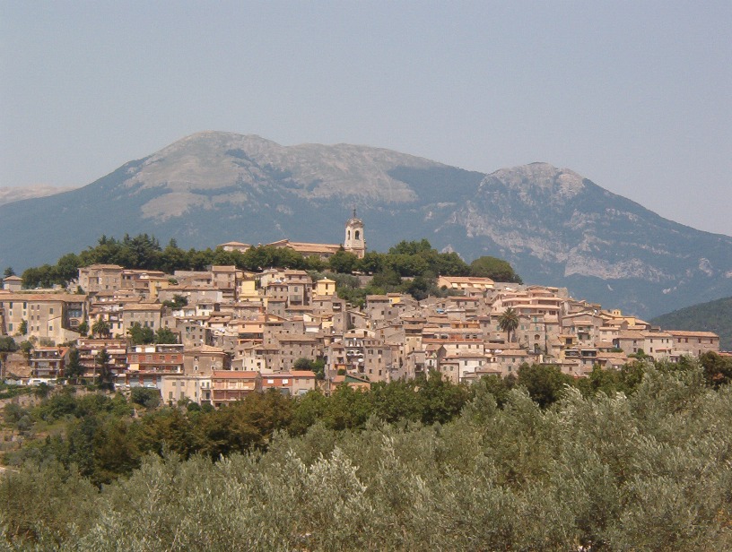
Monte Monna
Vico nel Lazio
Monte Monna is one of the main peaks of the Monti Ernici range, rising above Vico nel Lazio in the province of Frosinone, Lazio. At 1,952 meters above sea level, it's one of the most prominent landmarks in this stretch of the central Apennines. Vico nel Lazio itself sits at the foot of the mountain, perched on a limestone outcrop at 721 meters above sea level. This small, fortified medieval town holds the Bandiera Arancione (Orange Flag) designation, an award from the Touring Club Italiano recognizing towns with strong tourism and environmental standards. Its old town, with intact defensive walls and narrow lanes, makes a natural starting point before heading into the mountains. How do you get to the summit? The most demanding but also most rewarding route runs directly from Vico nel Lazio. The trail climbs through extensive beech forests covering the slopes of Monte Monna and counts among the tougher ascents in the whole Ernici range — plan for a full day and proper hiking boots. An easier alternative starts from the Campocatino plateau, at 1,792 meters. From there, a roughly 13-kilometer route with about 450 meters of elevation gain leads to the summit, a much gentler climb than the approach from Vico nel Lazio. More experienced hikers can also tackle a loop via Monte Vermicano, starting at Colle Pannunzio (reachable from Frosinone heading toward Fiuggi and then Guarcino), which takes about five hours. What will you see at the top? The name "la Monna" likely comes from the local dialect word "monnata," referring to peeling fruit — the summit is nearly stripped of vegetation, "peeled" much like a piece of fruit. That contrast between the lush beech forest on the slopes and the bare, rocky summit dome is one of the most distinctive features of the landscape here. From the top, a sweeping panorama opens over Ciociaria, the Sacco Valley and the area around Alatri, and on clear days you can pick out the Gran Sasso, the Monti Lepini, the Circeo promontory and Lake Canterno. It's one of the best viewpoints in the entire central Apennines. The mountain's slopes also hold the source of the Cosa River, a tributary of the Sacco, and the massif is known for an extensive karst cave system, among the most complex in all of Lazio. When should you go? Late spring and early autumn offer the best conditions, with moderate temperatures and the beech forest at its most striking — vivid green in spring, gold and red in autumn. Summer brings busier trails, especially on weekends, while winter ascents can require proper snow gear, since the upper sections hold snow and ice. Frequently asked questions How high is Monte Monna? The summit reaches 1,952 meters above sea level, making it one of the highest points in the Monti Ernici range. Is the route from Vico nel Lazio difficult? Yes, it's one of the more demanding paths to the summit — a long, steep climb through beech forest. Hikers looking for an easier option can start from Campocatino instead. Is water or a shelter available on the mountain? Bring your own water supply for the hike; the source of the Cosa River lies on the slopes, but it shouldn't replace proper preparation. What's worth seeing in Vico nel Lazio itself before heading into the mountains? The medieval defensive walls, narrow lanes and historic center of this Bandiera Arancione town make a good warm-up stop before the trek.
-
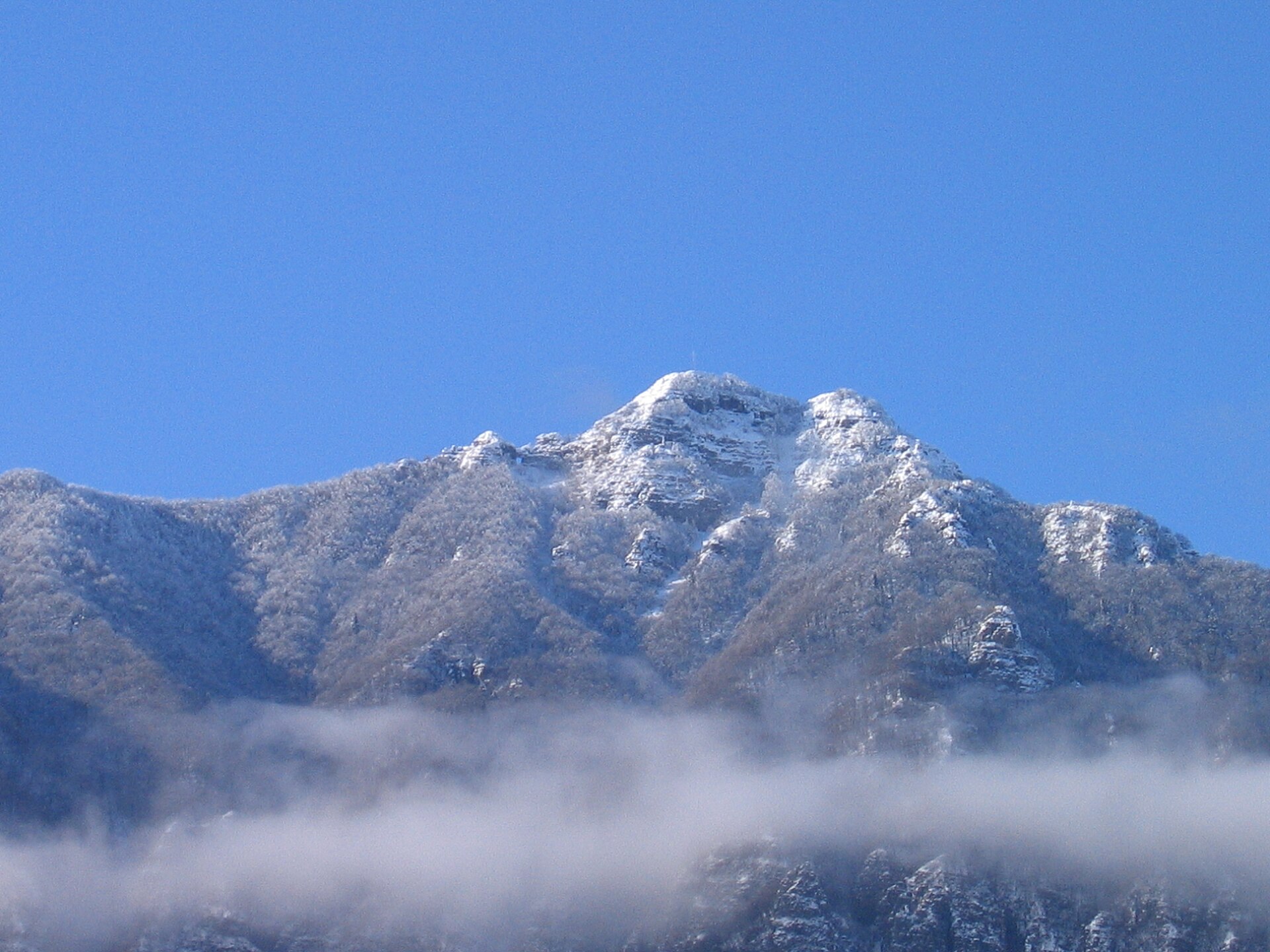
Monte Priaforà
Posina
Monte Priaforà rises above the municipality of Posina in the Province of Vicenza, in Italy's Veneto region. Reaching 1,659 metres, it forms part of the Piccole Dolomiti (Little Dolomites) range together with the neighbouring Cima Palon, one of the more distinctive ridgelines in this stretch of the Venetian Prealps. Where is Monte Priaforà located? The mountain sits in the northern part of the Province of Vicenza, within the municipality of Posina, close to the border with Trentino-Alto Adige. Its summit lies at roughly 45.787°N, 11.319°E. Together with Cima Palon, it belongs to the Piccole Dolomiti chain — a lower but geologically related counterpart to the famous Dolomites, running along the boundary of the Vicenza, Trento and Verona provinces. What is the mountain made of? Like the surrounding peaks of the Piccole Dolomiti, Monte Priaforà is built from sedimentary rock dating to the Triassic and Jurassic periods. This geology — limestone and dolomite formed on the floor of ancient seas — explains the steep, jagged faces typical of the whole range, even though the summits themselves aren't dramatically high compared with the main Alps. What history does this area hold? Monte Priaforà lies within the Ecomuseo della Grande Guerra nelle Prealpi Vicentine, an ecomuseum dedicated to the First World War heritage of the Vicentine Prealps. This section of the Prealps formed part of the Italian-Austrian front, and the terrain around Posina and the surrounding peaks still holds traces of fortifications, trenches and supply paths from 1915–1918. As a result, hikes through this area combine mountain scenery with direct contact with military history. How do you get there, and when is the best time to visit? Posina serves as the natural starting point for exploring Monte Priaforà, with trails leading into the heart of the Piccole Dolomiti. Late spring through early autumn is the best window for hiking, when paths are dry and free of snow — in winter and early spring, the higher sections of the ridge can stay snow-covered and demand more experience and the right equipment. Plan for a full day out, since weather in the Prealps can change quickly. What will you see along the way? From the ridge near Monte Priaforà and Cima Palon, views open out over the jagged limestone crests of the Piccole Dolomiti and the valleys of the Province of Vicenza. Along the way, hikers can come across remnants of Great War fortifications that form part of the ecomuseum's themed route. This blend of geological landscape and twentieth-century history makes the area worthwhile both for hikers and for anyone interested in WWI history. Frequently asked questions How high is Monte Priaforà? The summit reaches 1,659 metres above sea level and belongs to the Piccole Dolomiti range. Which municipality is the mountain in? Monte Priaforà lies within the municipality of Posina, in the Province of Vicenza. Are there First World War remains on the mountain? Yes — the area is part of the Ecomuseo della Grande Guerra nelle Prealpi Vicentine, which documents the heritage of the Italian-Austrian front in this part of the Prealps. When is the best time to hike here? Late spring through early autumn is ideal, when trails are clear of snow and ice.
-
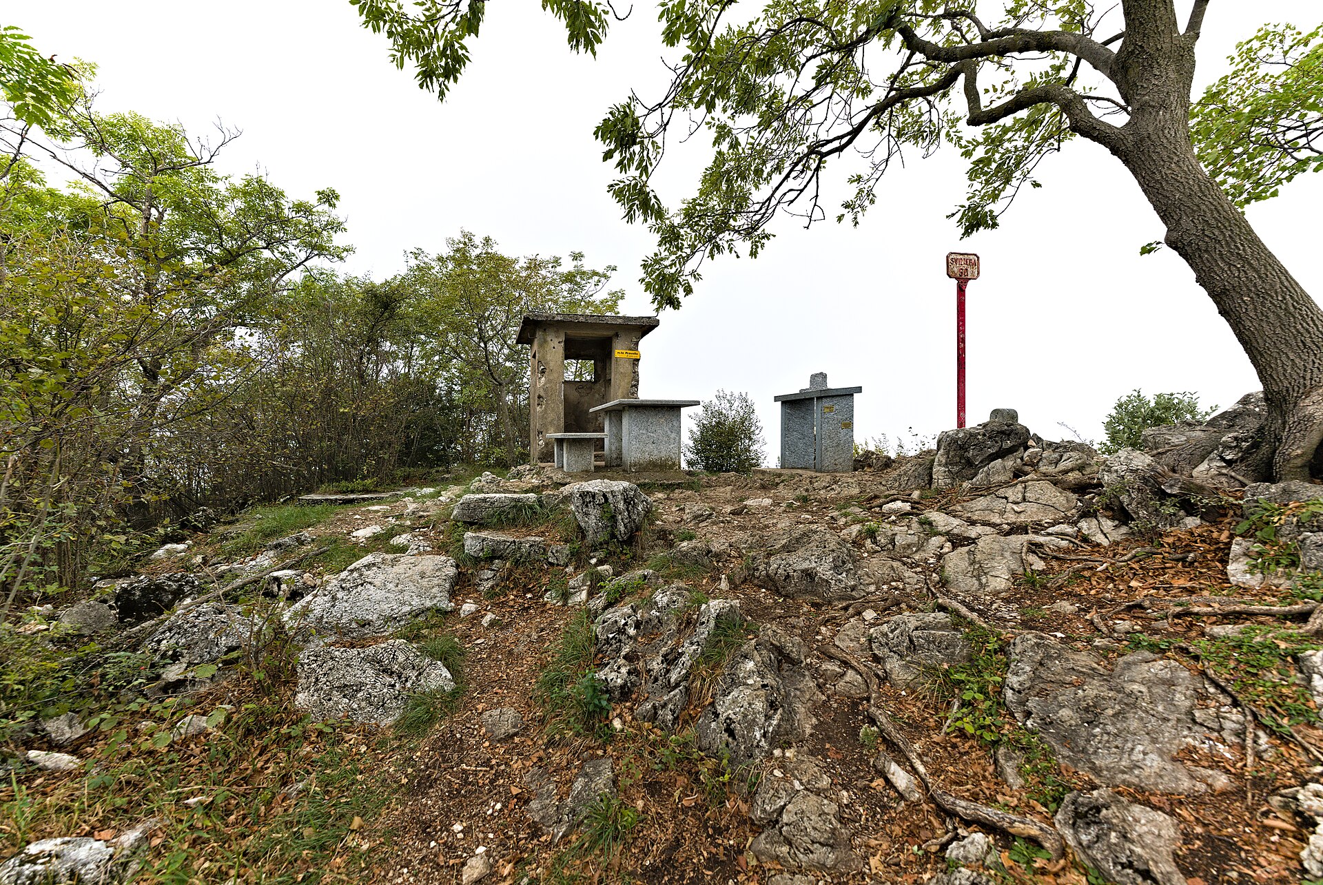
Monte Pravello
Mendrisio
Monte Pravello is a summit in the Lugano Prealps, situated in the municipality of Mendrisio in Canton Ticino, right on the Swiss-Italian border. It rises to 1,015 metres above sea level and offers one of the finest viewpoints over Lake Lugano from this corner of southern Switzerland. What will you find at the top? The north summit of Monte Pravello is marked by a stone cross, with a bench and table positioned nearby — a natural resting spot with open views across the lake and the surrounding ridgelines. Remnants of a wartime bunker are embedded into the hillside close to the peak, adding an unexpected layer of history to the walk. About 340 metres southwest of the summit, Rifugio Monte Pravello operates as a mountain hut serving hikers with refreshments. The route to the summit passes through the village of Arzo, historically known for its marble quarries. Marble was extracted here since antiquity, and Roman-era finds have been documented in the area. The white stone was traded widely throughout the region. Monte Pravello sits in close proximity to Monte San Giorgio, which holds UNESCO World Heritage status for its exceptional fossil record from the Middle Triassic period. Combining both peaks in a single circular route is a popular option among day hikers in the area. How do you get there? The main access points are Mendrisio town and the villages of Arzo and Meride. Mendrisio is well served by rail, and local bus connections run to Arzo and Meride. From Meride, several marked trails lead up to Monte San Giorgio and across the ridge to Monte Pravello. The standard ascent is rated T1 (easy mountain hiking), though the total elevation gain from the valley is around 400–500 metres. Trails pass through mixed forest before opening onto the exposed ridge, where views extend southward into Italy. When is the best time to visit? The hiking season runs from spring through autumn, with April to October being the most reliable months. Autumn brings exceptional colour to the forests on both sides of the border, making October a particularly rewarding time to visit. There is no ski infrastructure here; in winter, the upper trail can become icy and is less suitable for casual walkers. Weekday visits are quiet. Summer weekends attract more foot traffic, especially on the Monte San Giorgio – Monte Pravello circuit, which is one of the more popular loop hikes in the Mendrisio district. Frequently Asked Questions Is the hike to Monte Pravello suitable for beginners? Yes. The trail is rated T1, which means it is appropriate for anyone with a reasonable level of fitness and sturdy footwear. No climbing gear or technical skills are required. How long does it take to reach the summit? From Arzo or Meride, allow approximately 2 to 2.5 hours for the ascent. The full circular route including Monte San Giorgio takes 4 to 5 hours. Is there food available on the mountain? Rifugio Monte Pravello, located just below the summit, offers snacks and drinks during its open season. At the very top, the bench and table next to the stone cross make a good spot for a packed lunch. Is Monte Pravello in Switzerland or Italy? The summit sits on the Swiss-Italian border. Trails start predominantly from the Swiss side — Mendrisio, Arzo, and Meride — but the ridge itself runs along the boundary line between the two countries.
-
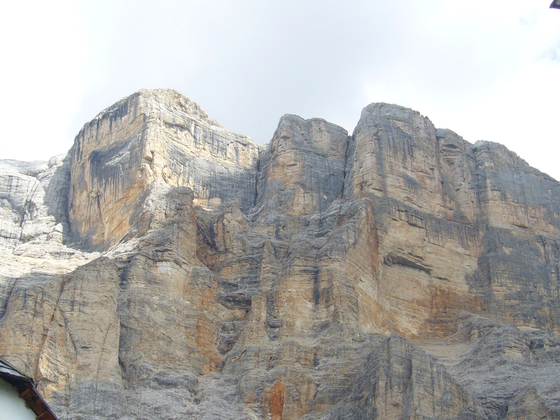
Sas dla Crusc
Badia - Abtei
Sas dla Crusc — known in German as Heiligkreuzkofel and in Italian as Sasso della Croce — rises to 2,907 metres in the Alta Badia area of South Tyrol, Italy. The massif stands out as one of the most recognisable rock formations in the central Dolomites, visible from a wide arc of surrounding trails and valleys. How do you get there? The village of Badia in the Val Badia valley is the natural starting point. A chairlift called Santa Croce runs from Badia up to the La Crusc platform, cutting the initial ascent to a few minutes. Walking the same distance takes about an hour. By car, Bolzano is roughly 1.5 hours away; Cortina d'Ampezzo is a similar distance from the opposite direction. SAD regional buses serve the valley throughout the year, with more frequent schedules in summer. What will you find at the summit? The top opens onto a sweeping panorama of the central Dolomites, including the Fanes-Sennes massif, the Puez-Odle group, and — on clear days — the distant spires of Tre Cime di Lavaredo. The summit plateau also holds the remains of an old sanctuary, which gave the mountain its Ladin name: sas dla crusc means "rock of the cross." On clear autumn days the northern horizon reveals the Austrian Alps. How do you climb it? The standard route follows a via ferrata up the western face. The first iron fixtures appear about 40 minutes above La Crusc, followed by roughly 1.5 hours of protected climbing on exposed rock. The angle eases as you gain the high plateau, and a short walk leads to the true summit. Total time from Badia is around 3 hours. The route is graded suitable for beginners, though it demands a good level of fitness and proper gear: harness, via ferrata set, helmet, and mountain boots are all required. An alternative approach traverses through Rifugio Fanes (Fanes Hut), connecting Sas dla Crusc with the wider Fanes-Sennes-Braies Nature Park and allowing a longer multi-day circuit. When is the best time to visit? The climbing season runs from June to September. July and August see the best-prepared trails and the most activity on the mountain. September is quieter, with stable weather and early autumn colour on the slopes below the rock band. Outside these months, snow lingers on the eastern faces and the via ferrata becomes a serious winter undertaking requiring crampons and ice tools. Frequently asked questions Is Sas dla Crusc suitable for families with young children? The via ferrata section is not appropriate for small children. Families who want the views without technical climbing can stop at the La Crusc chairlift station — the outlook across the Alta Badia valley and onto the rock face is already impressive from there. What equipment do I need? A via ferrata harness with lanyards, a helmet, and sturdy mountain boots are the minimum. Equipment can be hired at outdoor sports shops in Badia and San Cassiano. How long does the full outing take? A loop from Badia — ascending via the via ferrata and descending on a separate trail — takes 5–6 hours. Using the chairlift in one direction cuts roughly an hour off that. Is there a mountain hut near the summit? There is no hut on the summit itself. Rifugio Fanes lies a few kilometres away and can be reached via the Fanes-Sennes-Braies Nature Park. Staying overnight there makes it easy to combine the Sas dla Crusc climb with a longer trek through the Ladin Dolomites.
-
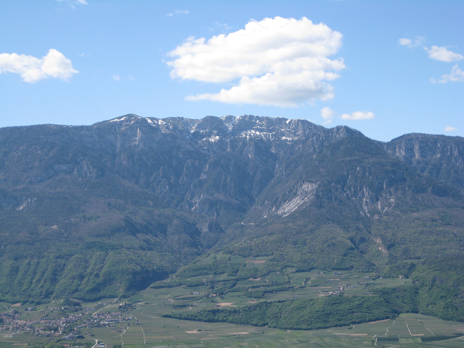
Roen
Tramin an der Weinstraße - Termeno sulla Strada del Vino
Roen is the highest peak of the Nonsberg group in the Eastern Alps, situated on the border between Trentino and South Tyrol in northern Italy. The mountain rises above the Val di Non valley, renowned for its apple orchards, and draws hikers with views stretching from the Dolomites to the Ortler massif. What Will You See at the Summit? From the top of Roen the panorama spans a wide arc across northern Italy. On a clear day the Dolomite ridges appear to the east, the snow-capped Ortler group stands to the northwest, and the patchwork of apple orchards in the Val di Non valley spreads out far below. The summit sits on the administrative boundary between two regions — Trentino and South Tyrol — which means hiking routes approach from both sides. How Do You Get to Roen? The main starting point from the Trentino side is the village of Proves, known as Proveis on the South Tyrolean side. Trails are well marked and suited to hikers with average fitness. Ascent time varies by route, but a typical climb takes several hours. By car, Proves is reachable via the road from Cles or from the Passirio valley to the north. When Is the Best Time to Visit? The hiking season runs from late spring through early autumn. July and August offer the best trail conditions, though the summit can be busier during peak summer weeks. June and September tend to be quieter while still providing reliable views. In winter the area is snow-covered and reaching the top requires alpine experience and appropriate gear. Frequently Asked Questions How high is Roen? Roen stands at 2,116 metres above sea level, making it the highest point of the Nonsberg group in the Eastern Alps. Is the hike to Roen difficult? Standard trails are designed for fit leisure hikers without technical climbing equipment. Good trekking boots are essential, and layers are recommended because summit temperatures can be considerably lower than in the valley. Are there other attractions near Roen? The Val di Non is known for its DOP-certified apple production and for Castel Thun, a well-preserved medieval castle open to visitors. The valley's main town, Cles, provides access to Lake Santa Giustina. Where does the shortest approach begin? The shortest routes start from the Proves/Proveis area on the Trentino–South Tyrol border. Checking an up-to-date trail map before setting out is advisable, as path availability can vary by season.
-

punta Masiennera
Anela
Punta Masiennera is a rocky peak reaching 1,157 metres, rising at the heart of the Goceano mountain chain within the municipality of Anela, in north-central Sardinia. It's a favourite hiking destination in the area, known for sweeping panoramas and the ancient forest that surrounds it. Where is Punta Masiennera located? The peak sits inside Foresta di Anela, one of Sardinia's oldest state forests, established back in 1886. Punta Masiennera stands right next to the slightly taller Punta Masiedda (1,158 m), the highest point of the entire Goceano range. Together the two summits form a distinctive rocky silhouette visible from a considerable distance. How do you get to the top? Marked hiking paths cross the Anela forest on the way to Punta Masiennera, and the route is popular with local hikers and organised groups, including sections of the Italian Alpine Club (CAI). The trail winds through dense woodland, gradually opening up wider views as it climbs toward the rocky summit. No technical climbing gear is needed — it's a straightforward mountain walk suited to anyone with average fitness. What will you see at the summit? The rock forming Punta Masiennera consists of sharply shaped boulders made of acidic metavolcanic rock, dated to roughly 470 million years old — placing its origin in the mid-Ordovician period. That geological age explains the rugged, weathered look of the summit, where bare rock formations rise above the tree line. From the top, the panorama stretches a full 360 degrees: you can pick out the hills around Pattada, the coastline near Bosa, the Gallura mountains, Monte Corrasi, and the distant Gennargentu massif, Sardinia's highest range. Few viewpoints in the region let you take in both mountains and sea in a single glance. What vegetation surrounds the peak? The slopes of Punta Masiennera are covered by dense holm oak forest, mixed in places with holly. Around the Masiennera area itself grow notable Atlas cedars, encircling clearings within the woods. In spring, those clearings turn into colourful wildflower meadows, making the season especially rewarding for hikers and nature photographers. When is the best time to visit? Spring is the ideal season — the meadows around the Atlas cedars are in full bloom and temperatures suit longer hikes comfortably. Summer heat in this part of Sardinia can be intense, though the thick forest cover offers shade along most of the trail. Autumn and winter bring clearer air and better long-range visibility toward the distant ranges, but expect cooler conditions and occasional rain. Frequently asked questions How high is Punta Masiennera? The peak reaches 1,157 metres and sits right beside Punta Masiedda (1,158 m), the highest point of the Goceano range. Do you need climbing experience to reach the top? No — it's a forest hiking trail suited to average fitness levels, requiring no technical climbing gear. What can you see from the summit? A 360-degree panorama covering the Pattada hills, the Bosa coastline, the Gallura mountains, Monte Corrasi, and the Gennargentu massif. What forest surrounds Punta Masiennera? Foresta di Anela, one of Sardinia's oldest state forests, established in 1886, covered in holm oak, holly, and Atlas cedars.
-
monte Mutria
Cusano Mutri
Monte Mutria is a mountain peak rising above the town of Cusano Mutri, in the province of Benevento, in the Campania region of southern Italy. The peak reaches 1,822 meters above sea level and belongs to the Matese range, part of the central-southern Apennines. It sits in the eastern portion of the massif, right on the boundary between the Molise and Campania regions, making it a natural landmark shared by both sides of the mountains. Cusano Mutri, which lends the peak the second part of its name, lies at its foot on the Campania side and is the most obvious starting point for anyone planning to reach the summit. Where exactly is Monte Mutria? The peak stands at the eastern edge of the Matese massif — a range that separates the Volturno river valley from the higher terrain of Molise. The administrative border between the two regions runs precisely through this part of the mountains, which is why Monte Mutria is often described as sitting "at the crossroads" of Molise and Campania. Its coordinates are roughly 41.385°N, 14.523°E. How do you get to Monte Mutria? The most convenient starting point is Cusano Mutri, a small town lying directly at the mountain's base on the Campania side. From the town center and the surrounding access roads, trails climb gradually into the higher parts of the massif, eventually reaching the ridge and the summit itself. By car, you can reach parking areas at the edge of town or along the roads leading toward the mountains, and cover the rest of the route on foot. Given the mountainous terrain, it's worth allowing enough time for the ascent and checking weather conditions before setting out. What will you see along the way and at the top? Matese is one of the less crowded mountain ranges in southern Italy, which translates into quieter trails than those found in more famous parts of the Apennines. The lower slopes of Monte Mutria are covered in forest, while higher up the landscape becomes rockier and more open. From the ridge and the area around the summit, views stretch across the valleys on both sides of the massif — toward Molise and toward Campania — and on clear days you can also spot neighboring peaks of the Matese range. It's a destination for travelers looking to experience the mountain scenery of central-southern Italy without the crowds typical of more touristy summits. When is the best time to visit? Spring and autumn bring the most stable weather and moderate temperatures, making them ideal for longer hikes. In summer, the higher parts of the mountain offer natural relief from the heat of the Campania lowlands, though an early start is recommended. In winter, the summit can be covered in snow, and reaching it requires more experience and proper equipment due to the rocky terrain and changeable conditions. Frequently asked questions How high is Monte Mutria? The peak reaches 1,822 meters above sea level. Which region is Monte Mutria in? It lies on the border between Molise and Campania, in the eastern part of the Matese massif. Is Monte Mutria close to Cusano Mutri? Yes, the mountain rises directly above the town, on the Campania side of the Matese range. Is the hike to the summit difficult? It requires good fitness and mountain navigation skills — the upper sections are rocky and weather can change quickly, so checking the forecast beforehand is recommended.
-
Monte Faete
Vallerona
Monte Faete is a modest hill above the village of Vallerona, in the municipality of Roccalbegna, tucked into the southern Maremma countryside in the shadow of Monte Amiata. It's a spot for travelers looking for a quiet corner of Tuscany far from the Val d'Orcia crowds — a rocky ridge, old chestnut groves, and views over the Albegna river valley. Where exactly is Monte Faete? The hill sits at the south-western edge of Roccalbegna's territory, close to the village of Triana, which shares a similar elevation. The summit reaches roughly 767 metres above sea level, in the transition zone between the rolling Maremma hills and the steeper slopes of Amiata. The landscape shifts noticeably as you climb: olive groves and vineyards lower down, giving way to beech and chestnut woods higher up. What is there to see? On the slope of Monte Faete stands the former hermitage of San Cristoforo della Selva. For centuries it served a religious purpose before being deconsecrated and converted into agricultural buildings — a quiet witness to how both faith and farming have shaped this stretch of Tuscany. The summit itself has no grand monuments, and that's part of its appeal: this is a place for walkers, cyclists, and anyone chasing silence rather than a stop on the mass-tourism trail. From the upper slopes, the view opens onto the Albegna valley and the surrounding hills of Roccalbegna — worth bringing a camera, since the late-afternoon light here can be striking. How do you get to Monte Faete? A car is the easiest option — Vallerona lies on a local road connecting Roccalbegna to the Albegna valley, within reasonable reach of Grosseto and the Siena–Grosseto highway. The final approach to the summit is short but demanding: about 1.2 km of road with nearly 70 metres of elevation gain at an average gradient around 6%. That makes it a popular short training climb for road cyclists — a brief, intense effort rewarded with a view at the top. Walkers can cover the same stretch comfortably in under an hour, with a natural stop at the hermitage along the way. When is the best time to visit? Spring (April to June) and early autumn (September and October) are the most pleasant seasons, with mild temperatures and the surrounding hills turning green or taking on the chestnut trees' autumn colours. Summer afternoons can get hot, so it's best to plan the climb for morning or evening. In winter the road tends to be quiet and empty, which suits those after a peaceful walk, though it can get chilly at altitude. Frequently asked questions Do you have to walk up Monte Faete, or can you drive? The road runs close to the summit, but the final stretch is a steep climb — it's best to park lower down and cover that last part on foot or by bike. What is the San Cristoforo della Selva hermitage? A former religious site on the hillside that was later deconsecrated and turned into farm buildings — an interesting trace of the area's history. Is Monte Faete suitable for families with children? Yes, the short walk to the top is manageable even with younger kids, though the final section can be steep. How far is Vallerona from Monte Faete? The village sits at the foot of the hill, within the municipality of Roccalbegna — just a few minutes' drive or a short walk away.
-
Punta Palai
Bolòtana/Bolotana
Punta Palai rises above the town of Bolòtana, in the province of Nuoro, Sardinia, reaching an elevation of 1,200 metres. It forms part of the Marghine-Goceano mountain chain and ranks among its highest peaks, alongside nearby Monte Lammeddari (1,118 m). The wider massif, stretching from Montiferru to the mountains near Alà, is built from volcanic rock — basalt, trachyte, andesite and rhyolite — giving the surrounding slopes a distinctly rugged character. How do you get there? Most hikes to Punta Palai begin at the megalithic stone circles of Ortachis, just above Bolòtana. From there the trail climbs gently through holm oak and maple woods toward the ridge of the Marghine massif. A typical circular route linking Ortachis, Punta Palai, Badde Salighes and the Pabude park covers about 13 km with roughly 350 metres of elevation gain, taking around six hours to complete. The path is graded easy and suits most hikers with average fitness. What will you see? A fire lookout tower stands on the summit, and from here one of the widest panoramas in Sardinia unfolds. On a clear day you can pick out the island of Asinara to the north, the Gulf of Oristano to the west, the Gennargentu massif to the south, and even the mountains of southern Corsica on the horizon. Closer at hand, the whole Ottana plain spreads out below, with Bolòtana itself visible at the mountain's foot. Along the way, it's worth stopping at the Ortachis archaeological site, considered a sacred place since the Neolithic (around 3000 BC), at the Mularza Noa waterfall, and in the Pabude park, home to centuries-old yew trees. The summit also holds the gravestone of Gerald Piercy, a member of the Welsh Piercy family who died in a car accident in 1923 — a quiet reminder of the family's long ties to Bolòtana and this mountain. When should you visit? At this altitude the climate is noticeably cooler than on Sardinia's coast. Rainfall, averaging 1,200–1,300 mm a year, is concentrated in autumn and winter. Snow falls between November and March and can settle up to a metre deep — an unusual sight on an island better known for its sea and sun. Spring and early autumn remain the best times for hiking, offering mild temperatures and the clearest views from the summit. Frequently asked questions How high is Punta Palai? The peak reaches 1,200 metres above sea level, making it one of the highest points in the Marghine-Goceano range. How long does it take to reach the summit? The full loop covering the area's main sights (Ortachis, Punta Palai, Badde Salighes, Pabude) is about 13 km long and takes roughly six hours, with 350 metres of elevation gain. What can you see from the top? On clear days you can spot Asinara island, the Gulf of Oristano, the Gennargentu massif, and even the mountains of southern Corsica, plus the Ottana plain with Bolòtana below. Does it snow on Punta Palai? Yes — snowfall occurs between November and March, occasionally building up to a metre deep, a rare feature on an island typically associated with a Mediterranean coastal climate.
-
Sas dales Diesc
La Val - Wengen - La Valle
Sas dles Diesc is a striking rock peak towering above the Val Badia valley, right next to the village of La Val in Alta Badia, in the heart of the Dolomites. Known in Italian as Sasso delle Dieci and in Ladin as Sas dles Diesc — the language still spoken in this part of the Dolomites — the mountain rises to 3,026 metres above sea level. It is the highest point of the Sasso di Santa Croce group, itself part of the wider Fanes group. Its sharply pyramidal shape makes it one of the most recognisable landmarks visible from viewpoints around La Val. Where exactly is this peak located? Sas dles Diesc sits on the western edge of the Fanes massif, right on the boundary of the Fanes-Sennes-Braies Nature Park. Reaching it means crossing one of the wildest and best-preserved natural areas in the entire Dolomites. Because the peak dominates the Val Badia valley below, both its slopes and the approach trails offer sweeping views across the valley and the surrounding summits. How do you get to the trail leading up to it? The starting point for tackling Sas dles Diesc is the Lavarella mountain hut, set among the Fanes Piccola pastures. From there, trail no. 7 heads toward Jú dla Crusc, taking hikers almost to the very base of the peak, just below the summit of Sasso Croce. La Val, recognised as South Tyrol's first certified hiking village, serves as the natural launchpad for excursions into the Fanes-Sennes-Braies Nature Park and makes a convenient base for anyone planning a longer stay in the area. How difficult is reaching the summit? Walking the marked trail up to the foot of Sas dles Diesc requires no climbing skills and is manageable for experienced hikers. Things change on the final stretch to the actual summit: the ridge there is highly exposed, calling for good fitness, agility and prior high-mountain experience. Anyone uneasy with heights should turn back before this section. Given the exposure and technical nature of the last stretch, hiring a local mountain guide is strongly recommended. When is the best time to visit? Summer, from June to September, is the ideal window for exploring the Sas dles Diesc area, when the high-altitude trails are free of snow and huts such as Lavarella are open and staffed. Early in the season, patches of snow can still linger on the upper ridge, adding extra difficulty to the final approach. Frequently asked questions How tall is Sas dles Diesc? The peak reaches 3,026 metres above sea level and is the highest summit of the Sasso di Santa Croce group in the Dolomites. Where's the best place to start the hike? The Lavarella hut on the Fanes Piccola pastures is the most convenient starting point, with trail no. 7 leading toward Jú dla Crusc almost to the foot of the peak. Can you reach the summit on your own? The approach to the base of the mountain suits experienced hikers, but the final, heavily exposed ridge section requires a qualified mountain guide. Why does the mountain have two different names? Sasso delle Dieci is the Italian name, while Sas dles Diesc is the Ladin form used around La Val, where Ladin remains the traditional language of the local community.
-
Monte Caprara
Marzabotto
Monte Caprara rises to 632 meters in the Bolognese Apennines, entirely within the municipality of Marzabotto and at the heart of the Monte Sole Historical Park. It's a place where hiking trails and one of Italy's most sobering wartime histories meet on the same ridge. How do you get to Monte Caprara? Most trails start from Marzabotto itself, reached by car from Bologna in roughly 40 minutes along the Reno valley toward the Apennines. Once there, stop at the park's information point for a trail map — the network of paths is extensive and crosses itself at several junctions, so a map genuinely helps. What will you see along the way? Climbing Monte Caprara is usually combined with a walk over neighboring Monte Sole: a roughly 14.8 km loop rated moderate, running along open ridgelines with views over the Reno valley and the wider Apennine range. For those wanting more, a longer route from Marzabotto covers about 18.4 km with 900 meters of elevation gain, typically completed in under six hours. The park maintains more than 35 marked trails across difficulty levels — around five easy routes, nearly thirty moderate ones, and a handful demanding real stamina. On Monte Caprara's slopes, remnants of the Gothic Line's defenses are still visible: trenches, defensive positions, and shelters used by German forces during the winter of 1944–45, when the front stalled in this exact area for months. The ridge linking Monte Sole, Monte Venere, and Monte Caprara, sitting between 800 and 1000 meters, served as a key connecting route between Bologna and the front line at the time. A particularly significant stop on the trail is the Rovine di Caprara di Sopra, the ruins of a former hamlet where German troops carried out the massacre of civilians in September 1944 as part of what's known as the Marzabotto massacre. In Caprara alone, 107 people were killed, including 24 children. Today the site is marked with informational panels as part of a broader memorial trail running through the park. When is the best time to visit? Spring (April to June) and autumn (September to October) are the best seasons for hiking Monte Sole and Monte Caprara — temperatures suit longer routes and the park's vegetation is at its most striking. Summer can bring strong sun with little shade along the ridge sections, while parts of the trail network may be harder to access in winter depending on conditions. Who is this destination for? Monte Caprara appeals both to hikers looking for a moderately challenging route with panoramic views and to visitors drawn to recent history — the park also runs educational trails specifically dedicated to the events of 1944. That combination of nature and historical memory makes it a distinctive stop in the hills around Bologna. Frequently asked questions How long does it take to climb Monte Caprara? The loop covering both Monte Sole and Monte Caprara generally takes 4 to 6 hours, depending on the chosen route and hiking pace. Is the trail suitable for children? The park's shorter, easier routes (five of them) work well for families, while the full loop over both peaks calls for reasonable fitness. What can you find at the summit and along the way? Besides scenic viewpoints, the trail passes remnants of World War II fortifications and the ruins of Caprara di Sopra, which commemorate the victims of the 1944 massacre. Do you need a guide? Trails are well marked, so hiking independently is straightforward, but the park's educational materials or a local guide add valuable historical context.
-
Monte di Stagno
Camugnano
Monte di Stagno is a 1,213-metre peak in the Tuscan-Emilian Apennines, sitting within the municipality of Camugnano in the metropolitan area of Bologna, right along the border between Emilia-Romagna and Tuscany. It rises between Monte Calvi to the south and the L'Alpe ridge to the north, forming a divide that separates the valleys of the Brasimone and Limentra di Treppio streams — the two main tributaries feeding Lake Suviana and Lake Brasimone. The mountain falls within the Suviana and Brasimone Lakes Regional Park, one of the more popular hiking destinations in the Bolognese Apennines. How do you get to Monte di Stagno? Most trails start from the village of Stagno, roughly 7 km from Camugnano's main town centre. Marked footpaths run from the shores of Lake Suviana and Lake Brasimone toward the base of the mountain, with a short detour from the main route leading up to the summit itself. No technical climbing skills are needed, but sturdy trekking shoes are worth packing, since some stretches cross the rocky terrain typical of this stretch of the Apennines. What will you see along the way? Before reaching the top, it's worth pausing in the village of Stagno itself — a 15th-century mountain settlement clustered around its church, once home to a fortified outpost. The village still shows the sandstone slab roofs, stone porticoes, and traditional doorways and windows characteristic of this part of the Apennines. The Rio Malsacco stream rises on the slopes of Monte di Stagno and flows down the western side of the mountain into Lake Suviana, one of two artificial reservoirs in the area, both ringed by popular walking and cycling routes. What can you see from the summit? On a clear day, the summit of Monte di Stagno opens up a wide view over the surrounding ridgelines and the broader Tuscan-Emilian Apennine chain. It's a favourite stop for hikers looking for a panoramic viewpoint without a particularly demanding climb — reaching the top is usually the final short stretch of a longer loop hike that circles past both lakes. When should you visit? Spring and early autumn are the best seasons for hiking here, with mild Apennine temperatures and the clearest views from the top. Summer draws more visitors to the valleys around Lake Suviana and Lake Brasimone looking to cool off by the water, which livens up the area but can also mean busier trailhead parking. In winter, snow on the higher ridges means the hike calls for proper preparation. Frequently asked questions How high is Monte di Stagno? The summit reaches 1,213 metres above sea level, part of the Tuscan-Emilian Apennine chain on the border between Emilia-Romagna and Tuscany. Is there more to see nearby than just the mountain? Yes — the route passes through the village of Stagno, a historic 15th-century settlement with stone roofs and porticoes, and trails also connect to Lake Suviana and Lake Brasimone. Is the hike to the summit difficult? No, it's a relatively gentle approach suitable for hikers with average fitness, though sturdy trekking shoes are recommended for the rocky sections of the path. Is Monte di Stagno inside a protected park? Yes, it lies within the Suviana and Brasimone Lakes Regional Park, an area known for its hiking and cycling routes around the two artificial lakes.
-
Monte Capannello
Rio nell'Elba
Monte Capannello is a modest 496-metre peak rising above Rio nell'Elba, one of the most scenic inland towns on the eastern side of Elba. Part of the ridge that encircles this former mining town, it's a favorite short hike among visitors staying on this quieter, less beach-focused side of the island, prized above all for views that take in both coastlines at once. How do you get to Monte Capannello? Most routes start near Le Panche, right off provincial road SP32, about 13 km from Portoferraio. A small panoramic parking area marks the trailhead, and the walk continues from there straight toward the summit ridge. Rio nell'Elba itself sits inland, away from the coast, making it a natural base for travelers drawn to the island's rockier, mountainous interior rather than its beaches. Driving is the easiest option — the roads up to Le Panche are narrow but paved and manageable, and from that point the marked trail takes over. The route belongs to the trail network of the Tuscan Archipelago National Park, so waymarking is consistent along the whole stretch. What will you see along the trail? The climb to Monte Capannello follows a ridgeline that opens up into one of the widest viewpoints on eastern Elba — from up here you can pick out the coast near Rio Marina and Cavo on the Tyrrhenian side, as well as the land toward Porto Azzurro and Monte Calamita on the opposite flank of the island. The terrain is classic Elban interior: Mediterranean scrubland (macchia) mixed with rocky outcrops and traces of the old mining activity that once defined this part of the island. A popular loop links Monte Capannello with the neighboring Monte Strega, passing Santa Caterina and Torre Giove before closing back at Rio nell'Elba. The full circuit runs about 7 km with roughly 380 m of elevation gain, typically taking 3 to 4 hours at a steady pace. It's a demanding walk in terms of climbing, but not technical, and manageable for anyone with reasonable fitness. When is the best time to visit? Spring (April to June) and early autumn (September to October) offer the most comfortable conditions, with mild temperatures and the macchia scrubland in full bloom. Summer heat can be intense on the exposed ridge sections, especially at midday, so an early start is recommended. Winter hiking is possible, but days are shorter and the ridge can get windy. Who is this hike for? Monte Capannello suits hikers looking for a quiet, view-driven walk away from Elba's crowded beach resorts. There's no tourist infrastructure at the summit — no cafes, no viewing platforms — so bringing water and snacks is essential. It's best suited to trekking enthusiasts and landscape photographers rather than families with young children or casual strollers. Frequently asked questions How long does it take to hike Monte Capannello? The full loop via Le Panche, Monte Strega, and Santa Caterina takes 3 to 4 hours. A shorter out-and-back climb directly to the summit takes about 1.5 to 2 hours. Is the trail difficult? It's rated demanding due to the elevation gain and uneven terrain, but no climbing gear or mountaineering experience is needed — sturdy hiking shoes are enough. Is there anything to see at the top besides the view? The main draw is the panorama spanning both of Elba's coastlines. The surrounding area also holds remnants of the old mining industry tied to Rio nell'Elba's history. Where's the best place to start the hike? The most convenient starting point is the parking area at Le Panche on provincial road SP32, from which the trail leads directly up to the ridge and summit.
-
Canfedin
Vallelaghi
Canfedin is a 2,034-metre summit rising above the municipality of Vallelaghi in Trentino, right next to Paganella. It's the second-highest point of the Paganella-Gazza massif, surpassed only by the main Paganella peak itself (2,125 m). Canfedin isn't a sharp rocky peak but rather a broad, grassy ridge dotted with mountain huts — a natural viewing balcony above the Adige valley and the Brenta Dolomites. Where exactly is it? Canfedin sits on a long ridge, also known as the Gazza ridge, stretching for roughly ten kilometres from Paganella toward the villages of Ranzo and Margone. From its southern edge, the view opens onto the Valle dei Laghi — the valley of lakes including Terlago, San Massenza, Toblino and Cavedine, with Lake Garda visible in the distance. How do you get to the top? The most popular approach starts in Molveno: from the lakeside parking area, walk a few hundred metres along the road before turning onto trail no. 612 near Hotel Lago Park, which climbs steeply through the forest. The full route covers about 1,000 metres of elevation gain and presents no particular technical difficulties — a typical hiking trail suited to anyone in reasonably good shape. An alternative is to start from Andalo, hiking up on foot and descending using the cable car (Paganella 2 station or Doss Pelà). This shortens the time on the trail and works well for families — the stretch from the upper cable car station to the summit involves only around 350 metres of elevation gain, covered in roughly 3–4 hours round trip. What will you see at the summit? At the top stands a distinctive panoramic "observatory" built by the Alpini Section Trento-Covelo and the SAT (Società Alpinisti Tridentini) of Vezzano. Direction markers point out the peaks visible across the full 360 degrees: the Ortles group to the northwest, the Brenta Dolomites to the west, Lake Garda to the south, Monte Bondone and Trento, and the Lagorai range together with the eastern Dolomites to the east. On a clear day, it's one of the widest viewpoints in the Paganella-Andalo-Molveno area. When should you visit? The best window for hiking runs from late spring through autumn (June–October), when the trails are free of snow and the huts and lifts operate at full capacity. In summer, it's worth setting off early to avoid the heat on the exposed ridge sections and to catch the clearest views before afternoon clouds roll in over the distant ranges. Frequently asked questions How high is Canfedin? The summit reaches 2,034 metres — the second-highest point of the Paganella-Gazza massif, after Paganella itself (2,125 m). Is the route technically difficult? No, it's a hiking trail with no climbing sections. The approach from Molveno does require decent fitness, though, given the roughly 1,000 m of elevation gain. Can you shorten the hike using the lifts? Yes — starting from Andalo, you can ride the cable car (Paganella 2 or Doss Pelà) and reach the summit from the upper station in about 3–4 hours round trip, covering around 350 m of elevation gain. What can you see from the top of Canfedin? A full 360-degree panorama including the Ortles group, the Brenta Dolomites, Lake Garda, Monte Bondone, Trento, the Adige valley, the Lagorai range and the eastern Dolomites, plus the lakes of the Valle dei Laghi to the south.
-
Cima di Fojorina
Valsolda
Cima di Fojorina rises right on the border between Italy and Switzerland, in the Lugano Prealps, within view of Valsolda on Lake Lugano's eastern shore. The ridge it sits on marks a genuine watershed: on one side it drops toward Val Colla in Swiss Ticino, on the other it slopes down toward the lake — a contrast that makes the summit an appealing goal for hikers looking for wide views away from the region's busier peaks. How do you get to Cima di Fojorina? The mountain sits at a crossroads of trails reachable from both sides of the border — from Valsolda in Italy or from Val Colla in Switzerland. It lies along route 52, the "Sentiero del Lago di Lugano," and also along the longer "Scenic Trail," a ridge-top path that runs high above the lake. At the saddle just below the summit stands a distinctive yellow double-pointed signpost giving directions and walking times in several directions at once: to Capanna Pairolo via Cima dell'Oress (about an hour), to Cimadera via Mosè (about an hour and 50 minutes), to Bocchetta di San Bernardo (20 minutes), to Capanna San Lucio (an hour and 10 minutes), and to Bogno (2 hours 10 minutes). That junction makes Cima di Fojorina work well as a waypoint on a longer ridge traverse, not just as a destination in itself. What will you see at the top? Standing on the divide between two countries and two watersheds — Val Colla and Lake Lugano — gives views in two quite different directions: a rougher, more alpine Ticino landscape on one flank, and the blue of the lake framed by wooded slopes on the other. That double perspective is the summit's real draw, more than its height or the difficulty of getting there. For visitors based in Valsolda, it makes a natural day-trip target, pairing an active outing with a vantage point over scenery normally seen only from the shoreline. When should you visit? Late spring through early autumn is the best window, when the ridge trails are dry and well-trodden and visibility favors the panorama on both sides of the border. Early morning or late afternoon light works particularly well on the slopes facing the lake, which landscape photographers will appreciate. In winter and early spring the route can get technically trickier, with dampness and possible icing on the higher stretches of trail. Frequently asked questions Is Cima di Fojorina a difficult summit to reach? No climbing skills are needed — access is on hiking trails that converge at a saddle below the top, from which further paths branch off in several directions. Should you start the hike from the Italian or the Swiss side? Trails approach from both sides of the border, and the choice mostly comes down to where you're staying — from Valsolda the approach ties directly into the lake panorama, while from Val Colla the route feels more distinctly mountainous. How long does it take to reach the nearest mountain huts? From the saddle below the summit it's roughly an hour to Capanna Pairolo, just over an hour to Capanna San Lucio, and about two hours ten minutes down to the village of Bogno. Is the route well marked? Yes — it follows the official route 52, the "Sentiero del Lago di Lugano," as well as the broader "Scenic Trail," and the trail junctions are marked with signposts giving walking times.
-
Monte Canda
Poggio Tignoso
Monte Canda rises to 1,158 metres in the Tuscan-Emilian Apennines, overlooking the small village of Poggio Tignoso in the municipality of Firenzuola, right on the border between Tuscany and Emilia-Romagna. It rewards hikers with wide-open panoramas without demanding a full-day effort. How do you get to Monte Canda? The starting point is Passo della Raticosa, a mountain pass sitting at 968 metres that links the province of Florence with the Bologna side of the Apennines — a route well known to motorcyclists and drivers who enjoy winding mountain roads. From the chalet beside the pass, the path follows the left side of a ridge, marked as CAI trail 801. By car, the pass is reached via the provincial road connecting Passo della Raticosa with Piancaldoli, where parking is available nearby. Poggio Tignoso itself is a tiny hamlet of around 28 residents, close to the village of Pietramala, and serves as a useful landmark for anyone planning a day in this stretch of the Apennines. What is the trail like? The climb from Passo della Raticosa is steep and demands attention: it can turn slippery after rain, and some stretches show wear from motocross use, so a steady pace with regular breaks is the safer approach. Reaching the summit takes about half an hour. Once the trail clears the forest, it opens onto broad meadows that lead straight to the top. The descent back down to the provincial road between Passo della Raticosa and Piancaldoli takes another half hour, making the full loop a manageable few-hour outing suitable even for less experienced walkers. What will you see at the summit? The top of Monte Canda spreads out into wide meadows thick with wildflowers, with views opening in every direction. Looking north, the Idice valley stretches all the way to the outskirts of Bologna, alongside the ridge separating the Idice and Diaterna valleys. To the south, through a ravine roughly 100 metres deep, you can pick out the Peglio and Poggio Tignoso area, complete with a wind farm installation, with an entire mountain ridge chain running along the horizon behind it. It's a spot for travelers who appreciate a single viewpoint that takes in both the lowlands around Bologna and the rolling ridgelines of the Tuscan Apennines — a rare combination within one short hike. When is the best time to visit? Late spring and summer are ideal, when the summit meadows are in full bloom and the trail is dry and safer to climb. Autumn often brings exceptionally clear air for the panorama, though caution is still needed after rainfall, which makes the steep section slippery. In winter, snow above 1,100 metres means the route requires proper preparation. Frequently asked questions How high is Monte Canda? The summit sits at 1,158 metres above sea level, while the trailhead at Passo della Raticosa is at 968 metres. How long does it take to reach the top? The climb from Passo della Raticosa to the summit takes about half an hour, and the descent to the provincial road on the other side takes roughly the same. Is the trail difficult? It's short but steep and can be slippery after rain; a moderate pace and sturdy hiking boots are recommended. What can you see from the summit? Views stretch north over the Idice valley to the outskirts of Bologna, and south toward Peglio and Poggio Tignoso, including a visible wind farm.
-
Poncione di Ganna
Cavagnano
Poncione di Ganna is a modest peak rising above the village of Cavagnano, in the province of Varese, Lombardy. Standing at 993 meters above sea level, it belongs to the Varese Prealps, a subgroup within the wider Lugano Prealps that straddle the border area between Italy and Switzerland. It's a fitting goal for anyone looking for a short but rewarding hike near Varese, without committing to a full-day expedition into the higher Alps. How do you get to Poncione di Ganna? Most hikes start from Cavagnano or the neighboring Valganna, where trails wind through the deciduous woodland typical of this pre-alpine belt. Driving from Varese usually takes well under an hour, after which the walk to the ridge begins on foot. No technical gear is required — sturdy trekking shoes are enough, especially after rain, when the paths can turn muddy. Thanks to the moderate elevation and relatively gentle climb, the route suits hikers with average fitness, including families with children already used to walking trails. What will you see at the top? Sitting within the Varese Prealps, the area around the summit opens up views over the rolling landscape of the Italian-Swiss border zone — hills, valleys, and the lakes scattered across the Varese region. It's a rewarding spot for landscape photography and for anyone wanting to experience the Prealps from a quieter angle than the more crowded viewpoints nearby. The summit itself has an unassuming character — there's no heavy tourist infrastructure here, which many visitors count as an advantage: quiet, calm, and genuine contact with nature away from the crowds. When is the best time to visit? Spring and autumn offer the most favorable conditions, with temperatures well suited to physical effort and woodland scenery at its most striking — fresh greenery in spring, colorful foliage in autumn. In summer, an early morning start helps avoid the midday heat during the climb. In winter the trail can still be accessible, though snow and icy patches call for extra caution and proper footwear. Whatever the season, it's worth checking the forecast beforehand, since weather in the Prealps can shift quickly. Who is this hike for? Poncione di Ganna suits travelers who prefer quiet walking routes over crowded ones. It works well as a day trip from Varese or the surrounding area, and makes a solid alternative to the region's better-known, busier peaks. It's also a good pick for anyone wanting to combine physical activity with exploring the less obvious corners of Lombardy, where the Lugano Prealps landscape remains largely untouched by mass tourism. Frequently asked questions How high is Poncione di Ganna? The peak reaches 993 meters above sea level. Where exactly is this mountain located? Poncione di Ganna is located in Lombardy, in the province of Varese, near the village of Cavagnano, and forms part of the Varese Prealps, themselves a subgroup of the Lugano Prealps. Is the climb difficult? No — it's a moderate route suitable for hikers with average fitness, though extra care is advisable on wet ground or in winter conditions. Are there other attractions nearby worth visiting? Yes, the Varese area and Valganna offer numerous hiking trails and pre-alpine lakes that can be combined with a visit to Poncione di Ganna for a longer stay in the region.
-
Monte Piana
Auronzo di Cadore
Monte Piana is a broad summit plateau in the Sexten Dolomites above Auronzo di Cadore, famous both for its panorama of the Tre Cime di Lavaredo and for the preserved First World War trenches that cover its top. Where is Monte Piana? The mountain rises to 2,324 m and sits directly on the border between the provinces of Belluno and South Tyrol. Auronzo di Cadore lies below its southern slopes, near Lake Misurina and the road that leads toward the Tre Cime di Lavaredo. A smaller northern summit carries its own name, Monte Piano. How do you get to Monte Piana? Most visitors start from the car park at Passo Tre Croci or from the area around Lake Misurina, where a paved former military road climbs gently onto the plateau. The route needs no climbing skills — it's a steady uphill walk on a wide track, manageable for families with children and for hikers without advanced fitness. In summer, a shuttle service sometimes covers part of the road, shortening the walk for those who want an easier trip. What will you see at the top? The flat summit works as an open-air museum. During the First World War, Monte Piana sat exactly on the front line between Italy and Austria-Hungary, and stretches of trenches, artillery positions and tunnels have survived in remarkably good condition. Information panels along the paths trace the fighting that took place over this small stretch of terrain. From the edge of the plateau opens one of the most photographed views in the Dolomites, taking in the Tre Cime di Lavaredo, the Cadini di Misurina peaks, and Lake Misurina far below. When is the best time to visit Monte Piana? The route is at its best from June to September, when the access road and trails are clear of snow and the mountain huts along the way are open. Early summer and September bring fewer crowds than peak August while still offering stable weather for the long-distance views. In winter the whole area is snow-covered and reaching the plateau requires proper mountaineering equipment. How long does the hike take? Walking from Passo Tre Croci up to the plateau and back, including time to explore the trenches, typically takes 3 to 5 hours depending on pace and how many stops you make at the viewpoints. That's enough time to walk the marked historical trails at a relaxed speed and take a break at one of the huts along the route. Frequently asked questions Is hiking Monte Piana difficult? No — it's a gentle climb on a former military road with no climbing sections, suitable for most reasonably fit visitors, including families with children. Can you reach the top without hiking the whole way? A shuttle service runs in summer and covers part of the road, but you still need to walk the final stretch on foot to reach the viewpoints and the trenches. What is there to see besides the views? Well-preserved First World War fortifications — trenches, observation posts and tunnels — with panels explaining the fighting along this section of the Dolomites front. What's the best starting point from Auronzo di Cadore? Head toward Lake Misurina and Passo Tre Croci; the signed road onto the Monte Piana plateau begins there.
-
Hohe Gaisl
Prags - Braies
Croda Rossa d'Ampezzo is one of the striking peaks of the Dolomites, rising above the Prags - Braies area in the province of Belluno, northern Italy. Also known by its German name, Hohe Gaisl, the massif is famous for the reddish tone of its rock faces, which glows most intensely at sunrise and sunset — the very feature that gave the mountain its name. Where exactly is Croda Rossa d'Ampezzo? The peak sits at the edge of two valleys, bordering the Fanes-Sennes-Braies Nature Park. This location places it close to one of the region's best-known landmarks, Lake Braies (Pragser Wildsee), which lies at the foot of the surrounding ridges. The summit's coordinates are roughly 46.63°N, 12.13°E, putting it right in the heart of the Dolomite range between the Ampezzo and Prags valleys. How do you reach the area around the peak? The usual starting point for hikes toward the massif is the village of Prags (Braies) or the neighboring valleys on the Ampezzo side. Trails leading into the nature park start from the car park by Lake Braies, offering views of the distinctive red wall that dominates the skyline. Longer routes are also accessible from mountain passes and refuges closer to the base of the massif — it's worth planning ahead and checking trail conditions, since the terrain is high-alpine in character. What will you see in this part of the Dolomites? The landscape around Croda Rossa d'Ampezzo combines rocky ridges, alpine meadows, and spruce forests typical of the Dolomites. The massif is built of dolomite rock, which shifts from pale grey to a vivid red depending on the light — a shift best observed in the early morning or during the evening hours. Below the ridges stretch the grounds of the Fanes-Sennes-Braies Nature Park, one of the best-preserved protected areas in the region, home to chamois and other alpine wildlife. When is the best time to visit? Summer, from June through September, is the best season for hiking in this part of the Dolomites, when trails are fully accessible and the meadows are in bloom. In spring and autumn, the higher sections can still hold snow or ice, making approaches to the base of the rock faces more difficult. In winter, the surrounding valleys, including Prags, shift into ski mode, offering downhill and cross-country routes, while the massif itself remains a high-alpine destination reserved mainly for experienced mountaineers. Frequently asked questions Can you climb Croda Rossa d'Ampezzo without mountaineering experience? The upper sections of the massif are technical and require proper preparation and equipment. Visitors without climbing experience can still enjoy the lower trails through the Fanes-Sennes-Braies Nature Park, which offer clear views of the mountain's red wall. Is Lake Braies close to the peak? Yes, Lake Braies (Pragser Wildsee) lies right next to the massif and serves as a natural starting point for exploring this part of the Dolomites. What is the mountain's German name? In this bilingual Italian-German region, the peak is also known as Hohe Gaisl, alongside its Italian name, Croda Rossa d'Ampezzo. Are there mountain huts nearby? Yes, the valleys surrounding the massif host several mountain refuges (rifugi) that serve as bases for hikers and climbers planning longer routes through the Dolomites.
-
Monte Bastia
Cazzano di Tramigna
Monte Bastia is a 488-metre hill in the province of Verona, sitting right on the border between the municipality of Cazzano di Tramigna and neighbouring Montecchia di Crosara. Once known as Monte Bastiglia, it separates the Val Tramigna from the Val d'Alpone and ranks among the favourite viewpoints of this corner of Veneto. What's the history behind the hill? The summit has been settled for thousands of years. Archaeologists have uncovered traces of a Neolithic village here, including pottery fragments and flint tools that point to human presence dating back millennia. In the Middle Ages, the Scaligeri rulers of Verona built a fortified stronghold on top of the hill to defend the valley against the Visconti family of Milan. Sections of the old defensive walls still survive, scattered among the grass and scrub along the ridge. What will you see at the top? A tall cross — the Croce del Monte Bastia — marks the summit and serves as the informal goal of most hikes. From here the view opens up across a full 360 degrees: the plain around Verona on one side, the wooded slopes of the Venetian Prealps on the other, with the terraced vineyards of Val Tramigna and Val d'Illasi spread out below. The spot is especially popular at sunset, when the light picks out the patchwork of fields and vines. How do you get there and which route should you take? The classic option is a loop starting from Castelcerino, a scenic hamlet known for its vineyards and rock-cut wine cellars. The route covers roughly 8 km with about 240 m of elevation gain and typically takes 2.5 to 3 hours round trip. The path follows a ridge with wide-open views, passes the remains of the fortress walls, and loops back down to Castelcerino. It's well marked and suited to moderately fit hikers — sturdy trekking shoes are worth packing, since stretches of the trail run over uneven, stony ground. What else is worth pairing with the hike? At the foot of the hill, in the centre of Cazzano di Tramigna, there's a natural spring known as the Fontanone or Lake Mora, fed by water draining from the slopes of Monte Bastia and the Illasi valley — a good stop before or after the walk. The municipality of Cazzano di Tramigna itself, which includes the hamlets of Campiano, Costeggiola, Monti and Pissolo, lies about 20 km northeast of Verona and makes a convenient base for exploring the Valpolicella and Soave wine country. Frequently asked questions How high is Monte Bastia? The summit reaches 488 metres above sea level, right on the border between Cazzano di Tramigna and Montecchia di Crosara. How long does the hike take? The popular loop from Castelcerino runs about 8 km with 240 m of elevation gain, usually taking 2.5 to 3 hours. What can you see along the way? Remains of the medieval Scaligeri fortress, the summit cross, and panoramic views over the Val Tramigna, Val d'Illasi and the Venetian Prealps. Is there anything else nearby worth visiting? Yes — the Fontanone spring (Lake Mora) in the centre of Cazzano di Tramigna, plus the vineyards and wine cellars of Castelcerino.
-
Testa del Mater
Malesco
Testa del Mater is a 1,846-metre peak rising above Malesco, in the Vigezzo Valley in Piedmont. It sits on the ridge separating Val Loana from Val di Finero, two side valleys on the southern slope of Vigezzo, and is a favourite hiking destination for locals in the Verbano-Cusio-Ossola area. Where exactly is Testa del Mater? The summit lies on the crest dividing two valleys: Val Loana to the west and Val di Finero to the east. On one side, hikers look down over the Vigezzo Valley itself, known as the "Valley of Painters and Chimney Sweeps," and on the other, over the Val Grande National Park, the largest wilderness area in Italy. That contrast — a cultivated, inhabited valley on one flank and an untouched, rugged wilderness on the other — is what makes the summit such a distinctive viewpoint. How do you get to the top? Several trails of varying difficulty lead to Testa del Mater, so the route can be matched to fitness level and available time. The most popular option starts at Alpe Cortino in Val Loana and follows the ridge past La Cima (1,810 m) to the summit. Other variants set off from Malesco itself via the Passo La Forcola, from Colle di Finero, or from Pian del Sale — the latter route also used in winter by ski mountaineers. Some trip reports rate the climb as EE (for experienced hikers), meaning it calls for solid fitness and confident route-finding rather than technical climbing skills. Walking time depends on the chosen route. Shorter options take around 4 hours 30 minutes over roughly 7.3 km with about 800 m of elevation gain. A full loop with a summit stop and a different return path can stretch to around 6 hours including breaks, with pure walking time closer to 4 hours. Local sections of the Italian Alpine Club (CAI), including the Verbano and Luino chapters, regularly organise group outings here, a sign of how popular the route is among seasoned mountain hikers. What will you see from the summit? Testa del Mater offers a full 360-degree panorama. Looking one way, you see the terraced villages of the Vigezzo Valley, known for its picturesque towns and chimney-sweep heritage; looking the other, the vast, largely roadless expanse of Val Grande, one of the wildest corners of the Alps. On a clear day, further ranges along the Swiss border come into view as well. When is the best time to go? Late spring through summer is the best window for hiking, when the trails are fully clear and the ridge vegetation is at its peak. Early autumn is a good alternative for avoiding crowds while still getting stable weather. In winter and early spring, the peak also attracts ski mountaineers, notably via the Pian del Sale approach, though that requires experience and the right equipment. Frequently asked questions How high is Testa del Mater? The summit stands at 1,846 metres above sea level. Where's the best place to start the hike? Alpe Cortino in Val Loana is the most common starting point, with the trail climbing via the La Cima pass. Alternatives include routes from Malesco via Passo La Forcola or from Colle di Finero. How long does the climb take? It depends on the route — roughly 4.5 hours for a shorter loop, up to around 6 hours for a longer circuit with a different descent. Is the trail difficult? Some reports grade the ascent as EE (for experienced hikers), requiring good fitness and sure footing in mountain terrain, though it isn't a technical climb.
-
poggio di Petto
Vernio
Poggio di Petto is a scenic peak rising to 1,121 metres in the municipality of Vernio, in the province of Prato, on the border between Tuscany and Emilia-Romagna. Set along the ridge of the Tuscan-Emilian Apennines among wide pasture meadows and beech woods, it has long been a popular destination for day hikes from the surrounding villages. How do you get to Poggio di Petto? The most common starting point is Montepiano, a mountain hamlet within the municipality of Vernio sitting at roughly 700 metres elevation. From there a loop trail of about 13 km with around 550 metres of elevation gain leads up to the peak, mostly on a compact, easy-to-walk surface. The route passes through the Alpe di Cavarzano pass, which opens onto wide views of the surrounding ridgeline, before climbing into the green alpine meadows around Poggio di Petto. The summit sits along the famous CAI trail "00", which runs the entire length of the Apennine ridge, so it can also be folded into a longer ridge trek. Cars can reach Montepiano, after which the rest of the route is covered on foot or by mountain bike — the area is also popular with off-road cyclists. What will you see at the top? The summit is marked by a distinctive cross, visible from a distance and serving as a natural landmark for hikers approaching from any direction. Around it stretch broad meadows and pastures bordered by forest, a landscape typical of the higher reaches of the Tuscan-Emilian Apennines. Right along the trail stands the Rifugio Poggio di Petto, a mountain refuge with 8 beds, useful for planning a longer stay in the mountains or a stopover on a multi-day ridge route. The open meadows make it a good spot to rest, picnic, and take in the panorama, and the quiet surroundings appeal to anyone looking to get away from busier trails. When is the best time to visit? Late spring through early autumn is the best window for hiking here, when the meadows are green and the trail is dry and easy to follow. In summer, temperatures above 1,000 metres stay noticeably milder than in the valleys, making Poggio di Petto a pleasant escape on hot days. In autumn the surrounding beech forests turn striking shades of orange and gold, while in winter the area sees snowshoe hikers, though the route then calls for more experience and proper gear. Frequently asked questions How high is Poggio di Petto? The peak reaches 1,121 metres above sea level, part of the Tuscan-Emilian Apennine ridge within the municipality of Vernio. Where's the best place to start the hike? Montepiano, a hamlet of Vernio at about 700 metres, is the most convenient starting point, with a loop of roughly 13 km and about 550 metres of elevation gain. Can you stay overnight on the route? Yes — the Rifugio Poggio di Petto sits right by the summit and offers 8 beds, useful for hikers tackling longer ridge routes. Is the trail suitable for families? The route from Montepiano runs mostly on a compact, easy surface, making it accessible to less experienced walkers, though its length (about 13 km) and elevation gain are worth factoring in when hiking with children.
-
Kleiner Laugen
Sankt Pankraz - San Pancrazio
Kleiner Laugen is a 2,297 m mountain peak rising above San Pancrazio (Sankt Pankraz) in the Ultimo Valley (Ultental), South Tyrol, Italy. Where is it located? Together with its taller neighbor, Laugen (2,434 m), it forms a mountain massif overlooking the Ultimo Valley, east of San Pancrazio — the valley's first settlement, sitting at 736 m and about 10 km from Lana. To the west, the ridge continues toward Kleine Kornigl (2,311 m) and Große Kornigl (2,418 m). How do you get there? The hike starts at Gampenpass (1,518 m), following trail no. 10 along a forest road toward the Laugenalm pasture. The route is easy and family-friendly, requiring no climbing experience or technical gear. From Lake Laugensee (2,182 m), tucked in a hollow between the two summits, the final stretch to the top of Kleiner Laugen is straightforward. What will you see along the way? The trail crosses the Laugenalm pasture, opening up views over the Ultimo Valley. In the basin between Kleiner Laugen and the higher Laugen lies the scenic Laugensee, a popular rest stop before the last climb to the summit. What's the view like from the top? From the summit cross, the panorama stretches over the Adige Valley toward Merano and the Passeier Valley to the north, Hafling and Vöran to the east, and the Dolomites to the south. To the west you can see Lake Laugensee, the Laugen summit, and the whole Ultimo Valley. When is the best time to go? The trail is best hiked from late spring through early autumn, once the route from Gampenpass is free of snow. In winter, the climb via Laugenalm to Kleiner Laugen is also a popular easy ski tour. Frequently Asked Questions How high is Kleiner Laugen? The peak stands at 2,297 m, making it the lower of the two independent summits in the Laugen massif, alongside the taller Laugen (2,434 m). Where's the best starting point for the hike? Gampenpass (1,518 m), via trail no. 10 along a forest road to Laugenalm, continuing from there toward Lake Laugensee and the summit. Is the trail suitable for children? Yes, the hike is considered easy and family-friendly — no climbing skills are needed, and the final stretch from the lake to the summit is straightforward. What's worth seeing along the way? The Laugenalm pasture and Lake Laugensee (2,182 m), set in a hollow between Kleiner Laugen and Laugen — a popular rest stop before the final climb.
Earn badges for the places you visit
Download NextOnTrip, discover new places and check off your trails.