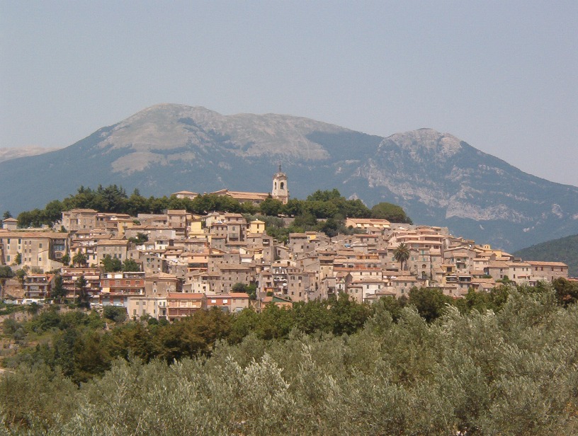
About this place
Monte Monna is one of the main peaks of the Monti Ernici range, rising above Vico nel Lazio in the province of Frosinone, Lazio. At 1,952 meters above sea level, it's one of the most prominent landmarks in this stretch of the central Apennines.
Vico nel Lazio itself sits at the foot of the mountain, perched on a limestone outcrop at 721 meters above sea level. This small, fortified medieval town holds the Bandiera Arancione (Orange Flag) designation, an award from the Touring Club Italiano recognizing towns with strong tourism and environmental standards. Its old town, with intact defensive walls and narrow lanes, makes a natural starting point before heading into the mountains.
How do you get to the summit?
The most demanding but also most rewarding route runs directly from Vico nel Lazio. The trail climbs through extensive beech forests covering the slopes of Monte Monna and counts among the tougher ascents in the whole Ernici range — plan for a full day and proper hiking boots.
An easier alternative starts from the Campocatino plateau, at 1,792 meters. From there, a roughly 13-kilometer route with about 450 meters of elevation gain leads to the summit, a much gentler climb than the approach from Vico nel Lazio. More experienced hikers can also tackle a loop via Monte Vermicano, starting at Colle Pannunzio (reachable from Frosinone heading toward Fiuggi and then Guarcino), which takes about five hours.
What will you see at the top?
The name "la Monna" likely comes from the local dialect word "monnata," referring to peeling fruit — the summit is nearly stripped of vegetation, "peeled" much like a piece of fruit. That contrast between the lush beech forest on the slopes and the bare, rocky summit dome is one of the most distinctive features of the landscape here.
From the top, a sweeping panorama opens over Ciociaria, the Sacco Valley and the area around Alatri, and on clear days you can pick out the Gran Sasso, the Monti Lepini, the Circeo promontory and Lake Canterno. It's one of the best viewpoints in the entire central Apennines. The mountain's slopes also hold the source of the Cosa River, a tributary of the Sacco, and the massif is known for an extensive karst cave system, among the most complex in all of Lazio.
When should you go?
Late spring and early autumn offer the best conditions, with moderate temperatures and the beech forest at its most striking — vivid green in spring, gold and red in autumn. Summer brings busier trails, especially on weekends, while winter ascents can require proper snow gear, since the upper sections hold snow and ice.
Frequently asked questions
How high is Monte Monna? The summit reaches 1,952 meters above sea level, making it one of the highest points in the Monti Ernici range.
Is the route from Vico nel Lazio difficult? Yes, it's one of the more demanding paths to the summit — a long, steep climb through beech forest. Hikers looking for an easier option can start from Campocatino instead.
Is water or a shelter available on the mountain? Bring your own water supply for the hike; the source of the Cosa River lies on the slopes, but it shouldn't replace proper preparation.
What's worth seeing in Vico nel Lazio itself before heading into the mountains? The medieval defensive walls, narrow lanes and historic center of this Bandiera Arancione town make a good warm-up stop before the trek.
Earn badges for the places you visit
Download NextOnTrip, discover new places and check off your trails.