About this place
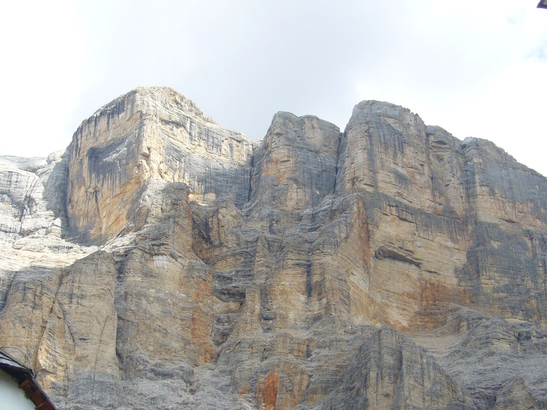
Sas dles Diesc is a striking rock peak towering above the Val Badia valley, right next to the village of La Val in Alta Badia, in the heart of the Dolomites.
Known in Italian as Sasso delle Dieci and in Ladin as Sas dles Diesc — the language still spoken in this part of the Dolomites — the mountain rises to 3,026 metres above sea level. It is the highest point of the Sasso di Santa Croce group, itself part of the wider Fanes group. Its sharply pyramidal shape makes it one of the most recognisable landmarks visible from viewpoints around La Val.
Where exactly is this peak located?
Sas dles Diesc sits on the western edge of the Fanes massif, right on the boundary of the Fanes-Sennes-Braies Nature Park. Reaching it means crossing one of the wildest and best-preserved natural areas in the entire Dolomites. Because the peak dominates the Val Badia valley below, both its slopes and the approach trails offer sweeping views across the valley and the surrounding summits.
How do you get to the trail leading up to it?
The starting point for tackling Sas dles Diesc is the Lavarella mountain hut, set among the Fanes Piccola pastures. From there, trail no. 7 heads toward Jú dla Crusc, taking hikers almost to the very base of the peak, just below the summit of Sasso Croce. La Val, recognised as South Tyrol's first certified hiking village, serves as the natural launchpad for excursions into the Fanes-Sennes-Braies Nature Park and makes a convenient base for anyone planning a longer stay in the area.
How difficult is reaching the summit?
Walking the marked trail up to the foot of Sas dles Diesc requires no climbing skills and is manageable for experienced hikers. Things change on the final stretch to the actual summit: the ridge there is highly exposed, calling for good fitness, agility and prior high-mountain experience. Anyone uneasy with heights should turn back before this section. Given the exposure and technical nature of the last stretch, hiring a local mountain guide is strongly recommended.
When is the best time to visit?
Summer, from June to September, is the ideal window for exploring the Sas dles Diesc area, when the high-altitude trails are free of snow and huts such as Lavarella are open and staffed. Early in the season, patches of snow can still linger on the upper ridge, adding extra difficulty to the final approach.
Frequently asked questions
How tall is Sas dles Diesc? The peak reaches 3,026 metres above sea level and is the highest summit of the Sasso di Santa Croce group in the Dolomites.
Where's the best place to start the hike? The Lavarella hut on the Fanes Piccola pastures is the most convenient starting point, with trail no. 7 leading toward Jú dla Crusc almost to the foot of the peak.
Can you reach the summit on your own? The approach to the base of the mountain suits experienced hikers, but the final, heavily exposed ridge section requires a qualified mountain guide.
Why does the mountain have two different names? Sasso delle Dieci is the Italian name, while Sas dles Diesc is the Ladin form used around La Val, where Ladin remains the traditional language of the local community.
Nearby places

Earn badges for the places you visit
Download NextOnTrip, discover new places and check off your trails.