Recreation and entertainment in Spain
A guide to 685 Recreation and entertainment in Spain — with descriptions, photos and traveler visits from the NextOnTrip community. Locations spread across 255 cities and towns. Most visited by the community: Hotel Pazo Libunca, Museo del Bonsai, Madrid Wax Museum.
-
Jardí del Bisbe
Palma
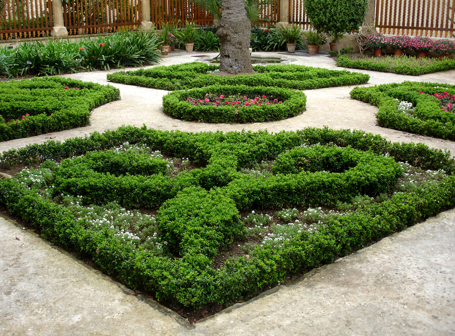
Jardí del Bisbe (the Bishop's Garden) is a small, secluded garden tucked away in the historic center of Palma de Mallorca, right behind the city's cathedral, La Seu, on Carrer de Sant Pere Nolasc. Rarely mentioned on the front page of travel guides, it is one of the most rewarding quiet spots for anyone strolling through the Centre district looking for a break from the old town's busier streets. What to see in the garden The garden keeps the classical layout typical of Palma's old mansion gardens, divided into distinct areas: a fruit-growing section, a former vegetable patch, and a purely ornamental zone. It's this last part that draws most of the attention from visitors. At the heart of the ornamental area sits a small decorative fish pond, framed by neatly trimmed geometric hedges that give the whole space a calm, contemplative feel. Above the pond stretches a pergola covered in bougainvillea, offering welcome shade on hot days. Citrus trees are scattered throughout the grounds, filling the air with their scent, especially in spring and summer — one of the most memorable features of a visit here. History and the origin of the name The name of the garden — literally "the Bishop's Garden" — reflects its proximity and historical connection to Palma's bishop's palace and the cathedral. Gardens of this kind were common alongside the ecclesiastical and bourgeois residences of the old town, combining a practical role (growing fruit and vegetables for the household) with a decorative, representative one. Since the year 2000, the garden has been maintained by Palma City Hall, which keeps it well cared for and open to residents and visitors free of charge. Why visit Jardí del Bisbe makes for a natural stop for anyone exploring Palma's old town on foot — it sits right next to the cathedral, so it fits easily into a walk through the Centre district. Unlike the crowded squares and main streets of the old town, the garden offers a compact, quiet space where you can sit for a moment, photograph the neatly geometric greenery, or simply rest in the shade of the citrus trees. It's also worth a visit for anyone curious about Palma's urban history — the garden's layout illustrates what green spaces attached to bourgeois and ecclesiastical residences once looked like, before the city grew into its present-day shape. Frequently asked questions Is admission to the garden free? Yes, entry to Jardí del Bisbe is free and does not require a reservation or ticket. What are the opening hours? The garden is open Tuesday to Sunday, from 10:00 AM to 6:00 PM. It is closed on Mondays. Where exactly is the garden located? It is located at Carrer de Sant Pere Nolasc 6, in the Centre district of Palma, right next to La Seu Cathedral. How long does a visit take? It's a small garden, so a relaxed walk through the whole area usually takes about 15–20 minutes — a perfect short stop while exploring the old town. Is it worth combining with other attractions? Yes — given its proximity to the cathedral and Palma's historic center, the garden fits naturally into a walking route through the oldest part of the city.
-
Jardin de la Marquesa de Arucas
Arucas
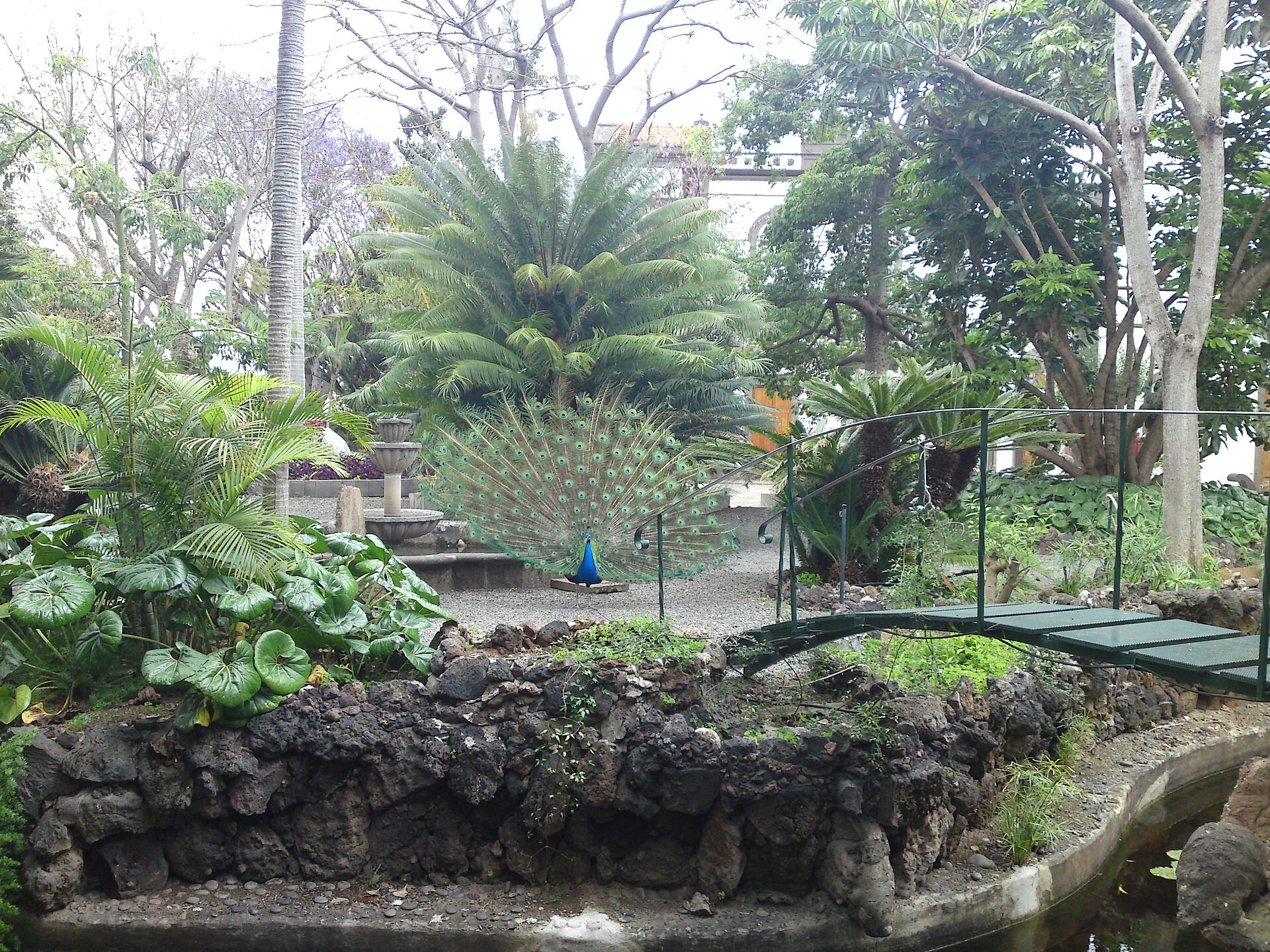
Jardín de la Marquesa de Arucas is a historic botanical garden located in the town of Arucas, in the northern part of Gran Canaria, about 8 km west of Las Palmas de Gran Canaria. It ranks among the island's most valuable garden estates — a private plant collection that eventually grew into one of the region's most visited natural attractions. Who founded the garden, and when? The garden was created around 1880 on the initiative of the first Marquis of Arucas, Ramón Madan y Uriondo, together with his wife, María del Rosario González y Fernández del Campo. The Marquis was a passionate botany enthusiast who, over the years, brought plants from all five continents to his estate, shaping a spacious, irregularly laid-out garden with a distinctly romantic character. Why was this particular spot chosen? The location at the foot of the Arucas mountain, combined with its proximity to the coast, created an unusually favorable microclimate. Natural shelter from the wind and mild temperatures allowed tropical and subtropical plants to thrive here almost without restriction — a factor that directly explains the garden's remarkable botanical richness today. What can visitors see in the garden? Spread across roughly five hectares, the garden holds more than 2,500 plants belonging to nearly 400 tropical and subtropical species, though some sources now put the figure at around 500 classified species. Palms occupy a special place in the collection — one of its most distinctive features, the result of decades of dedicated work by the founders and their successors. The garden's symbol is an impressive dragon tree (Dracaena draco), estimated to be between 400 and 500 years old. It is the most recognizable specimen in the entire collection and one of the main reasons botany enthusiasts from across the island come to visit. A colony of peacocks also roams freely throughout the grounds, adding a picturesque, exotic touch that makes a walk along the garden's paths even more enjoyable, especially for visitors traveling with children. When was the garden opened to the public? For decades, Jardín de la Marquesa remained a private estate, closed to outside visitors. That changed in November 1985, when the founder's granddaughter opened the garden to the public. Since then, it has become one of the key tourist attractions in Arucas and in northern Gran Canaria as a whole. Frequently asked questions Where exactly is the garden located? In Arucas, in the northern part of Gran Canaria, about 8 km west of Las Palmas de Gran Canaria. Who founded Jardín de la Marquesa? The first Marquis of Arucas, Ramón Madan y Uriondo, together with his wife María del Rosario González y Fernández del Campo, around 1880. What is the garden's main highlight? A dragon tree (Dracaena draco) over 400 years old, regarded as the symbol of the entire estate, along with an extensive collection of palms and other tropical plants. Since when has the garden been open to visitors? Since November 1985, when the founder's granddaughter opened it to the public. How many plant species grow in the garden? Estimates vary between roughly 400 and 500 tropical and subtropical species, depending on the source, all growing across the garden's five hectares.
-
Botanical Garden of Santa Catalina
Iruña Oka / Iruña de Oca
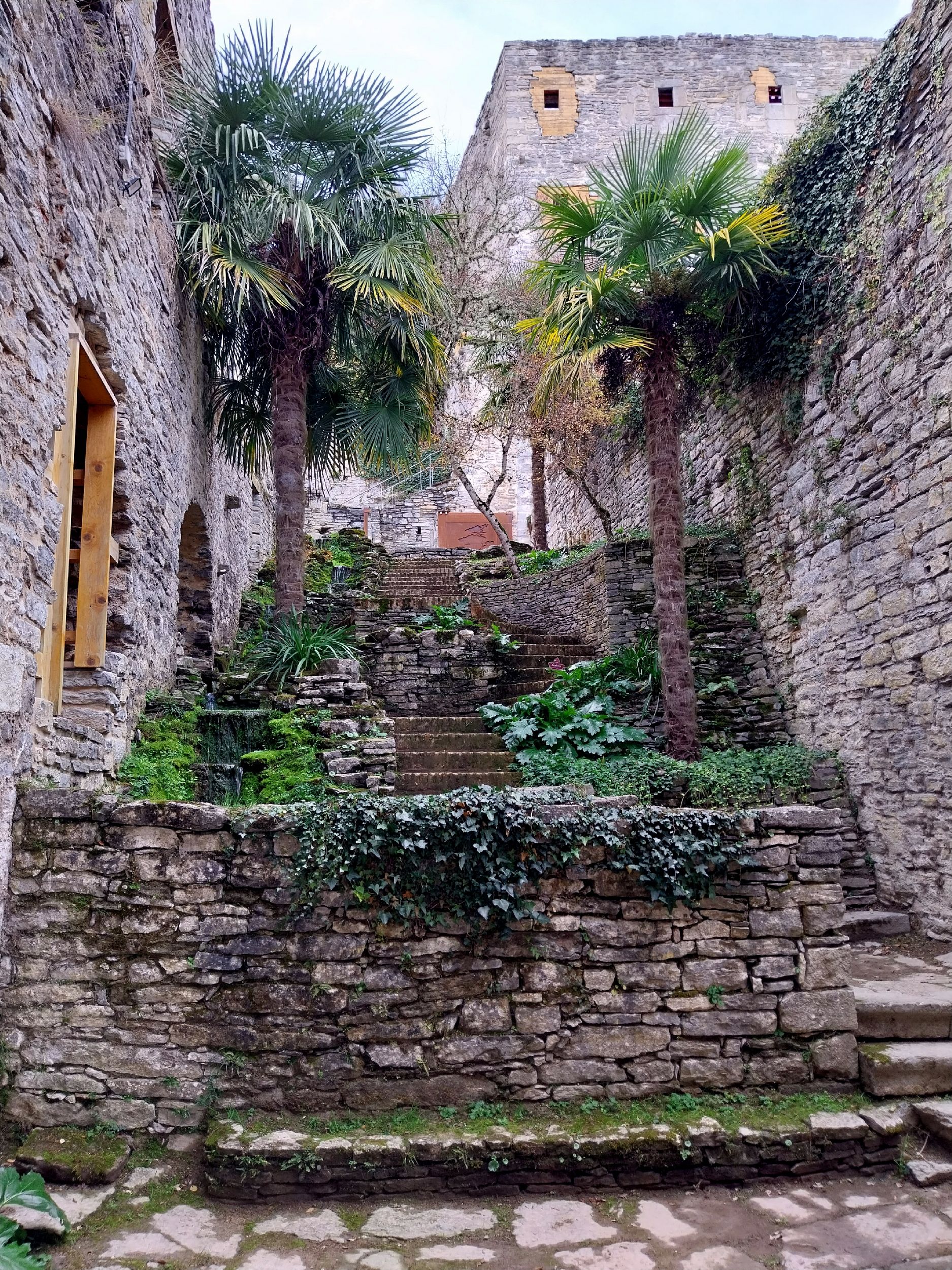
The Botanical Garden of Santa Catalina is located in the municipality of Iruña de Oca, in the province of Álava, in the Basque Country, northern Spain. The garden is centered around the ruins of the Santa Catalina convent, situated between the Zadorra river and the Badaia mountain range, close to the village of Trespuentes. Where exactly is it located? The garden's position is closely tied to the local terrain of this part of Álava. On one side, the land borders the Zadorra riverbed, one of the rivers draining the central part of the province; on the other, it rises toward the limestone slopes of the Badaia range. This combination means the surrounding landscape blends a lower, damper riverside setting with a rockier, more rugged mountain backdrop. Trespuentes, the nearest settlement, sits right next to the site, and it is around this village that the garden's coordinates are commonly placed. The convent ruins at the heart of the garden The reference point for the whole site is the ruins of the former Santa Catalina convent. The garden's layout is organized around these remains, which form its historical core and give the place a character different from a purely recreational park. The presence of the ruins means visitors encounter both a natural element and a trace of former religious architecture, set within a specific Basque historical context. Regional geographic context Álava is one of the three provinces of the Basque Autonomous Community, known for its varied landscape — from fertile river valleys to mountain ranges surrounding the central basin where the provincial capital, Vitoria-Gasteiz, is located. The Badaia range, mentioned as one of the garden's natural reference points, belongs to the system of hills enclosing that basin from the west and north. The Zadorra river, in turn, is one of the region's main watercourses, playing a significant role in the local landscape and water management of the surrounding municipalities. Iruña de Oca and Trespuentes The municipality of Iruña de Oca, where the garden is located, comprises several smaller settlements in this part of Álava. Trespuentes, mentioned as the closest landmark to the garden, is one of them — its proximity to the site where the convent once stood, and where a botanical garden now extends, makes it a natural starting point for anyone planning a visit. Coordinates and orientation on the ground The garden can be located at geographic coordinates around 42.849° north latitude and -2.808° longitude. For anyone planning a route through this part of Álava, this is a useful reference point, especially since the area is not densely built up, and orientation based solely on settlement names can be harder than in larger urban centers. Frequently asked questions Where exactly is the Botanical Garden of Santa Catalina located? In the municipality of Iruña de Oca, in the province of Álava, in the Basque Country, between the Zadorra river and the Badaia mountain range, near the village of Trespuentes. What forms the central point of the garden? The ruins of the former Santa Catalina convent, around which the entire site is organized. Which settlement is closest to the garden? Trespuentes, part of the municipality of Iruña de Oca. What natural landscape features surround the garden? The Zadorra river on one side and the Badaia mountain range on the other — these two elements define the garden's geographic setting.
-
Jardín Botánico de la Universidad de Valencia
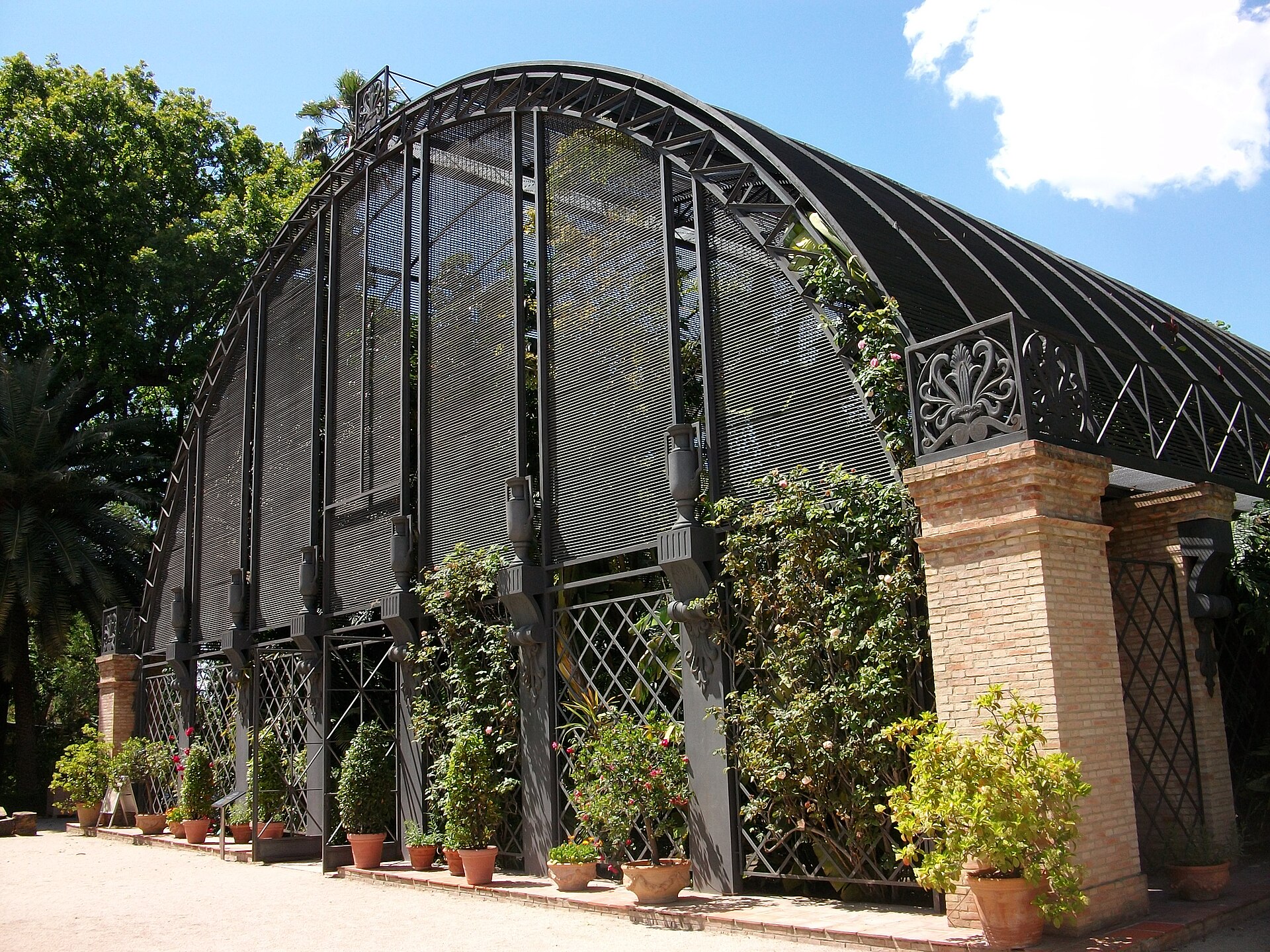
The Jardín Botánico de la Universidad de Valencia is the botanical garden of the University of Valencia, tucked along Calle Quart in the city's historic center, right next to the old Torres de Quart gate towers. It ranks among the oldest gardens of its kind in Spain, with roots going back to the 16th century, and today combines a scientific, educational and recreational role. How old is the garden? The garden was founded in 1567 as a huerto de simples — a medicinal plant garden linked to the university's Medicine studies. For nearly two centuries it served that purpose, helping train future physicians and apothecaries to recognize plants with therapeutic properties. In 1802 the university moved it permanently to its current site, the so-called Huerto de Tramoyeres, then located outside the city walls, near the San Sebastián convent and the Quart towers. Throughout the 19th century the grounds were used for botany classes and for experiments aimed at acclimatizing plants of agricultural interest — testing which species brought in from other climate zones could adapt to Mediterranean conditions. The 20th century proved difficult: the garden went through a long period of neglect and its infrastructure deteriorated. That changed in 1987, when the University of Valencia launched a full restoration process that was completed in 2000, allowing the garden to regain its former condition and open more widely to visitors. What can be seen among the plant collections? The garden holds over 3,000 species of trees and plants from all five continents, making it one of the richer collections of its kind in Spain. The display is organized into 20 separate collections — the so-called Escuela Botánica plus 19 monographic collections, grouped around three criteria: plants used by people, plants grown under protection in greenhouses, and plants originating from the same ecological environment. Highlights include extensive collections of palms, aquatic plants and tropical species, along with display greenhouses dedicated to carnivorous plants, ferns, orchids and bromeliads. The grounds also preserve monumental trees, living evidence of two hundred years of continuous cultivation on the site, and the complex includes architectural heritage tied to the garden's long history. Who is this place for? While the garden primarily serves a scientific and teaching function — as part of the University of Valencia, used for research and academic classes — it is equally open to visitors looking for a quiet green corner in the middle of the city. It suits both plant enthusiasts and travelers who, after walking along the old city walls and the Quart towers, want to rest in a shaded, historic setting. Frequently asked questions When was the garden founded? In 1567, though it moved to its present location in 1802. How many plant species can be seen here? Over 3,000 species of trees and plants from all five continents. Was the garden ever neglected? Yes — it went through a long period of decline during the 20th century, with a full restoration carried out between 1987 and 2000. Where exactly is it located? On Calle Quart, next to the historic Torres de Quart towers in the center of Valencia.
-
Siam Park
Adeje
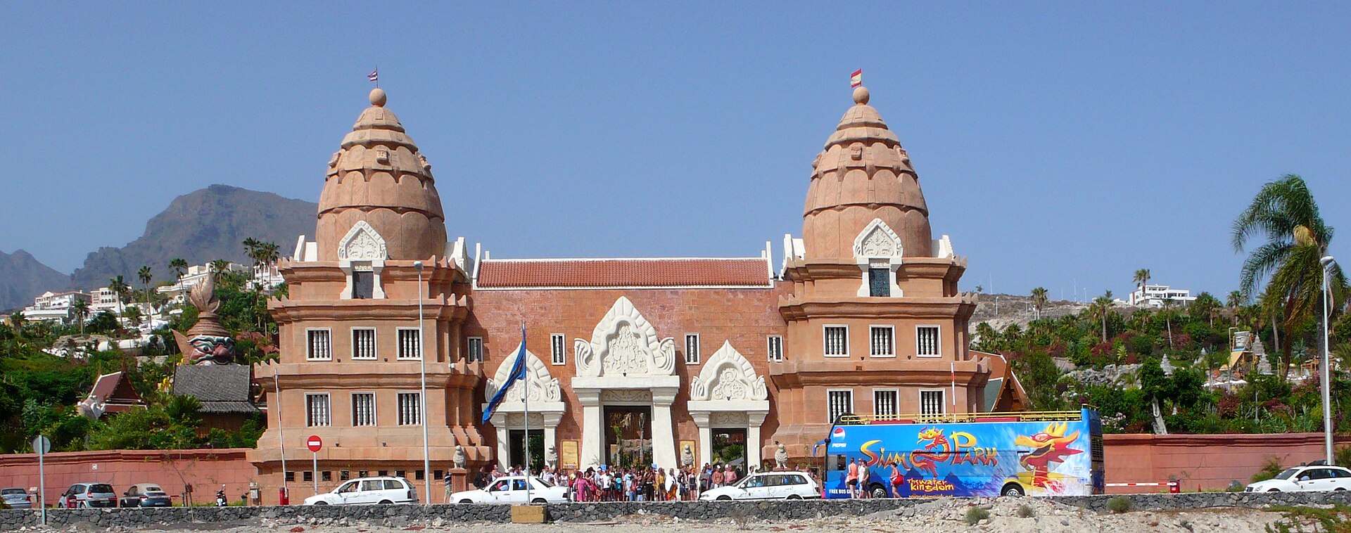
Siam Park is Europe's largest water park, located in Adeje on the south coast of Tenerife, right next to the area's tourist centre. It is the kind of stop that often makes it onto a holiday itinerary before travellers even board the plane, and once on site it is easy to see why: the scale and the design concept set it apart from other water parks on the island. What makes Siam Park different from other water parks? The park opened to visitors in 2008 and covers 185,000 m². The entire site was designed around Thai architecture, which explains both the name and the exotic decor that surrounds guests at almost every turn. Rather than a standard concrete slide complex, visitors walk through gardens where the water infrastructure blends into scenery that evokes Southeast Asia. What can visitors do inside the park? Slides are the main draw, but the park also includes a beach-style pool, built for guests who would rather unwind than chase adrenaline. Restaurants on site mean a full day can be spent there without ever needing to leave the grounds. Landscaped gardens connect the different water attractions, so walking between them is part of the experience rather than a detour. Can you learn to surf at Siam Park? Yes. This is one of the features that sets it apart from many similar parks: on-site surfboard lessons are available for both adults and children. It is a good option for families looking to combine slide time with something beyond straightforward water play. Is Siam Park suitable for events and corporate gatherings? The park has dedicated spaces for events, meetings and corporate functions, as well as music performances. That means the site works not only as a standalone tourist attraction but also as a venue used for larger-scale gatherings, from company events to live shows. Where exactly is Siam Park located? The park sits on the south coast of Tenerife, in Adeje, directly next to the local tourist centre. That location is convenient for anyone staying in the resorts on the island's south side, since the trip from the popular tourist areas usually takes relatively little time. Frequently asked questions When did Siam Park open? The park opened to tourists in 2008 and has since operated as Europe's largest water park in terms of both area and scope. How big is the park? Siam Park covers 185,000 m², an area that includes slides, gardens, restaurants and a beach-style pool. Is Siam Park just about slides? No — the park combines slides with a beach pool, gardens, restaurants, surf lessons, and event spaces for meetings and corporate functions. Who is the park suited for? It works both for visitors chasing the thrill of the slides and for those who prefer a calmer day by the beach pool, as well as for families with children thanks to the surf lessons available for younger guests.
-
Zoo Aquarium de Madrid
Madryt
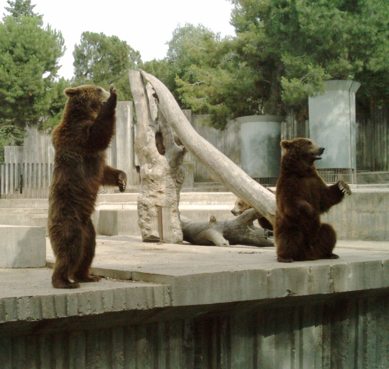
Zoo Aquarium de Madrid is one of Spain's largest zoological parks, set inside the vast Casa de Campo park just a short walk from the city's amusement park. Where exactly is the Madrid zoo located? The zoo sits within Casa de Campo, the largest municipal park in the Spanish capital, on the western side of the city. The grounds cover more than 20 hectares and combine four distinct sections under one ticket: the zoo itself, an aquarium, a dolphinarium, and an aviary. A metro line runs straight to the entrance, making it one of the easiest major zoos in Europe to reach without a car. Which animals live at the zoo? The collection includes roughly 6,000 animals from about 500 species. The star attraction is a pair of giant pandas, You You and Jiu Jiu, on loan through a cooperation agreement with China — Madrid is one of only a handful of places in Europe where visitors can see pandas year-round. Other highlights include white tigers, lowland gorillas, Bornean orangutans, Asian elephants, and less common species such as koalas, takins, and tapirs. A separate area lets younger visitors get close to farm animals in a petting-zoo setting. What does the aquarium section include? The aquarium spans two floors and holds around 2 million litres of seawater across dozens of tanks. Sharks and sea turtles are among the main draws, alongside a coral-breeding programme that has been running since the mid-1990s, one of the first of its kind in Spain. An underwater tunnel lets visitors watch tropical fish swim overhead and on all sides. Are there dolphin shows at the zoo? Yes. The dolphinarium hosts shows with bottlenose dolphins, typically twice a day, and it is one of the few dolphinariums in Spain located away from the coast, with seating for several thousand spectators. The programme mixes educational commentary with acrobatic displays, and sea lions also perform as part of the show. What else is there besides the animals? The aviary covers roughly 3,000 square metres and houses dozens of bird species, from rainbow lorikeets to bald eagles, some featured in free-flight birds-of-prey demonstrations. A small train circulates through the park to help visitors cover the large grounds, and bus transport is also available on site. The zoo's history dates back to 1770, when Madrid's first animal collection, the Casa de Fieras, opened in Retiro Park; it moved to its current, much larger Casa de Campo site in 1972. Frequently asked questions How many animals are at Zoo Aquarium de Madrid? The park is home to around 6,000 animals across nearly 500 species, ranging from giant pandas to sharks in the aquarium section. Should visitors plan a full day for the visit? With four separate sections — zoo, aquarium, dolphinarium, and aviary — spread across a large site, seeing everything along with the shows typically takes several hours. Can children watch the animal shows? Yes, the standard ticket includes dolphin and sea lion shows in the dolphinarium as well as birds-of-prey flight demonstrations in the aviary. What is the easiest way to reach the zoo without a car? The metro is the most convenient option, with a station located right next to the Casa de Campo entrance where the zoo is situated.
-
Rancho Texas Park
Puerto Del Carmen
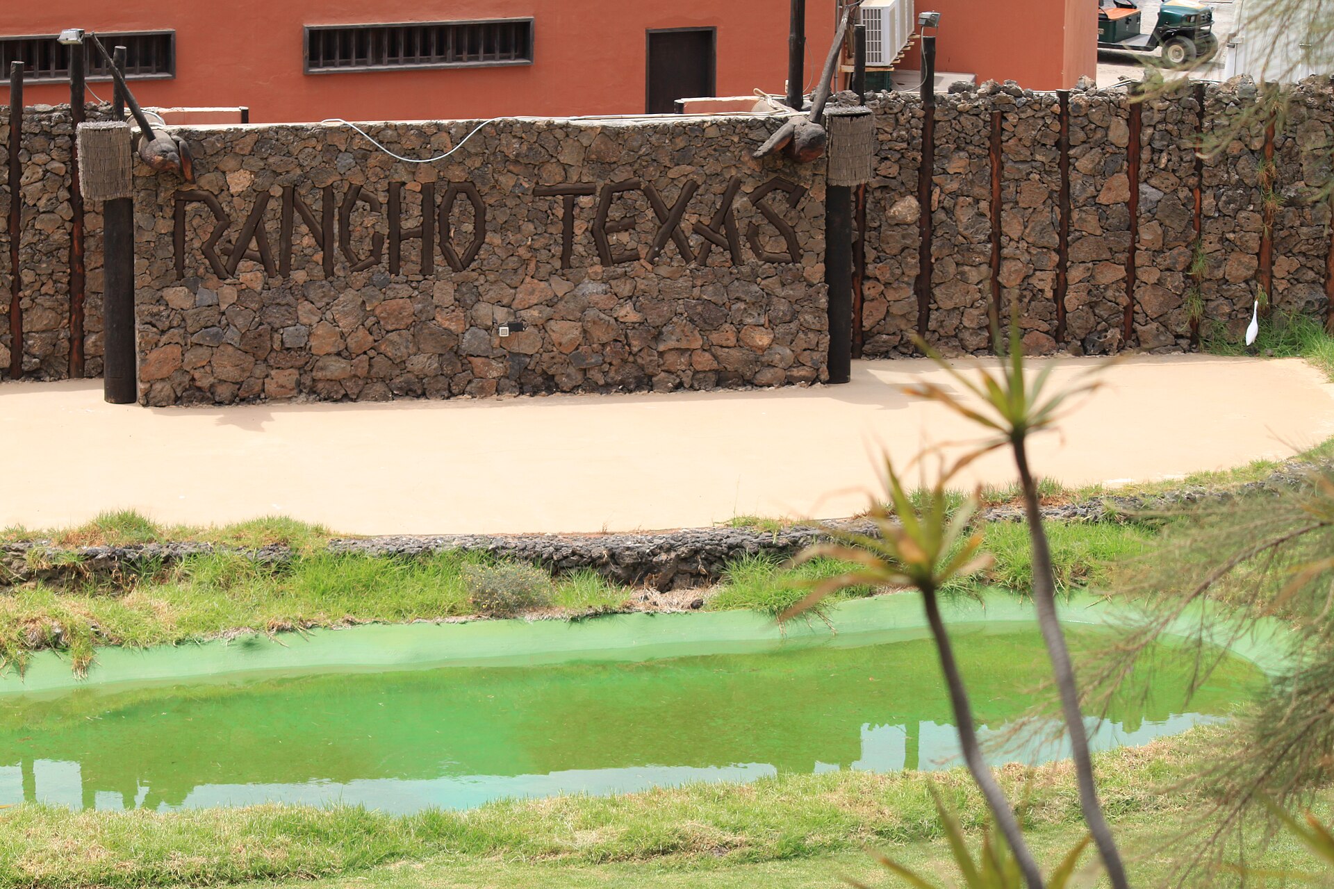
Rancho Texas Park is an animal park and family attraction in Tías, right by Puerto del Carmen on Lanzarote in the Canary Islands. Rather than a conventional zoo, it presents its animal exhibits inside a setting built around the look and feel of the American Wild West, giving it a distinct identity among the island's leisure venues. Why is it called Rancho Texas? The name carries a deliberate historical meaning. On February 20, 1730, a group of settlers left Teguise, on Lanzarote, sailing first to Tenerife and then, on March 15 of that same year, on to Havana in Cuba. From there they continued to Veracruz in Mexico, before finishing the journey overland in a caravan, enduring weeks of hardship. The expedition brought together ten Canarian families — seven from Lanzarote and one each from Gran Canaria, Tenerife and La Palma — 55 people in total, 43 of them from Lanzarote. These settlers went on to found the town known today as San Antonio, Texas. Rancho Texas Park was created as a tribute to that migration story and to the resilience of the people who made the crossing. What is there to see at the park? The venue operates as a non-profit organisation and functions as a home for a range of animal species, staged within a ranch-style, Wild West-inspired environment. Wooden structures and cowboy-era visual cues frame the animal areas, which makes a visit feel different from a standard zoo trip — something that appeals to families looking for a change of pace from the beaches of Puerto del Carmen. Where exactly is Rancho Texas Park located? The park sits within the municipality of Tías, just next to Puerto del Carmen, one of Lanzarote's busiest resort towns. Its coordinates are roughly 28.9313 N, 13.6449 W. Because of this position, the park is within easy reach for anyone staying in the hotels and apartment complexes along the Puerto del Carmen seafront, without the need to travel far inland. Frequently asked questions When did Rancho Texas Park open? The park in its current form has operated since November 29, 2002, although the story it commemorates — the 1730 emigration from Lanzarote — dates back much further. Is Rancho Texas Park just another zoo? Not quite. It is technically an animal park, but it is run as a non-profit and shaped around a Wild West ranch theme tied directly to the history of Canarian emigration to Texas, which sets its concept apart from a standard zoo. Why does a park on Lanzarote focus on Texas? Because people from Lanzarote played a direct role in founding San Antonio, Texas, in the 18th century. The park was built to keep that historical connection between the island and the state of Texas visible, and it is the backbone of the whole concept. How far is the park from Puerto del Carmen? Rancho Texas Park lies within the Tías municipality, essentially adjoining the Puerto del Carmen area, so it is only a short ride away from most hotels in that resort. Who is this attraction suited for? Given its animal-park format and themed setting, it works well as a family day-out option, offering an alternative to the beach-focused routine typical of a Puerto del Carmen holiday.
-
Selwo Aventura
Estepona
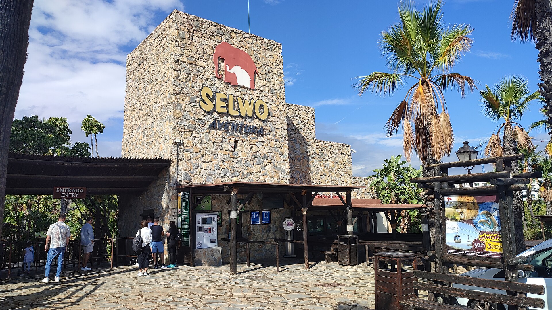
Selwo Aventura is a wildlife and adventure park spread across roughly 100 hectares in Estepona, on Spain's Costa del Sol in the Malaga province. It pairs close-up encounters with more than 2,000 animals hailing from five continents with a lineup of outdoor adventure activities set among natural landscapes. What animals live in the park? The park is organised into four themed zones that recreate different habitats, from African savannah to the forests of Asia and the Americas. Visitors can spot lions, rhinos, giraffes, wildebeest and cheetahs roaming spacious enclosures, alongside species rarely seen at other zoos, such as red pandas and meerkats. A particular highlight is the Iberian lynx, one of the most endangered predators on the planet. The park also keeps a bird collection that includes hornbills, ibises, storks and cranes. Has any animal been born at Selwo Aventura? Yes, the park runs a long-standing breeding programme. Kanvar, the first and only Asian elephant to be born on Spanish soil, came into the world there. Other notable arrivals include Bengal tiger cubs, bald ibis chicks, Angolan giraffes, red pandas, emperor tamarins and European bison. What can visitors do besides watching the animals? Selwo Aventura pairs wildlife viewing with adrenaline-driven activities. The grounds feature zip-lines strung between the trees, long hanging bridges, an archery range, and trampolines capable of catapulting visitors several metres into the air, up to eight metres at the highest point. What is the Serengeti Safari? It is one of the park's signature experiences: a tour aboard an open 4x4 vehicle through the Great Lakes Reserve area, where animals move about freely and guests can approach them much as they would on a real African safari. Have any well-known people visited the park? Yes. During a private stay on the Costa del Sol in 2010, the family of then-US President Barack Obama stopped by Selwo Aventura. In tribute to that visit, the park later launched a special touring experience named the "Obama VIP Visit." Who runs Selwo Aventura? The park is part of Parques Reunidos, a Spanish group that operates leisure and wildlife parks across several countries. Frequently asked questions Where is Selwo Aventura located? In Estepona, in the province of Malaga, on Spain's Costa del Sol. How many animals live in the park? More than 2,000 animals from five continents. How large is the park? Selwo Aventura covers roughly 100 hectares. Are there endangered species at the park? Yes, including the Iberian lynx, one of the world's most endangered predators. What adventure activities are available? Zip-lines, hanging bridges, an archery range, trampolines, and the Serengeti Safari 4x4 truck tour.
-
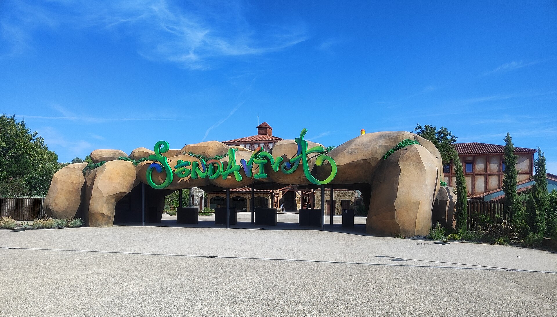
Sendaviva
Arguedas
Sendaviva, Arguedas Sendaviva is a nature and amusement park in Arguedas, in southern Navarre, and one of the largest theme parks in Spain. Spread across more than a hundred hectares on the slopes of the Sierra del Yugo, right next to the Bardenas Reales nature reserve, it combines close encounters with exotic animals, family-friendly rides, and outdoor shows. Where is Sendaviva and how do you get there? The park sits in the municipality of Arguedas, in southern Navarre, close to the border with Aragon. It's roughly an hour's drive from Pamplona and a bit further from Zaragoza. Because it borders the semi-arid badlands of Bardenas Reales, the surrounding landscape is an attraction in its own right, and a visit to Sendaviva pairs naturally with exploring the reserve. How is the park laid out? The visit unfolds across several themed zones, connected on foot or by a small train that loops around the grounds. One area recreates a village with craft workshops and demonstrations, another gathers fairground-style rides and mechanical attractions, a wooded section houses open-air animal enclosures, and a separate farm zone lets children get close to domestic animals. Splitting the park this way means visitors can mix animal encounters with rides without constantly backtracking across the site. What animals live in Sendaviva? Wildlife is one of the main reasons families come here. The park keeps hundreds of animals representing species from several continents — large mammals, birds, and reptiles among them — housed in large, open enclosures designed to resemble their natural habitats as closely as possible. Visitors can watch them at close range, and some species take part in scheduled presentations and shows held throughout the park. What else is there beyond the animals? Sendaviva also runs a full amusement-park programme, with dozens of rides ranging from gentle attractions for young children to faster rides aimed at older kids and adults. Seasonal outdoor performances add to the mix, and rest areas and food stalls are spread across the different zones so visitors don't need to trek back to the entrance for a break. When is the best time to visit? The park operates seasonally, roughly from spring through autumn, with extended opening hours during the busy summer months. Visiting outside peak season makes it easier to avoid crowds, though some seasonal attractions may not run then. Given the size of the grounds, it's worth setting aside a full day for the visit. Frequently asked questions Where exactly is Sendaviva located? In the municipality of Arguedas in southern Navarre, on the slopes of the Sierra del Yugo, right next to the Bardenas Reales nature reserve. How long does it take to see the whole park? Given how large and spread out the grounds are, it's best to plan a full day for the visit. Can you get close to the animals at Sendaviva? Yes, the park keeps hundreds of animals from different continents in large open enclosures, and some take part in scheduled shows. Is Sendaviva suitable for young children? Yes, the park offers gentle rides and a dedicated farm area for younger visitors alongside faster attractions for older kids and adults. Is Sendaviva open all year round? No, the park operates seasonally, mainly from spring to autumn, with longer hours during summer.
-
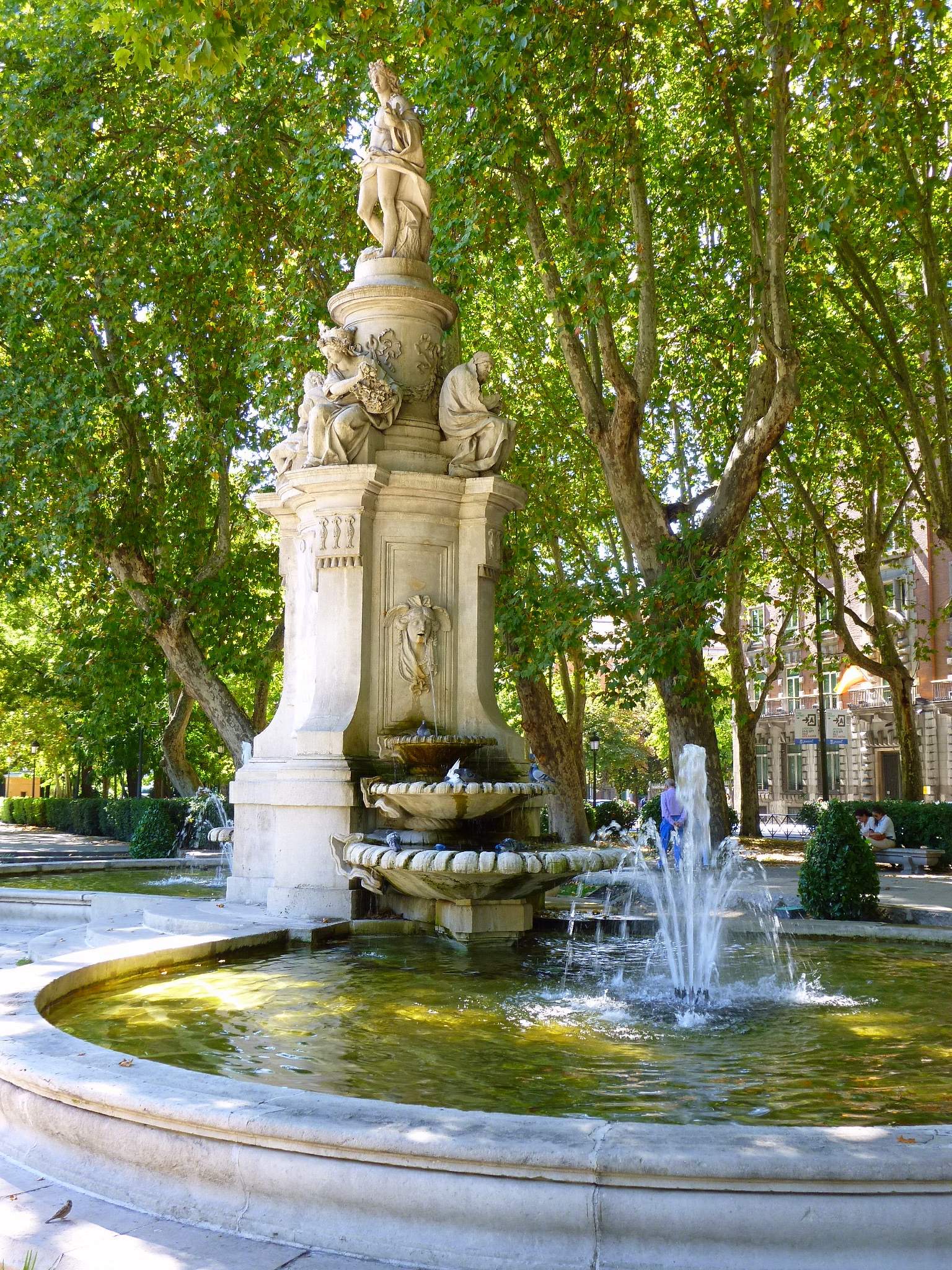
Fountain of Apollo
Madryt
The Fountain of Apollo is one of three monumental fountains lining Paseo del Prado in Madrid, alongside the Fountain of Cibeles and the Fountain of Neptune. It stands at the heart of the boulevard, near the Prado Museum, and has marked this stretch of the city for more than two centuries. Where exactly is the Fountain of Apollo? The fountain occupies the middle of Paseo del Prado, on the section historically known as Salón del Prado — a grand promenade laid out in the 18th century under King Charles III. This entire area, together with the neighboring Retiro park, is recognized by UNESCO as part of Madrid's landscape and architectural heritage. The fountain sits only a few minutes' walk from the Prado Museum, Plaza de Cibeles, and the Neptune Fountain, so a visit here fits naturally into a walk along Madrid's main cultural axis. What will you actually see? The centerpiece is Apollo himself — the Greek god of light, reason, and the arts, presiding over harmony and knowledge. Four allegorical figures representing the seasons surround him, which is why the monument is also known as the Fountain of the Four Seasons. The architectural design dates to 1777 and was created by Ventura Rodríguez, one of the leading architects of the Spanish Enlightenment, while the sculptural work itself was carried out by Manuel Álvarez, a sculptor from Salamanca. The fountain took decades to complete: it was finally inaugurated in 1803 under King Charles IV, to mark the wedding of his son, the future King Ferdinand VII. Look closely at the stonework and the layout of the basin — the fountain isn't an isolated object but part of a wider urban composition that lines up all three Prado fountains along a single visual axis. Why was it built exactly here? Placing Apollo on Paseo del Prado was part of a much larger urban reform pushed by Charles III, who wanted to modernize Madrid and raise its standing among Europe's great capitals. The plan produced not just the three fountains but also the Alcalá Gate and the promenade layout itself. Apollo, as the god of reason and progress, fit perfectly into the Enlightenment-era symbolism of the project — a figure meant to represent the light of knowledge guiding the city toward modernity. How do you get there? The easiest way is by metro to Banco de España station (line 2) or Atocha (line 1 and Cercanías trains), both a short walk from the fountain along Paseo del Prado. Several bus lines also run along the boulevard. On foot, it's roughly a 15–20 minute walk from Puerta del Sol or Plaza Mayor, passing through some of the city center's most representative streets. When is the best time to visit? The fountain sits in open public space, so it can be seen at any time, day or night, all year round. Early morning or evening hours offer the calmest conditions for photos, with less traffic and fewer tourists crowding the boulevard. Spring and autumn bring the most comfortable temperatures, while midday sun in summer can be intense, so plan accordingly if visiting then. Frequently asked questions Is there an entrance fee? No, the fountain stands on a public street and can be viewed free of charge at any time. Is the Fountain of Apollo the same as the Fountain of the Four Seasons? Yes, it's the same monument — the second name refers to the four allegorical figures surrounding Apollo. How long does a visit take? Seeing the fountain itself takes only a few minutes, but combining it with a walk along the whole Paseo del Prado takes about 30 minutes to an hour. Are there other attractions nearby? Yes, the Prado Museum, the Cibeles Fountain, and the Neptune Fountain are all within easy walking distance, making it simple to plan a single route covering all of them.
-
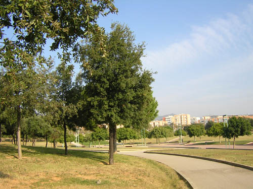
Parc de Montigalà
Badalona
Parc de Montigalà is one of the most significant green spaces in Badalona, located in the Montigalà neighborhood and bordered by Avinguda de Puigfred, Carrer de Sant Fermí, Travessera de Montigalà and Rambla de Sant Joan. Covering 8.1 hectares, the park has been one of the most visited spots among the city's residents since it opened in 1991. How do you get there? The park sits in the heart of the Montigalà district, in the northern part of Badalona, a few kilometers from the seafront promenade. The main entrance is on Avinguda de Puigfred, where a wide, tree-lined avenue planted with jacarandas leads into the park. Additional access points open onto Carrer de Sant Fermí, Travessera de Montigalà and Rambla de Sant Joan — the latter forms a broad green corridor connecting Montigalà with Parc de les Muntanyetes, a large municipal park on the other side of the neighborhood. From the northern part of Montigalà, closer to the highway, the Camí de Sant Jeroni de la Murtra also links the park to open natural areas on the outskirts of the city. What will you see inside? The central area of the park has a semi-forested character: gentle, grass-covered slopes are planted with Mediterranean vegetation, mainly holm oaks and pines, crossed by paved paths suited for walking or jogging. The entrance avenue from Avinguda de Puigfred, lined with jacarandas and grass, is one of the park's most distinctive features — in spring and early summer these trees burst into purple blossom. In February 2025, a new recreation area opened on an esplanade in front of the Joan Llongueras and IE Llibertat schools, near Avinguda del Puigfred. The 3,000 m² space includes a 500 m² play area for children and teenagers, refreshing that part of the park and making it more attractive for families. Thanks to its connection to Parc de les Muntanyetes, Parc de Montigalà effectively functions as part of a larger urban green network, allowing for longer walks without ever leaving green surroundings. When is the best time to visit? Spring is an especially good time to visit, when the jacarandas along the main avenue bloom and the grassy slopes turn a deep green. In summer, the Mediterranean vegetation — holm oaks and pines — provides plenty of shade, making the park a comfortable place to rest on hot days. The paved paths keep the park accessible year-round regardless of weather, though shorter daylight hours in autumn and winter are worth keeping in mind. Who is this park for? Given its size, terrain and mix of features, Parc de Montigalà suits both locals looking for a spot for a daily walk or jog and families with children — especially since the new recreation area opened in 2025. The open grassy areas are well suited for picnics, while the wooded sections offer shade and a break from the noise of the city. Frequently Asked Questions How big is Parc de Montigalà? The park covers 8.1 hectares and is located in the Montigalà neighborhood of Badalona. When did the park open? It opened in 1991 and has since become one of the most visited parks in the city. Is there a playground in the park? Yes. In February 2025, a new 500 m² recreation area for children and teenagers opened in the section of the park near Avinguda del Puigfred. Does the park connect to other green spaces? Yes. Rambla de Sant Joan forms a corridor linking Parc de Montigalà to Parc de les Muntanyetes, and the Camí de Sant Jeroni de la Murtra leads to natural areas in the northern part of the neighborhood.
-

Simón Andreu
sa Pobla
Plaça Simón Andreu is a small public square in sa Pobla, Mallorca, named after the town's best-known actor. Who is the square named after? Simón Andreu Trobat was born in sa Pobla on 1 January 1941. Since 1961 he has appeared in more than 180 films and television productions, building a career across Spanish and European genre cinema. In 2013 he received the Nosferatu Award at the Festival Internacional de Cinema Fantàstic de Catalunya (the Sitges film festival) in recognition of his long career. The town council of sa Pobla decided to honor its native son by dedicating a square to him — the idea originated in 2020 as an 80th-birthday tribute, though the project was delayed by the pandemic. The square was officially inaugurated in 2023, with Simón Andreu himself attending the ceremony. What will you find there? Plaça Simón Andreu sits at the junction of camí de Can Peu Blau and the ronda, the ring road that runs around the center of sa Pobla. It is primarily a green, open space — lawns and plantings that create a quiet spot for a break in an otherwise busy part of town. A plaque bearing the actor's name marks the site, reminding both locals and visitors of his artistic career. This is not a heavily developed tourist attraction with facilities and signage; rather, it's a modest, functional public space — the town's understated way of thanking one of its most famous residents. How do you get there? Sa Pobla sits in the northern part of Mallorca, in the Pla de Mallorca region, close to the coast of Alcúdia Bay. The square is on the edge of the town center, right along the main ring road, so it's a short walk from the heart of sa Pobla. Driving or cycling is the easiest way to reach it — sa Pobla is well connected by road to Inca and Alcúdia, and the town also has a train station on the Palma–Inca–sa Pobla line, making it accessible without a car. When should you visit? The square can be visited year-round, but spring and autumn are the most pleasant times, when Mallorca's temperatures are mild and the greenery looks its best. It's worth combining a visit with a walk through sa Pobla itself — a town known for potato farming and local festivals — where the square makes for an off-the-beaten-path stop for anyone interested in the region's culture and history. Frequently Asked Questions Who was Simón Andreu? An actor born in sa Pobla in 1941 who appeared in over 180 film and television productions from 1961 onward, and who received the Nosferatu Award at the Sitges film festival in 2013. When was the square opened? It was officially inaugurated in 2023, although the idea for it dates back to 2020. Where exactly is the square located? At the junction of camí de Can Peu Blau and the ring road (ronda) in sa Pobla, on the edge of the town center. Is there anything else to see nearby? Yes — sa Pobla is a town with its own character, known for potato farming and local traditions, and is well worth exploring alongside the square.
-
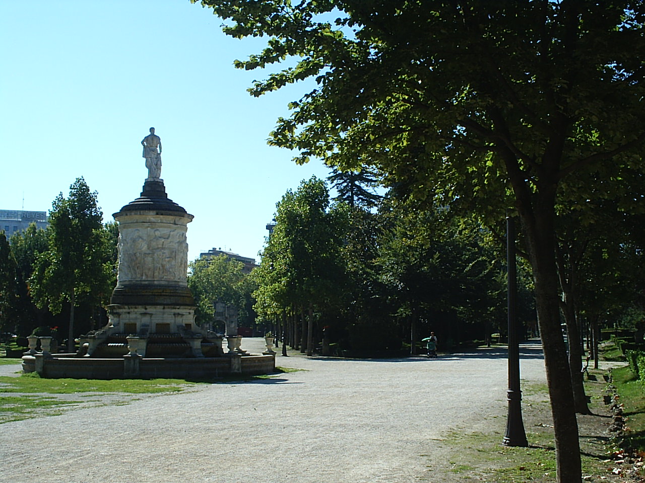
Taconera
Pampeluna
Taconera is Pamplona's oldest municipal park, laid out over the old defensive moats and bastions that once protected the capital of Navarre. Covering roughly 90,000 square meters, it is actually made up of three connected sections — Parque de Larraina, the Jardines de la Taconera proper, and Parque Antoniutti — forming a green belt between the old town and the San Juan district. How to get there? The park sits right on the edge of Pamplona's Casco Viejo, so it's an easy 10-15 minute walk from the city centre. Its most recognizable entrance is the Portal de San Nicolás, a Baroque triumphal arch that once served as one of the gates into the walled city and now marks the main approach from the old town. Because the park borders the Citadel of Pamplona, both sites pair naturally into a single walking route. What will you see? The land first appears on city plans as early as 1719, and it became part of Pamplona's fortified centre after the Citadel was built. The gardens as they look today date from 1830, when the old defensive moats were reworked into public grounds — a transformation that gives the park its distinctive layout of sunken walkways running below street level, right along the old city walls. The park's signature feature is the network of moats between the ramparts, home to a small open-air urban "zoo" that has existed here for generations. Fallow deer graze in the walled hollows, visible from paths that trace the old fortifications, while peacocks fan their tails near the Paseo de los Castaños, the park's chestnut-tree promenade. Ponds and small lagoons hold mallards, swans, and other waterfowl — in total the park is home to more than 280 animals, including several dozen deer, close to 150 waterfowl of various species, over a hundred other birds, and a handful of squirrels. Beyond the moats, Taconera keeps the character of a classic 19th-century romantic garden: winding gravel paths, flowerbeds, fountains, and mature trees, anchored by the long chestnut avenue. It's a favourite spot for locals out for a walk or a quiet break, and at the same time a living piece of Pamplona's military history — the same walls and bastions that once defended the city now enclose one of its calmest corners. When to visit? The park is free to enter and open year-round, and each season brings something different — flowerbeds and greenery peak in spring and summer, while the chestnut avenue and deciduous trees turn gold and red in autumn. Early morning or late afternoon are the best times to spot the deer and birds in the moats, when foot traffic is lighter and the animals are more active. Taconera also makes a good escape from the crowds during the San Fermín festival in July, when the city centre is packed but the park stays comparatively calm. Frequently asked questions Is there an entrance fee? No, Taconera is a free public park, open to everyone year-round. What animals can I see in the moats? The walled moats are home to fallow deer and peacocks, while the ponds host mallards, swans, and other waterfowl — over 280 animals in total. How much time should I plan for a visit? A relaxed walk through the whole park, including a stop at the moats and the Portal de San Nicolás, usually takes 45 to 60 minutes. Is it a good place to bring children? Yes — the animals, wide paths, and nearby playgrounds make it one of the most popular spots in Pamplona for families with kids.
-
Municipal La Granja Park
Burjassot
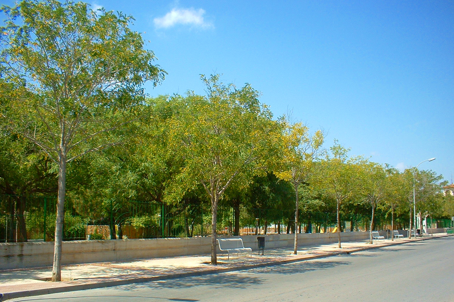
Municipal La Granja Park is one of the largest public parks in Burjassot, just outside Valencia — a favourite spot for families spending an afternoon outdoors and for anyone looking for shade and quiet away from the city bustle. Where is it and how do you get there? The park sits on Carrer del Pintor Goya 16, in the heart of Burjassot, a short distance northwest of central Valencia. The easiest way in is by metro toward the Burjassot-Godella line or by city bus, with stops right next to the park entrance. Drivers can find street parking nearby, though spaces fill up fast on weekends, especially in the afternoon. The park is open every day, typically from 9:00 to 21:00, so a visit fits equally well into a morning stroll or an after-work walk. What will you find inside? The grounds cover roughly 80,000 square metres and once served a very different purpose: this was the site of Valencia's Orange Growing and Plant Health Station (Estación Naranjera y Fitopatológica), and for years it also hosted the practice fields of the School of Agronomic Engineering. Traces of that past survive in the mature trees and pathway layout, and the park itself is split into two distinct sections. The first section holds the Casa de Cultura (House of Culture), a café, a children's library, and a summer terrace that turns into an open-air cinema and event space during the warmer months. The second section is built for younger visitors: a playground, sports zones, skateboard ramps, and a mock traffic town where kids on bikes, skates, and scooters practise road rules alongside real signs and signals. The park's standout attraction, especially for families, is a ride on its miniature steam train — a genuine coal-fired locomotive that carries passengers around a loop through the park on weekends, usually Sundays. It's one of the few attractions of its kind in the Valencia region and tends to draw a queue from early in the day. When is the best time to visit? Spring and autumn bring the most comfortable weather, with tree cover making even midday walks pleasant. In summer, the park comes alive in the evenings, when the terrace hosts open-air film screenings and the heat is easier to handle after sunset. If riding the steam train is the goal, plan for a Sunday and arrive early before the queue builds. Who is this park for? Municipal La Granja Park is above all a family destination — the playground, mock traffic town, and steam train make it one of Burjassot's most child-friendly corners. It also appeals to anyone seeking calm: the wide grounds, shaded paths, and old trees are well suited to walking, jogging, or simply sitting on a bench away from the pace of central Valencia. Frequently asked questions Is entry to the park free? Yes, access to the park is free and open to all visitors during opening hours. Does the steam train run every day? No, it typically runs on Sundays only — it's the park's main weekend draw, so arriving early is worth it since queues can build up. Is there somewhere to eat or grab a coffee inside the park? Yes, there's a café in the section near the Casa de Cultura, a convenient stop during a walk. Is the park suitable for a visit with young children? Absolutely — the playground, sports zones, and mock traffic town were designed specifically with younger visitors in mind.
-
Parque Las Indias
Santa Cruz na Teneryfie
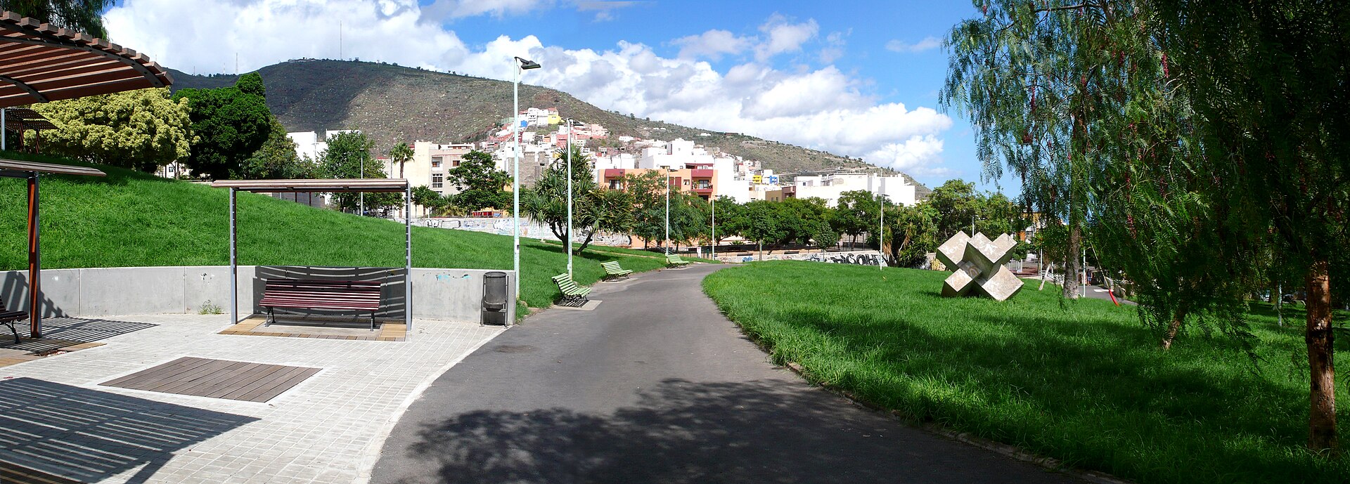
Parque Las Indias is an urban park in Santa Cruz de Tenerife, built on a steep hillside between the El Perú and La Salud neighborhoods. It was created to physically link two districts that previously had no direct urban connection, and today it stands as one of the main green recreational spaces in this part of the city. Where does the park come from, and what is its history? The park was designed by architects Federico García Barba and José Lorenzo García García. Their concept was presented in July 1983 as a response to the disconnection between the Cruz del Señor and La Salud neighborhoods. The project won two awards — the First Prize in the Parque de Las Indias competition and the Oraá Prize for Canarian Architecture 1992-93. Construction took far longer than the design phase: the park was not finished until November 1992, nearly a decade after the original proposal. How is the terrain laid out, and what will you see there? The defining feature of Parque Las Indias is its geometry: the plot forms an elongated triangle spread across a sloped site of roughly 22,000 square meters, with a gradient exceeding 11%. To manage the steep terrain and make walking through it easier, the park is organized into five square plazas arranged in a stepped sequence along the slope, all facing east. This terraced layout turns a walk through the park into a gradual climb through different levels, with each plaza offering its own view over the surrounding area. What changed after the latest renovation? In September 2019, the city formalized a renovation contract as part of the Neighborhood Plan for the Salud-La Salle district. The budget was around 2.5 million euros, with a planned construction window of 12 months — the work ultimately took nearly two years. The park reopened to the public on May 27, 2021. Following the renovation, each of the terraced plazas was given a distinct functional profile aimed at different age groups, complete with dedicated street furniture and activity zones. The space was decorated with murals from several artists, and LED lighting was installed throughout, improving usability in the evening hours. How do you get to Parque Las Indias? The park sits on Calle Ribera in Santa Cruz de Tenerife, right on the boundary between the El Perú and La Salud neighborhoods. Public transport connections are convenient, with nearby bus and tram stops serving routes that link the city center to this part of the Salud-La Salle district. Drivers will find street parking in the surrounding residential area, though spaces can be harder to come by during peak hours given the dense housing nearby. Who is this park for? Thanks to its terraced layout and clearly differentiated zones, Parque Las Indias works both as an everyday recreational space for residents of the surrounding neighborhoods and as a short, off-the-beaten-path stop for visitors exploring Santa Cruz de Tenerife beyond the usual sights. The park is also pet-friendly — the renovation was designed so the space could serve families with children as well as dog owners at the same time. Frequently asked questions Where exactly is Parque Las Indias located? On Calle Ribera in Santa Cruz de Tenerife, on the boundary between the El Perú and La Salud neighborhoods. When was the park built, and who designed it? It was designed in 1983 by architects Federico García Barba and José Lorenzo García García and completed in November 1992. When did the most recent renovation finish? The park reopened on May 27, 2021, after nearly two years of work costing around 2.5 million euros. What makes the park's layout distinctive? A triangular plot of about 22,000 square meters divided into five stepped square plazas designed to handle a slope of over 11%.
-
Campo de San Francisco, Salamanca
Salamanka
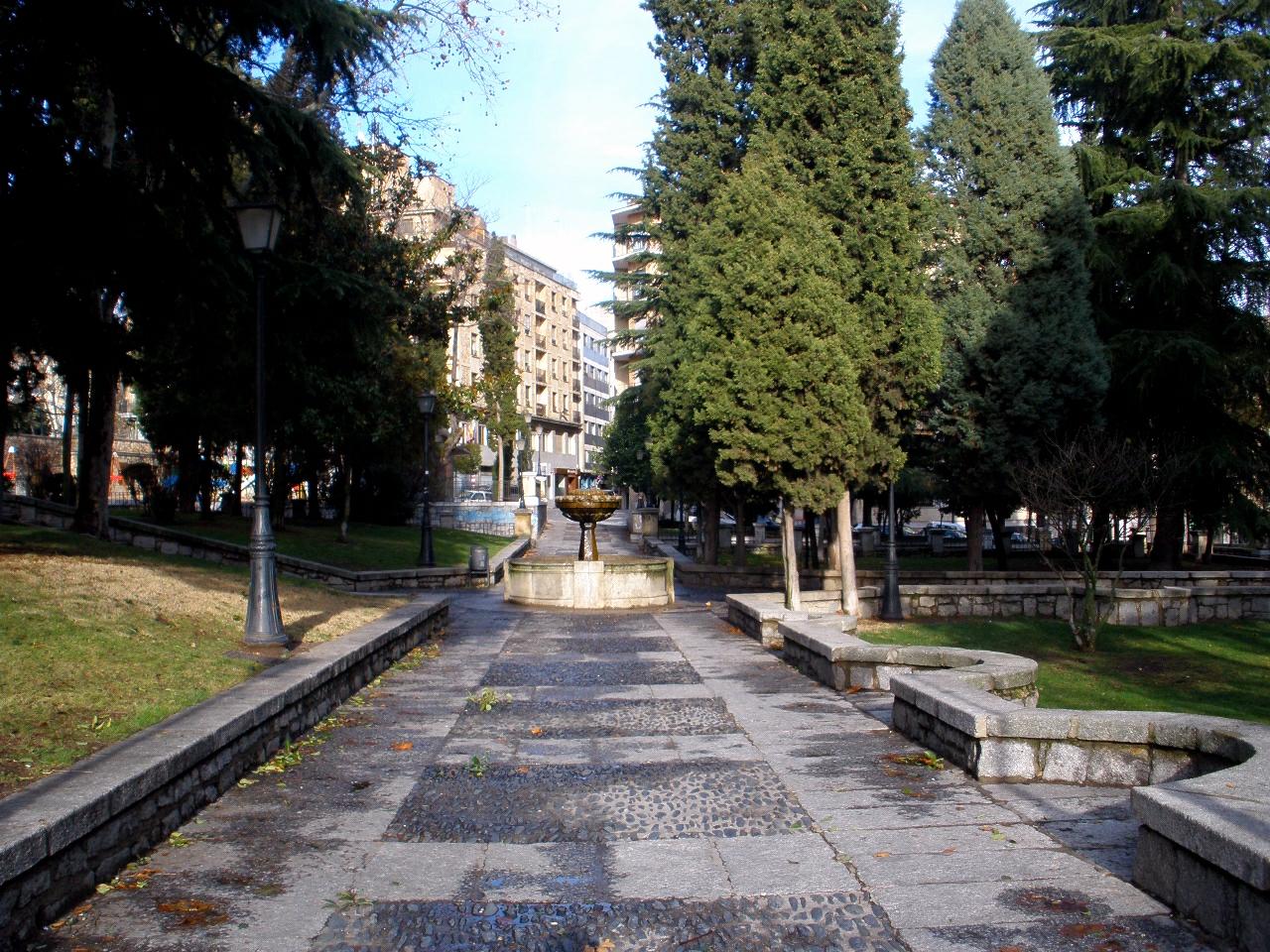
Campo de San Francisco is the oldest park in Salamanca, a green enclave right in the city centre, stretching between Paseo de Carmelitas and Calle Ramón y Cajal. It's a favourite spot for locals to walk and, together with the Huerto de Calisto y Melibea, one of the city's two romantic gardens. Where did this park come from? The site was originally the vegetable garden of the San Francisco El Grande convent, which no longer stands. In the 17th century there were plans to build two military barracks here, but the War of the Spanish Succession put a stop to the project, leaving the land undeveloped for decades. It wasn't until 1781 that the city's corregidor, José de Oliveras y Coronel, decided Salamanca should have a garden in the French style. The ground was levelled, flowerbeds, paths, staircases and sculptures were laid out — an expensive undertaking, carried out jointly with the city council, that was only partly finished by 1828. In the 19th century, governor Isidro López had 600 poplar trees planted and a fountain installed at the centre, giving the park the form it still has today. What will you see there? Inside the park stand two notable fountains: the Tomás Bretón fountain and the popular "la Taza" fountain. Tree-lined avenues, shaded benches and a classic garden layout make it a welcome stop for tourists looking for a break after exploring the old town, as well as a daily fixture for residents. The park has long been a source of inspiration for Salamanca's writers, who strolled through it and described it in prose and verse — among them Miguel de Unamuno and Carmen Martín Gaite. That literary pedigree makes Campo de San Francisco more than just green space; it's part of the city's cultural identity. How do you get there? The park sits in central Salamanca, within easy walking distance of the Plaza Mayor and the cathedral. The simplest way to reach it is on foot — a short walk of about ten to fifteen minutes from the main old-town landmarks, along Paseo de Carmelitas or Calle Ramón y Cajal. Given its central location, it works best as a stop along a walking tour of the city rather than a separate destination. When is the best time to visit? The park can be visited year-round, but it looks its best in spring and autumn, when the trees — descendants of the 19th-century poplars — turn colour and the mild weather invites longer walks. In summer, the shade of the mature trees offers relief from Salamanca's heat, and in the evenings the park tends to be a quieter place to rest than the busier area around the Plaza Mayor. Frequently asked questions Is there an entrance fee? No, Campo de San Francisco is a public city park, open all day with no admission charge. How long does a visit take? Walking through the park and seeing both fountains usually takes 20-30 minutes, though many visitors stay longer to rest on a bench. Are there other attractions nearby? Yes, the park borders Salamanca's historic centre, so it's easy to combine a visit with the cathedral, the Plaza Mayor or the Universidad de Salamanca. Why is the park called "de San Francisco"? The name comes from the former San Francisco El Grande convent, whose vegetable gardens occupied this site before the park was created.
-
Parque de San Lázaro
Ourense
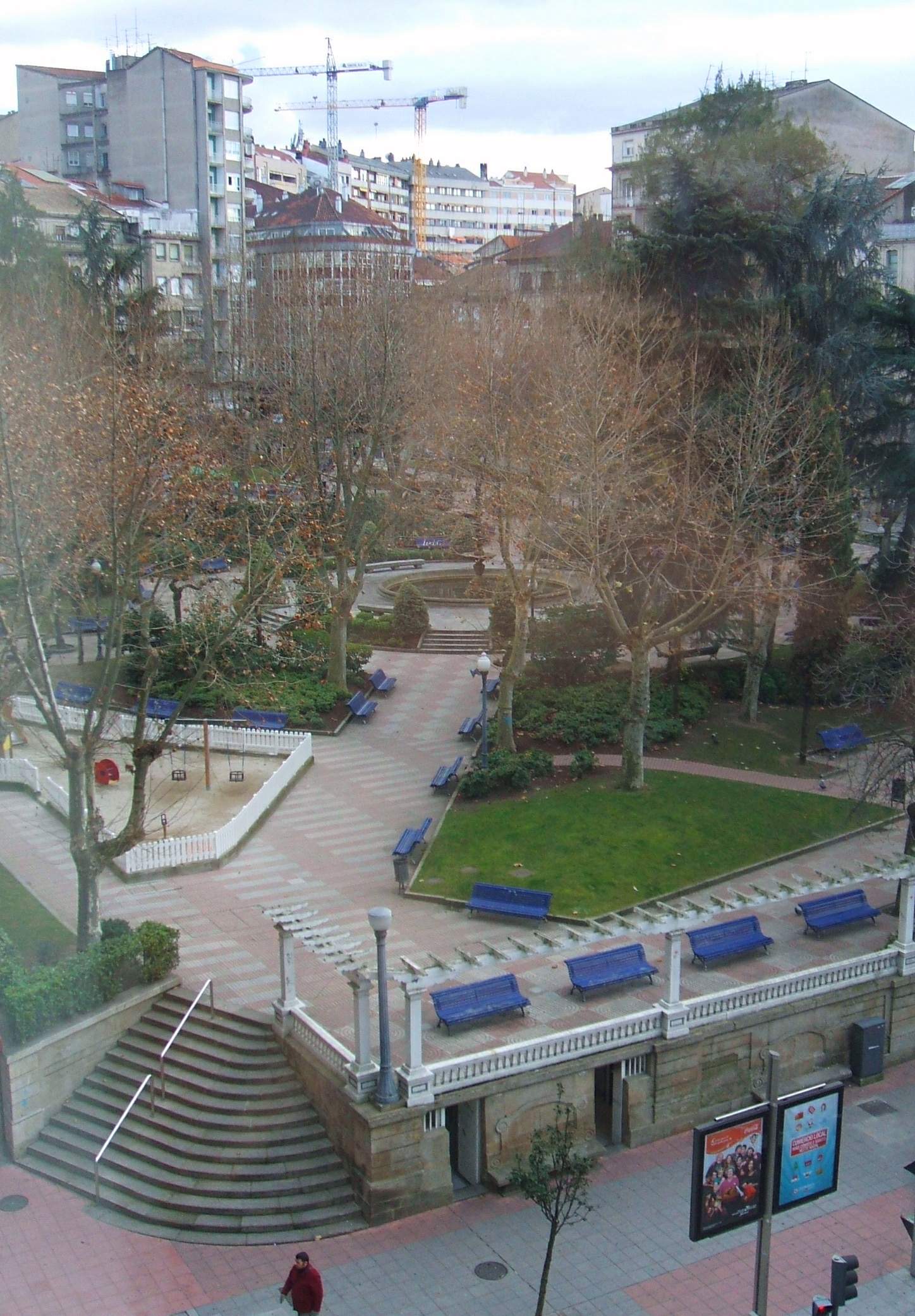
Parque de San Lázaro is the most central park in Ourense, capital of the Galician province of the same name. Laid out on a square plot split across two levels, criss-crossed by tree-lined paths and dotted with benches, it sits right in the heart of the city's shopping district — which is exactly why locals treat it as their favourite spot to pause between errands. Where does the park's name come from? The name goes back to the Middle Ages, when this site was home to a hospital for pilgrims walking the Camino de Santiago — a shelter that cared for the sick and travelers under the patronage of Saint Lazarus, traditionally associated with lepers and pilgrim hospices. A chapel dedicated to the same saint stood here until 1923, when it was demolished; the grounds were then gradually turned into the public gardens visitors see today. What is there to see in the park? The park's current layout follows the English garden style — looser and more naturalistic than a formal French design, with winding paths and freely spreading greenery. Its centrepiece is a Baroque fountain moved here from the Monastery of Oseira, one of Galicia's most important Cistercian abbeys, making it an interesting example of a historic religious element repurposed inside a city park. The second landmark is a large monument carved by Francisco Asorey, one of the most celebrated Galician sculptors of the 20th century. Completed in 1951, it commemorates the victims of the Spanish Civil War and now serves as a natural meeting point right at the centre of the park. When is the best time to visit? Parque de San Lázaro is worth a visit year-round: the tree canopy offers shade in summer, while the open, sunlit layout works just as well in spring and autumn. A particularly good moment to come is the Sunday before Palm Sunday, when the city celebrates the Fiesta de San Lázaro, a local festival tied directly to the site's history as a pilgrim hospital. It's a good chance to combine a walk through the gardens with a genuine local tradition. Thanks to its central location, the park makes an ideal base for exploring Ourense's old town — the main shopping streets and the historic centre are only a short walk away, making it a convenient resting point during a day of sightseeing. Frequently asked questions Is entry to the park free? Yes, Parque de San Lázaro is a public city park, open year-round with no admission fee. Where did the fountain in the park come from? The Baroque fountain was brought to the park from the Monastery of Oseira, one of Galicia's most important Cistercian abbeys. What does the monument in the centre of the park commemorate? The sculpture by Francisco Asorey, completed in 1951, commemorates the victims of the Spanish Civil War. What is the history behind the park's name? The name recalls the medieval hospital for pilgrims on the Camino de Santiago that once stood here, alongside a chapel dedicated to Saint Lazarus that was demolished in 1923.
-
Parque El Toríl
San Roque
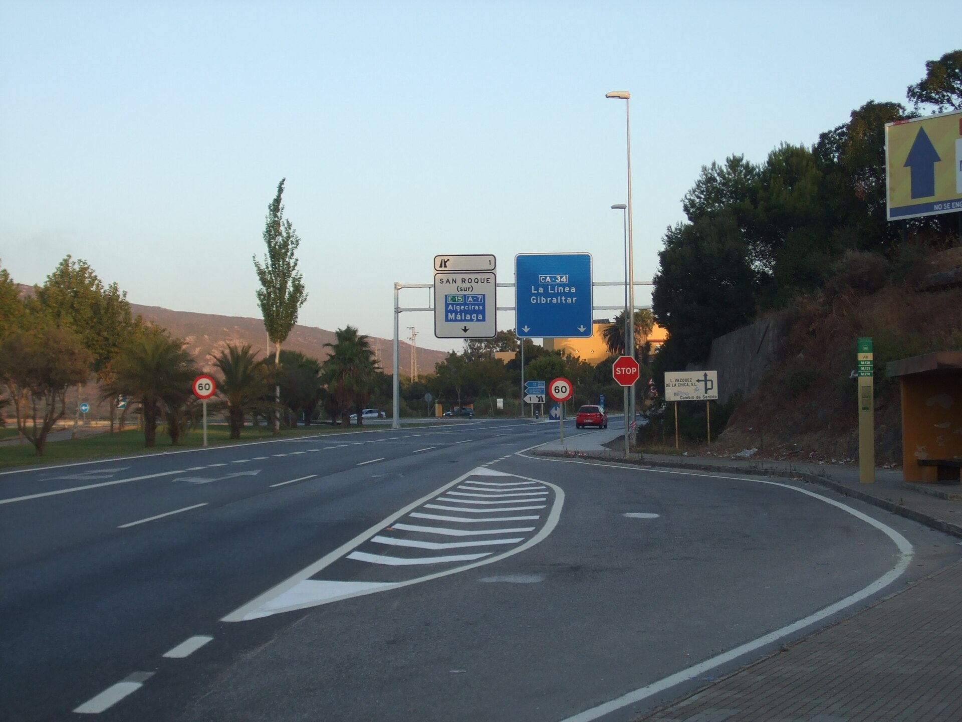
Parque El Toríl is a municipal park in San Roque, in the province of Cádiz, designed by landscape architect Emilio Maestre. It sits on the southern edge of town, right next to the junction of the Mediterranean Highway (A-7) with the CA-34 road — the very interchange that forms the main gateway into San Roque. The park is bordered by Calle Velázquez, the municipal sports pavilion, and the El Toríl junction itself, which gave the park its name. What can you see there? El Toríl has more than twenty years of history behind it, with the San Roque city council steadily adding new features to keep the site multidisciplinary and appealing to residents of every age. Younger visitors get a dedicated play area with a double zip-line, slides built into the slope, a pyramid-shaped climbing structure, a rope trampoline and a sandbox. Older visitors have their own recreation zone with exercise equipment, and the middle of the park opens onto a wide sandy ring used for walking and general outdoor activity. There's also a spot for four-legged visitors: the park includes a dog park that recently underwent a full renovation. The whole area is green and spacious, which makes it a popular place for families to spend an entire afternoon, combining play for the kids with a place to unwind for the adults. How do you get to Parque El Toríl? The park doubles as San Roque's main transport hub — it's home to the town's interurban bus station. Buses from the north stop run to Algeciras, Los Barrios, Cádiz and Seville, while the south stop serves La Línea de la Concepción and Málaga. That makes El Toríl a natural reference point for both locals and travellers moving around the Campo de Gibraltar area. Drivers arriving by car benefit from the park's location right next to the A-7 exit and its link to the CA-34 — the park becomes visible almost as soon as you turn off toward San Roque's town centre. When should you visit? The park is open year-round, and its open, green layout works best in spring and autumn, when temperatures in Andalusia are milder. In summer, mornings or evenings are the better choice, avoiding the hottest part of the day. Because the municipal sports pavilion sits right next door, the park can also get busier around sporting events held nearby. Frequently asked questions Is Parque El Toríl good for kids? Yes — that's one of its main draws. The play area includes a zip-line, slides, a climbing structure and a sandbox, so it's clearly set up with younger visitors in mind. Can I bring my dog? Yes, the park has a dedicated dog park that was recently renovated. How do I reach the park by public transport? El Toríl hosts San Roque's main bus station, with connections to Algeciras, Los Barrios, Cádiz, Seville, La Línea and Málaga. Are there facilities for older visitors? Yes, there's a recreation zone with exercise equipment aimed at senior visitors.
-
Jardín de Isabel II, Aranjuez
Aranjuez
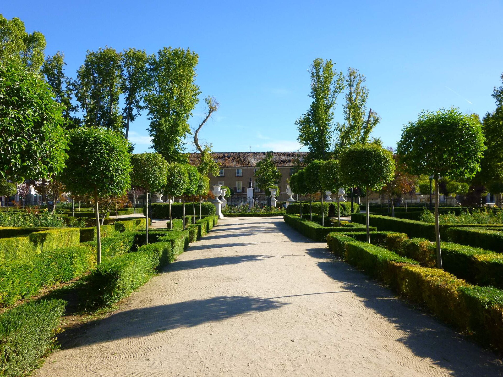
Jardín de Isabel II is a small historic urban garden at the heart of Aranjuez, the Spanish town famed for its royal residences on the banks of the Tagus river. Unlike the sprawling palace gardens Aranjuez is known for, this green square is modest in scale — yet it holds a distinctive place in the town's urban history. Where does the name come from and when was it built? The garden takes its name from Queen Isabel II, who was still a child when the space was created. Trees were first planted on the plot in 1830, and four years later, in 1834, a statue of the infanta Isabel — then only four years old — was placed at its center. The garden dates from the period of her minority, when the Crown oversaw the regency. Historians consider it the first landscaped space in Aranjuez designed for the town's residents rather than the royal court, and quite possibly one of the earliest public gardens of its kind anywhere in Spain. Where exactly is it, and how does it fit into the town plan? The garden occupies a plot originally earmarked for a building block next to the Casa de Infantes, closing off one side of the Plaza de San Antonio. Its closeness to the Royal Palace meant the neglected corner it once was could not be left as an eyesore, so the site was turned into a representative green enclave befitting its royal neighbor. What will you see walking through it? The square shape of the plot dictated a geometric, almost cloister-like layout: paths cross at a central point, forming a cruciform plan. The four arms of that cross align with the four street entrances around the perimeter, so the garden can be crossed easily from any direction. At the very center stands the statue of the young infanta Isabel — the feature that gives the garden its identity and serves as a natural landmark for anyone strolling through. Mature trees, shaded paths and a symmetrical layout give the space the feel of a 19th-century urban garden, a deliberate contrast to the grand scale of Aranjuez's nearby palace gardens. Why does it hold heritage status? Jardín de Isabel II has been listed as a Bien de Interés Cultural — Spain's highest category of protected heritage — since 1931. Since 2001 it has also formed part of the area inscribed on the UNESCO World Heritage List as the "Aranjuez Cultural Landscape," a designation covering the town's entire historic palace-and-garden ensemble. How do you get there, and when is the best time to visit? Aranjuez lies about 50 km south of Madrid and is well connected by rail — Cercanías line C-3 trains reach it from the capital in under an hour. The garden itself sits within the historic center of town, close to the Royal Palace, so the easiest approach is on foot after visiting the main sights of the Real Sitio. As a public open space, it's free to enter and has no fixed opening hours like a ticketed monument. Spring and autumn are the most comfortable seasons to visit, with milder temperatures than Spain's hot summers and the greenery at its most attractive. Frequently asked questions Is there an entrance fee? No, it's an open public urban space, free to enter at any time of day. How long does a visit take? It's a small square, so a walk-through typically takes 10–15 minutes — best combined with a visit to the Royal Palace or the other gardens of Aranjuez nearby. What does the statue at the center represent? It depicts Queen Isabel II as a four-year-old girl. It was placed in 1834, during her minority, and has given the garden its name ever since. Is the garden part of a larger tourist complex? Yes, it lies within the Real Sitio de Aranjuez, listed by UNESCO as the Aranjuez Cultural Landscape, alongside the Royal Palace and the town's other historic gardens.
-
Plaza Zabalburu
Bilbao
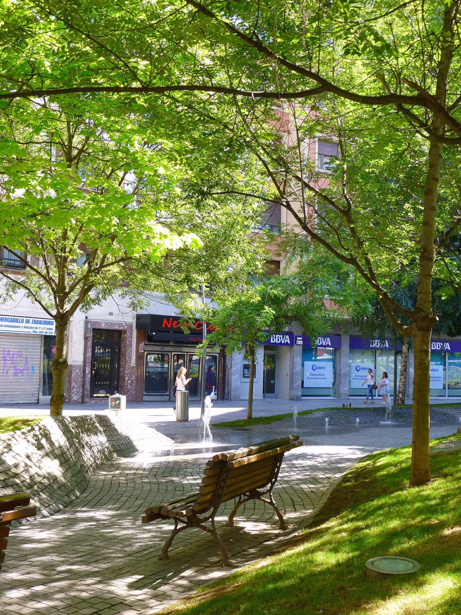
Plaza Zabalburu is one of Bilbao's more unexpected squares — a place where an aristocratic family estate gave way to an urban "forest" filled with illuminated sculptures. It sits at the junction of Calle Autonomía and Calle Hurtado de Amézaga, right in the city center, next to Abando metro station. Where does the square's name come from? The land the square now occupies once belonged to the Zabálburu family, Basque industrialists and patrons whose estate, Villa Mena, originally stood on this exact spot. As Bilbao expanded through the 19th and 20th centuries, the private residence gradually gave way to public space. It was here, on the grounds of today's square, that the ceremony formally annexing the municipality of Abando to the city of Bilbao took place on 1 July 1890 — an event that permanently redrew the city's administrative map. How has the square changed over time? Back in the 1960s, Plaza Zabalburu still had a circular layout. In 1977, an illuminated fountain was installed at its center, becoming a defining feature of the square for decades. It was dismantled in 2004, however, when work began on an underground car park beneath the plaza — a common solution for tight urban centers. The real transformation came in 2008, when the square underwent a full redesign. Instead of the old circular layout with its fountain, a completely new concept emerged: an urban forest meant to shield pedestrians from the noise and traffic of the surrounding streets. What can you see there today? Today's Plaza Zabalburu covers nearly 3,000 square meters of reclaimed recreational space. Its defining feature is a collection of 77 trees of varying sizes, forming a natural green barrier between the square and the busy streets around it. The ground itself has been shaped into rolling "dune"-like waves, an architectural detail that adds visual interest on its own. Families will find two children's playgrounds, while those looking for a quiet moment can rest by two ground-level fountains set flush with the pavement. The square's real signature, though, is a set of eight illuminated sculptures by Italian artist Mario Nanni. These slender, obelisk-shaped structures rise 15 meters and project beams of light that shift color depending on weather conditions. The effect is especially striking after dark, making an evening visit well worth planning for. How do you get to Plaza Zabalburu? The easiest way to reach the square is by metro — Abando station sits right next to it. Thanks to its central location, the square pairs easily with a stroll through other parts of downtown Bilbao, including the adjoining Calle Autonomía and Calle Hurtado de Amézaga. When is the best time to visit? The square can be visited year-round, but keep in mind that Mario Nanni's illuminated sculptures reveal their full effect only after nightfall. In summer, the trees provide welcome shade on hot days, and the playgrounds draw local families, keeping the square lively for much of the day. Frequently asked questions What is Plaza Zabalburu? A modern urban square in downtown Bilbao, designed as an "urban forest" with 77 trees, two fountains, and eight illuminated sculptures. Where does the square's name come from? From the Zabálburu family, Basque industrialists and patrons whose Villa Mena estate once stood on this site. How do you get to the square? The nearest metro station is Abando, located right next to the plaza. What is the square's biggest attraction? Eight 15-meter illuminated sculptures by Mario Nanni that change color with the weather — best seen after dark.
-
G4 park
Badalona
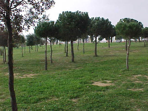
G4 park is a six-hectare municipal park in the Montigalà neighborhood of Badalona, opened in 1994. How do you get to G4 park? The park sits in the northern part of Badalona, in the Montigalà district, bordered by Carrer de la Ciència, Travessera de Montigalà, Camí de Sant Jeroni de la Murtra and Avinguda de la Comunitat Europea. The main entrances are on Carrer de la Ciència and Avinguda de la Comunitat Europea, making it easy to reach on foot from the surrounding residential blocks or by the bus lines that run along those streets. It pairs naturally with a walk through Montigalà's other green spaces, though it's worth double-checking the exact address before heading out — the district has a handful of similarly numbered parks, including a separate "G5 park" nearby. What will you see there? G4 park is essentially a large meadow with a woodland feel. Pines, cork oaks and Mediterranean shrubs grow throughout, and most of the ground is covered in regularly mown grass, with paved paths crossing the open lawns. That mix of open grassy areas and clusters of trees gives the park good summer shade while still keeping a sense of open space that's less common in Badalona's denser neighborhoods. The paved paths make it equally suited to a slow walk, a run, or a bike ride. The park's best-known feature is a sculpture by the Catalan poet and artist Joan Brossa, known as the "Far de Joan Brossa" (Joan Brossa Lighthouse). It began as a visual poem from 1987 dedicated to the city of Badalona, later turned into a physical sculpture in 1996 under the title "On és Bada l'ona" — a wordplay on the city's name. The structure does double duty: it's a public artwork that also conceals a telecommunications antenna, an unusual pairing of urban infrastructure and public art. When is the best time to visit? With its open lawns and shaded tree cover, the park works year-round, though spring and autumn are the most comfortable, with milder temperatures and the greenest-looking meadow and shrubs. In summer, the shade under the pines and cork oaks offers relief from the midday sun. The park is free and open to the public, so it can be visited at any time within standard local opening hours for green spaces. Who is this park for? G4 park is a neighborhood-level recreational space — no admission fees, no elaborate visitor infrastructure, just room to walk, run and relax on the grass. It suits anyone looking for a quiet break away from central Badalona, as well as fans of public art who want to see Joan Brossa's unusual sculpture in a green, everyday setting rather than a museum. Frequently asked questions How big is G4 park? The park covers roughly 6 hectares in the Montigalà district of Badalona. When did the park open? G4 park opened in 1994. What is the sculpture in the park? It's the "Far de Joan Brossa," a visual poem from 1987 by Joan Brossa turned into a sculpture in 1996, which also conceals a telecommunications antenna. Is entry to the park free? Yes, G4 park is a public municipal park with no admission charge.
-
Parc de Can Barriga
Badalona
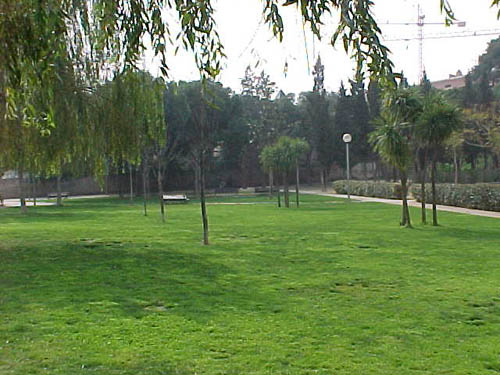
Parc de Can Barriga is a small municipal park in the Bufalà neighbourhood of Badalona, right along Avinguda de Martí Pujol. It's a quiet local green space rather than a major attraction, but it's an easy add-on to a walk through this part of the city, especially if you're after shade and greenery away from the busy seafront promenade. Where does the name come from and what does the park look like? The park takes its name from the former Can Barriga estate, part of whose land it now occupies. It was opened to the public in 1993. Two historic farmhouse buildings from the original estate, along with their surrounding grounds, still stand today — they now house a special education school, which is why the park sits directly next to that institution. The park is compact, covering roughly 0.52 hectares, and is laid out over two levels. It's bordered by Avinguda de Martí Pujol and the streets of Tànger and Xaloc. Entrances were designed with accessibility in mind, so getting in is straightforward from any of the surrounding streets, including for visitors with reduced mobility. What will you find inside? The grounds are organised into three distinct zones. The section facing Avinguda de Martí Pujol is covered in grass and low shrub vegetation — the greenest part of the park. The middle zone has sandy ground and is where you'll find children's play areas and rest spots with benches, making it the part where families tend to gather. The third zone is a gentle slope descending toward Tànger street, adding some natural variation to the terrain. The planting mixes Mediterranean species — pines and oaks — with more exotic trees such as jacarandas and pepper trees. One notable detail: the park is irrigated with water drawn from the Can Barriga well, which it shares with the neighbouring Nelson Mandela park, a reminder that both green spaces grew out of the same old agricultural estate. How do you get there? The park sits on Avinguda de Martí Pujol, one of Badalona's main arteries, so it's easy to reach by public transport. Bus lines B2, B6 and B9 all stop nearby, making it a simple trip from the city centre or other neighbourhoods. For those on foot or by bike, the park makes a convenient stop on routes connecting the inner city with areas further from the coast. When should you visit? Given its modest size and low-key character, Parc de Can Barriga works best as a spot for a short break during the day — a morning stroll, an afternoon with kids at the play area, or a few minutes in the shade during the hot summer months. The Mediterranean planting keeps the park shaded for most of the year, so it's a pleasant stop in any season, though spring and summer make the most of the greenery and shade on offer. Frequently asked questions Is Parc de Can Barriga good for a walk with kids? Yes — the sandy middle section of the park has play areas and rest zones, making it a convenient spot for families with young children. What's the easiest way to reach the park without a car? By bus. Lines B2, B6 and B9 all stop right along Avinguda de Martí Pujol, next to the park. Is the park accessible for people with disabilities? Yes, the entrances were designed to be accessible for wheelchair users and people with reduced mobility. How does this park differ from the neighbouring Nelson Mandela park? The two parks sit side by side and share irrigation water from the Can Barriga well, but Can Barriga is smaller and more intimate, centred on the site of a former agricultural estate, while Nelson Mandela park is a separate, adjoining green space.
-
Parque de la Isla, Plasencia
Plasencia
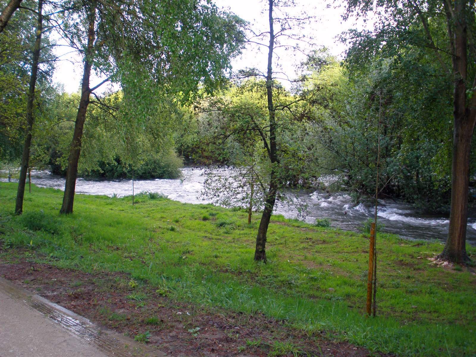
Parque de la Isla is a municipal park in Plasencia, spread across a river island in the middle of the Jerte, right in the heart of the city. Covering roughly 10 hectares, it is one of the most popular spots for locals to relax and a natural stop for anyone exploring the old town. Why is it called "the island park"? The name comes straight from its location — the park sits on a natural island formed by the branches of the Jerte river as it flows through the urban stretch of Plasencia. Water wraps around the park on two sides, giving it the feel of a green enclave tucked away from city noise, even though the cathedral and main square are only a few minutes' walk away. What makes its history unusual? The park has an unusually old pedigree by Spanish standards — it is considered one of the first public parks in Spain. King Felipe V took a liking to the area, using it as his favorite hunting ground, and his fondness for the spot helped preserve it as open green space for the city. Over the following centuries the park gradually gained new recreational features while keeping its riverside vegetation intact. What is there to see and do? The star attraction is a natural swimming area fed by the Jerte, stretching along the section between the new bridge and the island bridge — in summer it becomes a favorite spot for locals to cool off. Beyond the water, the island also offers: children's playgrounds with swings and other equipment, sculptures and small architectural features scattered through the grounds, an outdoor gym area aimed at older visitors, a designated space for dogs, shaded spots for picnics and rest under the trees. A bar, restaurant, and kiosk operate on the island as well, run by local businesses under agreement with the town hall — a convenient stop for a meal or a coffee break during a walk. How do you get there? The park sits right in the center of Plasencia, so it's just a short walk from anywhere in the old town. Several bridges connect the island to the rest of the city, allowing entry from multiple directions — from the historic quarter as well as from the newer neighborhoods across the river. When is the best time to visit? Summer draws the biggest crowds thanks to the natural pool and the shade of the trees, which offers welcome relief from Extremadura's heat. Spring and autumn bring a quieter atmosphere, better suited to strolling and taking in the riverside greenery. In winter the park is calmer still, but remains open and pleasant for walkers and joggers. Frequently asked questions Can you swim in the park? Yes, during the summer season a natural river pool operates along the stretch of the Jerte that flows through the park — it's one of the main draws of the place. Is the park suitable for children? Yes, there are playgrounds and open green areas, which make it a popular choice for families. Can you get something to eat there? The island has a bar, restaurant, and kiosk, so you can stop for a meal or a snack without leaving the park. How long does it take to see the whole park? A relaxed walk around the grounds usually takes 30 to 60 minutes, longer if you plan to rest by the water or stop for a meal.
-
Parque Periurbano de La Pulgosa
Albacete
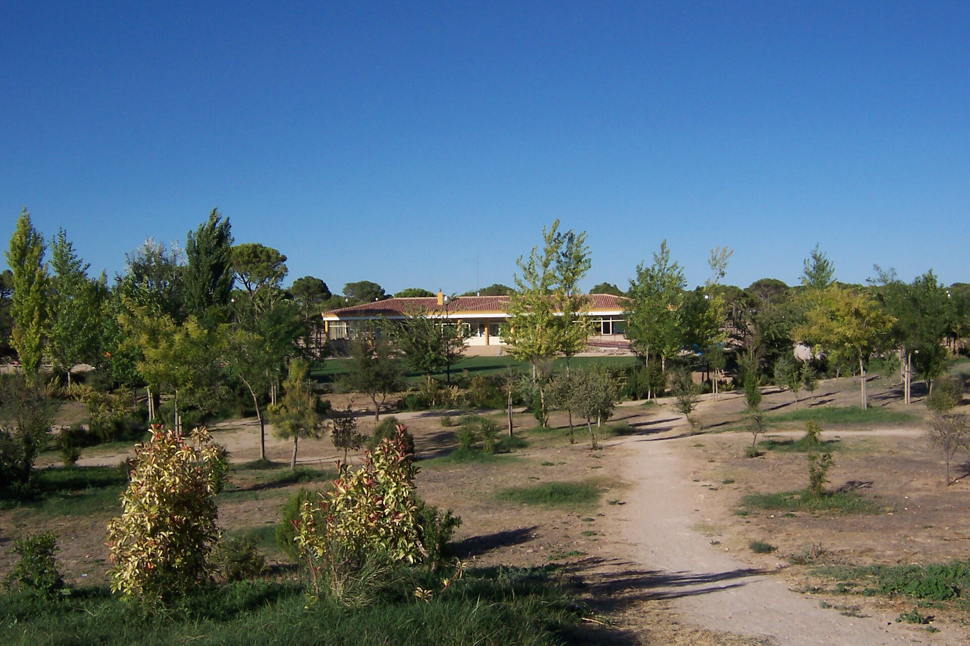
Parque Periurbano de La Pulgosa is the largest park in Albacete and one of the biggest periurban parks in Castilla-La Mancha, covering roughly 40 hectares south of the city center, close to the Los Llanos Air Base and the NATO Pilot Training School. How do you get there? The park sits on the southern edge of Albacete, a manageable distance from downtown, so a car or a local city bus is the most convenient way to arrive — there's on-site parking for visitors. Walkers and cyclists can also reach it via paths connecting the park to neighboring districts. Given how spread out the grounds are, it's worth deciding in advance which section to explore, especially on a short visit. What will you see inside? The landscape is dominated by the stone pine (Pinus pinea), with some Aleppo pine (Pinus halepensis) mixed in, alongside aromatic Mediterranean shrubs and wide grassy clearings. This is the result of decades of transformation: land that was neglected agricultural ground for much of the 20th century was turned into an organized municipal park in the 1990s, aimed at protecting greenery and giving residents a proper recreational space. The park includes three sports courts, a skating rink, a BMX track, and children's playgrounds. Its large lawns are made for picnics and family gatherings, and the tree cover offers welcome shade even during Albacete's hot summer days. The city keeps investing in the site: a recent environmental plan calls for planting over 4,050 new trees and nearly 9,450 shrubs, backed by a 2.6-million-euro investment from European funds, aimed at boosting biodiversity and improving quality of life around the park. When should you visit? Spring and autumn bring the mildest temperatures and the greenery looks its best. In summer, the pine woodland provides shade, making the park a solid alternative to the sweltering city center during the hottest part of the day. Families tend to show up on weekends, when the sports courts and playgrounds see the most activity, while anyone after a quieter visit should aim for weekdays or early mornings. Who is this park for? La Pulgosa works for almost everyone: families with children (playgrounds, picnic space), sports enthusiasts (courts, BMX track, skating path), and anyone simply looking to get some fresh air away from the city bustle. The park's size means different groups of visitors can use it at the same time without getting in each other's way. Frequently asked questions How big is Parque Periurbano de La Pulgosa? It covers around 40 hectares, making it the largest park in Albacete and one of the biggest periurban parks in all of Castilla-La Mancha. What sports facilities does the park have? There are three sports courts, a skating rink, a BMX track, and playgrounds for children — the park mixes leisure space with dedicated sports infrastructure. Is there plenty of greenery and shade? Yes, the dominant species is the stone pine (Pinus pinea), with some Aleppo pine as well, providing shaded paths even on hot days. Are there further improvements planned for the park? Yes — the city is carrying out an environmental plan to plant over 4,050 trees and close to 9,450 shrubs, funded with 2.6 million euros from European funds, aimed at improving the site's biodiversity.
Earn badges for the places you visit
Download NextOnTrip, discover new places and check off your trails.