- Botanical Gardens
- Recreation and entertainment
Botanical Garden of Santa Catalina
About this place
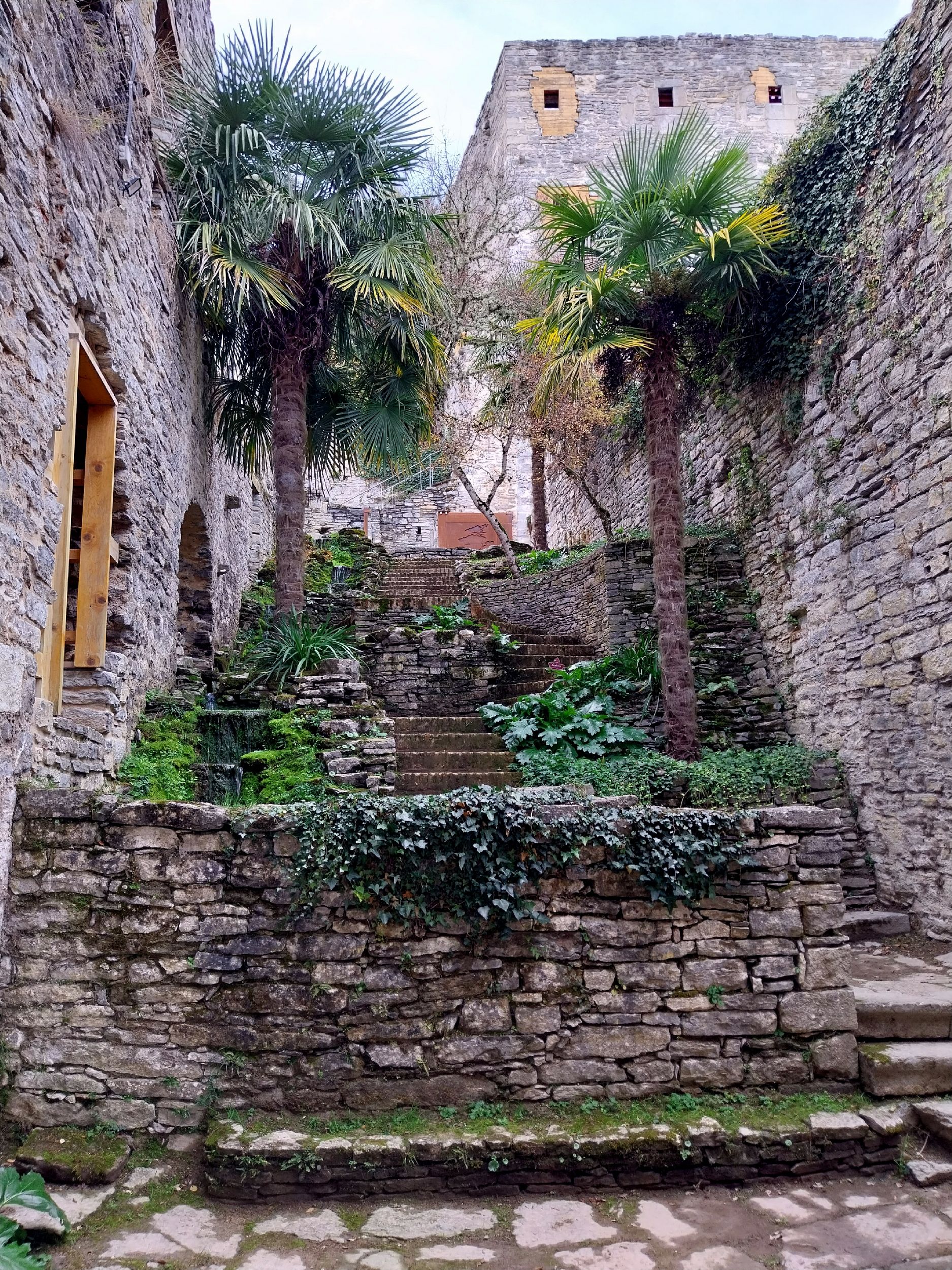
The Botanical Garden of Santa Catalina is located in the municipality of Iruña de Oca, in the province of Álava, in the Basque Country, northern Spain. The garden is centered around the ruins of the Santa Catalina convent, situated between the Zadorra river and the Badaia mountain range, close to the village of Trespuentes.
Where exactly is it located?
The garden's position is closely tied to the local terrain of this part of Álava. On one side, the land borders the Zadorra riverbed, one of the rivers draining the central part of the province; on the other, it rises toward the limestone slopes of the Badaia range. This combination means the surrounding landscape blends a lower, damper riverside setting with a rockier, more rugged mountain backdrop. Trespuentes, the nearest settlement, sits right next to the site, and it is around this village that the garden's coordinates are commonly placed.
The convent ruins at the heart of the garden
The reference point for the whole site is the ruins of the former Santa Catalina convent. The garden's layout is organized around these remains, which form its historical core and give the place a character different from a purely recreational park. The presence of the ruins means visitors encounter both a natural element and a trace of former religious architecture, set within a specific Basque historical context.
Regional geographic context
Álava is one of the three provinces of the Basque Autonomous Community, known for its varied landscape — from fertile river valleys to mountain ranges surrounding the central basin where the provincial capital, Vitoria-Gasteiz, is located. The Badaia range, mentioned as one of the garden's natural reference points, belongs to the system of hills enclosing that basin from the west and north. The Zadorra river, in turn, is one of the region's main watercourses, playing a significant role in the local landscape and water management of the surrounding municipalities.
Iruña de Oca and Trespuentes
The municipality of Iruña de Oca, where the garden is located, comprises several smaller settlements in this part of Álava. Trespuentes, mentioned as the closest landmark to the garden, is one of them — its proximity to the site where the convent once stood, and where a botanical garden now extends, makes it a natural starting point for anyone planning a visit.
Coordinates and orientation on the ground
The garden can be located at geographic coordinates around 42.849° north latitude and -2.808° longitude. For anyone planning a route through this part of Álava, this is a useful reference point, especially since the area is not densely built up, and orientation based solely on settlement names can be harder than in larger urban centers.
Frequently asked questions
Where exactly is the Botanical Garden of Santa Catalina located? In the municipality of Iruña de Oca, in the province of Álava, in the Basque Country, between the Zadorra river and the Badaia mountain range, near the village of Trespuentes.
What forms the central point of the garden? The ruins of the former Santa Catalina convent, around which the entire site is organized.
Which settlement is closest to the garden? Trespuentes, part of the municipality of Iruña de Oca.
What natural landscape features surround the garden? The Zadorra river on one side and the Badaia mountain range on the other — these two elements define the garden's geographic setting.
Nearby places

Earn badges for the places you visit
Download NextOnTrip, discover new places and check off your trails.