Sacred Monuments in the United Kingdom
A guide to 422 Sacred Monuments in the United Kingdom — with descriptions, photos and traveler visits from the NextOnTrip community. Locations spread across 186 cities and towns. Most visited by the community: Bar Convent, St Pancras and Islington Cemetery, Hampstead Cemetery.
-

Sinai Synagogue, Leeds
Leeds
Sinai Synagogue is a Reform Jewish congregation on Roman Avenue in Roundhay, a suburb in the north of Leeds, West Yorkshire. Founded in 1944, it is affiliated to the Movement for Reform Judaism and is still an active place of worship today. What is Sinai Synagogue? Sinai is a synagogue and a community at the same time: a congregation of Reform Jews that meets in a purpose-built home in Roundhay. The building combines the main synagogue hall with a function hall, a library and classrooms, so it serves as a place for worship, learning and community events. Visitors interested in the Jewish heritage of Leeds will find it one of the city's best-known Reform institutions. When and how was the congregation founded? The story begins in the middle of the Second World War. On 8 January 1944 a small group of six people gathered at a private house in the Oakwood area of Leeds for a service led by Rabbi L. Graf from the Reform synagogue in Bradford. Many of the early members were refugees, and the new congregation grew from that modest start. In its first years the community had no building of its own. Services were held in borrowed rooms, among them the Friends' Meeting House on Street Lane and a schoolroom at Newton Park Union Church on Spencer Place in Chapeltown. Where did the congregation worship before Roman Avenue? From around 1951 until 1960 the congregation used a building at 21 Leopold Street, which had previously been the Spanish and Portuguese Synagogue. Sinai bought it for £700. After the congregation left, the premises were converted into the Jinnah Mosque in 1961. The Roman Avenue building In 1950 a member and community leader, Malcolm Featherman, bought the plot on Roman Avenue where the synagogue now stands. The purpose-built synagogue was completed in 1960 to a Modernist design by the architects Halpern & Associates. In the mid-1980s the building was extended, which added the facilities that now surround the main hall. Cemetery In the early 1960s the congregation was given a burial plot at Harehills Cemetery in Leeds. It is still in use. Practical information Address: Roman Avenue, Roundhay, Leeds, West Yorkshire, England. Movement: Movement for Reform Judaism. Founded: 1944; current building from 1960. Area: Roundhay, a residential suburb in north Leeds. Frequently asked questions Is Sinai Synagogue still active? Yes. It is a working Reform congregation with its own building, library and classrooms. When was the current building completed? In 1960, with an extension added in the mid-1980s. Who designed it? The Modernist building was designed by Halpern & Associates. What happened to the earlier synagogue on Leopold Street? After Sinai moved out, it became the Jinnah Mosque in 1961. Is the synagogue open to casual visitors? It is an active place of worship, so check the congregation's own website for opening times and visiting arrangements before you go.
-

Lansdown Cemetery
Bath
Lansdown Cemetery is a historic burial ground on Lansdown Hill, just outside Bath in Somerset, England. It is inseparable from Beckford's Tower, the neo-classical folly that rises beside it, and together the two form one of the most unusual memorial landscapes in the city. What is Lansdown Cemetery? The cemetery was consecrated in 1848 and holds more than 5,000 graves, among them the resting places of many well-known residents of Bath. It is not a typical parish churchyard. It grew up around a tower built as a private retreat, and the story of how it came to exist is part of its appeal. Both the cemetery and the tower are protected. The tower and its attached railings are Grade I listed, and the cemetery together with the tower is included on the Register of Historic Parks and Gardens of special historic interest in England, at Grade II. The joint entry was designated on 30 April 1987. Who was William Beckford, and why is he buried here? William Beckford was a wealthy collector and writer who lived in Bath. After buying two houses in Lansdown Crescent, he bought land on Lansdown Hill and commissioned the local architect Henry Edmund Goodridge (1797-1864) to design a tower there. Originally called Lansdown Tower, it was completed in 1827. Beckford had hoped to be buried on his own land, but the ground was unconsecrated. When he died in 1844 he was instead buried in the Bath Abbey cemetery, in front of the chapel, in a large granite sarcophagus standing above ground. How did the cemetery come about? After Beckford's death the tower was due to be sold to an innkeeper. His daughter, the Duchess of Hamilton, stepped in and bought it back. She then gave the tower and the surrounding grounds to the former parish of Walcot, on one condition: that a cemetery be created so her father's tomb could be returned to his own land. The parish agreed. The new cemetery was consecrated in 1848, the tomb was moved there, and the tower was converted into a mortuary chapel. What can you see today? Beckford's granite tomb is the best-known monument. It sits isolated on its own island, surrounded by elaborate and varied memorials from the Victorian era onward. The grave of his architect, Henry Edmund Goodridge, is also here. Walking the paths, you can read inscriptions, compare monument styles and enjoy the views typical of a hilltop site. The tower beside the cemetery is the focal point, and the two are best seen together. Frequently asked questions Where is Lansdown Cemetery? On Lansdown Hill, on the edge of Bath, Somerset, next to Beckford's Tower. Who is buried at Lansdown Cemetery? William Beckford, his architect Henry Edmund Goodridge and many other well-known Bath residents. There are more than 5,000 graves in total. When was the cemetery consecrated? In 1848, when Beckford's tomb was brought back from the Abbey cemetery. Is it a protected site? Yes. Beckford's Tower is Grade I listed, and the cemetery with the tower is on the Register of Historic Parks and Gardens at Grade II. What is the connection to the tower? The tower was built in 1827 as Beckford's retreat and became the cemetery's mortuary chapel after the cemetery was founded. Is it worth a visit? For anyone interested in Georgian and Victorian Bath, architecture or quiet historic places away from the city centre, yes. It pairs naturally with a visit to the tower.
-

Mount Cemetery
Guildford
Mount Cemetery in Guildford, Surrey, is a quiet hillside burial ground that doubles as one of the town's most atmospheric viewpoints and history walks. Also known as Guildford Cemetery, it occupies the Mount, a spur of the North Downs rising just above the town centre, and it sits right beside the eight-sided Victorian landmark known as Booker's Tower. What is Mount Cemetery? It is the municipal cemetery of Guildford, laid out on a steep chalk slope. Rows of weathered headstones, mature trees and winding paths give it the feel of a small park, and the elevated position means the surrounding Surrey countryside opens up in places between the monuments. Visitors come for the calm, for local history, and for the unusual neighbour next to the graves. What is Booker's Tower? The tower is the cemetery's best-known feature. Charles Booker, who served three times as Mayor of Guildford, had it built in 1839, partly as a memorial and partly to keep his own name alive. Local accounts say it commemorates his two sons, who both died aged fifteen. One, Charles Collyer Booker, died of smallpox in December 1824; the other, Henry, drowned after falling into the River Wey near the town wharf. Booker leased a corner of Cradle Field from Dr James Stedman and put up the tower there. The builder was John Mason, although it is not clear whether Mason also designed it. The structure is eight-sided and built of Bargate stone, a local sandstone that gives many older Surrey buildings their warm brown colour. When the tower was opened in 1840, the celebrations dedicated it to the marriage of Queen Victoria and Prince Albert. Some locals call it Booker's Folly. What has the tower been used for? Its life since has been varied: After Booker's death, J. Rand Capron, who ran a neighbouring observatory, used the tower for experiments on atmospheric electricity, fixing a "corona" of platinum points to a staff on the roof. The staircase later crumbled and the tower became inaccessible. During the Second World War it served as a lookout post for spotting enemy aircraft. Guildford Borough Council, its owner, restored it in 1985, and for a time it was used by CB radio enthusiasts. It has been a Grade II listed building since 15 March 1988. Who is buried at Mount Cemetery? The cemetery is the resting place of Lewis Carroll, author of Alice's Adventures in Wonderland, who is an important reason literary visitors make the climb. His grave is the one most people look for first. Tips for visiting Wear sturdy shoes: the paths are steep in places and can be slippery after rain. Treat the site as a place of remembrance and keep voices low. Combine the visit with a walk through Guildford's old town, which lies a short distance downhill. The tower is best appreciated from the outside; it is a landmark to photograph rather than a building to enter. Clear days reward the effort with views over the town and the surrounding Surrey Hills. Frequently asked questions Is Mount Cemetery the same as Guildford Cemetery? Yes, they are two names for the same site. Can you go inside Booker's Tower? The tower was restored in 1985, but it is best treated as an exterior landmark; it stands next to the cemetery rather than being part of a visitor attraction. Who built Booker's Tower and why? Charles Booker, three-time Mayor of Guildford, had it built in 1839 as a memorial and to perpetuate his name. Local accounts link it to the early deaths of his two sons. Is Lewis Carroll buried here? Yes, the author of Alice's Adventures in Wonderland is buried at Mount Cemetery. Is the tower protected? Yes, it is Grade II listed, a status it has held since 1988.
-

Redan Road Cemetery
Rushmoor
Redan Road Cemetery is the main public burial ground for the town of Aldershot in Hampshire, England. It is also known as Aldershot Civic Cemetery or simply Aldershot Cemetery, and it is maintained by Rushmoor Borough Council. For visitors it is a quiet place with a history reaching back to the mid-nineteenth century and a telling record of a garrison town's past. Where is Redan Road Cemetery and what is it? The cemetery lies in Aldershot on Redan Road, at the foot of Redan Hill, at roughly 51.249 N, 0.748 W. It is the town's principal civilian burial ground. The much larger Aldershot Military Cemetery is a separate site nearby. How did the cemetery begin? In the 1850s the Army moved into the area, and the civilian town grew quickly alongside it. A new burial ground became a pressing need. The Aldershot Burial Board was formed in October 1860, and before the year was out it had bought a plot known as "Bedford's Field" at the foot of Redan Hill. The cemetery opened in 1861. What can you see there? Two chapels. One chapel for the Church of England and one for Nonconformists were built on either side of the entrance roadway. The Redan Road chapels still host funeral services today. Jewish section. The Jewish section was consecrated in 1865 and also contains two military Jewish graves. War graves. Most military burials take place at the nearby Aldershot Military Cemetery, but 57 servicemen from all three services who died on active service in the First and Second World Wars are buried at Redan Road. Who is it for? This is a working cemetery, so it is first of all a place of mourning and remembrance. It may interest people researching local history, family history, Jewish communities in Hampshire, or war commemoration. Visitors should keep quiet, respect those tending family graves, and follow the rules set by the cemetery's managers. Frequently asked questions Who runs the cemetery? Rushmoor Borough Council, the local authority for Aldershot and the surrounding area. When did it open? In 1861, after the burial board was formed in October 1860. Are there war graves? Yes. 57 people from all three services who died on active service in the two World Wars are buried here. Is there a Jewish section? Yes, consecrated in 1865. It also holds two military Jewish graves. Is the crematorium on the same site? No. The crematorium is a separate site, while the chapels at Redan Road are used for funeral services. Can I visit? The cemetery is public but still in use. Visit respectfully and check the current guidance on the Rushmoor Borough Council website. In short Redan Road Cemetery combines the role of a living town cemetery with the story of nineteenth-century Aldershot, which grew up around the Army. Its two chapels, Jewish section and war graves make it a worthwhile stop for anyone interested in the local history of Hampshire.
-
Grove Road Cemetery
Harrogate
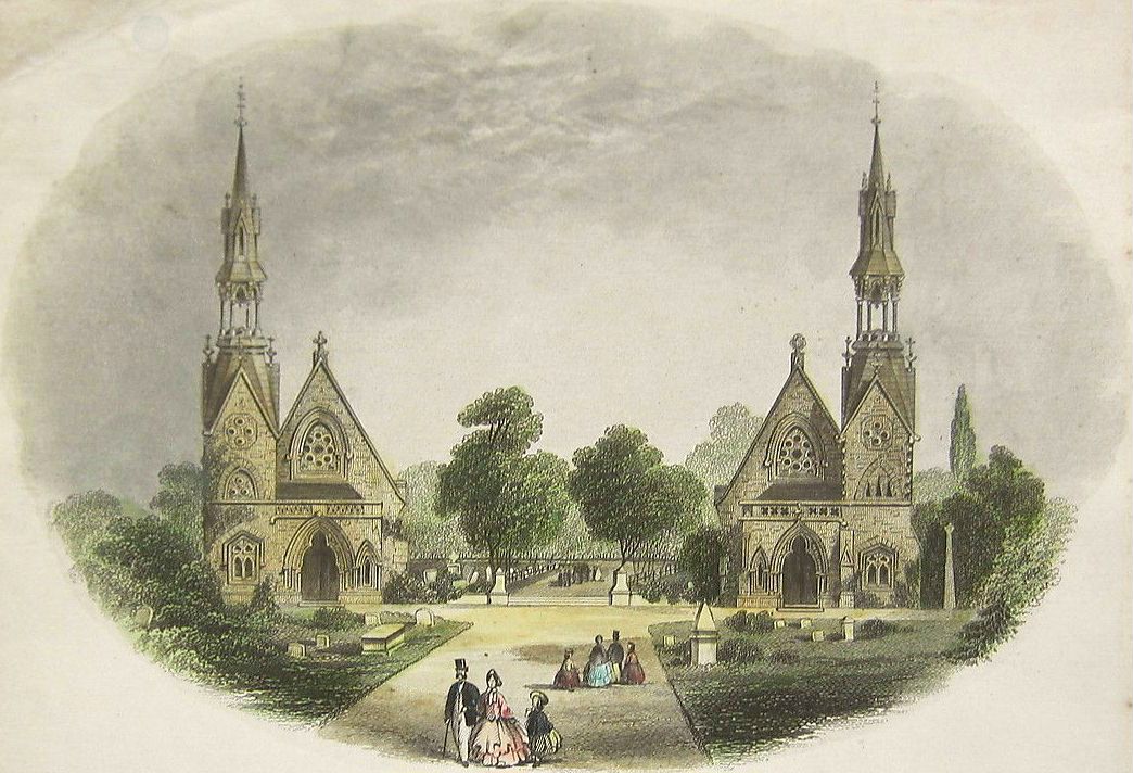
Grove Road Cemetery is a historic municipal cemetery in Harrogate, a spa town in North Yorkshire, England. Opened in 1864, it still has its original lodge and gates, designed by Thomas Charles Sorby. It suits anyone who enjoys local history, Victorian architecture and a quiet walk among old gravestones. Why does Harrogate have this cemetery? In the 19th century Harrogate grew quickly thanks to the fashion for mineral-water cures. The population rose, and so did the need for new burial space. The old graveyard at Christ Church was full, so a new cemetery opened in 1864. It was set up by the newly formed Burial Board. The first person buried there was a seven-year-old girl. The site was originally called Harrogate Cemetery; the current name comes from the road it sits on. Who was Thomas Charles Sorby? Sorby was the architect behind the cemetery's buildings. The grounds once held a pair of chapels topped with spires, built at a cost of around £5,000. Locals admired them because they enhanced the view of the town. Even so, the chapels were demolished in 1958, so you will not see them today. The entrance gates and the lodge, also by Sorby, survived. They are the best reminder of how the place looked in Victorian times. What to know before you visit Gates and lodge: you can view them from outside. The lodge is a private home unconnected with running the cemetery, so please do not approach the door. War graves: there are more than thirty military graves. One belongs to Sergeant Major Robert Johnston, who rode in the Charge of the Light Brigade. "Bilton Boys" memorial: it commemorates First World War soldiers and is a key stop for anyone interested in military history. Local figures: civic leaders and businesspeople of Harrogate are buried here too. Is the cemetery still in use? Yes, in a limited way. Burials now take place only in existing graves. It remains a place of remembrance, not just a heritage site, so keep quiet and show respect for visiting families. Frequently asked questions When was Grove Road Cemetery established? In 1864, when the Christ Church graveyard ran out of space. Are the chapels still standing? No. The two spired chapels were demolished in 1958. The gates and lodge remain. Can I go inside the lodge? No, it is a private residence. Are there military graves? Yes, more than thirty, including that of a Light Brigade veteran. Are burials still carried out? Yes, but only in graves that already exist. Who is it for? History lovers, fans of Victorian architecture and anyone curious about the First World War. A visit is short, so it pairs well with a walk through Harrogate's spa-town centre. Bring a camera and look closely at the gate details and at how the paths reflect the layout of a Victorian spa town.
-
Hitchin Cemetery
North Hertfordshire
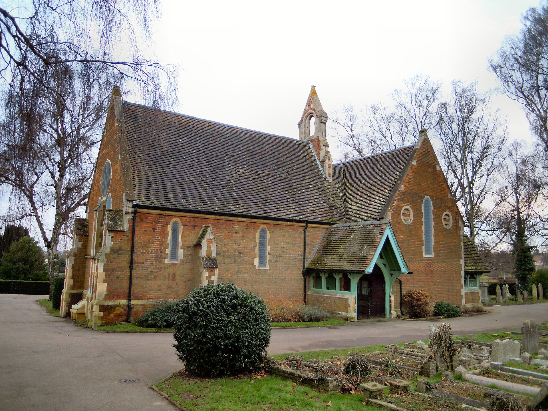
Hitchin Cemetery, also known as St John's Road Cemetery, is the main burial ground of the town of Hitchin in Hertfordshire, England. It is a Victorian cemetery that doubles as a quiet green space, and it appeals to visitors interested in local history, Victorian funerary landscapes and urban wildlife. Where is Hitchin Cemetery? The cemetery lies on Hitchin Hill, on the edge of the town centre. Standhill Road runs along its north-western boundary, while St John's Road marks the south-eastern side. The location makes it easy to combine a visit with a wider walk around Hitchin, a historic market town in North Hertfordshire. When was the cemetery founded? The cemetery was created in the 1850s. Under the Burial Act 1853, the local Board of Health appointed a burial board, which financed the project from the borough rate. The grounds were laid out by George Beaver and opened in 1857. A lodge cottage and a chapel were built at the same time, forming the core of the site that visitors see today. Responsibility for the cemetery later passed to Hitchin Urban District Council in 1894. Since 1974 it has been owned and managed by North Hertfordshire District Council. What is the chapel like? The cemetery chapel was designed in the Victorian manner with two parts, one for Anglican services and one for Non-Conformist worship, set at right angles to each other. This reflects the religious divisions of mid-19th-century England, when public cemeteries often had to serve several denominations. Today the chapel can hold around 50 mourners on fixed bench seating, with room for a few more standing, and it is available for the burial of all faiths. What can visitors see? Visitors come mainly to walk among the Victorian and later graves, read the inscriptions and enjoy the planted, mature grounds. Cemeteries of this age are often valuable habitats for birds, insects and plants, and Hitchin Cemetery is no exception. Guided walks have been organised that look at the origins of the cemetery, notable graves and the wildlife living there. Such events usually require advance booking, so check the current programme before you go. The cemetery also contains Commonwealth war graves from the two world wars, which gives the site additional historical significance for those researching local military history. Practical tips The cemetery is an active burial ground, so keep to the paths, speak quietly and respect any ceremonies in progress. Photography is generally fine for personal use, but avoid including mourners. Wear comfortable shoes, as the site sits on a hill and paths can be uneven or wet. Check opening times with North Hertfordshire District Council, which manages the site. Frequently asked questions Who runs Hitchin Cemetery? North Hertfordshire District Council has managed it since 1974. Can the chapel be used by any faith? Yes, it is available for burials of all faiths and holds about 50 people. Is Hitchin Cemetery another name for St John's Road Cemetery? Yes, both names refer to the same site. Is it a good place to learn about local history? Yes. Its Victorian origins, chapel and graves reflect the growth of Hitchin in the 19th and 20th centuries, and occasional guided tours explore these themes.
-
Shorncliffe Military Cemetery
Folkestone and Hythe
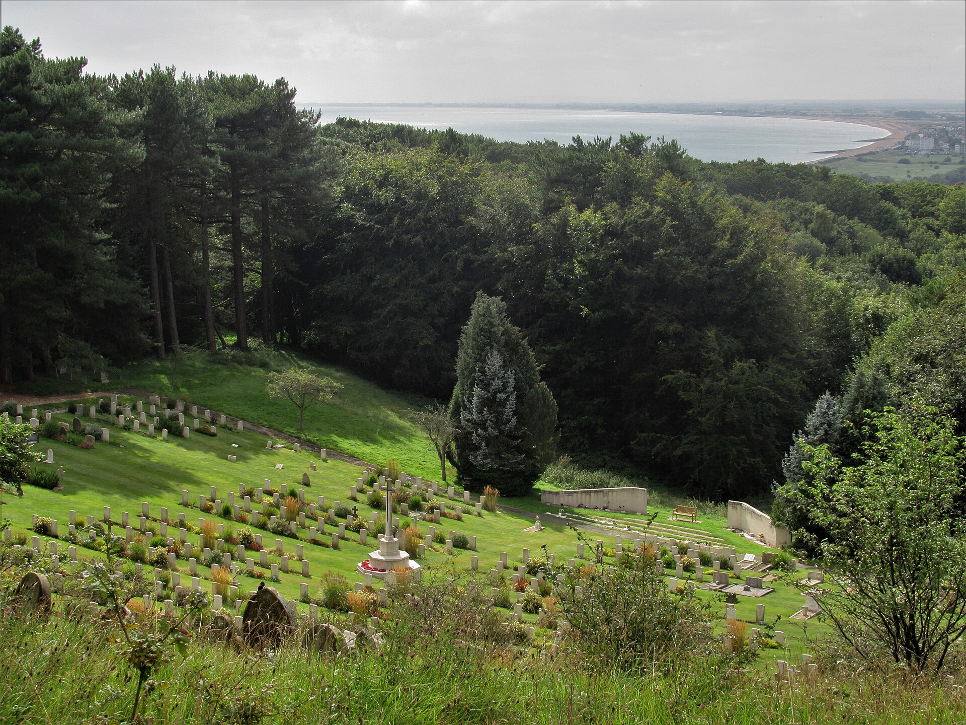
Shorncliffe Military Cemetery sits in a hollow on the hillside above Sandgate in Kent, in south-east England, looking out over Hythe Bay. Closely tied to the nearby Shorncliffe Camp for more than 150 years, it is a quiet, well-kept place of remembrance and one of the most significant Canadian war cemeteries in England. How did the cemetery begin? It was established in the 1850s to bury soldiers based at Shorncliffe Camp and their family members. The first recorded burial dates from August 1856. Over the following decades it served the garrison, and today its graves from different eras form a record of military life on this stretch of coast. Who is buried here? The largest group comes from the First World War: 471 burials, more than 300 of them Canadian. Canadian training units and hospitals were based in the area, and many of those buried here died in air raids on Shorncliffe. The Second World War accounts for 81 graves, including an unidentified British soldier from 1940, an American pilot and a Polish soldier. People of other nationalities are also commemorated, among them China, South Africa, the United States, Australia and Portugal. A screen wall recalls 18 Belgians who were first buried in a mausoleum that has since been demolished. You will also find the graves of two British service personnel who died during operations in Afghanistan, and the resting place of John Doohan, a Victoria Cross recipient (1853-1940). Canada Day at Shorncliffe In 1917, Edward Palmer, founder and editor of the local newspaper the Hythe Reporter, proposed inviting local dignitaries and schoolchildren to a service honouring the Canadians buried here. Since then the service has been held every 1 July, Canada Day, apart from the years of the Second World War. Children traditionally lay flowers at the graves. Practical tips for visitors The cemetery is on the hill above Sandgate in the Folkestone and Hythe district, so it combines well with a walk around the village and the seafront. It is an active place of remembrance, so visitors are expected to be quiet and respectful. The Commonwealth War Graves Commission (CWGC) runs free guided tours here; one took place on 17 September 2025 and another is listed for 16 September 2026. Advance booking is required. For details of individual burials, consult the CWGC database. Frequently asked questions Is the cemetery open to visitors? Yes, it is a place of remembrance that visitors can enter, provided they keep the peace and show respect. Check current arrangements before you go. How many Canadians are buried here? More than 300 of the 471 First World War burials are Canadian, mostly soldiers linked to nearby training camps and hospitals. When is the annual ceremony? On 1 July, Canada Day. The tradition began in 1917 and was interrupted only during the Second World War. Are there Second World War graves? Yes, 81 of them, including a Polish soldier and an American pilot. Can I visit with a guide? The CWGC offers free tours on selected dates, with advance booking. Shorncliffe Military Cemetery is a short but moving stop for anyone interested in military history, the links between Canada and Britain, or the story of the Kent coast. People from many countries and eras are remembered in one small space, and the yearly ceremony shows that their memory is still alive in the local community. Allow at least an hour to walk slowly along the rows of graves and read the inscriptions.
-
Exeter Higher Cemetery
Exeter
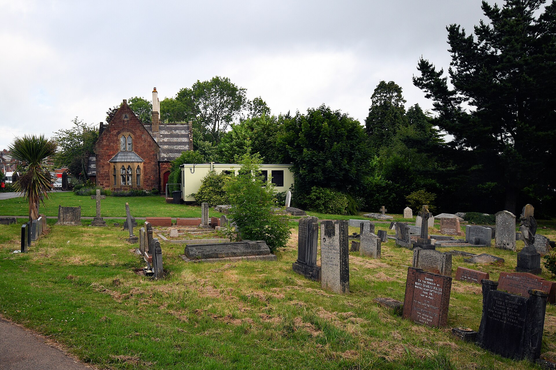
Higher Cemetery in Exeter is the largest of the city's three working cemeteries, set in the Heavitree district of Devon, England. Opened in 1866, it combines an active burial ground with Victorian heritage, quiet greenery and an important place of wartime remembrance. What is Higher Cemetery? It is a municipal cemetery with more than 70,000 burials and over 12,000 headstones. The grounds were consecrated on 26 May 1866 by Bishop James Chapman. The landscaping was carried out by Robert Veitch and Son, a firm well known for garden design in the region, while Edward Ashworth designed the buildings: an entrance lodge and two chapels, all built from local Heavitree stone. How was the site divided in Victorian times? The layout reflected the religious divisions of the age. Around four and a half acres were reserved for the Church of England and one and a half acres for Nonconformists. Two chapels served the two groups, and the whole design fits the Victorian idea of a cemetery as an orderly, park-like place for walking and reflection. Why visit? For anyone interested in local history and funerary architecture, the cemetery reads like an open book of Exeter's past. Along the paths you will find monuments from many decades, from nineteenth-century tombs to modern headstones. The older sections are shaded by mature trees and shrubs, giving the place the feel of a quiet park. War graves and memorials In April 1915 a section was set aside for the war dead. Today the cemetery holds more than 200 First World War burials, over 180 of them in two war graves plots near the entrance. At the centre of the First World War plot stands a granite cross, the City of Exeter War Memorial, unveiled in 1922. The Second World War plot holds most of the burials from that conflict, which number over a hundred. It also contains the graves of service personnel of other nationalities, including Polish and German, which makes it particularly meaningful for Polish visitors. Three separate rows of graves commemorate victims of the 1942 air raids on Exeter, close to the Long Valley Path. Tips for visiting This is a working cemetery, so keep a quiet manner and show respect to mourners. Entry is free, and a walk along the main paths usually takes an hour or two depending on your interests. A good plan is to begin near the entrance, with the lodge and the war plots, and then move deeper into the grounds. Frequently asked questions Where is Higher Cemetery? In the Heavitree district of Exeter, Devon, in south-west England. When was it founded? It was opened and consecrated in 1866. Is it still in use? Yes, it is the largest of the city's three active cemeteries. Are there war graves? Yes, plots from both World Wars, with a memorial cross and graves of servicemen of several nationalities, Polish among them. Is there an entrance fee? No, it is a public municipal cemetery open to visitors.
-
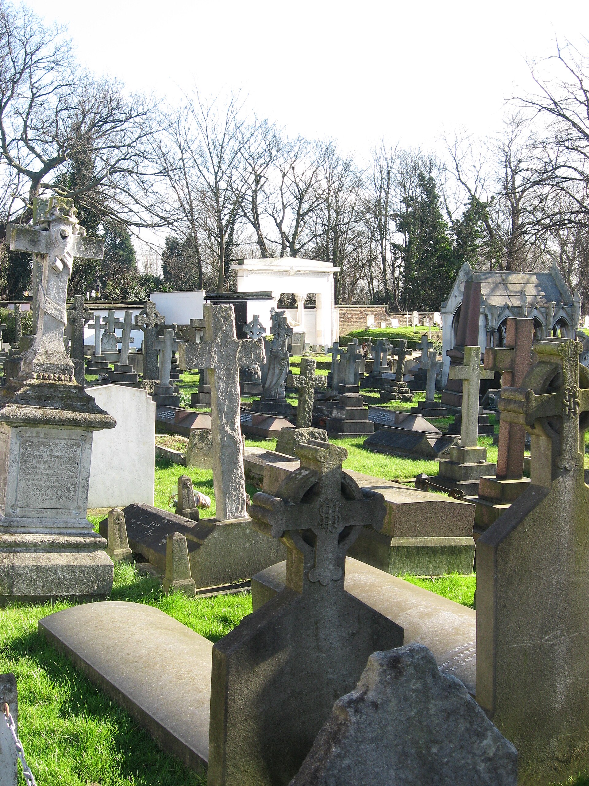
St Mary's Catholic Cemetery, Kensal Green
Londyn
St Mary's Catholic Cemetery in Kensal Green is a Catholic burial ground in west London, on Harrow Road beside the famous Kensal Green Cemetery. It opened for burials on 10 May 1858 as a place exclusively for Catholics. It is a quiet corner of Victorian sculpture, mausoleums and stories that guidebooks rarely tell. Why a separate Catholic cemetery? The neighbouring All Souls cemetery opened in 1832. Many Catholics were buried there, but it was felt that a cemetery for Catholics alone was needed. A site of about 29 acres was bought from the company running the adjacent cemetery, and the first burials took place in 1858. St Mary's and St Patrick's in Leytonstone are the only two fully Catholic cemeteries in London. What is there to see? The cemetery has its own chapel, which opened in 1860. Together with the lodge and the upper and lower catacombs, it was designed by Samuel Nicholl. Three mausoleums are Grade II listed, as is the Belgian war memorial. That memorial honours Belgian soldiers of the First World War who were wounded, evacuated to England and died in hospital. A Cross of Sacrifice commemorates British, Irish, French, Czechoslovak and Canadian servicemen. The grounds hold 208 Commonwealth graves from the First World War and 107 from the Second. Who is buried here? Burials include the conductor Sir John Barbirolli and the Irish inventor Louis Brennan. Particularly intriguing are three spies: the German agent Josef Jakobs, the British agent Krystyna Skarbek (known as Christine Granville), and Andrzej Kowerski, an SOE agent in the Second World War. For Polish visitors, it is one of the most meaningful memorial sites in London. The cemetery office keeps a list of "persons of note" with short biographies. Practical information The cemetery is still active, with burials and ashes interments. A mass is held in the chapel every month. Sources give different totals for burials, from more than 165,000 to more than 172,000 on the cemetery's own site. By 1992 it was almost full, so a second layer of soil was placed over graves in the southern part. Remember that this is a working burial ground. Keep quiet, respect mourners and be discreet with photography. It sits on Harrow Road, so a visit pairs easily with a walk through neighbouring Kensal Green. Frequently asked questions Is St Mary's the same as Kensal Green Cemetery? No. It is a separate Catholic cemetery in the same area, opened in 1858. Can I visit? Yes, but it is an active cemetery, so calm and respectful behaviour is expected. Who is buried here? Among others Krystyna Skarbek, Andrzej Kowerski, Josef Jakobs, Louis Brennan and Sir John Barbirolli. Is there a chapel? Yes, dating from 1860, with a monthly mass.
-
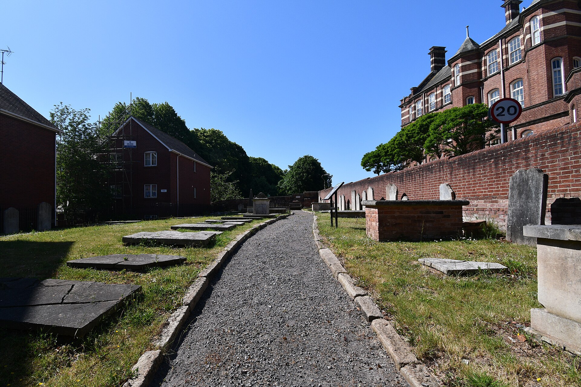
Dissenters Graveyard
Exeter
Dissenters Graveyard is a historic cemetery in Exeter, Devon, in south-west England. For more than a century it served Protestants who stood outside the Church of England, known as Dissenters. It is a quiet, understated place, but one that says a lot about the city's religious history. What is the Dissenters Graveyard? The graveyard was in use from 1748 to 1854 by the united congregations of Protestant Dissenters, mainly Presbyterians and later Unitarians. "Dissenters" were Christians who did not belong to the established church. The site lies at roughly 50.720 N, 3.526 W, just outside the old city walls, within the Southernhay and Friars Conservation Area. Why was it created? Dissenters faced obstacles to burial in Anglican churchyards. The Bishop of Exeter forbade the burial of Dissenters in church graveyards across his diocese. The congregations responded by buying a plot of land and founding a burial ground of their own. Some of them called it "The Saints' Rest". Who is buried here? The first burial, in October 1748, was Mary Green, wife of the Reverend James Green, minister of James's Meeting. Sources suggest at least 1,300 people were buried here, and by some estimates as many as 2,000. Those interred include Samuel Kingdon, father of "Iron Sam", and Micaijah Towgood. Neglect and revival For many years the site was closed to the public, neglected and overgrown. A volunteer-led project later helped to identify and record the tombs and their condition. The Exeter Dissenters' Graveyard Trust works on research and restoration planning, and has published a 32-page booklet covering the site's history from 1748 to 2018, written by Beryl G Coe, Gordon Read and Ian M. Varndell. How to visit Access can be limited, so check current details with the organisers before you go. The graveyard features in Heritage Open Days, when guided tours, exhibitions and talk series are run by the Trust. Frequently asked questions Who were the Dissenters? Protestants outside the Church of England, including Presbyterians and Unitarians. When was the graveyard in use? From 1748 to 1854. How many people are buried here? At least 1,300, and by some estimates up to 2,000. Can I visit? Mainly during events such as Heritage Open Days; check with the Exeter Dissenters' Graveyard Trust first. Why it is worth knowing It is a small, calm piece of history close to the centre of Exeter. It shows how communities shut out of the established church built their own institutions, down to their own burial ground, and it adds a different layer to a city better known for its cathedral and quayside. For anyone interested in genealogy, religious history or local stories, it pairs well with a walk through the city.
-
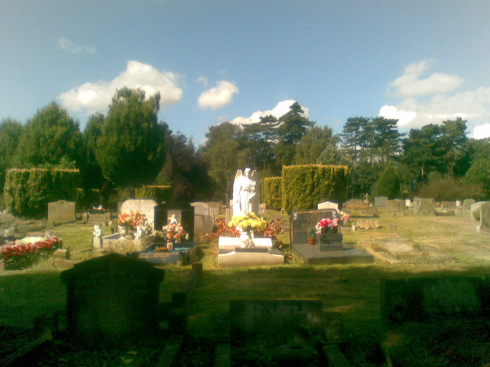
Bybrook Cemetery
Ashford
Bybrook Cemetery is the municipal cemetery of Ashford, Kent, in south-east England. It sits on Cemetery Lane, has been open since 1928 and is owned by Ashford Borough Council. For visitors it offers a quiet place with several threads of history: the grave of a celebrated French philosopher, Second World War graves of Commonwealth servicemen, and a plaque honouring Ashford's civilian war dead. How did Bybrook Cemetery begin? The cemetery opened in 1928 as Ashford's town burial ground. It has always been run by local government, serving residents of the town and surrounding parishes. Over the decades its layout has grown, and alongside traditional sections there are newer areas designed for different communities and needs. Who is buried here? The best-known person resting at Bybrook is Simone Weil, the French philosopher who spent her final months in the Ashford area. Her grave draws readers of her work and anyone interested in twentieth-century thought. The council lists her among the notable people buried here. War graves The cemetery holds Second World War graves cared for by the Commonwealth War Graves Commission (CWGC). Records show several dozen identified casualties, including servicemen stationed around Ashford. One grave belongs to Gunner Walter Pike of St John's, Newfoundland. He died on 1 October 1941 in a road accident while his regiment was billeted at Ashford School. His story came to light through the research of a local resident, which led to contact with his family across the Atlantic. In 1999 a memorial plaque was also unveiled to the nineteen Ashford civilians killed during the war. What sections does the cemetery have? The council describes several distinct areas at Bybrook: children's sections, including Roman Catholic, consecrated and non-faith areas, Woodland, for natural green burials, a Muslim burial section where graves face Mecca. This allows the cemetery to serve residents of different beliefs and needs. Frequently asked questions Where is Bybrook Cemetery? In Ashford, Kent, on Cemetery Lane. Who manages it? Ashford Borough Council. Can I visit Simone Weil's grave? Yes, the philosopher is buried here and the cemetery is open to visitors. Are there war graves? Yes. The cemetery has Commonwealth Second World War graves and a plaque for Ashford's civilian casualties. Who is it of interest to? People interested in Second World War history, Simone Weil's biography and local Kent history. It is a working cemetery, so quiet and respect for mourners are expected. Tips for visitors Bybrook is a place of remembrance rather than a typical tourist attraction. Visit during the day, keep noise down and give funerals space. The war graves carry uniform CWGC headstones, easy to spot among the other burials. If you are looking for a specific grave, it is best to ask the council's cemetery office in advance. A visit pairs well with a walk around Ashford and learning about a town that hosted troops in local buildings during the war, including the school connected to Walter Pike's story.
-
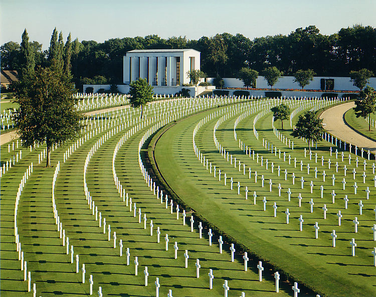
Cambridge American Cemetery and Memorial
Cambridge
Cambridge American Cemetery and Memorial Cambridge American Cemetery and Memorial is a World War II American military cemetery in Cambridgeshire, about 7 km (4.3 mi) north-west of central Cambridge. It lies between the villages of Coton and Madingley, which is why locals often call it simply the Madingley cemetery. It holds the graves of 3,811 American war dead, and the walls of its memorial carry the names of a further 5,127 service members who went missing during the war. What is this place? The cemetery covers 30.5 acres (12.3 ha) of gently sloping ground. It was dedicated in 1956 and is one of 26 overseas military cemeteries run by the American Battle Monuments Commission (ABMC). The grounds are kept like a park, with broad lawns, clipped hedges and rows of white marble crosses and Stars of David. Many of those buried here served in the air forces and navy, and the countryside around Cambridge hosted numerous airfields during the war. The cemetery is therefore tied closely to the story of the bomber campaign launched from eastern England. How is the site laid out? The grounds form a quarter circle. The entrance, visitor centre and flagpole stand at the narrow tip. As you enter, the Walls of the Missing, the reflecting pool and the memorial chapel come into view on your right. The walls bear the names of soldiers, airmen and sailors whose remains were never recovered. A bronze rosette beside a name shows that the person was later identified. The visitor centre sits to the left, along a short path. Inside you will find photographs, interactive films from the war years and memorabilia from the period. It makes a good first stop, because it explains why so many Americans were in Britain and what role the eastern counties played. Practical information Admission: free, no booking required. All visitor services are free of charge. Opening hours: daily 9:00 to 17:00, closed on 25 December and 1 January. Last entry is 15 minutes before closing. Staff: a staff member is on duty during opening hours to answer questions and help relatives find graves and memorial sites. Accessibility: the cemetery, visitor centre and car park are fully wheelchair accessible. Getting there: from London take the M11 north, leave at junction 13 and turn left onto the A1303. The cemetery is on Madingley Road in Coton. Frequently asked questions How many people are buried at Cambridge American Cemetery? There are 3,811 American war dead buried here. A further 5,127 names are inscribed on the Walls of the Missing. Is there an entrance fee? No. Entry and all visitor services are free. When was the cemetery dedicated? In 1956. Who manages the cemetery? The American Battle Monuments Commission (ABMC), which looks after 26 overseas military cemeteries. How long should I plan for a visit? A quiet walk around the grounds, the chapel, the Walls of the Missing and the visitor centre exhibition usually takes one to two hours. Why visit? The Madingley cemetery combines the calm of the English countryside with the weight of history. It is a place for reflection and a key stop for anyone interested in aviation history and the Second World War. It is easy to reach from Cambridge, so you can pair it with a visit to the university city and nearby villages. Keep your voice low and show respect: this is the resting place of thousands of young people who died far from home.
-
Cambridge City Cemetery
Cambridge
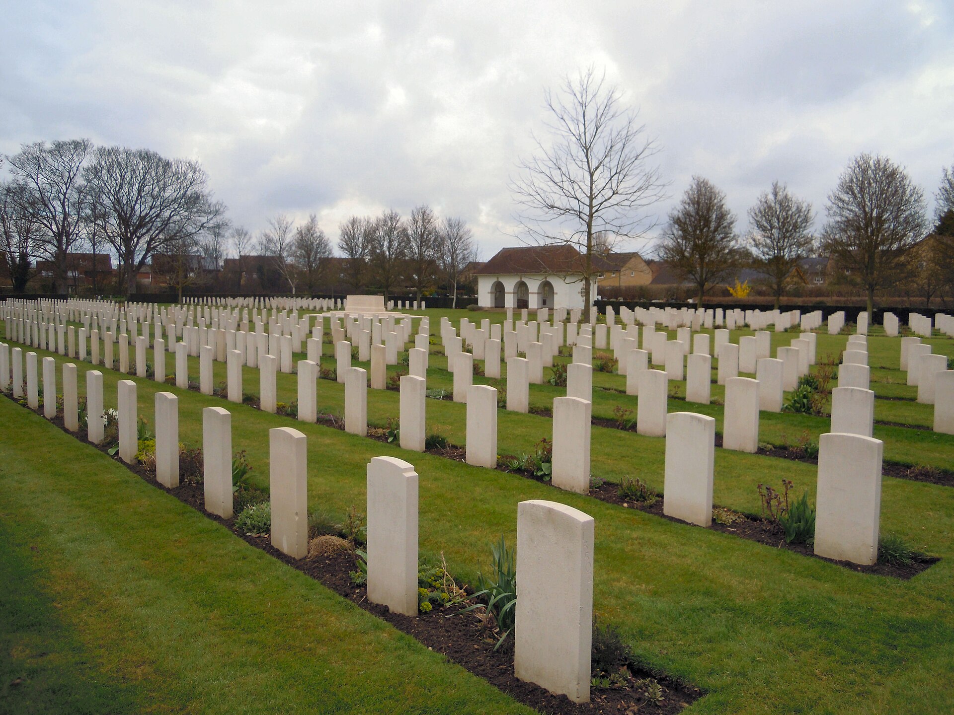
Cambridge City Cemetery is the main burial ground of the city of Cambridge in Cambridgeshire, England. It lies on the north-eastern edge of the city, at the junction of Newmarket Road and Ditton Lane, close to Cambridge Airport. It is a working municipal cemetery, but also a place where local history, wartime memory and a few well-known names meet. Where is Cambridge City Cemetery and how do you get there? The cemetery sits to the north-east of the historic centre, on the busy Newmarket Road, one of the main routes leading out of Cambridge towards the east. The entrance area is at the crossing with Ditton Lane. The nearby Cambridge Airport gives a useful landmark when you look for it on a map. Its coordinates are roughly 52.212 N, 0.167 E. Because it is an active cemetery, visitors should behave as in any place of remembrance: keep voices low, stay on the paths and respect graves and people attending funerals. When was it founded? The first burial took place on 6 June 1903, at a time when the site was known as Cambridge Borough Cemetery. Sources do not fully agree on the exact founding date: one gives 1902 as the opening year, while another says the cemetery was laid out in 1905. For a visitor, the safest summary is that it dates from the very beginning of the twentieth century and has served the city ever since. Why is it important for war history? The cemetery is a significant war grave site. More than 1,000 servicemen and women who died as a result of service in the two world wars are buried here. First World War: there are 181 burials from this conflict. Most are connected with the 1st Eastern General Hospital, which was based in Cambridge during the war, so many of the men buried here were treated in the city and died there. Second World War: the plots include a General Service plot, established by the Council in 1940, and a section for Air Force burials. In the Air Force plots 731 airmen lie together, along with three members of the Women's Auxiliary Air Force. The graves are cared for by the Commonwealth War Graves Commission, and the site is also listed on websites dedicated to war cemeteries in the United Kingdom. Who is buried at Cambridge City Cemetery? Several people with a place in history rest here: Norman Bleehen, an oncologist, radiologist and professor. Bertha Lewis, principal contralto of the D'Oyly Carte Opera Company. Alec David Young, a British aero-engineer. Philip de Fonblanque, a senior British officer who organised logistics for the British Expeditionary Force in 1939-40. Choudhary Rahmat Ali, regarded as one of the founders of Pakistan. Barbara Yung, a Chinese actor. Is it worth visiting? This is not a classic sightseeing attraction, but it suits visitors interested in the history of Cambridge beyond the university colleges: military history, the story of the city's hospitals in the First World War, local biography and the quiet atmosphere of an early twentieth-century municipal cemetery. Frequently asked questions Is Cambridge City Cemetery still in use? Yes, it is the main burial ground of the city. How many war graves are there? Over 1,000 servicemen and women from both world wars. Where exactly is it? At the junction of Newmarket Road and Ditton Lane, near Cambridge Airport.
-
Whitland Abbey
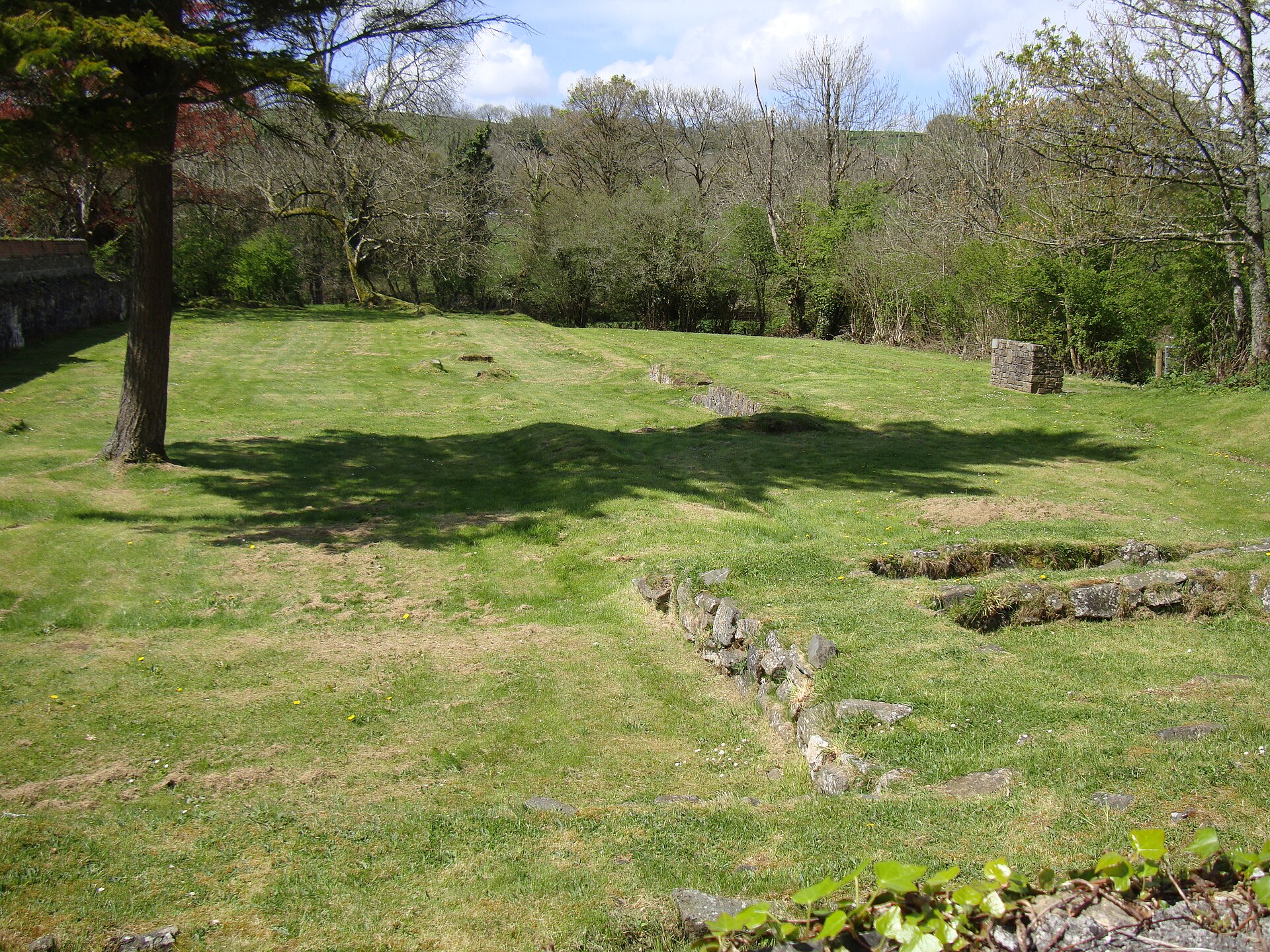
Whitland Abbey (Welsh: Ty Gwyn ar Daf, "the White House on the Taf") was a Cistercian monastery in south-west Wales. Only ruins remain today, yet the site is one of the more significant places in the country's medieval story, and the nearby town of Whitland takes its name from the abbey. What was Whitland Abbey? It was a Cistercian house that functioned from the 12th to the 16th century. It is generally said to have been founded in 1140 by Bernard, Bishop of St Davids, as the first Welsh monastery colonised directly from Clairvaux in France. The monks first settled at Little Trefgarn near Haverfordwest, then moved to the banks of the River Taf at Whitland around the middle of the 12th century. What is the link to Hywel Dda? Before the monastery existed, the spot was home to a residence called Ty Gwyn ar Daf. Tradition ties it to Hywel Dda, a tenth-century ruler of much of Wales. According to that tradition, a council held here around 940 drew up the laws later named after him. It is worth remembering that this is a traditional account rather than a firmly documented fact, but it explains why Whitland carries such symbolic weight in Welsh history. A distinctly Welsh house Although the foundation had Cambro-Norman roots, the abbey soon came under the patronage of Rhys ap Gruffudd, ruler of Deheubarth, and many Welsh monks joined the community. This gave the monastery a strongly Welsh character, and it supported the country's independence. Daughter houses Whitland became the starting point for further foundations. Monks from here established communities at Strata Florida and Strata Marcella in Wales, and at Comber and Tracton in Ireland, so the abbey's influence reached well beyond its immediate surroundings. Turbulent times In 1257, monks sympathetic to the Welsh cause were attacked when Anglo-Norman lords invaded the abbey. The monastery also suffered during Edward I's wars in Wales. It was finally dissolved in 1539 during the Dissolution of the Monasteries. Frequently asked questions What is left of the abbey? Only ruins survive, so the site is valued mainly for its history and its setting. Where does the name of the town Whitland come from? The town grew up near the monastery and took its name from it. Where is Whitland Abbey? Near the town of Whitland in south-west Wales, on the River Taf, at roughly 51.83 N, 4.60 W. Who is it for? Anyone interested in medieval history, Welsh history and monastic architecture, as well as those curious about the origins of Welsh law.
-
Hinton Priory
Hinton Charterhouse
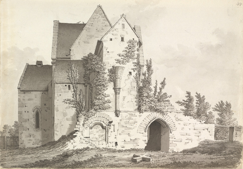
Hinton Priory was a Carthusian monastery in northeast Somerset, England, close to the village of Hinton Charterhouse. The community lived here from 1232 until 1539, and what remains today are surviving fragments of the buildings and traces in the landscape. What was Hinton Priory? The priory was a charterhouse, a house of the Carthusian order, one of the strictest contemplative orders of medieval Europe. Carthusians lived in silence and solitude, spending most of their days in prayer and work within individual cells. Hinton belonged to a small group of medieval charterhouses in England. Sources disagree on the exact count, giving either nine or ten. Witham, also in Somerset, was older. Who founded it, and how did it begin? The founder was Ela, Countess of Salisbury, widow of William Longespée. The community first settled at Hatherop in Gloucestershire. That site was judged unsuitable, so the monks were moved to Hinton, on land belonging to the foundress. Sources vary on the start date: 1227 appears as the founding year, while 1232 is given as the year of dedication and the start of the house in its new home. What happened in 1539? The priory was dissolved in 1539 during the Dissolution of the Monasteries under Henry VIII. Most of the buildings were demolished or destroyed. Parts of the chapter house and refectory survived. In the late 16th century a manor house was built on the site, incorporating part of the former guest house. What else remains of the Carthusians? The Carthusian way of life split a community into two parts. The monks lived in the upper house, while the lay brothers, who handled manual labour and farming, lived in a separate lower house called the correrie, about a mile away. Its earthworks and buried remains are now protected as a separate scheduled monument. It was founded in the early 13th century and probably abandoned in the 14th. The main priory site is also a scheduled monument, and traces of historic water-management features are part of the protected area. Frequently asked questions Where is Hinton Priory? In northeast Somerset, near the village of Hinton Charterhouse, in southwest England. When was the monastery active? From 1232 until 1539, when the monasteries were dissolved. Can you visit Hinton Priory? The site is not generally open to the public, so check current access arrangements before planning a visit. Some of the remains stand on private land. Why does the village have "Charterhouse" in its name? The name refers to the charterhouse, the Carthusian monastery founded nearby. Who was Ela of Salisbury? The Countess of Salisbury and widow of William Longespée, who founded the priory and moved the community to Hinton. Who is this place for? It suits anyone interested in medieval English history, archaeology and monastic life. It is an interesting stop when planning a trip around Somerset, particularly for travellers who enjoy lesser-known heritage sites and the cultural landscape of the region.
-
Ewenny Priory
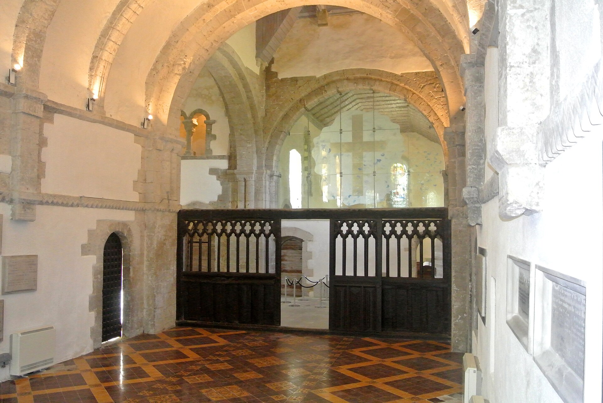
Ewenny Priory is a former Benedictine monastery in the village of Ewenny, in the Vale of Glamorgan, Wales. Founded in the 12th century, it is best known for two things that rarely appear together: an exceptionally well-preserved Norman church and a ring of defensive walls built to protect the monks. What makes Ewenny Priory special? Most medieval monasteries were stripped, ruined or rebuilt after the Dissolution. Ewenny largely escaped that fate. The architectural historian John Newman called it "the most complete and impressive Norman ecclesiastical building in Glamorgan", and Cadw, the Welsh heritage agency, regards the church as the finest example of Norman Romanesque architecture in this part of Wales. The building is a Grade I listed monument. Its second distinctive feature is the military character of the site. Monasteries are usually thought of as peaceful places, but Ewenny stood in a border landscape where Welsh raids were a real threat. A gatehouse, a tower and fortified walls were first raised in the 12th century and extended in the late 13th century. The church tower also served as a look-out post. Together they give the priory the look of a small fortress rather than a quiet cloister. How did the priory begin? Accounts of the founding differ in detail. The church is linked to William de Londres, lord of Ogmore, and was dedicated to St Michael in the first half of the 12th century, during the time of Bishop Urban of Llandaff. His son Maurice de Londres gave the church to St Peter's Abbey in Gloucester in 1141, which established the priory as a daughter house of that abbey. Some pre-Norman memorial stones found on the site are now displayed in the south transept. They indicate that an older, native Welsh church stood here before the Benedictines arrived. What happened after the Dissolution? The priory was dissolved in 1536 and leased in the same year to Sir Edward Carne, a lawyer and diplomat. He bought it in 1545. Parts of the priory buildings were converted into a private house. That Elizabethan house was demolished between 1803 and 1805 and replaced by a Georgian mansion, Ewenny Priory House, which is still owned by the Turbervill family, descendants of Carne. Can you visit Ewenny Priory? Access is partial. The priory grounds are mostly not open to the public in the usual way. The western part of the building, the Church of St Michael, still serves as the parish church of the village, so it remains a living place of worship. The presbytery and transepts are in the care of Cadw, while the nave belongs to the Church in Wales. Before planning a trip, check current opening arrangements with Cadw or the parish. Frequently asked questions Where is Ewenny Priory? In the village of Ewenny, in the Vale of Glamorgan, South Wales. Who looks after it? Cadw cares for the priory's historic fabric, and the Church in Wales owns the nave, which is used as the parish church. Why are there defensive walls around a monastery? The priory stood in a region exposed to Welsh raids, so its builders added a gatehouse, tower and walls to protect the monks. Is the priory still in private hands? The adjoining house, Ewenny Priory House, is still owned by the Turbervill family, descendants of Sir Edward Carne.
-

Bury St Edmunds Abbey
West Suffolk
Bury St Edmunds Abbey is the ruined shell of a once great Benedictine monastery in the heart of Bury St Edmunds, Suffolk, in eastern England. Today it is an open garden setting with scattered ruins and two imposing medieval gatehouses, ideal for an unhurried afternoon with a lot of history behind it. Why does this place matter? The abbey was once among the richest and most powerful Benedictine monasteries in England. It became a major centre of pilgrimage because it housed the shrine of Saint Edmund, the Anglo-Saxon martyr-king killed in 869 by the Great Heathen Army of Danes. The town grew up around the abbey and still carries the saint's name. The monastery was dissolved in 1539 during the English Reformation. What is left of the abbey? The abbey church and most of the monastic buildings survive only as rubble cores, low lumps of masonry among the lawns. Yet two very large medieval gatehouses remain standing, along with two secondary medieval churches built within the abbey precinct. The Norman Tower The Norman Tower was the main gateway to the abbey church. It also served as the bell tower for the neighbouring church of St James, and its belfry is still in use. Built in the 12th century under Abbot Anselm, it is often described as one of the best preserved 12th-century buildings in England. It is also known as St James' Gate. The Abbey Gate The Abbey Gate, or Great Gate, dates from the 14th century. An earlier gate was damaged in 1327 when townspeople rose up against the abbey. The present Decorated Gothic building has battlements, a portcullis and arrow slits, so it looks more like a fortress than a monastery entrance. Visiting tips The ruins lie within the Abbey Gardens, run by West Suffolk Council, and the abbey is cared for by English Heritage. Entry is free. Most visitors enter through the Abbey Gate from Angel Hill, though there is also an entrance from Mustow Street. Paths are tarmac, but some areas are grassy, stepped or uneven, and can get muddy in wet weather. The gardens have toilets, a refreshment kiosk and a children's play area. Parking is in a pay car park opposite the Abbey Gate, not run by English Heritage. Opening times can vary, so check before you go. Frequently asked questions Is there an admission charge? No, entering the ruins and gardens is free. Who was Saint Edmund? An Anglo-Saxon king killed by Danish invaders in 869. His burial place turned the abbey into a major pilgrimage destination. Where is the main entrance? Most people walk in through the Abbey Gate from Angel Hill. What survives today? Rubble remains of the abbey church and other buildings, two large medieval gatehouses (the Norman Tower and the Abbey Gate) and two smaller medieval churches within the precinct. Is it suitable for children? Yes, there is a play area in the gardens, though some paths have steps and uneven ground, which matters if you have a pushchair. For anyone curious about medieval England, the abbey offers a clear sense of how large and wealthy a great monastery could be, and a pleasant place to wander among its ruins.
-
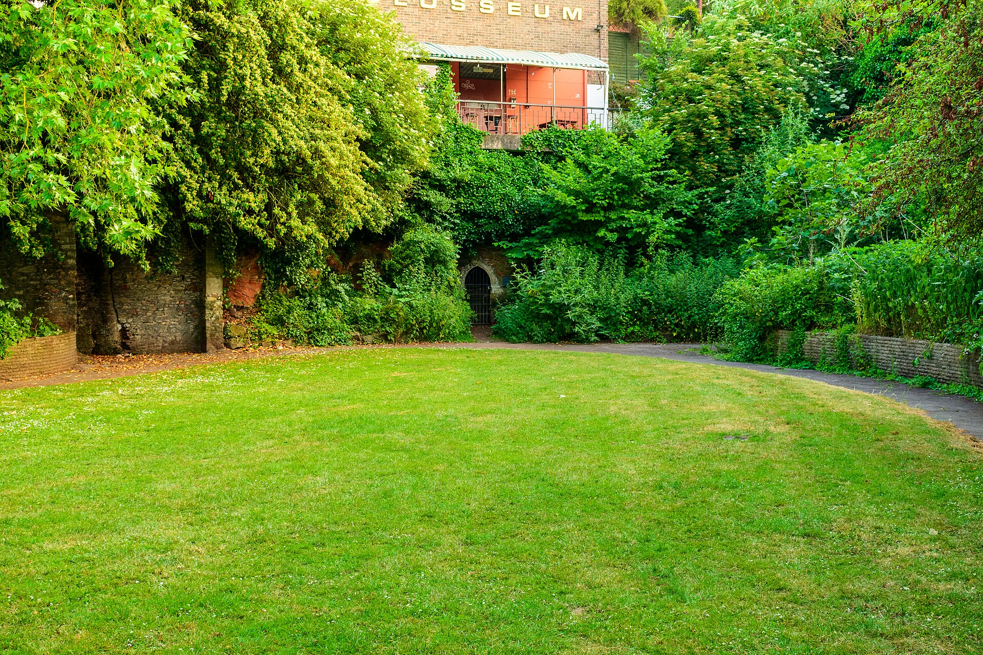
Hermitage in Quaker burial ground near St Mary Redcliffe
Bristol
The hermitage beside St Mary Redcliffe in Bristol is a medieval hermit's cave set in a former Quaker burial ground, now a small public park. It is protected as a scheduled monument, listed by Historic England as "Hermitage in Quaker burial ground near St Mary Redcliffe". Think of it as a short stop for history lovers and fans of offbeat corners rather than a full outing. What is the hermitage? It is a small chamber cut into the red sandstone that Redcliffe is built on. Local histories credit Thomas Berkeley with founding it in the 14th century, traditionally in 1346, and name John Sparkes as the first hermit, charged with praying for the Berkeley family. Hermits are said to have lived here in succession until the 17th century. Sources disagree on exact dates, so treat 1346 as local tradition. What about the Quaker burial ground? Quakers bought the land in 1665 and buried their dead here until the early 20th century. In 1950 they gave it to the city so a road could be widened. Part of the site became carriageway and the rest was laid out as a park. A plaque on site records the 1665 purchase and the gift to the people of Bristol. What can you see today? You cannot walk into the hermitage. A gate closes the entrance, but you can look through the opening. Inside lie nearly 200 headstones lifted from the old burial ground. The heritage listing also mentions a concrete wall blocking the passage further in, and a plaque dated 1669 commemorating a mariner named Christopher Birchead. The rest of the site is a green square with benches, hemmed in by a busy junction. How do you get there? The park sits between St Mary Redcliffe church and the Phoenix Wharf waterfront, close to the Redcliffe Way roundabout. From central Bristol it is a walk of roughly a quarter of an hour over Redcliffe Bridge or along the quayside. Pair it with a visit to St Mary Redcliffe itself, one of the city's best-known churches. When should you go? The park is open during the day and viewing from outside costs nothing. Choose a dry day with good light, since the cave interior is dark. Allow 15 to 20 minutes. Frequently Asked Questions Can I go inside the hermitage? No. A gate blocks the entrance, but you can see in through the opening, where the old headstones are stacked. Is there an entry fee? No. The park is public and free. Is this the same as the Redcliffe Caves? No. The Redcliffe Caves are a separate network of man-made sandstone caverns. This hermitage is a single chamber in the park beside St Mary Redcliffe. How long should I allow? About 15 to 20 minutes, ideally combined with a visit to St Mary Redcliffe church.
-
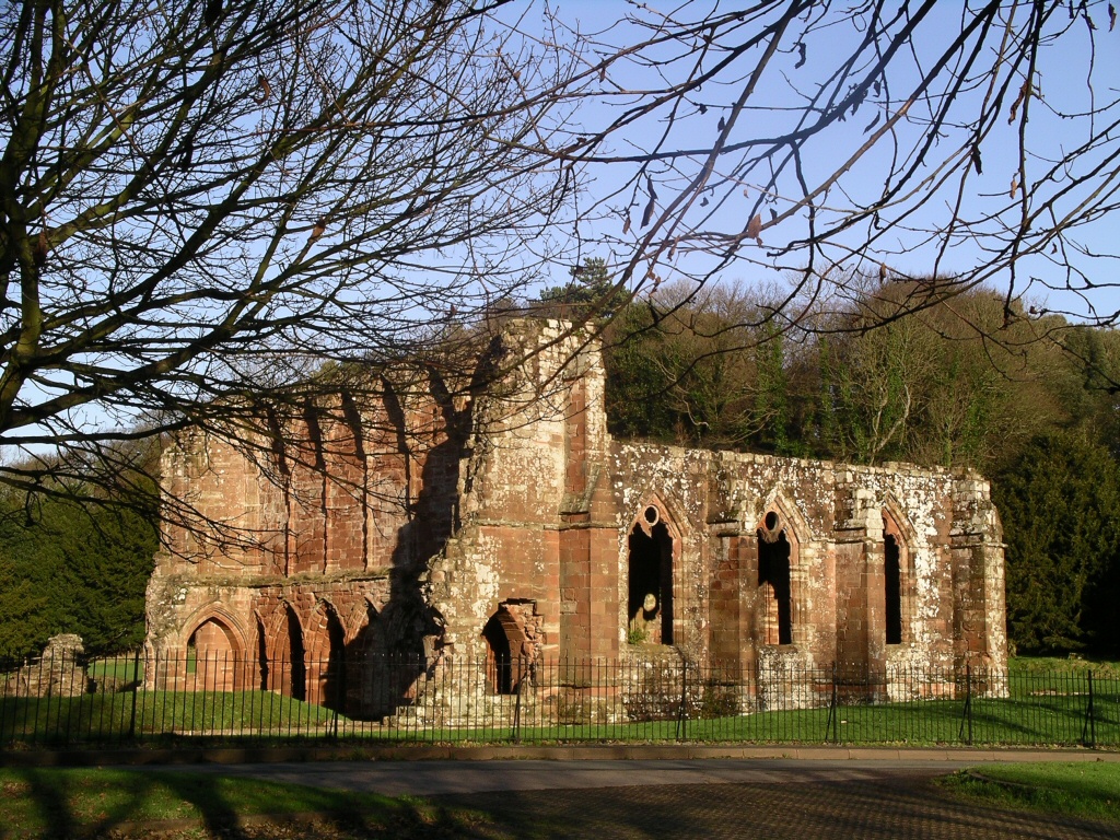
Furness Abbey
Barrow-in-Furness
Furness Abbey is a ruined medieval monastery just north of Barrow-in-Furness in Cumbria, north-west England. Its red sandstone walls rise from a sheltered valley on the edge of town, and they are among the most impressive monastic remains in this part of the country. What is Furness Abbey and why does it matter? The monastery was founded in 1123. Its monks later adopted the Cistercian rule, and the house grew into one of the richest and most influential in England, second only to Fountains Abbey. Its wealth came from large estates around Furness, sheep farming and the wool trade, with holdings reaching well beyond what is now Cumbria. The abbey was dissolved in 1537 during the English Reformation, after which the buildings slowly fell into ruin. What will you see there? The site is spacious and easy to explore on foot, moving freely between the former monastic buildings. Highlights include: The abbey church – tall stretches of wall, arches and the remains of the tower show how large the building once was. The chapter house and cloister area – the monks met here, and the layout of the rooms helps you picture a day in the community. Carved details – pointed windows, sedilia and decorative doorways show the skill of the medieval masons. The museum – a small display of carved stones and objects found on site explains the abbey's story. Several buildings within the complex are Grade I listed, and the whole site is a Scheduled Monument. English Heritage looks after it. How do you get to Furness Abbey? The abbey lies a few kilometres north of central Barrow-in-Furness. Driving is the easiest option, and there is parking by the ruins. By train, you can reach Barrow-in-Furness station and continue by taxi or local bus. Check timetables in advance, as off-peak services can be infrequent. When should you visit and how long do you need? Late spring and summer are the best times, with long days and dry grass around the ruins. In autumn the red stone glows in low light, but paths can get muddy after rain, so wear sturdy shoes. Allow roughly 1.5 to 2 hours for the ruins and museum. Photographers will like the afternoon, when the sun brings out the colour of the sandstone. What else is worth seeing nearby? Barrow-in-Furness is known for shipbuilding and has a museum on the town's history. Nearby you will find the Furness peninsula, Piel Island with its castle, and the Morecambe Bay coast. The Lake District is also within easy reach. Frequently asked questions Is there an entry fee? The site is run by English Heritage, so its rules apply. Check their website for current prices and opening times, which change with the season. When was the abbey founded? In 1123. The monks later joined the Cistercian order, and the abbey was dissolved in 1537. Is it suitable for families with children? Yes. The grounds are open and easy to walk around, and the walls and arches make exploring fun for children. Just watch for uneven ground. Can I combine it with other attractions? Yes, with Piel Island and its castle, the centre of Barrow, or a trip towards the Lake District.
-
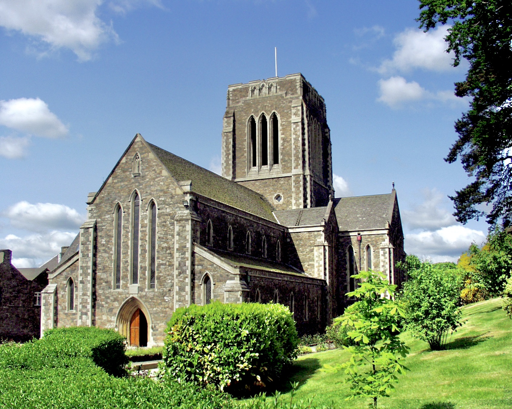
Mount St Bernard Abbey
North West Leicestershire
Mount St Bernard Abbey is a working Trappist monastery near Coalville in Leicestershire, on the edge of Charnwood Forest in the English Midlands. Its monks belong to the Cistercians of the Strict Observance, and the buildings mark a key moment in the story of English Catholic architecture. What is Mount St Bernard Abbey? Founded in 1835, it was the first permanent monastery established in England after the Reformation, and it remains the only Trappist house in the country. The community lives by a daily pattern of prayer and work. The abbey sits in the parish of Charley, within the old parish of Whitwick. Who designed it, and is it protected? The church choir, the cloister ranges and the central block of the guest house date from 1839–44 and follow designs by A.W.N. Pugin, the leading figure of the Gothic Revival. His original scheme was far more ambitious than what was built, and work on the church stopped in 1844. Edward Welby Pugin and Albert Herbert added later work. Between 1935 and 1939 the church was extended eastward, bringing a lay nave and a crossing tower. Historic England records the abbey as a Grade II listed building. What will you see? The abbey church is the main draw, pairing Victorian Gothic work with a much later extension. It is not a museum: the monks sing the daily offices here, so the mood is quiet and contemplative. A gift shop sells monastic products, souvenirs and Tynt Meadow, the first British Trappist beer, brewed since 2018 and 7.4% ABV. Can you go inside? Visitors can enter the church and the shop, but the enclosure and most monastery buildings are closed to the public. The National Churches Trust notes that the church has no fixed opening hours and that visitors are welcome. Shop hours differ between sources (generally Monday to Saturday, with breaks for prayer), so check mountsaintbernard.org before you travel. The guest house serves retreatants and people interested in monastic life rather than tourists, bookings go through the guestmaster, and the abbey website has carried a notice that guests are not currently being accepted. How do you get there? The abbey stands on Oaks Road in Whitwick, a few kilometres from Coalville town centre. Driving is easiest, and Charnwood Forest walking routes nearby make it simple to combine the visit with a hike. Leicester and Loughborough are the nearest larger towns. Frequently asked questions Is Mount St Bernard Abbey a working monastery? Yes. It is an active Trappist abbey and the only one of its order in England. Keep quiet and respect the times of prayer. Is there an entry fee? There is no ticket for the church, and visitors are welcome. Check the abbey website for current guidance before you go. Can I buy Trappist beer there? Yes. Tynt Meadow is sold in the abbey shop and at selected local outlets. Can I stay overnight? The guest house is meant for retreatants and those interested in monastic life, and availability can be limited. Contact the guestmaster first.
-
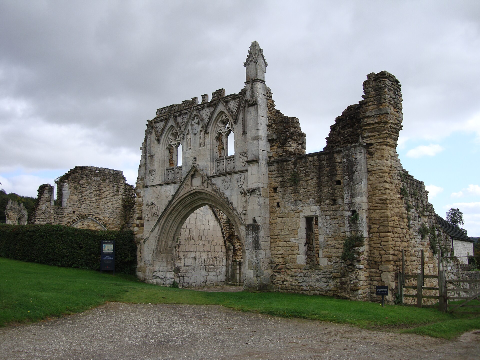
Kirkham Priory
Westow
Kirkham Priory, near Westow in North Yorkshire, is a ruined Augustinian monastery standing beside the River Derwent. Its best-known feature is the surviving gatehouse, carved with heraldic shields. The site is looked after by English Heritage. What is the history of Kirkham Priory? The priory was founded in the 1120s by Walter l'Espec, lord of nearby Helmsley and the builder of Rievaulx Abbey. Local tradition says he founded it in memory of his only son, killed in the area when his horse bolted at the sight of a boar. The canons lived here for roughly four centuries until 8 December 1539, when the house was surrendered during the Dissolution of the Monasteries. What can you see today? The highlight is the gatehouse, dated to the turn of the 13th and 14th centuries. Its front carries the arms of the lords of Helmsley, plus badly weathered carvings of St George and the dragon and of David and Goliath. Above the wide entrance arch the first-floor windows still stand. A stump of a medieval cross survives close by. Beyond the gate you can walk among low walls of the priory church, cloister remains and the domestic buildings. The layout is easy to read on the ground, and the riverside setting, with the former fishponds nearby, makes for a quiet stroll. Why is it protected? The remains are Grade I listed on the National Heritage List for England. A separate Scheduled Monument entry covers the monastic precinct, three fishponds and the precinct boundary. It counts as a well-preserved example of an Augustinian house in the north of England. What is the wartime connection? During the Second World War the grounds and surrounding land were used to test landing vehicles ahead of D-Day. Winston Churchill came to watch, and King George VI joined a secret visit to see the exercises. How should you plan a visit? The priory lies in the Derwent valley a few miles from Westow and not far from Malton, so a car is the easiest way to arrive. It pairs well with Castle Howard or Rievaulx Abbey, which shares its founder. The ruins are outdoors, so bring waterproof shoes; late afternoon light suits photos of the gatehouse. Check English Heritage for current opening times and ticket prices before you travel. Frequently asked questions Who founded Kirkham Priory? Walter l'Espec, lord of Helmsley, in the 1120s, as an Augustinian house. When was it closed? On 8 December 1539, during the Dissolution of the Monasteries. Is this the Kirkham in Lancashire? No. These ruins are in North Yorkshire, on the Derwent, in the parish of Westow. Who looks after the site? English Heritage. The ruins are Grade I listed and form a Scheduled Monument.
-

Kirkstall Abbey
Leeds
Kirkstall Abbey in Leeds is the ruin of a medieval Cistercian monastery, set in a public park on the north bank of the River Aire, a short way northwest of the city centre. It ranks among the best-preserved Cistercian sites in England. Historic England protects it as a scheduled monument, covering the abbey and its wider precinct. Who founded Kirkstall Abbey and when? Henry de Lacy founded the abbey after vowing to establish a monastery if he recovered from illness. The first monks settled at Barnoldswick, then moved to the Kirkstall site in May 1152. The abbey was a daughter house of Fountains Abbey, another great Yorkshire Cistercian monastery. Most of the buildings went up in the second half of the 12th century. Monastic life ended in 1539, when Henry VIII dissolved the monasteries. What can you see today? The ruins include the abbey church and the surrounding monastic buildings where the monks lived and worked. The protected area reaches well beyond the main ruins. It takes in the precinct wall, the inner and outer gatehouses, the Vesper Gate and earthworks from the old water-management system. A prehistoric cup-and-ring marked rock also lies within the scheduled area. A visitor centre beside the ruins explains the daily routine of Cistercian monks through displays and interactive exhibits. The former gatehouse of the abbey houses Abbey House Museum, part of the Leeds Museums & Galleries group. What happened after the Dissolution? The buildings fell into ruin after 1539. In the 19th century the site passed to the city of Leeds as a gift from Colonel North and was opened to the public. Leeds City Council looks after it today. The park around the ruins is an everyday green space for local residents, so a visit easily combines history with a riverside walk. How to get there and when to go Kirkstall lies a few kilometres from central Leeds and is reachable by bus or car. Daylight hours suit the ruins best, and the park is at its most pleasant in dry weather. Entry arrangements and opening hours for the visitor centre and museum change over time, so check the Leeds Museums & Galleries website before you go. Frequently asked questions Who founded Kirkstall Abbey? Henry de Lacy, with the first community coming from Fountains Abbey. When did the abbey close? In 1539, during the Dissolution of the Monasteries under Henry VIII. Is it a protected monument? Yes. Historic England lists it as a scheduled monument, together with the monastic precinct. What else is there besides the ruins? A visitor centre with exhibits on monastic life, and Abbey House Museum in the former abbey gatehouse.
-
Llanthony Priory
Llanthony
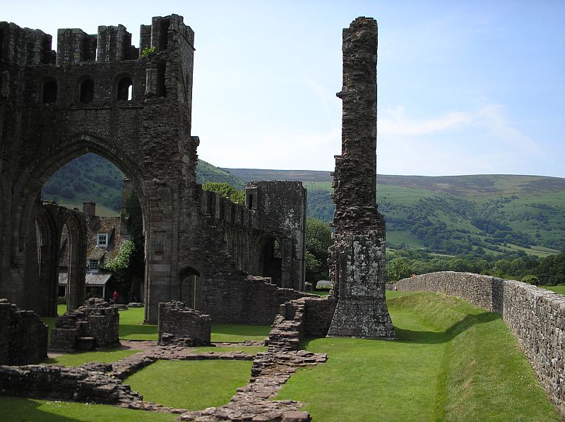
Llanthony Priory in Llanthony is a partly ruined Augustinian monastery set in the remote Vale of Ewyas, among the Black Mountains of Brecon Beacons National Park in Monmouthshire, south-east Wales. The ruins lie in a steep, glacier-carved valley about seven miles north of Abergavenny, beside the old road towards Hay-on-Wye. The site is Grade I listed, the main ruins are looked after by Cadw, and visiting is free. How did Llanthony Priory begin? The story starts around 1100. A Norman knight, William de Lacy, a kinsman of Hugh de Lacy, Lord of Ewyas, was drawn to the solitude of the valley and settled as a hermit. He was joined by Ersinius, once chaplain to the queen of Henry I. A church dedicated to St John the Baptist was consecrated in 1108, and the community of canons regular is regarded as the first of its kind in Wales. Peace did not last. Around 1135 the canons left after attacks by local people and founded Llanthony Secunda in Gloucester. Endowments from Hugh de Lacy brought the community back: about 1186 he redirected income to the abandoned valley house. The present church was built up to the early 13th century. The priory was closed during Henry VIII's dissolution, in 1538 or 1539, and the buildings then fell into disrepair. What can you see today? The best-known sight is the arcade of the nave and the church towers, framed by the slopes of Hatterrall Ridge, an eastern spur of the Black Mountains. The ruins sit among fields and can be explored freely without a ticket. Other Grade I listed buildings stand within the precinct: the church of St David and Court Farm Barn. Some of the former priory buildings, including the south-west tower, now form the Abbey Hotel, also Grade I listed. Cadw records medieval roots there and a vaulted 13th-century undercroft. The buildings were later converted into a residence in the 19th century. How do you get to Llanthony? The nearest sizeable town is Abergavenny, from which the road runs about seven miles north up the Ewyas valley. Driving is the easiest option: the valley is remote and the lanes are narrow. It works well as a stop on a loop through the Black Mountains and on towards Hay-on-Wye. When should you go, and how long do you need? The ruins are open to explore all year, but they look best in dry weather from late spring to early autumn, when the surrounding hills are clearly visible. An hour covers the ruins; allow half a day if you add a walk in the valley and a meal at the hotel. Frequently asked questions Is Llanthony Priory free to visit? Yes. The main ruins are in Cadw's care and entry is free. Where is Llanthony Priory? In the Vale of Ewyas, Monmouthshire, inside Brecon Beacons National Park, roughly seven miles north of Abergavenny. Is it the same as Llanthony Secunda? No. Llanthony Secunda is the later priory the canons founded in Gloucester after leaving Wales in 1135. Can you stay overnight at the priory? Yes. The Abbey Hotel, a Grade I listed building, occupies part of the former priory buildings.
-
Portsmouth Cathedral
Portsmouth
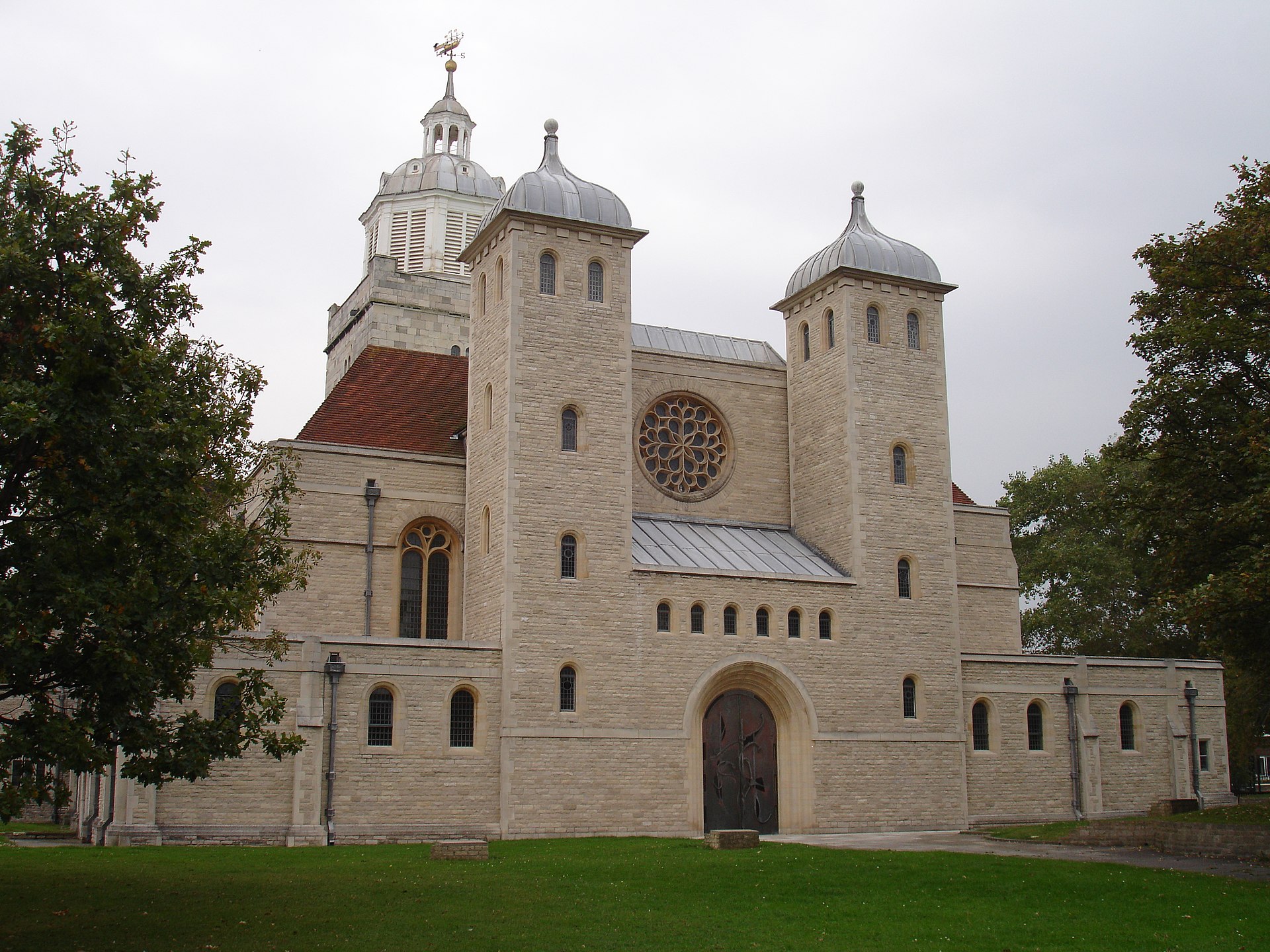
Portsmouth Cathedral (the Cathedral Church of St Thomas of Canterbury) is an Anglican cathedral in the heart of Old Portsmouth, close to the harbour and waterfront. A Grade I listed building, it blends medieval origins with a Baroque-era rebuild and twentieth-century extensions. How did Portsmouth Cathedral begin? Around 1180, a wealthy Norman merchant named Jean de Gisors granted land to the Augustinian canons of Southwick Priory so they could build a chapel honouring Thomas of Canterbury, who had been murdered only a decade earlier. Construction was under way by the mid-1180s, and the chancel and nave were consecrated in 1188. The church was cruciform with a central tower, which besides ringing bells also worked as a lighthouse and lookout over the channel. Civil War damage and rebuilding In 1642, during the English Civil War, Parliamentary forces attacked the town and the church was badly damaged. The original nave was lost. Between 1683 and 1693 a new aisled nave and a west tower were built, with a cupola added in 1703. This part of the building carries classical-style decoration, which is why the interior mixes several eras. What is the architecture like? The surviving chancel and transepts are in a transitional style between Romanesque and early English Gothic, with close parallels at Chichester Cathedral and Boxgrove Priory. Historic England describes the building as a mix of Transitional, Early English, Classical and Byzantine elements. Sir Charles Nicholson carried out work between 1935 and 1939, and a west extension by Michael Drury of Winchester followed in 1990–91. The completed cathedral was consecrated in 1991. From parish church to cathedral St Thomas's served as a parish church until the twentieth century, when it became the cathedral of the new Diocese of Portsmouth. Sources give different years for the change of status (1927 or 1935), so it is safest to place it in the late 1920s to 1930s. What to look for when you visit The medieval chancel and transepts, the oldest parts of the church. The late seventeenth-century nave. The 1703 cupola on the west tower. The twentieth-century additions, visible at the west end. The cathedral sits in the historic Old Portsmouth quarter, so it pairs easily with a walk along the waterfront and through the old streets. Frequently asked questions Is Portsmouth Cathedral a listed building? Yes, it is Grade I listed, the highest level of protection in England. Who is the cathedral dedicated to? St Thomas of Canterbury (Thomas Becket). How old is the building? The oldest parts date from the late twelfth century, the nave and tower from 1683–1693, with twentieth-century extensions. Where is it? In Old Portsmouth, near the harbour, on the south coast of England in Hampshire.
Earn badges for the places you visit
Download NextOnTrip, discover new places and check off your trails.