Nature in Belgium
A guide to 203 Nature in Belgium — with descriptions, photos and traveler visits from the NextOnTrip community. Locations spread across 144 cities and towns. Most visited by the community: Waggelwaterpark, Hof ter Musschen Park, Beislovenpark.
-
Ketelbossen
Waasmunster
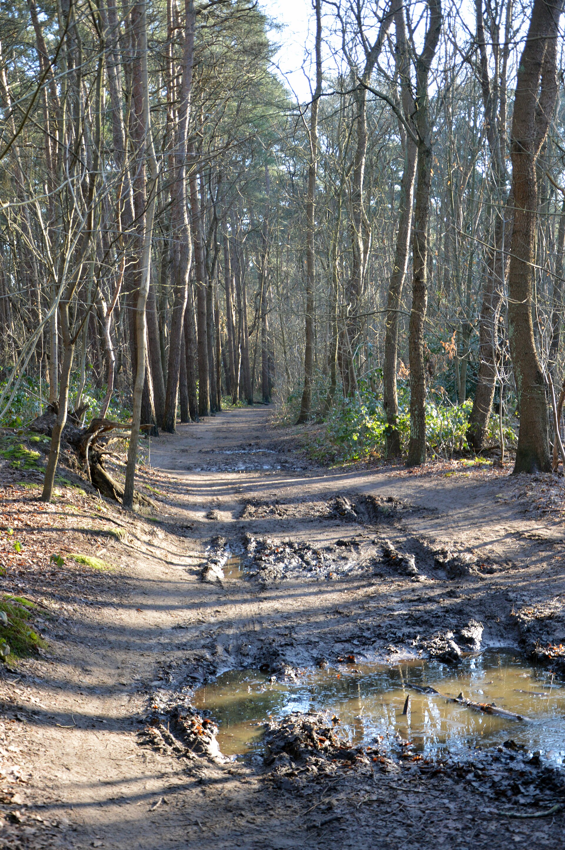
Ketelbossen is a woodland area in Waasmunster, in the Belgian province of East Flanders, spread across a sandy ridge between the E17 motorway and the village center. It borders directly onto the De Vaag nature reserve, together forming a larger green enclave in the Waasland region. What grows in Ketelbossen? Pine currently dominates the tree cover, alongside birch and oak. The forest is part of what's known locally as the "Z-shaped forest structure" — a chain of woodland running along an inland sand ridge from Stekene through Waasmunster to Beveren. That sandy, well-drained soil has shaped the vegetation over time, favoring pine stands, though younger deciduous plantings are increasingly visible in places. Why is the forest being transformed? Natuurpunt, the nature conservation organization that acquired much of the woodland — including several hectares around the former Roosenberg Abbey, bought from the Franciscan Sisters — is running a long-term restoration program here. The goal is to gradually replace the uniform pine plantations with a more varied oak-birch forest interspersed with heathland patches. This kind of habitat mosaic is meant to boost biodiversity and support a wider range of species than a conifer monoculture typically allows. What wildlife lives here? Squirrels and roe deer are regular residents, and birdwatchers can spot crested tits, black woodpeckers, and spotted flycatchers among the canopy. Of particular conservation value is the presence of the barbastelle, a bat species considered rare across Flanders — a detail that gives this patch of forest real weight within the region's broader nature protection efforts. How can visitors explore Ketelbossen? The woodland itself is accessible to walkers only — there are no cycling or horse routes through it, which helps keep the area calm for more skittish wildlife. The adjoining De Vaag reserve, by contrast, is freely open year-round, making the combined area a practical base for a longer walk linking both sites. Marked hiking routes in the vicinity, including a loop through Ketelbossen starting from Waasmunster's center, are used by both locals and visitors from further afield. Frequently asked questions Can you cycle through Ketelbossen? No — the woodland is reserved for pedestrians only, unlike the neighboring De Vaag reserve. What makes this forest notable? The presence of the barbastelle, a bat species rare in Flanders, and an ongoing project to convert pine monoculture into a more natural oak-birch forest with heathland. Where exactly is Ketelbossen located? On a sandy ridge between the E17 motorway and the center of Waasmunster, in East Flanders, forming part of a wider forest belt stretching from Stekene to Beveren. Who manages the area? A large part of the forest, including land around the former Roosenberg Abbey, is managed by Natuurpunt, the nature conservation group active in the Waasland region.
-
De Vaag
Waasmunster
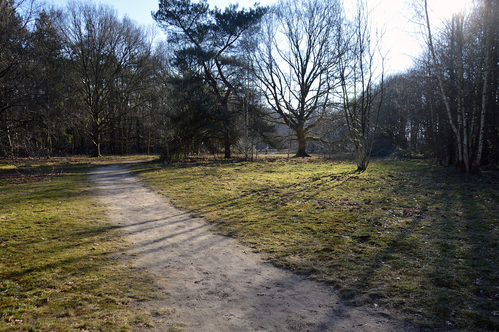
De Vaag is a small but charming nature area in Waasmunster, in the East Flanders province of Belgium. Covering roughly 10 hectares, it combines a narrow strip of heathland with a surrounding forest of old oak trees, offering a peaceful destination for nature lovers and a playful outdoor space for families. Who owns and manages the site? De Vaag belongs to the municipality of Waasmunster, while its day-to-day ecological management is handled by Natuurpunt, a Belgian nature conservation organization. This partnership between local authorities and volunteers has turned the area into a place where biodiversity protection and recreation go hand in hand, open to residents and visitors alike. What grows and lives on the heathland? At the heart of De Vaag lies a long, narrow strip of heathland grassland. Depending on the season, visitors can spot blooming heather, greater yellow rattle — a plant typical of nutrient-poor grasslands — and common sorrel. This habitat also supports a range of insects, including sand bees, gall wasps, and oak sawflies, which rely on the surrounding oaks. To keep the heath open and prevent it from overgrowing, sheep are occasionally brought in to graze, and the heather sections are sometimes fenced off with flip gates to control access. Forest and play area for children Surrounding the heathland is a varied woodland dominated by old oak trees, which provide significant ecological value by supporting local insect and bird life. Thanks to an initiative by the local group Team Natuur in de buurt, part of the forest has been set up as a play and walking forest, designed with younger visitors in mind. The site also includes a recreational meadow with a fire pit, which youth associations can use for camps or outdoor gatherings. Can you visit De Vaag, and when? The area is freely accessible year-round, making it a convenient destination for a short walk or a longer outing in any season. A few rules apply, though: dogs must be kept on a leash, and some sections may be temporarily closed while sheep are grazing — this mainly concerns the fenced heather plots. Why is it worth a visit? De Vaag shows how a small, well-managed site can balance the protection of a valuable heathland habitat with recreational value for the local community. A walk among the old oaks, a moment spent watching pollinating insects, or simply relaxing in the meadow all make De Vaag, despite its modest size, a spot worth including on a tour of the Waasland region. Frequently asked questions Is entry to De Vaag free? Yes, the area is freely accessible year-round at no cost. Can I visit with a dog? Yes, but dogs must be kept on a leash. Who manages the area? The municipality of Waasmunster owns the land, while Natuurpunt handles its ecological management. Is there anything for children? Yes — part of the forest has been developed as a play forest, and there is also a meadow with a fire pit used by youth groups. Why is the area sometimes partially closed? Because of periodic sheep grazing used to maintain the heathland, which can temporarily restrict access to fenced sections.
-
De Meetkerkse Moeren
Meetkerke
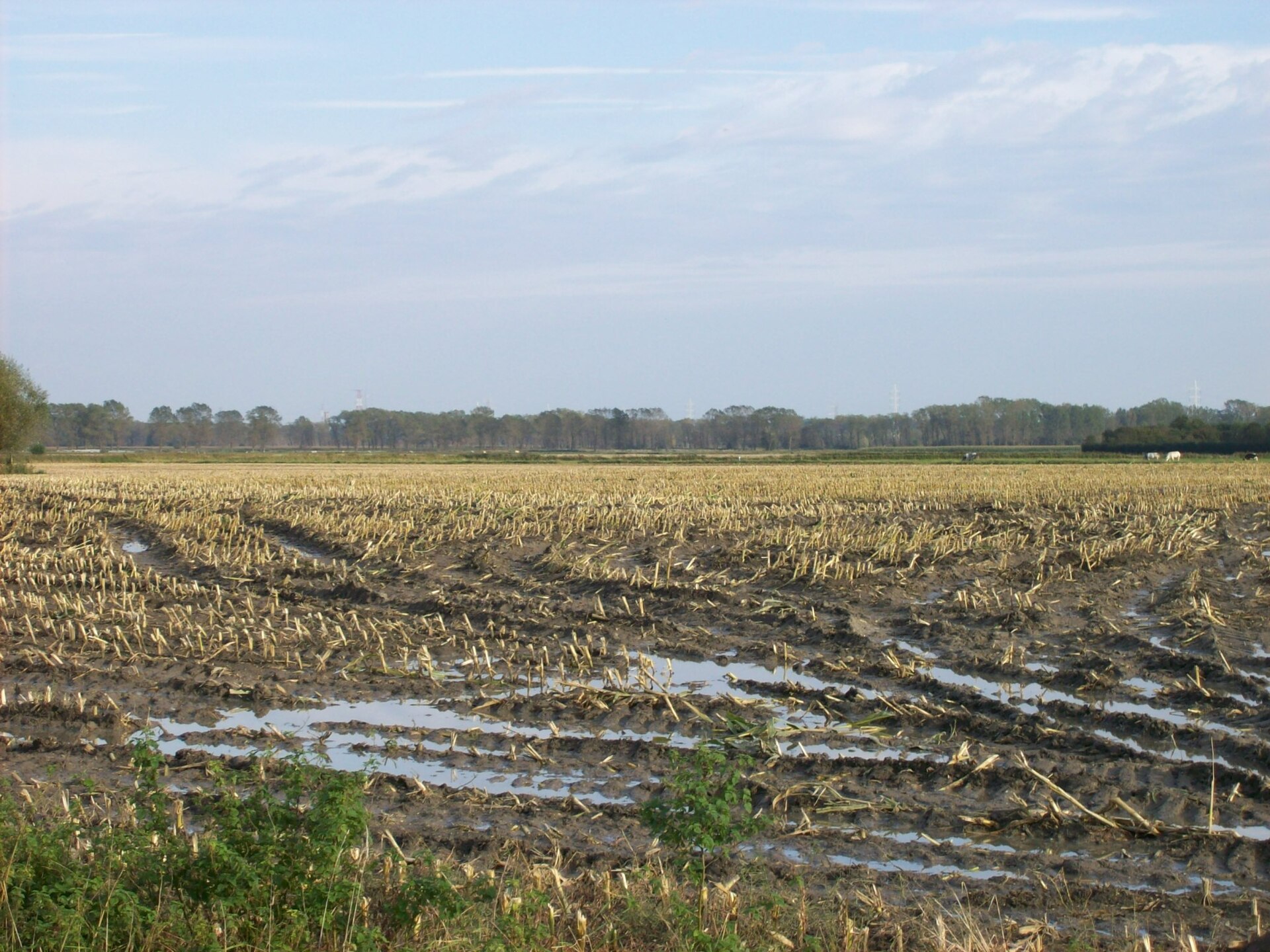
De Meetkerkse Moeren is a sprawling polder area of roughly 570 hectares stretching between the village of Meetkerke and the canal connecting Bruges to Ostend, within the municipality of Zuienkerke in Belgium. Unlike the surrounding polder landscape, this area has a distinctive backstory as a former raised peatland, and it remains a patchwork of wet meadows and pastures, much of it lying below sea level. Where does the name "Moeren" come from? The Dutch word "moeren" means marshes, and the name fits. During the Middle Ages this stretch of land was covered by an extensive raised peat bog, which was intensively cut for fuel — a resource that helped power the growth of nearby Bruges, then a major trading city. Centuries of peat extraction gradually turned the exhausted bog into a hollow lying lower than the surrounding farmland. How was the land drained? Systematic reclamation only began in the 17th century. A ring dike was built along with two wooden windmills, known as the Small and Large Mills, whose job was to pump excess water out of the low-lying basin toward the Blankenbergse Vaart canal. This slowly converted the marsh into meadow and pasture, though the persistent wetness meant only extensive, low-intensity farming was ever possible here. What does the landscape look like today? The Meetkerkse Moeren today is crisscrossed by ditches and small watercourses running through damp meadows. A nature reserve covering close to 250 hectares provides habitat for a wide range of wetland-associated flora and fauna, from waterfowl to plant species typical of wet grassland and pasture. The area's best-known landmark is the Poldermolen in Meetkerke, a historic drainage windmill that, after a thorough restoration, has been turning its sails again since 2014 — a working reminder of the site's centuries-old drainage function. What role did nature restoration play? At the turn of the millennium the area underwent an ambitious ecological restoration project. Led by the Flemish Land Agency (Vlaamse Landmaatschappij) between 2001 and 2009, it covered 245 hectares spanning Meetkerke and Houtave (Zuienkerke), Varsenare (Jabbeke), and Sint-Andries (Bruges). The project restored hay meadows, hay pastures, small tree-lined lanes, and a traditional duck decoy trap, while raising water levels through weirs installed on several watercourses. Frequently asked questions Where exactly is De Meetkerkse Moeren located? Between the village centers of Meetkerke and Houtave and the Bruges–Ostend canal, in the municipality of Zuienkerke in West Flanders. How does it differ from a typical polder landscape? Unlike most surrounding polders, this area developed on a former raised peat bog, giving it a different soil structure and an unusually wet character. Can visitors walk through the area today? Yes, marked walking routes cross the reserve, including the popular Meetkerkse Moerenwandelroute, roughly 15 kilometers long. What does the Poldermolen in Meetkerke represent? It's a restored drainage windmill that has been operating again since 2014, pumping excess water toward the Blankenbergse Vaart canal — a living monument to the area's long history of land reclamation.
-
Presqu'île de l'Ilal
Eijsden
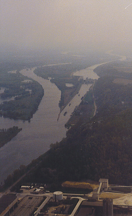
Presqu'île de l'Ilal is a small peninsula and nature reserve set along the Meuse river, in the Dutch municipality of Eijsden-Margraten, close to the village of Oost-Maarland, right on the border with Belgium. It forms part of the larger Eijsder Beemden nature reserve, one of the protected riverside areas in this part of Limburg. Where exactly is this peninsula located? Presqu'île de l'Ilal lies in the southern Netherlands, within the municipality of Eijsden-Margraten, directly adjacent to the Belgian border. Its geographic coordinates are approximately 50.8047°N, 5.6961°E. The proximity to the border gives the surrounding area a distinctly cross-border character — the Meuse naturally separates Dutch and Belgian territory at this point, and the peninsula itself was shaped by the course of the river. What is Eijsder Beemden and how does it relate to this site? Eijsder Beemden is a broader nature complex encompassing riverside land along the Meuse near Eijsden. Presqu'île de l'Ilal is an integral part of it — a small but distinct section of this area, formed by the river into a characteristic peninsula shape. Riverside areas of this kind, such as Eijsder Beemden, function as nature reserves, protecting the natural environment of the Meuse valley from excessive human interference. What kind of place is this? Presqu'île de l'Ilal is described as a small peninsula that serves as a nature reserve. Its position along a bend or bank of the Meuse means the land is closely tied to the river's dynamics — fluctuating water levels and the natural processes of erosion and sediment deposit that shape the shoreline of this kind of landform. The nearby Belgian border adds a cross-border dimension to the site — the Meuse acts as the national boundary along this stretch, making the area notable from a political-geography perspective as well as a natural one. Why does Oost-Maarland matter for locating this place? Oost-Maarland is the village situated in the immediate vicinity of Presqu'île de l'Ilal, within the municipality of Eijsden-Margraten. This village is the most common reference point used to locate the small peninsula, which helps visitors unfamiliar with the exact topography of the Meuse valley in this part of Limburg get their bearings. What is the key takeaway about Presqu'île de l'Ilal? Presqu'île de l'Ilal is, above all, an example of a modest but noteworthy patch of riverside nature on the Dutch-Belgian frontier. As part of the Eijsder Beemden reserve, it belongs to a wider system protecting land along the Meuse, which includes floodplain meadows, old river branches, and other landforms shaped by the river over time. Although the site itself is small, its location — straddling the border of two countries, at the heart of the Meuse valley, within the municipality of Eijsden-Margraten — makes it a point of interest on the regional map for anyone drawn to riverside nature and border geography. Frequently asked questions Where is Presqu'île de l'Ilal located? In the municipality of Eijsden-Margraten in the Netherlands, along the Meuse, right on the border with Belgium, near the village of Oost-Maarland. Is it a standalone nature reserve? No, it forms part of the larger protected area known as Eijsder Beemden. What does the name "presqu'île" mean? It is French for "peninsula" — land that is almost entirely surrounded by water. Is the site located directly on the international border? It sits in the immediate vicinity of the Dutch-Belgian border, which at this point is marked by the Meuse river.
-
Fond des Vaulx
Marche-en-Famenne
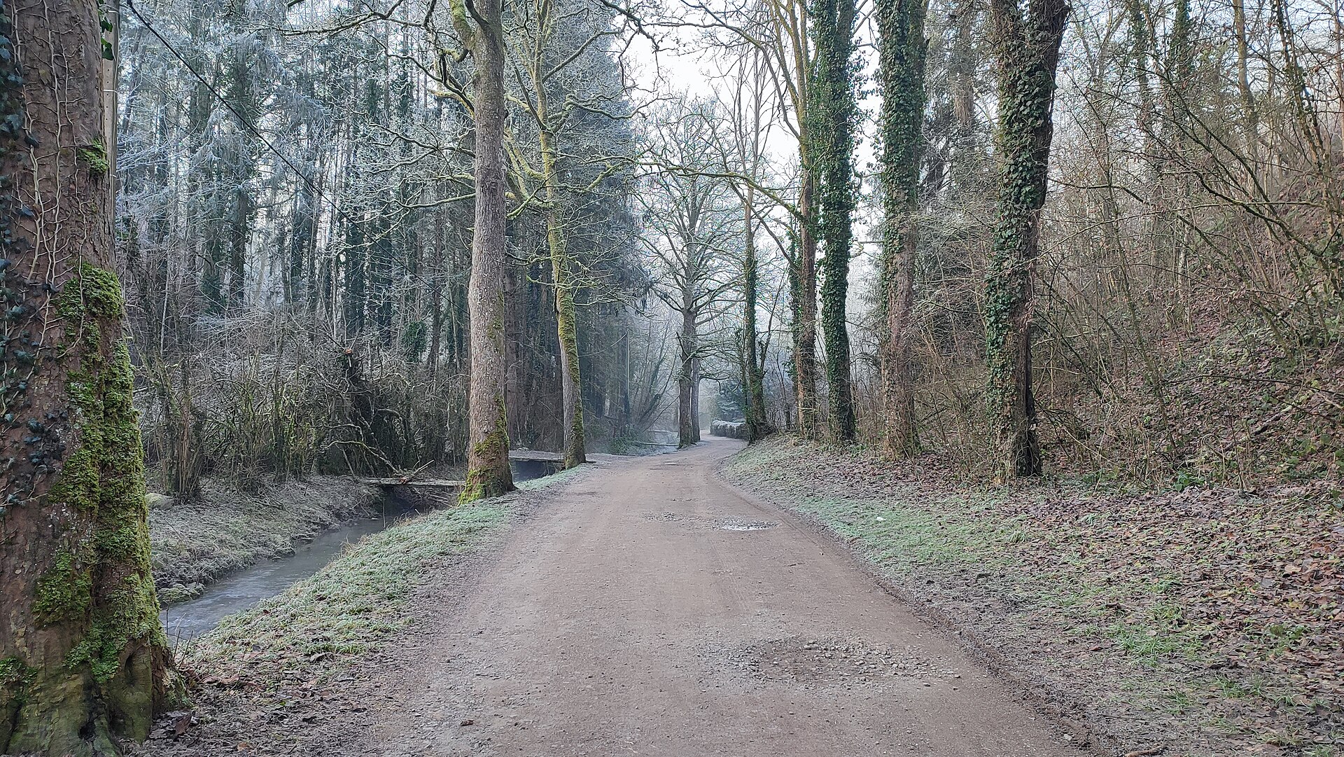
Fond des Vaulx is a small, wild karst valley tucked just a few minutes from the centre of Marche-en-Famenne, in the province of Luxembourg, Wallonia. Covering roughly 15 hectares, the valley stands in sharp contrast to the flat farmland plain surrounding the town — descend into it, and the landscape shifts abruptly into a rugged world of rock, caves and woodland. What makes it geologically special? The valley sits on the Calestienne, a limestone band running across southern Belgium. Over millions of years, acidic water flowing down from the Ardennes massif met the limestone bedrock and carved out an intricate network of caves, sinkholes and fissures. This slow erosion produced the jagged terrain that defines Fond des Vaulx today. Because of its geological importance, the site is part of the Famenne-Ardenne Geopark, Belgium's first UNESCO Global Geopark. What can visitors see there? The valley's best-known feature is the Trotti aux Fosses, a deep, funnel-shaped chasm considered unique in Belgium and protected as a cavity of scientific interest. Along the walking trails, visitors also pass several caves, including the Grotte de la Ducasse and the Trou du Renard, as well as steep rock walls and other karst formations that have long fed local legends about this mysterious corner of the region. Getting there and trail options Access to the valley runs through a long tunnel beneath the Liège–Jemelle railway line, giving the walk an unusual, almost cinematic start. Once inside, three marked trails ranging from 2.2 to 4.4 km let visitors explore the area at different levels of effort and available time. Fitness enthusiasts can also use a Hébert-style obstacle course set up in the valley, while a covered barbecue area offers a spot to rest for families and groups partway through the walk. Nature and species protection Beyond its scenery, Fond des Vaulx is a valuable nature reserve. The site is part of the Life Hélianthème project, which works to restore limestone grasslands — one of the richest and most threatened ecosystems in Wallonia. The valley's particular microclimate and varied limestone substrate support numerous plant species typical of calcareous habitats that are otherwise uncommon elsewhere in the region. Frequently asked questions How long does it take to visit Fond des Vaulx? Depending on the trail chosen, a walk takes roughly 45 minutes to just under two hours — the shortest loop is 2.2 km and the longest 4.4 km. Is entry to the site free? Yes, the valley is an open-access walking area with no entrance fee. Can visitors explore the caves on their own? The trails run alongside cave entrances and rock formations, but entering the caves themselves is not the main purpose of a visit — this is primarily a scenic and nature walk rather than a caving destination. Who is this site best suited for? Fond des Vaulx works equally well as an easy family outing with a barbecue stop or as a longer excursion for geology and nature enthusiasts looking for a lesser-known highlight of the Famenne-Ardenne region. How far is it from central Marche-en-Famenne? The entrance to the valley lies just a few minutes on foot or by car from the town centre, making it an easily accessible attraction even for a short visit.
-
Mombeekvallei
Hasselt
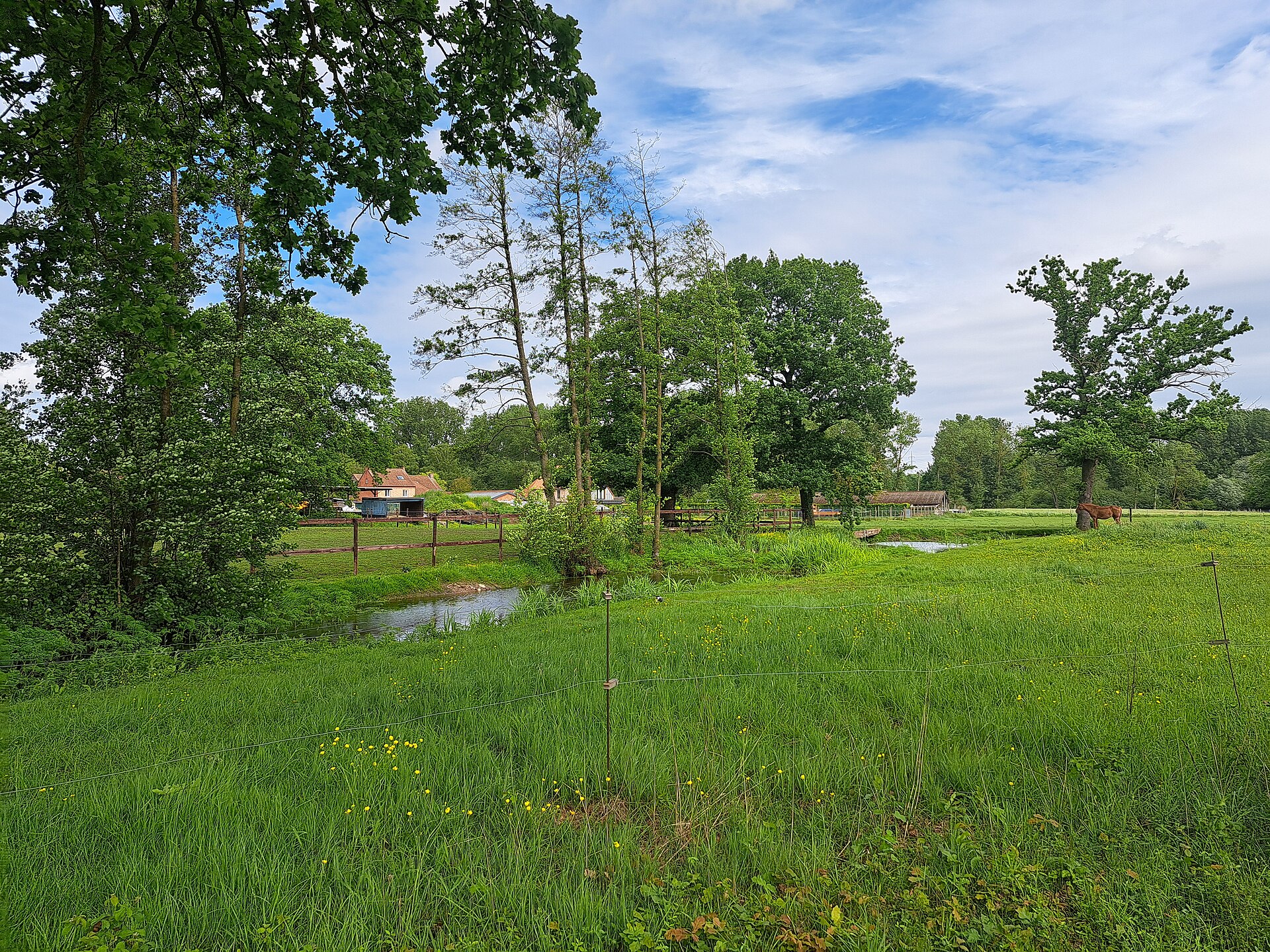
Mombeekvallei is a nature reserve that stretches like a narrow green ribbon along the border between Sint-Lambrechts-Herk (part of the city of Hasselt) and the municipality of Alken, in the Belgian province of Limburg. The area is managed by Natuurpunt and represents a classic example of the wet valley landscapes found throughout Haspengouw — a rolling agricultural region in eastern Belgium where streams have carved narrow, moisture-rich depressions into the loess soil over centuries. What shapes the valley's landscape? Two watercourses run through the reserve: the Old Mombeek (Oude Mombeek) flows through the center of the valley, while the New Mombeek (Nieuwe Mombeek) runs parallel to it closer to the steep northern slope. This dual-stream layout gives the landscape a layered structure — wet meadows and reed beds near the water, scrubland and hedgerows further out, and strips of riparian woodland tracing the course of the streams. The surrounding land consists of the fertile farmland typical of Haspengouw, making the valley a clear visual and ecological contrast to the open farmland around it. Why does it matter for biodiversity? Mombeekvallei is known for its remarkably rich plant life, with more than 250 species recorded in its meadows. Particularly striking are the relatively young hay meadows restored through Natuurpunt's conservation work, which burst into a full palette of color in late spring as wildflowers and grasses bloom. This mosaic of habitats — wet grassland, scrub, and riparian woodland — turns the valley into an important ecological corridor, linking fragmented pockets of nature scattered across the surrounding cropland. How can you explore the valley? The reserve is freely accessible year-round, and visitors are asked to stick to the marked walking paths. Because the valley is genuinely wet underfoot, especially after rain, sturdy footwear such as boots is strongly recommended. Marked hiking routes exist on both sides of the municipal border: a red route of roughly 8 km (about two hours) starting from Alken, and from the Sint-Lambrechts-Herk side, a red route of about 6 km and a yellow route of about 5 km. This range of distances makes it easy to pick a walk that matches the time and energy you have available. Where exactly is it located? The reserve lies on the border between Alken and Hasselt, in the heart of the Limburg province, close to coordinates 50.8879° N, 5.3253° E. It's a convenient destination for anyone exploring the area around Hasselt who wants a quiet nature outing without traveling far from the city. Frequently asked questions Is there an entrance fee for Mombeekvallei? No, the reserve is open to visitors free of charge throughout the year, as long as you keep to the designated paths. When is the best time to visit? Late spring is the most rewarding time, when the hay meadows are in full bloom and the valley's plant diversity is most visible. Are the walking routes difficult? No, they are gentle trails ranging from around 5 to 8 km, suitable for an average fitness level, though the ground can be muddy in wetter periods. Who manages this nature reserve? The reserve is managed by Natuurpunt, the Belgian nature conservation organization.
-
Swamp of Ganshoren
Ganshoren
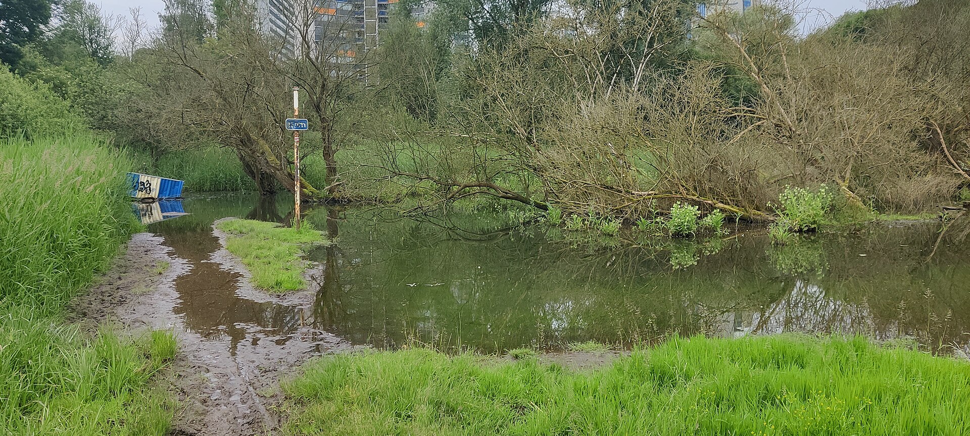
The Swamp of Ganshoren (Moeras van Ganshoren) is one of the last surviving fragments of the wetlands that once lined the Molenbeek valley, located in the Brussels municipality of Ganshoren. The nature reserve covers roughly eleven hectares and is owned by the Brussels-Capital Region. What does the reserve look like? The site alternates between moist meadows and patches of scrub and bushes, creating a mosaic of open and semi-wooded habitats within a compact area. This mix supports a wide range of species, from those tied to wet ground to others favouring drier, shrubbier corners. The swamp is what remains of a much larger network of wetlands that once stretched along the Molenbeek valley before urban expansion drained and built over most of the surrounding land. Which animals live here? The reserve is best known for its birdlife: more than 65 species have been recorded here, making it one of Brussels' notable birdwatching spots. Beyond birds, the wet meadows and scrub shelter small mammals, including rodents, and bats that hunt over the damp grassland at dusk. Amphibians make use of the reserve's wetter corners, and grass snakes — a harmless species tied to watery habitats — have also been observed, a sign of the ecosystem's good condition. Why does this site matter for Brussels? Urban wetlands are among the most vulnerable habitats to disappear, as drainage for housing and roads has erased nearly all traces of the Molenbeek valley's original marshland across the city. The Swamp of Ganshoren survives as a valuable relic of the valley's pre-urban state, giving species that have lost ground elsewhere in Brussels a place to persist. It's worth noting that Brussels has another well-known wetland with a similar name: Het Moeraske, in the municipality of Evere, often described as the last true swamp within the city limits. Despite the similar naming, the two sites are separate reserves in different parts of the capital. How do you get to the Swamp of Ganshoren? The reserve is easy to reach by public transport: bus lines 84 and 87 serve the area, along with tram line 9. The proximity of these stops makes it simple to combine a walk through the wetland with a visit to other parts of Brussels, without needing a car. Frequently asked questions Can visitors walk through the reserve on their own, or is a guide required? The site is a publicly accessible nature reserve with walking paths, so no guide is required, though themed events are occasionally organised, including during Brussels' Heritage Days. What's the best time of year to visit? Given the high number of recorded bird species, spring and early summer tend to offer the richest wildlife observation, though the wet meadows and scrub have their own character throughout the year. How is the Swamp of Ganshoren different from Het Moeraske in Evere? They are two distinct nature reserves in different Brussels municipalities, sharing only their wetland character and their role as some of the last remnants of the city's historic marshland.
-
Île de Dave
Namur
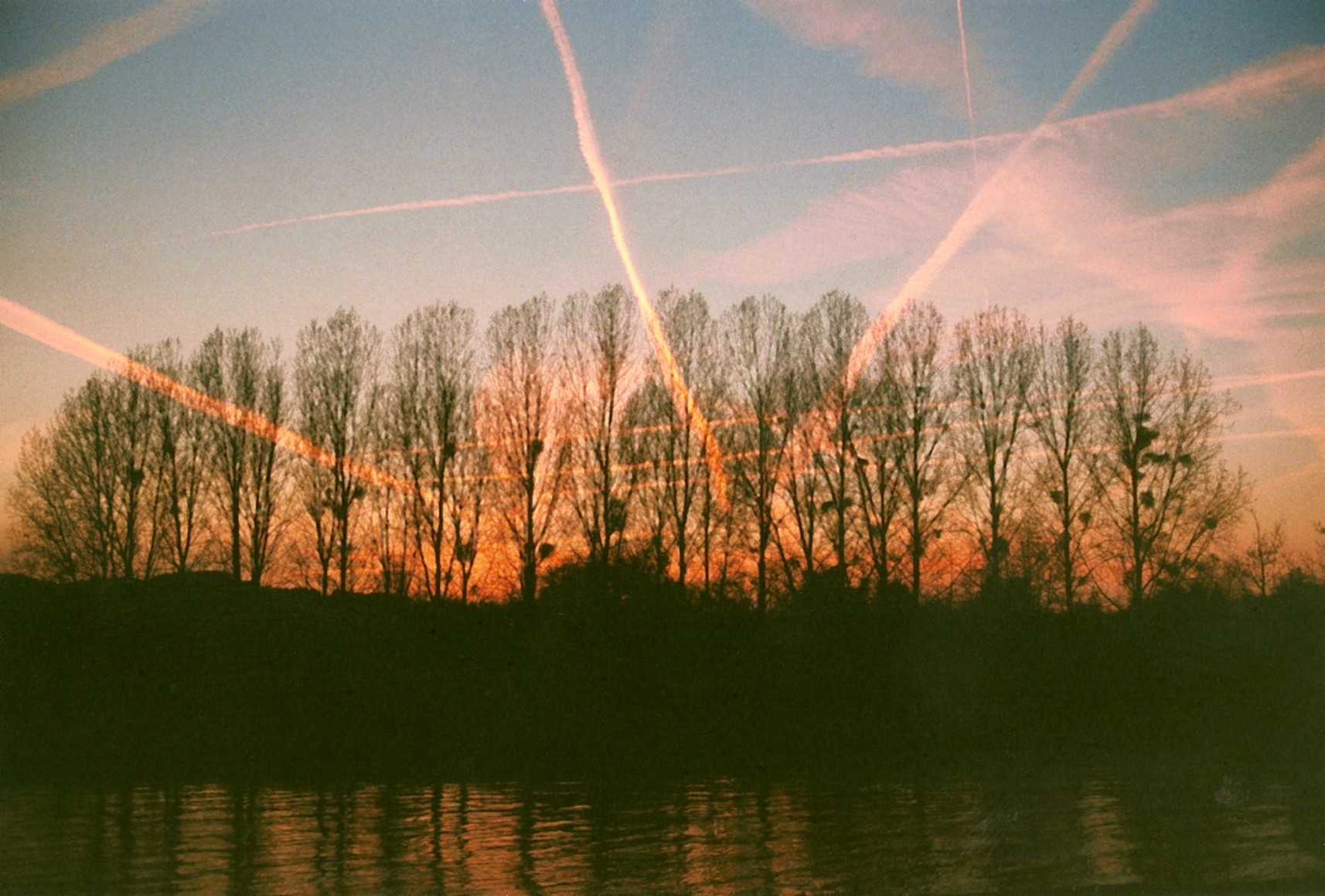
Île de Dave is one of the largest river islands in Belgium, sitting in the Meuse River roughly 5 kilometres south of Namur, in the Walloon Region. The island lies between the villages of Dave and Wépion, which the river separates from one another. How big is the island? Île de Dave covers close to 12 hectares. Most of that area is wooded, dominated by poplar plantations alongside patches of alder woodland, old willows, and even the remains of a former orchard. This mix of habitats has made the island one of the more valuable natural sites in the Meuse valley. Why is the island protected? The city of Namur first requested protected status for the island in 1982. A state nature reserve was formally established there in 1992, and today Île de Dave holds the status of a state-managed nature reserve (réserve naturelle domaniale) and forms part of the Natura 2000 protected area network. The island is also described as one of the few along this stretch of river to have escaped the destruction that affected other islands during past river-engineering works, which is why it has kept its natural character. What wildlife lives there? The island is a refuge for water and woodland birds that nest there throughout the year. Species most often mentioned include the great crested grebe, the common kingfisher, and the grey heron — the latter being relatively uncommon elsewhere in Wallonia, which adds to the site's ecological value. This richness of birdlife goes hand in hand with a variety of habitats: tree- and shrub-lined banks, open clearings left by the old orchard, and damp patches of alluvial forest provide shelter for many species year-round. What kind of vegetation grows on the island? The vegetation is typical of alluvial forest found on floodplains of large rivers. Poplars are the most abundant trees, growing alongside ash, alder, and willow. This type of forest is particularly sensitive to changes in water levels, which is one reason it needs protection — the Meuse's regular flooding shapes the conditions under which this vegetation develops. Can visitors explore the island? A signposted walking trail links the villages of Naninne and Dave, known as the "Naninne–Dave" route, and another trail follows the banks of the Meuse near Wépion. These routes let visitors admire the island and its surroundings from the riverbank without disturbing the reserve's ecosystem itself, which — like most state-managed reserves in Wallonia — is subject to access restrictions designed to protect the nesting birds and the sensitive alluvial vegetation. Frequently Asked Questions Where exactly is Île de Dave located? On the Meuse River, about 5 km south of Namur, between the villages of Dave and Wépion. How large is the island? It covers close to 12 hectares. Since when has the island been protected? Namur requested protection in 1982, and a nature reserve was formally established in 1992. What birds can be seen there? Among others, the great crested grebe, the common kingfisher, and the grey heron, which is rare elsewhere in Wallonia. Is the island part of the Natura 2000 network? Yes, Île de Dave is protected as part of the Natura 2000 network.
-
Caves of Hotton
Menil-Favay
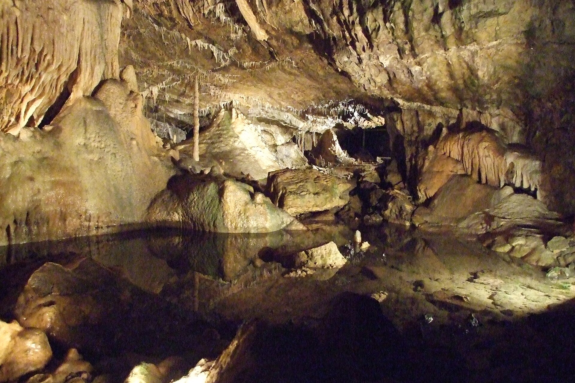
Caves of Hotton form a karst cave system tucked away near the town of Hotton in the Walloon region of Belgium. Carved out over long stretches of time by water working through limestone rock, the caves offer visitors a chance to step away from the surface world and into a quiet, dripping underground landscape shaped entirely by nature. How large is the cave system? The Caves of Hotton stretch for roughly 5 to 6 kilometers, making them one of the more extensive underground networks in this part of Belgium. The system descends to a depth of about 70 meters, so a visit involves a genuine sense of descent, moving from the surface down through successive chambers and passages. What's at the bottom of the caves? At the lowest point of the system runs an underground stream called Syphon. This flowing water is a reminder that the caves are not a static relic but an active geological feature, still shaped in part by the movement of water through the limestone. The sound of the stream accompanies visitors through the deepest sections of the network. When were the caves discovered? The caves were discovered in 1958. That timing places them among the mid-20th-century wave of speleological exploration that revealed many of the karst cave systems found across Wallonia and the wider Ardennes region, several of which were subsequently opened to public visits. What kind of rock formations can you see inside? Caves of Hotton are classified as speleothem caves, meaning their interior is lined with mineral formations built up as water carrying dissolved limestone drips from ceilings and walls over very long periods. These formations are the centerpiece of most karst cave visits and are the primary reason such caves attract geology enthusiasts and curious travelers alike. Where exactly are the caves located? The caves sit in Wallonia, close to the town of Hotton in Belgium's Luxembourg province, at approximately 50.259 latitude and 5.456 longitude. The surrounding area belongs to the hilly, forested Ardennes landscape, a region well known for its karst terrain and its concentration of caves open to the public. Who should visit the Caves of Hotton? Given the scale of the system — several kilometers of passages reaching down some 70 meters — the Caves of Hotton appeal to visitors with an interest in geology and speleology, as well as travelers looking for something different from the region's more typical hiking trails and historic architecture. It's a destination that rewards patience, both in the slow natural process that created it and in the quiet, careful walk through it. Frequently asked questions How old are the Caves of Hotton? The rock formations themselves developed over a very long geological timescale through the action of water on limestone, but the caves as a visitable site were only discovered in 1958. Is there water inside the caves? Yes, an underground stream called Syphon flows at the bottom of the system, running through the deepest passages visitors encounter. How deep do the caves go? The system reaches a depth of around 70 meters, making it one of the deeper cave networks in the Wallonia region. Where are the caves in relation to Hotton? They are located right next to the town of Hotton, in Belgium's Luxembourg province, within the scenic Ardennes region.
-
Chantoir du Rouge-Thier
Sougné-Remouchamps
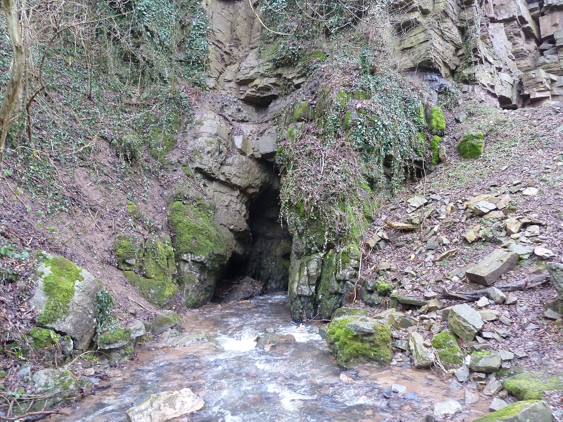
Chantoir du Rouge-Thier is a natural sinkhole located in the small hamlet of Rouge-Thier, part of the municipality of Aywaille in the province of Liège, in the Walloon region of Belgium. It sits within the Vallon des Chantoirs, at the northern edge of the Calestienne limestone belt, and ranks among the more notable karst features of this part of the Ardennes. What exactly is a chantoir? "Chantoir" is the Walloon term for a swallow hole — a spot where a surface stream disappears underground, flowing into a cave system carved out of limestone bedrock, before re-emerging somewhere else further downstream. This is a classic karst phenomenon: over thousands of years, water slowly dissolves the limestone, carving out underground channels, chambers, and passages. At Rouge-Thier, the stream responsible is the Fond Bastin, which plunges into the ground here, feeding an underground network also known locally as the Trou du Moulin. What visitors can see The cave entrance is accessible for around 250 meters, making this chantoir one of the more approachable caving sites in the area — though it still calls for caution and proper preparation rather than casual sightseeing. Inside, visitors can observe classic karst features: water-carved rock walls, damp passages, and the point where the stream vanishes into the depths. The site draws local cavers and geology enthusiasts, and speleological groups from the region — including a caving section affiliated with the University of Liège — carry out regular exploration and documentation work here. When not to visit Because this is an active karst system with real water flow, visiting during or after rainfall, or whenever the stream is running high, is strongly discouraged. Under those conditions the cave can flood rapidly, posing a genuine risk to anyone inside. The best time to explore is during dry spells, when water flow is low and predictable. The surrounding area and hiking routes Rouge-Thier and the neighboring village of Deigné lie within a scenic valley dotted with several chantoirs, forming part of a wider network of hiking trails around Aywaille and Remouchamps. The area combines the rolling, forested landscape typical of the Ardennes with a distinctive karst geology, making it a popular destination for day trips among nature lovers, geology enthusiasts, and outdoor hikers. Walking routes through the valley let visitors take in not just the Chantoir du Rouge-Thier itself, but several other similar sinkholes nearby. Frequently asked questions Can you actually go inside the chantoir? Yes, roughly 250 meters of the cave are accessible, but exploring it calls for caution and is best done during dry weather. Why should you avoid visiting on rainy days? Because the Fond Bastin stream actively flows through the chantoir — during rain or high water levels, the cave can flood quickly, which is dangerous for anyone inside. Where exactly is it located? In the hamlet of Rouge-Thier, part of the municipality of Aywaille, province of Liège, near the village of Deigné, within the Vallon des Chantoirs valley. Who is this attraction best suited for? Mainly for people interested in karst geology and caving, as well as hikers exploring the trail network around Remouchamps and Aywaille.
-
Westerpunt
De Panne
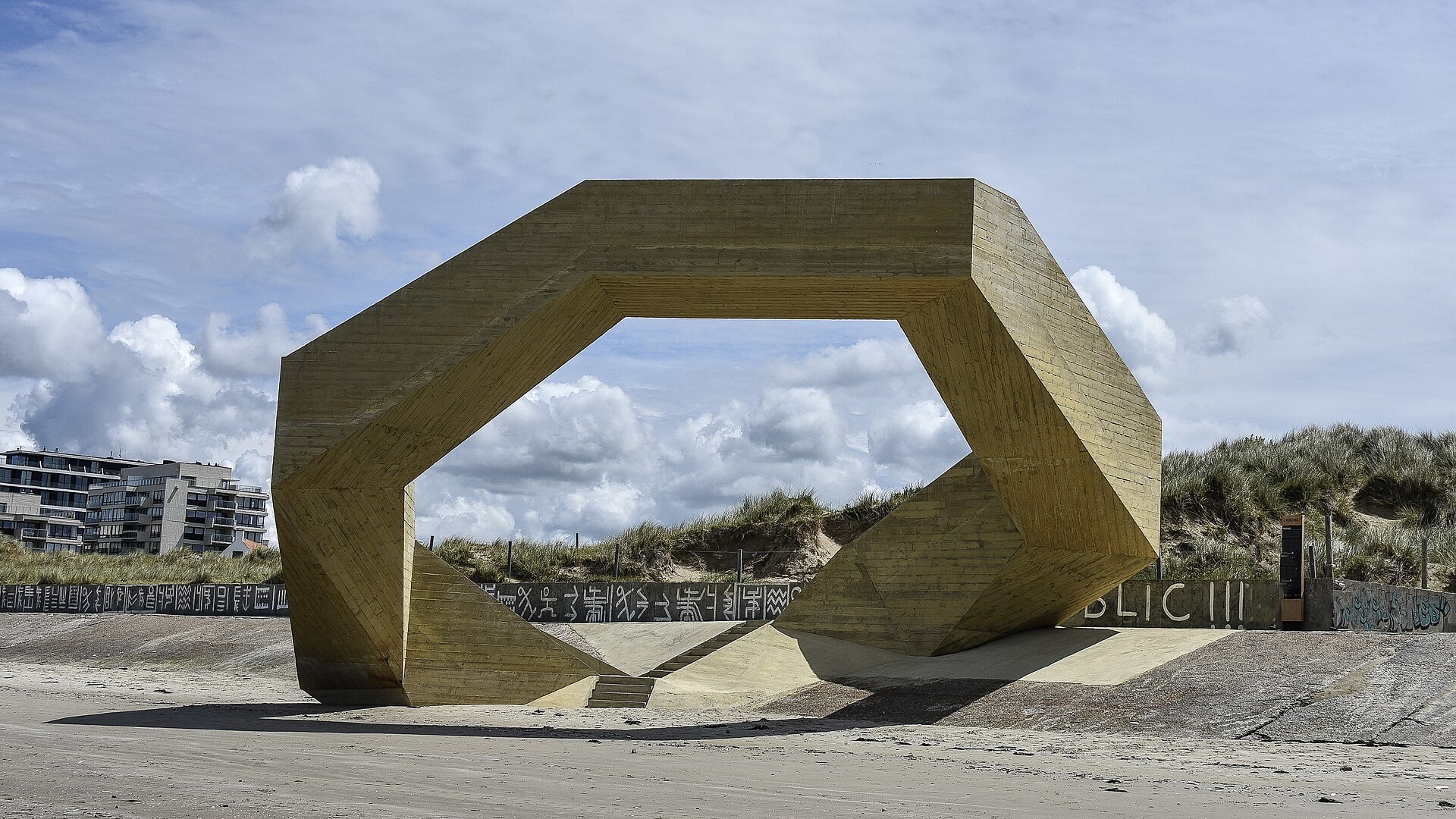
Westerpunt is a six-metre-high concrete viewpoint structure standing at the western edge of De Panne, right where the Belgian coast meets France, next to the Westhoek nature reserve. It opened to the public on 4 May 2024 as part of Horizon 2025, a West Flanders provincial project aiming to create a series of distinctive lookout points along the coastline. What does Westerpunt look like? The structure was designed by Studio MOTO in collaboration with engineering firm MOUTON Engineering. Its shape is an elongated pentagon made up of stair segments joined at 108-degree angles, with landings that double as resting spots and viewing platforms. The way the stairway loops back on itself in an endless circuit has drawn comparisons to the work of M.C. Escher, giving the impression that people are climbing and descending at once, in the same direction. The entire structure is cast in concrete, a material chosen so its texture and colour would echo the adjoining promenade while standing up to the harsh, salty sea climate of this stretch of coast. Why visit? Westerpunt sits on the slope of the local dike promenade, with stairs leading up from both sides of the structure. From its highest point, more than six metres above the beach, visitors get a panoramic view over the sand, the sea, and the dunes of the neighbouring Westhoek reserve. At high tide the base of the structure is partly submerged, adding to the sensation of hovering above the water. The design is meant to express a symbolic link between sea and dunes, nature and coastline, and the local community itself — Westerpunt functions both as a lookout and as a stop along the wider walking and cycling route that runs along the western tip of the Belgian coast. Where is it located? Westerpunt stands at the western edge of De Panne, close to the French border, along the dike path heading toward the French coastline. Its proximity to the Westhoek nature reserve — one of the last large stretches of wild dune landscape on the Belgian coast — ties the architecture directly to the surrounding natural setting. Frequently asked questions When did Westerpunt open? The structure opened to visitors on 4 May 2024. Who designed it? It was designed by Studio MOTO, with engineering support from MOUTON Engineering. What material is it built from? Westerpunt is built entirely of concrete, chosen for its resistance to the salty, humid air of the North Sea coast. Can visitors climb it? Yes, stairs lead up from both sides of the structure to viewing landings more than six metres above the beach. What can you see from the top? A panoramic view of the beach, sea, dunes, and the neighbouring Westhoek nature reserve.
-
Roche aux Faucons
Neupré
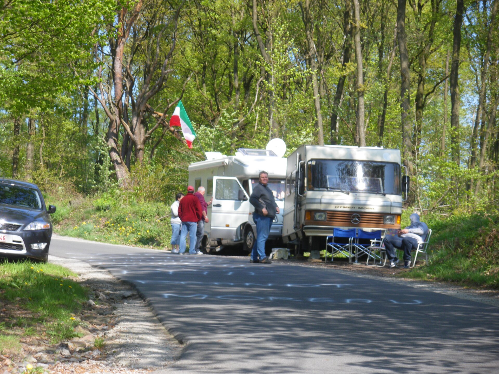
Roche aux Faucons is a rocky outcrop and viewpoint in the municipality of Neupré, in the province of Liège, about ten kilometers south of the city of Liège. It rises roughly 120 meters above the Ourthe valley and ranks among the most distinctive scenic spots in this part of Wallonia. Where does the name come from? The name refers to peregrine falcons, which once nested on these cliffs. The birds disappeared from the site in 1958, yet the name has endured as a lasting reminder of the birds of prey that once ruled the crag above the river. What is the rock made of? Roche aux Faucons is an outcrop of dolomitic limestone dating back to the Devonian period. The rock is hard and compact, and it has resisted erosion for millions of years, which is why it still forms a sharp, steep spur overlooking a bend in the Ourthe. Because of its natural value, the area is part of the Natura 2000 network, meaning the habitats and species found here are under protection. How was the site formally recognized? In 2015, Roche aux Faucons was inscribed on the list of Wallonia's exceptional landscape heritage under the newly created "Grand Site Paysager" label — the first such designation awarded in the region. This recognition confirms the site's importance not only as a viewpoint but as a landscape feature of regional significance. Why is this spot known to cyclists? The slope leading to the top of Roche aux Faucons is one of Belgium's better-known cycling climbs. It stretches about 1.3 kilometers, with an average gradient of nearly 11 percent and sections reaching as steep as 15 percent. Since 2008, the climb has been a regular feature of Liège–Bastogne–Liège, one of the oldest and most prestigious classic races in professional cycling. For many amateur riders, tackling Roche aux Faucons has become something of a rite of passage and a test of form. What can you see from the top? From the summit, a broad view opens over the meander of the Ourthe river and the wooded hills surrounding it. The panorama takes in the valley's characteristic bend from a considerable height, making the spot one of the more photogenic viewpoints in the Liège region. What hiking options are nearby? Roche aux Faucons serves as both a starting point and a destination for numerous hiking trails running through the Ourthe valley. The routes vary in length and difficulty, but most of them offer, at some point, a view of the rock itself or from its summit over the surrounding countryside. This makes the site appealing both to casual walkers and to those looking for a more demanding hike. Frequently asked questions Can you climb at Roche aux Faucons? The rock is known among climbers as a training spot, though most visitors come primarily for the view and the cycling climb. How far is it from Liège? The site lies about ten kilometers south of central Liège, within the municipality of Neupré. Is the cycling climb difficult? Yes — with an average gradient of nearly 11 percent and stretches up to 15 percent, it is one of the more demanding climbs in the region and has been a fixture of Liège–Bastogne–Liège since 2008.
-
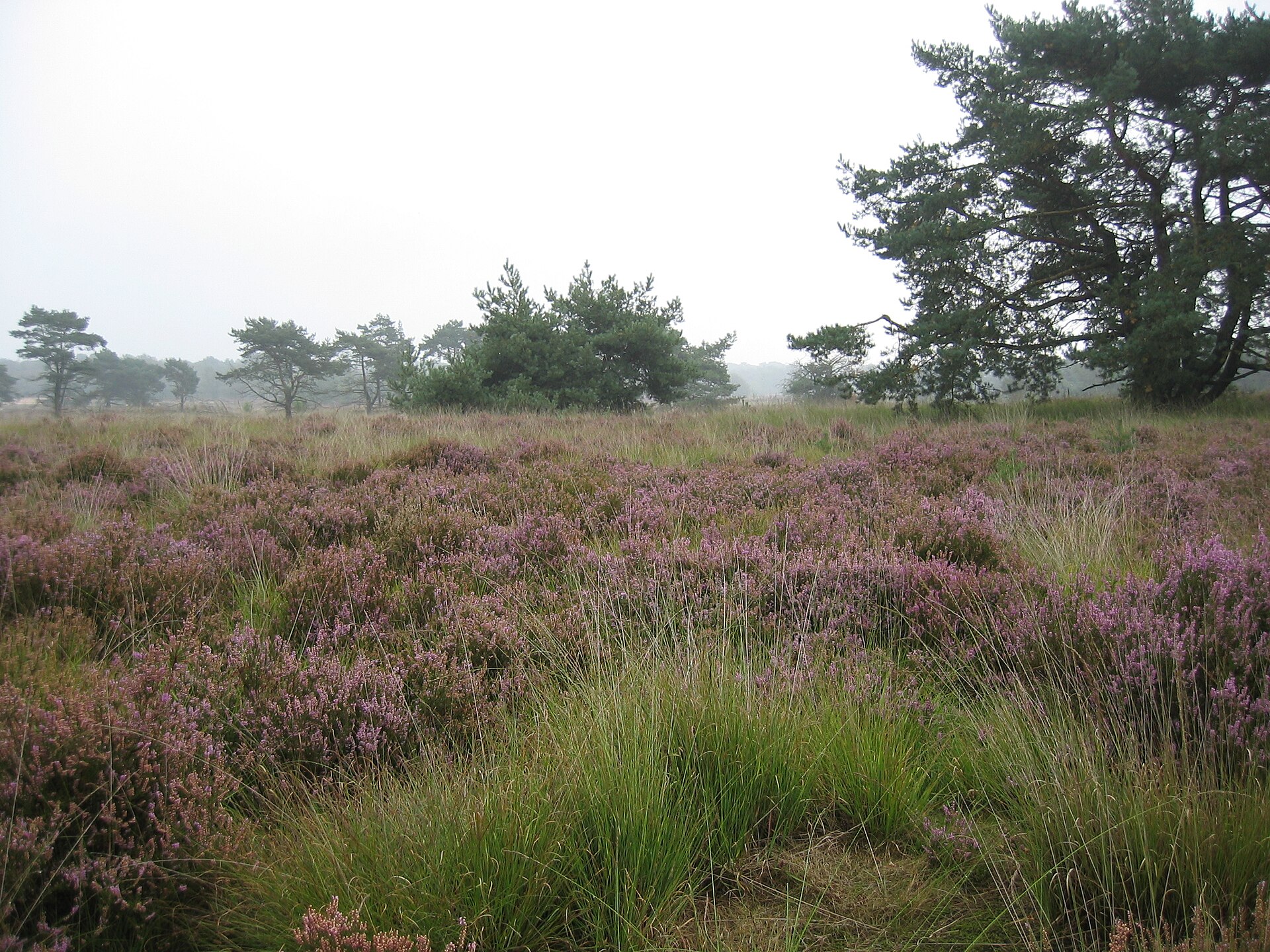
De Zoom - Kalmthoutse Heide
Ossendrecht
De Zoom - Kalmthoutse Heide is a cross-border nature park straddling the Belgian-Dutch border, near the town of Ossendrecht. The protected area was formed by merging two previously separately managed parks: the Belgian Kalmthoutse Heide (Kalmthout Heath) and the Dutch De Zoom. Together they form one of the larger heathland complexes in Western Europe, covering roughly 37.5 square kilometres in total. What can visitors find in the park? The landscape of De Zoom - Kalmthoutse Heide is dominated by extensive heathland, which gives the area its distinctive appearance and much of its ecological value. Open, heather-covered stretches alternate with patches of woodland, inland dunes, and wetter low-lying sections, creating a mosaic of habitats suited to species adapted to this particular type of ecosystem. Why is the park cross-border? A defining feature of this area is that it sits precisely on the national border between Belgium and the Netherlands. Historically, the land on each side of the border was managed as two entirely separate parks - the Belgian Kalmthoutse Heide and the Dutch De Zoom - each under the nature conservation authorities of its own country. Over time, the two areas were joined conceptually and operationally into a single cross-border park, making it easier to protect the continuity of the heathland ecosystem, which of course pays no attention to lines drawn by people on a map. What is the ecological significance of this place? Heathlands of this kind are increasingly rare and threatened habitats in Western Europe, largely due to changes in land use, afforestation, and urbanisation. The considerable size of De Zoom - Kalmthoutse Heide allows the park to play an important role in preserving this type of landscape at scale, something far harder to achieve in smaller, fragmented reserves. The cross-border cooperation between Belgium and the Netherlands in managing the area is also a useful example of how nature conservation can extend beyond national administrative boundaries. Who is this destination for? The wide, open heathland stretches attract people looking for a break from city life - walkers, cyclists, and nature observers alike. The distinctive scenery, especially during the heather flowering season, produces views typical of this part of Europe, quite different from the more forested or mountainous landscapes found elsewhere. Its proximity to Ossendrecht on the Dutch side makes it a convenient base for anyone exploring the Belgian-Dutch border region. Frequently asked questions Where exactly is De Zoom - Kalmthoutse Heide located? The park lies on the border between Belgium and the Netherlands, near the town of Ossendrecht on the Dutch side and Kalmthout on the Belgian side. How large is the protected area? The park covers approximately 37.5 square kilometres in total, making it one of the larger heathland areas in the region. How did this park come into being? It was formed by merging two separate parks - the Belgian Kalmthoutse Heide and the Dutch De Zoom - which were previously managed independently on either side of the border. What is the park's main natural attraction? The extensive heathland, which covers much of the area and creates the open, characteristic landscape typical of this part of Western Europe. Can the park be visited from both sides of the border? Yes, its cross-border nature means it can be accessed from either Belgium or the Netherlands, with the administrative border posing no barrier to visitors.
-

Moervaartdepressie
Lokeren
Moervaartdepressie is a broad, low-lying depression in the northern part of the East Flanders province in Belgium, stretching between the towns of Moerbeke, Wachtebeke and Stekene. Its name comes from the Moervaart, a southern tributary of the Durme river that runs through the area and has shaped its character for centuries. How did the depression form? The landscape as we see it today took shape mostly at the end of the Pleistocene and during the following Late Glacial period, roughly between 20,000 and 11,000 years ago. The result is an asymmetrical basin: on its northern side there is a fairly steep edge, about two metres high, marking the transition to a higher sandy ridge formed by wind-blown deposits (a so-called coversand ridge). That edge is the clearest visible trace of the area's geological past — the rest of the terrain slopes gently down toward the river channel. Landscape and nature Because the soil here is boggy and waterlogged, the area has remained largely free of buildings. Grassland, pastures and small pockets of woodland dominate, criss-crossed by drainage ditches and old river branches. As a result, Moervaartdepressie has kept an open, agricultural character that has become rare in the more densely built-up parts of Flanders. For visitors, that mostly means quiet, wide horizons, and good chances to spot waterfowl and other species tied to wetland habitats. The Moervaart river and its history The Moervaart itself was already straightened back in 1531, when its course was regulated and bridges were built to make crossing easier. Traces of that early engineering work are still visible today in the almost straight-line stretches of the river. Along the old towpath — once used to pull barges by hand or with animals — runs a popular cycling route today, offering views over polders, ponds and tree-lined lanes bordering the fields. What can you do in Moervaartdepressie? The area is popular among hikers and cyclists alike, with over a dozen marked trails of varying difficulty that consistently receive high ratings from users of outdoor and hiking apps. The flat terrain makes the routes suitable both for families with children and for anyone looking for a longer, relaxed bike ride. Rides along the canals and polders are especially popular, giving visitors a good look at the water-and-meadow landscape typical of this region. Frequently asked questions Where exactly is Moervaartdepressie located? It lies in the northern part of East Flanders in Belgium, covering land within the municipalities of Moerbeke, Wachtebeke and Stekene. Where does the name come from? It comes from the Moervaart river, which flows through the depression and has historically shaped its landscape. What is there to do here? Mainly hiking and cycling along the river and the polders — the terrain is flat and the trails are well marked. Is the area heavily built up? No — because of the boggy ground, the area has remained largely undeveloped, dominated by grassland and woodland.
-
Paddenbroek
Berchem
Paddenbroek is a small nature reserve in Berchem, a sub-municipality of Kluisbergen in the Flemish Ardennes, East Flanders, Belgium. Covering roughly 14 hectares of wetland, it is a remnant of the old course of the nearby River Scheldt, which left behind a marshy, low-lying valley that has kept its wetland character to this day. Where does the name come from? The name Paddenbroek derives from the toads ("pad" in Dutch) that gather here every year to spawn. The marshy ground has persisted for centuries, and it is precisely this waterlogged character that has made the area an important breeding site for amphibians. What can visitors see on-site? At the heart of the reserve lies a star-shaped water system: a central pond from which eight streams radiate outward. Until the 1980s the site was used for water extraction, before the municipality of Kluisbergen purchased it with nature conservation in mind. Today the area is jointly managed by the conservation organisation Natuurpunt, the municipality of Kluisbergen, and the Regionaal Landschap Vlaamse Ardennen. What wildlife and plant life live here? The wet meadows and reed beds of Paddenbroek provide habitat for numerous water-associated bird species, including the water rail, reed warbler and bluethroat, as well as the corncrake, tufted duck, redshank, snipe and teal, alongside the red-eyed damselfly. During a single "1000species" recording year, as many as 1,200 different species were documented here, including several rare ones. Characteristic plants of the star-shaped water body include marsh marigold, marsh ragwort and various sedge species typical of this kind of wetland. How can you explore the reserve? The easiest access to Paddenbroek is from Paddenstraat, where a small parking area with an information board is located. Further along stands a viewing hut, while a wooden boardwalk (knuppelpad) crosses the marshland in both directions, letting visitors take in the wetland without disturbing its sensitive habitats. Because of the waterlogged ground, walking is only possible along this boardwalk, so sturdy, water-resistant footwear is recommended. A circular walking route of 4.2 km has also been laid out around the reserve, rated as easy with about 28 m of elevation gain, and typically completed in thirty minutes to an hour. The route follows and crosses the former Scheldt valley, offering views of the star-shaped water system and the surrounding marsh meadows. Frequently asked questions Can you see wildlife at Paddenbroek? Yes — it is an important breeding site for toads and frogs, and also hosts many wetland bird species, dragonflies and insects. How long does a walk around Paddenbroek take? The loop around the reserve is 4.2 km long and usually takes between thirty minutes and an hour, depending on pace. Where can you park to visit the reserve? The closest parking to the entrance of Paddenbroek is a small area on Paddenstraat, equipped with an information board. Is the site accessible all year round? Because of the marshy ground, walking is only possible on the wooden boardwalk, so comfortable, waterproof footwear is advisable regardless of the season.
-
Kleiputten
Roeselare
Kleiputten is a small but ecologically rich nature reserve in Roeselare, in the West Flanders province of Belgium, tucked between the Zilverberg and Oekene areas within the sub-municipality of Rumbeke. Covering roughly 4.2 hectares, it's a compact example of how a former industrial site can gradually turn into a valuable wetland habitat. Where does the name come from, and what's the history? The Dutch name "Kleiputten" translates literally to "clay pits," pointing directly to the site's origin as a clay extraction area. The clay dug here once fed local brickmaking, an industry long associated with the West Flanders region. Once excavation stopped, the leftover depressions in the ground slowly filled with water, forming a patchwork of open pools and marshy ground. That natural process of succession turned an old industrial scar into an environment now supporting a wide range of plants and animals. What can visitors find in the reserve today? Kleiputten today is a mix of open water and wetland, managed by Natuurpunt, the Belgian nature conservation organization. In summer, the site becomes a breeding and feeding ground for various bird species, including warblers such as the common whitethroat, chiffchaffs, and turtle doves. The variety of habitats — from open water to reedbeds and scrub — draws both waterbirds and species tied to dense vegetation. The reserve itself is not freely open to the public. Because the habitats are sensitive, access is only possible through guided visits organized periodically by the managing organization. This protects breeding birds and less common plant species from excessive foot traffic. What's accessible without a guide? Right next to Kleiputten lies an additional green area that, unlike the reserve itself, is open to everyone. It includes a planted urban forest and hay meadows, creating a pleasant space for a walk close to the edge of the city. This is where a loop trail of around 2.4 miles (roughly 3.9 km) runs, typically completed in a little over 50 minutes. The route is considered easy and is popular with joggers, birdwatchers, and casual walkers alike. Is there anywhere to eat nearby? A local tavern named after the site itself sits just next to the reserve, serving food and drinks — a convenient stop before or after a walk around Kleiputten. Who is this destination for? Kleiputten suits anyone looking for a slice of nature close to central Roeselare without traveling far out of town. The open section with its urban forest and meadows works well for a relaxed family walk or a short run, while the reserve itself, accessible through guided tours, appeals more to birdwatchers and nature enthusiasts curious to see the results of rewilding a former industrial site. Frequently asked questions Can Kleiputten be visited on your own? Not the reserve itself — access is only available through guided tours organized periodically. The adjacent green area with the forest and meadows, however, is open to everyone. How big is the reserve? About 4.2 hectares. What is there to see at Kleiputten? Open water pools formed in former clay pits, wetland areas, and birds such as warblers, chiffchaffs, and turtle doves. Is there somewhere to eat nearby? Yes, a tavern next to the site offers food and drinks.
-
Favechamps
Liège
Favechamps is a small rural pocket on the Citadel hillside in Liège, tucked into the Pierreuse neighborhood just five hundred meters from the city's historic center, Place Saint-Lambert. This triangular, four-hectare plot climbs a slope with roughly forty meters of elevation change and an average gradient above ten percent, making it both one of the steepest and the most countryside-like of the eight sites that together form the Coteaux de la Citadelle (Citadel Hillsides). Where does the name come from? Favechamps comes from Old French and literally means "bean fields," a direct reference to the site's former agricultural use. Its documented history goes back to the early seventeenth century: on October 2, 1614, English Jesuits settled here to found their college, and for the following two centuries, until the early 1800s, they maintained a vegetable garden and an orchard on the grounds. That farming heritage still shapes the landscape today, even though dense city blocks now surround it on nearly every side. What is there to see? Favechamps has kept its pastoral character — cattle, goats, and donkeys graze on the slopes here, an unexpected sight this close to the center of a major city. The site also holds two artificial ponds, which have allowed several frog species and the slow worm (a legless lizard often mistaken for a snake) to reestablish themselves. This mix of grazing animals and returning wildlife gives the place ecological value that goes beyond its scenic appeal. Why is it worth a visit? The main draw of Favechamps is its unusual double perspective: rural and urban views meet on the same hillside. Looking out from the slope, visitors can take in grazing animals in the foreground and the rooftops and towers of Liège below, with the Meuse valley stretching out behind them. That combination is rare enough that locals regularly come here specifically to get a dose of nature without actually leaving the city. Favechamps belongs to the wider network of the Coteaux de la Citadelle, eight green sites spread across the hill that carries Liège's citadel. Each site has its own character and points of interest, and together they form a web of walking paths linking the historic city center to green, often surprisingly wild corners on the surrounding hillsides. Frequently asked questions Is Favechamps open to the public? Yes, it is a public green space accessible via the walking path network of the Coteaux de la Citadelle. What does the name Favechamps mean? It is an Old French term meaning "bean fields," reflecting the site's former agricultural role. What animals can be seen there? Cattle, goats, and donkeys graze on the slopes, while frogs and slow worms live around the ponds. How far is it from central Liège? About five hundred meters in a straight line from Place Saint-Lambert, though the steep climb makes it feel farther on foot.
-
Sonian Forest – Réserve forestière du Ticton B
La Hulpe
The Ticton Forest Reserve is one of the most striking corners of the Sonian Forest, tucked away in the municipality of La Hulpe in Walloon Brabant, right at the edge of the Brussels region. It's a place where the forest has been left to its own devices — no logging, no maintenance, no human intervention beyond what is strictly necessary. What exactly is it? Ticton is a forest reserve covering more than 22 hectares, formally established in 2016 by decree of the Walloon Government. It falls under the management of the region's Department of Nature and Forests. Unlike most of the Sonian Forest, which is actively managed for timber production, Ticton is a zone of integral protection — trees grow, age and die without foresters stepping in. Why this particular spot matters The heart of the reserve is its stand of old beech trees, some reaching around 40 metres in height, with most specimens aged between 150 and 200 years. Their tall, straight trunks, bare of branches for much of their length, create the cathedral-like effect the Sonian Forest is famous for in postcards and guidebooks. In Ticton this effect is especially pronounced, because the trees grew densely and almost uniformly in age — a legacy of forestry practices from centuries past. How the reserve is protected The only interventions allowed inside Ticton are the removal of invasive species and the felling of individual trees that pose a genuine safety risk, for instance those at risk of falling across a path. Beyond that, nature is left to run its own course: trees fall, decompose, and are replaced by new generations. This keeps the soil undisturbed and preserves deadwood — a vital habitat for insects, fungi and birds — instead of clearing it away as happens in commercially managed woodland. Part of a wider story Ticton is one piece of the ongoing effort to have the Sonian Forest inscribed as a UNESCO World Heritage Site. Within that initiative, the network of integral forest reserves also includes Joseph Zwaenepoel in the Flemish part of the forest and Grippensdelle in the Brussels region — Ticton represents the Walloon section. Despite the forest being split administratively across Belgium's three regions, it is treated as a single ecosystem of exceptional natural value. Frequently asked questions Can you walk through the Ticton reserve? Yes, walking trails cross the area and are popular with visitors exploring the grounds around Domaine Solvay in La Hulpe. Visitors should stick to marked paths, since this is a strict nature protection zone rather than an ordinary park. What sets Ticton apart from the rest of the Sonian Forest? The absence of forestry management. Most of the forest is actively used and periodically thinned, while Ticton has been left as close to a natural state as possible, with trees dating back roughly two centuries. How old are the oldest trees here? The reserve is dominated by beech trees aged 150 to 200 years, some standing about 40 metres tall. Is the reserve linked to UNESCO? Yes, Ticton forms part of the effort to have the Sonian Forest recognised as a UNESCO World Heritage Site, representing the Walloon portion among the forest's integral reserves. Where exactly is it located? In the municipality of La Hulpe, in Walloon Brabant, in the southern part of the Sonian Forest near the border with the Brussels-Capital Region.
-
Sonian Forest – Forest reserve Ticton A
La Hulpe
Forest Reserve Ticton A is a small, strictly protected patch of the Sonian Forest located in the municipality of La Hulpe, in the province of Walloon Brabant, Belgium. It forms part of the wider Ticton reserve complex, which together covers roughly 23.5 hectares of old-growth woodland at the southern edge of the forest, close to the Solvay Estate. What makes this stretch of forest special? The Sonian Forest, including the Ticton reserve, is a remnant of a much larger primeval forest that once surrounded Brussels. Today the forest is split across Belgium's three regions – Brussels-Capital, Flanders and Wallonia – and Ticton sits in the Walloon section, right next to the town of La Hulpe. Because of this location, the reserve borders some of the most popular walking grounds in the area, built around the former estate of the Solvay family. Why was Ticton given integral protection? Three forest reserves within the Sonian Forest have been designated as "integral" reserves, meaning the woodland is left to develop entirely on its own, without forestry intervention. Alongside Ticton, these are Grippensdelle in the Brussels Region and Joseph Zwaenepoel in Flanders. What unites all three is an unusually rich age structure of trees: very old specimens are neither felled nor thinned, so dead wood is allowed to decay in place, enriching the soil and creating habitats for insects, fungi and birds that depend on decaying timber. UNESCO recognition Since 7 July 2017, sections of the Sonian Forest, including the Ticton reserve, have been inscribed on the UNESCO World Heritage List as part of a transnational listing covering ancient and primeval beech forests across Europe. This recognition highlights how exceptional these surviving ecosystems are – areas that have been left outside active forest management for years, allowing them to retain the natural character of old deciduous woodland dominated by beech and oak. What can visitors see nearby? While the Ticton A reserve itself, as a strictly protected zone, is not designed for heavy foot traffic, the surrounding area is among the most visited in the region. A long walking route links Groenendael, La Hulpe Castle and the Solvay Estate with the Ticton reserve – a moderately demanding trail spanning several kilometres and taking a few hours to complete, winding through a mosaic of old stands, clearings and beech avenues typical of the wider Sonian Forest. Frequently asked questions Where exactly is the Ticton A reserve located? In the municipality of La Hulpe, in Walloon Brabant province, at the southern edge of the Sonian Forest, next to the Solvay Estate. What distinguishes an integral reserve from a regular managed forest? In an integral reserve all human intervention is halted – trees are neither cut down nor planted, and the forest develops according to its own natural cycles of ageing and renewal. Is Ticton A part of the UNESCO listing? Yes, since 2017 parts of the Sonian Forest, including integral reserves such as Ticton, have been included in an international UNESCO World Heritage listing covering Europe's ancient beech forests. Can the reserve be visited on foot? Direct access to the strictly protected zones may be restricted, but the surrounding trails, including the route through the Solvay Estate, are open to the public and popular with hikers.
-
Bomputten
Zemst
Bomputten is a small but remarkable nature reserve straddling the boundary between Houtem (part of Vilvoorde) and Eppegem (part of Zemst), in the province of Flemish Brabant, Belgium. Covering roughly 17 hectares, the site is managed by Natuurpunt, the organization responsible for much of Belgium's grassroots nature conservation. It's a place where World War II history and present-day wildlife intersect — and its name tells the story of how it came to be. Where does the name Bomputten come from? The reserve takes its name from nine authentic bomb craters left over from World War II. These were created during Allied bombing raids that targeted nearby factories in Vilvoorde; while aiming for industrial sites, the bombers left deep craters scattered across the surrounding land, several of which gradually filled with water. Originally there were many more craters than survive today — over the following decades many were backfilled or converted into farmland. The ones that remain have partly served as watering holes for cattle, and are now maintained as ecologically valuable habitats. What does the landscape look like? The terrain of Bomputten is shaped by numerous ponds and drainage ditches, formed both directly from the bomb craters and from natural depressions in the ground. This patchwork of small wetland pools is what has turned the area into a valuable habitat for species tied to damp environments. What plants and animals live there? The reserve is home to three newt species: the smooth newt, the alpine newt, and the rarer great crested newt, a species under special protection in Belgium that depends on clean standing water for breeding. Alongside these amphibians, Bomputten supports wetland vegetation such as water plantain and water violet, along with other plants typical of pond and ditch margins. Can visitors access Bomputten? Yes, the reserve is open to the public. It makes for a quiet destination for anyone who enjoys nature walks, and its layered history adds an extra dimension for visitors interested in WWII heritage — the combination of the two makes Bomputten a distinctive spot near Vilvoorde and Zemst, an uncommon example of a place where traces of wartime conflict became the foundation for biodiversity. Frequently asked questions Where exactly is Bomputten located? On the border between Houtem (Vilvoorde) and Eppegem (Zemst), in the province of Flemish Brabant, Belgium. How large is the reserve? It covers approximately 17 hectares. Who manages the site? The reserve is managed by Natuurpunt. Why does Bomputten have so many ponds? They formed in the craters left by World War II bombing raids aimed at factories in Vilvoorde, supplemented by natural depressions in the terrain. What wildlife can visitors look out for? Mainly three newt species, including the rare great crested newt, alongside other wetland-dependent species. Is entry free? Yes, the reserve is open to the public at no cost.
-
Nekkerbos
Grimbergen
Nekkerbos is a modest but ecologically valuable forest and wetland area on the western edge of Grimbergen's town centre, in the Flemish Brabant province of Belgium. It sits at the point where the Amelvonnebeek stream flows into the Maalbeek, and together with the neighbouring Nekkerweide and 's Gravenmolenweide it forms a strip of alder woodland and meadows running along the Maalbeek valley. Who owns and manages the area? Nekkerbos does not belong to a single owner. The land is divided among the nature conservation organisation Natuurpunt, the Province of Flemish Brabant, the Royal Gift foundation (Koninklijke Schenking), and several private landholders. This patchwork of ownership is fairly typical for river valleys in this part of Flanders, where former meadows and woodlots passed through many hands over generations before parts of them came under nature protection. What did the landscape look like before 1900? Before Nekkerbos became a protected area, the land was largely covered by nutrient-poor hay meadows. A remnant of these meadows survives next door in Nekkerweide, which has long been managed by Natuurpunt as a nature reserve. This kind of habitat — poor, unfertilised grassland — tends to favour rarer plant species that cannot compete on richer, intensively farmed land. What role does Nekkerbos play in flood control? In 2009, the Province of Flemish Brabant established a controlled flood area here named 'Nekkerbos', with a buffer capacity of 45,000 m³. Such an area is designed to absorb excess water during heavy rainfall before it reaches the built-up parts of Grimbergen further down the Maalbeek catchment. The buffer capacity was later expanded, aimed at reducing recurring waterlogging problems along this stretch of the stream. The site therefore combines a nature function with a very practical one — green space doubling as a natural retention basin. What plants and animals live here? The wet, extensively managed habitats of Nekkerbos and the surrounding meadows support plant species typical of marshland, including those adapted to nitrogen-poor soils. Birdlife in the Maalbeek valley includes wetland species such as common snipe, water rail, and teal. Their presence points to good-quality wet habitat, a type of terrain that has been drained for building or farming in many other parts of Flanders. What can visitors do at Nekkerbos? The area forms part of a network of walking paths connecting Nekkerbos with Nekkerweide and 's Gravenmolenweide. The municipality of Grimbergen organises landscape walks starting from 's Gravenmolenweide that pass alternately through alder wet woodland and open buttercup meadows. It is a spot for a quiet nature outing close to the town centre, without needing to travel out to more remote countryside. Frequently asked questions Is Nekkerbos open to the public? Yes, walking paths run through the area, linking it to neighbouring nature sites and used for organised landscape walks. Is it a protected area? Part of the land is managed by Natuurpunt as a nature reserve, and since 2009 it has also functioned as an official controlled flood area managed by the province. Why does the area sometimes flood on purpose? That is by design — the 'Nekkerbos' flood area is meant to capture excess water from the Maalbeek during heavy rain, protecting the lower-lying built-up parts of Grimbergen.
-
Helderbeekvallei-terril
Heusden-Zolder
Helderbeekvallei-Terril is a nature reserve of roughly 124 hectares in the Belgian province of Limburg, situated between the towns of Heusden and Helchteren within the municipality of Heusden-Zolder. Its centerpiece is a former coal spoil heap left behind by the Zolder coal mine, which closed in 1992. Over the decades of mining, the pile of waste rock grew into a hill roughly 85 meters above the surrounding land, turning it into one of the region's most recognizable landmarks. Where did this hill come from? The Zolder coal mine extracted coal from underground for decades, and the rock waste that came with it — mostly slate — was piled up next to the mining site, gradually forming a growing mound. When the mine shut down in 1992, the heap lost its original industrial purpose. In 1997, the mining company NV Mijnen sold the spoil heap and the surrounding land to the Flemish authorities, who set out to convert the former industrial site into a nature reserve. What makes this place ecologically distinctive? The rocky composition of the heap — dominated by slate — combined with slopes facing in different directions, has created a patchwork of microclimates packed into a small area. As a result, the terril supports plant life that is unusual for this part of Europe. Alongside species deliberately seeded during the reclamation, many plants have established themselves spontaneously — species normally found in chalk grasslands or coastal areas, rarely seen in inland Limburg. The site forms part of a larger protected area designated under the EU Birds Directive, which also covers the valley of the Zwarte Beek stream and an adjacent military domain. This makes Helderbeekvallei-Terril a notable spot for birdwatching: visitors can encounter nightjar and woodlark, along with black woodpecker, sparrowhawk, common buzzard, and the strikingly colored kingfisher. The varied habitats of the heap and the valley also draw large numbers of insects, including many butterfly species. How is the reserve managed? Left untouched, the spoil heap would gradually be overtaken by forest, which would threaten the heathland habitat that has developed on its slopes. To prevent this, the site is grazed by sheep, which keep tree and shrub growth in check and help preserve the open, heather-covered landscape that defines the terril. Frequently asked questions Can visitors explore Helderbeekvallei-Terril? The reserve is managed by the Flemish Agency for Nature and Forests (Agentschap voor Natuur en Bos), and walking trails run through the area, allowing visitors to explore both the spoil heap itself and the surrounding Helderbeek valley. Why does the heap have such unusual vegetation? The mineral composition of the mining slate, combined with slopes exposed to different amounts of sunlight, created conditions resembling chalk grassland and coastal habitats, allowing plant species rarely found elsewhere in this part of Belgium to take hold. What wildlife can be seen here? The area lies within a bird-directive protected zone and is known for nightjar, woodlark, black woodpecker, sparrowhawk, common buzzard, and kingfisher, alongside a wide variety of insects and butterflies. Where does the name of the terril come from? The name refers to the valley of the Helderbeek stream, which runs alongside the former spoil heap of the Zolder coal mine.
-
Caetsweyers
Diepenbeek
Caetsweyers is a nature reserve straddling the border of Diepenbeek, Genk and Bilzen in the Belgian province of Limburg. At its heart lies a chain of interconnected historical ponds, surrounded by wet meadows and green buffers that separate the reserve from the Genk-Zuid industrial zone to the north and residential neighbourhoods of Diepenbeek to the south. Where did the ponds come from? The ponds that now form the backbone of the reserve were dug in 1948. They were originally used for fish farming, including carp, a common form of pond management in the low-lying areas of Flanders. Over time, as commercial fish farming declined in importance, the site gradually shifted towards a more natural, conservation-oriented character. Who manages Caetsweyers today? A turning point came on 15 October 2013, when Limburgs Landschap vzw, a regional nature conservation organisation, became the owner of roughly 22 hectares of wetland known as "De Caetsweyers". In the years that followed, the organisation acquired additional adjoining land, expanding the protected area to its current size of 48 hectares. What did the restoration work involve? The historical chain of ponds underwent a comprehensive restoration, supported by a contribution of 1.7 million euros from the Flemish Blue Deal programme, an initiative aimed at tackling drought and water scarcity. As a result, the area now also functions as an additional climate buffer, able to retain rainwater in quantities of around 95,000 cubic metres — a benefit both for local wildlife and for reducing flood risk in the surrounding area. The works also delivered clear ecological gains, improving the quality of aquatic and marshland habitats. What did visitors gain from the project? Alongside the ecological restoration, new infrastructure was built for residents and visitors: a wooden boardwalk running over the water and two viewing points from which people can observe birdlife and the pond landscape without disturbing this sensitive ecosystem. As a result, a site that for decades served purely economic purposes has become a place open to walking and nature watching. What wildlife can be found here? The mosaic of ponds, reed beds and wet meadows attracts birds tied to aquatic habitats. Species recorded at Caetsweyers include the teal, the bittern and the kingfisher — birds typical of well-preserved, undisturbed wetlands. The presence of such demanding species is a good indicator of the habitat quality achieved through years of conservation work. Frequently asked questions Where exactly is Caetsweyers located? The reserve lies at the meeting point of the municipalities of Diepenbeek, Genk and Bilzen, between the Genk-Zuid industrial zone and residential areas of Diepenbeek. How large is the reserve? It currently covers about 48 hectares, though it was only around 22 hectares when Limburgs Landschap vzw took ownership in 2013. Where did the ponds at Caetsweyers come from? They were dug in 1948 for fish farming, including carp, and were only later converted into a protected nature area. What can visitors see there? A chain of ponds, wetland areas, a wooden boardwalk and two viewing points, with a chance of spotting water birds such as the kingfisher or the bittern. Does the restoration of Caetsweyers matter beyond nature conservation? Yes — the restored pond system also acts as a climate buffer, retaining rainwater and helping mitigate the effects of drought in the region.
-
Étangs de Saint-Denis
Mons
Étangs de Saint-Denis is a small cluster of ponds in Mons, tucked into the woods that surround a former abbey of the same name, close to the village of Obourg on the city's north-eastern edge. The area covers more than 35 hectares and combines several quiet pools, wet meadows and a strip of alder woodland lining the Obrecheuil stream. Because of its ecological value, the site has been recognised as an area of high biological interest in the Walloon region. What does the site look like? The landscape is made up of small, scattered ponds framed by trees, connected by marked walking paths. Wet meadows and damp thickets give the area a rich mix of vegetation typical of wetland and pond-edge habitats. It is a popular spot with anglers and hunters, but above all with residents of Mons looking for a quiet escape close to the city. Where does the name come from? The ponds take their name from the nearby Saint-Denis abbey, founded in 1081 by Richilde, Countess of Hainaut, with the support of her son Baudouin II. The abbey was built amid forests and water, and a small settlement of the same name gradually grew up around it. The village of Saint-Denis remained independent until 1964, when it was absorbed into the municipality of Obourg, which was in turn merged into Mons in 1971 during Belgium's first wave of municipal mergers. Today the former settlement is a quiet outlying district of the city, and the ponds remain its most recognisable feature. What can visitors do here? The area around the ponds is fully open to walkers, with marked trails allowing visitors to circle most of the water bodies and take in the surrounding flora and fauna without any special equipment. Anglers value the calm waters of the ponds, and hunters use the surrounding woodland in season. A small café sits right beside one of the ponds, offering a place to rest after a walk with a view over the water and the old trees that line its banks. Who is this place for? Given its short distance from central Mons and easy access, the Saint-Denis ponds make a good option for a short escape into nature, suited to families with children as well as anyone looking for a break during the day. The site is also appealing for nature lovers and photographers, since the mix of habitats — woodland, meadow and water — supports birdwatching and offers a good look at the wetland vegetation typical of the Hainaut region. Frequently asked questions Is entry to the ponds area free? Yes, the walking paths around the ponds are open to the public at no charge. Can you fish here? Yes, the ponds are a popular fishing spot, though it is worth checking local rules and any permits required before visiting. How do you get to Étangs de Saint-Denis from central Mons? The site lies on the city's north-eastern outskirts, near the Obourg district, and is usually a short drive or bike ride of around fifteen minutes. Is there somewhere to eat or sit down nearby? Yes, a small café with a terrace overlooking one of the ponds is located right at the site.
Earn badges for the places you visit
Download NextOnTrip, discover new places and check off your trails.