About this place
Nekkerbos is a modest but ecologically valuable forest and wetland area on the western edge of Grimbergen's town centre, in the Flemish Brabant province of Belgium. It sits at the point where the Amelvonnebeek stream flows into the Maalbeek, and together with the neighbouring Nekkerweide and 's Gravenmolenweide it forms a strip of alder woodland and meadows running along the Maalbeek valley.
Who owns and manages the area?
Nekkerbos does not belong to a single owner. The land is divided among the nature conservation organisation Natuurpunt, the Province of Flemish Brabant, the Royal Gift foundation (Koninklijke Schenking), and several private landholders. This patchwork of ownership is fairly typical for river valleys in this part of Flanders, where former meadows and woodlots passed through many hands over generations before parts of them came under nature protection.
What did the landscape look like before 1900?
Before Nekkerbos became a protected area, the land was largely covered by nutrient-poor hay meadows. A remnant of these meadows survives next door in Nekkerweide, which has long been managed by Natuurpunt as a nature reserve. This kind of habitat — poor, unfertilised grassland — tends to favour rarer plant species that cannot compete on richer, intensively farmed land.
What role does Nekkerbos play in flood control?
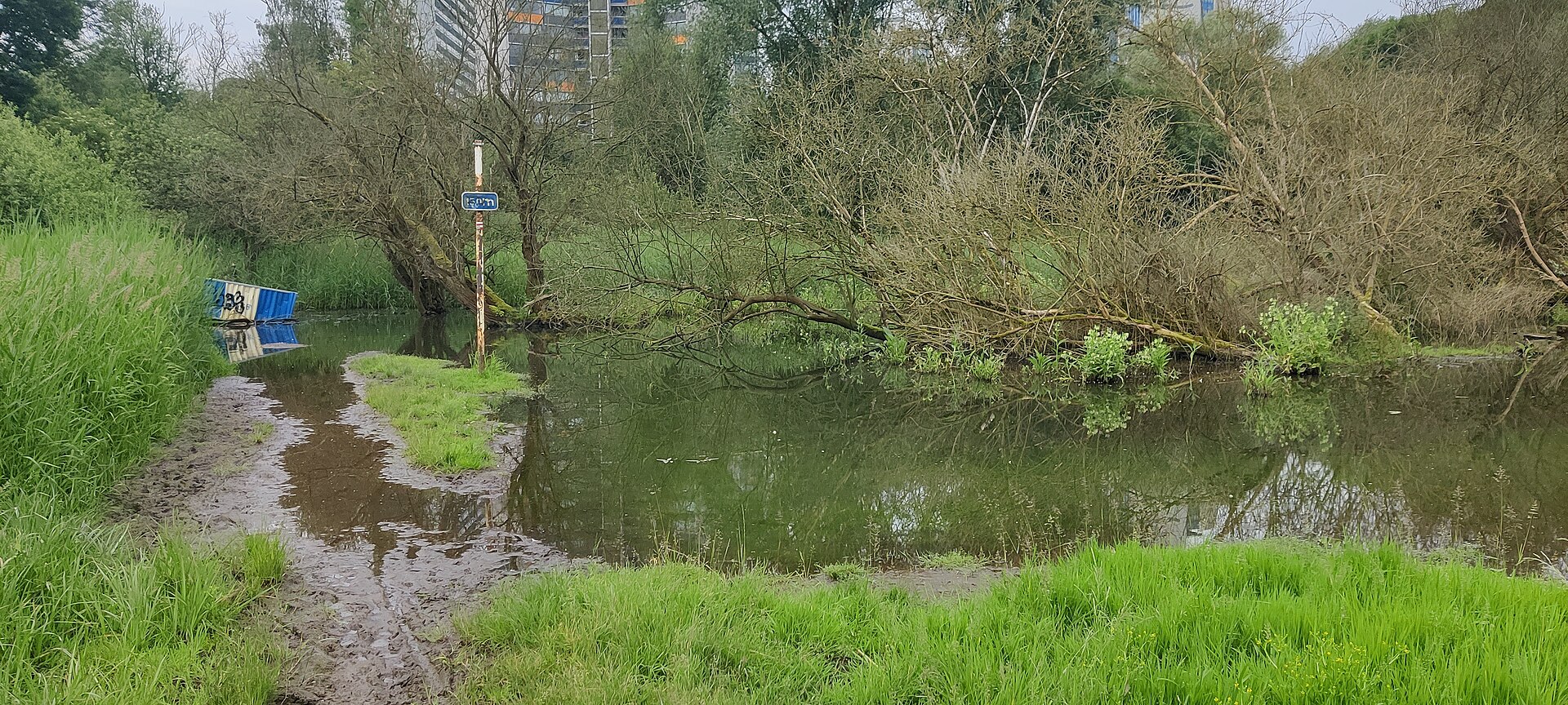
In 2009, the Province of Flemish Brabant established a controlled flood area here named 'Nekkerbos', with a buffer capacity of 45,000 m³. Such an area is designed to absorb excess water during heavy rainfall before it reaches the built-up parts of Grimbergen further down the Maalbeek catchment. The buffer capacity was later expanded, aimed at reducing recurring waterlogging problems along this stretch of the stream. The site therefore combines a nature function with a very practical one — green space doubling as a natural retention basin.
What plants and animals live here?
The wet, extensively managed habitats of Nekkerbos and the surrounding meadows support plant species typical of marshland, including those adapted to nitrogen-poor soils. Birdlife in the Maalbeek valley includes wetland species such as common snipe, water rail, and teal. Their presence points to good-quality wet habitat, a type of terrain that has been drained for building or farming in many other parts of Flanders.
What can visitors do at Nekkerbos?
The area forms part of a network of walking paths connecting Nekkerbos with Nekkerweide and 's Gravenmolenweide. The municipality of Grimbergen organises landscape walks starting from 's Gravenmolenweide that pass alternately through alder wet woodland and open buttercup meadows. It is a spot for a quiet nature outing close to the town centre, without needing to travel out to more remote countryside.
Frequently asked questions
Is Nekkerbos open to the public? Yes, walking paths run through the area, linking it to neighbouring nature sites and used for organised landscape walks.
Is it a protected area? Part of the land is managed by Natuurpunt as a nature reserve, and since 2009 it has also functioned as an official controlled flood area managed by the province.
Why does the area sometimes flood on purpose? That is by design — the 'Nekkerbos' flood area is meant to capture excess water from the Maalbeek during heavy rain, protecting the lower-lying built-up parts of Grimbergen.
Nearby places

Earn badges for the places you visit
Download NextOnTrip, discover new places and check off your trails.