Recreation and entertainment in Spain
A guide to 685 Recreation and entertainment in Spain — with descriptions, photos and traveler visits from the NextOnTrip community. Locations spread across 255 cities and towns. Most visited by the community: Hotel Pazo Libunca, Museo del Bonsai, Madrid Wax Museum.
-
Madrid Río
Madryt
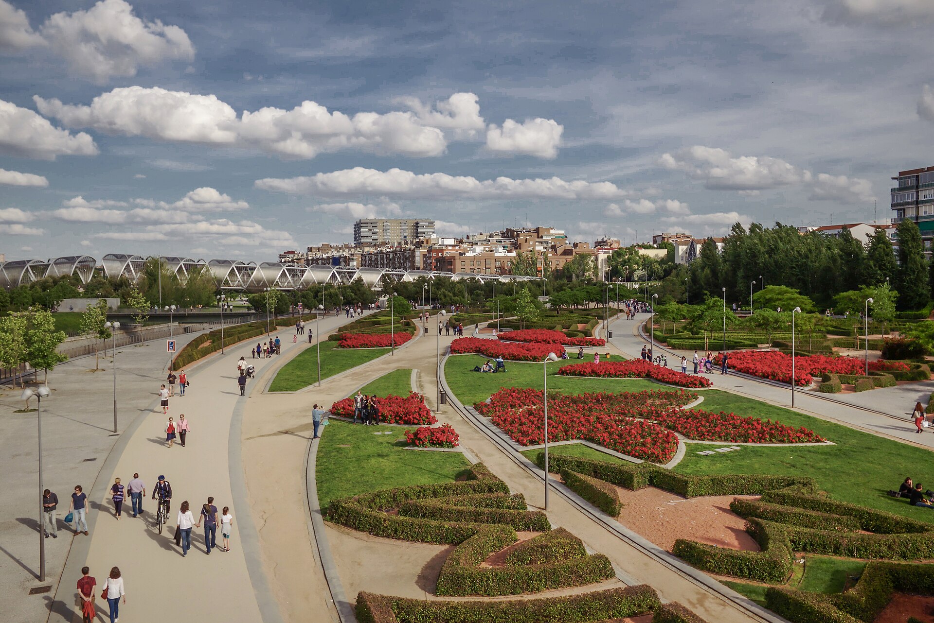
Madrid Río is one of Madrid's largest urban parks, stretching along the Manzanares River from the Puente de los Franceses bridge down to the Nudo Sur junction. The site once carried the M-30 ring road along the riverbank; once that stretch was buried underground between 2005 and 2011, the surface above it was turned into a green corridor running more than 6 kilometers and covering over 106 hectares. The redevelopment was chosen through an international competition launched by Madrid's city council in 2005, with architect Ginés Garrido leading the winning design. How do you get to Madrid Río? Because the park runs the length of the river, there's no single entrance — visitors pick whichever access point suits their route. The metro stations Príncipe Pío, Puerta del Ángel, and Marqués de Vadillo all sit within walking distance of the riverbank and are the easiest way in. City buses running along the surrounding streets and BiciMAD bike-share docks are good alternatives, dropping riders straight onto the park's paths. From central Madrid, walking from the Royal Palace toward the Segovia bridge takes only about fifteen minutes, making it a natural extension of a sightseeing route through the old town. What is there to see? The park's bridges are its defining feature, old and new alike. The Puente Monumental de Arganzuela, designed by Dominique Perrault, forms a distinctive spiralling structure over the water. The twin Matadero and Invernadero bridges stand out for their vaulted underpasses decorated with mosaics by artist Daniel Canogar. Nearby are the Puente del Principado de Andorra and the Puente Oblicuo, alongside much older crossings — the Puente del Rey, Puente de Segovia, and Puente de Toledo. The view from Puente de Segovia is one of the best vantage points in the city for the Almudena Cathedral and the Royal Palace rising above the river. Along the banks, the Parque de Arganzuela section offers football, basketball, and tennis courts, skating tracks, a climbing wall, and a skatepark. In summer, fountains and water jets turn part of the park into an informal "beach," a favorite with families looking to cool off on hot days. After dark, the park regularly hosts open-air concerts and cultural events. Just next door, in what used to be the city's slaughterhouse, Matadero Madrid now runs as a cultural center with exhibitions, a cinema, and event spaces. When should you visit? Spring and autumn are the most comfortable seasons for a long walk or bike ride, with mild temperatures and quieter paths than in summer. The summer season draws the biggest crowds in the evenings and on weekends, when the fountains run and outdoor events take place. Winter tends to be the calmest stretch, appealing to anyone who wants a quiet riverside walk away from the city center's bustle. Frequently asked questions Is there an entrance fee for Madrid Río? No, it's a free public park — walking, cycling, and using the sports courts cost nothing year-round. How much time should you set aside? The stretch between Puente de Segovia and Puente de Toledo can be walked in about an hour, but covering the park's full length with a few stops takes a relaxed half-day. Is Madrid Río a good choice with children? Yes — the summer water features and playgrounds, plus the flat, wide paths, make it easy to bring kids along by foot, bike, or scooter. What else pairs well with a visit? A stop at Matadero Madrid right next door, and a walk toward the Royal Palace and Almudena Cathedral, both visible from the Puente de Segovia.
-
Central Park of Arona
Arona
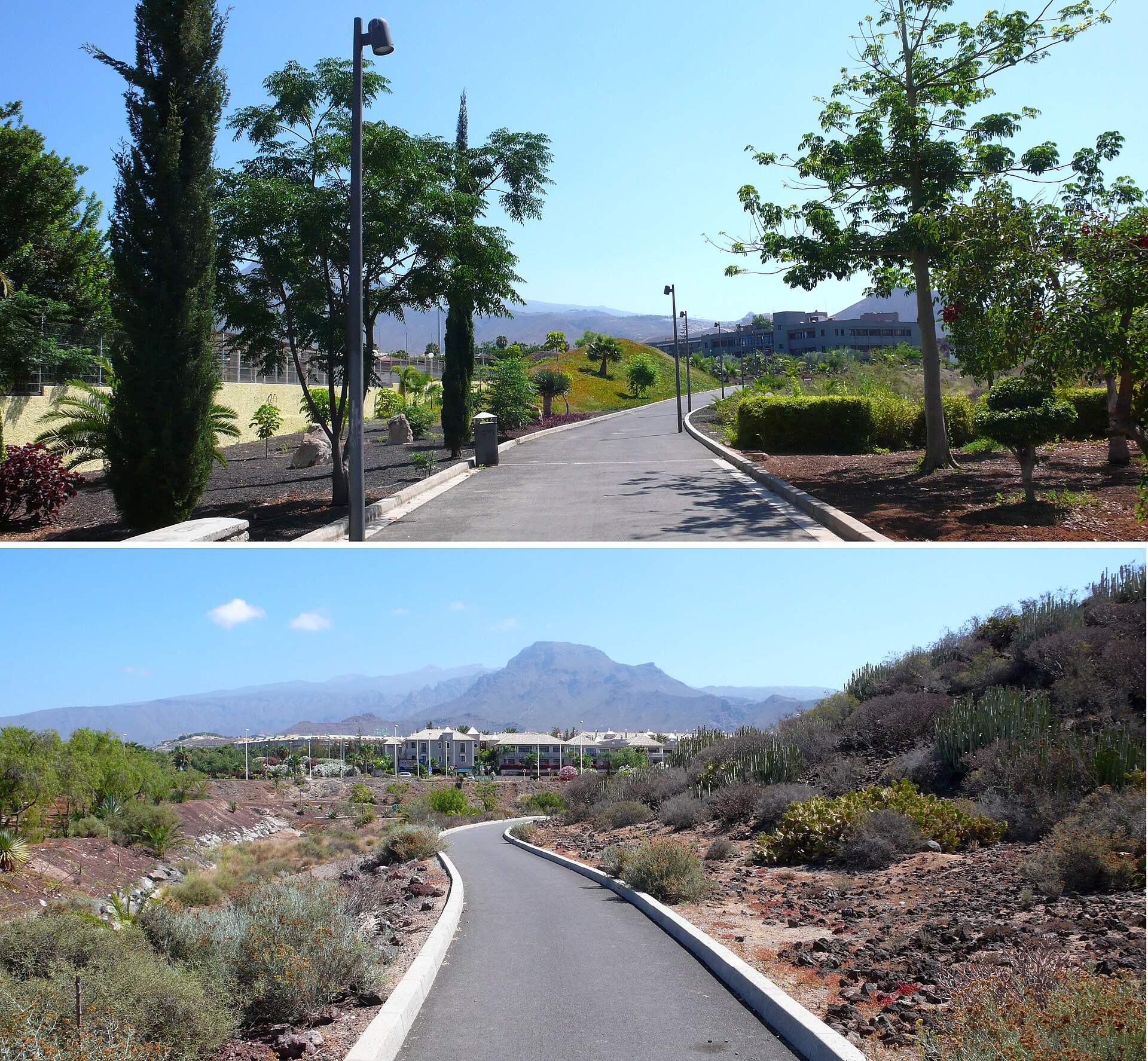
Central Park of Arona is the main municipal park of Arona, sitting right in the heart of Playa de las Américas, one of Tenerife's busiest tourist districts. Covering roughly 42,000 square metres, it brings together several squares and gardens, forming a green pause point among the dense hotels, restaurants, and shopping streets of the island's south coast. How do you get there? The park sits right in the middle of Playa de las Américas, so most hotels in the area are only a short walk away — a few minutes at most. It's the kind of place you stumble into rather than plan a special trip for, tucked just off the main pedestrian and shopping routes. If you're staying further away, in Los Cristianos or Costa Adeje for instance, local Titsa buses run along the coast with stops within easy reach of the park. Drivers will find several car parks in central Arona; from there it's a short walk in, since traffic in the tourist strip can get heavy during peak season. What will you see once you're there? Central Park of Arona is essentially a resting space — its layout of connected squares and gardens invites a slow walk away from the noise of the beaches and shopping centres nearby. Trees, shaded benches, and open lawns make it a natural spot to break up a day of sightseeing or shopping. Because it links different parts of the Playa de las Américas tourist zone, many visitors pass through it simply while walking across town, rather than seeking it out on purpose. It's also a genuine local gathering spot — a place where residents and holidaymakers alike sit down, get out of the sun for a while, or let children run around for a bit. When should you visit? Tenerife's mild, year-round climate means the park is pleasant to visit in any season. The best times to walk through are early morning or late afternoon, when temperatures are lower and the sun less intense — particularly useful advice in summer, when midday heat in this part of the island can be strong. In the evenings, the park is a popular spot for an unhurried after-dinner stroll before heading toward the nightlife of Playa de las Américas. Who is this park for? Thanks to its central location and low-key character, the park suits families with children looking for a breather, couples wanting a quiet walk, and travellers curious to see a side of Arona beyond beaches and shopping malls. It also works well as a landmark and rest stop while exploring the town on foot, before continuing on toward the coastline. Frequently asked questions Where exactly is Central Park of Arona located? The park is located in Arona, within the Playa de las Américas tourist district in the south of Tenerife, surrounded by hotels and services. How much time do you need to see the park? It's a compact urban space, so a full walk through usually takes 20–30 minutes, depending on your pace and how many stops you make. Is entry to the park free? Yes, it's an open public municipal park with no entrance fee. Are there shaded areas and seating in the park? Yes, the layout of squares and gardens includes benches and shaded sections, making it a comfortable place to rest during the day.
-
José Celestino Mutis Botanical Park
Palos de la Frontera
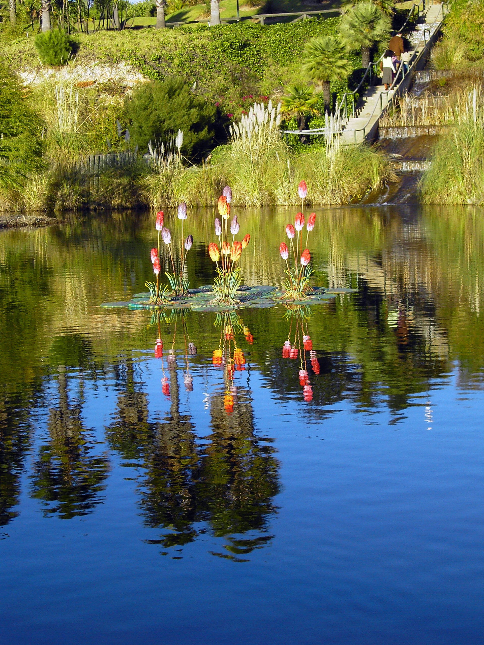
José Celestino Mutis Botanical Park in Palos de la Frontera spreads across 12 hectares of greenery in the natural surroundings of La Rábida, in the province of Huelva, Andalusia. The park opened in March 1993 and takes its name from José Celestino Mutis, a Spanish botanist born in Cádiz who led one of the most significant scientific expeditions of the colonial era. Why is the park named after Mutis? For 33 years, Mutis directed a botanical expedition to the New Kingdom of Granada — present-day Colombia — carried out with the approval of King Carlos III. The expedition produced a herbarium of more than 20,000 plant species and a collection of 6,000 botanical plates, which were later sent to the Royal Botanical Garden of Madrid. The park in Palos de la Frontera echoes that legacy, linking the history of Spanish exploration in the Americas with a living display of plants from around the world. What will you see inside? The grounds are crossed by a network of footpaths and walking routes, along which several themed plazas are arranged, each dedicated to a different country of the Americas. Every plaza showcases plant species characteristic of that particular region, turning a walk through the park into a journey across the different climate zones and ecosystems of the American continent. Since its opening, the collection has grown steadily and today includes plants gathered from all five continents, making it one of the more varied botanical gardens in the Huelva region. The park also offers a quieter alternative to the busier Columbus-related attractions nearby — Palos de la Frontera itself, together with neighbouring La Rábida, is closely tied to the history of the voyages to the New World. How do you get there? The park sits within the municipality of Palos de la Frontera, right next to La Rábida, in the province of Huelva. Arriving by car is the most convenient option, with free parking available on site. The area is well connected to central Huelva and to other landmarks linked to Columbus-era heritage, making it easy to combine a visit to the park with a stop at nearby monasteries and the historic harbour. When is the best time to visit? Thanks to the region's mild Mediterranean climate, the park can be visited year-round. Spring and autumn offer the most pleasant conditions for walking, with moderate temperatures and the plant collections at their most striking. In summer, it is best to plan a visit for the morning or late afternoon, avoiding the hottest hours of the day. How long should you plan to stay? Walking through the main paths and themed plazas typically takes between one and two hours, depending on how long visitors linger at each collection. That is generally enough time to take in most of the represented plant zones without rushing. Frequently asked questions Is entry to the park free? Yes, admission to the botanical park is free, as is the on-site parking. What kind of plants can you see there? The collection includes species from all five continents, with particular emphasis on the flora of Latin American countries, each presented on its own themed plaza. Why is the park named after José Celestino Mutis? Mutis was a Spanish botanist who spent more than three decades leading a scientific expedition to study the flora of present-day Colombia, with his collections eventually reaching the Royal Botanical Garden of Madrid. Is the park suitable for a family visit? Yes, its flat paths, free admission and relaxed atmosphere make it a comfortable choice both for families with children and for anyone looking for a quiet break while exploring the area around Palos de la Frontera.
-
Safari Park Costablanca
Dénia
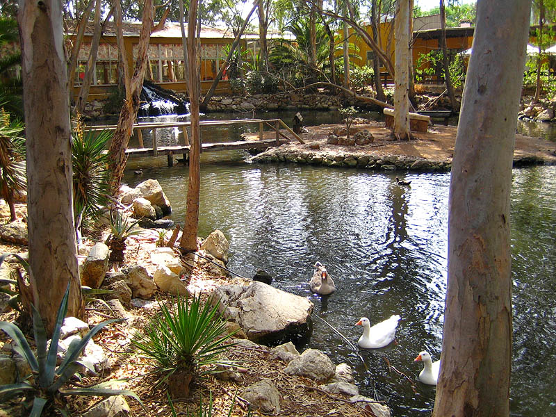
Safari Park Costablanca was a safari-style attraction a few kilometres from Dénia, along the road linking El Verger and Pego, in the Marina Alta region of Alicante province. For more than three decades it was one of the recognisable stops in this part of the Costa Blanca, which is why it still turns up on maps and in older travel guides even though the site is no longer operating. What kind of place was it? The park was built as a private venue split into two distinct zones. The first was the paid safari area, where visitors drove through open enclosures to see African species, including lions and tigers alongside other exotic animals. The second zone had free entry and worked more like a recreational park: two large lakes home to swans and ducks, framed by tall trees, plus an aviary housing birds. A small train circled the main lake, a detail that made the place a popular family outing. On-site services included a café, a restaurant, a bar and a car park. How long did it operate, and why is it closed? Safari Park Costablanca ran for roughly 33 years before shutting down for good. The grounds no longer receive visitors, and the former park's infrastructure now sits unused. Anyone planning a trip around Dénia should check the current status before heading there, since the attraction no longer functions the way it is often described online. Where exactly was it located? The site sat away from Dénia's main tourist routes, further inland, about 2.5 km from the centre of El Verger towards Pego. That distance is why the location is sometimes mistakenly associated directly with Dénia, when it actually lies in a neighbouring municipality within the Marina Alta region. What can visitors do instead? Travellers looking for a similar experience on the Costa Blanca can look at other operating safari and wildlife parks in the Marina Alta and Marina Baixa areas, which offer close-up encounters with exotic animals in a format comparable to the former Safari Park Costablanca. It's also worth remembering that Dénia itself has plenty to offer independently of this closed attraction, including its castle, marina, beaches and old town. Frequently asked questions Is Safari Park Costablanca still open? No. The park closed after around 33 years in operation and no longer receives visitors. Where exactly was the park in relation to Dénia? A few kilometres from Dénia, towards El Verger and Pego, in the Marina Alta region. What animals could be seen there? The safari zone featured African species such as lions and tigers, while the park zone had swans, ducks and an aviary with birds. Are there other safari parks nearby that are still open? Yes, the wider Costa Blanca region has other operating theme and safari parks with exotic animals that can serve as an alternative to the now-closed Safari Park Costablanca.
-
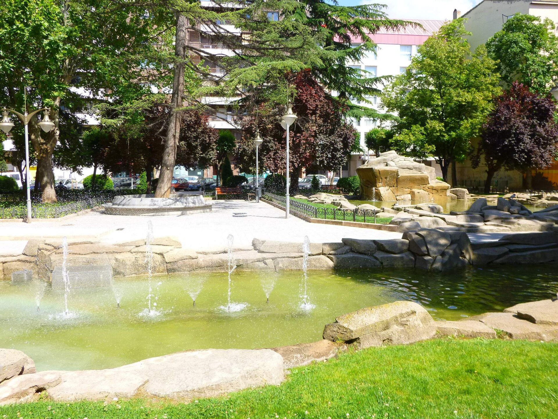
Gallarza Park
Logroño
Gallarza Park, in the heart of Logroño, the capital of La Rioja, is a neighborhood green space valued by locals for everyday relaxation and family time. It won't appear on a list of monumental sights, but that everyday, unpolished character is exactly what makes it worth a stop for travelers who want to see Logroño beyond the Camino de Santiago crowds. Where is the park and how do you get there? The park sits right in the city center, within easy walking distance of most hotels and guesthouses in Logroño. Its central location means visitors can fold in a stop here while wandering the old town, without needing a separate trip or public transport. What's the story behind this place? The park takes its name from General González Gallarza, though over time the official name was shortened to simply "Gallarza." The most notable chapter of its recent history is its expansion. Part of the land now covered in greenery stood empty for years — the site had housed a public children's school that closed in 2012, followed by a shelved plan for a "Casa del Cuento" (House of Storytelling) project, and then a building collapse in 2017. The city eventually turned this neglected corner into public space, with a renovation budget of roughly 408,000 euros that delivered the enlarged park visitors see today. What will you actually see while walking through? The park is known for its well-kept gardens and mature trees — the expansion project deliberately preserved the existing tree cover while adding new plantings, including some less common ornamental species. The centerpiece of the new multipurpose area sits exactly where an old building once stood, originally intended as the "Casa de las Letras," and stands out for its grey granite paving against the surrounding green. This multipurpose zone was designed as an open space for residents, hosting cultural events, recreational activities, sports, and community-oriented programming. Who is this park for? Families with children make up much of the park's regular crowd — this is where locals come for a stroll, outdoor play, or a break from the pace of the city center. The atmosphere is relaxed and neighborhood-like, giving visitors a genuine feel for everyday life in Logroño rather than a curated tourist experience. When's the best time to visit? The park is open year-round, but it looks its best in spring and summer, when the greenery is at its fullest and the outdoor areas see the most use from both families and organizers of local events. Evenings during the warmer months are a good time to catch the park at its liveliest. Frequently asked questions Is entry to the park free? Yes — as a public city park, it's open to everyone at no charge throughout the day. Is there a playground for children? The park has long drawn families with kids, and its multipurpose area was designed with recreational activities for different age groups in mind. Where does the park's name come from? It's named after General González Gallarza; over time the shorter form "Gallarza" became the name used officially by the city. How much time should I plan for a visit? A quick walk through takes about 20–30 minutes, but with shaded seating and good weather, it's easy to linger longer here to rest after exploring central Logroño.
-
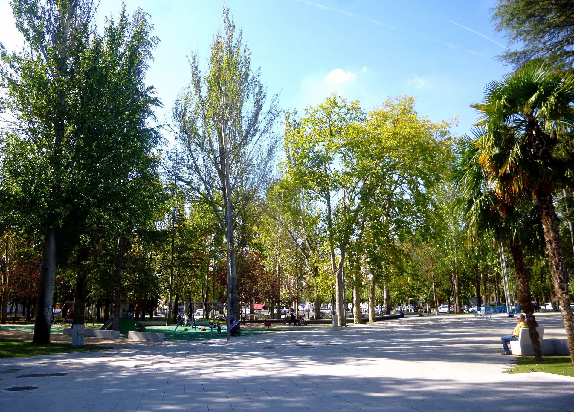
Jardinillos de la Estación
Palencia
Jardinillos de la Estación is a municipal park in Palencia, in the Castile and León region of northern Spain, positioned right next to the city's railway station. It is usually the first patch of greenery travellers see on arrival, and for locals it works as an everyday spot for walking, resting, or cutting through toward the historic centre. Why was this park created? The park was inaugurated in 1875, at the same time as the North railway line station next to it. The idea was straightforward: give the city a proper, welcoming entrance for anyone arriving by train, rather than a bare stretch of tracks and pavement. In 1925 a distinctive dovecote, designed by architect Fernando Unamuno Lizarraga, was added and remains one of the park's recognisable features. A major redevelopment in the early 1980s brought the park to its current size of 26,130 square metres. What is there to see inside the park? Beyond its role as green cover, the park mixes ornamental gardens with functional public space. Visitors will find a small open-air amphitheatre used for minor outdoor gatherings, an artificial waterfall, and a canal running through the grounds. The park also borders the smaller Parque de San Pablo, so the two effectively form one continuous green stretch at this entrance to the city. What kind of trees and plants grow here? The planting is mature and varied: holm oaks, acacias, cedars, plane trees, cypresses, chestnut trees, ornamental red-leafed plums (a Pissard variety), and walnut trees all grow within the park. This mix means the appearance shifts noticeably with the seasons — dense shade in summer, strong colour changes in autumn. Is it a good stop for families with children? Yes. There is a recreational skating rink for children along with swings, and a marked botanical route runs through the park so visitors can identify individual tree species as they walk. It is a practical way to combine a stroll with a bit of nature education, without needing a guide or extra planning. How has the park changed in recent years? Under a municipal action plan covering 2015–2019, the area around the station and the start of Calle Mayor underwent a 2.3-million-euro redevelopment, funded in part by European EDUSI funds together with the regional government of Castile and León. The goal was a more accessible, better-organised public space at this gateway point into the city. The works were not free of controversy: in February 2020, 73 trees were felled during the renovation, which triggered protests from residents in nearby neighbourhoods over the scale of the clearing in such a long-established park. Frequently asked questions Where exactly is the park located? Directly beside Palencia's railway station, postal code 34005, on the side facing the city centre. Is there an entrance fee? No, it is a fully public municipal park with open access and no fixed opening hours typical of enclosed sites. How long does a visit take? Walking the main paths and the botanical route usually takes around 20 to 30 minutes, though the park also works well for a longer rest under the trees. Is it suitable for children? Yes — the skating rink, swings, and generous, safe green space make it a convenient stop for families, especially right after arriving by train. Can it be combined with another nearby stop? Its border with Parque de San Pablo makes it easy to extend the walk through another stretch of greenery before continuing toward Calle Mayor and the old town.
-
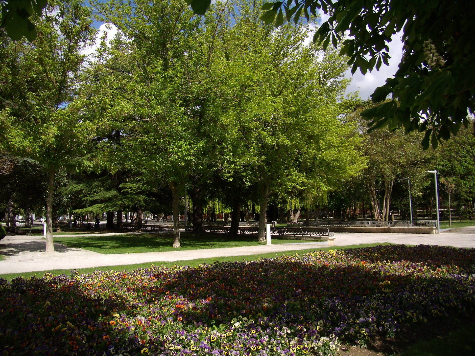
Salón de Isabel II
Palencia
Salón de Isabel II is a historic city park in Palencia, known locally simply as "El Salón" and considered the most popular green space in town. Where does the park's name come from? The grounds were laid out in 1830 on land that had once belonged to a Carmelite convent, just outside the old Market gate — at the time, still beyond the city limits. It was originally called Paseo del Carmen. In 1844 it was renamed Paseo del Salón de Isabel II to mark Queen Isabel II's coming of age, and the name has stuck ever since. The urbanization works, including public lighting, were finished in 1860, and the Canal de Castilla company had already helped plant the grounds back in 1840. How is the park laid out? The garden follows a Romantic-era design modeled on French garden promenades: straight gravel paths, neatly kept lawns and symmetrical flower beds. The greenery is organized around six main avenues, which still gives the park its orderly, formal feel today. It covers more than 30,000 square meters and, now sitting right in the center of Palencia between República Argentina and Modesto Lafuente avenues, has become a natural gathering spot for locals. What will you see while walking through? The tree collection is remarkably varied: shade-giving plane trees, white-flowering magnolias, weeping willows, yews, horse chestnuts and Japanese plum trees grow alongside pines, cedars and acacias brought in as exotic species. Successive renovations over the years have refreshed the ornamental details while keeping the original Romantic layout intact. An old cast-iron bandstand and a go-kart track have since given way to newer additions — today the park has a children's playground, an open-air auditorium and a café terrace where you can rest in the shade. What else happens in the park besides walking? Thanks to its size and central location, the park regularly hosts exhibitions, concerts, markets and fairs, making it one of the liveliest meeting places in Palencia. Families use the playground, and the auditorium is often the venue for city-organized cultural events. When is the best time to visit? The park is open year-round, but spring and early summer are the most striking, when the magnolias bloom and the trees offer the most shade for a stroll. In autumn, the mix of species — especially the chestnuts and willows — turns the foliage into a rich display of color. Given its central location, the park is easy to combine with a visit to Palencia's cathedral and historic center in a single day. Frequently asked questions Where exactly is Salón de Isabel II located? The park sits in the center of Palencia, between República Argentina and Modesto Lafuente avenues, on the site of the former Market gate. Why is the park named after Isabel II? It was renamed in 1844 to mark Queen Isabel II's coming of age; before that it was known as Paseo del Carmen. Is there somewhere to sit down and eat in the park? Yes, there is a café terrace on site, and the wide lawns and paths make it easy to settle in for a longer rest. Are there events for locals and visitors in the park? Yes, the park regularly hosts exhibitions, concerts, markets and fairs, and its open-air auditorium is used for cultural events.
-
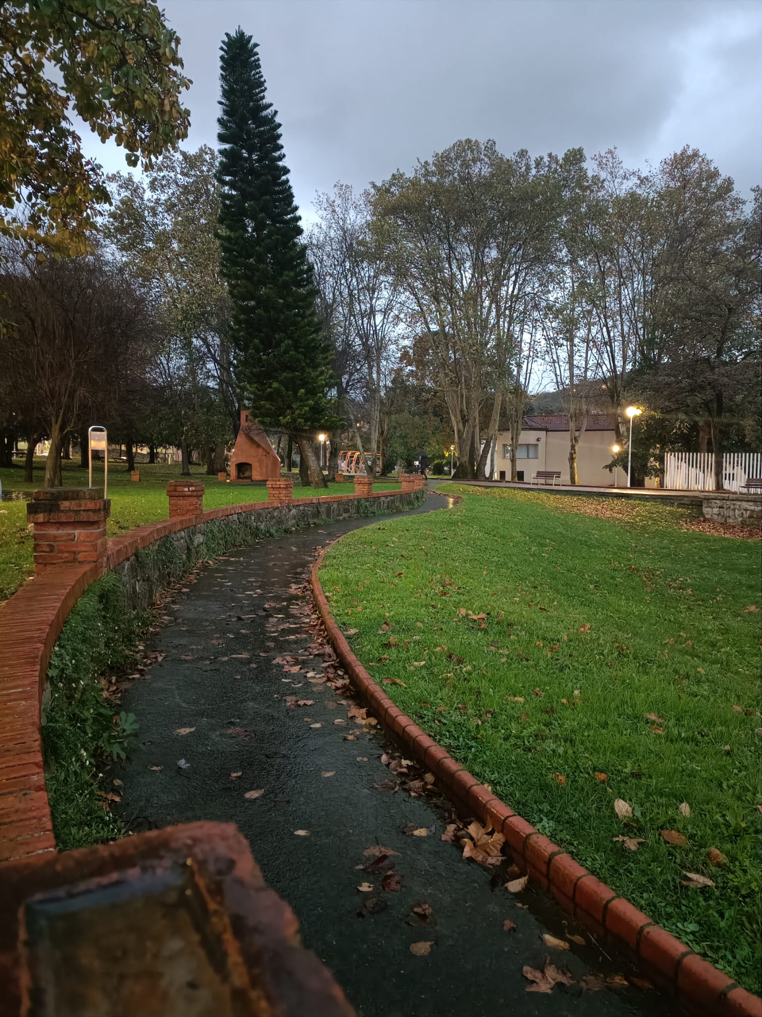
Sarrikoko parkea
Bilbao
Sarrikoko parkea (Parque de Sarriko) is a municipal park in the Deusto district of Bilbao, a favorite among locals for walking, sport, and family time outdoors. Where is it and how do you get there? The park sits along Etxezuri Bidea in Deusto, just a short stretch from the banks of the Nervión river. The easiest way in is by metro: Line 1 stops at Deusto station, a few minutes' walk from the park entrance. Worth knowing — the nearby Sarriko metro station (served by Lines 1 and 2) actually takes its name from this park, even though it sits a bit further away, closer to the university campus. From central Bilbao, expect a 10–15 minute ride. Close by you'll also find Unibertsitate parkea, the park attached to the Faculty of Economics and Business, while San Mamés stadium lies roughly 1.25 km to the southeast. What can you see inside the park? The Larrako Tower and remnants of a former estate The land now occupied by the park once belonged to the Counts of Zubiría, who held it from the early 20th century. After the family left in the 1950s, Bilbao's city council bought the estate in 1960, using part of the plot to build the Faculty of Economics and Business and turning the rest into a public park. Several traces of the old residence survive today: fragments of the palace, a gatehouse, and a decorative arch bearing a heraldic shield. In 1962 a reconstructed version of the Larrako Tower was also moved onto the grounds — its original foundations may date back as far as the 16th century, making it one of the park's more distinctive architectural features. A botanical garden and varied greenery The park covers roughly 31,920 m² of green space, complemented by 6,500 m² of paths and paved areas. A small botanical garden holds a surprisingly varied tree collection: Canary palms, eucalyptus, white poplars, Atlas cedars, black pines, sequoias, oaks, magnolias, Japanese cherry trees, lindens, ash trees, and Chinese soapberry trees all grow within the grounds, giving the park a different character depending on the season. What is there to do for families and sport? Sarrikoko parkea ranks among Bilbao's more sport-oriented parks. It's home to the city's first municipal parkour zone — also the largest in all of Biscay. On top of that, visitors will find a Cross Zone for outdoor training, outdoor gym equipment, naturalized play areas with rope nets strung between trees, and two separate children's play zones. Dog owners get their own agility circuit. In summer, as part of Bilbao's "urban beaches" program, the park switches on showers and water features to help visitors cool off during hot spells. The park recently underwent a renovation, completed in four months at a cost of around €300,000. When is the best time to visit? The park is open year-round, though it looks its best in spring and autumn, when the botanical garden's varied trees shift color. Summer draws families thanks to the water features, and on weekends the park often becomes a community gathering spot, hosting sport and recreational activities for different age groups. Frequently Asked Questions How do you reach Sarrikoko parkea by metro? The closest stop is Deusto on Line 1 — about a fifteen-minute ride from the city center, followed by a short walk from the platform to the park. Is there anything for kids at the park? Yes — two dedicated play zones plus naturalized play areas with rope installations hung between trees, and in summer, showers and water features as well. What's the tower inside the park? It's the reconstructed Larrako Tower, moved onto the grounds in 1962; its original foundations may date to the 16th century. Is the park good for sport and exercise? Definitely — it has Bilbao's first municipal parkour zone (the largest in Biscay), a Cross Zone training area, and outdoor gym equipment.
-
Parque Moret
Huelva
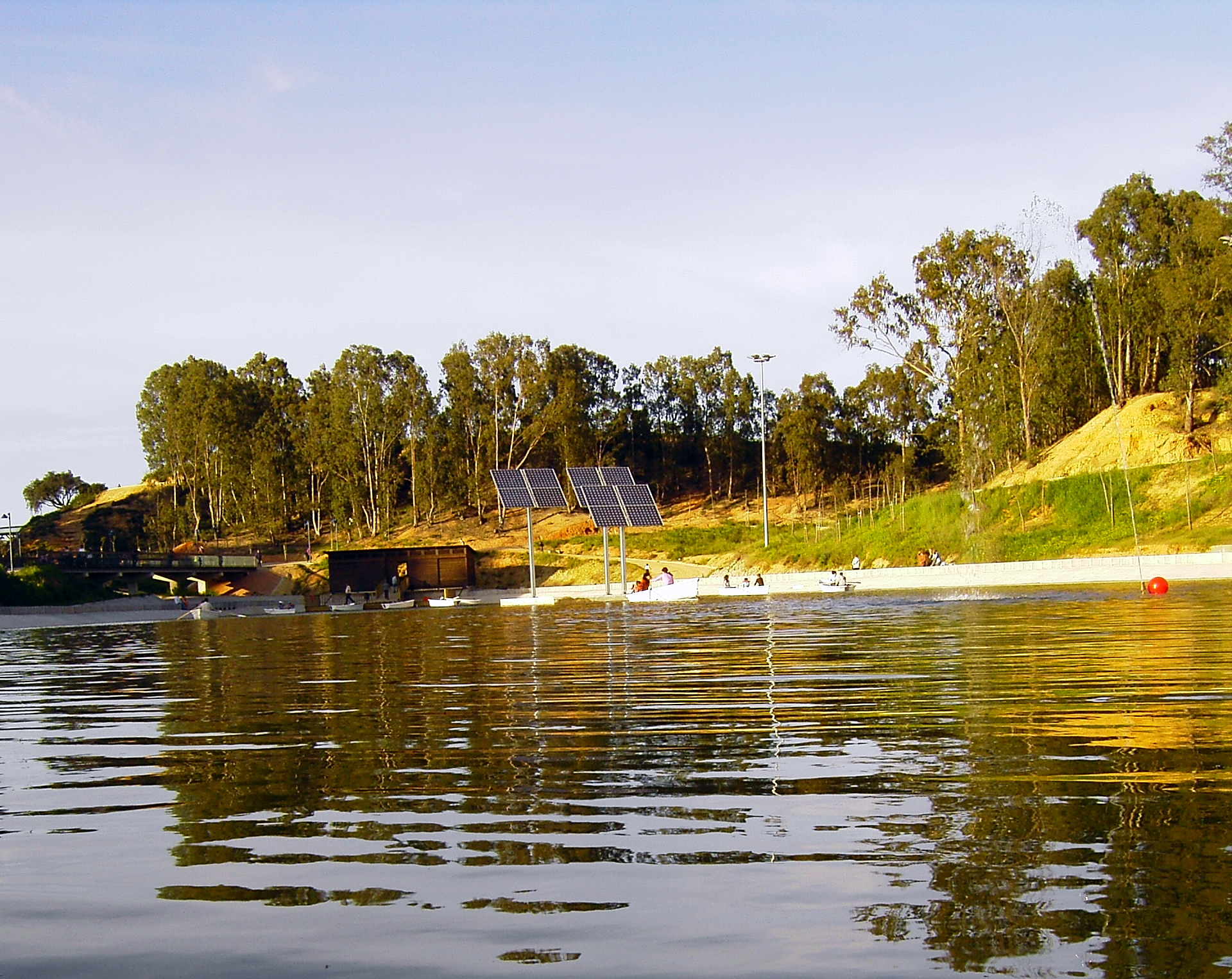
Parque Moret is the largest urban park in the whole of Andalusia, spreading across more than 70 hectares on the northern edge of Huelva. Locals call it the city's "green lung," and once you spend an hour walking its trails, the nickname makes perfect sense — it blends recreation, sport and history that reaches back well before the Roman era. How do you get to the park? The park sits on the northern side of Huelva, a short distance from the city centre, so most visitors simply walk or cycle in — a dedicated bike lane runs right through the grounds. City buses also stop nearby, and there is parking near the main entrances for those arriving by car. Access is free and the park is open every day without restricted hours. What are the main things to see? The heart of the park is a pair of artificial lagoons where ducks paddle around and, during the warmer months, visitors can rent small recreational boats from the lakeside kiosk that doubles as a jetty. A network of paths winds through vegetation typical of the Huelva region, including fig trees, pines and cork oaks, making for an easy, shaded stroll regardless of the season. History lovers should head to the Cabezos del Coquero area, bordering the Marismas del Odiel wetlands, where remains of a Roman aqueduct still stand. The park hides an even older layer of history: archaeological digs have uncovered a necropolis from the orientalizing period, with burial mounds belonging to the Tartessian culture dated to the 7th–6th centuries BC. Parque Moret was officially inaugurated on 20 January 1910, when the mayor formally took possession of the grounds on behalf of the city of Huelva. It has been upgraded several times since, most recently in 2020, when the municipality invested 1.5 million euros in improving the park's facilities. What can you actually do here? The recreational offer is unusually broad for a city park: a skatepark, barbecue areas, picnic spots, outdoor exercise stations, and community allotment gardens used by residents of the surrounding neighbourhoods. Families will appreciate the large playground, while anyone looking for a quiet moment can pick from several scenic viewpoints scattered across the grounds. When is the best time to visit? Given Huelva's Mediterranean climate, mornings and late afternoons are the most pleasant times for walking, particularly in spring and autumn when temperatures are milder. In summer, most visitors come early in the day or in the evening once the heat eases, since the lagoons and tree cover offer natural relief from the sun. Weekends tend to draw the biggest crowds of locals, so a weekday visit is the better choice for a quieter walk. Frequently asked questions Is there an entrance fee for Parque Moret? No, entry is completely free and the park is open daily, with no fixed opening or closing hours like a ticketed attraction. Can you rent a boat inside the park? Yes, one of the two lagoons offers recreational boat rentals, run from the lakeside kiosk-jetty, mainly during spring and summer. What is the park's biggest historical attraction? The remains of a Roman aqueduct near Cabezos del Coquero, together with traces of a prehistoric Tartessian necropolis whose burial mounds date back more than 2,600 years. Is the park suitable for a family visit with children? Absolutely — the large playground, gentle terrain, cycling paths and picnic areas make it one of the favourite weekend spots for families in Huelva.
-
José Antonio Labordeta Grand Park
Saragossa
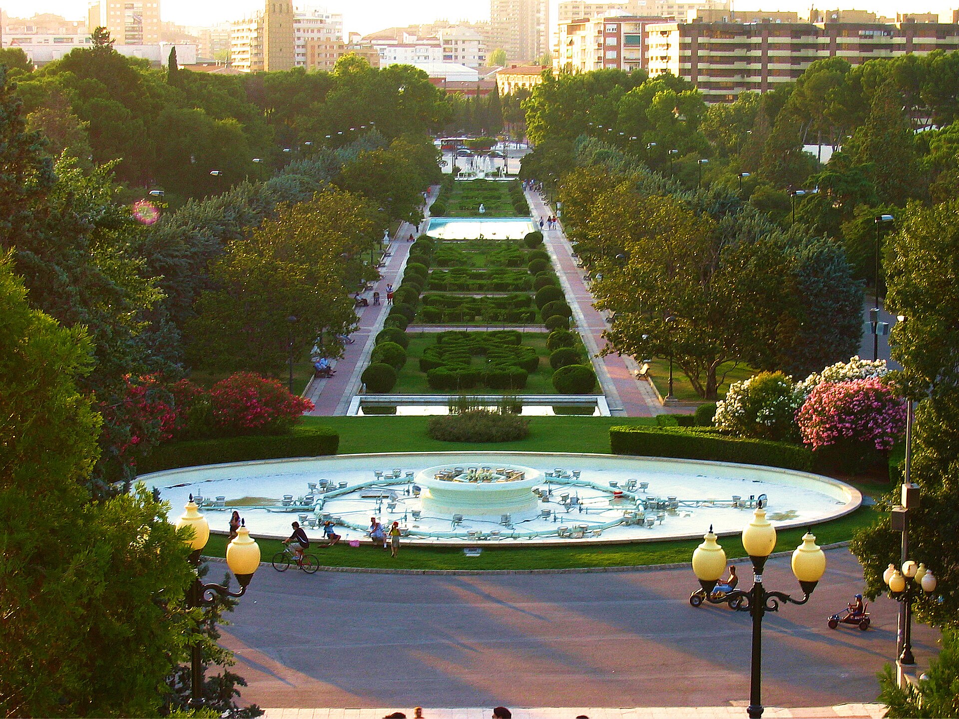
José Antonio Labordeta Grand Park is Zaragoza's largest urban park, a roughly 40-hectare green expanse in the southern part of the city, close to the university district. Where does the park's name come from? The park first opened its gates in 1929 under the name of Miguel Primo de Rivera. In 2010 the city council renamed it in honor of José Antonio Labordeta, an Aragonese singer, poet and politician whose work is deeply tied to the region's cultural identity. Locals today simply call it "Parque Grande," and the renaming stands as a lasting tribute to one of Aragon's most beloved public figures. What can you see inside the park? Broad, tree-lined avenues form the backbone of the park, offering welcome shade during Zaragoza's often scorching summers. Two small lakes and eight monumental fountains anchor the layout, complemented by nine smaller drinking fountains and water features that make water one of the park's defining elements. Plant lovers should head for the botanical garden, home to species gathered from several continents — a quiet corner away from the busier paths. The park also doubles as an open-air gallery: it holds 22 sculptures and monuments, the most striking being the monument to King Alfonso I "the Battler," one of medieval Aragon's most important rulers. What is there for families and everyday visitors? Parque Grande is far more than a place for a stroll. Cafés and terraces invite visitors to linger, while playgrounds keep younger children entertained. Bocce courts and open spaces for skating add to the mix of activities. Families often enjoy the small tourist train that loops through the park, and bike rental points make it easy to cover the sizeable grounds. Kiosks and small food stalls are scattered throughout for a quick snack or drink. How do you get to the park? The park sits in an easily reachable part of the city, close to the center and the university campus, so getting there by bus or tram is straightforward. Given its size, it helps to plan ahead and pick the entrance closest to whichever feature interests you most — the botanical garden, the lakes, or the children's play areas. When is the best time to visit? The park is open year-round and is especially popular in spring and autumn, when temperatures are mild and the greenery is at its best. In summer, the shaded avenues and proximity to water make it a natural refuge from the heat, while evenings turn it into a favorite gathering spot for locals. Frequently asked questions How large is José Antonio Labordeta Grand Park? The park covers about 40 hectares, making it the largest urban park in Zaragoza. Where does the park's current name come from? It opened in 1929 under the name of Miguel Primo de Rivera and was renamed in 2010 to honor Aragonese artist and politician José Antonio Labordeta. Is the park suitable for children? Yes — playgrounds, a small tourist train, and bike rentals make it a popular destination for families. Are there cultural attractions inside the park? Yes. The park functions as an open-air gallery with 22 sculptures and monuments, including one dedicated to King Alfonso I "the Battler," plus a botanical garden featuring plants from around the world.
-
Méndez Núñez garden
A Coruña
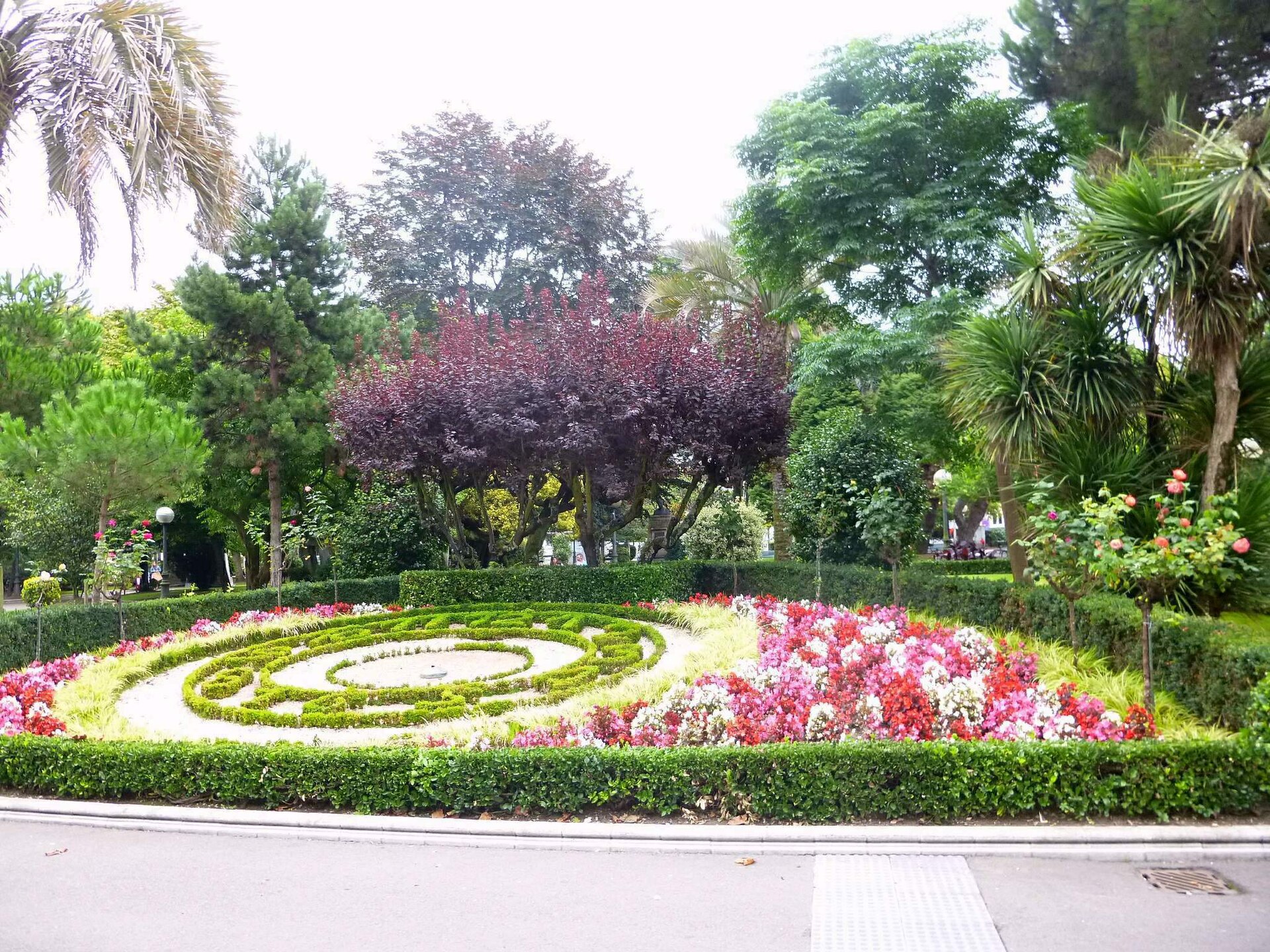
Méndez Núñez garden is the largest park in the heart of A Coruña, forming a green strip between the harbour and the elegant seafront promenade of Los Cantones. It's where locals come to sit under old trees and where visitors can pause for a breather between the old town and a walk along the ocean. Where does the name come from? The garden is named after Casto Méndez Núñez, a Spanish naval admiral who made his name commanding the fleet during the war against Chile and Peru in the 1860s. The ground the trees now stand on was, until the mid-19th century, simply open sea. It was only reclaimed once port engineer Celedonio de Uribe's expansion works created new dry land, an area locals called "El Relleno" — literally, the infill. Turning that reclaimed patch into a public garden was proposed by municipal architect José María Noya, while the layout of the paths was designed by Narciso García de la Torre. The public promenade opened in 1868, and on 8 May 1871 it was officially named after the admiral. What is there to see? Walking the paths, visitors come across Belle Époque kiosks, monuments and trees brought here from around the world, some of them predating the turn of the 20th century. The garden grew over the decades thanks to donations from residents and notable local figures, among them Modesta Goicouría. As early as the 19th century, refreshment kiosks and pavilions for city fairs appeared here, the first one designed in 1877 by Faustino Domínguez Domínguez. It's these historical touches, as much as the greenery itself, that draw people looking to see a side of A Coruña beyond the beach and the lighthouse. How do you get there? The garden sits right in the city centre, so no transport is really needed — it's an easy walk from the old town, the harbour or the Los Cantones promenade, all of which border the garden directly. It works as a natural crossing point for anyone moving between the shopping district and the historic quarter, making it worth a short stop regardless of the rest of your route. When is the best time to visit? The garden is open year-round, but it's most enjoyable in spring and summer, when the trees are in full leaf and temperatures suit a longer stroll. Thanks to A Coruña's coastal location, even the cooler months tend to feel milder here than further inland, so the garden remains a pleasant stop outside peak season too. Frequently asked questions Is entry to the garden free? Yes, it's an open public park with free access throughout the day. How long does a visit take? Walking the main paths takes about 20–30 minutes, but allow closer to an hour if you want to stop by the kiosks and monuments along the way. Is it suitable for children? Yes, the wide paths and shaded trees make it comfortable for a stroller walk or a short rest during a day of sightseeing. What else is nearby? The garden borders the harbour and the Los Cantones promenade directly, putting the old town and other central attractions within easy reach.
-
Alamillo Park
Sewilla
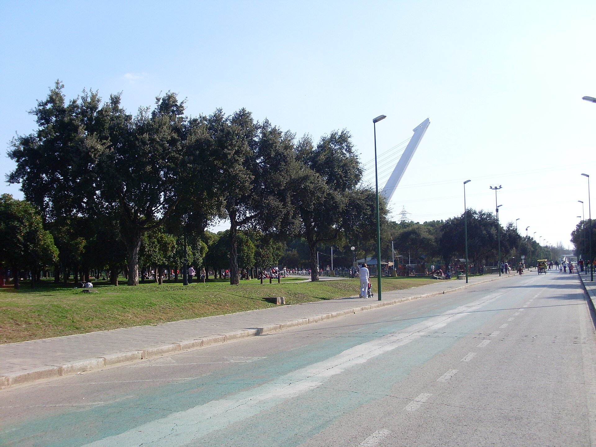
Alamillo Park is a large metropolitan green space in Seville, ranked among the biggest urban parks in Spain. Where is it located? The park stretches across an area linking the city of Seville with the neighboring municipality of Santiponce, running along the eastern bank of the Guadalquivir river relative to Seville's historic center. Covering roughly 120 hectares, it is one of the largest urban parks in the country. Because of its scale and the role it plays for residents, locals often refer to it as the "green lung" of Seville — a fitting description for a densely built, hot Andalusian city. What can you see there? The sheer size of the park makes it a place built for walking and unwinding away from the noise of the city center. Wide lawns, pathways, and open stretches of green space allow for a long walk without retracing the same route twice. For visitors looking to connect with nature inside a metropolitan area of over a million people, a green area of this scale is unusual and worth noting as an attraction in its own right. The proximity of the Guadalquivir river gives the park its character — the water forms a natural edge along which the grounds extend, and it's a landscape feature worth including in any visit. The park also acts as a green buffer between built-up Seville and the smaller town of Santiponce, which says something about the scale of the site itself — this isn't a neighborhood square, but grounds the size of a small town. How do you get there? Alamillo Park sits on the opposite bank of the river from Seville's historic center, so the easiest way in is on foot or by bike, crossing the Guadalquivir over one of the bridges linking both sides. That's the route many locals take, since the park is a natural spot for morning and evening outdoor activity. Visitors arriving by car or public transport can also reach one of the entrances without difficulty — given its size, the park has multiple access points from different parts of the city. When is the best time to visit? Seville is known for scorching summers, so a large, open green space like this is best visited early in the morning or late in the afternoon, when temperatures are more bearable and the light is better for walking and photos. Spring and autumn tend to offer the most comfortable conditions for spending extended time outdoors, though the park functions year-round as a daily recreation spot for residents. Frequently asked questions How big is Alamillo Park? The park covers about 120 hectares, making it one of the largest urban parks in Spain. Where exactly is the park in relation to Seville? It lies between Seville's historic center and the town of Santiponce, on the eastern side of the Guadalquivir river. Why is it called the "green lung" of Seville? Because of its enormous green surface area within a hot, urbanized metropolis — the park acts as a natural microclimate regulator and a recreational space for residents. Is the park worth a full day out? Yes — its size supports a multi-hour walk or bike ride, though it's best planned around the cooler hours of the day rather than peak heat.
-
Parque de Ametzola
Bilbao
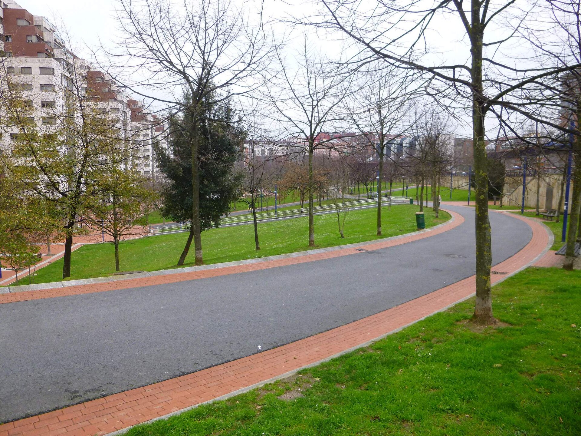
Ametzola Park sits in Bilbao's Recalde district, on the left bank of the Nervión river. The site once carried the southern railway tracks running through the city, and today it's one of the greenest, most-used public spaces in this part of Bilbao. Why is there a park here instead of railway tracks? Until the late 19th century, Ametzola was rural land belonging to the municipality of Abando, dotted with farmland and scattered farmhouses, and it sat outside Bilbao's city limits altogether. As industry and the railway expanded, the area turned into a rail junction that for decades acted as a physical barrier separating the Ensanche from the Recalde neighbourhood. That changed with a special urban renewal plan (PERI), which called for rerouting and burying the railway line, building a new station, adding new housing, and opening a public park for everyone to use. The project was designed by architects Javier López Chollet and Marta Dalmau, and the park opened in 2004. The redevelopment was carried out by Bilbao Ría 2000, the company responsible for reclaiming former industrial land across the metropolitan area for green public use. What will you actually find there? The park covers roughly 36,000 square metres and holds more than 450 different plant species, making it one of the botanically richest parks in the city. Its centrepiece is a pond of nearly 1,000 square metres, ringed by walking paths. Above the train station, now tucked underground, rises a pergola — a distinctive architectural feature that ties the park directly to the transport infrastructure beneath it. Another focal point is a 12-metre aluminium sculpture by Miquel Navarro, one of the park's more recognisable artistic touches. Older kids and teenagers gravitate toward the dedicated skate and parkour zones, while anyone looking to stay active can use the marked 1.2-kilometre running and walking loop that circles the grounds. How do you get there, and when's the best time to visit? The park sits directly above Ametzola train station (Renfe Cercanías), which makes it easy to reach by public transport from central Bilbao. Admission is free, and the park is open daily — generally from 7:00 AM to 10:00 PM in summer, and until dusk in winter. Morning or late afternoon tends to be the nicest time to visit, when the light flatters the greenery and the pond, and temperatures are more comfortable for walking or running. Given how close it sits to the Recalde district and the train station, the park works well as a stop along the way between central Bilbao and other parts of the city — you don't need to plan a separate trip, just fold it into whatever route you're already walking. Frequently asked questions Is there an entrance fee? No, entry to Ametzola Park is completely free and open to everyone, year-round. What's the fastest way to get there? Take the Renfe Cercanías train to Ametzola station — it sits literally underneath the park, so you're there the moment you walk up the stairs. Is there anything for kids and teenagers? Yes, the park has dedicated skate and parkour zones popular with older children and teens, plus wide lawns and paths that work well for younger kids too. How much time should I plan for a visit? A relaxed walk around the pond and paths takes about 30–45 minutes, but if you want to use the 1.2 km running loop or just sit by the water for a while, plan for an hour or more.
-
Parque Lineal
Rivas-Vaciamadrid
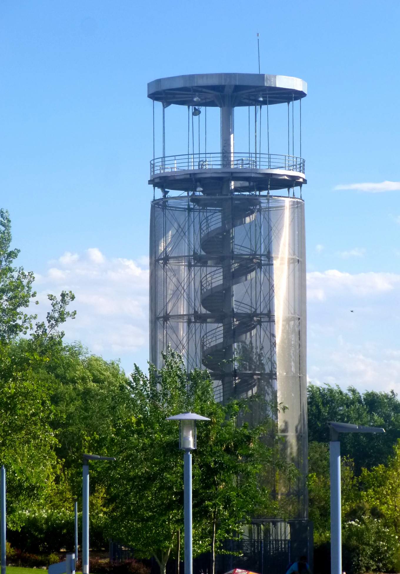
Parque Lineal is a modern municipal park in Rivas-Vaciamadrid, a town on the south-eastern edge of the Madrid metropolitan area. It was built over what used to be an urban divide — a metro line cutting through the town — and today it works as a green link stitching together the Centro and Oeste neighborhoods. Spread across roughly 85,000 m², the park is organized into recreational, sports, and educational zones aimed at families, seniors, and anyone looking for outdoor activity close to the Spanish capital. How did this park come about? The project traces back to an urban design competition launched by the Rivas-Vaciamadrid town council in 2019. After public exhibitions of the finalist proposals in 2020, the council approved the final scheme in early 2021. The core idea was to cover more than a kilometer of exposed metro track and turn that strip of land into a shared green space — transforming a physical barrier between two parts of town into a connector. What is there to do in Parque Lineal? The park is split into several functional areas: a zone for youth sports, a water-play area, a children's playground that includes a maze, an educational section, and a dedicated area for older visitors. Walking paths and separate cycling lanes run through the whole site, and dogs are welcome on both. A small stream feeding into a modest lagoon adds a natural touch to what is otherwise a fairly urban stretch of land. What about the lookout tower? The park's most recognizable landmark is a steel lookout tower, the Torre Mirador, built around a central mast with a spiral staircase winding up to a circular viewing platform set at 18.5 meters, while the structure itself reaches 23 meters in total height. The tower stands where Parque Lineal meets the neighboring Parque del Encuentro, just outside the section that directly covers the metro line, and serves as a handy reference point for anyone walking the park. Who is this park for? Because of its zoned layout, Parque Lineal draws a mix of visitors: families with young children heading for the playground, teenagers using the sports areas, cyclists riding the dedicated lanes, and older residents looking for a quieter corner to sit. It works equally well as a short afternoon stop or as part of a longer walk connecting different parts of Rivas-Vaciamadrid, and it functions first and foremost as everyday green space for locals rather than a purely touristic attraction. Frequently asked questions How big is Parque Lineal? The park covers roughly 85,000 m² and runs along a stretch of what used to be an exposed metro line through Rivas-Vaciamadrid. What neighborhoods does the park connect? It links the Centro and Oeste districts of Rivas-Vaciamadrid, previously separated by the railway/metro line now covered by the park. Is there a viewpoint tower? Yes — the steel Torre Mirador has a circular viewing platform at 18.5 meters and a total height of 23 meters, located at the boundary with Parque del Encuentro. Is the park suitable for children? Yes, it includes a playground with a maze and a dedicated water-play area for younger visitors. Can I bring my dog? Yes, the walking and cycling paths throughout the park are open to visitors with dogs. Where exactly is the park located? It's in the town of Rivas-Vaciamadrid, on the south-eastern outskirts of the Madrid metropolitan area, next to the local metro line.
-
Parque Reina Sofía
La Línea de la Concepción
Parque Reina Sofía is a municipal park in La Línea de la Concepción, in the province of Cádiz, sitting right on the Spanish side of the border with Gibraltar. It ranks among the town's largest green spaces and draws both locals on their daily routines and travellers pausing on the way to the Rock. Where is the park located? The park sits within the town of La Línea de la Concepción itself, part of the Campo de Gibraltar district, only a short walk from the border crossing into Gibraltar. That proximity makes it easy to fold a stop here into a day trip that also covers Gibraltar — the two are close enough to cover on foot without any real planning. What is there to see inside? The grounds cover close to 18 hectares, making this one of the larger parks along the Cádiz coastline. Mediterranean and subtropical plantings fill the site, and together they create a noticeably cooler, more humid microclimate than the surrounding streets — a welcome contrast on a hot summer afternoon. The park's best-known feature is a century-old dragon tree (drago), a striking Canary-Mediterranean species prized here for its age and size. Scattered through the grounds are also bunkers dating from the Second World War, remnants of the defensive fortifications built across the wider Campo de Gibraltar during that period. Families will find playgrounds and shaded rest areas throughout, and the paths are laid out for an easy, unhurried walk at any time of day. Why is it called Reina Sofía? The name traces back to the Spanish royal family. The park opened as Parque Princesa Sofía, honouring Princess Sofia of Greece and Denmark. When Sofia became Queen of Spain in 1975, the park's name changed accordingly to its current form, Parque Reina Sofía — a straightforward update reflecting her new title rather than any separate event. What events take place here? The park doubles as a hub of everyday town life. Every Wednesday it hosts El Piojito, a well-known street market where residents shop for clothing, accessories and small household goods — a good chance to see the park functioning as a working part of the town rather than just a place to stroll through. Once a year, during the Feria de La Línea, the park and its surroundings become the main stage for the town's festival, filled with marquees, music and crowds of locals. Anyone timing a visit around the feria should expect a very different atmosphere from an ordinary weekday. Frequently asked questions How long does a visit take? Walking the main paths and taking in the highlights — the dragon tree and the wartime bunkers — usually takes 30 to 45 minutes, though families using the playgrounds tend to stay longer. Is it a good stop with children? Yes. The park has playgrounds and rest areas, and its size and tree cover make it a comfortable place to spend time even on warmer days. Can a visit be combined with a Gibraltar trip? Easily. Given how close the park sits to the border, it works well as a starting point or a stopover on the way to Gibraltar, and many visitors cover both in a single day. Are there any wartime remains inside the park? Yes, the grounds still hold bunkers from the Second World War, part of the wider fortification network built across Campo de Gibraltar during that era. When is the best time to visit? Beyond the weekly Wednesday market, the liveliest atmosphere comes during the annual Feria de La Línea; for a quieter walk, an ordinary weekday is the better choice.
-
Olivos Park
Leganés
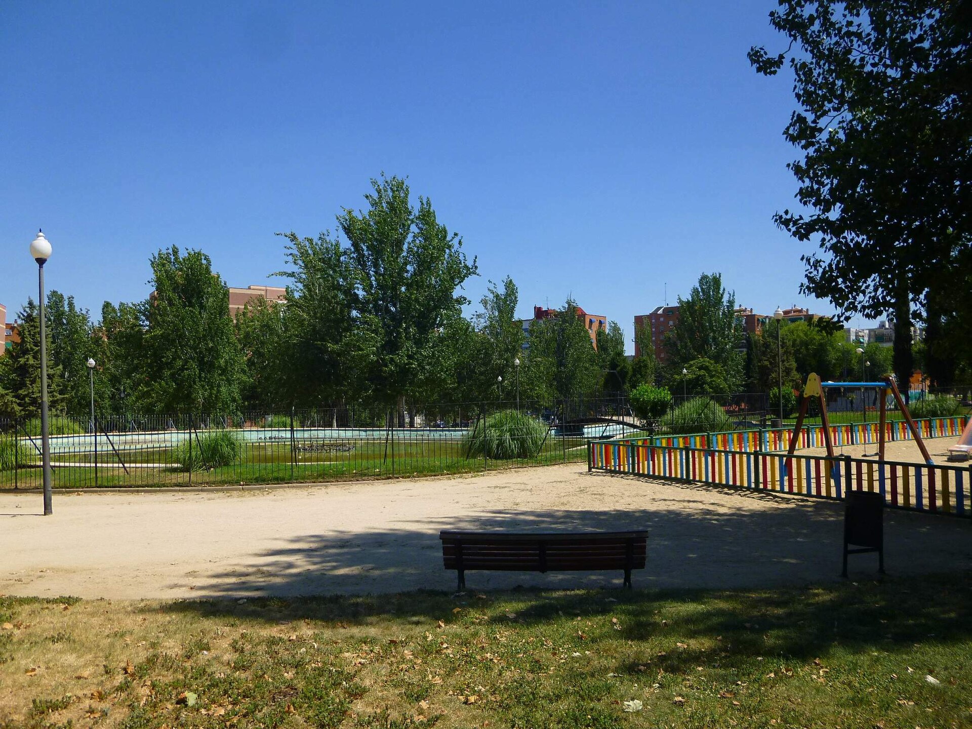
Olivos Park sits in Leganés, a city just south of Madrid, within the Zarzaquemada neighborhood. It rarely makes it onto a visitor's shortlist of Madrid attractions, yet for locals it functions as a daily green refuge, and for anyone exploring Leganés beyond the city center it's a worthwhile, low-key stop. Where is the park and how do you get there? The park covers roughly 9 hectares (about 90,000 square meters) and sits directly across the street from Parque de la Chopera. The easiest way in is by metro: Julián Besteiro station is around a 10-minute walk from the entrance. Zarzaquemada train station offers another short-walk approach if you're arriving by rail. Drivers will find residential streets nearby with some parking, though spaces can get tight during peak hours, as in most densely built parts of Leganés. What is there to see inside the park? The park's defining feature is a stand of century-old olive trees, which gave it its name. They share the grounds with conifers and other leafy trees, casting welcome shade during Madrid's hot summers. At the center sits a pond with an ornamental fountain, the Fuente de los Olivos, reached by a walking path that threads through the park and connects to the children's play area. This combination — old trees, still water, and quiet paths — gives the park a more intimate, garden-like feel than the larger showcase parks in central Madrid. What can families and children do here? A dedicated playground makes the park a natural pick for a family afternoon, and drinking-water points around the grounds make longer visits easier, especially in summer heat. The paths are flat and even, suitable for strollers as well as jogging, and many Zarzaquemada residents treat the park as a regular exercise route rather than just a place to sit. When is the best time to visit? Early morning or late afternoon works best, when the trees provide shade and temperatures are more comfortable — central Spain's summers can get intensely hot. Spring and autumn show off the park's greenery and pond to best effect, making a walk around the water especially pleasant. As an open public space, the park has no fixed opening hours or entry restrictions typical of ticketed attractions. Frequently asked questions How big is Olivos Park? It covers roughly 9 hectares, making it a mid-sized neighborhood park — smaller than Madrid's grand central parks, but large enough for an unhurried walk. Is there anything for children? Yes, the park has a dedicated playground area linked by path to the central pond and fountain. How do you reach the park without a car? The nearest metro stop is Julián Besteiro, about a 10-minute walk away; Zarzaquemada train station is another nearby option. How does it differ from the neighboring Parque de la Chopera? The two parks face each other across the street, but Olivos Park stands out for its mature olive trees and the fountain-fed pond, giving it a more garden-like, intimate atmosphere than its neighbor.
-
Paseo de Cánovas
Cáceres
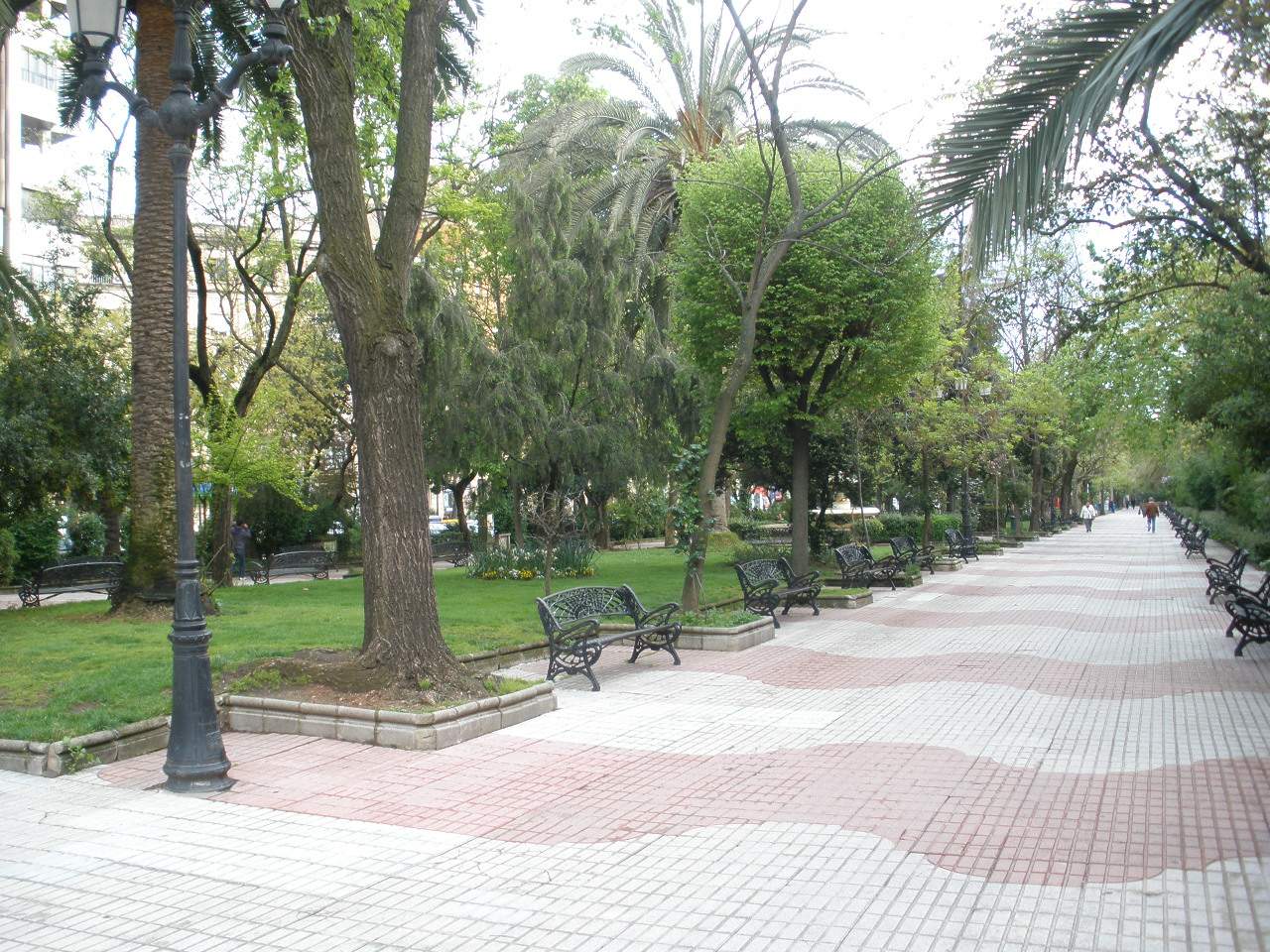
Paseo de Cánovas is a landmark tree-lined promenade in the centre of Cáceres, in Spain's Extremadura region. This long, shaded walkway links the historic town centre with the railway station and has served as the city's main gathering place for well over a century. Where does the name come from, and what's its history? The promenade was laid out in 1895 to connect the old town with the newly built railway station, at a time when the railway stood for progress and Cáceres opening up to the rest of the country. Two years later, in 1897, it was given its current name in honour of Antonio Cánovas del Castillo, the Spanish prime minister assassinated that same year by an Italian anarchist. Since then, Paseo de Cánovas has remained one of the city's oldest planned public spaces, still following its nineteenth-century layout today. What can you see along the way? The promenade stretches across roughly fourteen thousand square metres, where mature trees and flowerbeds alternate with walking paths, fountains and benches. Along the route stand monuments to figures who shaped the city's past: senator Juan Muñoz Chaves and writer and poet José María Gabriel y Galán. A distinctive feature is the bandstand built in 1887, where the municipal band of Cáceres performed for decades — today it's one of the promenade's best-known landmarks and a popular spot to pause on a walk. What kind of place is this? Paseo de Cánovas sits somewhere between a park and a formal city boulevard — the shade of its trees, newspaper kiosks and unhurried pace exist right alongside the bustle of the city's commercial and transport hub. It functions as an everyday leisure spot for locals in Cáceres, while also serving as a natural point of reference for visitors moving between the station and the old town. What events take place on Paseo de Cánovas? The promenade has long doubled as a stage for the city's cultural and commercial life. It regularly hosts the Feria del Libro (book fair), the WOMAD world music festival, the Extregusta food event, an annual tribute to Gabriel y Galán, and Christmas market stalls in December. Thanks to this, the promenade stays lively throughout the year, not only during the peak tourist season. How do you get to Paseo de Cánovas? The promenade lies in the centre of Cáceres, directly next to the railway station, making it a natural starting point for anyone arriving by train. From there, it's a short walk through the city centre to the old walled town, the Ciudad Monumental. Frequently Asked Questions Is Paseo de Cánovas a park or a street? It's something in between — a tree-lined city promenade with a park-like feel that also functions as a formal walking avenue through the centre of Cáceres. Where does the name come from? From Antonio Cánovas del Castillo, a Spanish prime minister, whose name was given to the promenade in 1897, two years after it opened. What can you see along the route? Mature trees, flowerbeds, fountains, monuments to local historical figures, and a historic bandstand dating from 1887. Is it a good spot for a break or a visit with children? Yes — the shaded promenade with benches and a calm setting makes for a pleasant break from sightseeing, especially in summer, when central Cáceres can get very sunny.
-
Jardines de Albia
Bilbao
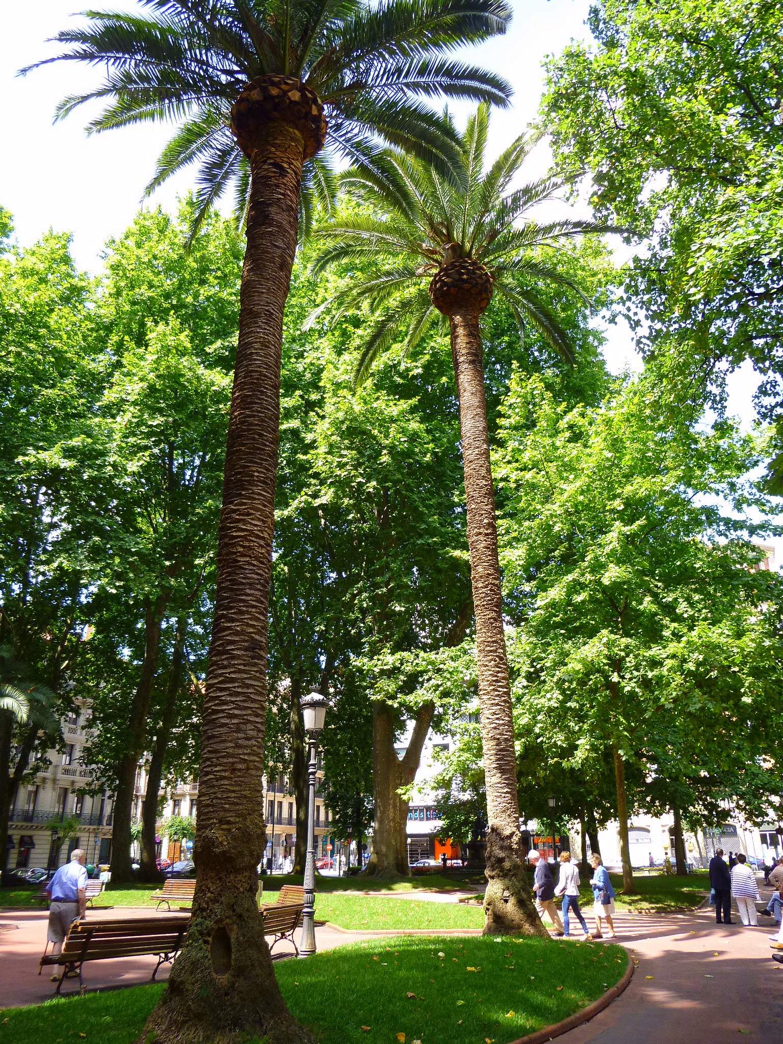
Jardines de Albia is one of the most recognizable green squares in the heart of Bilbao, sitting right beside the city's grand Gran Vía avenue. Located in the Abando district, the garden has served for more than a century as a kind of open-air living room — a meeting point, a resting spot, and a shortcut between the city's most important landmarks. Where exactly is the garden located? The garden covers roughly 6,000 square meters and is split into two sections by Ibáñez de Bilbao street: the larger Jardines de Albia proper (about 4,500 m²) and the smaller Plaza de San Vicente (about 1,500 m²). Because of this layout, the space feels more like a linked pair of squares than one continuous park, which makes it easy to cut straight through on foot from one side of downtown to the other. Where does the name "Albia" come from? The name has nothing to do with the square itself when it was first built — it comes from a much older tradition. It originally referred to a small plateau atop Larraskitu hill, where residents of Abando once held Sunday pilgrimages into the mountains among beech forests. According to the interpretation of Ceferino de Jemein, "Albia" derives from "ari-be-a," meaning "on the slope, beneath the peak of Pagasarri." The name was later carried over to the city square, even though the square itself has no topographical connection to its mountain namesake. What is the history behind this square? The Jardines de Albia took shape in the late 19th century, during the first phase of Bilbao's Ensanche (Expansion) — the period when the city gained a set of new representative public spaces built in the spirit of the romantic urban garden, with broad lawns and dense tree cover. In 1889, the city council decided to name the square Plaza de Trueba. For decades afterward, until 1983, it was known instead as Jardines de Berástegui, after the nearby Berástegui school that gave its name to the whole area. What can visitors see there today? The garden's defining feature is its collection of enormous plane trees, planted more than a hundred years ago and now taller than the surrounding apartment buildings — they give the square its shaded, cool microclimate, especially welcome in summer. Two historically significant monuments also stand within the gardens: a statue of Sabino Arana Goiri, positioned near the Palace of Justice, and a monument to the writer Antonio Trueba, whose name the square carried for most of the 19th century. Who is this spot suited for? Jardines de Albia is a natural stop for anyone exploring downtown Bilbao on foot — the garden sits directly on the route between Gran Vía and the old town, so it fits naturally into a walking itinerary rather than requiring a special detour. It also doubles as a resting place for locals: benches under the plane trees draw retirees reading the newspaper alongside office workers on a coffee break. It isn't a destination to seek out on its own, but rather a pleasant pause on the way to other parts of the city. Frequently asked questions Is Jardines de Albia a large park? No, it's a compact urban square of around 6,000 m², split into two sections by Ibáñez de Bilbao street — closer to a green plaza than a sprawling park. How much time should I set aside? Walking through the whole area takes about 15–20 minutes — it works best as a stop along the way between other central landmarks rather than a standalone destination. What does the name "Albia" mean? It comes from a former mountain plateau atop Larraskitu hill and, by traditional interpretation, means "on the slope, beneath the peak of Pagasarri." What monuments are in the garden? The garden holds statues of Sabino Arana Goiri and the writer Antonio Trueba, after whom the square was named Plaza de Trueba for many years.
-
Parque Enrique Tierno Galván
Valdemoro
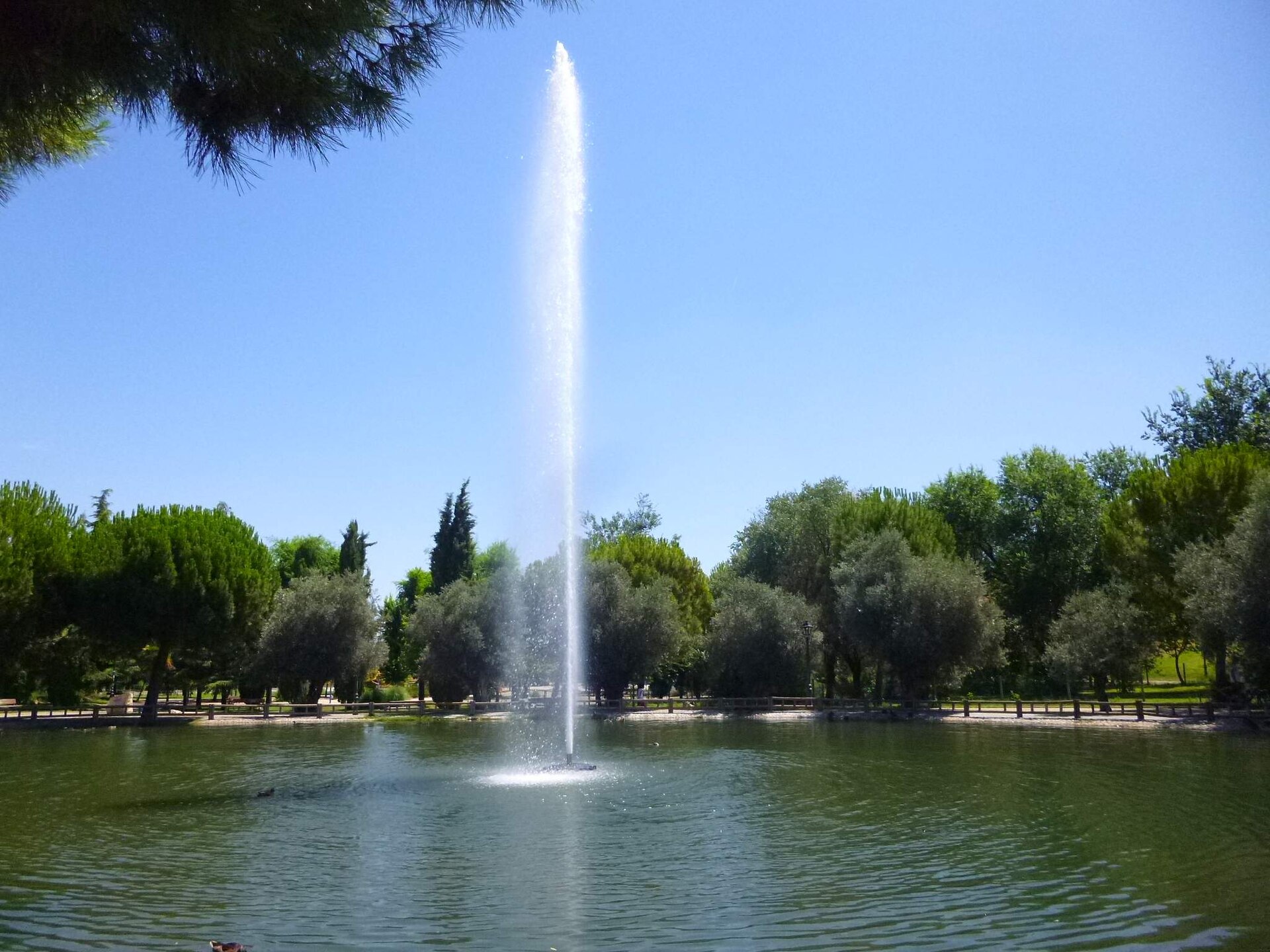
Parque Enrique Tierno Galván is a municipal park in Valdemoro, a town just south of Madrid. Spanning roughly 56,000 m², it currently ranks as the second-largest park in town, and an ongoing expansion is set to double that footprint to around 12 hectares. The park sits on Paseo Enrique Tierno Galván, at the junction with Calle Chequia and Avenida de Andalucía, right next to the El Restón shopping center — a location that makes it an easy stop for both local residents and shoppers looking for a break outdoors. Why is the park named this way? The park takes its name from Enrique Tierno Galván, a Spanish politician, jurist and sociologist who served as mayor of Madrid from 1979 to 1986. Naming a local green space after him follows a common Spanish practice of honoring figures tied to municipal and political history within the urban landscape. What is there to see inside the park? The park's most distinctive feature is a stand of centuries-old olive trees, which give it a Mediterranean character not often found in ordinary urban green spaces. Alongside the olives grow magnolias, cedars, cork oaks, pines and cherry trees — a mix that keeps the grounds shaded and green for most of the year. The town council has recently carried out intensive planting campaigns, gradually thickening the park's tree cover. The grounds are divided into fourteen separate lawn areas, which makes the park equally suited to an organized picnic or an impromptu rest on the grass. A pond sits within the park as well, functioning as a natural landmark and a quiet spot to pause during a walk. What amenities does the park offer? Families with children can use the dedicated play areas scattered through the grounds. Dog owners will find an enclosed area set aside specifically for pets, letting dogs off the leash without the risk of running into other park users. Between the paved paths and open lawns, the layout works well for a walk, a jog, or simply spending time outdoors. What changes are coming to the park? Parque Enrique Tierno Galván is currently undergoing an expansion that will double its surface area, from the current 56,000 m² to a planned 120,000 m² (12 hectares). The project includes new, clearly differentiated green zones, along with the construction of a climbing wall (rocódromo) and a headquarters building for the Casa de Andalucía association. Once finished, the expansion is meant to cement the park's role as a key recreational space for Valdemoro residents. Who is this park suited to? Between its wide lawns, Mediterranean greenery and basic recreational infrastructure, the park works well for families with young children as well as for anyone looking for a quiet place to walk or unwind after shopping at nearby El Restón. The planned climbing wall could also draw a younger, more active crowd once the expansion is complete. Frequently asked questions How big is Parque Enrique Tierno Galván? It currently covers about 56,000 m², and the expansion underway is set to bring it to 120,000 m² (12 hectares). Can I bring my dog to the park? Yes, the park has a dedicated, enclosed area set aside for dogs. Are there play areas for children? Yes, the park includes play areas for younger visitors. Where exactly is the park located? It sits on Paseo Enrique Tierno Galván, at the intersection with Calle Chequia and Avenida de Andalucía in Valdemoro, close to the El Restón shopping center. What does the ongoing expansion include? The expansion will double the park's surface area and add a climbing wall (rocódromo) and a headquarters building for the Casa de Andalucía association.
-
Santurtziko parkea
Santurtzi
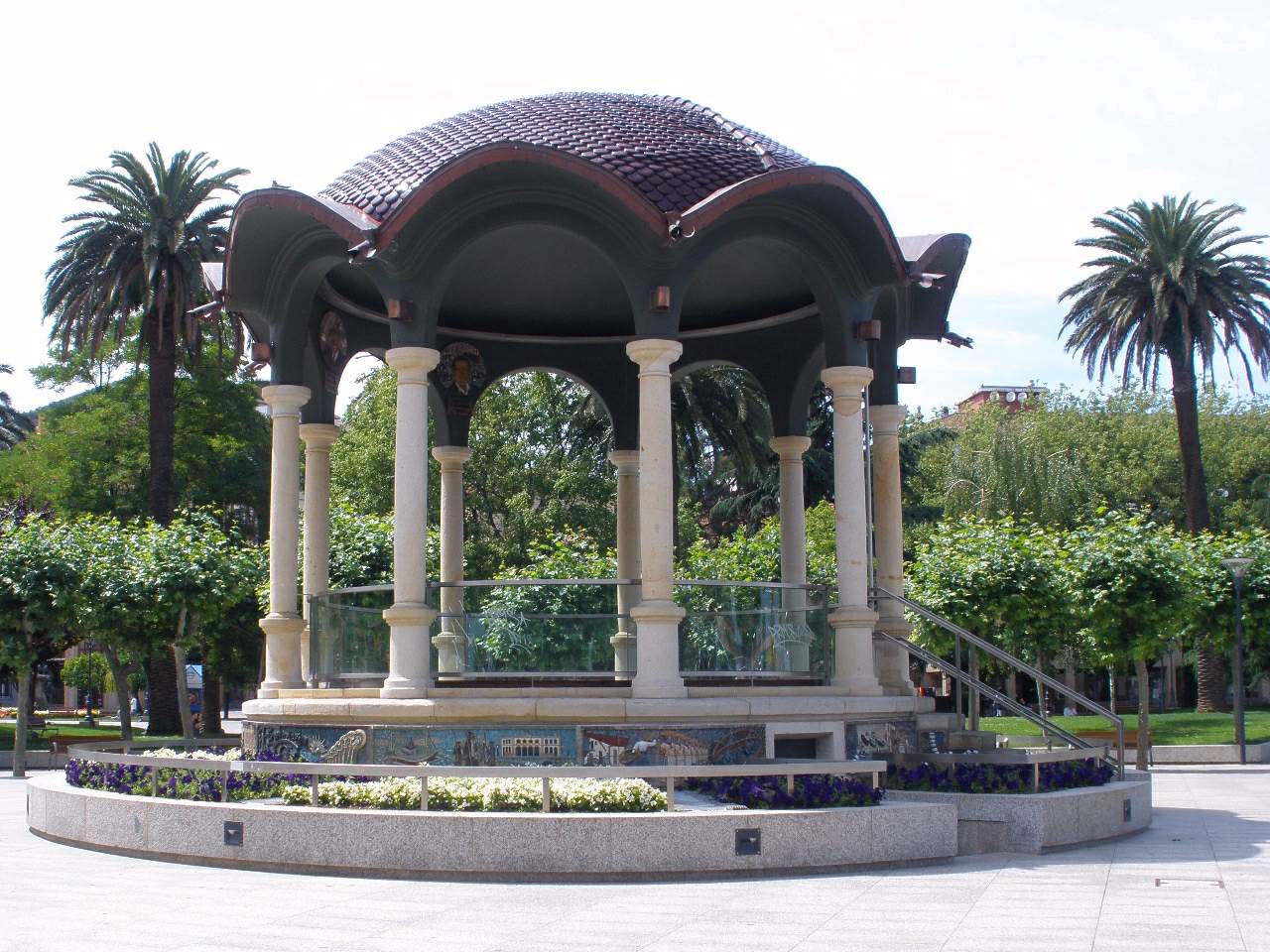
Santurtziko parkea is a waterfront town park in Santurtzi, a small fishing port in Biscay, in Spain's Basque Country. It sits right along the Nervión estuary, next to the fishing harbor, the town hall, and the Church of San Jorge, making it the natural heart of the town. What is there to see in the park? The park was laid out in 1918 and has been the main green space in Santurtzi ever since. Its most distinctive feature is a collection of trees rarely found in this part of Spain: a giant sequoia and Himalayan cedars grow here alongside shrubs brought from Japan and palms originating from the Americas and Africa. Walking its paths feels noticeably different from a typical Basque town square, and that mix of species is often what catches visitors off guard. At the center of the park stands a bandstand-style kiosk built in 1917, a year before the park itself officially opened. Its walls are covered in colorful mosaic tiles depicting the municipalities that line the estuary, along with scenes of sardine fishing — the trade that shaped Santurtzi's identity as a fishing town for generations. The kiosk remains one of the most photographed spots in the park. Why is it worth a visit? Because the park sits directly on the water, it offers open views of the estuary and the daily comings and goings of the fishing port. Locals use it for quiet walks, for sitting on a bench facing the harbor, or simply for watching boats return from the day's catch. Its location near the train station also makes it an easy stop for anyone arriving by rail from Bilbao or exploring the Biscay coast. Santurtziko parkea also functions as the town's main meeting point. Many local events and festivities take place here, which makes it a useful reference spot when planning a visit — it sits within easy walking distance of both the harbor and the town center. How do you get to the park? The park lies right in the center of Santurtzi, next to the town hall and the Church of San Jorge, so finding it is straightforward: just head toward the waterfront and the fishing port. Travelers coming from Bilbao can reach it comfortably by train, since the station is only a short walk away. Frequently asked questions When was Santurtziko parkea built? The park opened in 1918, while the kiosk at its center is a year older, built in 1917. What do the mosaics on the kiosk show? The mosaics depict the towns along the Nervión estuary and scenes of sardine fishermen, referencing Santurtzi's fishing history. What kind of trees grow in the park? The park features species uncommon for the region, including a giant sequoia and Himalayan cedars, along with plants introduced from Japan and palms from the Americas and Africa. Is the park close to the center of Santurtzi? Yes, it sits directly beside the town hall, the Church of San Jorge, and the fishing harbor, right in the middle of town. Is the park easy to reach without a car? Yes, it is a short walk from the train station, making it easy to reach by rail, including directly from Bilbao. What can you do in the park besides walking? Sit on a bench overlooking the estuary and watch ships and fishing boats entering the harbor, and take a look at the historic kiosk at the center of the park.
-
Parque Lo Morant
Alicante
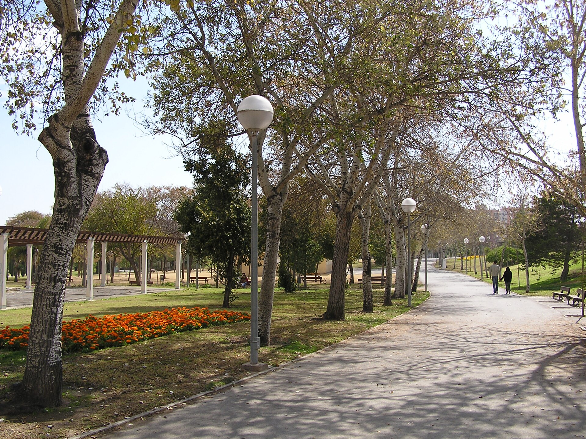
Parque Lo Morant is one of the largest urban parks in Alicante, a fully flat twelve-hectare green space in the north of the city, built on the grounds of a former country estate whose name it kept. It opened on 10 May 1987 and has since become a central gathering spot for the surrounding Lo Morant-San Nicolás de Bari, Virgen del Carmen and Virgen del Remedio neighborhoods. Where is the park located? The park sits within a grid bounded by Pedro Salinas, Vicente Aleixandre, Pablo Neruda and Lugo streets, in the northern part of Alicante. Because the whole site is level, it works as an easy pedestrian link between neighborhoods on either side, letting people cross a large stretch of the city on foot without dealing with traffic. What is there to do inside? The park is organized into several distinct zones connected by internal paths. There's a landscaped ornamental area, a rockery planted with aromatic and succulent species, a specialized garden built around a small pond, and a wooded section with a dedicated picnic area. For active visitors, facilities include football pitches, tennis courts, a skate park, plus areas set aside for petanque and croquet, along with a children's playground. An open-air amphitheater hosts outdoor events. A paved perimeter path over a kilometer long circles the whole park, popular with joggers and anyone looking for a longer walk. What kind of trees and plants grow here? The wooded zone is dominated by Aleppo pine (Pinus halepensis), joined by tipu trees (Tipuana tipu) — together they provide year-round shade and help muffle traffic noise from the surrounding streets. White poplars (Populus alba) line the perimeter walking path, keeping it shaded along its full length. A recent renewal project added 320 new trees across eight different species, along with additional shrub planting, further diversifying the park's greenery. Has the park been renovated recently? Yes. Alicante's city council carried out renovation works that included new tree and shrub planting along with upgrades to the park's general infrastructure, part of an ongoing effort to modernize one of the city's most recognizable green spaces. What are the opening hours? The park is open daily, from 8:00 to 22:00 in winter and until midnight in summer. Entry is free. Frequently asked questions Is Parque Lo Morant good for a family visit? Yes — the flat layout, playground and wide paved paths make it easy to get around with children or strollers. Can you play sports in the park? There are football pitches, tennis courts, a skate park, and dedicated petanque and croquet areas, plus a perimeter path suited to running. Where does the park's name come from? It's named after Lo Morant, the country estate that originally occupied the land where the park now stands. Is there any water feature in the park? Yes, a small pond sits within the specialized garden area, as part of the ornamental planting zone. Is admission free? Yes, Parque Lo Morant is free to enter year-round during opening hours.
-
Parc de l'Espanya Industrial
Barcelona
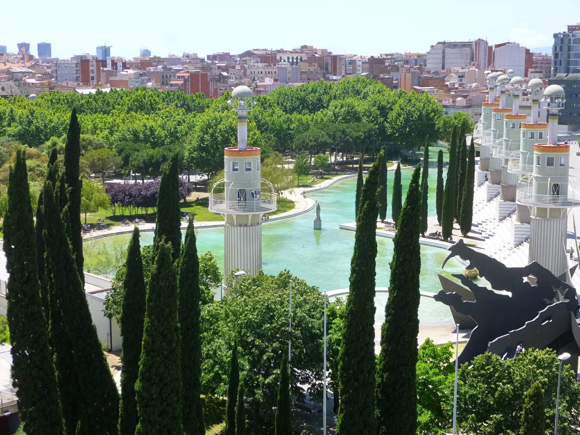
Parc de l'Espanya Industrial sits right next to Barcelona-Sants station, in the Sants district — a park that turned an old industrial site into one of the city's more unusual green spaces. What's the story behind this park? For most of the 20th century, the land now covered by the park was occupied by La España Industrial, a large textile mill. When the factory relocated its operations elsewhere, the site's owners planned to build new housing blocks on the vacated land. Neighbours in Sants pushed back — the neighbourhood movements of the 1970s campaigned for the site to remain public space rather than be built over. The city council eventually sided with residents, and the park designed by Basque architect Luis Peña Ganchegui opened in 1985. Sants owes its green lung today largely to that grassroots resistance. What will you see there? The park's centerpiece and best-known feature is a monumental dragon sculpture by Basque artist Andrés Nagel, added in 1987, two years after the park itself opened. The structure runs about 32 metres long and stands 12 metres high, built from steel and concrete, and doubles as both public art and a playground slide. Three separate slides are built into different parts of the dragon's body — its jaws, its wings, and its tail, which reaches down toward the park's lake. That mix of sculpture and play equipment makes the park a genuine draw for families with children, not just a spot to admire from a bench. The park itself is laid out as an open, multi-level space built around a large central lake, which anchors most of the activity — people walking, sitting, or watching kids clamber over the dragon. In 2024 the park underwent renovation work that improved accessibility, expanded its recreational areas, and added better facilities for families and dog owners. How do you get there? The park sits directly next to Barcelona-Sants railway station, one of the city's main transport hubs, served by long-distance trains, regional lines, and the metro. That makes it about as easy to reach as a park can be — get off at Sants Estació and you're steps away. It's a convenient stop on the way to or from the airport, and a natural base if you're exploring the western part of the city. When's the best time to visit? The park is open year-round and is especially pleasant in spring and autumn, when temperatures suit longer walks. In summer, tree cover and the lake make it a welcome break from the heat and the crowds in the city centre. Given its location right by the station, it also works well as a short stopover between trains. Frequently asked questions Is the park free to visit? Yes, Parc de l'Espanya Industrial is a public city park with free entry, open daily. Is it a good spot for kids? Very much so — Andrés Nagel's dragon sculpture doubles as a slide and playground, and the 2024 renovation added more family-friendly recreational space. How far is the park from Sants station? It sits right next to Barcelona-Sants station, so it's a walk of just a few minutes. Who designed the park and the dragon? The park was designed by Basque architect Luis Peña Ganchegui, and the dragon sculpture was added in 1987 by Basque artist Andrés Nagel.
-
Berlin Park
Madryt
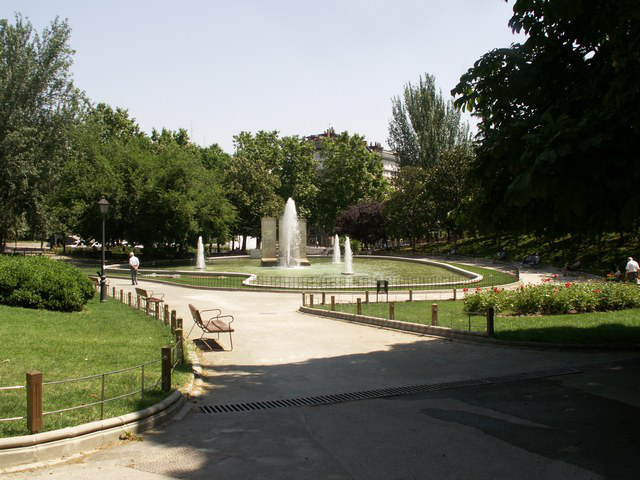
Parque de Berlín is a green enclave in Madrid's Chamberí district, in the Ciudad Jardín area, right off Avenida de Ramón y Cajal. The park was established in 1967, taking its name from the nearby German School and from a 1967 visit to Madrid by Willy Brandt, then mayor of West Berlin. Today it blends history with everyday leisure, drawing walkers, families, and sports enthusiasts alike. What can you see in the park? The park's main draw is a set of three original Berlin Wall fragments, installed here in 1990, a year after the wall came down — one slab still bears the date November 9th, the symbolic day the border between the two Germanys opened. A fountain set against the wall pieces has turned into a quiet spot for reflecting on Germany's division and reunification. Beyond the wall fragments, the park holds a few other notable details. A bronze bear standing on its hind legs — the emblem of the city of Berlin — greets visitors, alongside a Beethoven monument where the composer's head rests atop a granite piano-shaped sculpture. A bust honoring Álvaro Iglesias Sánchez can also be found on the grounds. Rounding things out is a small open-air auditorium where Madrid's city council hosts concerts, theatre performances, and storytelling sessions, plus outdoor cinema screenings and free live music in summer. What can you do with kids? Parque de Berlín is a genuine playground paradise for younger visitors. A pirate-themed play area lets children act out seafaring adventures, while a climbing rope pyramid gives braver kids something more challenging to tackle. The park's elevated section hosts a multi-sport court for basketball, football, futsal, and handball, giving older kids and teenagers plenty to do as well. Where to rest and what else to do? A café-bar with a terrace sits inside the park, perfect for a coffee or snack mid-stroll. Picnic-goers will find a dedicated area with tables and outdoor games. Dog owners get their own designated off-leash zones. The wide paths and open lawns also make the park a comfortable spot for cycling and general outdoor exercise. How do you get there? The park sits in northern Madrid, in the Chamberí district, at Avenida de Ramón y Cajal 2. The area is well connected to the city centre by public transport, making it an easy stop for both locals and visitors looking for a break from the busier, more crowded avenues downtown. When should you visit? The park is pleasant year-round, though spring and autumn show off the greenery at its best and offer comfortable temperatures for longer walks. In summer, an evening visit is worthwhile, when outdoor film screenings and concerts take place and the heat eases off as the sun sets. Frequently asked questions Are there really pieces of the Berlin Wall in Parque de Berlín? Yes, three original wall segments were installed in the park in 1990, a year after the wall's fall, commemorating Germany's division and reunification. Is the park good for a visit with children? Absolutely — a pirate-themed playground, a climbing rope pyramid, and sports courts offer entertainment for kids of different ages. Can you eat or relax with a dog in the park? Yes, there's an on-site café-bar with a terrace and a dedicated picnic area, while dog owners can use designated off-leash zones. Why is the park named after Berlin? The name comes from the nearby German School and from a 1967 visit to Madrid by Willy Brandt, then mayor of West Berlin, the same year the park was founded.
-
Gasómetro, Madrid
Madryt
Gasómetro is the popular name for a former gasworks in Madrid's Arganzuela district, today surviving as a park built around its landmark chimney — also known as Parque del Gasómetro, Parque de la Chimenea, or Parque del Rastro. What is this place? The story starts in 1848, when Madrid City Council granted land just outside the old Toledo Gate to the Sociedad Madrileña para el Alumbrado de Gas, the company in charge of supplying the city with gas lighting. On that plot rose an industrial complex with furnaces, coal warehouses, several gas storage tanks (the gasometers that gave the whole site its nickname), a forge, offices, and even housing for the workers. Gas was produced from a mixture of coal and resin, and the plant kept running for well over a century. As electric lighting spread from the 1940s onward, the gasworks gradually lost its purpose. Production moved to the Manoteras district in 1967, and the original buildings along Ronda de Toledo were demolished shortly after. A few elements survived, though: the administrative building, later restored and converted into a vocational school (the Escuela Taller Ronda de Toledo, finished in 1977), a handful of small warehouses now used by the city's cleaning services, and the tall chimney that still towers over the park and has become its emblem. How do you get there? The park sits in the Arganzuela district, bounded by Ronda de Toledo and the Paseo de las Acacias and Paseo de los Olmos, next to the street that shares its name, Calle del Gasómetro. The nearest metro stop is Arganzuela-Planetario. The area borders the Madrid Río riverside park and lies close to the neighborhood famous for the El Rastro flea market, so a visit here pairs easily with a longer riverside walk. What will you see on site? The main landmark is the tall chimney of the old gasworks, visible from a distance — the reason locals call the place Parque de la Chimenea. The park covers roughly 8,950 square meters and underwent a full renovation in 2022, officially reopened by Madrid mayor José Luis Martínez-Almeida. The refreshed space combines city greenery with traces of the site's industrial past, making it worth a stop for anyone curious about Madrid's industrial history, while also serving as an ordinary neighborhood park for Arganzuela residents. When should you visit? Daytime is best for taking in the chimney and the layout of the renovated park. As an open green space it works for a stroll in any season, though spring and autumn temperatures in Madrid make it more comfortable to extend the walk toward the nearby Madrid Río promenade. Frequently asked questions What was the Gasómetro? It was Madrid's municipal gasworks, operating from the mid-19th century until 1967, when production was relocated to the Manoteras district. What remains of the original buildings? The restored administrative building (now a vocational school), a few warehouses, and the landmark chimney around which the park was later laid out. How do you reach the park? The easiest way is by metro, getting off at Arganzuela-Planetario, close to both the park and the Madrid Río promenade. Is it worth combining with other sights in the area? Yes — the park borders the Madrid Río riverside area and sits near the neighborhood known for the El Rastro market, making it easy to plan a longer walk through Arganzuela.
Earn badges for the places you visit
Download NextOnTrip, discover new places and check off your trails.