Recreation and entertainment in Spain
A guide to 685 Recreation and entertainment in Spain — with descriptions, photos and traveler visits from the NextOnTrip community. Locations spread across 255 cities and towns. Most visited by the community: Hotel Pazo Libunca, Museo del Bonsai, Madrid Wax Museum.
-
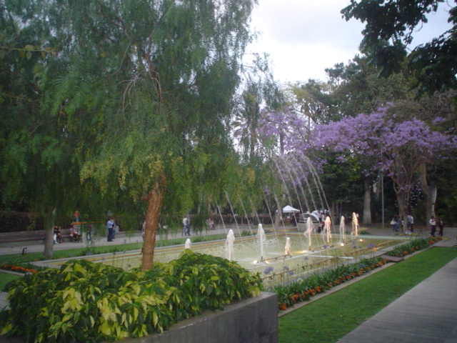
Parque García Sanabria
Santa Cruz na Teneryfie
Parque García Sanabria is one of the most notable urban parks in Santa Cruz de Tenerife, the capital of Tenerife. Inaugurated in 1926, this expansive garden combines greenery, fountains and architectural groupings into one of the city's most visited public spaces. The park holds official recognition as a site of cultural interest from the Government of the Canary Islands, underlining its historical and landscape value for the region. Where is the park located? Parque García Sanabria sits right in the heart of Santa Cruz de Tenerife, close to the city's main shopping streets and pedestrian avenues. Its approximate coordinates are 28.472319 N, -16.25412 W. Thanks to this central position, the park works naturally as a resting point while exploring the city, easily reached on foot from surrounding neighborhoods or from the capital's principal commercial streets. How do you get there? Given its central, urban setting, walking is by far the most convenient way to reach the park, since it borders the main streets of Santa Cruz de Tenerife directly. Visitors relying on public transport can take city buses serving the downtown area and continue on foot from the nearest stop. Those arriving by car will find municipal parking nearby, though spaces can be limited during peak hours, as is typical for any large city center. What can you see inside the park? The park is defined by its extensive garden layout, where fountains and architectural groupings form the backbone of the design along its walking paths. This combination of carefully planned greenery with small architectural features gives the space the character of a formal city garden rather than a simple square. Walking through the paths, visitors can notice how different sections of the park vary in planting style and water features, with the fountains acting as natural landmarks for orientation during a visit. Its official status as a site of cultural interest, granted by the Canary Islands authorities, means the park is regarded not only as recreational space but also as part of the architectural and landscape heritage of Tenerife's capital. That alone makes it worth more than a passing glance between other stops on a sightseeing itinerary. When is the best time to visit? Thanks to the mild climate of the Canary Islands, the park can be visited year-round. Morning and late-afternoon hours are best suited for an unhurried walk through the greenery, particularly during warmer months when midday sun can make the open paths feel hotter. As an urban public space, the park remains accessible outside the main tourist season as well, making it a solid addition to an itinerary regardless of when you visit the island. Who is this park suited for? The extensive garden layout with fountains and pathways makes the park suitable both as a short stop during a city walking tour and as a quieter alternative for anyone looking for a break from the bustle of downtown Santa Cruz de Tenerife. Its central location makes it easy to fold into a broader sightseeing route through the capital without needing extra travel time. Frequently asked questions Is entry to the park free? As a public urban green space, the park is freely accessible — it functions as an ordinary city garden rather than a paid attraction. How much time should you plan for a visit? Walking the main paths and taking in the fountains and architectural groupings typically takes between thirty minutes and an hour, depending on your pace. Is the park suitable for families with children? The open garden layout, with its walking paths and water features, makes it well suited to relaxed family strolls in the city center. Is it worth combining with other sights in Santa Cruz de Tenerife? Yes — the park's central location makes it easy to include alongside other landmarks in the capital, without needing to travel outside the downtown area.
-
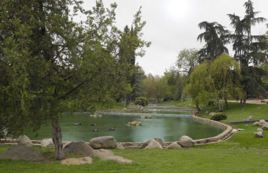
Aluche Park
Madryt
Parque de Aluche is an urban park in the Latina district of Madrid, valued by locals as a green space for rest and sport away from the city's tourist center. Where is the park located? The park sits at the heart of the Aluche neighborhood, part of the Latina district in southwestern Madrid. It covers more than 14 hectares and stretches roughly 1,350 meters from north to south, laid out as two elongated strips of land separated by Calle de Illescas. That shape makes a walk through the whole park a genuine workout rather than a quick stop. How do you get to Parque de Aluche? The easiest way is by metro — Aluche station on Line 5 sits right next to the park. Bus routes 17, 117 and 139 also stop nearby, and commuter rail (Renfe) users can get off at the Aluche station. This makes the park easy to reach both for residents of the surrounding neighborhoods and for visitors curious about a more local, less crowded side of Madrid. What is there to see in the park? The park's signature feature is an artificial stream with waterfalls, laid out along the former course of the Arroyo Luche, a brook that once ran through the area and gave both the neighborhood and the park their name. Along the water, tree-lined green areas planted with pines, poplars and cedars offer welcome shade during Madrid's hot summers. The park has extensive sports infrastructure: football pitches, a basketball court, skating tracks and petanque courts. Families with children will find playgrounds, and dog owners can use a dedicated off-leash area in the northern section of the park. The park's history is closely tied to the modernization of the neighborhood — it was built following an agreement between Madrid's city council and local electricity companies to bury high-voltage power lines that previously crossed the area overhead. The park officially opened on 25 July 1973. For decades it carried the official name Parque Alcalde Carlos Arias, even though residents always simply called it Parque Aluche. In November 2015, applying Spain's Historical Memory Law, the city council decided to change the official name, since Carlos Arias Navarro had been a senior official of the Franco dictatorship. The new official name, Parque Aluche, was formally recognized in 2016. When is the best time to visit? The park is pleasant year-round, but spring and autumn show off the greenery along the artificial stream at its best, with temperatures suited to longer walks. In summer, the shaded paths under the trees are the way to go, ideally in the morning or evening when Madrid's heat is at its most intense. Weekends bring local families out to the sports fields and playgrounds, so a weekday visit is a better bet if you're after a quieter atmosphere. Frequently asked questions What's the fastest way to reach Parque de Aluche from central Madrid? The quickest option is Metro Line 5 to Aluche station, which sits right at the park's entrance. Can you play sports in the park? Yes, the park has football pitches, a basketball court, skating tracks and petanque courts. Where does the park's name come from? It comes from the former Arroyo Luche stream that once flowed through the area — its route is echoed today by the artificial stream and waterfalls inside the park. Is the park dog-friendly? Yes, there is a dedicated off-leash dog area in the northern part of the park.
-
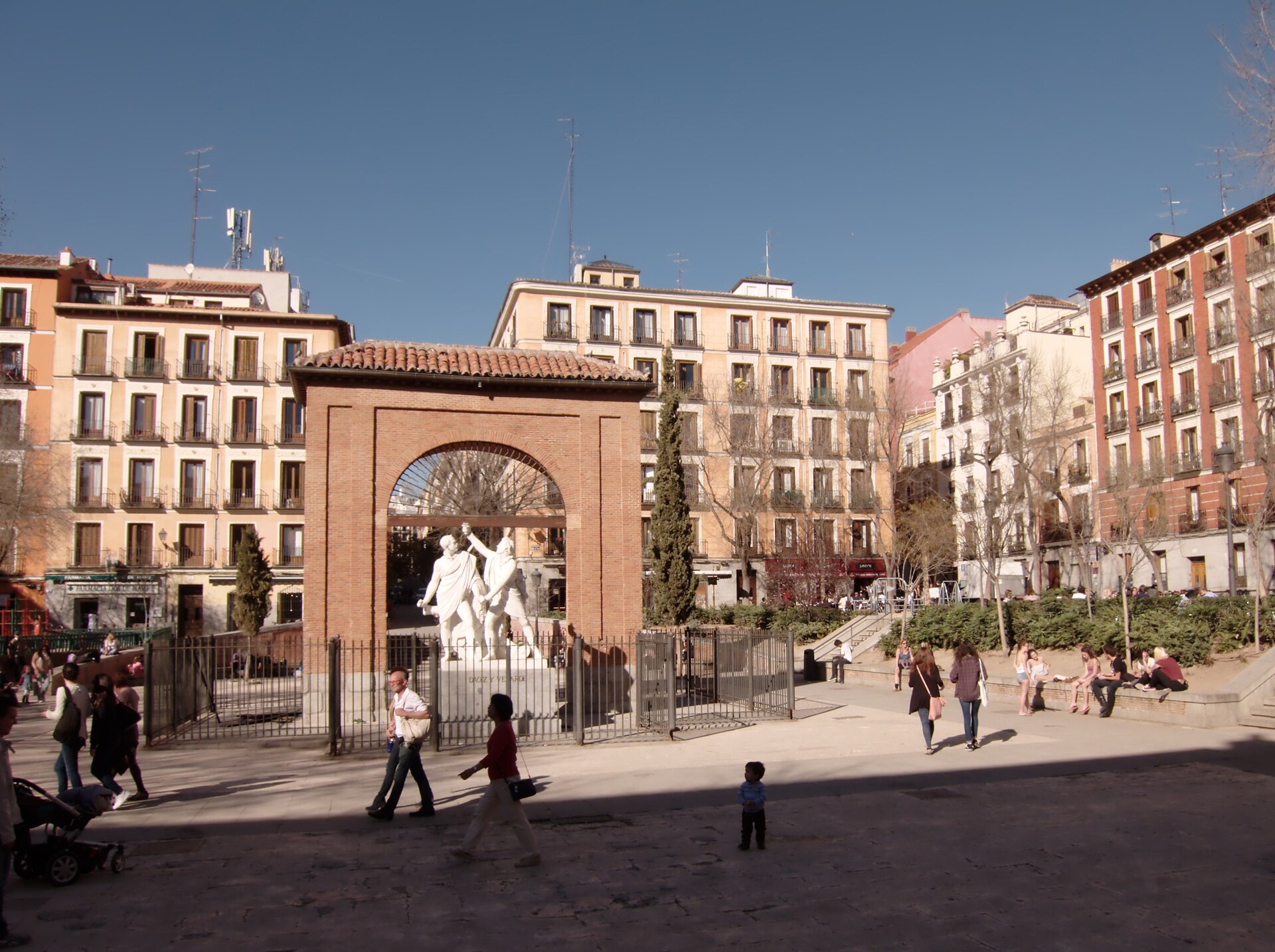
plaza del Dos de Mayo
Madryt
Plaza del Dos de Mayo is a compact square at the heart of Madrid's Malasaña neighborhood, one of the Spanish capital's most distinctive districts. Where exactly is the square located? The square sits within the administrative district of Universidad, right in the middle of Malasaña — an area known for its alternative vibe, colorful facades, and dense cluster of cafés and bars. Plaza del Dos de Mayo functions as the informal center of the neighborhood: most of the local bars, vintage clothing shops, and everyday meeting spots surround it. The nearest metro stations are Noviciado and Tribunal, both a short walk away, making the square easy to reach even for first-time visitors. Where does the square's name come from? The name refers to May 2, 1808, the day Madrid's residents rose up in arms against the Napoleonic troops occupying the city. Part of that uprising unfolded on this very site, where the Monteleón artillery barracks once stood. Although the revolt was crushed with heavy bloodshed, it became a lasting symbol of resistance against the French occupation and is still commemorated across Spain every year. What is there to see at the square? The centerpiece is a monument dedicated to captains Luis Daoíz and Pedro Velarde, the officers who led the defense of the barracks during the uprising and became two of the most recognized figures from that chapter of Spanish history. The square itself is modest in scale — a rectangular open space framed by residential buildings, with benches, trees, and enough room for locals to gather on the steps or the grass in the evening. Unlike Madrid's grander, more monumental squares, Dos de Mayo has kept an easygoing, neighborhood feel — it works as a gathering place rather than a checklist tourist stop. What is the atmosphere like around the square? Malasaña is currently one of Madrid's liveliest districts, and the square acts as its unofficial living room. In the evenings and on weekends, nearby bars set up outdoor tables, and the square itself fills with people — especially younger madrileños — hanging out informally. During the day the pace is calmer, offering a break from the busier avenues closer to the city center. When is the best time to visit? The square can be visited year-round, but it comes most alive in spring and summer, when warm evenings invite people outdoors. Travelers looking for a quieter experience should aim for weekday mornings or early afternoons. It's also worth keeping May 2 in mind, since local commemorations tied to the square's history take place around that date. Frequently asked questions How do you get to Plaza del Dos de Mayo? By metro: Noviciado (line 2) and Tribunal (lines 1 and 10) stations are both within a few minutes' walk of the square. What does the square commemorate? The 1808 uprising of Madrid's residents against Napoleon's occupying forces, and the defense of the Monteleón barracks led by captains Daoíz and Velarde. Is this a tourist spot or a local one? Mainly local — it's a everyday gathering point for Malasaña residents, though its historical significance also draws visitors. What else is worth seeing nearby? The surrounding streets of Malasaña, with their vintage shops, murals, and cafés, form a cohesive, characterful area centered on the square.
-
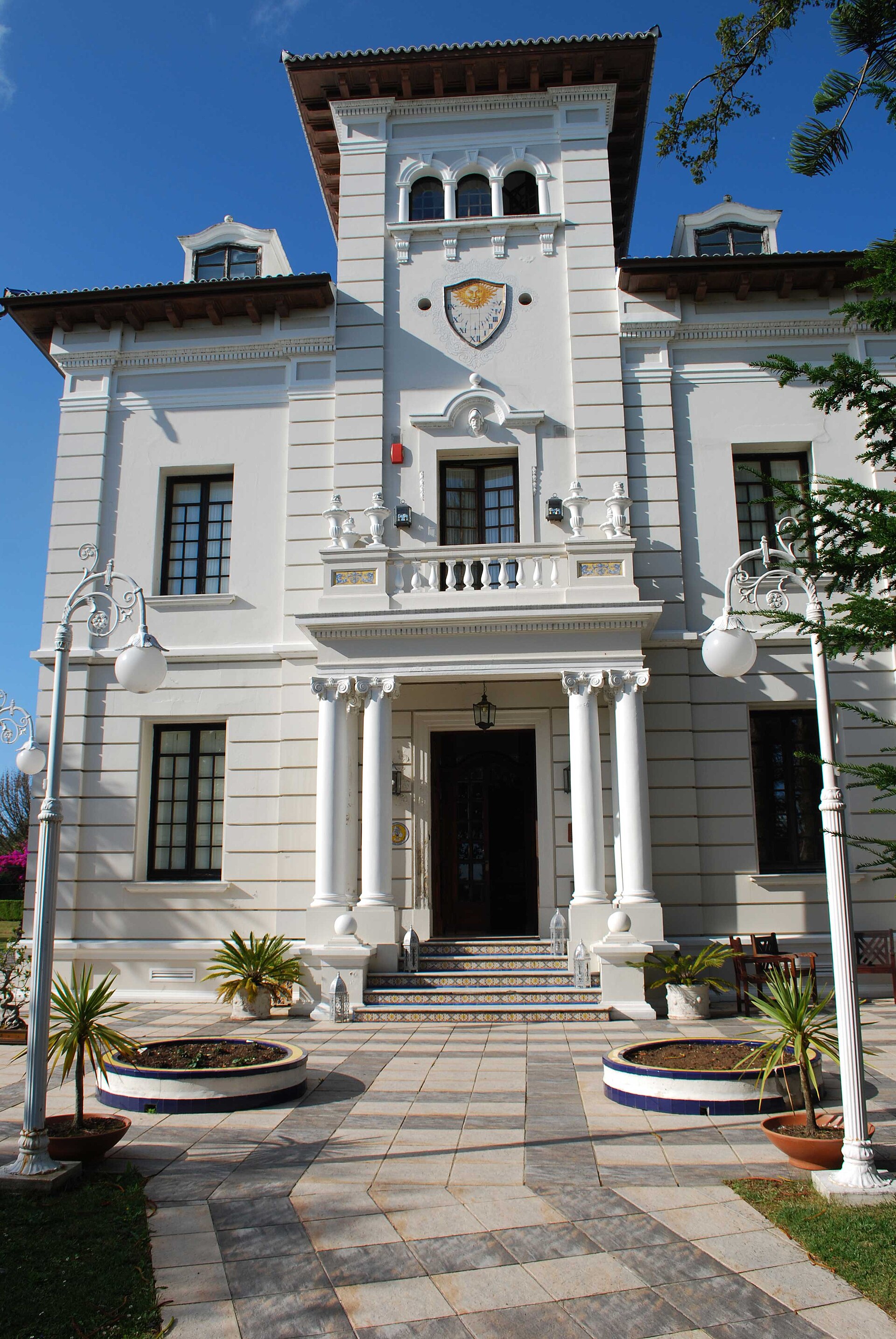
Hotel Pazo Libunca
Narón
Hotel Pazo Libunca, in Narón, Spain, is a four-star hotel set in a building styled after a traditional Galician pazo — a stone manor house surrounded by gardens. It pairs the quiet character of a countryside estate with the comforts modern travelers expect, making it a solid base for both beach time and day trips around Ferrol. How do you get to Hotel Pazo Libunca? The hotel sits in Narón, roughly 10 minutes by car from central Ferrol, one of Galicia's key coastal cities with a long naval and shipbuilding history. Driving is by far the easiest way to arrive, and the hotel backs that up with free private parking — genuinely useful in a region where a rental car is the most practical way to explore the coastline. Travelers flying in will find A Coruña airport the closest reference point, with Narón under an hour away by main road. The front desk operates 24 hours, and private check-in and check-out are available, so late arrivals aren't an issue. What's there to see at the hotel and nearby? The hotel itself invites a slower pace: a garden, a sun terrace, and a shared lounge all make for an easy afternoon with a book or a coffee. Rooms come with a private bathroom (including a bidet), air conditioning, a minibar, and a flat-screen TV, and free Wi-Fi covers the whole property. On site, the restaurant serves Spanish cuisine with vegetarian, gluten-free, and dairy-free options — a useful detail for groups traveling with different dietary needs. There's also a bar, well suited to an evening drink after a day at the beach. And beaches are exactly what the area delivers. A short drive brings you to Valdoviño beach, Pantín beach (well known among surfers for its consistent waves), and Doniños beach with its distinctive dunes. That mix makes Pazo Libunca a good base whether you're after simple beach days or more active time on the water. When's the best time to visit? Galicia has a mild, Atlantic climate, so the hotel works year-round, but travelers chasing warm swimming weather will get the most out of a visit between June and September. Spring and early autumn suit anyone looking for a quieter pace — fewer visitors, but still pleasant enough for strolls through the hotel garden or along the coast. It's worth noting that the Ferrol–Narón area tends to get overlooked by travelers focused on Galicia's better-known spots, like Santiago de Compostela or the Rías Baixas — which usually translates into fewer crowds and a more genuine feel for local life. Frequently asked questions Does Hotel Pazo Libunca have parking? Yes, the hotel offers free private parking for guests. How far is it to the beach? Valdoviño, Pantín, and Doniños beaches are all a short drive from the hotel, making it a good choice for anyone planning days along the Atlantic coast. Does the hotel restaurant cater to special diets? Yes, the menu includes vegetarian, gluten-free, and dairy-free dishes alongside traditional Spanish cuisine. How long is the drive to Ferrol? About 10 minutes by car, which makes it easy to combine a hotel stay with time exploring the city.
-

Mossèn Costa i Llobera Gardens
Barcelona
Mossèn Costa i Llobera Gardens is a botanical garden in the center of Barcelona, Catalonia, Spain, situated at the foot of Montjuïc and facing the sea. It occupies a slope of the hill that looks out toward the coastline, making it one of the more distinctive green spaces in a city already known for its parks. What makes these gardens different from other green spaces in Barcelona? The gardens are known as Barcelona's cactus garden — their defining feature is a collection of cacti and other succulent plants. That sets them apart from the more typical Mediterranean greenery found elsewhere on Montjuïc: instead of the pines, palms, and flowering shrubs common across the hill, this stretch of terrain is given over almost entirely to spiny, drought-adapted plant forms more often associated with arid and semi-arid landscapes than with a European coastal city. Where exactly are the gardens located? Mossèn Costa i Llobera Gardens sit in central Barcelona, at the base of Montjuïc — the hill long regarded as one of the city's key green lungs and vantage points. Their position facing the sea means the terrain opens toward the coastline rather than toward the city center, a layout that sets them apart from gardens located deeper inland, away from the shore. How do the gardens fit into the wider Montjuïc landscape? Montjuïc is threaded with parks and gardens along its slopes, each offering a different combination of views, plantings, and terrain. Mossèn Costa i Llobera Gardens occupy a specific part of that green belt, distinguished by their thematic focus: while most of the hill carries conventional Mediterranean vegetation, here the succulent and cactus collection takes center stage. Walking through this section of Montjuïc therefore feels markedly different from visiting the more classically landscaped gardens nearby. The fact that the gardens face the sea is not just a matter of scenery — it is one of the features that separates this particular stretch of Montjuïc from the parts of the hill set further back from the coast. Why visit? For travelers exploring Barcelona and looking beyond the city's best-known landmarks, a botanical garden centered on cacti and succulents, positioned on a hillside overlooking the sea, offers a distinctive stop within the Montjuïc area. The combination of sloped terrain and an unusual plant selection creates a setting unlike most of the city's other parks. Frequently asked questions What are the Mossèn Costa i Llobera Gardens? A botanical garden in Barcelona known as the city's cactus garden, located at the foot of Montjuïc. Where are they located? In the center of Barcelona, Catalonia, Spain, on a slope of Montjuïc facing the sea. What is their most distinctive feature? A collection of cacti and succulent plants, combined with a hillside position looking out toward the coast. Are the gardens connected to Montjuïc? Yes — they sit directly at the foot of Montjuïc, one of Barcelona's most important green and scenic areas. Who are the gardens best suited for? Visitors interested in botany, particularly succulent plants, as well as anyone looking for a sea-facing green space in Barcelona as an alternative to the city's more conventional parks.
-
Parterre del Retiro
Madryt
Parterre del Retiro is a formal French-style garden tucked into the western side of Madrid's Retiro Park, and one of the oldest and most photogenic corners of the entire grounds. While most visitors picture Retiro as sprawling tree-lined avenues and a large boating lake, the Parterre is something different: a compact, geometric composition designed according to the classical aesthetic of French palace gardens. Where did this garden come from? Retiro Park began taking shape in the first half of the 17th century as the grounds surrounding the Palacio del Buen Retiro, a palace built at the urging of Gaspar de Guzmán, Count-Duke of Olivares, for King Philip IV. The Parterre itself, however, is a later addition. It was King Philip V, the first Bourbon monarch of Spain, ruling in the 18th century, who commissioned it. Philip V reportedly disliked the surroundings of the old Retiro Palace where he lived, so he ordered a section of the grounds reshaped in the French style he had grown accustomed to before ascending the Spanish throne. The result was the only French garden within the whole Retiro complex. How was the garden laid out? Visitors reach the Parterre through the Baroque Puerta de Felipe IV gate. Inside, eight paths — four running along the main axes and four diagonal — cross one another to form a regular, symmetrical grid. Two large fountains mark the central points of this layout. The arrangement of paths, fountains, sunken sections and ornamental details follows the classical principle of order and symmetry typical of French gardens, in clear contrast to the looser, more naturalistic design found in the rest of the park. What is the garden's biggest attraction? The Parterre's most valuable feature is a tree: a striking Montezuma cypress (Taxodium, a species native to Mexico), considered the oldest tree in Madrid. It was planted in 1633, almost at the same time the park itself came into being, and is now over 400 years old. Its massive trunk and wide canopy stand in deliberate contrast to the geometric regularity of the surrounding paths, making it one of the most photographed sights in all of Retiro. How has the park's status changed over time? Until 1868, the entire Retiro grounds, including the Parterre, belonged to the Spanish crown and were reserved for court use. Following the Glorious Revolution, a decree transferred management of the park to the City Council of Madrid, turning it into a public park. From that point on, the council carried out a series of reforms that shaped Retiro — the Parterre included — into the space that residents and tourists can freely enjoy today. Why is it worth a visit? In 2021, Buen Retiro Park, together with the nearby Paseo del Prado, was inscribed on the UNESCO World Heritage list as part of a larger combined site. The Parterre, though small compared to the park as a whole, condenses several centuries of history — from a Bourbon king's personal tastes to the everyday life of the city — into a single quiet corner where one of Madrid's oldest living witnesses to that history still grows. Frequently asked questions What makes the Parterre different from the rest of Retiro Park? The Parterre is a French-style garden with a symmetrical grid of paths and fountains, while the rest of the park has a looser, more naturalistic layout. How old is the garden's oldest tree? The Montezuma cypress growing in the Parterre was planted in 1633 and is now more than 400 years old, making it the oldest tree in Madrid. Who commissioned the Parterre? It was built at the request of King Philip V, who wanted a French-style garden around the old Retiro Palace. Is there an entrance fee for the Parterre? No, Retiro Park, including the Parterre, is a public city park with free access.
-
Jardín Botánico Marimurtra
Blanes
Marimurtra Botanical Garden is one of the most important botanical gardens in Europe, perched on a rocky cliff above the Mediterranean Sea in Blanes, on the Costa Brava. It covers roughly 16 hectares and holds over 4,000 plant species brought from nearly every continent, from succulents to tropical trees, arranged in terraces so that almost every path offers a view of the sea. Who created the garden? Marimurtra was the creation of Carl Faust, a German businessman born in 1874 in Hadamar, near Frankfurt am Main. He settled in Catalonia in 1897 and, together with a partner, founded the company Faust & Kaufmann in Barcelona, which still exists today. Although drawn to natural sciences from an early age, his family pushed him toward business instead. It was only after turning 50, in 1924, that Faust stepped back from his managerial role in the company and devoted himself fully to building the garden, investing practically his entire fortune in the project. Where does the name Marimurtra come from? The name combines two Catalan words: "mar" (sea) and "murtra" (myrtle), a shrub common along this coastline. It reflects the idea that guided Faust from the start — blending Mediterranean vegetation with an open sea view, a combination that sets this garden apart from most others in Europe. What role does the garden serve today? Marimurtra was never meant to be just a tourist attraction — it had a scientific purpose from the beginning. Faust made sure of that during his lifetime: in 1951, through a notarial deed, a foundation bearing his name was established in Blanes, tasked with maintaining the garden and continuing the research carried out there. Today the garden functions as a research and educational center studying Mediterranean flora alongside plants from other climate zones, while remaining open to visitors. What can visitors see when touring Marimurtra? The garden's layout follows the natural shape of the cliff, with paths descending in terraces toward the sea through collections of cacti and succulents, a palm house, sections dedicated to Australian and American plants, and viewpoints overlooking the bay of Blanes and the Costa Brava coastline. The garden's architecture, including its classicist decorative elements and terraces, was designed to blend harmoniously with the landscape rather than dominate it. Frequently asked questions Where exactly is the garden located? In Blanes, on the Costa Brava coast in Catalonia, on a cliff above the Mediterranean Sea. Who founded the garden and when? German businessman Carl Faust, in 1924. How many plant species can be seen here? Over 4,000 species from various climate zones around the world. Does the garden have a scientific role? Yes, since 1951 it has been run by a foundation that conducts botanical research, combining a scientific mission with its role as a visitor attraction. Where does the name Marimurtra come from? From the Catalan words for sea and myrtle, a plant typical of this coastline.
-
Jardim Manuel Faria
Vizela
Jardim Manuel Faria is a landmark municipal garden in the center of Vizela, a small town in Portugal's Minho region, best known for the thermal springs of the Vizela river that have drawn visitors for centuries. The garden sits right next to Praça da República, and after a major renovation it has become one of the town's most symbolic public spaces. Where does the garden's name come from? The park is named after Manuel Faria, who served as provedor (administrator) of the Santa Casa da Misericórdia in Vizela and as a councilman representing Vizela in the Guimarães municipal chamber. Faria donated a significant part of the land on which the garden now stands. The site was previously known as the Jerufino field, a former agricultural plot in the heart of town that was gradually turned into public green space for residents. What can visitors see in the park? The garden's most distinctive feature is its coreto (bandstand), decorated with ceramic azulejo panels and built in 2006. Each panel depicts a church from one of the parishes within the municipality of Vizela, turning the bandstand into a kind of visual map of the region's religious heritage. The structure is regularly used for local cultural events, concerts, and municipal celebrations. The park also includes a monument honoring veterans of the overseas colonial wars, along with tributes to writer Camilo Castelo Branco and to the Brotherhood of Traditional Pão de Ló, the region's famous sponge cake associated with the Minho area. Another notable feature is the "Vizela Romana" sculpture, which references the Roman origins of the town's thermal waters — waters that have attracted visitors seeking their healing properties since antiquity. How has the garden changed in recent years? Jardim Manuel Faria and the adjoining Praça da República underwent a comprehensive renovation in recent years. The works, which cost approximately 1.845 million euros, were fully financed through the European Regional Development Fund (FEDER). The renewed square and garden complex was officially reopened in 2021, and local media have described it as the new "heart of the city" — a gathering place for walks, leisure, and public events for the people of Vizela. Frequently asked questions Where exactly is Jardim Manuel Faria located? The garden is in the center of Vizela, directly adjacent to Praça da República, in an easily accessible part of town. Is entry to the park free? Yes, as a public municipal space, the garden is open to everyone free of charge. What is the main attraction inside the park? The highlight is the ceramic-tiled bandstand depicting the churches of Vizela's parishes, along with the "Vizela Romana" sculpture and monuments commemorating local history. Are events held in the garden? Yes, the space regularly hosts concerts, festivals, and other cultural events organized by the municipality. Is it worth combining a visit here with the rest of Vizela? Definitely — the garden's proximity to Praça da República and the town's thermal spa tradition make it a natural starting point for exploring Vizela further.
-
Jardín de la Isla, Aranjuez
Aranjuez
Jardín de la Isla is a Renaissance royal garden in Aranjuez, laid out on an artificial island of roughly 25 hectares, encircled by the waters of the Tagus River and a channel dug alongside it. It sits directly at the northern edge of the Royal Palace and ranks among the oldest parts of the whole complex that once served as the summer residence of the Spanish Habsburgs and Bourbons. How did the island itself come to exist? The site's story predates the garden's golden age by centuries. Between 1387 and 1409, masters of the Order of Santiago, which then administered the Aranjuez estate, made use of a natural bend in the Tagus and cut a channel that separated a stretch of land from the riverbank. That is how the island was formed — though at the time it was purely an engineering intervention in the river's course, not yet a designed landscape. Who designed the garden as it exists today? Serious work on the garden began under Philip II. The design was entrusted to Juan Bautista de Toledo, an architect also known for his work on El Escorial, with construction carried out between 1561 and 1564. After Toledo's death, Juan de Herrera took over the project, and in 1582 he arranged the fountains — still one of the garden's most recognizable features. The composition follows a single main axis running along the island's longest line, around which rectangular beds were laid out in a symmetrical, orthogonal pattern typical of the Renaissance garden tradition imported into Spain from Italy. What was the garden used for in the 17th century? Under Philip III and Philip IV, the Jardín de la Isla stopped being only a place for strolling and quiet contemplation. Court spectacles, theatrical performances and even bullfights were staged there, showing how multifunctional the grounds around the palace became during the Baroque era. The garden was therefore not merely a decorative backdrop for the residence but also a stage for the social life of the Spanish court. What protected status does the garden hold today? The historical and artistic importance of the Jardín de la Isla was formally recognized as early as 1931, when it was granted Bien de Interés Cultural status — the highest category of heritage protection in Spain. Later, in 2001, the garden was included within the area inscribed on the UNESCO World Heritage List as part of the "Aranjuez Cultural Landscape," a listing that covers the entire historic residential complex together with its surrounding gardens and agricultural landscape. Frequently asked questions Is the Jardín de la Isla the same as the famous Jardín del Príncipe in Aranjuez? No — they are two separate gardens within the royal estate. The Jardín de la Isla is older and sits directly beside the palace, while the Jardín del Príncipe is a much larger complex from the late 18th century, located further along the river. Why is the garden called "de la Isla"? The name refers literally to the island (Spanish: isla) on which it was laid out — an artificial strip of land cut off by a channel from the main course of the Tagus back in the medieval period. Who was the main author of the garden's design? The work was initiated by Juan Bautista de Toledo under commission from Philip II, and after his death it was continued by Juan de Herrera, who was responsible among other things for the layout of the fountains. Can the garden be visited today? Yes, the Jardín de la Isla is open to the public and forms part of the tourist route through Aranjuez, alongside the Royal Palace and the estate's other gardens.
-
Garden of Robledo
Real Sitio de San Ildefonso
Jardín de Robledo is a small 18th-century garden tucked within the sprawling Real Sitio de San Ildefonso — the Royal Site of La Granja, at the foot of the Sierra de Guadarrama, roughly 12 km from Segovia and just under 80 km north of Madrid. Unlike the monumental, geometric avenues of the main palace park, this corner has kept a much more intimate, almost private character, which is why it's also known as the Jardinillo, or "little garden." Where does the name come from? The name refers to robles — oak trees that once covered this land before it was turned into an ornamental garden. That sets Robledo apart from the rest of the La Granja estate, where conifers and clipped hedges imported from the French formal garden tradition dominate the landscape. Who designed the garden? The garden was created by gardener Luis Lemmi, working under the orders of the then Prince of Asturias, Don Carlos — the future King Charles IV. The Robledo project was part of a broader pattern of small, personal garden schemes the prince commissioned at various royal sites, including the prince's own modest houses at El Escorial and El Pardo. This series of commissions points to Don Carlos's genuine personal interest in gardening, distinct in character from the more ceremonial, court-driven ambitions of his predecessors on the throne. How does it fit into the history of La Granja? The Real Sitio de San Ildefonso itself was built between 1721 and 1724 on the initiative of Philip V, who wanted to create a Spanish counterpart to Versailles at the foot of the mountains. The palace, together with its gardens and famous fountains, became the summer residence of the Spanish Bourbons. Jardín de Robledo, built later in an 18th-century spirit, shows that later generations of the royal family expanded the estate not only through grand, formal compositions but also through smaller, more personal spaces. Was the garden known to contemporaries? Yes — during the first half of the 19th century, Robledo was noted by travelers and contemporary writers, which suggests that despite its modest scale compared with the main palace gardens, the spot drew the attention of visitors to the Real Sitio. Those references make it possible today to treat the garden as a lasting part of La Granja's cultural landscape rather than a mere footnote to the main residence. What else is worth seeing nearby? A visit to Jardín de Robledo pairs naturally with a walk through the main gardens of the Royal Palace of La Granja, famous for their monumental fountains and French-Spanish-style avenues, as well as the palace itself, today managed as part of Patrimonio Nacional. Segovia, with its cathedral and Roman aqueduct, is within easy reach, making it possible to combine a visit to Robledo with a fuller exploration of the region. Frequently asked questions How does Jardín de Robledo differ from the main gardens of La Granja? Robledo is a smaller, more intimate composition, designed for the prince's private use, unlike the vast, ceremonial formal gardens surrounding the palace. When was the garden created? In the 18th century, at the initiative of Don Carlos, the future Charles IV, and carried out by the gardener Luis Lemmi. Where does the name Robledo come from? From "roble" (oak) — a reference to the oak trees that once grew on this land. Can the garden be visited together with the rest of the Real Sitio? Yes, it forms part of the wider La Granja estate managed by Patrimonio Nacional, making it easy to combine with a visit to the palace and its main gardens.
-
Jardins de la Nimfa
el Masnou
Jardins de la Nimfa is one of the most recognizable green spots in El Masnou, a coastal town in the Maresme region just outside Barcelona. The garden sits right beside the N-II road and works both as a neighborhood park and as a small landmark for the town. What's in the garden? The centerpiece is the sculpture La Nimfa del Masnou, created by Catalan artist Jordi Alumà. It was made to mark the entry into the new millennium and has since become a familiar symbol for locals. Around the sculpture the space opens into lawns, walking paths, and shaded spots for a break under the trees. Like most municipal parks, the gardens include a children's playground and picnic areas that get busy with local families on weekends. In recent years a calisthenics park was also added on site — an open-air training area that's free to use, although the town's sports center also runs organized group sessions here. Part of El Masnou's green network El Masnou has a long gardening tradition: in the 19th century it served as a summer retreat for the Catalan bourgeoisie, and many of the modernist villas and towers built for that purpose still stand today, often surrounded by well-kept greenery. The town's parks and gardens together cover roughly 15 hectares and count over 4,000 trees, and Jardins de la Nimfa is one of the most visited pieces of that network, alongside spots such as Parc del Llac and Parc Caramar. Thanks to its position along the main road connecting nearby towns, the garden is easy to reach both for El Masnou residents and for visitors passing through on a trip along the Maresme coast. The proximity to the sea and the Mediterranean climate give the vegetation here a slightly different character than further inland, with more sun-loving, drought-tolerant planting. Who is it for? Jardins de la Nimfa is mainly a spot for families with children and for anyone looking for a quiet place to walk or rest while exploring El Masnou. The calisthenics park also draws people interested in outdoor training, and the sculpture itself has become a reference point for orienting a stroll through town. When to visit Given its seaside, Mediterranean setting, the garden can be visited almost year-round, though spring and autumn are the most pleasant seasons, with milder temperatures than the height of summer. In summer, the shade of the trees is especially welcome in the afternoon, while mornings and evenings are better suited to a session on the calisthenics equipment. Frequently asked questions What does the sculpture in Jardins de la Nimfa represent? The sculpture La Nimfa del Masnou, by Jordi Alumà, commemorates the entry into the new millennium and forms the centerpiece of the garden. Is there anything for children? Yes, the garden has a playground and picnic areas suited to families. Is the calisthenics park free to use? Yes, the open-air training area is free and open to everyone, though the local sports center also organizes group sessions there. How do you get to Jardins de la Nimfa? The garden sits along the N-II road in El Masnou, a town in the Maresme region a short distance from Barcelona.
-
Jardines del Arquitecto Herrero Palacios
Madryt
Jardines del Arquitecto Herrero Palacios form a quiet, lesser-known corner of Madrid's Retiro Park, tucked away on its eastern edge. Unlike the crowded paths around the Estanque Grande, this section feels denser with trees, threaded with canals and ponds, and draws mostly local visitors rather than the bulk of park tourism. Where did this part of the park come from? The story begins in 1830, when King Ferdinand VII decided to establish his own private menagerie at the eastern boundary of the Retiro grounds, then reserved for royal use. The result was a building known as Casa de Fieras — literally "house of wild beasts" — effectively a municipal zoo that predates Madrid's current one. The menagerie operated and expanded over the decades, including work by architect Cecilio Rodríguez between 1921 and 1933, before finally closing at the end of the 1960s. Its animals were relocated to a new site in Casa de Campo, where the new Madrid Zoo opened in 1972. How did the old zoo become a garden? After Casa de Fieras closed, the site sat for a time awaiting a new purpose. The turning point came in 1976, with a thorough redesign carried out under architect Manuel Herrero Palacios, who at the time directed Madrid's municipal parks and gardens department. The new gardens were formally inaugurated on 29 July 1976. The layout is organized around two perpendicular axes, giving the space a more geometric, structured feel compared to the winding, romantic paths found elsewhere in Retiro. What can visitors actually see here? Entering from the south, through the gate on Menéndez Pelayo avenue — known as the Herrero Palacios gate — visitors first reach the twin ponds, a surviving trace of the old menagerie dating from roughly 1918 to 1921, originally used for keeping ducks. These sit just north of the neighboring Cecilio Rodríguez Gardens, with which this area forms a connected, though stylistically distinct, green complex. Why does it carry the architect's name? Since 1981, the gardens have officially borne the name of Manuel Herrero Palacios (1911–1992), a Madrid municipal architect who directed the city's parks and gardens department through the 1960s and 1970s. The name was given in recognition of his contribution to beautifying and developing Madrid's green spaces — a plaque at the garden's entrance commemorates the decision. Is this part of a World Heritage site? Yes. The gardens fall within the wider Retiro and Paseo del Prado area, inscribed on the UNESCO World Heritage List on 25 July 2021 under the name "Paisaje de la Luz" (Landscape of Light). Frequently asked questions Is there an entrance fee? No, the gardens are part of the publicly accessible Retiro Park and entry is free. Are there any remains of the old zoo? Yes — the main surviving features are the two historic ponds from the Casa de Fieras period and the layout of the entrance gate on Menéndez Pelayo avenue. How is this area different from the main part of Retiro? It is far less crowded, has a more geometric axial layout, and lacks the tourist infrastructure found around the Estanque Grande or the Crystal Palace. How do you get to the gardens? The most convenient access is through the gate on Menéndez Pelayo avenue, on the eastern side of Retiro Park, next to the Cecilio Rodríguez Gardens.
-
Jardines de Cecilio Rodríguez
Madryt
Jardines de Cecilio Rodríguez is an enclosed garden tucked into the southeastern corner of Madrid's Retiro Park, close to Calle Menéndez y Pelayo and the Niño Jesús children's hospital. It's easy to walk past Retiro without ever finding this spot, yet it stands out clearly from the rest of the park once you do. Where does the name come from? The garden is named after Cecilio Rodríguez, Madrid's head municipal gardener from 1914 (with a break during the Second Republic). Around 1940 he designed this section of the park, originally planned as an expansion of the old Casa de Fieras facilities intended for official municipal events. In 1949, the Madrid City Council honored him with a bust, created by sculptor J. Algueró, which still stands inside the gardens today. What is there to see? The style is often described as classicist with Andalusian touches. Among trimmed hedges and shaded paths, visitors find small ponds, fountains, sculptures, and climbing vines wrapped around columns and pergolas. The overall effect is an intimate, carefully composed space, quite different from the larger and more naturalistic areas of Retiro Park. Is it true that peacocks live here? Yes — it's one of the most distinctive features of the place. Peacocks roam freely through the gardens and have become a signature element of the Jardines de Cecilio Rodríguez for decades. Their unmistakable calls and the display of their tails, spread wide with bright, colorful plumage, draw the attention of visitors and make a stop here memorable. What is the significance of this place today? The gardens form part of the wider Retiro landscape, which on July 25, 2021, was inscribed on the UNESCO World Heritage List as part of the so-called "Paisaje de la Luz" (Landscape of Light), covering Retiro Park and the Paseo del Prado axis. This recognition highlights the value not only of the park as a whole but also of its lesser-known, more intimate corners, such as the Jardines de Cecilio Rodríguez. Frequently Asked Questions Where exactly are the gardens located? In the southeastern part of Retiro Park in Madrid, near Calle Menéndez y Pelayo and the Niño Jesús hospital. Who was Cecilio Rodríguez? Madrid's head municipal gardener, who designed this garden around 1940 and held his post from 1914 onward. Do the peacocks live here permanently? Yes, they move freely around the gardens and are one of the site's main attractions. Is there an entrance fee? The gardens are part of the publicly accessible Retiro Park. What sets this garden apart from the rest of Retiro? Its intimate, classicist style with Andalusian influences, featuring trimmed hedges, fountains, and pergolas — in contrast to the larger, more naturalistic sections of the park.
-
Jardins de Joan Maragall
Barcelona
Jardins de Joan Maragall is a quiet garden on Montjuïc hill in Barcelona, tucked between the Olympic Stadium and the National Palace (Palau Nacional). It's one of those spots most visitors never hear about, overshadowed by far more famous neighbors — which is a shame, because the garden has an interesting backstory and offers a calm contrast to the crowds at the Montjuïc fountain or the National Museum of Catalan Art next door. Where does the name come from? The garden is named after Joan Maragall, one of the most important Catalan poets of the late 19th and early 20th centuries. That's no coincidence: this part of Montjuïc holds a whole cluster of gardens dedicated to Catalan poets — alongside Jardins de Joan Maragall sit the gardens of Mossèn Cinto Verdaguer, Mossèn Costa i Llobera, and Joan Brossa. This literary thread gives the whole area a distinct, contemplative character, designed for quiet strolling rather than mass tourism. How was the garden created? The site's history goes back to the 1929 International Exposition. Around the Royal Pavilion (today's Palauet Albéniz), the French landscape architect Jean Claude Nicolas Forestier designed a garden layout that became the seed of today's Jardins de Joan Maragall. Decades later, in 1970, the garden was expanded — a decision tied to the Palauet Albéniz becoming a residence for the Spanish royal family, since Prince Juan Carlos de Borbón preferred it over the Royal Palace of Pedralbes. The expansion project was led by Joaquim Maria Casamor, chief architect of the city's parks and gardens department. What's worth seeing there? The garden's layout blends classic French geometry with elements typical of Mediterranean park design: symmetrical paths, trimmed hedges, calm open squares and viewpoints. Because the garden sits right next to Palauet Albéniz, a walk through it also means admiring the architecture of one of the few Exposition-era buildings on Montjuïc that has kept its original ceremonial function. Who is this place for? It's a good stop for travelers who've already covered Montjuïc's main highlights — the National Palace, the Olympic Stadium, the Joan Miró Foundation — and want a moment of shade and quiet away from queues and tour groups. It also appeals to anyone interested in landscape architecture, since it illustrates how 20th-century Barcelona blended French garden traditions with local design. Frequently asked questions Is entry to the garden free? Montjuïc's municipal gardens, including Jardins de Joan Maragall, are typically open to the public and free of charge, as part of the city's public park network. How do you get there? The garden sits right next to the National Palace and the Olympic Stadium, so the easiest way to reach it is on foot as part of a walk through Montjuïc's main sights, for example starting from Plaça Espanya. Is it a good spot for photos? Yes — the combination of trimmed greenery, symmetrical paths and the view of Palauet Albéniz makes it a photogenic, if less crowded, corner of Montjuïc. How much time should you set aside? A short 20-30 minute walk is enough to explore the garden and rest between visiting Montjuïc's other attractions.
-
Botanical Garden of Zaragoza
Saragossa
The Botanical Garden of Zaragoza sits inside Parque Grande José Antonio Labordeta, the largest urban park in the Aragonese capital. Easy to walk past as just another green corner of the park, it actually carries a history stretching back to the late eighteenth century, tied to the city's earliest organized effort to gather plants for scientific study rather than pure decoration. How did the garden come to be? The idea of creating a botanical garden in Zaragoza took shape in 1796, driven by the Real Sociedad Económica Aragonesa de Amigos del País, a society of local figures interested in advancing regional science and economy. The practical groundwork fell to a pharmacist connected to the city's college of apothecaries, who arranged for seeds and cuttings to be brought in from distant Spanish cities — Valencia, Seville, Madrid, Barcelona — as well as from Paris and the Americas. From its earliest days, then, the collection was never purely local; it reflected a deliberate effort to bring together plant material from across a wide geography. The garden's history was far from smooth. Between 1808 and 1809, during the Peninsular War, much of the original planting was destroyed. In the years that followed, a naturalist and physician who directed the institution took charge of rebuilding and reorganizing the collection, restoring its scientific purpose. What is there to see today? Following a thorough renovation that recovered the garden's eighteenth-century character — an investment of around 1.3 million euros — the present-day garden is organized into more than a dozen thematic collections. Visitors can walk through sections devoted to aromatic and medicinal plants, aquatic species, mountain flora, and edible and ornamental varieties. Among the older, surviving specimens are cedars, cypresses, plane trees, elms, lindens, ash trees, pines, ginkgos, oaks and walnuts — trees that predate the recent overhaul and connect the garden to its earlier incarnations. Particular attention has been given to native Aragonese flora, which stands out as one of the garden's main draws alongside species brought in from other parts of Spain and the world. The renovation also restored the ceramic benches characteristic of Parque Grande, and, as part of a broader push for biodiversity, small shelters for insects and reptiles have been added throughout the grounds. Where exactly is it located? The garden lies in the southern part of Zaragoza, within the university district, inside Parque Grande — a park covering roughly 40 hectares and often described as the city's green lung. Because of this setting, a visit to the botanical garden pairs naturally with a longer walk through the park, one of the most popular recreational spaces for residents of Zaragoza. Frequently asked questions Is there an entrance fee? The garden is part of Zaragoza's municipal green infrastructure and is managed by the city council as an open park space. How old is the garden? Its roots go back to 1796, making it one of the older botanical gardens in Spain, though its history includes a significant destruction and later reconstruction. How is it different from the rest of the park? Unlike the surrounding parkland, the botanical garden is organized as a scientific collection — plants are grouped by theme (aromatic, medicinal, aquatic, mountain) rather than arranged purely for visual effect. Is it worth visiting with children? Yes — the presence of small wildlife shelters and the variety of thematic collections make it a good spot for an educational walk with younger visitors.
-
Jardín Botánico Histórico de Barcelona
Barcelona
The Historic Botanical Garden of Barcelona sits tucked into the slope of Montjuïc, in an area known as La Foixarda. It's an easy place to overlook if you're only chasing the castle or the Olympic stadium nearby, yet it rewards visitors with a quieter, older layer of the mountain's history — plants growing out of the scars of a former quarry. How did this garden come to exist? The land where the garden now stands was once the active Foixarda quarry. In 1915, the family of Josep Rovira i Bruguera ceded the site to the Barcelona City Council. The real push for transformation came with preparations for the 1929 International Exposition, which turned the whole of Montjuïc into a large urban park. It was in that context, in 1930, that botanist Pius Font i Quer was commissioned to build a collection of plants across two hollows left behind by the old quarry works. When did the garden open to the public? Construction and planting took over a decade. The garden officially opened on 17 July 1941. For decades afterward it served as a space for conserving and displaying rare plant species, until it closed to visitors in 1986 so the terrain could be stabilized and the grounds reinforced. After years of restoration work, it reopened in 2003, now run as part of the Museu de Ciències Naturals de Barcelona (Natural Sciences Museum of Barcelona). What plants grow here? Font i Quer focused the collection on endemic and rare species, drawn mainly from the Iberian Peninsula, the Balearic Islands, and Morocco. That focus sets it apart from the newer, much larger Jardí Botànic de Barcelona, opened in 1999 on the other side of the mountain, which instead showcases vegetation from the five Mediterranean-climate regions of the world. The historic garden kept a more intimate, scientific character rooted in its near-century-old origins. What else is worth seeing on site? In the second of the two hollows stands a masia, a traditional Catalan farmhouse-style building, erected by the Livestock Breeders' Association as a model farm for the 1929 World Exposition. The original plan envisioned it becoming a center for gardening work, seed research, plant propagation, laboratories, and comparative crop trials. Today the building remains part of the garden's supporting infrastructure and is a reminder of the exhibition roots of the whole Montjuïc complex. Why visit while exploring Montjuïc? The garden sits close enough to other Montjuïc landmarks — the castle, the Fundació Miró, the Olympic stadium — to fold easily into a longer day on the mountain, while offering a completely different pace: a quiet walk along rocky paths carved by a former quarry, with vegetation now growing through the site's industrial scars. It ties together three layers of history at once — the quarry's industrial past, the exhibition history of 1929/1941, and an ongoing scientific mission to conserve rare Mediterranean plant species. Frequently asked questions Is the Historic Botanical Garden the same as the Jardí Botànic de Barcelona? No. They are two separate gardens on the same mountain. The historic one dates to 1930 and focuses on endemic species from Iberia, the Balearic Islands, and Morocco, while the newer Jardí Botànic opened in 1999 and presents vegetation from five Mediterranean-climate regions worldwide. When was the garden closed to visitors? It closed in 1986 due to the need to stabilize the terrain, and reopened in 2003 after restoration work was completed. Who created the garden? Botanist Pius Font i Quer, who in 1930 began assembling the collection on the site of the former La Foixarda quarry.
-
Jardines del Prado, Talavera de la Reina
Talavera de la Reina
Jardines del Prado is a historic urban park at the heart of Talavera de la Reina, in the province of Toledo, and one of the most recognizable green spaces in the Castilla-La Mancha region. The gardens originated in the 19th century as a way of landscaping the route that led from the city walls to the Hermitage of Our Lady of El Prado, a shrine later elevated to the rank of minor basilica. How has the park evolved over time? The gardens' present form is the result of several stages of redesign. In the 1920s the site was reworked and renamed Parque de Alfonso XIII, with the new layout officially opened in 1928. Another major transformation came in 1943, when, under the initiative of the city's mayor at the time, the park was remodeled in French style, with its geometric paths and trimmed greenery. That French character is still clearly visible in the garden's composition today, though closer inspection also reveals influences from other European garden traditions and even echoes of Islamic garden design. What can visitors see in Jardines del Prado? The park serves not just a recreational purpose but also a representative one for the city. Within its grounds stand two buildings of considerable local significance: the aforementioned Basilica of Our Lady of El Prado and the bullring, long a landmark within Talavera's urban fabric. Strolling along the paths, visitors will also come across ceramic details typical of the city — Talavera de la Reina is renowned for its centuries-old tradition of majolica pottery, reflected in decorative elements throughout the park. In 1982 the gardens were extended with the addition of Parque de la Alameda. This newer section was laid out in the style of an English garden, featuring a central lake and two bridges finished with Talavera's characteristic ceramic tilework. As a result, a single park complex now brings together two distinct garden traditions: the ordered French symmetry of the older section and the more picturesque, informal composition of the English-style addition. Why does the park matter to the city today? Given the historical and artistic value of the whole complex, since 2019 Jardines del Prado has been listed as an asset of cultural interest in the category of historic garden. This status confirms the site's importance not only as a leisure space for residents but also as part of the region's cultural heritage. The park remains a lively meeting point — locals use it for walks, rest in the shade of its trees, and outdoor events, while visitors touring the basilica or the bullring can, in passing, discover a piece of Talavera's history written into the layout of its paths and vegetation. Frequently asked questions Is admission to the park free? Jardines del Prado is a public urban park with free access for everyone. What connects the park to the city's ceramic tradition? The bridges in the Alameda section are finished with ceramic tilework characteristic of Talavera, reflecting the city's centuries-old tradition of majolica pottery. How do the two parts of the park differ? The older section, Jardines del Prado, was designed in French style with a geometric layout, while the Parque de la Alameda, added in 1982, has a more informal English character with a central lake.
-
Jardí Botànic Tropical Pinya de Rosa
Blanes
Jardí Botànic Tropical Pinya de Rosa is a botanical garden covering more than fifty hectares along the Costa Brava coastline in Blanes, in the province of Girona. Today the site is covered in plants gathered from nearly every continent, yet as recently as the mid-20th century it was a barren, dry stretch of land above the sea. Who created the garden and where does its name come from? The story begins in 1945, when the land was purchased by Fernando Riviere de Caralt, an industrial engineer with a lifelong passion for botany. Over the following decades he transformed the barren slopes, largely through his own effort and resources, into an intricate landscape of terraces, ponds, water reservoirs and scenic walkways overlooking the Mediterranean. He sourced plants from private collections, botanical gardens and field expeditions, gradually assembling one of the richest collections of succulents in Europe. What can visitors see in the garden? The garden's main draw is its remarkable collection of cacti and other succulent plants — thousands of species and varieties gathered from different climate zones around the world, from the deserts of North America to the arid regions of Africa and South America. Alongside the cacti, tropical and subtropical plants also thrive here, benefiting from the mild Mediterranean microclimate of this stretch of coast. The garden's layout follows the natural terrain, with paths winding up and down the slopes, passing artificial water reservoirs, viewpoints over the bay, and shaded corners where plants have developed over decades with minimal human intervention. Why does the name Riviere appear in plant names? Fernando Riviere de Caralt's dedication to the world of succulent botany was recognized by scientists who discovered and classified new species. In honor of his contribution, several taxa were named after him, including Leucostele rivierei, Opuntia rivieriana and Aloe rivierei — plants that carry his name as a lasting mark of the work he put into building the collection. How does the garden fit into the Blanes landscape? Blanes sits at the meeting point of the Costa Brava and the Costa del Maresme, and the town is also known for its other, older botanical garden, Marimurtra, founded earlier by German businessman Carl Faust. Although the two gardens were created independently of one another, together they form a green complex above the sea that is unusual on a regional scale, combining plant collections from around the world with views over the Mediterranean. Frequently asked questions Who founded Pinya de Rosa and when? The garden was founded by Fernando Riviere de Caralt in 1945, when he purchased a barren plot of land by the sea and spent years turning it into an extensive botanical garden. What is the garden's main attraction? Its collection of cacti and other succulent plants, comprising thousands of species and varieties gathered from different climate zones around the world. Do any plant names reference the founder? Yes — several species, such as Leucostele rivierei and Opuntia rivieriana, bear the name Riviere in recognition of his contribution to the collection. How large is the garden? The garden extends over more than fifty hectares along the coast in Blanes. Is there another similar garden in Blanes? Yes, nearby stands the older Marimurtra botanical garden, founded by Carl Faust — together the two sites form a unique green stretch above the Costa Brava.
-
Manuel Atienza García Gardens
Malaga
Jardines de Manuel Atencia García is a small, intimate park tucked into the historic heart of Málaga, sitting between the Roman Theatre and the Picasso Museum. It's easy to walk past while rushing between the old town's bigger sights, yet it's worth seeking out deliberately for a quiet break and a striking view of the Alcazaba. How to get there The gardens sit on Calle Alcazabilla, right where it meets Calle Granada and leads toward the old Jewish quarter, the Judería. This is the very center of Málaga — a few minutes' walk from the cathedral — with the Roman Theatre at the foot of the Alcazaba hill on one side and the Picasso Museum bordering the gardens along Calle Granada on the other. For anyone exploring the old town on foot, it's a natural stopping point between the Moorish monuments and the city's shopping streets. What you'll find The park takes its name from Manuel Atencia García, a figure tied to Málaga as a lawyer, politician, and member of one of the city's religious brotherhoods, honored here for his contribution to local civic life. Despite its modest size, the gardens are densely planted: magnolias, cedars, and palm trees dominate, creating shade and a cooler microclimate that stands in contrast to the sun-baked stone streets of the old town just outside. A distinctive feature of the gardens is a monument to Ibn Gabirol, the Jewish philosopher and poet born in Málaga in the 11th century, one of the most significant figures in medieval Hebrew philosophy and poetry, whose work reached influence far beyond Andalusia. The monument's placement here is no coincidence — the gardens border the old Judería, so commemorating a local scholar of that heritage fits naturally with the neighborhood's history. The real draw of the gardens, though, is the view: from within them, the Alcazaba hill rises above, its Moorish fortress walls framed by the garden's greenery. It's one of those spots where cultivated nature and centuries-old fortifications sit so close together that the park feels like a natural extension of old Málaga's landscape. When to visit Given its small size and role as an urban green pocket, the gardens can be visited at any time of year without much planning. Mornings and late afternoons are the most pleasant, when the sun is gentler and the tree cover offers welcome shade during a day of sightseeing. It pairs naturally with a visit to the neighboring Roman Theatre and the Picasso Museum, functioning as a brief, calm pause between the two. Frequently asked questions Where exactly are the Jardines de Manuel Atencia García? On Calle Alcazabilla in central Málaga, between the Roman Theatre and the Picasso Museum, at the entrance to the old Jewish quarter. Who are the gardens named after? Manuel Atencia García, a Málaga lawyer, politician, and member of a local religious brotherhood. What's the highlight besides the greenery? A monument to Ibn Gabirol, the medieval Jewish philosopher and poet born in Málaga, and the view of the Alcazaba hill. How long does a visit take? It's a small park — a stroll of ten to fifteen minutes is enough, though it's worth lingering longer to rest in the shade while exploring the area. Is entry free? Yes, the gardens are a public, city-run green space with no admission fee.
-
Gardens of the Royal Alcázar of Seville
Sewilla
The Gardens of the Royal Alcázar of Seville form one of the most enchanting corners of this historic palace complex, layering Moorish origins with later Gothic, Renaissance, and Baroque additions. Spread across several hectares behind the palace walls, they offer shade, water, and greenery as a natural extension of a visit to the Alcázar's chambers. Where did these gardens come from? Their origins go back to the Islamic period, when the grounds served as orchards and kitchen gardens supplying the royal court. Beyond their practical role, the space also carried aesthetic weight — fragrant plants and herbs, geometrically laid-out plots, and a network of irrigation channels created a place of retreat in keeping with the Islamic garden tradition, where water and symmetry played a central role. After Ferdinand III conquered Seville in 1248, the Alcázar became a royal residence, and the gardens began to expand. Gothic and early Renaissance elements were grafted onto the Moorish framework, producing the layered, multicultural composition still visible today. What changed during the Renaissance? The real turning point came in the 16th century, when Charles V and later monarchs introduced Italian garden models — pavilions, viewing axes, and regular, geometric plots. It was during this period that one of the complex's most recognizable features took shape. What is the Mercury Pond? The Mercury Pond is a raised water basin offering a view over the lower part of the gardens. It was built in the second half of the 16th century, originally as a purely decorative feature and as a water reservoir for the whole palace complex. It takes its name from a bronze figure of Mercury, the Roman god of trade — a symbolic choice referencing Seville's status as a wealthy trading port during the age of exploration. The statue's design is attributed to Diego Pesquera, with the bronze casting carried out by Bartolomé Morel. What other parts are worth seeing? Within the Renaissance gardens, alongside the Mercury Pond, lies the Prince's Garden (Jardín del Príncipe) and neighboring plots known as the Dance Garden, the Troy Garden, the Galley Garden, and the Flower Garden — each with its own planting character and path layout. Running along the eastern side of the Mercury Pond for more than 150 meters is the Grutesco Gallery. It was built on the foundations of an earlier Almohad defensive wall, transformed into an ornate stone structure with a theatrical quality, combining a scenic function with a relic of the site's older fortifications. Frequently asked questions Is entry to the gardens included in the Alcázar ticket? Yes, a visit to the gardens is included as standard in the general admission ticket to the palace complex. What should visitors prioritize seeing? The Mercury Pond with its statue of the god of trade, and the Grutesco Gallery — these two spots best showcase the site's layered history, from Moorish through Gothic to Renaissance. Are the gardens suitable for a relaxed walk with children? Yes, the extensive grounds, shaded pathways, and numerous fountains make it a popular spot for families to unwind after touring the palace interiors.
-
Casona y Jardines de San Fernando
Puerto de la Cruz
Casona y Jardines de San Fernando is a historic estate in Puerto de la Cruz, set in the Valle de La Orotava on Tenerife, blending late-19th-century English architecture with extensive botanical gardens. Who built the estate? The house was built in 1887 by Colonel Owen Peel Wethered, a member of the British community that settled in significant numbers along Tenerife's northern coast during that period, drawn by the mild climate and growing trade links with Britain. The residence was conceived as an English country house, raised in noble materials such as stone and timber, worked using the artisanal building techniques typical of the Victorian era. Its roof was originally covered in slate, a material foreign to the island's traditional construction methods. Why did the name change? The land on which the house stands was previously known as El Robado. It was a later owner, the Duke of Peñaranda, who gave the property its current name, Casona de San Fernando. He was also responsible for replacing the slate roof with typical Canarian tile, bringing the building closer to the local architectural vocabulary while preserving its essentially English structure. What can be found in the gardens? The grounds surrounding the house were laid out as a planned recreational and botanical complex rather than left as incidental greenery. They included spacious lawns for playing croquet and bowls, along with a tennis court, remnants of which are still visible today. Beyond these sporting areas, the property held large vegetable gardens and dedicated botanical sections planted entirely with species and trees native to the Canary Islands. This layout reflects a residence built for both daily living and social life, offering the kind of leisure and gathering spaces favoured by British residents of the period. Why does this site matter today? Casona y Jardines de San Fernando stands as an example of English architecture transplanted onto Canarian soil, documenting the strong British presence in Puerto de la Cruz around the turn of the 20th century. The town had long been a key destination for British emigration and early tourism in the Canary Islands, and residences of this kind record that chapter of local history. The property is recognised as a cultural monument in the region, a status that reflects the value of both the building itself and the surviving garden layout, which is considered just as significant as the architecture. Frequently asked questions Who built Casona de San Fernando? The estate was built in 1887 on the initiative of Colonel Owen Peel Wethered, a member of the British community settled in Puerto de la Cruz. Where does the current name come from? The land was previously called El Robado; the name Casona de San Fernando was given by a later owner, the Duke of Peñaranda. What can visitors see in the gardens? Traces of the former croquet and bowls lawns, remnants of a tennis court, and garden areas planted with species native to the Canary Islands. What architectural style does the building represent? Late-19th-century English country house architecture in stone and timber, later partly adapted to local aesthetics with the addition of Canarian roof tiles in place of slate.
-
Jardins de Walter Benjamin
Barcelona
Jardins de Walter Benjamin is an urban garden in the Sants-Montjuïc district of Barcelona, stretching along Josep Carner avenue at the foot of Montjuïc hill. Named after the German philosopher and essayist Walter Benjamin (1892–1940), associated with the Frankfurt School, the garden combines the role of city greenery with that of a pedestrian corridor linking the port area to the hill. How to get there? The gardens sit close to the former Drassanes (the city's old shipyards) and Plaça de les Drassanes, right next to Las Ramblas and Barcelona's port — one of the most accessible parts of the city, well served by metro and bus lines. From here, Josep Carner avenue leads toward the Miramar steps and onward to Montjuïc, making the garden a natural starting point for walks up the hill toward its main attractions, including Montjuïc Castle, the Joan Brossa Gardens, and the Joan Miró Foundation. What will you see? The garden was created in 1981, designed by architects Daniel Navas, Neus Solé, and Imma Jansana, as part of a broader plan to improve access to Montjuïc and establish a green corridor connecting the Drassanes area with the gardens built for the 1929 International Exposition. The layout is built around a promenade lined with a double row of plane trees that visually links the route from the old shipyards to the Miramar steps. A parallel row of palm trees runs alongside it, opening onto the garden's interior, which is divided into three distinct areas distinguished by different tree species and their respective flowering seasons, arranged along soft, curving paths. This design means a walk through the garden changes character with the seasons — flowering trees create one mood in spring, while the dense shade of the plane trees offers a different one in summer. The space was designed with pedestrians and cyclists moving along the coastal route toward Montjuïc in mind, not solely for stationary rest. Historical background The land now occupied by the garden belonged, for decades, to a very different part of the city's landscape — a border zone between the waterfront and Montjuïc hill, where maritime transport warehouses and coal storage facilities had proliferated since the late 19th century. Only in the second half of the 20th century, as part of Barcelona's broader urban transformation, was the area gradually turned green and opened to residents, culminating in the garden designed in the early 1980s. Naming the garden after Walter Benjamin references the philosopher's own biography: in 1940, fleeing the Nazi regime, he attempted to cross from France into Spain. Though his connection to the Catalan-Spanish region ended tragically, it made him a symbolic figure for places of memory tied to exile and intellectual freedom in Europe. When to visit? The garden can be visited year-round, with each season revealing a different face of its three planted zones. Summer offers the most shade thanks to the dense canopy of plane trees, while spring brings blossoming trees and the most vivid greenery. Given its proximity to Las Ramblas and the port, the garden works well both as a stop on the way up to Montjuïc and as a quiet resting point after exploring the city center. Frequently asked questions Is entry to the garden free? Yes, it is a public city garden, open and free to access throughout the day. How long does it take to walk through? Depending on pace, walking the full promenade takes roughly ten to thirty minutes, though many visitors treat it as part of a longer route up to Montjuïc. Is the garden a good spot for a picnic? Yes, the shaded paths and benches along the route are well suited for rest, though visitors should follow the general rules that apply to Barcelona's parks.
-
Romeral de San Marcos
Segovia
Romeral de San Marcos is a small but botanically dense garden in Segovia, spread across a steep slope right below the walls of the Alcázar, near the bridge over the Clamores river, on Calleja Marqués de Villena. Easy to miss if you stick to the main tourist route, it's a place that rewards a dedicated visit — especially for anyone interested in gardening and landscape architecture. Who created this garden? The Romeral de San Marcos was the work of Uruguayan landscape architect Leandro Silva Delgado (1930–2000). By the time he started this project, Silva already had a substantial professional career behind him — he took part in the restoration of the Real Jardín Botánico in Madrid and taught at the Castillo de Batres school — but this private garden in Segovia became his most personal and experimental creation. He began working on it in 1973 and continued for the next three decades, until his death in 2000, constantly bringing in and acclimating plants from around the world. What makes this garden unusual? The secret behind Romeral de San Marcos lies in its microclimate. Despite the steep terrain, the site is sheltered from northern winds by a formation of limestone rocks, which allowed Silva to introduce more than 300 plant species from very different climate zones — species that would have no chance of surviving on the open Castilian plateau under normal conditions. Silva had a particular passion for irises and built up a substantial collection, which led to the mid-May Fiesta del Lirio (Iris Festival), gathering specialists and gardening enthusiasts. For years the garden functioned as an almost private space, maintained by the Asociación Amigos del Romeral de San Marcos — an association founded by Silva himself to preserve his legacy after his death. What visiting the garden looks like today Since July 1, 2023, management of visits has been taken over by Turismo de Segovia, the city's tourism body, under an agreement designed to make this intimate cultural space more accessible, both for self-guided and guided visits. A standard walk through the garden takes about 45 minutes and leads visitors through successive terraces of vegetation arranged along the slope. Despite the change in management, the garden keeps up several traditional events held here for years — alongside the Iris Festival, there's also the Night of the Butterflies (Noche de las Mariposas), which draws visitors in the evening hours. Frequently asked questions Where exactly is Romeral de San Marcos located? At the foot of the Alcázar in Segovia, on Calleja Marqués de Villena, close to the Castilian bridge over the Clamores river. How long does a visit take? A standard visit takes about 45 minutes, and the garden can be visited either self-guided or with a guide. Who manages the garden today? Since July 2023, visits have been managed by Turismo de Segovia under an agreement with the organization that cares for the garden. What sets this garden apart from other Segovia attractions? It's not a historical monument in the classic sense, but a 20th-century work of landscape architecture — an experimental botanical garden created by a single designer over thirty years, built around the site's unique microclimate.
-
Parque Günter Kunkel
Níjar
Parque Günter Kunkel is a small, roughly 6,000-square-metre landscaped park in San José, a village within the municipality of Níjar in the province of Almería. It was created in 2010 as a tribute to Günter Kunkel, a German botanist who studied arid Mediterranean ecosystems — and Almería's coast is one of the best examples of such ecosystems in Europe. The park sits in the heart of San José, right along the routes visitors usually take toward the Cabo de Gata-Níjar Natural Park, making it easy to combine a visit here with a walk around the village itself. What is there to see in the park? Günter Kunkel was designed as a "wild garden" — a space planted with native vegetation typical of the dry Almería coastline, rather than exotic species brought in from other climates. Stone-paved paths wind between clusters of vegetation, and interpretive and educational signs are placed along the route, explaining which species grow in the park and how they have adapted to survive in such a harsh, dry climate. This gives the site a clearly educational character: rather than a conventional urban park with lawns and benches, it functions more like a living museum of local flora. Why is the park named after Kunkel? Günter Kunkel dedicated his scientific work to studying the vegetation of arid and semi-arid areas around the Mediterranean basin, and the Almería region — one of the driest in Europe — was a particularly important research area for him. Naming the park after him was meant to highlight the importance of protecting local biodiversity and to remind residents and visitors that the seemingly barren, dry landscape of Cabo de Gata actually hides unique, well-adapted plant species. What is happening in the park today? In spring 2026, the park made local headlines thanks to a land stewardship ("custodia del territorio") agreement signed by the Andalusian Federation of Municipalities and Provinces (FAMP), the Níjar municipal government, and the Serbal association. The agreement, carried out as part of the European Coastrust project (co-funded through the Interreg Euro-MED programme for Mediterranean coastal protection), is the first initiative of its kind in Spain to be implemented in an urban setting rather than in natural areas outside a town. In practice, this means regular environmental education and awareness activities, the involvement of volunteers in park-related initiatives, and ongoing monitoring of the condition of the park's public facilities and equipment. Who is this place for? Parque Günter Kunkel is a good stop for anyone interested in nature and ecology who wants to better understand the landscape they are passing through while exploring Cabo de Gata. It is also a pleasant spot for a short, quiet walk in the shade of native plants during a stay in San José, and it works particularly well for families with children, since the educational signage turns an ordinary stroll into a brief lesson about local nature. Frequently asked questions Where exactly is the park located? In the village of San José, within the municipality of Níjar, in the province of Almería, right next to the Cabo de Gata-Níjar Natural Park. Is there an entrance fee? The park is an open public urban space with free access. How long does a visit take? Given its small size (around 6,000 m²), walking through the park and reading the information panels usually takes between 20 and 40 minutes. Who was Günter Kunkel? A German botanist who specialised in studying the vegetation of arid Mediterranean ecosystems, including the Almería region.
Earn badges for the places you visit
Download NextOnTrip, discover new places and check off your trails.