Recreation and entertainment in Belgium
A guide to 105 Recreation and entertainment in Belgium — with descriptions, photos and traveler visits from the NextOnTrip community. Locations spread across 41 cities and towns. Most visited by the community: Park van Hoegaarden, Park Haffmans, Domain Breivelde.
-
Reine-Verte Park
Schaerbeek - Schaarbeek
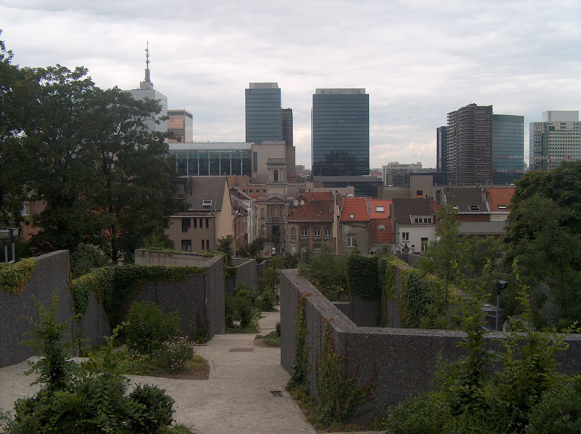
Reine-Verte Park is a small but surprisingly scenic pocket park in the municipality of Schaerbeek (Schaarbeek) in Brussels, tucked inside a city block between Rue Verte and Rue des Palais. Covering a little over 5,000 m², it ranks among the more compact green spaces in the Brussels-Capital Region, yet it stands out thanks to its terraced layout, which visually expands the space and offers an unexpected perspective on the dense urban surroundings. Where does the name come from and what's the history? The park was created on the grounds of the former gardens belonging to the old RTT palace on Rue des Palais and opened to the public in June 2007. Its design is the work of landscape architect Erik Dhont, working alongside Philippe Serck, who transformed a neglected, formerly monastic garden into a multifunctional green space linking two streets through the middle of a built-up block. The project formed part of the broader Brabant-Vert neighbourhood revitalisation programme, aimed at bringing more greenery into the densely built, historically industrial areas of Schaerbeek. What is there to see and do? Despite its modest size, the park packs in a fair amount for such an intimate setting. Its pronounced elevation change — the park unfolds across a series of terraces — creates a striking sense of depth and, from the upper level, delivers a view many visitors describe as unexpectedly rewarding for such an unassuming spot: a panorama stretching all the way to the Atomium and the church tower of Laeken. That kind of long-distance sightline is rare in this part of the city, where dense building typically limits views to the nearest street. The park also features a water element, adding a sensory and acoustic layer that helps mute the surrounding urban noise. For younger visitors there is a sandbox and a climbing structure, while older children can make use of a multipurpose field suited to various group games. Since January 2010, a small refreshment pavilion called Cannelle has operated on site, giving visitors a place to pause for a coffee or a snack mid-walk. How to get there, and who is it for? Two entrances lead into the park: one at 126 Rue Verte, the other at 42 Rue des Palais — meaning it can double as a shortcut between the two streets, a practical detail many Schaerbeek residents use as part of their daily route rather than as a destination in itself. That gives Reine-Verte Park a dual role: a place to relax and a quiet pedestrian passage through the interior of the block. Reine-Verte Park works best for visitors seeking a low-key, off-the-beaten-path corner of Brussels — families with children who appreciate a playground in an enclosed, safe setting, local residents looking for a brief escape from city noise, and fans of unusual viewpoints that don't require climbing a tower or a hill yet still deliver a panorama of distant city landmarks. Frequently asked questions Is entry to the park free? Yes, like most public parks in Brussels, Reine-Verte is open to everyone and free of charge. Is it suitable for children? Yes, the park has a sandbox, a climbing structure, and a multipurpose field for older kids. Can you get food or drinks there? Yes, the Cannelle refreshment pavilion operates on site. Is the park large? No — it's a small, intimate space of just over 5,000 m², though its terraced design makes it feel more spacious than it actually is.
-
Abbé Froidure Regional Park
Forest - Vorst
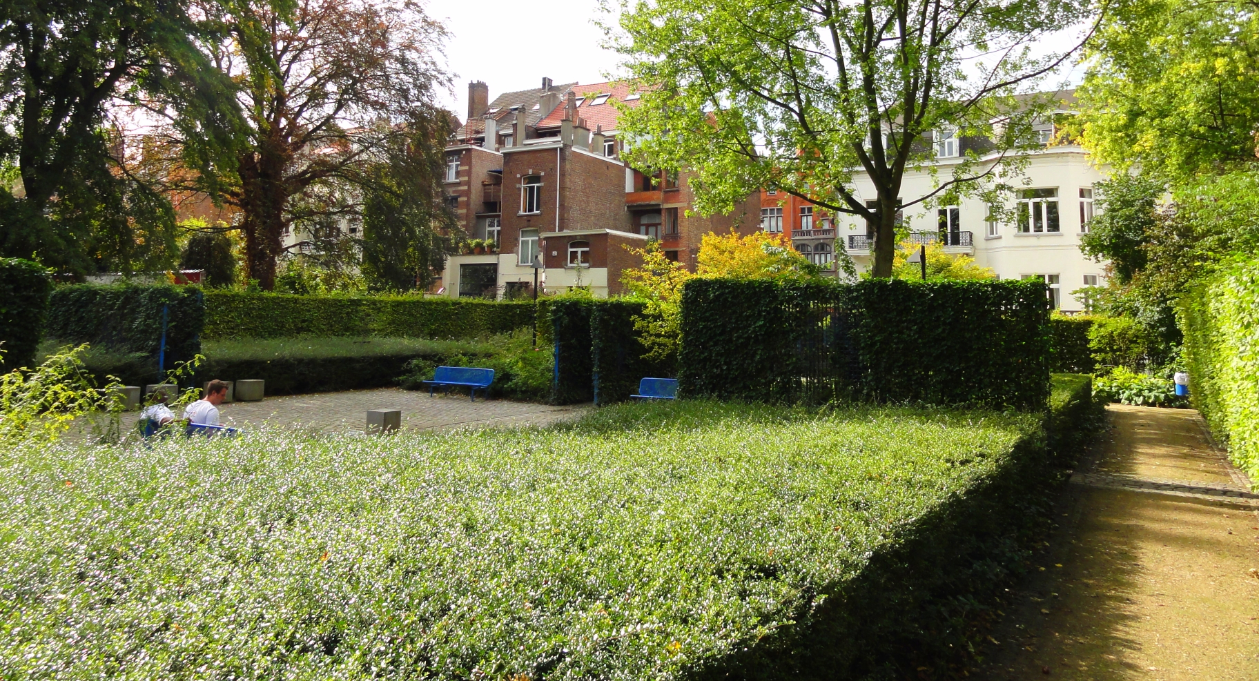
Abbé Froidure Regional Park is a small, intimate public garden straddling the boundary of two municipalities in the Brussels-Capital Region — Forest and Ixelles. It occupies an entire elongated city block enclosed by Avenue Brugmann, Avenue Haut-Pont, and Rue Darwin and Rue Franz Merjay, giving it a narrow, rectangular footprint with two entrances on opposite ends. Where does the park's name come from? The land now occupied by the park once belonged to Baron Raoul Richard, whose estate included a grand mansion and a garden stretching all the way to Rue Franz Merjay. In 1986 the Brussels-Capital Region purchased the property, and the park opened to the public in 1991. It was named after Abbé Édouard Froidure, founder of the well-known Belgian charity Petits Riens, in recognition of the close friendship between him and the baron's son — a personal connection that shaped the choice of name for the newly created green space. What does the park look like, and what makes it distinctive? The garden's design reflects a contemporary approach to landscape art: geometric shapes, crisp lines, and a disciplined layout of paths contrast with the mature trees preserved from before the site's transformation. A central walkway lined with flowering shrubs and neatly trimmed hedges forms the backbone of the composition, giving the whole space the feel of a formal, curated garden rather than a wild patch of greenery. A particular natural highlight is the presence of three trees officially listed among Brussels' remarkable trees: a horse chestnut, a sycamore maple, and a silver maple. Their age and size indicate that mature greenery existed on this plot well before the regional park was formally established — landscape architects deliberately preserved them within the new design instead of clearing the site for a uniform layout. Where are the park's entrances? The park has two main entrances on opposite sides of the block. The western entrance opens onto Avenue Brugmann, within the municipality of Forest. The eastern entrance leads onto Rue Franz Merjay and Place Léon Jacquet, on the Ixelles side. This layout allows the park to double as a pedestrian shortcut between two busy streets while still offering a quiet break from urban bustle. Who is this park best suited for? Given its modest size and intimate character, Abbé Froidure Park is better suited to a short stroll, a bench break, or a green shortcut between neighborhoods than to a full day out. It is mainly appreciated by residents of the surrounding streets looking for a nearby patch of nature, away from the heavier tourist traffic typical of Brussels' larger, more central parks. Frequently asked questions Is the park open to everyone? Yes, as a regional park it is freely accessible to all visitors year-round. Where does the park's name come from? From Abbé Édouard Froidure, founder of the charity Petits Riens, honored due to his friendship with the family that previously owned the property. What is worth seeing in the park besides greenery? Three trees recognized as remarkable trees of Brussels — a horse chestnut, a sycamore maple, and a silver maple — along with the geometric layout of paths and hedges typical of contemporary garden design. How do you reach the park? Through the western entrance from Avenue Brugmann (Forest) or the eastern entrance from Rue Franz Merjay and Place Léon Jacquet (Ixelles).
-
Parc de la Tourelle
Verviers
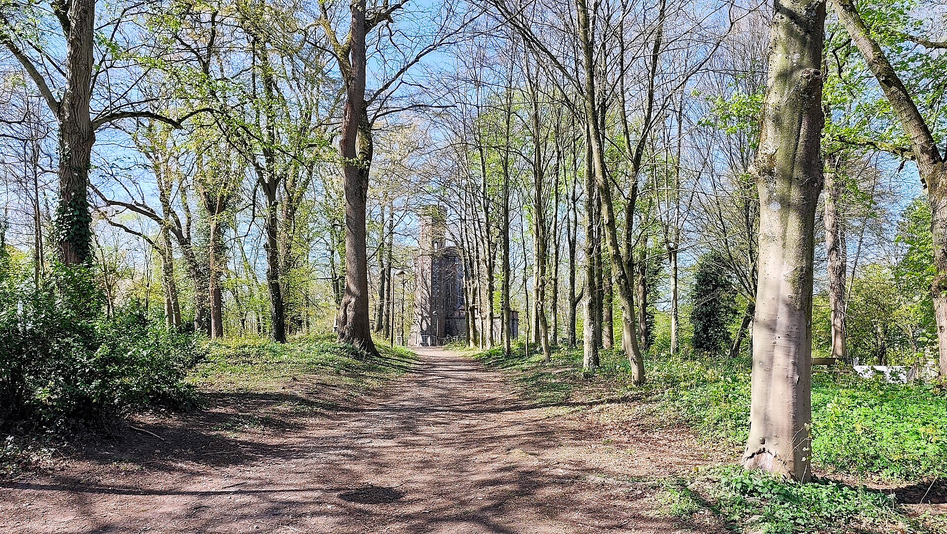
Parc de la Tourelle is a compact but characterful public park in Verviers, tucked into the Heusy district between Rue du Parc and Rue Herla. Covering roughly 1.6 hectares, it blends a green space for everyday relaxation with the remnants of a 19th-century private estate. Locals use it for walks and their children for play, while a piece of the town's history quietly stands at its edge. Where does the park's name come from? The name refers to a small tower (French: tourelle) built in 1851. It was commissioned by Jacques-François Hanlet de Seroule, the first mayor of Heusy, on his own extensive property, with the design credited to architect Charles Thirion. The tower became the defining landmark of the estate, and over time the surrounding grounds were transformed into the public park that exists today. What is there to see in the park now? Modern-day Parc de la Tourelle is primarily a recreational space: open lawns, walking paths, play areas, and shaded spots to sit beneath mature trees. The general layout still echoes the original 19th-century estate design, even though the site's purpose has shifted entirely — from a private residence to a shared green space serving the surrounding neighborhood. What is happening with the historic tower? In recent years, the tower has become the subject of local debate. A private real-estate company took on its restoration, while also proposing to add an annex intended for food-service and cultural use — a project that would nearly double the building's usable surface. Some residents and local groups support renovating the tower itself but oppose the planned extension, arguing that it would require cutting down trees and removing parking spaces currently used by park visitors. How to get there and what to know before visiting? The park sits at Rue du Parc 29 in Verviers, right next to the Centre Hospitalier Peltzer-La Tourelle, which is why the site is sometimes associated with the hospital itself. Being located in Heusy makes it easy to reach both for residents of that part of town and for anyone visiting the nearby hospital. Given its modest size, a visit doesn't take long, but the park works well as a short stop for a break while exploring Verviers and its surroundings. Frequently asked questions Is the park fenced or does it require a ticket? No — it is an open, freely accessible public space that can be visited at any time of day without charge. Is there a playground for children? Yes, the park includes a play area designed for younger visitors. Can visitors go inside the tower? The tower is currently undergoing restoration by a private developer, so access to its interior may be limited or temporarily unavailable. How long does it take to see the whole park? Given its compact size (about 1.6 hectares), a full walk through the park typically takes between 20 and 40 minutes. Are there other attractions nearby in Verviers? Yes, the park borders the Peltzer-La Tourelle hospital site, and the historic center of Verviers is within easy reach, making it simple to combine a visit here with further sightseeing in the city.
-
Square des Griottiers - Morelleboomsquare
Schaerbeek - Schaarbeek
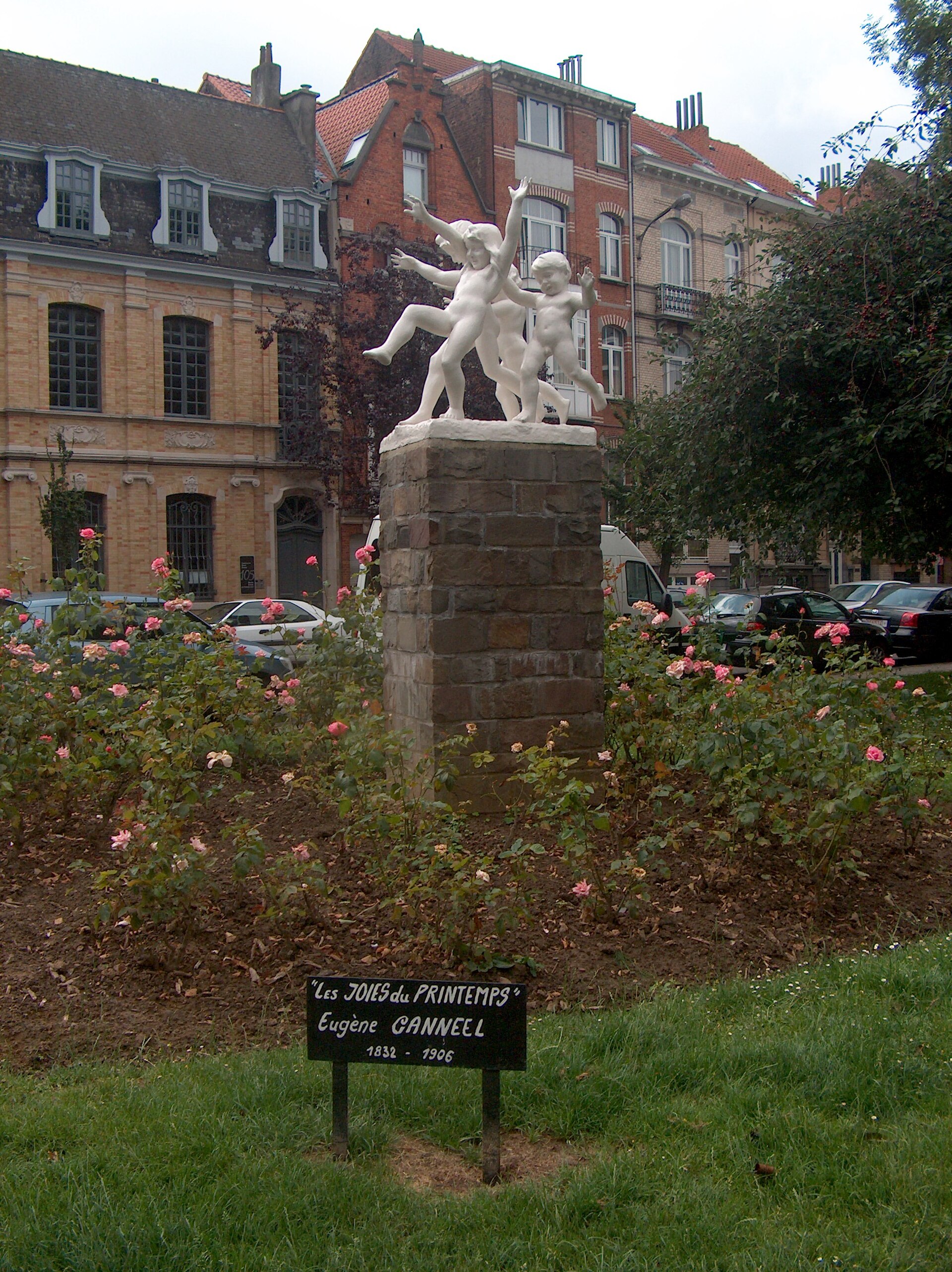
Square des Griottiers – Morelleboomsquare is a small, triangular public square in the Brussels municipality of Schaerbeek, formed at the meeting point of three avenues: Avenue Émile Max, Avenue Milcamps, and Avenue Félix Marchal. It's easy to walk past without noticing, yet it holds a surprising amount of local history and symbolism. Where does the name come from? The name refers to sour cherry trees – griottiers in French, morellebomen in Dutch. The sour cherry (griotte) is one of two unofficial symbols of Schaerbeek, alongside the donkey. That odd pairing has a concrete historical explanation: in the past, residents of Schaerbeek transported their cherry harvests to Brussels markets on donkeys' backs. Fruit trading was significant enough to the local economy that both the cherry and the donkey became lasting emblems of the municipality, and the square's name is one of their modern traces. When was the square created? Square des Griottiers – Morelleboomsquare was officially inaugurated on 22 November 1992. The date wasn't chosen at random – the ceremony coincided with the annual chapter of the Brotherhood of the Order of the Sour Cherry (Confrérie de l'Ordre de la Griotte), a local organization dedicated to keeping the fruit's tradition alive. Cherry trees were planted on the square specifically to honor that tradition – originally five of them. Only three remain today, a reminder that maintaining this kind of urban greenery over decades isn't always straightforward, even if the core layout is still clearly recognizable. What else is there to see? At the center of the square stands a sculpture by Eugène Canneel, titled "The Joys of Spring" ("Les Joies du printemps"). It's a modest but distinctive piece that gives the square more of an artistic identity than a purely functional one – a pattern common across Brussels, where small pockets of urban greenery are paired with public sculpture to create a resting spot with its own character. Who is this place for? Square des Griottiers isn't a tourist attraction in the conventional sense – it's more of a stopping point for people exploring Schaerbeek on foot or looking for a quiet moment between the avenues of this part of the city. Thanks to its triangular shape and position at the junction of three streets, the square also works as a small local landmark, easy to recognize by its cherry trees and the sculpture at its center. For anyone interested in the history and traditions of Brussels' neighborhoods, it's a good example of how a tiny piece of urban space can carry a layer of meaning tied to the trade and customs of the people who once lived there. Frequently asked questions How do you get to Square des Griottiers? The square sits at the intersection of Avenue Émile Max, Avenue Milcamps, and Avenue Félix Marchal in Schaerbeek, within easy walking distance of the municipality's main streets. Why is it called "des Griottiers"? The name comes from the sour cherry trees (griottiers) planted there – the griotte cherry is one of Schaerbeek's symbols, together with the donkey once used to carry the harvest to market. What does the sculpture on the square depict? It's a work by Eugène Canneel titled "The Joys of Spring." How many cherry trees remain on the square today? Of the original five, three still stand.
-
Scherdemael Park
Anderlecht
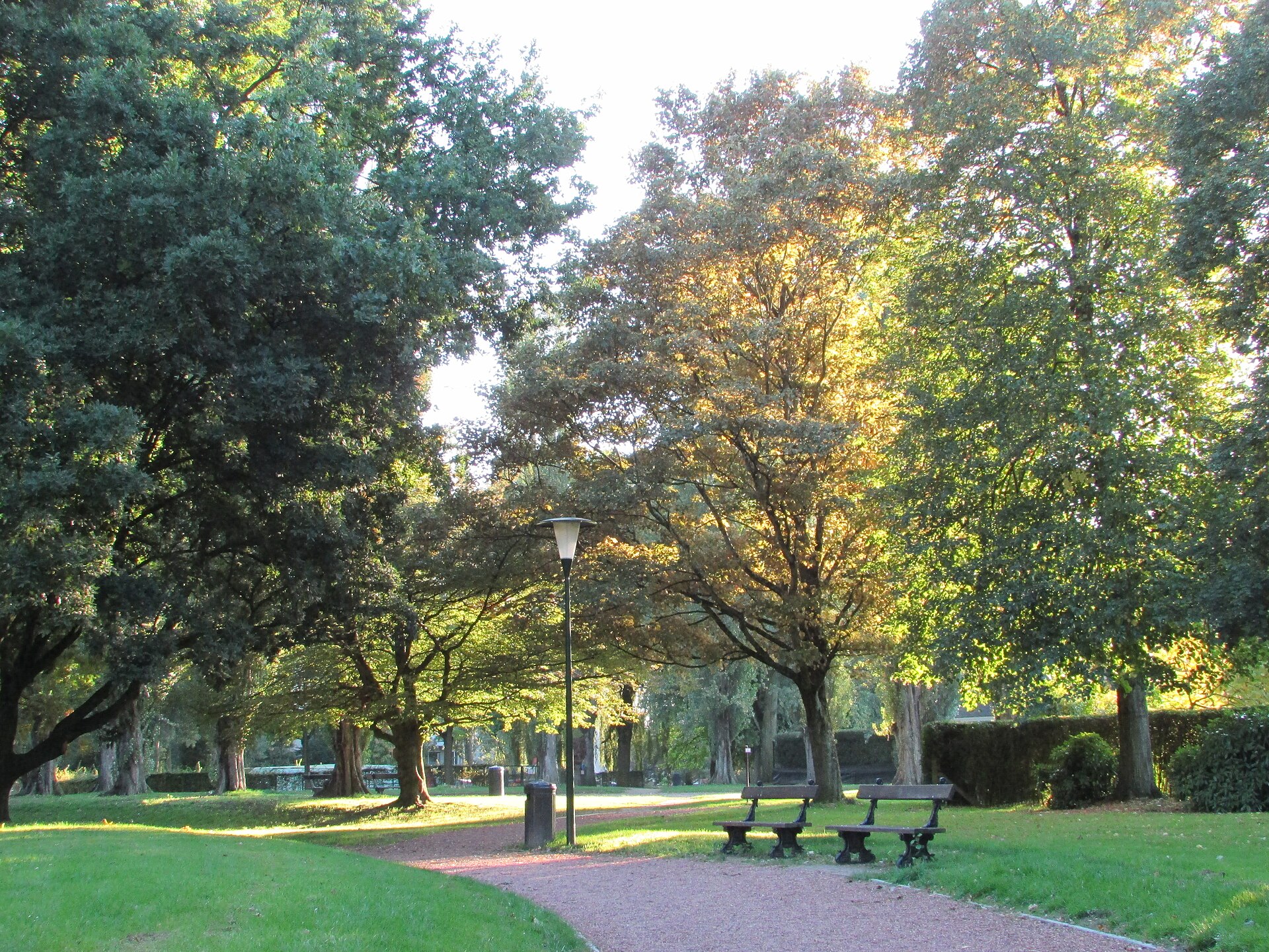
Scherdemael Park is a nearly eight-hectare green space in Anderlecht, one of Brussels' municipalities, spread across the Scherdemael plateau between Boulevard Joseph Bracops and the avenues Libre Académie, Camille Vaneukem and Capitaine Fossoul. It ranks among the larger neighbourhood parks on the western side of the city and is a popular everyday recreation spot for local residents. Where does the name come from and how did the park take shape? The land that is now the park spent centuries as vegetable farmland — Scherdemael was an area of intensive market gardening supplying Brussels. Change began in the early 1930s, when Anderlecht's municipal council decided to turn the plateau into a new residential district. The real turning point, however, came after the Second World War: in 1945 Régie Foncière, the municipal property company, bought up all the plots in the area and drew up a fresh development plan. What is the "park system" concept visible here? The 1945 plan followed the idea known as the "park system" — an urban model combining housing with extensive green areas. Rather than planning blocks, villas and infrastructure separately, the whole district was designed as a single coherent unit: apartment buildings, single-family villas, service facilities, a shopping centre, a church and a primary school were arranged around and within a green space equipped with recreational grounds, sports fields and parking areas. Scherdemael Park is precisely that central, connecting green element of this post-war urban planning concept. When was the park officially opened? The park officially opened on 19 July 1964, years after the 1945 development plan began to be implemented. From that point it became the main public space of a district built on former farmland. What can visitors see in the park today? The park stretches between Avenue d'Itterbeek and Rue de Neerpede and covers close to eight hectares of greenery. The Brussels-Capital Region's natural heritage inventory lists as many as 53 remarkable trees within its boundaries — a notable number for a park of this size, pointing to a mature tree stock that has had decades to grow since the site opened in the 1960s. The park's layout, designed in a post-war modernist spirit, combines recreational and sporting functions: alongside walking paths and lawns there are also areas set aside for physical activity, in keeping with the original "park system" idea of a space serving the whole surrounding community. Frequently asked questions Where exactly is Scherdemael Park located? In Anderlecht, one of Brussels' 19 municipalities, on the Scherdemael plateau between Boulevard Joseph Bracops and the avenues Libre Académie, Camille Vaneukem and Capitaine Fossoul, near Avenue d'Itterbeek and Rue de Neerpede. How large is the park? It covers close to eight hectares. When did the park open? Officially on 19 July 1964. What was on this land before? Farmland — Scherdemael was a market-gardening area supplying Brussels before the municipality decided, between 1930 and 1945, to turn it into a residential district built around a central park. Does the park have any notable trees? Yes, the regional natural heritage register lists 53 trees in the park as remarkable specimens.
-
Parc d’Enghien
Enghien
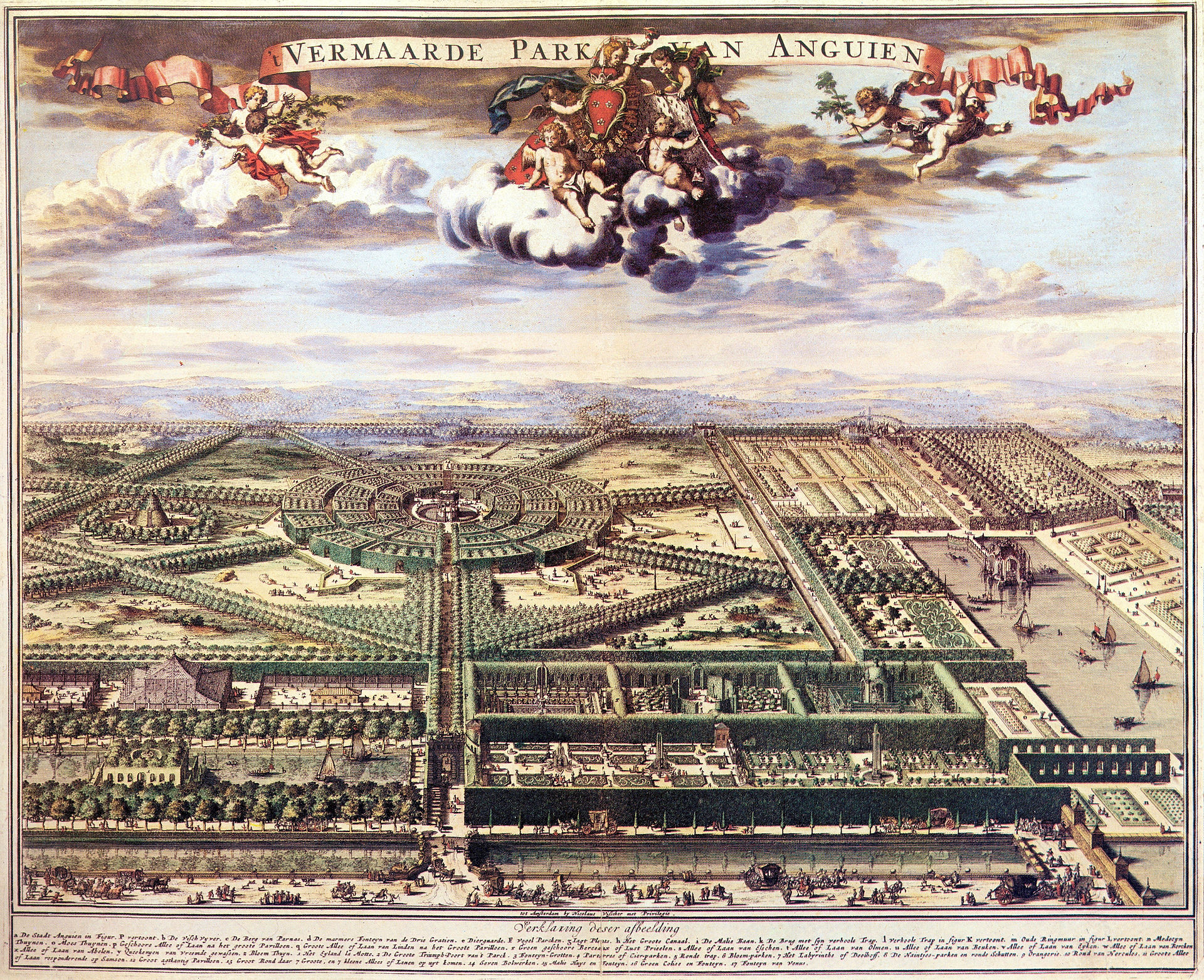
Parc d'Enghien is one of the oldest and most notable landscape parks in Belgium, covering roughly 182 hectares in the town of Enghien (Edingen in Dutch), in Wallonia near the border with Flanders. Its history stretches back to the 17th century and is closely tied to two aristocratic families who shaped its present appearance over the following centuries. Who founded the park? The park was laid out between 1630 and 1665 on the initiative of the House of Arenberg. Already in the 17th century it was regarded as one of the finest gardens on the European continent, admired for the scale of its design and the way its layout stood apart from other aristocratic estates of the period. The Arenberg family retained ownership of the land until the 20th century, gradually reshaping and expanding the original garden as tastes and fashions changed. What role did the Empain family play? At the start of the 20th century the estate passed to François Empain, brother of the well-known Belgian industrialist Baron Édouard Louis Joseph Empain. The purchase came with a condition: a new residence had to be built on the grounds. That obligation was fulfilled in 1913 with the construction of a distinctive Louis XV-style château, designed by architect Alexandre Marcel. Under the Empain family, the park was also enriched with numerous statues and decorative features, many of which have survived to the present day. Where do the Egyptian sphinxes come from? Among the park's most recognisable features are the stone sphinxes standing on the lawns in front of the château. They are no random addition — they refer directly to the Empain brothers' Egyptian venture. Édouard and François Empain, together with architect Alexandre Marcel, were involved in building Heliopolis, a modern garden city constructed from scratch in Egypt in the early 20th century. The sphinxes at Enghien are, in effect, a physical trace of that architectural and colonial expansion carried across continents and set into a Belgian park landscape. What is the park like today? In 1986, the town of Enghien purchased the entire former family estate and opened it to the public. Since then, Parc d'Enghien has functioned as a public green space that combines the role of a historic monument with that of a recreational area for local residents and visitors alike. Its extensive avenues, historic garden compositions, and surviving architectural and sculptural elements allow visitors to trace more than three and a half centuries of the estate's evolution — from its Baroque origins, through the modernisation under the Empain family, to its current public function. Frequently asked questions How large is Parc d'Enghien? The park covers approximately 182 hectares, making it one of the larger historic park estates in Belgium. Who built the château in the park? The Louis XV-style château was built in 1913 for François Empain, designed by architect Alexandre Marcel. Is the park open to visitors today? Yes — since 1986, when it became the property of the town of Enghien, the park has been an accessible public space. Why are there Egyptian sphinxes in the park? The sphinxes reference the Empain family's involvement in building the city of Heliopolis in Egypt in the early 20th century.
-
Zonder Naampark
Gandawa
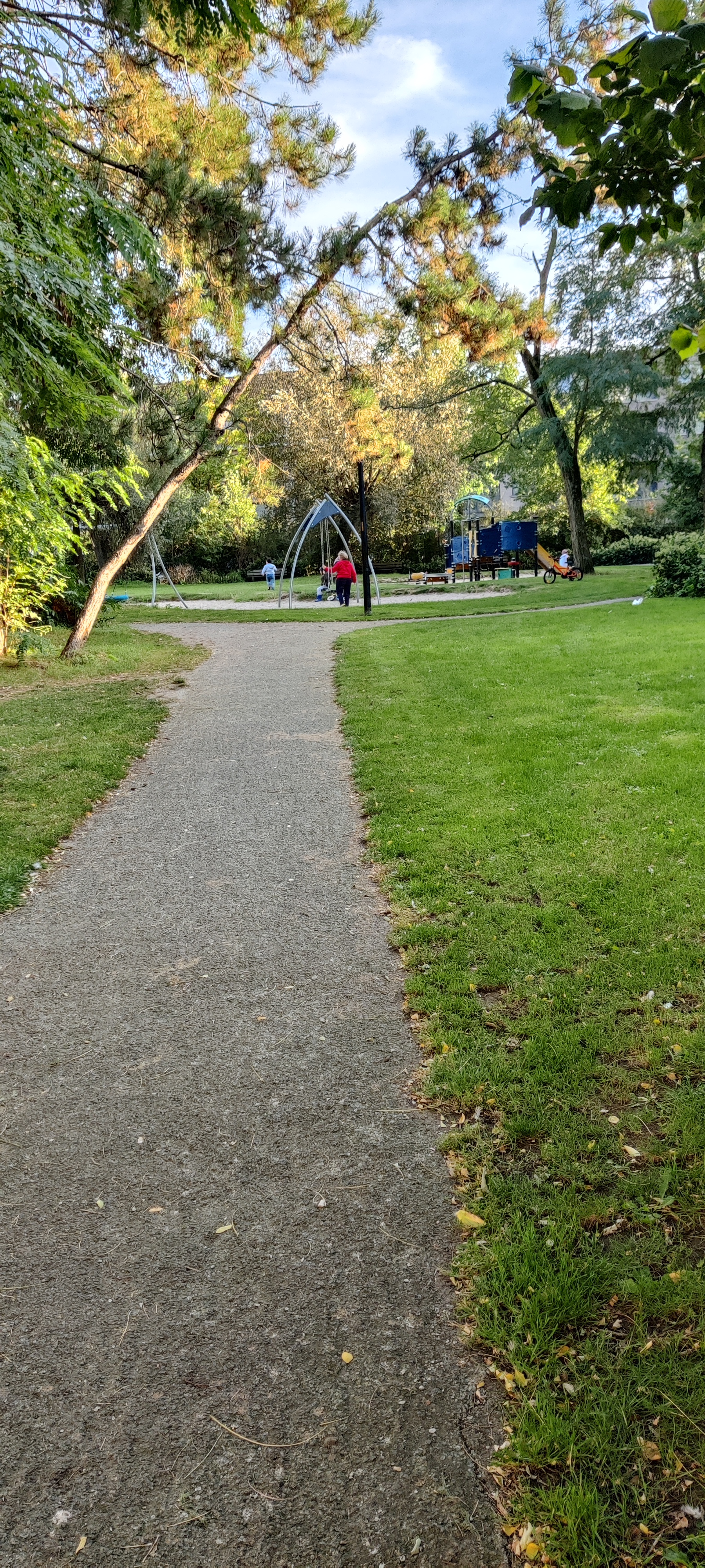
Zonder Naampark is a small neighborhood park in Ghent, tucked into the densely built residential fabric of the Sluizeken-Tolhuis-Ham district, right next to Zonder-Naamstraat, the street that gave it its name. This is not a grand botanical garden or a historic promenade — it's a compact pocket of green (roughly 0.6 hectares) built for the people living in the surrounding blocks, and it plays an outsized role as breathing space in one of the city's more urbanized corners. What can you actually do here? The park underwent a thorough renovation, with a festive reopening held on April 5, 2014. The redesign came out of a genuine consultation process — children from the neighborhood contributed ideas for how the space should look and function, and that input shows in the final layout. The park is organized into several distinct zones: a playground with a sandbox, a "wild hill" for climbing and active play, a football pitch, and an outdoor fitness area equipped with exercise equipment. That combination makes Zonder Naampark a magnet mainly for families with young children and for locals looking for a quick workout without leaving the neighborhood. Where does the unusual name come from? The name, which literally translates to "park without a name," ties back to the local history of Zonder-Naamstraat and an organization historically associated with this part of Ghent. It's one of those quirky bits of local toponymy that give a place character — the park, the street, and a nearby parking area all share the same unusual name. Right next to the park stands an electrical substation, which has unexpectedly become part of the site's artistic identity. Is there anything visually interesting beyond the greenery? Yes — the park blends recreation with street art. On the exterior wall of the sports shed along Zondernaamstraat, archival photographs are displayed showing the street as it looked in earlier decades, giving residents and passersby a glimpse of how the neighborhood has evolved. On the wall of the high-voltage substation, a piece of street art was created with the explicit intent of capturing the power and beauty of energy — an unusual pairing of technical infrastructure and public art that you don't often find at this small a scale. The park also includes a small stage and a long bench, suggesting the space occasionally hosts informal neighborhood gatherings or simply serves as a spot to sit and rest in the shade. The abundance of flowering plants creates a sharp, welcome contrast against the dense surrounding architecture — a genuine green pocket in the middle of urban concrete. Frequently asked questions Is Zonder Naampark suitable for children? Yes, children are one of the park's main intended audiences — the sandbox playground and the active-play hill were designed specifically for younger visitors, and neighborhood kids were directly consulted during the redesign. Can you exercise in the park? Yes, there's an outdoor fitness zone with exercise equipment, plus a football pitch for anyone wanting a more intense workout. Why does the park have such an unusual name? It comes from the adjacent Zonder-Naamstraat and a local organization historically tied to this part of Ghent — the park, the street, and a nearby parking area all carry the same name. Is this park worth visiting as a tourist? Zonder Naampark is primarily a space for residents of the Sluizeken-Tolhuis-Ham district, but visitors interested in street art and authentic, off-the-beaten-path neighborhood life in Ghent may find it a worthwhile, low-key stop.
-
Seny Park
Auderghem - Oudergem
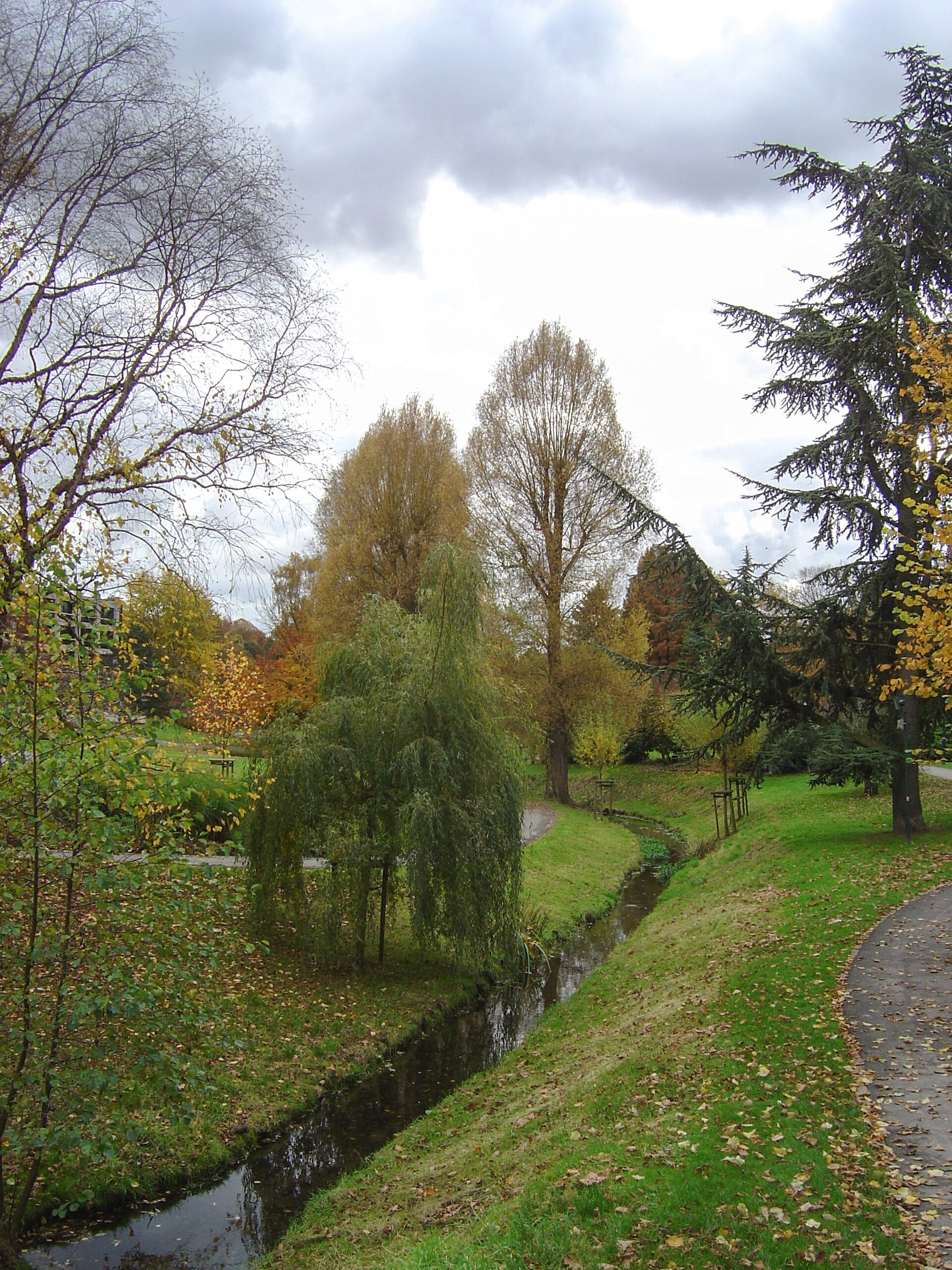
Seny Park is a landscape-style promenade park stretching along Boulevard du Souverain, on the border between the municipalities of Auderghem and Watermael-Boitsfort in Brussels. Inaugurated in 1963, it takes its name from Albert Seny, an industrialist who was one of the site's last private owners in the 19th century. Where does the park's name come from? The story of this site goes back much further than the park's opening date. Near its entrance, along the Woluwe river, once stood a water mill called Nedermolen ("lower mill"), whose origins date back to the 13th century. In 1836 the mill and its surrounding land were bought by Albert Seny, who first used it for paper manufacturing and later converted it into a cotton dye works. The park was later named after him, even though none of the original industrial buildings survive today. What does the park look like today? Seny Park is a green corridor crossed by the Woluwe river, framed by footpaths, wide lawns and small wooded areas. It stands out for its rich variety of conifers and deciduous trees, including specimens considered remarkable for the Brussels Region — among them black pines, hairy-cup oak, Hungarian oak, Jacquemont birch, white willow and several poplar species. The idea of creating a park here dates back to the 1950s, a period of intense green-space development in Brussels, with the approaching Expo 58 world's fair giving the project extra momentum. The original concept envisioned a kind of arboretum bringing together trees, shrubs and plants chosen partly for their distinctive scents. What can visitors do in Seny Park? The park's wide lawns invite ball games and relaxation outdoors. For children, there is a playground with swings, two combination play structures, single and double spring-mounted toys, and a sandbox. The park was also designed with visually impaired visitors in mind: plants are arranged and labeled by scent, while paths feature textured paving and handrails to aid orientation. The grounds are also suitable for cycling. Why does Seny Park matter ecologically? Seny Park is one of the sites included in the Natura 2000 special conservation area that, within Brussels, encompasses the Sonian Forest, its edges, neighbouring wooded areas and the Woluwe valley. This designation highlights the park's ecological role as part of a broader, connected green corridor linking several protected areas across the Belgian capital. Frequently asked questions Where exactly is Seny Park located? The park lies on the border between the municipalities of Auderghem and Watermael-Boitsfort in the Brussels-Capital Region, along Boulevard du Souverain, near Rue Charles Lemaire. Where does the park's name come from? From Albert Seny, an industrialist who in 1836 bought a water mill on the site along with its surrounding land, using it first for paper production and later as a cotton dye works. Is there a playground in the park? Yes, the park has a playground with swings, climbing structures, spring-mounted toys and a sandbox, suitable for children. Is the park accessible to people with disabilities? Yes, the park includes features for visually impaired visitors, such as plants classified by scent and textured paving with handrails along the paths.
-
Bergoje Park
Auderghem - Oudergem
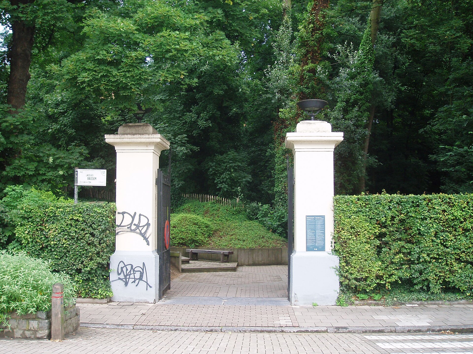
Bergoje Park is a small but striking green enclave in the Auderghem (Oudergem) district of Brussels, tucked between Avenue Hermann-Debroux, Chaussée de Wavre and Rue Jacques Bassem. The main gate sits on Rue Jacques Bassem, between numbers 28 and 42, and the park is easily reached by bus line 72 (Jardin Massart stop). Here the surrounding city suddenly gives way to a steep, wooded slope dropping into a damp stream valley. Where does the park come from historically? The land now occupied by Bergoje Park once belonged to the vast Sonian Forest. It was cut off in 1729, when the road linking Brussels to Wavre was built, and this made the Bergoje area one of the first inhabited corners of Auderghem. Maps from around 1770 still show ponds and kitchen gardens on the site, but as the surroundings urbanized, the ponds were gradually filled in and the streams in the lower, built-up sections were culverted underground. A mansion known as Villa de la Bruyère once stood at the top of the hill; it was demolished in 1986. The park in its current form dates from 1994, created by Bruxelles Environnement with the explicit aim of preserving the site's natural character. What can visitors see in the park? The defining feature of Bergoje is the contrast between the steep, wooded slope and the marshy valley floor below, through which the Roodkloosterbeek stream flows in the open air. Along the ridge stands a striking row of century-old sweet chestnut trees, listed by the Monuments and Sites Commission, alongside pedunculate oaks, beeches, and a distinctive mix of woodrush and beech typical of this spot. The forest floor is carpeted in ivy, with wood anemones and lily-of-the-valley emerging in spring. Stairs lead from the upper section of the park down toward the wet meadows, where an observation platform overlooks the marshland, letting visitors watch wildlife without stepping onto the sensitive wetland itself. Benches, waste bins and lighting are provided in the lower parts of the park. What wildlife lives in Bergoje Park? The mix of habitats, from the dry hillside to the damp stream valley, supports a surprisingly rich range of species. Sparrowhawks, several duck species, herons and kingfishers can all be spotted here, while bats hunt over the stream at dusk. Frogs live in the wetter corners, and the trees and undergrowth are filled with the song of numerous songbirds. The observation platform was built specifically to let visitors take in this diversity from a respectful distance. What protected status does the park hold? Because of its ecological value, Bergoje has been designated a Natura 2000 special conservation area, and the site itself carries protected heritage status. The park is open daily, though opening hours shift with the seasons, generally running from around 7am to 10pm. Dogs are welcome but must be kept on a leash at all times, a rule meant to protect the fragile habitats and the wildlife that nests there. Frequently asked questions Is entry to Bergoje Park free? Yes, the park is open to the public free of charge and is managed by Bruxelles Environnement. Can I walk my dog in the park? Yes, but dogs must be kept on a leash at all times due to the protected fauna and the site's Natura 2000 status. How do I get to Bergoje Park? The easiest way is bus line 72 to the Jardin Massart stop; the main entrance is on Rue Jacques Bassem. What is the park's main natural highlight? The row of century-old chestnut trees along the ridge and the observation platform over the marshy valley, from which visitors can watch birds and other wildlife.
-
Leopold Park
Bruksela
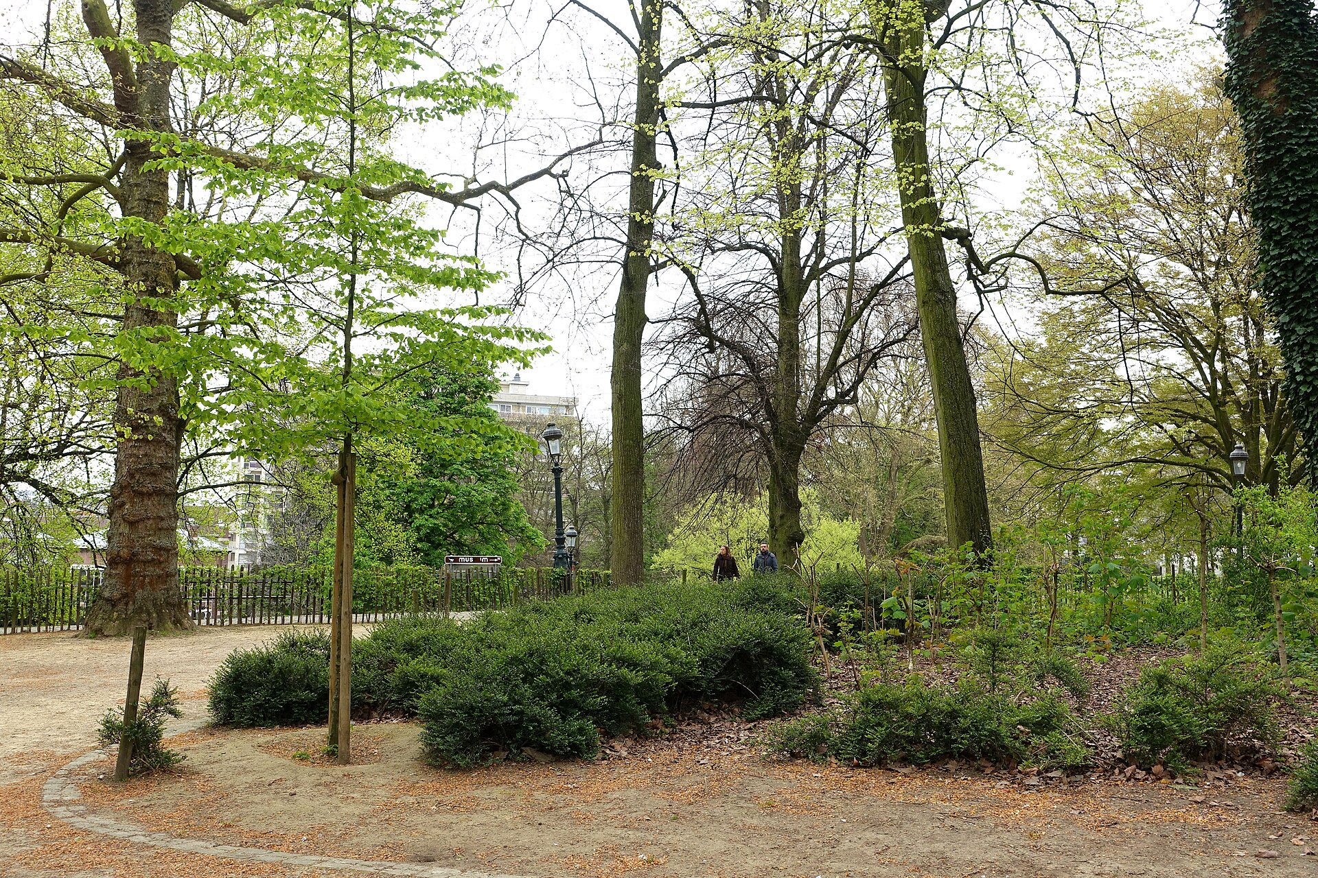
Leopold Park is a 6.43-hectare urban public park located in the Leopold Quarter of Brussels, Belgium. It sits directly adjacent to the Museum of Natural Sciences and to the Paul-Henri Spaak building, the seat of the European Parliament. Where exactly is the park located? The park lies at the heart of the European Quarter in Brussels, at coordinates 50.83833 N, 4.37944 E. This position places it right next to some of the key institutions of the European Union — the Paul-Henri Spaak building, where the European Parliament holds its sessions, stands immediately beside the park grounds. This proximity means Leopold Park functions as a green space embedded within the administrative core of the EU. What sits next to Leopold Park? The park's immediate neighbor is the Museum of Natural Sciences, one of Brussels' scientific institutions. On the other side, it borders the Paul-Henri Spaak building, one of the main structures of the European Parliament. This combination of scientific and political neighbors is characteristic of the wider Leopold Quarter, which has developed over decades as an area blending institutional functions with public urban space. How large is the park? Leopold Park covers 6.43 hectares. That is a scale typical of an urban park operating within the densely built, central part of a major European city — large enough to offer a genuine green space amid EU institutions, yet compact enough to be covered on a short walk. Who is this place for? Given its location in the European Quarter, the park is a natural resting point for people working in the nearby EU institutions, as well as for visitors exploring this part of Brussels while touring the European Parliament or the Museum of Natural Sciences. The proximity of both landmarks makes the park a convenient stop between visiting the natural history exhibits and observing the institutional life of the district. Frequently asked questions Where is Leopold Park located? In the Leopold Quarter of Brussels, directly next to the Museum of Natural Sciences and the Paul-Henri Spaak building, seat of the European Parliament. How big is the park? 6.43 hectares. What is located next to the park? The Museum of Natural Sciences and the European Parliament building (Paul-Henri Spaak building). What are the park's coordinates? 50.83833 N, 4.37944 E. Is the park connected to EU institutions? Yes — its location in the European Quarter and direct proximity to the seat of the European Parliament closely tie it to this part of Brussels, where EU institutions are concentrated.
-
Pierre Paulus Park
Saint-Gilles - Sint-Gillis
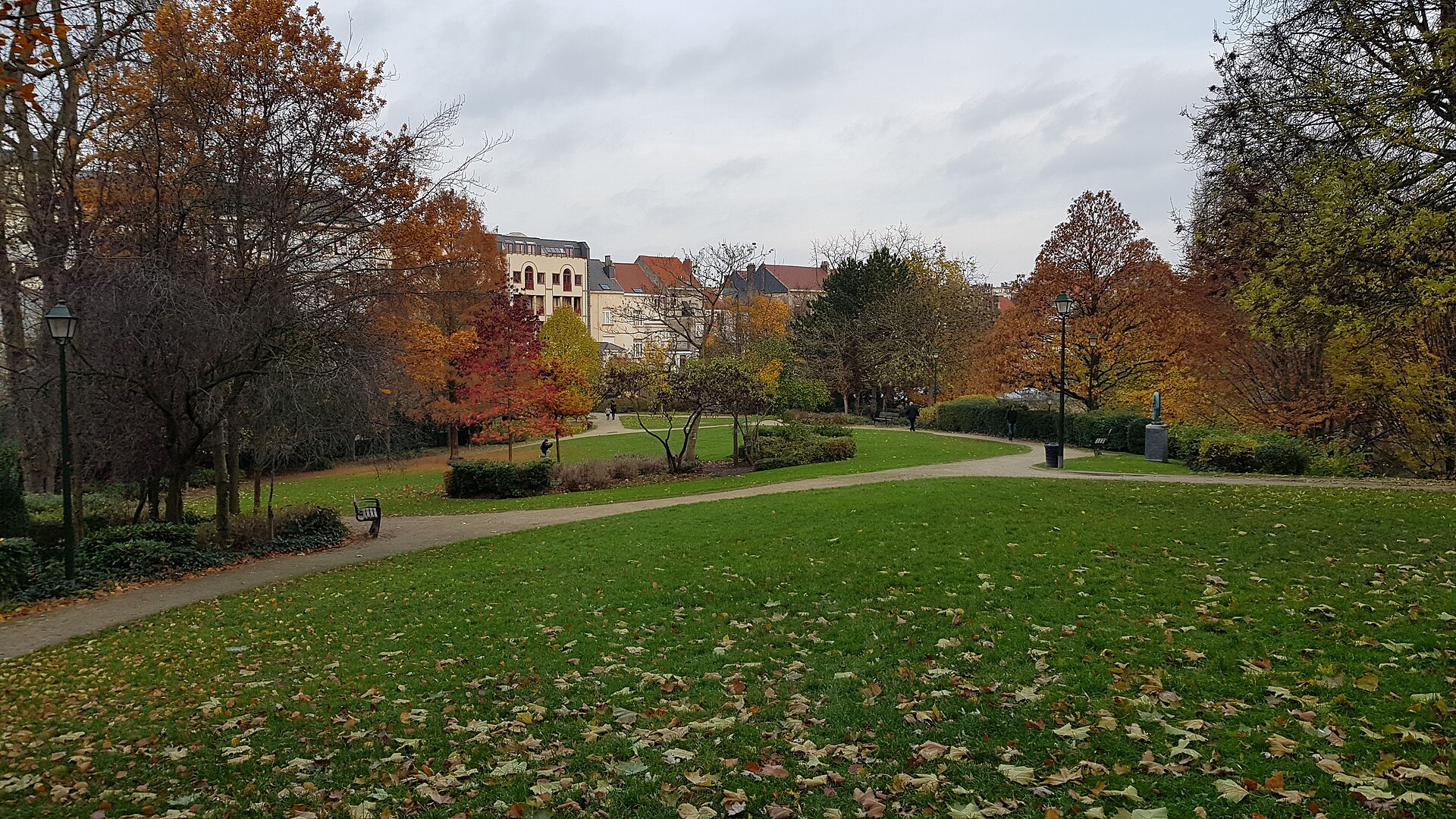
Pierre Paulus Park is a green pocket in the municipality of Saint-Gilles in Brussels, stretching between rue de Parme and rue de l'Hôtel des Monnaies. It rarely makes it onto standard tourist maps, overshadowed by Brussels' more famous parks, but for locals in this part of the city it's a genuine everyday retreat — intimate, quiet and densely planted. Where does the park's name come from? The park is named after Pierre Paulus de Châtelet (1881–1959), a Belgian painter, engraver and lithographer who lived in Saint-Gilles. Paulus was known for his expressionist depictions of the industrial landscape of his native Wallonia — mines, foundries, barges on the river Sambre, and the workers who powered them. Naming the park after him is a tribute to an artist closely tied to this neighbourhood. How did the park take its current shape? The site's history is more layered than it first appears. The park was formed from the merger of former private gardens that once belonged to a residence known as the Maison Pelgrims. Its eastern, older section retains the character of an English landscape garden — this was the original garden of the Pelgrims house, with the loose, naturalistic planting typical of that style. The western section has an entirely different origin. It occupies land that once belonged to a religious establishment, the Cénacle, and took its current form following metro construction works in 1973. It was at that point that the two parts — the older residential garden and the newer land shaped by infrastructure works — were joined into a single, cohesive municipal park. Given its historical and landscape value, the park was officially classified as a protected site on 17 April 1997. What can visitors see in the park? The park is often described as a miniature reproduction of a Romantic English-style park, and the description fits: fountains, a pond, a water basin and natural springs combine to create a picturesque, intimate landscape tucked into a densely built district. The park also serves a recreational role for the local community — it includes a boulodrome, a dedicated area for pétanque, a game popular across Belgium and France as a social pastime. It's a spot where Saint-Gilles residents gather throughout the year, whatever the season. Why is it worth a visit? Pierre Paulus Park is a good example of how urban green space can hold several layers of history at once — from a private residential garden, through land once owned by a religious order, to the imprint left by modern metro infrastructure. For visitors exploring Brussels beyond the usual tourist routes, it offers a glimpse of everyday life in one of the capital's more mixed and lively municipalities. Its calm atmosphere, romantic layout and local character make it a pleasant stop while exploring Saint-Gilles, a district also known for its Art Nouveau architecture and flea markets. Frequently asked questions Where exactly is the park located? Between rue de Parme and rue de l'Hôtel des Monnaies, in the municipality of Saint-Gilles, Brussels. Where does the park's name come from? From Pierre Paulus de Châtelet, a Belgian expressionist painter linked to Saint-Gilles, who lived from 1881 to 1959. Is the park a protected heritage site? Yes, it was classified as a protected site on 17 April 1997. What can be found inside the park? Fountains, a pond, natural springs, and a boulodrome for playing pétanque.
-

Park Haffmans
Bilzen
Park Haffmans is a municipal park in Bilzen, in the Belgian province of Limburg, laid out along the Demer river in the southeastern part of town. Designed in the English landscape style, it covers roughly 14.5 acres and ranks among the favourite green spaces for both locals and visitors exploring the Bilzen-Hoeselt region. Where does the park's name come from? The land now occupied by the park once served as the private garden of a notary's residence owned by the Haffmans family. That house, built in neo-rococo style, still stands and remains privately owned, separate from the publicly accessible park grounds. The Haffmans name is tied above all to Leon Haffmans, who served as mayor of Bilzen from 1947 to 1979. It was from his heirs that the town purchased the grounds, turning a once-private garden into a public recreational space. What can you find inside the park? Walking through Park Haffmans, visitors come across the Bilzermolen, a historic watermill standing right on the Demer. The mill is a reminder of how important the river once was to the local economy, its current having powered milling equipment for generations. The park is also known for its picturesque pond, a favourite stop along walking routes, where calm water contrasts with the surrounding greenery and mature trees typical of an English-style landscape garden. A distinctive feature of the park is its collection of life-size sculptures depicting figures tied to Bilzen's musical past. The town carries a legendary musical history, and these sculptures serve as a tribute to that heritage, blending the park's recreational role with a strong sense of local cultural identity. Where exactly is Park Haffmans located? The park sits at Beukenstraat 2-18, 3740 Bilzen. Its position along the Demer makes it a natural extension of the walking routes that run along the river, popular among residents of the wider Bilzen-Hoeselt area. Its proximity to the town centre makes the park easy to reach, whether for a short daily walk or a longer stretch of time spent outdoors. Who is this park for? Park Haffmans suits anyone looking for a quiet escape from town life — its network of paths and well-kept greenery make it ideal for walking, while the pond and historic mill give the grounds a character that many ordinary town parks lack. Families with children enjoy the space just as much as visitors curious about local history, for whom the musical-heritage sculptures offer an unexpected discovery along the way. Frequently asked questions Are there any historic structures in the park? Yes, the park contains the Bilzermolen, a historic watermill on the Demer river, alongside a surviving private house built in neo-rococo style that once belonged to the Haffmans family. Where does the park's name come from? The park is named after the Haffmans family, former owners of the land — most notably Leon Haffmans, long-serving mayor of Bilzen. Is there anything music-related in the park? Yes, the park features life-size sculptures representing figures connected to Bilzen's musical history, honouring the town's heritage in that field. How do you get to Park Haffmans? The park is located at Beukenstraat 2-18 in Bilzen, in the province of Limburg, in the southeastern part of town along the Demer river.
-
Park van Hoegaarden
Hoegaarden
Park van Hoegaarden is a public park in the Belgian municipality of Hoegaarden, stretching along Houtmarkt right behind the former Kapittelhuis. It's a place where roots reaching back to the Middle Ages meet a 19th-century gardening tradition, resulting in a green retreat popular with both locals and travellers passing through the region. Where does the site's history begin? The story of the grounds now occupied by the park goes back to the year 980, when Countess Alpaïdis founded the local chapter here. In 1634 the Kapittelhuis was built, a building that still stands right beside the park today and gives the whole site its historical backdrop. The park itself, however, has a much younger origin — its first layout only appeared in 1882–1883. Who created the first park and what was it for? The first park design is credited to Jacques Clement Dumont. Although the grounds were simply referred to as "hof" at the time, this wasn't a working garden or vegetable plot but rather a pleasure ground — a place for strolling and leisure. Planting was carried out gradually, and around the turn of the 20th century exotic tree species were added to enhance the estate's prestige. How did ownership of the park change over time? The park's fate is closely tied to a single family's history. Dymphna Dumont, Clement's daughter, married Albert Charles Bail in 1911, bringing the estate into the Bail family's hands. Their son, Paul Bail, became the last private owner of the park under dramatic circumstances — he was found murdered in 1980. As a result, ownership of the land passed to the state, and a few years later the municipality of Hoegaarden purchased the site and opened it to the public. How did the park become a public space? A turning point came in 1991 with the opening of the Vlaamse Toontuinen, the Flemish Demonstration Gardens (later known as Tuinen van Hoegaarden) — a showcase project highlighting Flemish garden design. This setup lasted for nearly three decades, until 2018, when the municipality took over management and gave the site its current form as an open public park, freely accessible to all visitors. What can visitors see in the park today? Today's Park van Hoegaarden combines recreational value with historical character. Its proximity to the Kapittelhuis means a walk through the park doubles as a short lesson in local history — from the medieval chapter, through the 19th-century estate, to the present-day municipal park. Mature trees, including remnants of the earlier exotic plantings, give the grounds a distinctive character and welcome shade, especially valuable in summer. Frequently asked questions Is entry to the park free? Yes, as a public park run by the municipality of Hoegaarden it is open to everyone at no cost. Where exactly is the park located? Along Houtmarkt in Hoegaarden, directly behind the Kapittelhuis. Are there historic buildings within the park? The park borders the Kapittelhuis, built in 1634, though the building itself technically sits outside the green area. Since when has the park been open to the public? Since 1991, when the Vlaamse Toontuinen were established here, with the site gaining its fully municipal public-park character after the local government took over management in 2018. Is it worth combining a visit with other attractions in Hoegaarden? Yes, the park lies in the town's central area, close to other sites tied to local history and the region's brewing tradition.
-
Domain Breivelde
Grotenberge
Domain Breivelde is a landscaped park of nearly 14 hectares in Grotenberge, a district of the town of Zottegem in East Flanders, Belgium. It combines a small Renaissance Revival-style castle with a rich arboretum of more than 50 tree species, making it one of the more rewarding green spots in this part of the country. Where does the estate come from? The story of the grounds goes back to the 19th century, when landowner August De Rouck laid out a large garden here in the romantic style. In 1871 he built a mansion, which was later replaced by a new residence. The current Breivelde castle was erected in 1904 at the initiative of Philippe Plancqaert van Exen van Beauvechain and remains a good example of Renaissance Revival architecture. In 1970 the estate was purchased by the city of Zottegem, and in 1982 it received official protected heritage status. What can visitors find in the park? Domain Breivelde is laid out as an English landscape garden, designed to imitate a natural setting rather than the strict geometry of French-style gardens. Water plays a central role: the grounds hold ten ponds, a cascade and a fountain, all of which shape the park's character. Particularly notable is an artificial river bend created around 1852, whose surface mirrors the castle. The park is also a genuine arboretum, home to more than 50 tree species, including a number of exotic specimens brought in at a time when collecting rare plants was a mark of prestige among wealthy landowners. Mature trees, varied aquatic vegetation and freely winding paths make a walk through Domain Breivelde feel like a stroll through a natural forest, even though the entire layout was carefully designed. Is the park open to the public? Yes — since 1971, a year after the city took ownership, Domain Breivelde has been permanently and freely accessible to visitors. No ticket or guided tour is required, which makes it an easy destination for both a short walk and a longer break outdoors. Who is this place for? Domain Breivelde is best suited to anyone looking for a quiet, green retreat away from busier towns, with an interest in landscape architecture and garden history. It makes for a pleasant family walk, a good spot for nature photography, or simply a place to rest among the ponds and old trees. Its proximity to Zottegem makes it easy to combine with other regional sights. Frequently asked questions Is entry to the park free? Yes, Domain Breivelde has been freely accessible to visitors since 1971. Can visitors go inside the castle itself? The castle serves as the historic centerpiece of the estate, while the park grounds are fully open to the public — access to the castle's interior may be limited and depends on its current use. What is the park's main highlight? The network of ten ponds, the cascade, and the artificial 1852 river bend reflecting the castle, alongside an arboretum of more than 50 tree species. When was the current castle built? The present Breivelde castle was built in 1904 in the Renaissance Revival style, replacing an earlier mansion from 1871.
-
Sincfalpark
Brugge
Sincfalpark is a small city park in the Sint-Michiels district of Bruges, tucked between Sint-Claradreef, Calvariebergstraat and Komvest streets. It's a quiet, green spot that few visitors associate with a history stretching back centuries, even though the park in its current form has only existed since the mid-1970s. Where does the park's name come from? The name Sincfalpark refers to the former Sincfal water arm, once part of the Zwin — the tidal inlet that connected Bruges to the North Sea and underpinned the city's medieval trading power. The park is considered the last remaining trace of that water arm in this part of the city. Nothing of the old waterway is visible in the landscape today, but the name is a reminder that this ground was tied to water for centuries, before the Zwin silted up and lost its navigational importance. How did the park come into being? Throughout the nineteenth century, the site now occupied by Sincfalpark was home to a Capuchin church and monastery. The city of Bruges purchased the land in 1973 to accommodate the housing needs of the growing district. Part of the plot was handed over to the Bruges housing company, which built a social housing neighborhood along Calvariebergstraat. The monastery buildings — the church and the monastery itself — were demolished, and the city chose to preserve the remaining part of the former monastery garden, roughly 6,000 square meters, as public green space. The park opened in its present form in 1975. What can you find in the park today? Sincfalpark is primarily an open green space, with lawns and trees that provide shade on hot days. A playground has been set up for the district's youngest residents, alongside a basketball court used by local teenagers. It's a typical neighborhood park — modest in size but functional, serving mainly the residents of Sint-Michiels for everyday relaxation, walks with children, or an afternoon game of basketball. Is Sincfalpark worth visiting as a tourist? Sincfalpark isn't a tourist attraction in the classic sense — there are no monuments or postcard viewpoints here like those found in central Bruges. Its value lies rather in offering a glimpse of everyday life for residents outside the historic core, or in providing a patch of greenery for those staying in Sint-Michiels. A stroll through the park offers a break from the bustle of the tourist center and reveals a quieter, residential side of Bruges. How do you get to Sincfalpark? The park sits in the Sint-Michiels district, southwest of the historic center of Bruges, surrounded by Sint-Claradreef, Calvariebergstraat and Komvest. Given its short distance from the center, the most convenient way to reach it is on foot, by bike, or via local public transport — Bruges is a city well suited to cycling, and its network of bike paths extends into the residential outskirts as well. Frequently asked questions Is admission to Sincfalpark free? Yes, it's a publicly accessible city park, free to enter and open year-round. Is there a playground in the park? Yes, the park includes a children's playground and a basketball court. How large is Sincfalpark? The park covers around 6,000 square meters — the former monastery garden that was preserved when the park was created in 1975. Are there any remaining traces of the old Capuchin monastery in the park? The monastery buildings themselves were demolished before the park was established, so no visible remnants of the nineteenth-century church and monastery survive above ground today.
-
Parc de Cointe
Liège
Parc de Cointe is a hillside municipal park of more than twenty hectares in the Cointe district of Liège, overlooking the Meuse valley. It is a favourite spot for locals who come here to walk, exercise, or simply escape the noise of the city centre, and it also doubles as a viewpoint over the whole city. Where did the park come from? The park's story goes back to the end of the 19th century. Liège's City Council approved an expropriation plan covering roughly 181,000 m² in 1894, extending an existing private park that already occupied the Cointe hill. The project that truly pushed its development forward was the 1905 Universal Exposition held in Liège, which created a need for representative green space near the exhibition grounds. Today the park covers more than 20 hectares and is organised into three distinct zones, each with its own character and purpose. How is the park laid out? The first zone is a sports and games field — an open, sunlit stretch of lawn used for physical activity. The second is the landscaped park proper, stretching between that field and Boulevard Kleyer: here you find the classic layout of a jardin paysager, with pedestrian paths, rockeries, and carefully composed greenery. The third zone lies below Boulevard Kleyer and is wooded — denser vegetation, more shade, and a wilder, more natural landscape that contrasts with the neatly arranged upper section. What can you do in Parc de Cointe? Because it sits on a hillside, the park offers numerous viewpoints over Liège — one of the reasons a popular walking route links Liège-Guillemins railway station to Parc de Cointe, also passing through the neighbouring Parc Comhaire and close to the Cointe Observatory. The full loop covers about 7.6 km with roughly 181 m of elevation gain, and typically takes 2 to 2.5 hours at a moderate pace. The park works equally well for a short stroll with a view over the city or as part of a longer walking route combining several attractions in this part of Liège. Footpaths run through all three zones, so a single walk can take in both the manicured, garden-like section and the wilder, wooded stretch below the boulevard. That combination is why Parc de Cointe is often recommended as a quiet retreat close to the city centre, with no need to leave Liège at all. Frequently asked questions How large is Parc de Cointe? The park covers more than 20 hectares in the Cointe district of Liège. When was the park created? Liège's City Council approved the expropriation plan for the land in 1894, and development accelerated ahead of the 1905 Universal Exposition. How many zones does the park have? Three: a sports and games field, a landscaped park section, and a wooded zone below Boulevard Kleyer. Does the park offer views over the city? Yes — its hillside position gives it panoramic views of Liège, making it a popular stop on walking routes in this part of the city. What is a popular walking route to the park? A well-known route runs from Liège-Guillemins station through Parc Comhaire to Parc de Cointe, passing near the Cointe Observatory, for a loop of about 7.6 km.
-
Kruisvest
Brugge
Kruisvest Kruisvest is a green, walkable stretch of Bruges' former defensive earthworks, running alongside the Ringvaart, the canal that circles the historic city. Lined with rows of poplars and other tall trees, it forms part of the Vesten — the ring of green ramparts around the old town that together cover about 26 hectares and hold more than 3,000 trees. Where does this path come from? The outer defence wall of Bruges dates back to the 13th century. The first Kruispoort gate was built at the same time as the second city rampart, raised between 1297 and 1304. As the wall gradually lost its military purpose, the embankment and the land around it took on a new, economic role — most visibly as a site for windmills. Why is Kruisvest associated with windmills? In the 16th century, at least 30 different windmills stood along this former defence line. A cadastral survey of Bruges drawn up in 1580 lists nine windmills alone between the Spei and Kruispoort gates, showing just how densely the area was built up with mills over several centuries. From the 18th century onward, the number of working windmills steadily declined. The main cause was falling demand for bread flour, driven by the rise of the potato as a dietary staple and by the introduction of steam-powered machinery, which took over tasks the windmills had previously performed. How many windmills survive today? Four windmills remain, all restored by the city of Bruges: Sint-Janshuismolen, Bonne-Chièremolen, Koeleweimolen, and Nieuwe Papegaai. Sint-Janshuismolen is the best known of the four, dating from 1770 and still standing on its original site — a rare case of a mill that was never relocated. Koeleweimolen has a different history: it was originally built around 1765–1766 in Meulebeke and only rebuilt on the Kruisvest in 1996–1997, on a spot where a windmill had stood since the 16th century. Nieuwe Papegaai, meanwhile, was moved to its current location in 1970 from Beveren-aan-de-IJzer. What can visitors do at Kruisvest today? Today Kruisvest is a popular walking and cycling route, valued by both Bruges residents and visitors looking for a quieter counterpoint to the busy historic centre. The sight of four heritage windmills lined up along the green rampart, framed by water and mature trees, is one of the city's recognisable views and a favourite spot for photographs, especially at sunset. Frequently asked questions What is Kruisvest? It is a section of Bruges' former defensive ring — a tree-lined rampart running along the city canal, now used as a walking path. How many windmills stand on Kruisvest? Four today: Sint-Janshuismolen, Bonne-Chièremolen, Koeleweimolen, and Nieuwe Papegaai. Which windmill is the oldest still on its original site? Sint-Janshuismolen, dating from 1770 — the only one of the four that has never been moved. Why did the number of windmills drop so much since the 16th century? Because more than 30 once stood here, and from the 18th century falling demand for bread flour — due to the potato's rise and the arrival of steam machinery — gradually put mill after mill out of use.
-
Cat Garden
Uccle - Ukkel
Cat Garden (French: Jardin du Chat) is a small municipal park in the Uccle-Ukkel district in southern Brussels, near the corner of Rue de Boetendael and Rue Emile Lecomte. It's a quiet green pocket tucked into a densely built, low-key residential corner of the commune, designed as a place to unwind for children and adults alike. Where does the name come from? The park takes its name from the surrounding neighbourhood, known as Chat (or Katte in Dutch), which in turn was named after an old inn called "In de Catte" ("At the Cat's"). The whole area grew up around this inn and inherited its name over time — and so did the local square and the small park that now bears the same "cat" title. It's worth noting the name has nothing to do with actual cats; it's simply a historical echo of the old tavern that once stood there. What was this area like in the past? At the turn of the 20th century, the Chat neighbourhood and the adjacent Altitude 100 district were still modest, semi-rural hamlets on the edge of Brussels. A distinctive feature of this part of Uccle are its picturesque "squares" (carrés) — small clusters of workers' housing arranged around cul-de-sac lanes off Chaussée d'Alsemberg. These were built to rehouse humble families, including residents displaced from the Marolles district during the construction of the Palace of Justice. That working-class origin still gives the area a distinctly intimate, unpretentious character, quite different from the more affluent parts of Uccle. What can you do at Cat Garden? The park is small, but it packs in a few practical amenities. There are benches for resting in the shade of the trees, a table-tennis table (bring your own paddles and balls, as none are provided on site), and a children's playground. The paths are wide and well maintained, making the park easy to navigate for people with reduced mobility, including strollers and wheelchairs. Functionally, the park works as a local neighbourhood meeting point for nearby residents — a typical example of the small, community-scale green spaces scattered throughout Uccle, a commune known for looking after green areas across its territory. How do you get to Cat Garden? The park sits in southern Brussels, within the Uccle-Ukkel commune, right next to Rue de Boetendael and Rue Emile Lecomte. The surrounding streets are quiet and residential, which makes for pleasant walking. Several other green spaces belonging to Uccle lie within a few hundred metres, including the larger Brugmann Park, so a visit to Cat Garden can easily be combined with a longer stroll through the surrounding greenery. Frequently asked questions Is there a playground for children at Cat Garden? Yes, the park has a playground area designed for young children. Can you play table tennis there? Yes, there's a table-tennis table in the park, but you need to bring your own paddles and balls — none are provided on site. Is the park accessible for wheelchairs or strollers? Yes, the paths are wide and well maintained, making it easy for people with reduced mobility to get around. Where does the name Cat Garden come from? It comes from the surrounding Chat neighbourhood, itself named after an old inn called "In de Catte" that once stood in the area. Are there other green spaces nearby? Yes, Brugmann Park is just a few hundred metres away, among other green spaces in the Uccle commune.
-
Hortus Botanicus Lovaniensis
Leuven
Hortus Botanicus Lovaniensis is a historic botanical garden right in the heart of Leuven, Belgium, and one of the oldest gardens of its kind in the country. Its story goes back to 1738, when Henri-Joseph Rega, a professor of medicine at the University of Leuven, founded the first garden on this site to grow medicinal herbs for the medical practice of the time. Over the following decades the garden expanded beyond its original purpose, developing into a place of study that held an extensive collection of ornamental plants, economically useful species, and rare specimens used for teaching and research. How has the garden changed over the centuries? The fortunes of the garden were closely tied to those of the university itself. When the university was shut down in 1797, the garden was seized by the state. A new chapter began in the 1820s, when a fresh botanical garden was established next to the original site, this time under the newly founded State University of Leuven. That university, in turn, closed its doors in 1835, after which ownership of the garden passed to the city authorities. The very first site from 1738 did not survive intact — in 1874 a girls' school was built over it. The garden created a few decades later, however, remained in place and continues to this day as a municipal park. What can visitors see in Hortus Botanicus Lovaniensis today? Today the garden covers 2.2 hectares and sits right in the city centre, making it easy to reach for residents and visitors alike. Entry is free, which helps explain why it is so widely used on a daily basis — for a walk, a quiet break, or a short pause between sightseeing stops elsewhere in Leuven. In many ways the garden now works as a green pocket within the dense historic core of the city, combining its academic and historical roots with a clear role as an everyday recreational space open to everyone. It is also worth noting that the garden's role is not purely botanical. The grounds are occasionally used as a venue for exhibitions of contemporary art, adding a cultural layer on top of the historical one. Visitors strolling among the plantings may therefore come across art installations or displays set within the framework of what was once a university teaching garden. Frequently asked questions When was Hortus Botanicus Lovaniensis founded? The first botanical garden in Leuven was established in 1738 on the initiative of Henri-Joseph Rega, a professor of medicine at the University of Leuven. Is today's garden on the same site as the original from 1738? Not exactly. The original site was built over in 1874, when a girls' school was constructed there, while the garden that exists today grew out of a new site established nearby in the 1820s. How big is the garden and where is it located? The garden covers 2.2 hectares and is located in the centre of Leuven, making it an easily accessible spot within the city. Is entry to the garden free? Yes, access to the garden is free, which is one reason it is used so widely by both locals and tourists. Are there any cultural events held in the garden? Yes, the garden is occasionally used as a space for contemporary art exhibitions.
-
Parc Bivort
Charleroi
Parc Bivort is a historic landscape park in Jumet, a district of Charleroi in Belgium, widely regarded as one of the finest green spaces in the city. It spreads across the former estate of the Bivort family and combines a carefully composed garden layout with numerous rare and exotic tree species. Where does the park's name come from? The park takes its name from Henri-Joseph Bivort, an industrialist who worked as a master glassmaker, and who between 1868 and 1869 built an imposing mansion on the site known as "Château de la Bruhaute," named after the surrounding neighborhood. It was around this residence that Bivort laid out an extensive park in the English landscape style. How did the park take its current shape? When designing the grounds, Henri-Joseph Bivort took care to preserve the existing tree cover, keeping a number of remarkable old trees already growing on the site, while also enriching the estate with new plantings: rare and exotic species brought in specifically for the property. The result was a sprawling landscape park in the English tradition, with winding paths and varied vegetation, standing in contrast to the more geometric French-style gardens typical of the period. What happened to the estate after Bivort's death? Following the death of Henri-Joseph Bivort, the property passed to his widow, who in 1902 sold the entire estate to the Société des Charbonnages du Centre de Jumet, a coal-mining company active in the region. From then on, the mansion served as housing for the mine's managing directors, reflecting the park's close ties to Charleroi's industrial past and to the Hainaut region, where coal mining shaped the economic and social landscape for decades. Why is the château no longer standing? The estate's fortunes shifted again toward the end of the 1960s, when the liquidation of the coal-mining company led to the entire property passing into the hands of the Belgian state, which subsequently transferred it to the municipality of Jumet. Left without upkeep, the mansion itself gradually fell into disrepair, suffering vandalism and decay, until it was finally demolished in 1988. The park, however, survived this change and retained its character independently of the fate of the residence that had once stood at its center. Who manages the park today? Parc Bivort is now owned by the Walloon Region and functions as a public green space open to residents of Jumet and Charleroi as a whole. It remains a valued place for recreation, appreciated for its tree collection and historic layout, which endured even after the disappearance of the mansion that originally anchored it. Frequently Asked Questions Where exactly is Parc Bivort located? The park is located in Jumet, a district of Charleroi, in the Belgian province of Hainaut, near the coordinates 50.445672, 4.416779. Can visitors still see the former Bivort family château in the park? No — the mansion known as "Château de la Bruhaute" was abandoned and fell into decay over the years before finally being demolished in 1988. The park itself, however, has survived in largely unchanged form. What sets Parc Bivort apart from other parks in Charleroi? The park is valued for its English-style landscape design, the old trees preserved from before the mansion was even built, and the rare and exotic species planted at Henri-Joseph Bivort's initiative, making it one of the city's most notable green spaces from a natural-heritage perspective. How is the park connected to the region's industrial history? After 1902 the estate belonged to the coal-mining company Charbonnages du Centre de Jumet and served as housing for the mine's management, directly linking the park to Charleroi's coal-mining past.
-
Directeur-Generaal Willemspark
Knokke-Heist
Directeur-Generaal Willemspark is a roughly 19-hectare park in the Belgian municipality of Knokke-Heist, straddling the boundary between its Heist and Duinbergen districts. It occupies former coastal dunes that remained after most of the surrounding wooded area, once known as the Bosje van Heist, gave way to urban development. Those leftover dunes were redesigned into the park visitors can walk through today, making it one of the larger green spaces in the municipality. Where does the park's name come from? The park is named after an official holding the title of director-general, whose efforts made its creation possible. This somewhat administrative-sounding tribute contrasts with the park's actual character, which is entirely natural and recreational rather than institutional. What stood on this site before the park existed? Before the park was laid out, the same ground was home to a sports and leisure venue known as the Chalet Suisse, alongside which a club and tennis courts were established in 1909. Long before the First World War, the site already served as a gathering place for outdoor recreation among local residents. What wartime traces does the park hide? During the First World War, the German army repurposed the area for military use, constructing two heavy artillery batteries named "Freya" and "Augusta". Their remains, largely invisible above ground today, still lie beneath the park's surface — Belgium's heritage agency (Agentschap Onroerend Erfgoed) has carried out work to map these hidden wartime remnants, showing that the site's military history remains an active subject of research and documentation. What do the park's paths commemorate? Seven paths within the park are named after political prisoners from Heist who did not survive the war: Pierre De Jonghe, Charles Jacobs, Frans and Damien Welvis, Camiel Ollevier, Robert Vanhulle, and Edgard Tonneau. This naming scheme gives a walk through the park a dimension of historical remembrance — visitors strolling among the trees are, in effect, tracing a route dedicated to local victims of the war. What amenities can visitors find here? The park features two ponds with reinforced banks that add variety to the landscape and attract waterfowl. There is also a bench set on a raised platform, offering a view over the surrounding greenery and water — a popular spot for a short rest during a walk. Is the vegetation actively managed? The municipality of Knokke-Heist carries out small-scale, targeted efforts to control invasive plant species within the park. This helps the site retain the biodiversity typical of coastal green spaces, without being overtaken by aggressive plants that crowd out local flora. Frequently asked questions Is the park suitable for a walk with children? Flat paths, the presence of ponds, and open green areas make it a family-friendly spot for a relaxed outdoor outing. Are there traces of wartime history in the park? Yes — remnants of German First World War artillery batteries still lie beneath the park's surface, and its paths are named after local wartime victims, giving the site a role as a place of historical remembrance as well as recreation. How big is the park? It covers around 19 hectares, making it one of the larger green spaces in Knokke-Heist.
-
Parc des Étangs
Anderlecht
Parc des Étangs ("Park of the Ponds") is a nearly nine-hectare green strip in Anderlecht, one of the municipalities of the Brussels-Capital Region, stretching along the bottom of the Neerpedebeek stream valley. As the name suggests, the park's core feature is a chain of water bodies fringed by natural vegetation, through which the stream traces its last visible meanders before disappearing underground and eventually flowing into the river Senne. Why are there ponds here? The water bodies in the park double as a municipal stormwater retention basin, collecting and buffering rainwater from the surrounding area before it is released into the sewer system and, ultimately, the Senne. This practical hydrological function has, over time, become inseparable from the park's identity — so much so that the surrounding neighborhood is officially known as the "Quartier Étangs" (Ponds District). When was the park created? Sources disagree on the exact founding date, with some pointing to the 1960s and others to the 1980s, a period when the land along the Neerpedebeek valley was progressively turned into public green space. Whatever the precise timeline, the park was established to preserve one of the last stretches of the stream's natural valley in an otherwise densely built-up part of Anderlecht. What grows along the water? The banks are lined with white willows, weeping willows, hawthorns and several species of maple, forming a natural buffer between the water and the surrounding urban fabric. Closer to the waterline, the marshy vegetation typical of Brabant water bodies thrives: sedges, arrowhead, yellow water-lily, water plantain, hairy willowherb, rush, yellow flag iris, common reed and bulrush. This variety makes the park, despite its modest size, a valuable habitat for waterfowl and wetland insects. What role does it play in the wider green network? Parc des Étangs is not an isolated patch of green — it forms a link in the so-called "Park System", a chain of connected green spaces that joins the nearby Scherdemael Park with the Pede Regional Park. This connection lets walkers and cyclists move between successive stretches of green without crossing busy streets, while also giving wildlife an ecological corridor linking larger natural areas in western Brussels. What should visitors know before going? The park has a quiet, naturalistic character: it is a place for walking, birdwatching or resting in the shade of the willows rather than a hub of built recreational infrastructure. It lies in the western part of Anderlecht, on land that once formed the Neerpedebeek valley, close to other green pockets of the district. Frequently asked questions Can you swim or fish in the ponds? The water bodies function as stormwater retention basins and wetland habitat, so they are not intended for swimming or recreational fishing. Is the park a good spot for birdwatching? Yes — the dense reed and tree vegetation around the ponds attracts waterfowl, making it an appealing stop for anyone interested in observing urban wildlife. Can you walk from Parc des Étangs to other nearby parks? Yes, the park is part of a connected green network linking it to Scherdemael Park and the Pede Regional Park, allowing for longer walks through several parks in a row. Where exactly is the park located? In Anderlecht, one of the municipalities of the Brussels-Capital Region in Belgium, within the area known as the Quartier Étangs.
-
Koningin Astridpark
Gandawa
Koningin Astridpark (Queen Astrid Park) is a small but charming landscape park in Ghent's Macharius district, right beside the Ferdinand Lousbergskaai quay. Covering roughly one hectare, it functions as a green pocket in an otherwise densely built-up part of the city, making it a pleasant stop for anyone exploring Ghent beyond the historic centre. Where does the park come from and what is its history? The park was formed by merging two former private gardens: the grounds of Villa De Groote and a property that once belonged to the Piers de Raveschoot family. Architect J.B. Pisson built the Villa De Groote in 1793 in the Empire style, and its owner subsequently laid out an English-style pleasure garden around it, complete with winding paths, a pond, and an island inspired by the Robinson Crusoe theme, along with a number of majestic old trees. The villa itself has been a protected monument since 1990. The park takes its name from Queen Astrid, wife of Belgian King Leopold III, and has been a favourite local gathering spot since 1949. What can visitors do here today? Koningin Astridpark still retains the character of an English landscape garden, with informal paths winding between lawns, mature trees, and a small pond that survives from the original late-18th-century garden layout. The park includes a playground designed for children aged 3 to 8, making it a family-friendly destination. Benches scattered along the paths invite visitors to rest in the shade, and the park's intimate scale makes it an easy place to escape the noise of the city for a while. Where is it located and how do you get there? The park sits in the Macharius district, east of Ghent's historic centre. The main entrance is via the Ferdinand Lousbergskaai quay, with a secondary access point from Ossenstraat. This makes it a convenient spot for anyone exploring the eastern parts of the city or walking along the canals that cross this part of Ghent. Who is this park for? Koningin Astridpark is best suited to travellers looking for a quiet green corner away from the tourist crowds of the centre. Families will appreciate the playground, while those interested in history and architecture can admire the neighbouring Villa De Groote. It also works well as a stop along a longer walk through some of Ghent's lesser-known local neighbourhoods. Frequently asked questions How big is Koningin Astridpark? The park covers about one hectare, making it compact but well laid out. Is there a playground in the park? Yes, there is a playground designed for children aged 3 to 8. Where does the park's name come from? It is named after Queen Astrid, wife of King Leopold III of the Belgians. How do you reach the park? The main entrance is from the Ferdinand Lousbergskaai quay, with an additional entrance from Ossenstraat, in the Macharius district. Are there any historical elements still visible in the park? Yes — the pond and some of the mature trees date back to the 18th-century pleasure garden originally laid out around Villa De Groote.
-
Marie-José Park
Molenbeek-Saint-Jean - Sint-Jans-Molenbeek
Marie-José Park is a small urban park in Molenbeek-Saint-Jean (Sint-Jans-Molenbeek), one of the nineteen municipalities of the Brussels-Capital Region. The park takes its name from Marie-José Pérec, a retired French track and field sprinter and one of the most decorated athletes of the late 20th century. It sits at coordinates 50.851452, 4.318755, in a densely populated, multicultural district west of central Brussels. Why is the park named after Marie-José Pérec? Marie-José Pérec was born in the French overseas department of Guadeloupe and moved to Paris at the age of 16, where she went on to build her athletic career. She specialised in the 200 and 400 metres and became a three-time Olympic gold medalist, an achievement that places her among the most significant figures in French athletics of her era. Naming urban parks and public squares after prominent athletes is a common practice across many European cities, and Brussels, with its long history of immigration and cultural diversity, often draws on figures who bridge different backgrounds and origins — a fitting parallel to Pérec's own story, born in the Caribbean and raised and celebrated athletically in metropolitan France. What is the surrounding neighbourhood like? Molenbeek-Saint-Jean is a municipality with a strongly diverse demographic makeup, stretching along the Brussels–Charleroi Canal. It is a densely built district combining residential housing, small local businesses, and public spaces, among which modest parks — such as Marie-José Park — serve as local spots for rest and neighbourhood life. These small urban green pockets are an important part of the fabric in high-density municipalities, giving residents a place for recreation without needing to travel to Brussels' larger central parks. Is Marie-José Park worth visiting when touring Brussels? The park is not among the Belgian capital's major tourist attractions, but it can be an interesting stop for visitors curious about the city's less obvious corners and its multicultural social fabric. It is more a place for residents than tourists — a compact green space woven into the daily life of the neighbourhood rather than a stop on a typical guided sightseeing route. Frequently asked questions Where exactly is Marie-José Park located? In the municipality of Molenbeek-Saint-Jean (Sint-Jans-Molenbeek), in the Brussels-Capital Region, at coordinates 50.851452, 4.318755. Who is Marie-José Pérec, the park's namesake? She is a retired French sprinter born in Guadeloupe who specialised in the 200 and 400 metres, a three-time Olympic gold medalist and one of the most decorated track and field athletes of the late 20th century. Is this a large, tourist-oriented park? No — it is a small, local green space that primarily serves the surrounding neighbourhood rather than a large park of major touristic significance. Are there other attractions nearby? The park lies in a densely built part of Molenbeek-Saint-Jean, close to the Brussels–Charleroi Canal, surrounded by typical Brussels residential housing and small local shops.
Earn badges for the places you visit
Download NextOnTrip, discover new places and check off your trails.