Nature in Poland
A guide to 375 Nature in Poland — with descriptions, photos and traveler visits from the NextOnTrip community. Locations spread across 142 cities and towns. Most visited by the community: Błonia Park, Pieniński Park Narodowy, Adam Mickiewicz Park in Gdańsk-Oliwa.
-
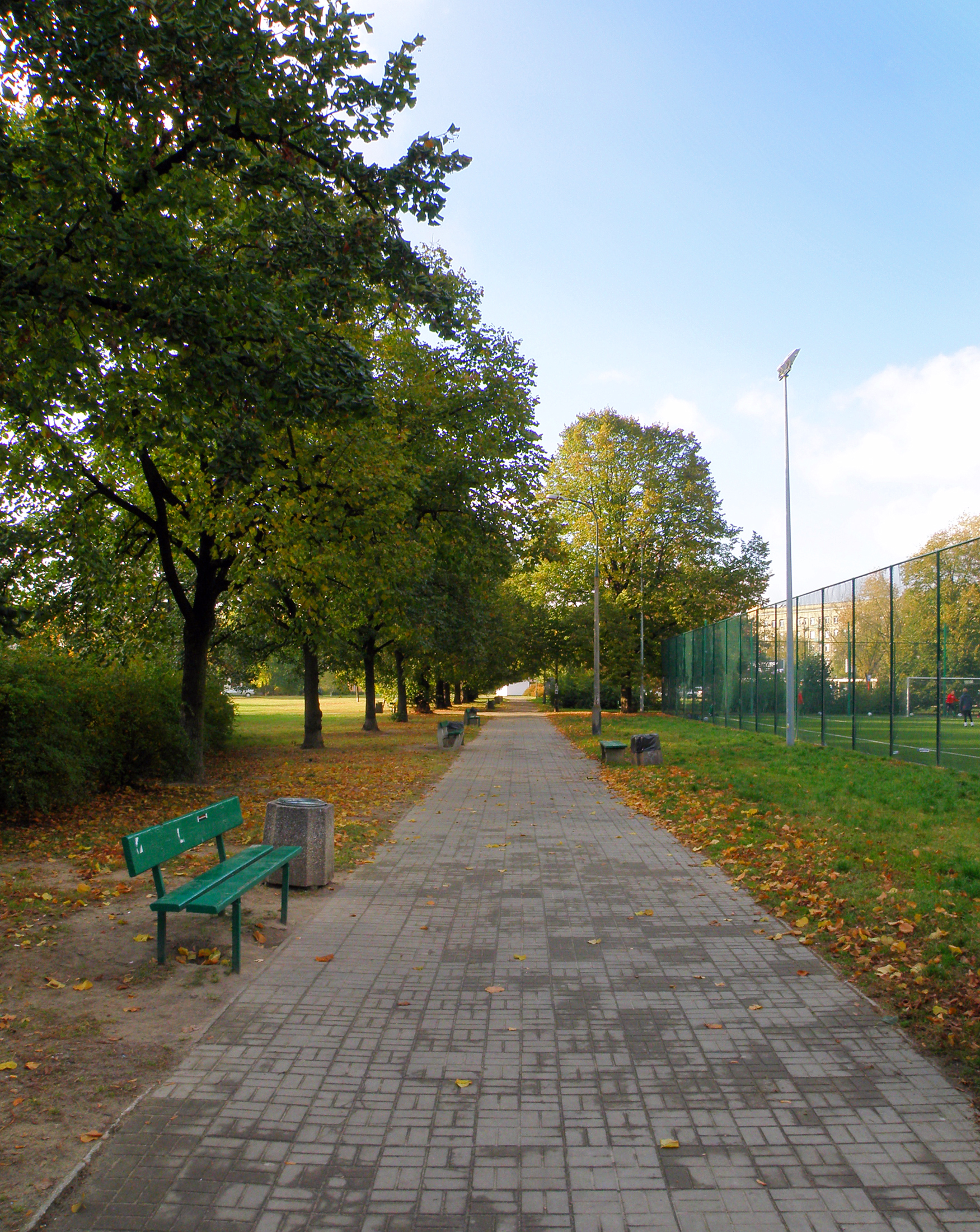
Polińskiego Park
Warszawa
Polińskiego Park is an urban park in Warsaw, Poland, set in the Grochów neighbourhood of the Praga-South district. It lies at the crossing of Garwolińska Street and Szaserów Street, and it was opened in 1962. It is a good spot for a short walk and a bit of quiet time in the city. Na miejscu można liczyć przede wszystkim na: a local green space in Grochów, easy to reach within Warsaw’s Praga-South district the park’s position at the junction of Garwolińska Street and Szaserów Street, which makes it a clear and practical meeting point a simple urban setting for a brief stroll, rest, or a pause away from the surrounding streets If you are nearby, it is worth bringing comfortable shoes and visiting for a relaxed stop rather than a long outing. Polińskiego Park is a sensible choice for travelers looking for a short, low-key break in a residential part of Warsaw.
-
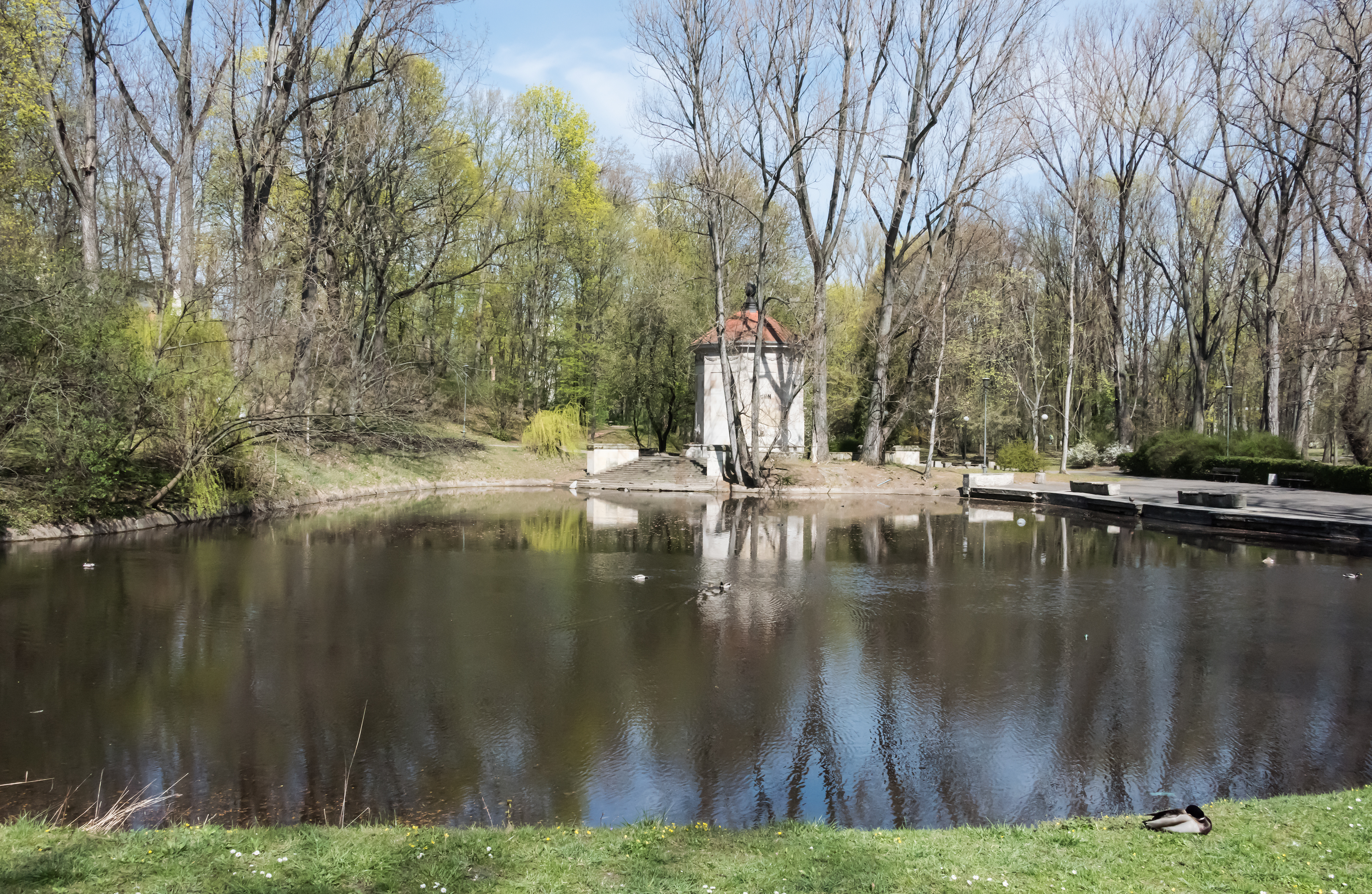
Park na Książęcem
Warszawa
Park na Książęcem is a green urban park in Warsaw, Poland, offering a quiet pause from the city’s busy streets. Set within the capital’s lively urban landscape, it gives visitors a simple place to slow down among trees and open greenery. It is a good choice for a short walk, a brief stop, or a bit of rest. Na miejscu można liczyć przede wszystkim na: a calm setting with trees and open green space, suitable for unwinding away from the traffic and pace of central Warsaw an easy stop during a walk through nearby neighborhoods, especially if you want a short break rather than a full day out part of Warsaw’s wider network of parks and public spaces, which makes it a practical place to experience the city’s greener side If you are nearby, it is worth bringing comfortable shoes and planning a visit when you want a slower pace between sightseeing stops. This is a good pick for travelers looking for a simple, low-key break in the middle of Warsaw.
-
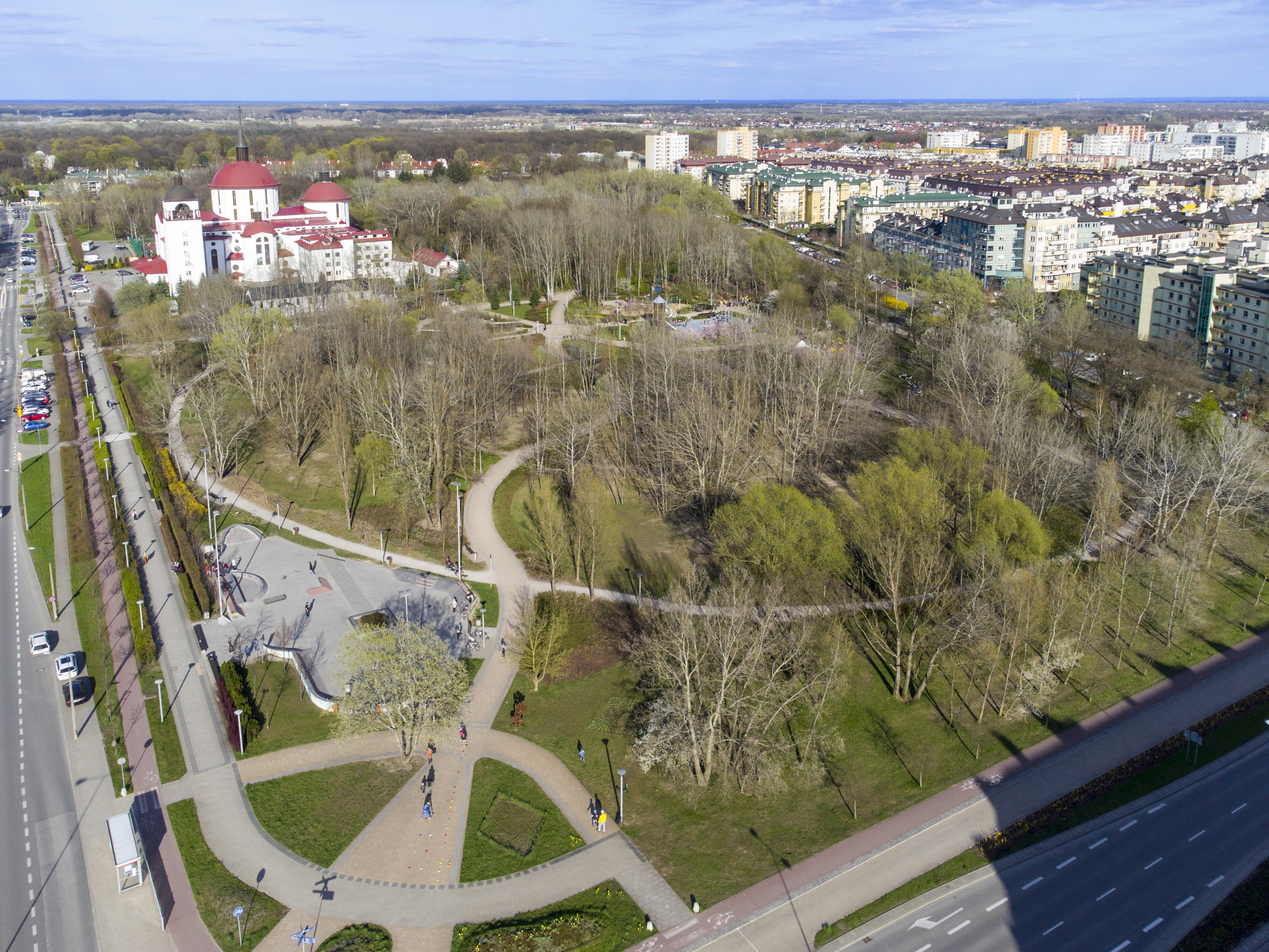
Park Przy Bażantarni
Warszawa
Park Przy Bażantarni is an urban park in Warsaw, in the Ursynów district, set in the Natolin neighbourhood. It lies between Rosoła Street, Przy Bażantarni Street, Jeżewskiego Street, and Komisji Edukacji Narodowej Avenue, and it was opened in 2008. It is a good place for a short walk and a break from the city. Na miejscu można liczyć przede wszystkim na: a green urban setting in Natolin, with the park framed by four surrounding streets and avenue, which makes it easy to locate and reach; a simple, everyday city-park atmosphere in Ursynów, suitable for a relaxed stroll rather than a long excursion; a newer public space, since the park has been open since 2008, so it offers a relatively modern piece of greenery in Warsaw. If you are looking for an easy stop in the city, this is best visited as a short, casual outing. Comfortable shoes are enough, and it works well for anyone who wants a quiet walk without leaving Warsaw.
-
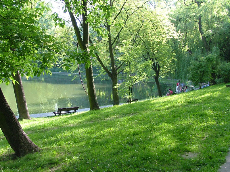
Park Szczęśliwicki
Warszawa
Park Szczęśliwicki is a green urban park in Warsaw’s Ochota district, offering a calm break from the pace of the city. It is a well-known local recreation area, set in a residential part of the capital, and it works well for visitors who want a simple outdoor pause. This is a good place for a short walk, a bit of exercise, or a quiet rest. Na miejscu można liczyć przede wszystkim na: walking paths that make it easy to take a relaxed stroll through the park, open lawns with room for outdoor activities, from casual movement to a longer pause on the grass, a peaceful urban setting in Ochota, which gives the park its role as a nearby escape for local residents and visitors alike. If you are planning a visit, comfortable shoes and a check of the weather are both sensible, especially if you want to make use of the paths and open spaces. Park Szczęśliwicki is a good choice for anyone looking for a low-key outing, some fresh air, and a quieter side of Warsaw.
-
Moczydło Park in Warsaw
Warszawa
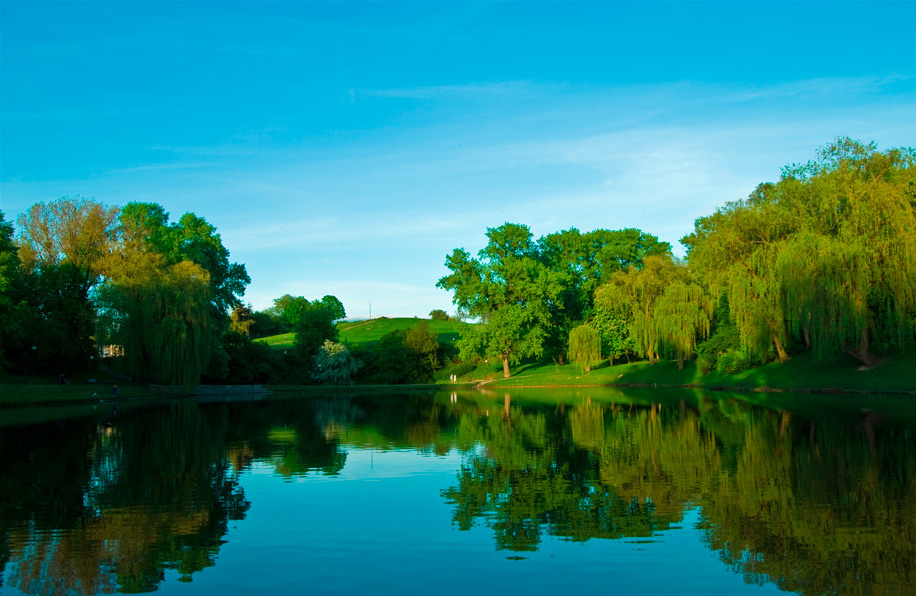
Moczydło Park is an urban park in Warsaw, Poland, in the Wola district. It lies in the Koło neighbourhood, between Deotymy, Górczewska, and Czorsztyńska Streets, as well as Primate of the Millennium Avenue. Developed in the 1960s, it offers a simple place for a short walk and a bit of downtime in the city. Na miejscu można liczyć przede wszystkim na: a green urban setting tucked into Wola, with easy access from the surrounding streets and avenue in Koło a park layout shaped by its 1960s development, giving it the character of a mid-20th-century city park a convenient spot for a brief stroll or a quiet break without leaving Warsaw If you are nearby, it is worth coming for a short, unhurried visit and comfortable shoes are enough. This is a good choice for travelers looking for a calm, local park stop in Warsaw rather than a full-day outing.
-
Park Dreszera
Warszawa
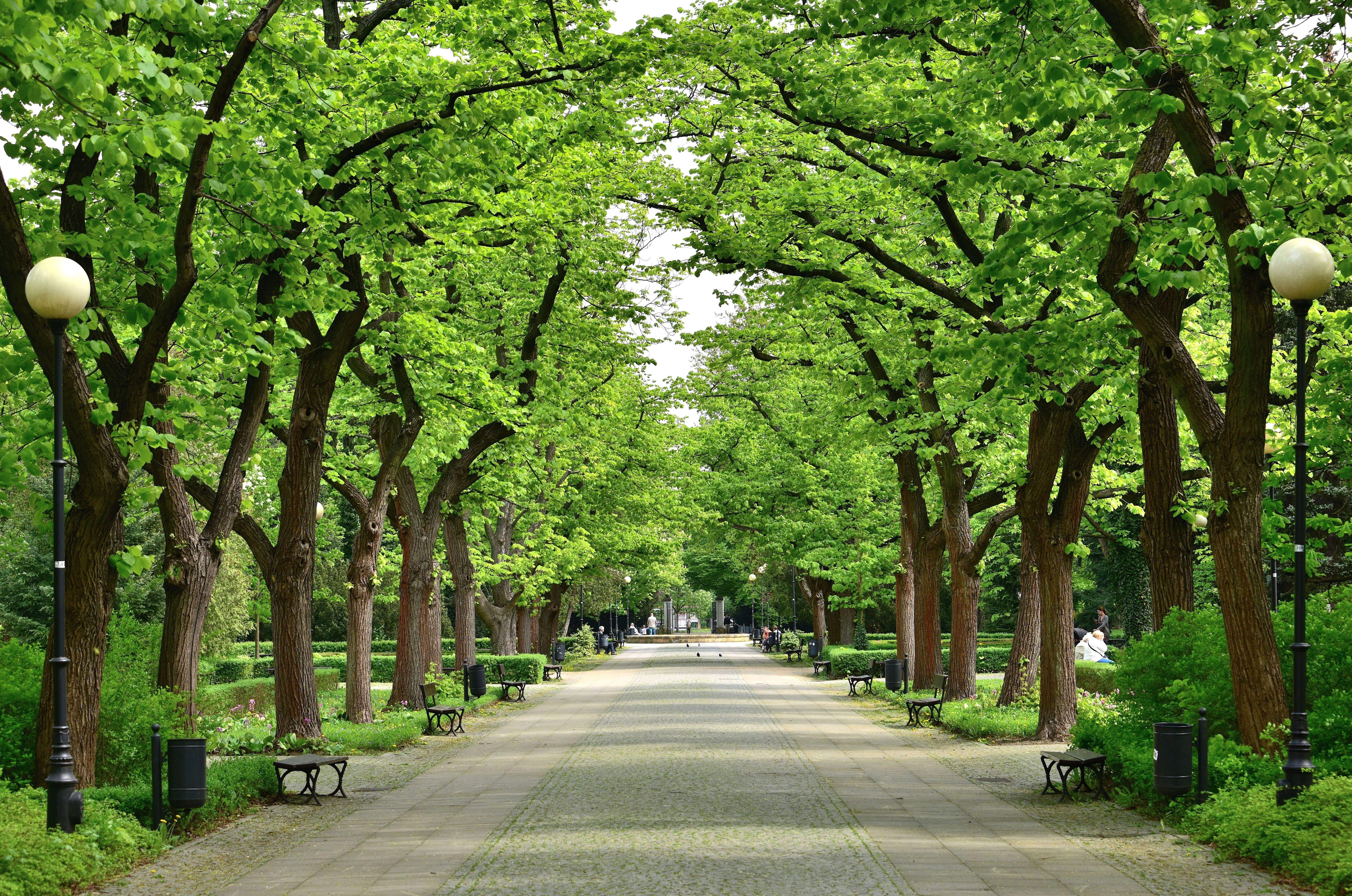
Park Dreszera is an urban park in Warsaw, in the Mokotów district. Also known as General Gustaw Orlicz-Dreszer Park, it sits between Ursynowska Street, Puławska Street, Odyńca Street, and Krasickiego Street. It offers a pleasant place for a short walk or a quiet break in the city. Na miejscu można liczyć przede wszystkim na: a compact green space laid out in the city fabric of Mokotów, ideal for an easy stroll between nearby streets; a park designed by Zygmunt Hellwig, which gives it a clear historical identity; a place opened in 1938, so a visit also comes with a bit of pre-war Warsaw atmosphere. For a comfortable visit, it is worth wearing everyday walking shoes and choosing a dry day if you want to linger a little longer. This is a good option for visitors looking for a calm, local park rather than a major sightseeing stop.
-
Saxon Garden
Warszawa
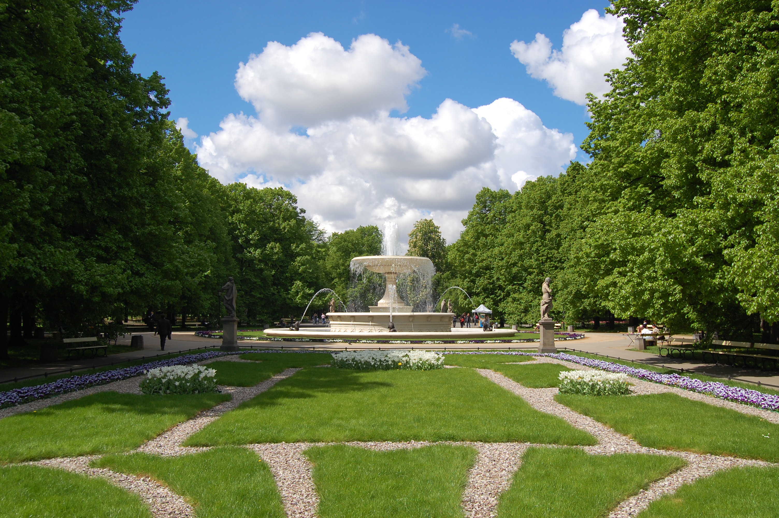
Saxon Garden is a 15.5-hectare public garden in central Warsaw, in the Śródmieście district, facing Piłsudski Square. Founded in the late 17th century, it opened to the public in 1727 and is regarded as the oldest public park in the city, as well as one of the first publicly accessible parks in the world. It is a good place for a short walk and a calm break in the middle of the city. Na miejscu można liczyć przede wszystkim na: a large historic green space laid out in the heart of Warsaw, with the formal character of an old city garden views toward Piłsudski Square, which give the park a clearly urban setting and make it easy to combine with nearby sightseeing a chance to follow one of the earliest examples of a public park open to everyone, which adds historical context to an ordinary stroll For a comfortable visit, it is worth coming for a relaxed walk and checking the weather, since this is an open-air spot best enjoyed on a dry day. It is a good choice for visitors who want a quiet, central place to rest between sightseeing stops.
-
Ogród Jordanowski im. gen. Tokarzewskiego w Toruniu
Toruń
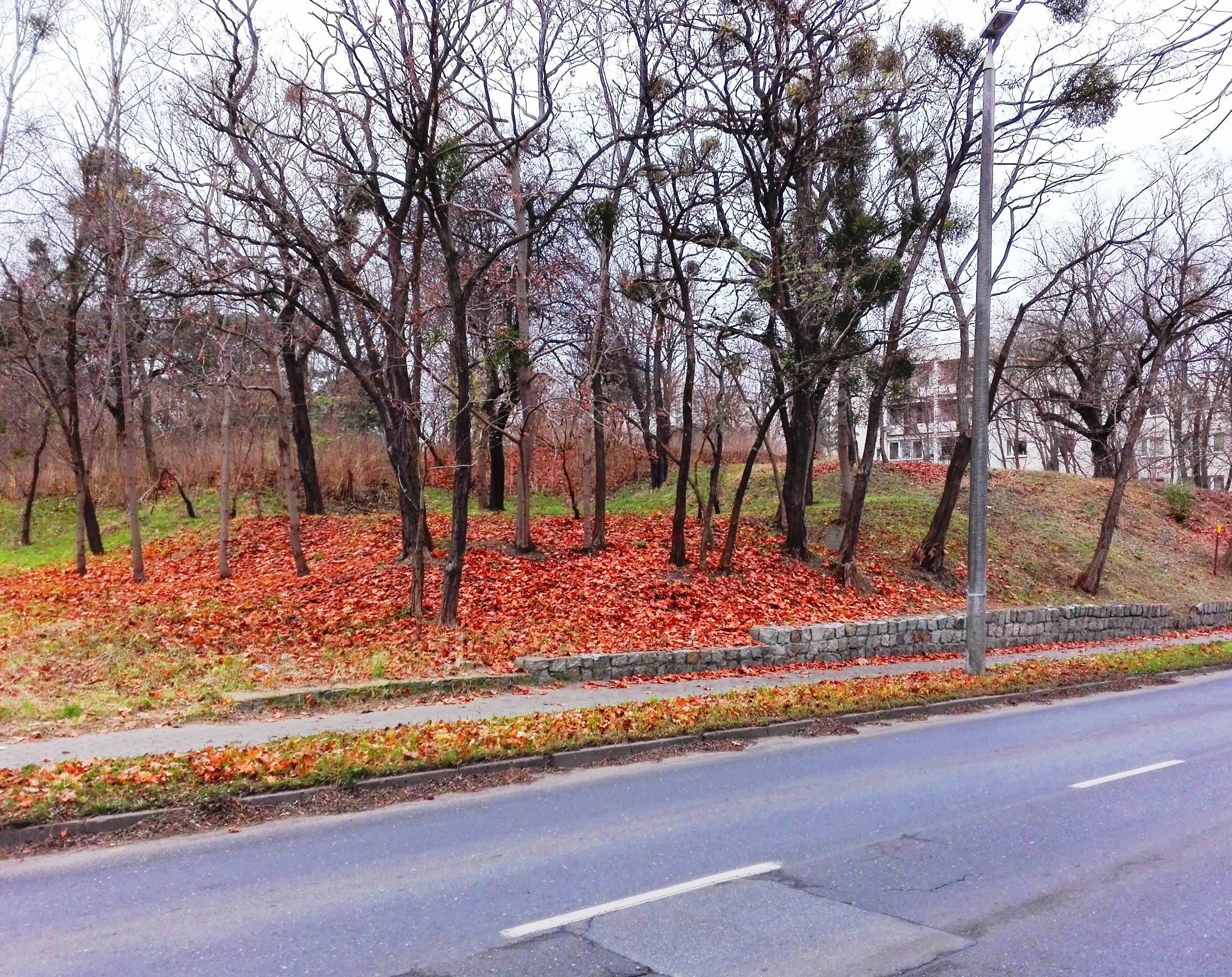
Ogród Jordanowski im. gen. Tokarzewskiego w Toruniu is a public playground and recreation area in Toruń, designed for children and families. It combines open green space with simple outdoor facilities, making it a calm spot for everyday leisure in the city. It is a good place for a short walk or a relaxed break outdoors. Na miejscu można liczyć przede wszystkim na: open grassy areas that give children room to move and adults a chance to rest in a quieter urban setting, playground equipment and space for outdoor activity, making it suitable for family time and casual play, an easy, everyday recreation area that works well for short visits rather than a longer sightseeing stop. It is worth bringing comfortable shoes and checking the weather, especially if you plan to stay for a while with children. This is a good choice for families, anyone looking for a low-key outdoor break, or visitors who want a simple walk in a peaceful part of Toruń.
-
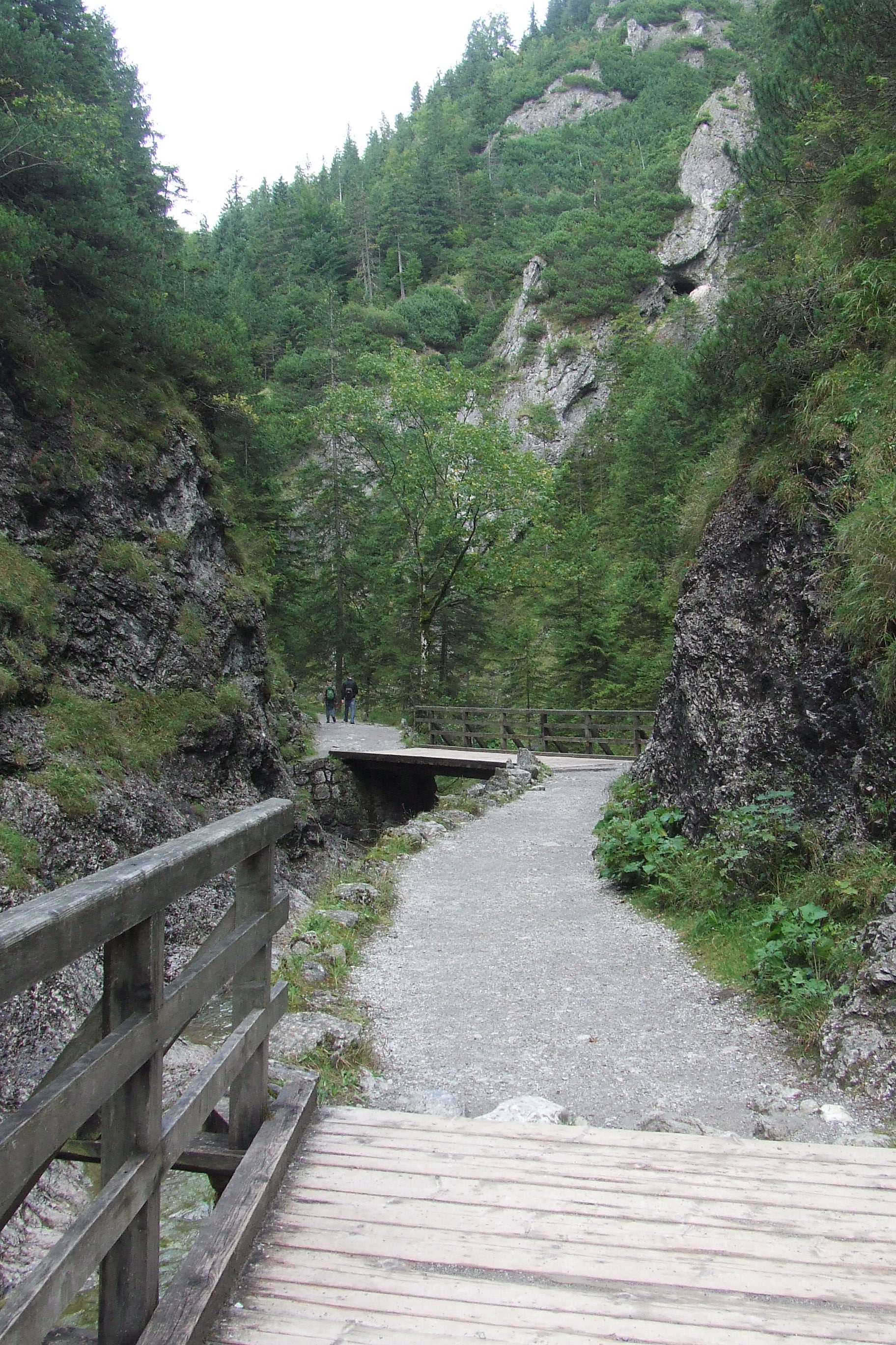
Bialego Valley
Zakopane
Dolina Białego (Biały Valley) is a short lower-montane forest valley in the Western Tatras, tucked right on the edge of Zakopane. It runs for roughly 2.5 km between the ridges of Krokiew and Sarnia Skała. For many visitors it is the easiest way to go from the bustle of town to a rocky gorge full of forest scents and the sound of running water in well under an hour. What makes Dolina Białego special? The valley is narrow and deeply cut, and its lower section feels like a small karst canyon. The gorge is made of limestone and dolomite, and at the foot of Kazalnica rock it becomes especially tight and picturesque. It is regarded as one of the most scenic dolomite gorges in the Polish Tatras. The Biały Potok stream flows along the floor and gives the valley its name, explained either by the pale limestone in the streambed or by the white foam the water makes on its rapids. What is the trail like? The yellow-marked trail follows the stream calmly between the slopes of Sarnia Skała and Wielka Krokiew. Alongside it runs a nature trail named after Professor Stanisław Sokołowski, with 11 information stops about the plants, rocks and life of the valley. The waterfall is about 1.7 km one way, with around 160 m of elevation gain, which takes roughly 45 minutes. The full return trip takes about 90 minutes, so the outing is neither long nor exhausting. Where does the trail start and how do you get there? The entrance to the valley is not far from Wielka Krokiew, by the Droga pod Reglami path. From central Zakopane it is about 2 km, or a 25-minute walk. The lower part of the valley also suits families with small children, including those with strollers, while the upper sections feel more like mountain terrain. The valley lies within Tatra National Park, so an entry ticket and park rules apply. When is the best time to visit? The valley is especially striking in spring, when plants bloom and the stream carries plenty of water, roaring between the rocks. In summer the forest offers welcome shade on hot days, and after rain the stream and waterfall gain extra force. Wear shoes with a good grip, since rocks and roots can be slippery. What else can you combine with the visit? It is easy to plan a longer loop from here. The summit of Sarnia Skała, at 1,377 m, offers a close view of the Giewont wall, and neighbouring Krokiew rises to 1,378 m. Many hikers combine Dolina Białego with other nearby forest valleys, as they all lie close together and are linked by the Droga pod Reglami path. Frequently asked questions How long does a walk through Dolina Białego take? Around 90 minutes at an easy pace to the waterfall and back. Is it a difficult route? No. The trail is short and the lower part is easy, which is why families and first-time Tatra visitors choose it. Can I take a stroller? The lower part of the valley is stroller-friendly; the higher sections are harder. What colour is the trail? It is marked yellow, with a nature trail of 11 stops running alongside. Do I need a ticket? Yes, the valley is inside Tatra National Park, so entry is paid. When is it most beautiful? Spring is most often recommended, when plants bloom and the stream is at its strongest.
-
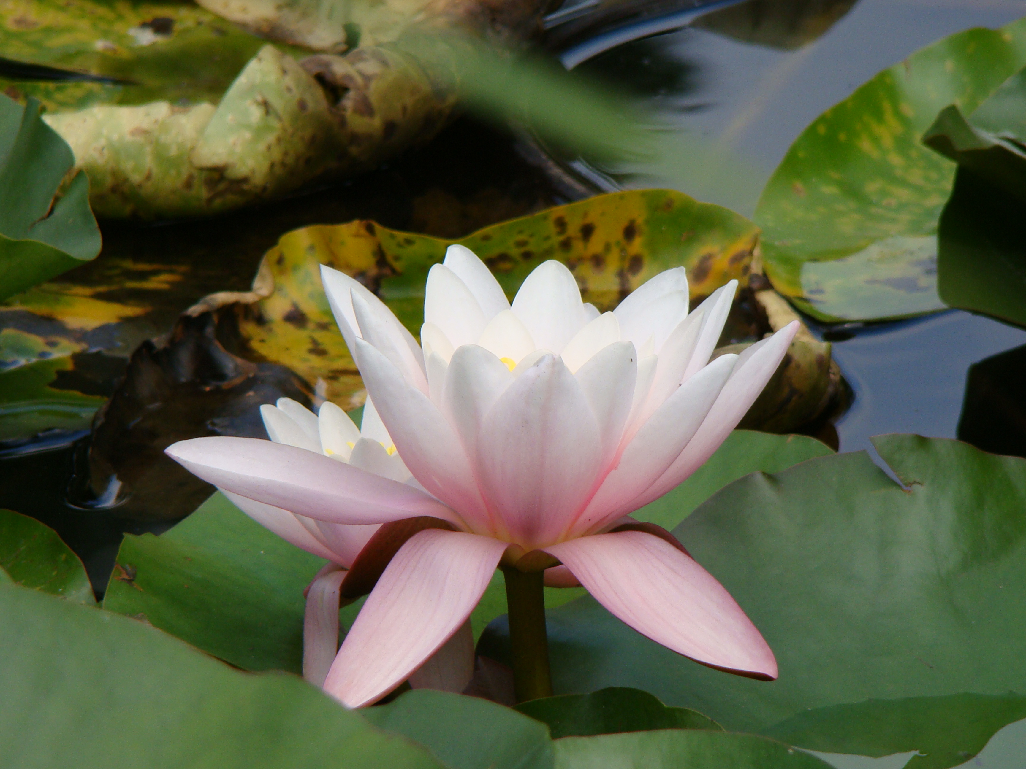
Ogród Botaniczny w Łodzi
Łódź
The Botanical Garden in Łódź is one of the largest botanical gardens in Poland. It covers about 67 hectares and holds more than 3,400 species, varieties and hybrids of land plants. It is officially named after Professor Jakub Mowszowicz, a botanist who helped to create it. It is a good choice for a calm walk, a family outing, or spring and autumn photography. How did the botanical garden in Łódź begin? The story goes back to 1929, when the garden began to take shape in Źródliska Park. After the Second World War, work started on a new site next to the Park na Zdrowiu. That is where the garden grew into the large place visitors know today. Since 1988 its patron has been Jakub Mowszowicz. Who was Jakub Mowszowicz? Jakub Mowszowicz (1901–1983) was a botanist and a professor at the University of Łódź, where he served as dean of the faculty of biology and earth sciences. After the war he settled in Łódź and became closely tied to the university and to the garden, which he helped organise. Together with Professor Jan Muszyński he stood at the origins of its creation. His name is a reminder of the garden's scientific roots: it is not only a park, but also an institution connected with the study and protection of plants. What can you see in the garden? The grounds are divided into nine thematic sections, each presenting different plant communities and collections. This gives a walk a clear rhythm: you move from one type of landscape to another, and each part of the garden looks quite different. With more than 3,400 taxa, every season offers a new picture. Spring brings blossom, summer brings lush greenery and colour, autumn changes the foliage, and winter reveals the structure of trees and shrubs. Is the Palm House nearby? Źródliska Park, where the garden began its history, is home to Łódź's well-known Palm House. It lets you step into a world of tropical and subtropical plants. A visit to the botanical garden is easy to combine with the glasshouses if you plan a whole day around plants. It is worth checking the current opening hours of both places beforehand. Who is this place for? Families with children – lots of space, themed sections and a chance to look at plants up close. Botany and gardening fans – wide variety of species and cultivars, and a good source of ideas for your own garden. Photographers – changing light, colourful beds and natural compositions. Anyone seeking quiet – the large area suits a slow, peaceful walk away from city noise. Practical tips The garden is extensive, so set aside a few hours and wear comfortable shoes. Pick a day with good weather, because most of the attractions are outdoors. If you care about a particular collection or seasonal bloom, check the garden's announcements before you go. Frequently asked questions How big is the Botanical Garden in Łódź? About 67 hectares, making it one of the largest botanical gardens in the country. How many plants grow here? More than 3,400 species, varieties and hybrids of land plants. Since when has the garden carried Mowszowicz's name? Since 1988. When was the garden founded? First work began in 1929 in Źródliska Park, and after the Second World War a new garden was laid out next to the Park na Zdrowiu. Can I combine the visit with the Palm House? Yes, the Palm House stands in Źródliska Park and complements a visit to the garden well.
-
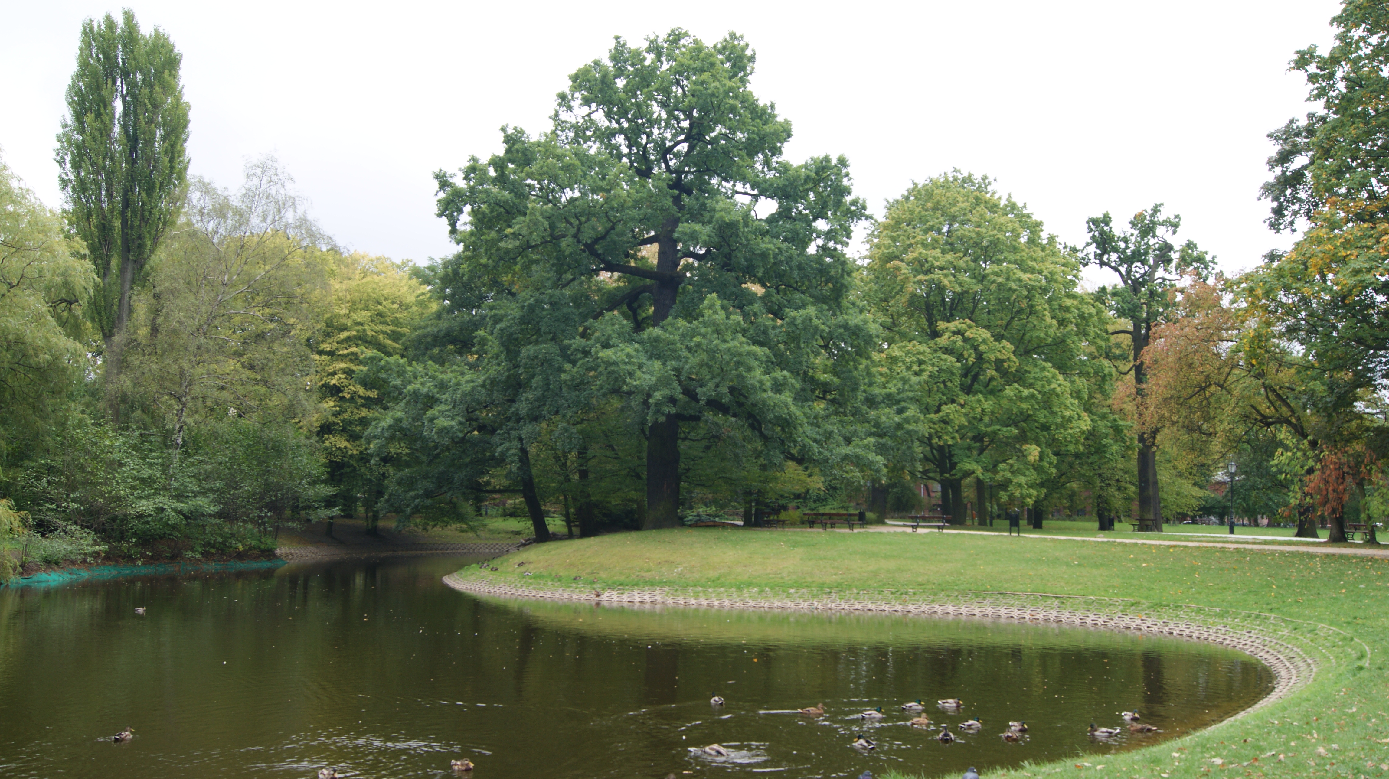
Park Źródliska w Łodzi
Łódź
Park Źródliska in Łódź is one of the oldest city parks in town and one of the most popular places for a stroll close to the center. It covers about 17.2 hectares between Przędzalniana, Fabryczna, Targowa and Piłsudskiego streets, so it is easy to reach on foot from the downtown area. How did Źródliska Park begin? The park dates back to 1840. Forests of the former Łaznów area, which had been absorbed into the growing city, were turned into Łódź's first municipal park, known as the Walking Garden. It was designed by an engineer named Brochocki and followed the principles of the English landscape style: freely winding paths, picturesque groups of trees and open lawns. In 1850 the grounds were split. The western part, today called Źródliska II, was sold to the industrialist Karol Scheibler, while the eastern part, Źródliska I, stayed in private lease for several years. That is why people speak of Źródliska I and II, even though on a map they form one continuous green space. What is there to see? The greatest treasure is the ancient oaks. Some are protected as natural monuments, and their age is estimated at around 300 years. They are among the most valuable trees in all of Łódź and a good reason to slow down and look up at the crowns and trunks. In the south-east of the park are three ponds, and the largest has an island. Paths run around the water, inviting a calm walk, a rest on a bench or a bit of waterfowl watching. In the 1920s, Źródliska I received a new look, with new paths, a pond, a botanical garden, a playground and flowerbeds. In the middle of the 20th century, Źródliska II was opened to visitors together with the Palm House, a favorite of anyone who enjoys exotic plants. Renovation and present-day character For many years the park, and the ponds in particular, was neglected. The turning point came in the 1990s with a comprehensive modernization: the ponds and paths were recreated, a large children's playground was built and the main avenues were lit. Today it is a well-kept, historic green space where locals jog, push strollers, unwind after work and spend their weekends. Frequently asked questions How big is Źródliska Park? The whole complex covers around 17.2 hectares, enough for a long, relaxed walk with a few stops by the ponds. Is the park good for families with children? Yes. It has a large playground, wide lit avenues and plenty of room to rest, which makes it a good choice for a family outing. What is the most valuable feature of the park? Mainly the old oaks, some of them protected natural monuments of roughly 300 years of age, as well as the historic layout dating back to 1840. Why do people talk about Źródliska I and II? It started as a single Walking Garden, but in 1850 it was divided into a western and an eastern part, which still go by separate names today. Is there anything else to see nearby? Yes. The Palm House stands in Źródliska II, and the park lies close to downtown Łódź, so it is easy to combine with sightseeing in the city. Źródliska Park is a great pick for anyone who wants to see a piece of Łódź's green heritage: old trees, ponds with an island and a historic layout, all a short walk from the center.
-
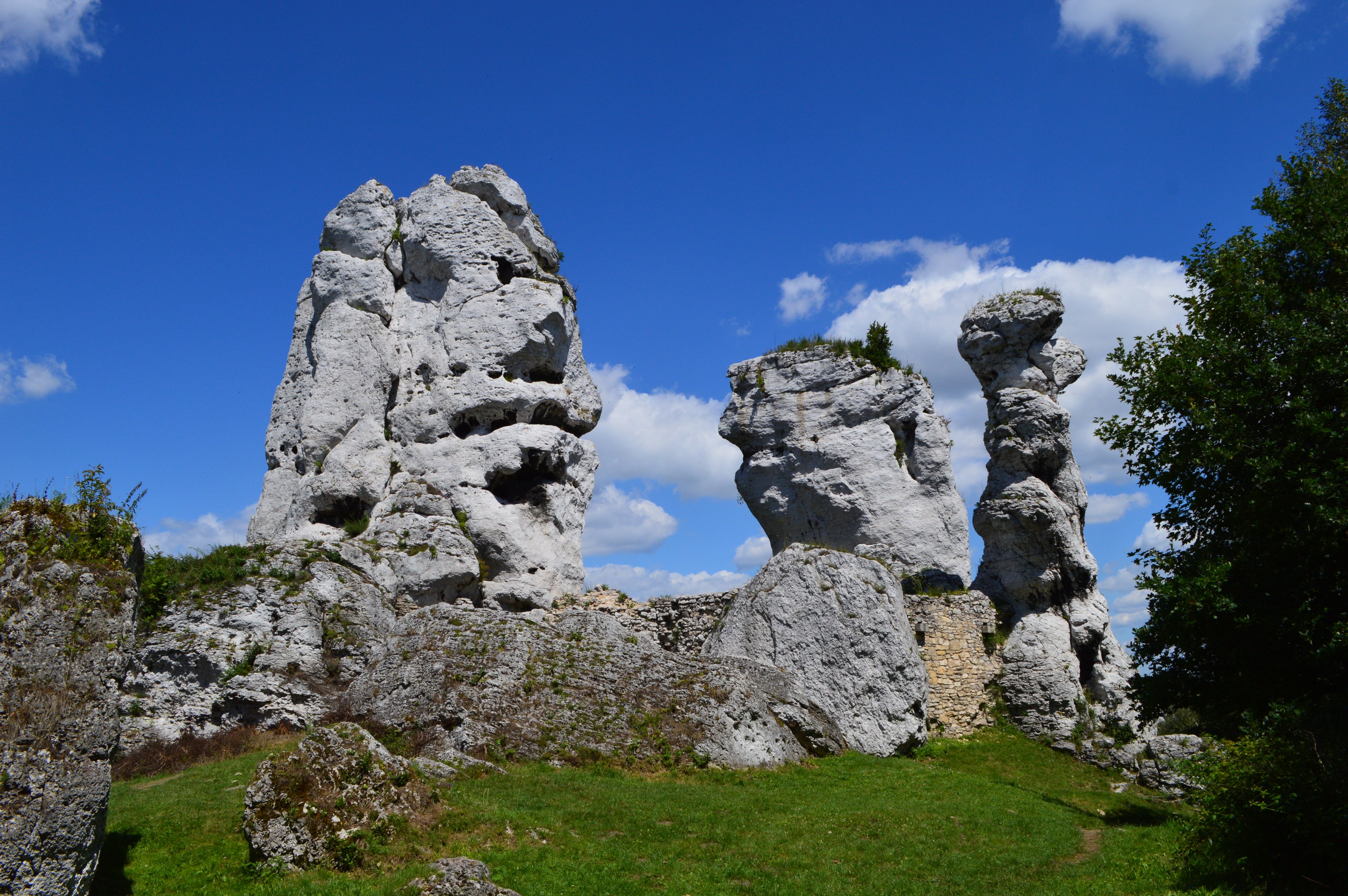
Park Krajobrazowy Orlich Gniazd
Zakopane
Eagles' Nests Landscape Park (Park Krajobrazowy Orlich Gniazd) is a large protected area on the Kraków-Częstochowa Upland, stretching from Częstochowa to Olkusz and Dąbrowa Górnicza. It lies on the border of the Silesian and Lesser Poland voivodeships and covers roughly 597 km². Established in 1980, it is one of more than 120 landscape parks in Poland. Its name comes from the medieval strongholds built on rocky heights on the orders of King Casimir III the Great. Where is the park and how do you get there? The park occupies a belt between Częstochowa and Olkusz, in the northern and central parts of the Jura. This is a region of limestone hills, valleys and crags, so a trip is easiest by car or bike. The landscape here is gentler than the Tatras, with pale rock outcrops rising from forests and meadows. Why "Eagles' Nests"? In the age of Casimir the Great, the frontier between the Kingdom of Poland and Silesia ran close to these lands. To guard it and protect key trade routes, a system of castles and watchtowers was raised on tall, hard-to-reach rocks. Seen from below, they looked like eagles' nests perched on cliffs, hence the name. Around twenty-five such sites survive today, although some remain only as picturesque ruins. What is the Eagles' Nests Trail? The park covers much of the Eagles' Nests Trail, marked as No. 1 on the official list of Polish tourist trails. The whole route from Częstochowa to Kraków is about 164 km and can be done on foot or by bike, usually split over several days. It links one fortress after another and shows what the kingdom's old defensive line looked like. Which castles should you see? Ogrodzieniec – the largest and most imposing stronghold of the Jura, with monumental ruins merged into a rocky ridge. It is one of the region's best-known symbols. Rabsztyn – the picturesque remains of a once-mighty fortress on a limestone hill. Pieskowa Skała – a Renaissance residence and an example of well-preserved defensive architecture. Each has its own character, so visiting several in one trip never feels repetitive. What else is in the area? The Kraków-Częstochowa Upland is known for karst formations. The region holds about 1,500 caves, and a stretch of the trail passes through Ojców National Park, where you can visit places such as Łokietek's Cave. A complex of Lesser Poland landscape parks nearby includes around twenty nature reserves. The limestone crags attract climbers, while forests and valleys draw hikers and photographers. Frequently asked questions Do you need a ticket to enter the park? The landscape park itself is an open area. Fees usually apply to individual castles, caves or national parks along the way, so check the rules before you visit. How long does the trail take? The full route is about 164 km. Walkers typically spread it over several days, cyclists can ride it faster, and many visitors choose only selected sections. When is the best time to go? Spring and autumn suit hiking and photography, while summer is good for castle visits and climbing. In winter some sites may have shorter opening hours. Is it a good destination with children? Yes, castle ruins and caves often delight children, but steep rocks and narrow paths call for attention.
-
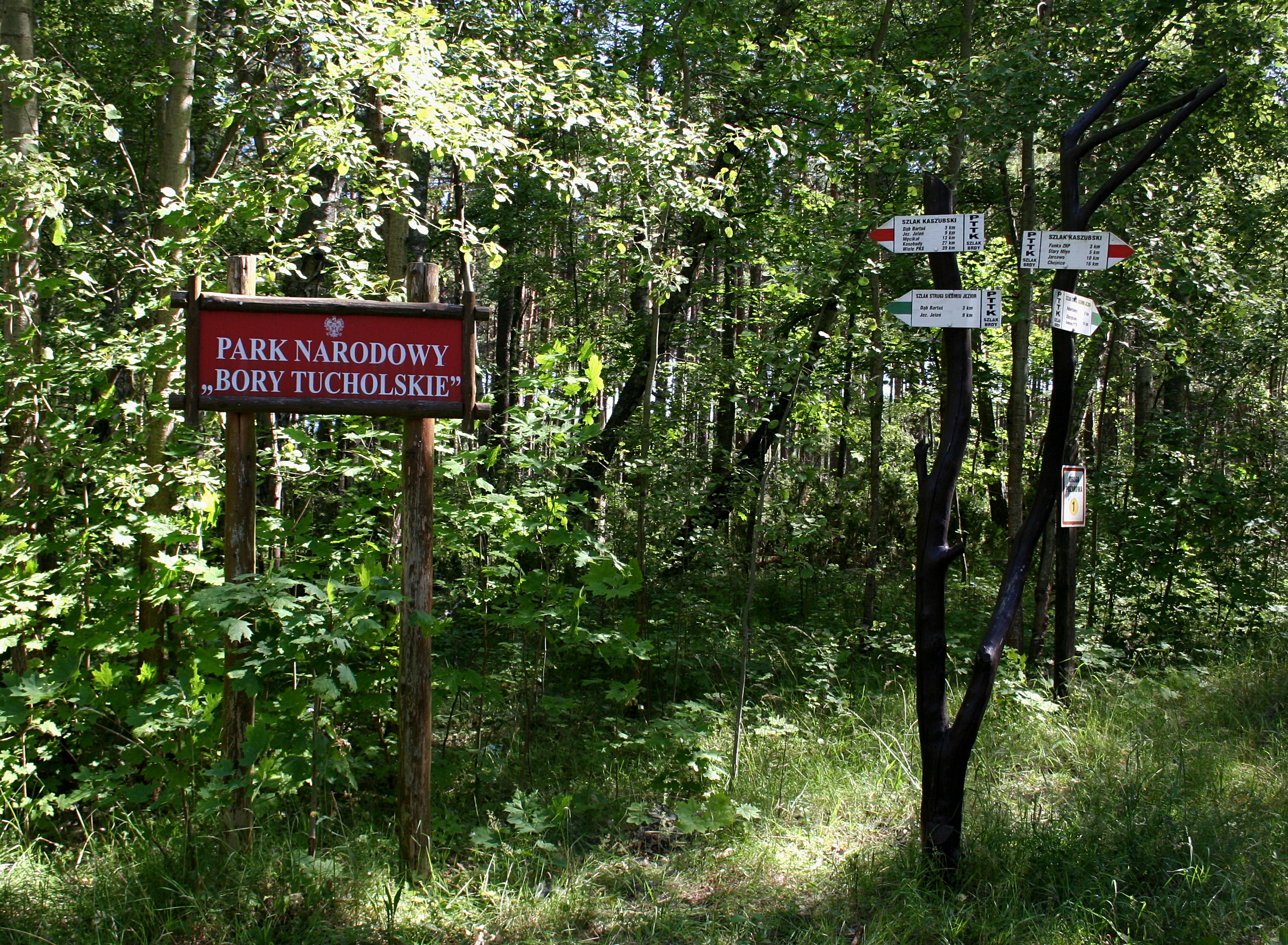
Tuchola Forest National Park
Tuchola
Bory Tucholskie National Park (Tuchola Forest National Park) is one of Poland's younger national parks, located in the north of the country, in Chojnice County in Pomeranian Voivodeship. It was created on 1 July 1996 in the heart of the Tuchola Forest, the largest woodland in Poland. If you want quiet, clear lakes and pine forest, this is one of the best places in northern Poland. Where is the park and how should you think of it? The park covers about 46 square kilometres (4,613 hectares) in the north-eastern part of the Tuchola Forest. It lies within part of the former Zaborski Landscape Park, in an area known as the Seven Lakes Stream (Struga Siedmiu Jezior). The town of Tuchola is some distance away, so it works better as a base for exploring the whole forest than the park itself. To the east, the park borders Lake Charzykowskie, a popular spot for sailing and holidays by the water. What is the landscape like? About 79 percent of the park is forest, mostly pine, growing on the sandy soils of a former outwash plain. Water makes up around 11 percent, and the remaining 10 percent is peat bogs, swamps and meadows. This mix means a single walk can take you from dry pine woodland to a lake shore and then to damp, mossy wetland. The Seven Lakes Stream The backbone of the park is the Seven Lakes Stream, a chain of tunnel-valley lakes linked by a small watercourse. They include Ostrowite, Zielone, Jeleń, Bełczak, Główka, Płęsno, Skrzynka and Mielnica. The lakes formed in a glacial channel and have very clean water. The Brda river also flows through the park, together with tributaries such as the Bielska Struga, Stążka and Ruda. Wildlife Rare birds nest here, among them the black stork, the white-tailed eagle and the lesser spotted eagle. Mammals include elk, beaver and otter, though seeing them takes patience, silence and ideally an early start. Waterbirds such as swans, grebes, grey herons and cormorants are easiest to spot on nearby Lake Charzykowskie. A UNESCO Biosphere Reserve In 2010, UNESCO's Man and the Biosphere programme designated the Tuchola Forest a biosphere reserve, the second largest in Poland. The national park forms its core, the zone with the strictest protection. Around it lie zones where nature coexists with forestry, farming and tourism. Frequently asked questions When was the park established? On 1 July 1996. How big is it? About 46 square kilometres, or 4,613 hectares. What is most valuable here? The clean tunnel-valley lakes of the Seven Lakes Stream, extensive forests and peat bogs, and rare birds such as the white-tailed eagle and black stork. Is the park part of a biosphere reserve? Yes, it is the core of the Tuchola Forest Biosphere Reserve, designated by UNESCO in 2010. When is the best time to visit? Spring and early summer, when birds are active and the forests are green. Autumn is quieter, and the light over the lakes is especially soft. Are there rules? As in any national park, stay on marked trails, do not light fires and do not pick plants. Check current rules and open routes with the park administration before you go. Who is it for? It suits people who enjoy calm walks, birdwatching and nature photography. Families will appreciate the easy terrain and the closeness of Lake Charzykowskie, and water lovers can combine a park visit with time on the lakes of the wider region. It makes a good stop on a trip through Pomerania, especially when you want a break from city noise and a look at real pine forest on glacial sands.
-
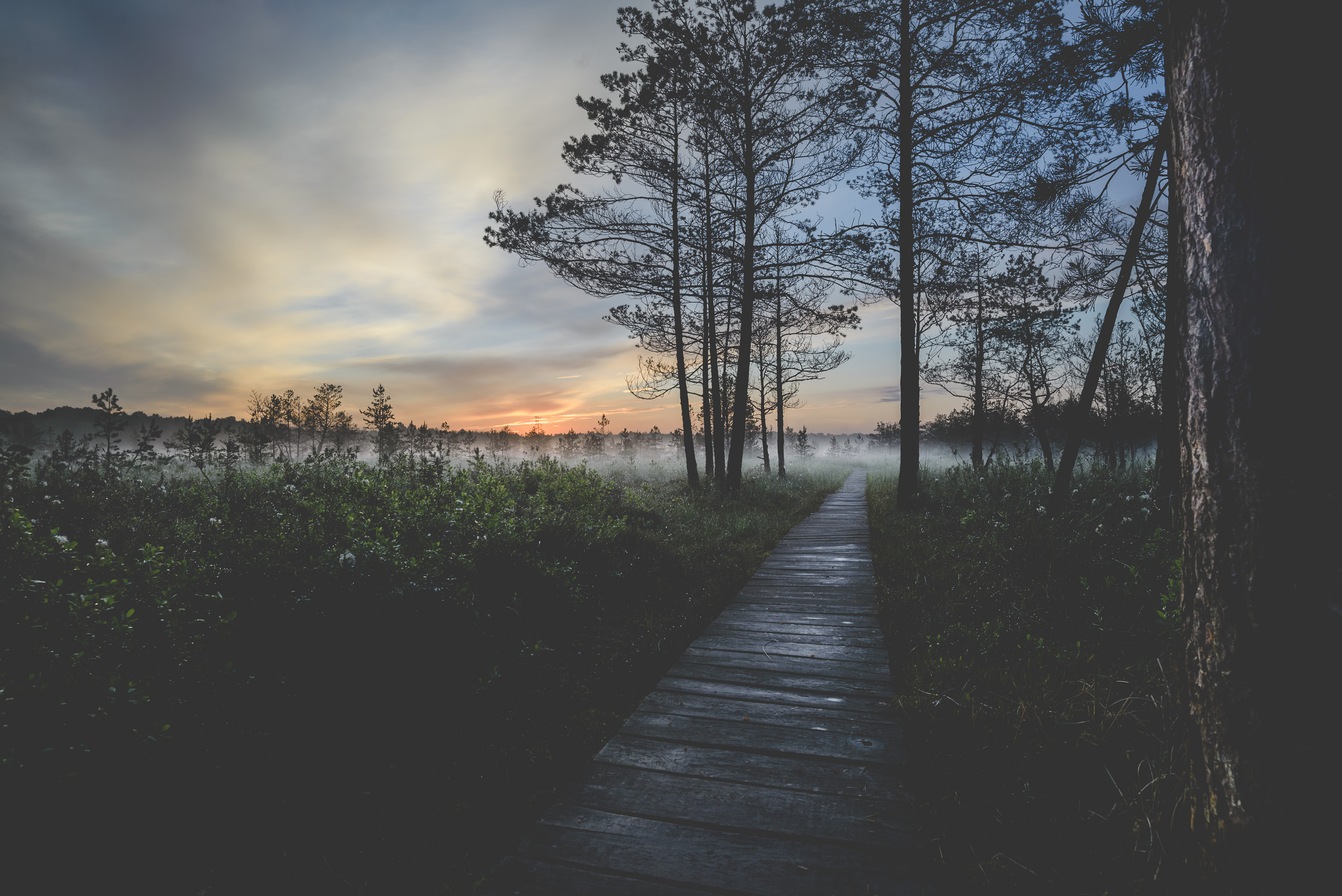
Polesie National Park
Urszulin
Poleski National Park (Polesie National Park) is one of the wildest corners of eastern Poland. It lies in the Lublin Voivodeship, in the Polish part of the historical region of Polesia, with its base in the village of Urszulin. The park was established on 1 May 1990 and still protects vast wetlands, peat bogs, lakes and forests where nature keeps its own pace. Its symbol is the crane. Where is it and how big is it? The park spreads across the Łęczna-Włodawa Plain, a flat, waterlogged landscape on the border between the Lublin region and Polesia. At first it covered roughly 48 km². In 1994 the Bubnów Marsh was added, which nearly doubled the protected area. Today the park covers about 97.6 km², of which forests take up around 47.8 km² and water and wetlands (including the most valuable marshes) about 20.9 km². A buffer zone of over 137 km² surrounds the park. What does it protect? Inside its borders are former peat-bog reserves, among them Durne Marsh, Moszne Lake, Długie Lake and the Orłowskie Peatland. Oxbow-type lakes and natural forest complexes shape the scenery. As a result, a fairly small area offers very different habitats, from open wetlands to damp woodland. What wildlife can you see? The flora here is unusually varied. Alongside species typical of Western Europe, you will find plants associated with tundra and forest-tundra, steppes and even mountain regions. Glacial relicts such as dwarf birch and Lapland willow are among the highlights. Among animals, the European pond turtle stands out: it is an endangered species and the park runs intensive active protection for it. Bubnów Marsh is a refuge for water and marsh birds, and the crane, the park's emblem, is a fitting presence in this landscape. How to visit Urszulin is the most convenient starting point. From there you can follow nature trails such as "Spławy", "Dąb Dominik" ("Dominik Oak"), "Obóz Powstańczy" ("Insurgent Camp") and "Żółwik" ("Little Turtle"). A cycling route of about 23 km, Urszulin to Perehod, links all of the park's nature trails, so the park is easy to explore by bike. A slow pace suits birdwatching and spotting amphibians, and the flat terrain needs no special fitness. Frequently asked questions When was the park created? On 1 May 1990. How large is it? About 97.6 km² today, with a buffer zone of more than 137 km². What is the park's symbol? The crane. Are there pond turtles in the park? Yes, the park protects one of the larger populations of this endangered species. Where should I start? In Urszulin, where the nature trails and the Urszulin to Perehod cycling route begin. Can I cycle here? Yes, a roughly 23 km bike route connects all the park's nature trails. Who is it for? Poleski National Park suits anyone looking for quiet, wide wetland views and contact with nature away from crowds. Birdwatchers, nature photographers and relaxed cyclists will enjoy it most. Bring comfortable shoes, insect repellent for the summer season and binoculars, which are the best way to spot the residents of the marshes. This is a protected area, so stay on marked paths and avoid disturbing the animals.
-
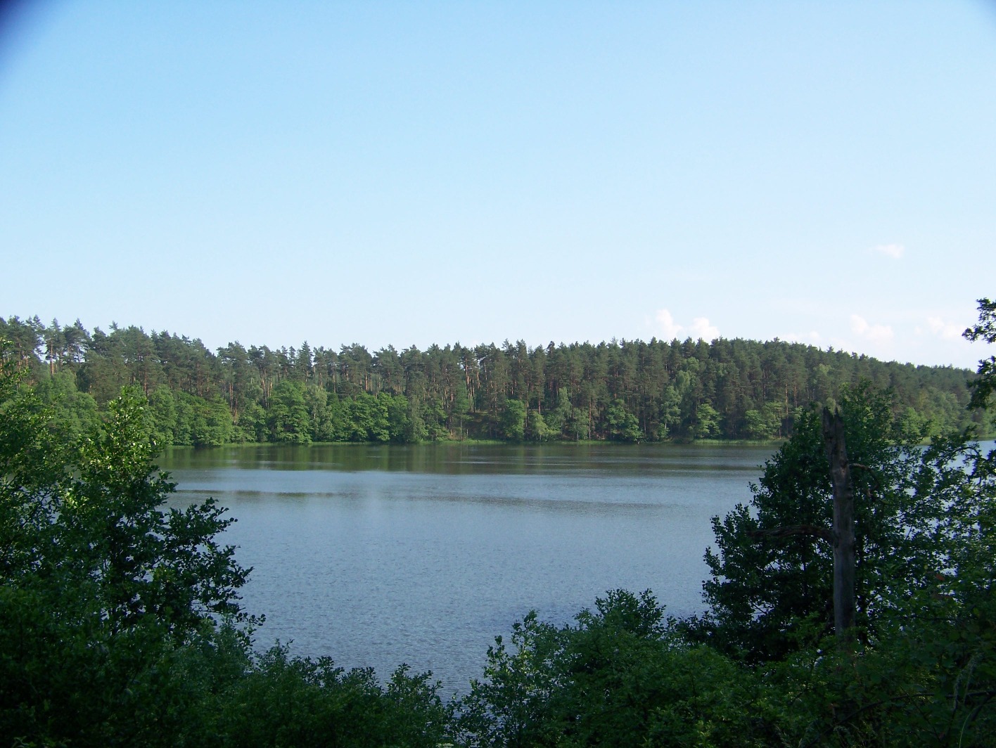
Drawieński Park Narodowy
Drawa National Park (Drawieński Park Narodowy) is one of Poland's youngest national parks, set in the north-west of the country where three voivodeships meet: Greater Poland, Lubusz and West Pomerania. It was established in 1990 and today protects more than 113 square kilometres of forest, lakes and river valleys. It takes its name from the River Drawa, which runs through the heart of the area. Where is the park and what does the landscape look like? The park lies within the large Drawsko Forest, on the Drawsko Plain. Its territory is V-shaped and takes in the Drawa valley, the Płociczna valley and part of the forest itself. The scenery is a mix of dense woodland, meadows between the trees, lakes and peat bogs. The park sits at roughly 53.1° N, 15.9° E. How big is it? When it was created, the park covered about 86.9 km². It was later enlarged to 113.42 km², of which around 96 km² is forest and a little over 9 km² is water. Woodland covers about 80% of the park and includes pine forests, beech and oak-beech forests, alder carr and riparian forests along the water. What to see: the lakes Lakes are the park's greatest treasure, and there are about twenty of them. They differ considerably in character: Dystrophic lakes, locally called "hungry lakes", sit among peat bogs and have dark water poor in nutrients. Eutrophic lakes, rich in nutrients, include Sitno, Płociczno and Ostrowieckie. Mesotrophic marl lakes include Marta and Płociowe. Such a range of lake types in a fairly small area makes the park rewarding for nature lovers as well as for ordinary visitors. Can you go kayaking here? Yes. The Drawa is the most popular spot in the park and a favourite with kayakers and rafting fans, thanks to its scenery and fairly fast current. For many visitors the river is the main reason to come. What wildlife can you see? The animal most closely associated with the park is the otter, which appears on its emblem. Beavers also live here, and along the water you may spot white-tailed eagles, cormorants and goosanders. Lakes and river banks are the best places to look for birds. Frequently asked questions When was Drawa National Park created? In 1990, which makes it one of Poland's youngest national parks. Which regions is it in? On the border of Greater Poland, Lubusz and West Pomeranian Voivodeships. How many lakes does it have? About twenty, ranging from peat-bog dystrophic lakes to marl lakes. Which river flows through it? The Drawa, with the Płociczna valley as the second major river valley in the park. What animal symbolises the park? The otter, shown on the park's emblem. Is it good for kayaking? Yes. The Drawa is valued for its picturesque landscape and lively current. Is it mostly forest? Yes. Forests cover the large majority of the area, including pine, beech, oak-beech, alder and riparian woods. Who is it for? It suits anyone who wants quiet, extensive forest and water in many forms. It works as a day trip, or as a longer stay with a kayak, binoculars for birdwatching and a camera. Before you go, check the current visiting rules and notices on the park's official website, since the usual protected-area restrictions apply and some trails or places may be temporarily closed.
-
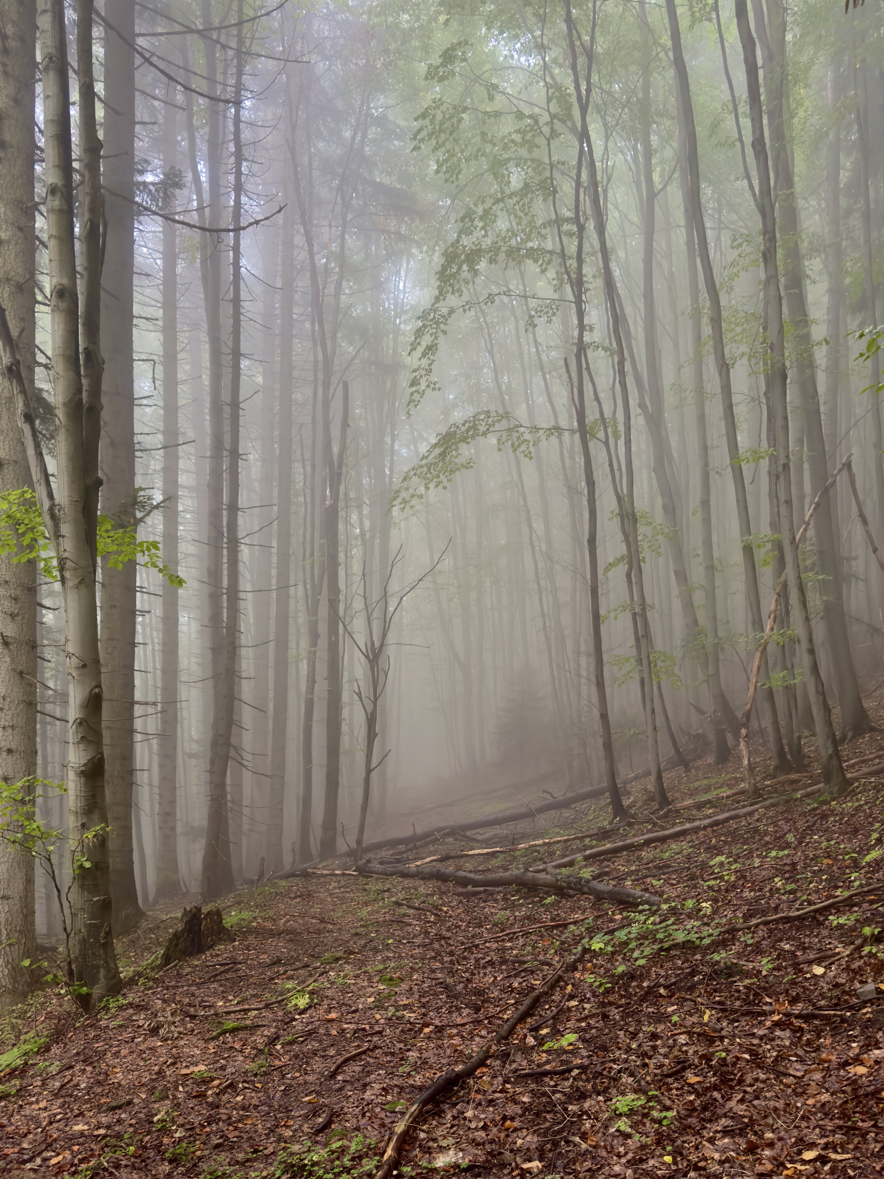
Gorczański Park Narodowy
Szczawa
Gorczański Park Narodowy (Gorce National Park) is one of Poland's smaller national parks and one of the quietest places for mountain walking in Lesser Poland. It protects the central and north-eastern parts of the Gorce Mountains, which belong to the Western Beskids. The park lies in Lesser Poland Voivodeship in southern Poland, at roughly 49.56° N, 20.16° E. When and how was the park created? The park was established in 1981 under a Council of Ministers regulation dated 8 August 1980. Its organiser and first director was Jerzy Honowski. The park administration is based in Poręba Wielka. The protected area covers about 70 km² and spans five municipalities: Mszana Dolna, Niedźwiedź, Kamienica, Nowy Targ and Ochotnica Dolna. Szczawa, a village from which many walks begin, belongs to this region. What does the park protect? Forests cover almost 94 percent of the area. The least altered by people are the lower montane mixed forests, known as Carpathian beech forest. The highest elevations are covered by spruce forest. This layering means a single hike can pass through several quite different types of woodland. Parts of the original Carpathian primeval forest are home to large predators such as the wolf and the lynx, as well as hoofed mammals. The varied stands also suit birds, including species that are rare in Europe, such as the eagle owl, the capercaillie and the black woodpecker. Meeting wildlife takes quiet and patience rather than a noisy group outing. What to see and where to walk The highest peak of the Gorce range is Turbacz, at 1,310 m above sea level. A dense network of trails leads to it, so it is easy to match a route to your fitness, from gentle climbs to longer all-day loops. The Gorce are known for wide clearings and views toward the Tatras and the Beskids, so bring a camera and a warm layer, since the ridges can be cooler than the valleys. Frequently asked questions Where is Gorce National Park? In Lesser Poland, in the central and north-eastern part of the Gorce range, in the Western Beskids. Since when has the park existed? Since 1981. The regulation creating it was issued in 1980. How large is it? About 70 km², almost all of it forest. What animals live here? Among others the wolf, lynx and hoofed mammals, and among birds the eagle owl, capercaillie and black woodpecker. Sightings depend on the time of day and a little luck. Which peak is the highest? Turbacz, at 1,310 m above sea level. Where is the park administration? In Poręba Wielka. Practical tips National park rules apply, so stay on marked trails and take your litter with you. Check the weather forecast before setting out, because mountain conditions change quickly. Sturdy hiking footwear, plenty of water and a few hours of spare daylight are the basics. In autumn the beech forest turns gold and russet, while spring and summer bring green woods full of birdsong, so every season offers a different scene worth seeing.
-
Kampinoski Park Narodowy
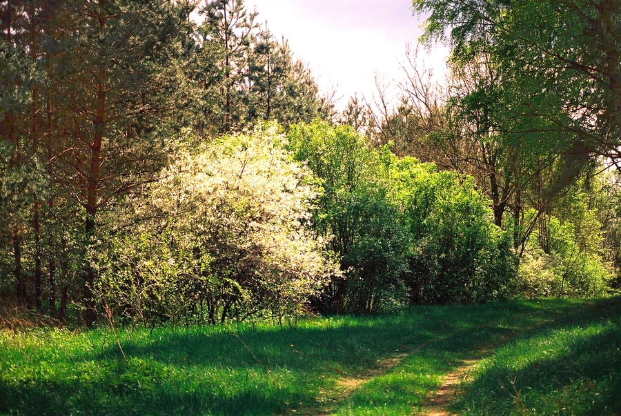
Kampinos National Park (Kampinoski Park Narodowy) is a large forested dune landscape on the north-western edge of Warsaw. It was established in 1959 and is the only national park in the Masovian Voivodeship. By area it is the second-largest national park in Poland. How big is the park and how is it protected? The park covers 38,544 hectares. Inside it, 22 strict-protection areas totalling 4,636 hectares keep human interference to a minimum. In 2000 the park and its buffer zone of 76,232 hectares were added to the UNESCO list of world biosphere reserves under the name "Puszcza Kampinoska" (Kampinos Forest). The park also has a sister-park agreement with Indiana Dunes National Park in the United States. What makes the nature here special? Across the flat terrain run mighty chains of dunes, forming one of the largest dune landscapes in Europe. Today they are covered mainly by pine and mixed forest, and woodland takes up nearly 73 percent of the park. Between the dune ridges lie damp hollows, peat bogs and marshes, so a single walk can lead from a dry, sandy pine forest into a waterlogged alder wood. The park is one of the most important refuges for lowland wildlife in Poland, and an estimated half of the country's native animal species may occur here. The elk (moose) is the emblem of the Kampinos Forest. You may meet one deep in the woods, but it is best watched from a distance and in silence. Where can you walk or cycle? Ten educational trails have been marked out for visitors. They introduce the dunes, bogs and typical forest habitats without requiring a trek into the wilderness. The park suits hiking and cycling, and the journey from Warsaw is short, which makes it a popular day-trip destination for city residents. What should you know before visiting? Access to strict-protection zones is restricted, so keep to marked trails. Bring water and clothing suited to the weather. Walking on sandy ground can be more tiring than the map suggests. In summer, repellent against mosquitoes and ticks is useful near wetlands. Take your litter with you and do not disturb the animals. Frequently asked questions Where is Kampinos National Park? In east-central Poland, in the Masovian Voivodeship, on the north-western outskirts of Warsaw. When was the park founded? In 1959. How large is it? It covers 38,544 hectares and is Poland's second-largest national park. Is it a UNESCO site? The park and its buffer zone have been a UNESCO biosphere reserve called "Puszcza Kampinoska" since 2000. How many educational trails are there? Ten. Can I see wild animals? Yes. The park is a key refuge for lowland fauna and the elk is its symbol. Observe from a distance. Who is it for? Hikers, cyclists, nature lovers and anyone seeking quiet close to a major city. Kampinos National Park combines closeness to the capital with a forested dune landscape that is rare in Europe. Ten educational trails make it easy to plan a walk to match your time and fitness, and the variety of habitats means that each visit in a different season shows another side of the forest. In autumn the woods change colour, in winter snow settles on the dunes, and in spring life returns to the damp meadows and hollows between the ridges.
-
Woliński Park Narodowy
gmina Międzyzdroje
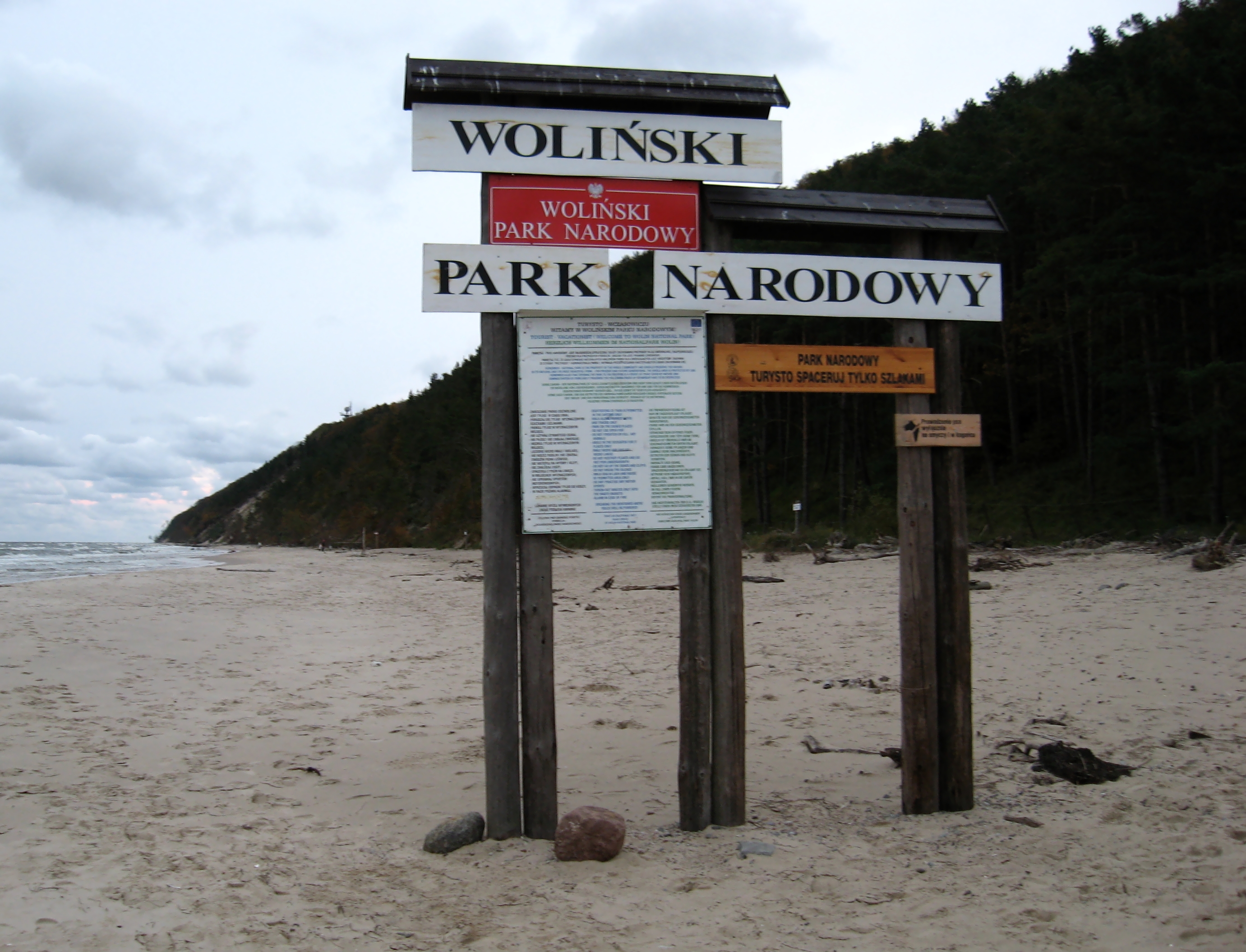
Wolin National Park (Woliński Park Narodowy) is one of Poland's 23 national parks, set on the island of Wolin in the far north-west of the country, in West Pomeranian Voivodeship. It covers the central-western part of the island, between the Bay of Pomerania and the Szczecin Lagoon. The park was established on 3 March 1960, spans 10,937 hectares (about 109 square kilometres) and is headquartered in the town of Międzyzdroje. It is an IUCN category II protected area, and its logo features a white-tailed eagle with a sea holly tucked in beside it. What to see in Wolin National Park The park's signature feature is the cliff coast between Wisełka and Międzyzdroje. Steep, high banks drop straight to the Baltic, with sandy beaches at their foot. This stretch looks very different from the flat, dune-lined shore found along most of the Polish coast. Two viewpoints draw the most visitors. Gosań is the highest cliff on the Polish coast, at roughly 93-95 metres, with views over the sea and towards Świnoujście. Kawcza Góra stands about 61 metres tall, has its own viewpoint, and a long staircase leads down to the beach. Where to see European bison The most visited spot in the park is the Bison Demonstration Reserve (Zagroda Pokazowa Żubrów). Bison have been bred on Wolin since 1976, and the reserve lets you see the animals up close. It is usually open in the summer season, roughly May to September, so check current opening hours and ticket prices before you go. Turquoise Lake The third landmark is Turquoise Lake (Jezioro Turkusowe), near the village of Wapnica. It is an artificial reservoir named for the distinctive colour of its water, and a popular stop for a short walk and photos. Nature in the park Wolin National Park is more than a stretch of seashore. You will find beech forests, peat bogs, sandy beaches and coastal dunes. Along the Szczecin Lagoon lie so-called dead cliffs, meaning stabilised ones no longer shaped by the sea. Wildlife associated with the park includes bison, white-tailed eagles and seals, and some species are easier to spot in educational enclosures than in the wild. Trails and planning your visit The park has well-marked trails of varying difficulty: short walks, routes to viewpoints, and longer hikes through its quieter parts. That makes it suitable for a family outing or a full day on foot. Międzyzdroje, home to the park's headquarters, and Wisełka at the other end of the cliff section are the natural bases. Frequently asked questions Where is Wolin National Park? On the island of Wolin in West Pomeranian Voivodeship, between the Bay of Pomerania and the Szczecin Lagoon. Its headquarters are in Międzyzdroje. When was it established and how big is it? It was established on 3 March 1960 and covers 10,937 hectares. How tall is the highest cliff? Gosań reaches about 93-95 metres, the highest cliff on the Polish coast. Can I see bison in the park? Yes. The Bison Demonstration Reserve has operated since 1976 and is the park's most visited attraction. What is the park's emblem? Its logo shows a white-tailed eagle and a sea holly.
-
Słowiński Park Narodowy
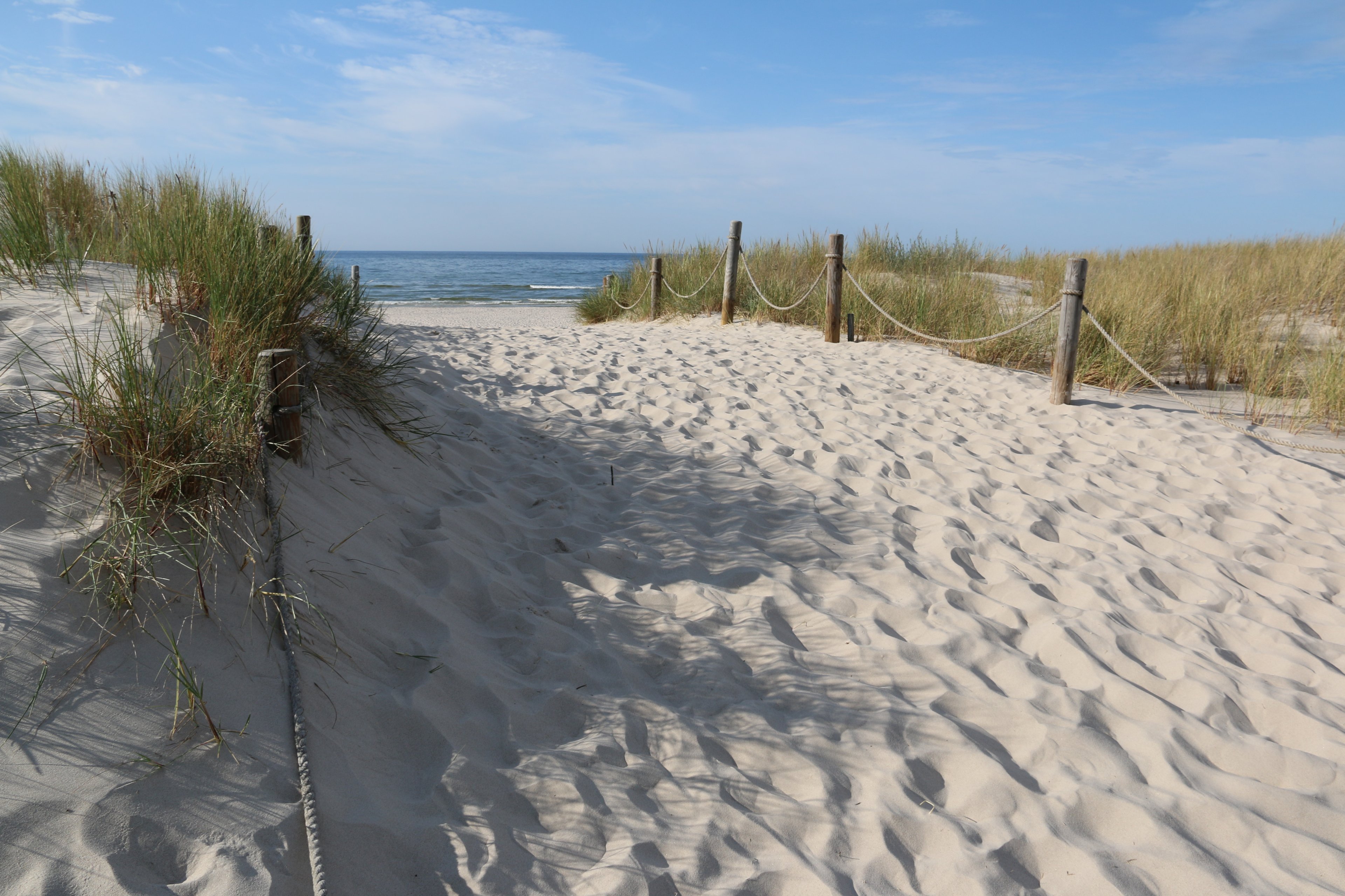
Słowiński National Park (Slovincian National Park) is one of Poland's twenty-three national parks, established on 1 January 1967. It covers roughly 327 km2 of the Baltic coast in Pomeranian Voivodeship, between Łeba and Rowy. It is best known for its shifting dunes, which look like a slice of desert right beside the sea. Where is the park located? The park runs along the Baltic Sea, and its northern boundary follows more than 32 km of coastline. Behind the beach comes a belt of dunes, then coastal lakes, peat bogs and forest. Such a variety of landscapes in a compact area is unusual, and it draws walkers, photographers and birdwatchers alike. Łeba is the main gateway to the park, while Rowy is a good base on the eastern side. What are the moving dunes? The moving dunes are the park's signature. Wind pushes the sand slowly inland, burying trees in its path, and over time the skeletons of former forests emerge from beneath it. The highest dunes, such as Łącka Góra, offer wide views over the sea, the lakes and the surrounding woods. Walking on loose sand is tiring, so allow more time than the map suggests and carry water. In summer the dunes can get very hot, with almost no shade. What lakes and habitats can you see? Behind the dune belt lie shallow coastal lakes, including Łebsko and Gardno, separated from the sea by sandbars. Meadows, reed beds and wetlands surround them, important for waterfowl and migrating birds. Further inland grow pine forests, and the hollows between the dunes hold damp peatland communities. The park belongs to a network of internationally recognised protected areas, so strict conservation rules apply. How do you explore the park? The park has a network of marked walking and cycling trails. From Łeba you can walk to the dunes, cycle, or use transport offered in season. Leaving the marked paths is prohibited, because trampling dunes and habitats damages protected nature. The area also has lighthouses and villages where you can learn about the history of the coast's former inhabitants. Outside the main season the park is quieter, and the empty dunes feel even more striking. Frequently asked questions When was the park established? On 1 January 1967. How big is it? About 327 km2, with more than 32 km of Baltic coastline along its northern edge. Where is it? In Pomeranian Voivodeship, on the Baltic coast between Łeba and Rowy. What is the best base? Łeba, from where the moving dunes are easiest to reach. Rowy works well from the east. Can I leave the trail? No. Dunes and peatlands are fragile, so stay on marked routes. When is the best time to visit? Spring and autumn are cooler and calmer, while in summer the dunes get very hot, so bring water and a hat. Check current entry rules and fees on the park's official website. Why visit? Słowiński National Park combines sea, sand, lakes and forest in one place. It suits a day trip from Łeba as well as a longer stay with several walks in different parts of the park. The scenery changes with the season and the weather, so the same route can look different every time. For families, the dramatic dunes are a draw, and for nature lovers the park offers rich birdlife and many habitat types in a small area. Bring sturdy closed shoes, since sand quickly gets into sandals, and sun protection, because the open terrain offers no shelter from wind or sun.
-
Ojcowski Park Narodowy
Ojców
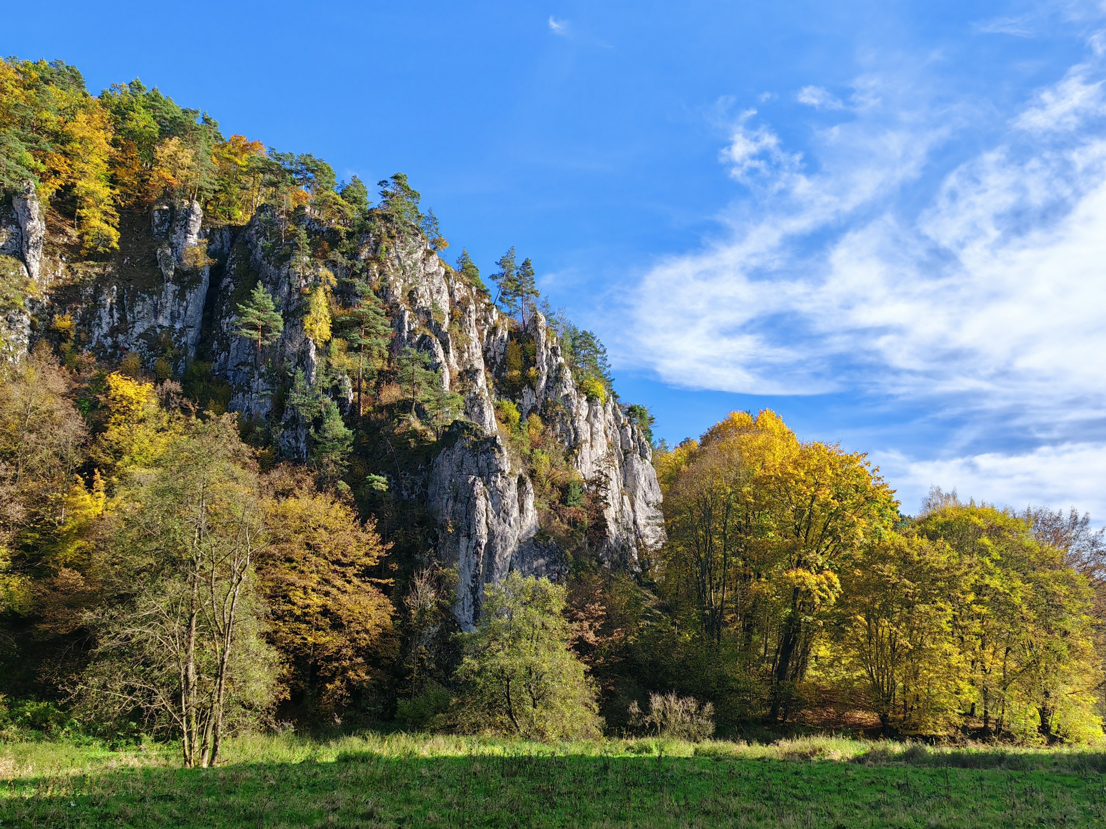
Ojców National Park (Ojcowski Park Narodowy) is the smallest national park in Poland, yet it ranks among the richest destinations near Kraków. It lies only about 16 km from the city, in the Prądnik River valley on the Kraków-Częstochowa Upland. Established in 1956, it covers 21.46 km² in Lesser Poland Voivodeship. Where is Ojców National Park? The park is in Kraków County and spreads across four municipalities: Skała, Jerzmanowice-Przeginia, Wielka Wieś and Sułoszowa. It takes its name from the village of Ojców, which is also home to the park's headquarters. The trip from Kraków is short, so the area is a popular day-trip choice. What are the main sights? The landscape is defined by white limestone cliffs rising from the valley slopes. Among the best known: Hercules' Club (Maczuga Herkulesa) – a rock pinnacle about 25 metres tall, shaped like a club, standing near Pieskowa Skała castle. Together with the castle it makes one of the most photographed views in the region. Kraków Gate (Brama Krakowska) – a large natural rock gate carved from resistant limestone. There are two castles to see. In Ojców you will find the ruins of a medieval stronghold, while the castle in Pieskowa Skała is well preserved and houses a museum with restored interiors. Which caves can you visit? The park is famous for its caves, with more than 400 within its area. The best known are: Łokietek's Cave – linked to the legend of King Władysław the Elbow-high. Dark Cave (Jaskinia Ciemna) – an important archaeological site dating to Neanderthal times. Bat Cave (Jaskinia Nietoperzowa) and Wierzchowska Cave – more caves worth a look. The bat is the park's symbol, and it inhabits many of these underground spaces. Why visit Ojców? The park protects distinctive rock formations, caves, and rare plants and animals. Ojców also has a place in cultural history: Frédéric Chopin visited in 1829. Today it combines forest walks, castles and caves with easy access from a major city. Frequently asked questions How far is Ojców National Park from Kraków? About 16 km. When was the park established? In 1956. How big is the park? It covers 21.46 km², making it the smallest national park in Poland. Are there castles in the park? Yes: the ruins of Ojców castle and the castle in Pieskowa Skała, which has a museum. Why is the bat the park's symbol? Bats live in many of the caves in the park. Can you visit caves here? The park has many caves, including Łokietek's Cave, Dark Cave, Bat Cave and Wierzchowska Cave.
-
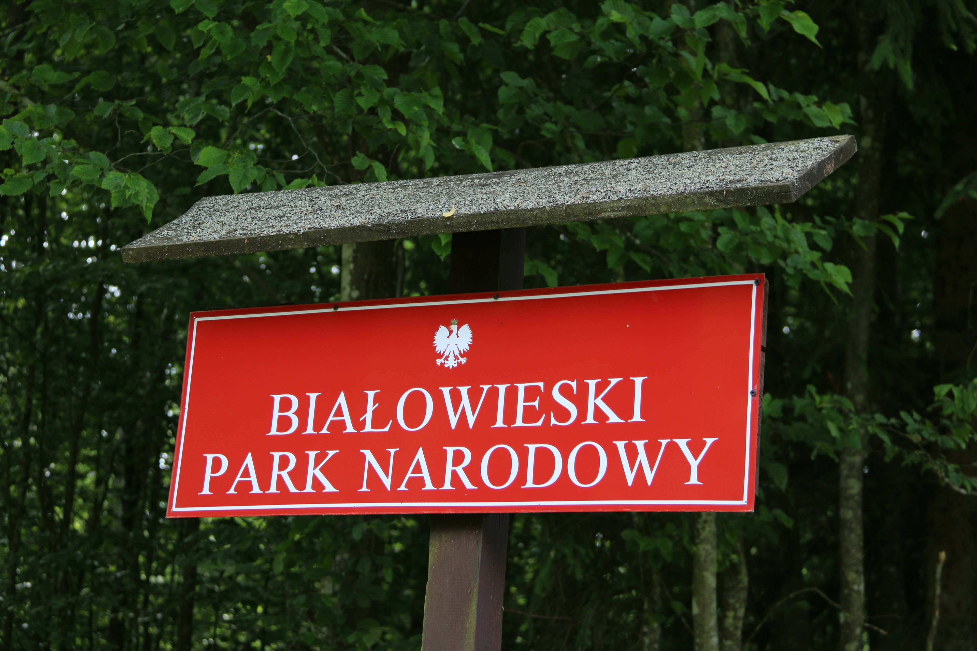
Białowieski Park Narodowy
Białowieża National Park is one of the oldest national parks in Poland and one of the few places in Europe where nature still runs largely on its own terms. It lies in Podlaskie Voivodeship in eastern Poland, right next to the Belarusian border, and protects the best preserved part of the Białowieża Forest, Europe's last fragment of temperate primeval lowland forest. Where is Białowieża National Park and how big is it? The park covers about 105.2 square kilometres (40.6 sq mi) and sits roughly 62 km (39 mi) southeast of Białystok. Its coordinates are around 52.77° N, 23.87° E. The remote location on Poland's eastern edge means the trip takes some planning, but the reward is a landscape that has almost vanished from the rest of the continent. When was the park created? Protection of this area has a long history. A national park in Białowieża was established by a regulation of the Minister of Agriculture and Agrarian Reforms, in force from 11 August 1932. The park was restored in its present form by a Council of Ministers regulation of 21 November 1947. It is the second national park in Poland after Pieniny National Park, and one of the first in Europe. What does the park protect? The forest itself is the main treasure. The Białowieża Forest is a remnant of primeval temperate woodland that once stretched across much of the European Plain. The second reason for the park's fame is the European bison. The forest is home to the world's largest free-living population of the species, counted in the hundreds. The bison is the heaviest land animal on the continent. Alongside it live wild boar, elk, wolves and lynx. How can you visit? The Strict Reserve, the most protected part of the park, can be entered only with a licensed guide. Contact details for guides, including the Sóweczka natural tourism office and the Czajka tourism agency, are listed on the park's website. It is wise to book ahead, especially in high season. On your own you can use the hiking and cycling trails and the observation towers located in the park and in the surrounding managed forest. Among the most popular routes are the "Żebra Żubra" boardwalk trail and the Royal Oaks Trail. Where can you see a bison up close? Meeting a wild bison in the forest is never guaranteed, so many visitors head to the Demonstration Bison Reserve. It shows the large forest mammals: bison, elk, deer, wild boar, wolves and lynx, as well as tarpan-type ponies and żubronie, hybrids of bison and domestic cows. Can you visit the Palace Park? The Palace Park lies just north of the tourist office. It is not part of the national park, so entry is free. It makes a calm walk at the start or end of a day in Białowieża. Frequently asked questions Can I enter the Strict Reserve on my own? No. Entry is possible only with a licensed guide. How many bison live in the forest? Several hundred, forming the largest free-living population in the world. More than 600 live on the Polish side of the forest. Is the Palace Park paid? No. It is outside the national park, so entry is free. How far is it from Białystok? About 62 km (39 mi) southeast of the city. Which animals might I see? Bison, elk, wild boar, wolves and lynx. The easiest place to see them is the Demonstration Bison Reserve. Are there cycling routes? Yes, the park and nearby forests have hiking and cycling trails and observation towers.
-
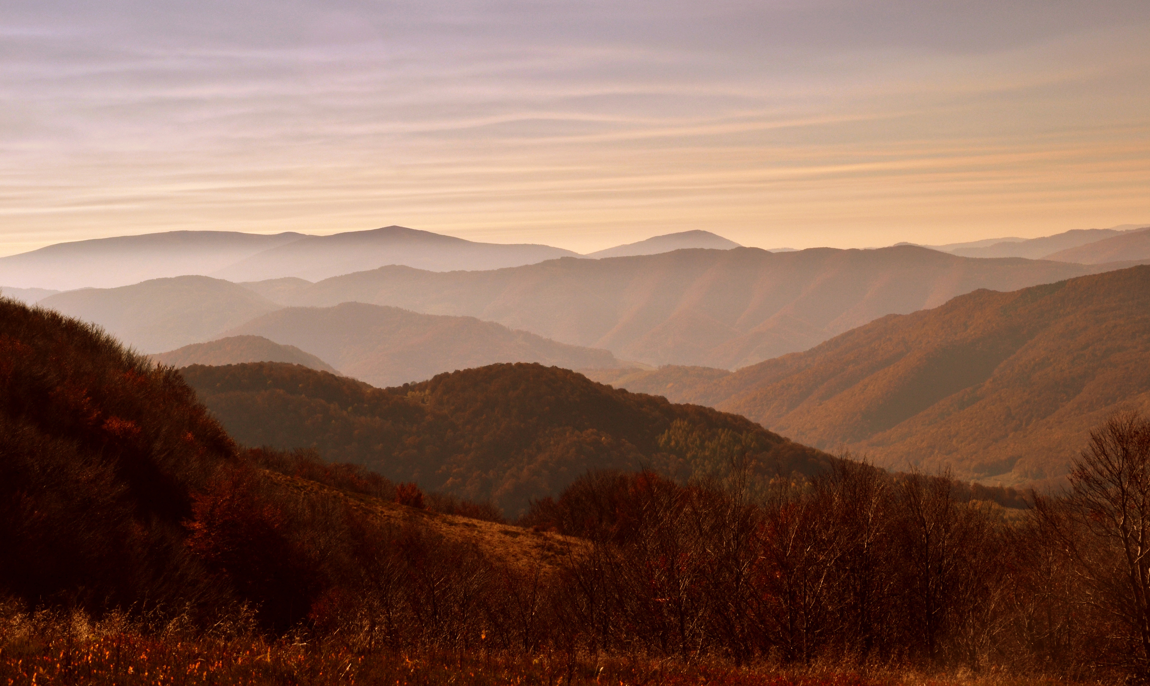
Bieszczadzki Park Narodowy
Bieszczady National Park in southeastern Poland’s Subcarpathian Voivodeship is the country’s third-largest national park, covering 292 km². Established in 1973, it has been part of the International Biosphere Reserve “Eastern Carpathians” since 1992, and its ancient beech forests gained UNESCO World Heritage status in 2021. The highest peak, Tarnica, reaches 1,346 m. The park’s defining feature is its open subalpine ridges — połoniny — with panoramic views stretching into Ukraine and Slovakia. Wildlife is exceptional: brown bear, grey wolf, over 500 European bison, Eurasian lynx, European wildcat, moose, European otter, and the Aesculapian snake. It is one of the few places in Poland where large predators and herbivores coexist in near-wilderness conditions.
-
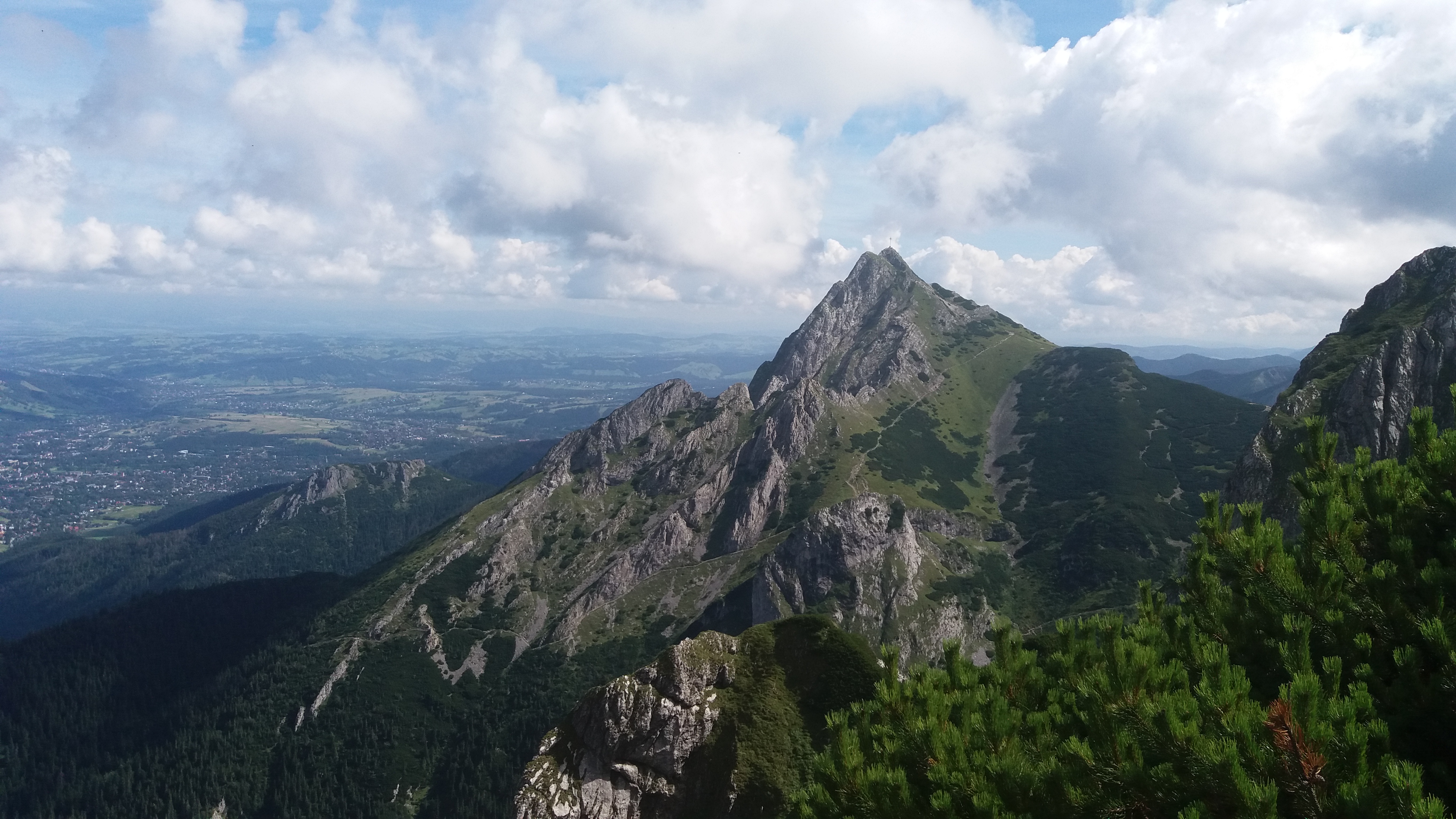
Tatrzański Park Narodowy
Tatra National Park (TPN) in Zakopane is the most visited national park in Poland and the country's only alpine mountain range. Covering 215.56 km², it forms a natural border between Poland and Slovakia; together with its Slovak counterpart it is a UNESCO transboundary biosphere reserve. Rysy peak (2,499 m), the highest point in Poland, lies within the park boundaries. More than 270 km of marked trails cross five vegetation zones — beech-fir forests, spruce woods, subalpine meadows, and alpine flora with Swiss pine and edelweiss. Wildlife includes Tatra chamois, Alpine marmot, brown bear, Eurasian lynx, and grey wolf. Summer draws hikers and climbers; winter brings skiers.
-
1 visits

Forest Park of Culture and Rest
Bydgoszcz
Forest Park of Culture and Rest is a large urban park on the edge of Bydgoszcz, Poland, laid out in a wooded area. It combines a natural setting with space for everyday recreation, making it an easy place to step away from the city for a while. For visitors, it works well as a relaxed walk or a short outdoor break. Na miejscu można liczyć przede wszystkim na: walking and cycling paths that let you explore the park at an easy pace open green spaces for resting, casual activities, and spending time outdoors recreational facilities, plus a setting that is used for leisure, sports, and outdoor events throughout the year If you are planning a visit, comfortable shoes are a good idea, especially if you want to make use of the paths and spend more time in the wooded areas. It is a practical choice for anyone looking for a calm outing close to nature, whether for a stroll, exercise, or a simple break outdoors.
Earn badges for the places you visit
Download NextOnTrip, discover new places and check off your trails.