Nature in France
A guide to 575 Nature in France — with descriptions, photos and traveler visits from the NextOnTrip community. Locations spread across 444 cities and towns. Most visited by the community: Belvédère du Couloir Samson, place Bellevue, Cuves du Buizin.
-
Lac de Pont-de-Salars
Le Vibal
Lac de Pont-de-Salars is a reservoir sitting at 718 metres above sea level, straddling the boundary between the communes of Pont-de-Salars and Le Vibal, on the Lévézou plateau in the Aveyron department of southern France. The lake covers roughly 1.82 square kilometres, making it one of several sizeable bodies of water on this upland plateau, alongside the larger Lac de Pareloup and the nearby Lac de Bage. Rolling pastures, patches of woodland and scattered farmhouses frame the shoreline, and the reservoir has long served as a swimming spot and weekend destination for people living between Rodez and Millau. Where exactly is the lake located? The lake follows an elongated, irregular shoreline typical of reservoirs formed by damming a river valley. Its southwestern shore belongs to Le Vibal, while the eastern and northern banks sit within Pont-de-Salars, the town that gave the lake its name. Its approximate coordinates are 44.2955°N, 2.7437°E, placing it firmly within the Lévézou, one of the highest plateaus in Aveyron. What can visitors do at the lake? Pont-de-Salars is primarily a family destination rather than a hub for extreme water sports. Calm water makes it well suited to swimming, fishing, pedal boats and canoeing. During the summer season, boat and paddle equipment can usually be rented near the beaches, and inflatable water parks with trampolines and slides draw both children and adults on warm afternoons. Because the water is generally shallow near shore and the lake is sheltered, it tends to attract families with young children looking for a quieter alternative to the busier Lac de Pareloup nearby. Which beaches can be found around the lake? Two main beaches serve the lake. On the Le Vibal side lies a small, low-key beach known locally as the Moulinoches beach, with an easy, gentle entry into the water. On the Pont-de-Salars side is a second, larger beach, near which a couple of restaurants overlook the water. During July and August, lifeguards typically supervise both beaches during set hours, making the lake a reasonably safe choice for a family day out. How do you get there, and is parking easy? Local roads connect Pont-de-Salars and Le Vibal directly to the lake, and parking near the main beaches is generally free. The Lévézou plateau lies only a short drive from Rodez, the departmental capital, which makes the lake an easy day-trip destination for visitors staying in the wider Aveyron region, as well as a regular weekend spot for locals. Frequently asked questions Can you swim in Lac de Pont-de-Salars? Yes. The lake has designated swimming areas that are supervised by lifeguards during the summer season, and access is free. How big is the lake? It covers approximately 1.82 square kilometres, making it a mid-sized lake compared with others on the Lévézou plateau. At what altitude does the lake sit? The lake sits at 718 metres above sea level, on the Lévézou plateau. Can you rent water equipment there? During the summer months, rental of canoes, pedal boats and paddleboards is usually available near the beaches, along with inflatable water parks for children. How does it compare with Lac de Pareloup? Lac de Pareloup is larger and more developed for tourism, while Lac de Pont-de-Salars offers a quieter, more local atmosphere, well suited to a short stay or an afternoon swim.
-
Lac du Rotondu
Venaco
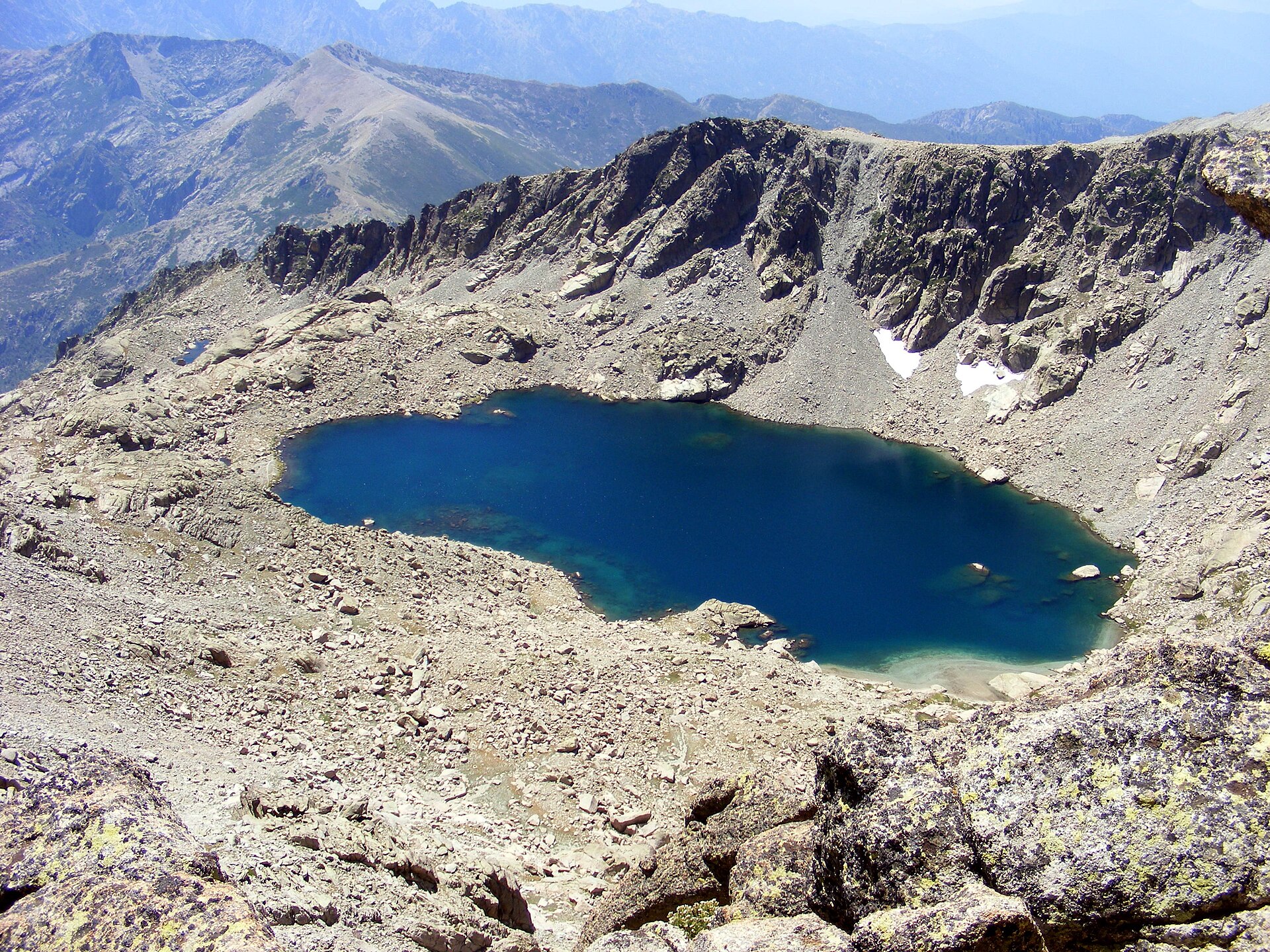
Lac de Bettaniella is the largest natural freshwater lake in Corsica, sitting at 2,321 metres above sea level in the commune of Venaco, at the foot of the Monte Rotondo massif in Upper Corsica. It is also known as Lac de Bellebone or Lac du Rotondo. The lake measures roughly 425 by 225 metres and owes its existence to glacial activity: it is a classic glacial lake, cupped in a rocky basin with no significant surface outflow, making it an endorheic body of water. Where is it and what does the landscape look like The lake sits at the heart of the Monte Rotondo massif, whose summit rises about 300 metres above the water. The surrounding scenery is textbook high-altitude Corsica: bare granite slabs, glacial cirques and sparse alpine vegetation. Because the basin faces southeast and stays frozen for roughly seven months of the year, the setting keeps a raw, wintry character for most of the calendar — snow can linger well into late spring. How do you get there From the Petra Piana refuge The most common starting point is the Petra Piana refuge (1,842 metres), a well-known stop on the GR20 long-distance trail. From there, reaching the lake takes a little over an hour to about ninety minutes. The first stretch is manageable, but the closer you get to the water, the steeper the path becomes, crossing boulder fields where hikers sometimes need to use their hands for balance. Via Vizzavona and the GR20 An alternative approach starts from Vizzavona, a popular GR20 trailhead village. From there the route heads toward Petra Piana and continues on to the lake. It is a longer, full-day option, but it lets hikers combine the visit with a stretch of Corsica's legendary long-distance trail. Climbing Monte Rotondo from the lake For many hikers, Lac de Bettaniella is only a waypoint on the way to the summit of Monte Rotondo (2,622 metres) — the second-highest peak in Corsica, behind only Monte Cinto. From Petra Piana, reaching the top takes about three hours, with the lake passed after just under an hour of walking. The stretch above the lake is noticeably tougher: rocky terrain that occasionally calls for scrambling and extra care, especially when the surface is wet or icy. A full loop combining the Monte Rotondo ascent with a stop at the lake runs to roughly 9-10 hours for well-prepared hikers, with elevation gain in the region of 1,700 metres. When to plan the hike Given the altitude and the long snow season, safe hiking conditions are really only reliable in summer, from July through September. Outside that window the trail is often snow-covered or icy, and crossing the boulder fields becomes considerably riskier. Frequently asked questions Is Lac de Bettaniella the largest lake in Corsica? Yes, it is the island's largest natural freshwater lake, measuring about 425 by 225 metres. What other names does the lake go by? It is also called Lac de Bellebone and Lac du Rotondo. Where is the best place to start the hike? Most visitors set out from the Petra Piana refuge on the GR20, reaching the lake in 1 to 1.5 hours. A longer route via Vizzavona is also possible. Can you climb Monte Rotondo from here? Yes, a steep, rocky trail continues from the lake to the 2,622-metre summit, Corsica's second-highest peak. The climb from Petra Piana to the top takes around three hours. When is the best season to visit? Because the lake stays frozen for about seven months of the year, summer — from July to September — is the safest and most reliable time to hike here.
-
Lac de Bastani
Ghisoni
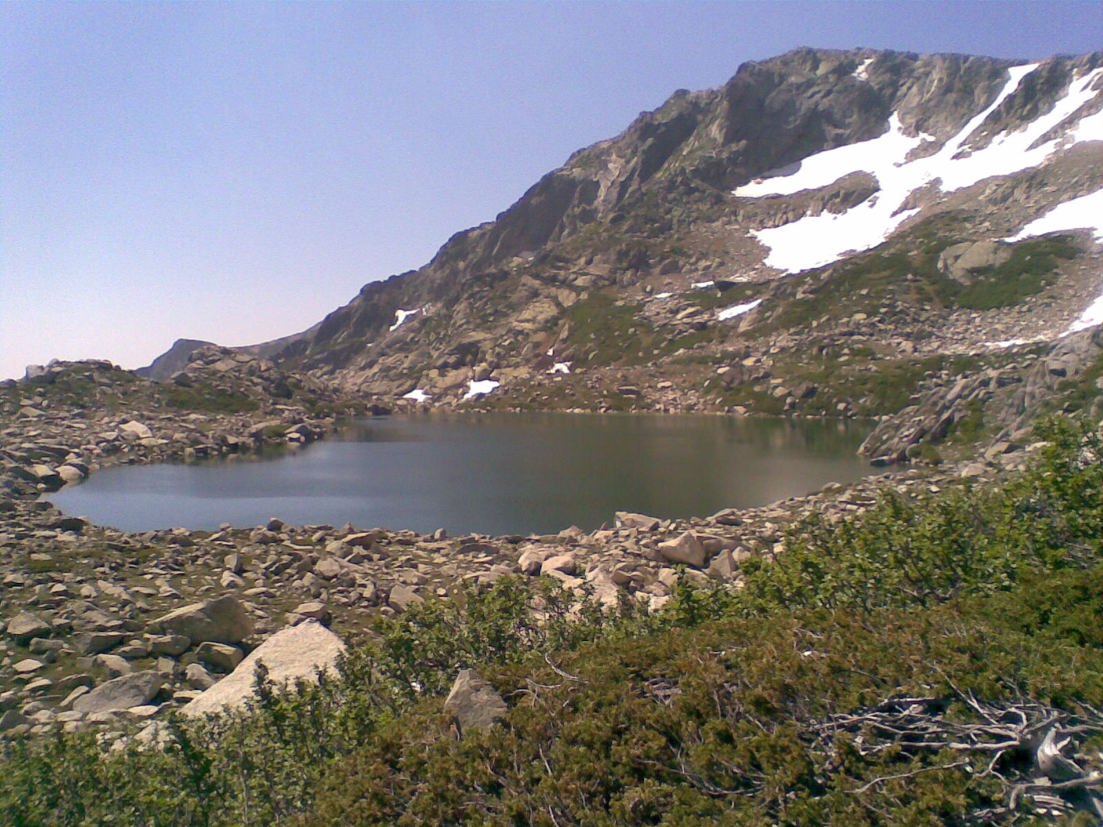
Lac de Bastani is a high-altitude glacial lake in the commune of Ghisoni, tucked inside the Regional Natural Park of Corsica roughly sixty kilometres from Corte. Sitting at nearly 2,100 metres, right below Punta Bacinello and facing Monte Renoso, it ranks among the highest lakes on the island. What makes this lake stand out? Seen from above, particularly from the summit of Monte Renoso, Bastani reveals a distinctive heart-shaped outline that has made it a favourite subject for hikers with a camera. Its water carries a striking emerald tint, produced by filamentous microalgae thriving in the cold, clear depths. The lake covers roughly 4.4 hectares and plunges to about 24 metres at its deepest point. Because of the altitude and harsh mountain climate, it stays frozen for as much as seven months of the year. Trout live in its waters, drawing the occasional angler willing to make the climb. Where exactly is it located? Bastani sits less than a kilometre northwest of its neighbour, Lac de Nielluccio, and barely half a kilometre from the summit of Monte Renoso itself (2,352 m). The two lakes share the same mountain range and a similar starting point, but they are separate bodies of water with their own shape and character — worth telling apart when planning a route. How do you get there on foot? Most hikers start from the bergeries and refuge of Capannelle, at about 1,586 metres, right on the GR20 long-distance trail above Ghisoni. From there, the route branches off the GR20 to follow the path that once served the Petraniella ski lift, climbing steadily toward the lake. The round trip covers around 7 kilometres with roughly 430 metres of elevation gain — a sustained but non-technical ascent across rocky sections and grassy plateaus. Reasonably fit walkers reach the lake in about one and a half to two hours. The path is well marked and does not require climbing equipment or special skills. When is the best time to go? The trail is fully walkable from June to September. Outside that window, snow can cover the higher sections, complicate route-finding, and make some rocky stretches genuinely hazardous. Even in summer, an early start is wise, since mountain weather in central Corsica can shift quickly by early afternoon. Frequently asked questions Can you swim in Lac de Bastani? No, swimming is not allowed. The lake functions as a natural high-mountain reservoir and its water stays extremely cold even in summer. How long does the hike from Capannelle take? With reasonable fitness and good weather, expect about one and a half to two hours one way — a half-day outing including the return. How is it different from Lac de Nielluccio? It's a separate lake in the same massif, less than a kilometre away, with its own shoreline and shape. Experienced hikers sometimes combine both lakes in a single outing. Can you continue on to the summit of Monte Renoso from here? Yes, the lake lies very close to the peak — under half a kilometre as the crow flies — though reaching the summit itself takes extra effort and clear visibility. Is the hike suitable for beginners? Yes, in good weather and with proper footwear it's a moderately demanding mountain walk, manageable for hikers with average fitness.
-
Lac de l'Abbaye
Grande-Rivière
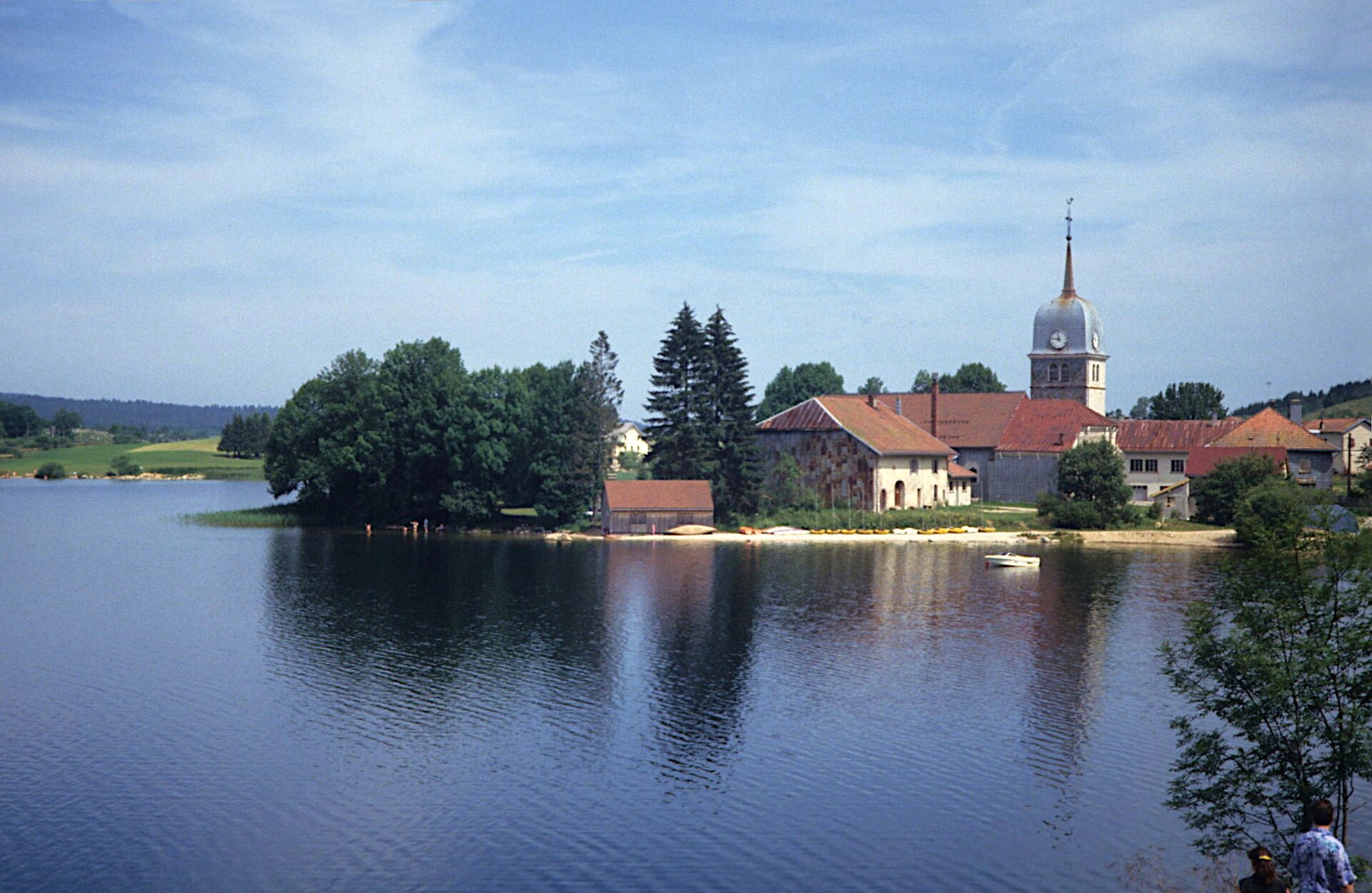
Lac de l'Abbaye is a glacial lake sitting at roughly 879 metres of altitude on the edge of the Jura Mountains, within the commune of Grande-Rivière, about 7 km south of Saint-Laurent-en-Grandvaux. It is also known locally as Lac de Grandvaux or Lac de la Grande Rivière and ranks among the best-known lakes of the Haut-Jura area. Where does the lake's name come from? The name refers to an abbey that stood on its shore from the 12th century onward, under the authority of the abbey of Saint-Claude. Little of the original monastic complex survives today except the church, which was rebuilt in the 19th century and remains the most visible trace of that religious community. Can visitors swim in Lac de l'Abbaye? The lake is privately owned, and swimming is not officially permitted. In practice, a small beach at a spot called L'Échappement is used for bathing during summer, and it is tolerated even though no lifeguard supervises it. Anyone planning to swim should treat it as an unsupervised spot without the usual beach facilities. What water activities are available? Windsurfing, sailing, canoeing, paddleboarding, fishing and rowing on the lake are reserved for guests of three establishments located on its shore: Hôtel Lou Granva, Hôtel de l'Abbaye and Ferme de Marguerite. These venues control access to equipment and water infrastructure, so visitors not staying there cannot arrange these activities independently. How do you reach the lakeshore? Several access points lead down to the water: next to the church, beside Hôtel Lou Granva, along a discovery trail, and near the former sawmill (scierie). This means the lake can be approached and admired from multiple spots even without booking a stay at one of the hotels mentioned above. What else is worth seeing nearby? A walking and cycling loop of 6.9 km runs around the lake, typically taking between one and a half and two hours to complete, not counting stops to enjoy the views. The path follows the shoreline and opens onto several viewpoints over the water and surrounding forest. A separate highlight is the Belvédère du Moulin, a viewpoint reachable by car, on foot or by mountain bike, offering a wider panorama over the lake and the Jura landscape beyond it. Practical information The former abbey church is open for free visits year-round, Wednesday to Sunday, from 10:00 to 17:00. Frequently asked questions Is Lac de l'Abbaye suitable for swimming? The lake is privately owned and swimming is not officially authorised, but it is tolerated in summer at a small beach at L'Échappement. There is no lifeguard, so anyone swimming does so at their own risk. Can you kayak or use a boat on the lake? Yes, but only as a guest of one of the three establishments on the shore: Hôtel Lou Granva, Hôtel de l'Abbaye or Ferme de Marguerite, since they are the ones providing access to water equipment. Where does the lake's name come from? It comes from an abbey founded on its banks in the 12th century, which depended on the abbey of Saint-Claude. Only the church survives from that period, having been rebuilt in the 19th century. How long does it take to walk around the lake? The loop trail around Lac de l'Abbaye covers 6.9 km and usually takes one and a half to two hours on foot, depending on how many stops are made for the views. Where exactly is Lac de l'Abbaye located? The lake lies in the commune of Grande-Rivière in the Jura department, at around 879 metres of altitude on the edge of the Jura Mountains, roughly 7 km south of Saint-Laurent-en-Grandvaux.
-
Lake Buena Vista
Chessy
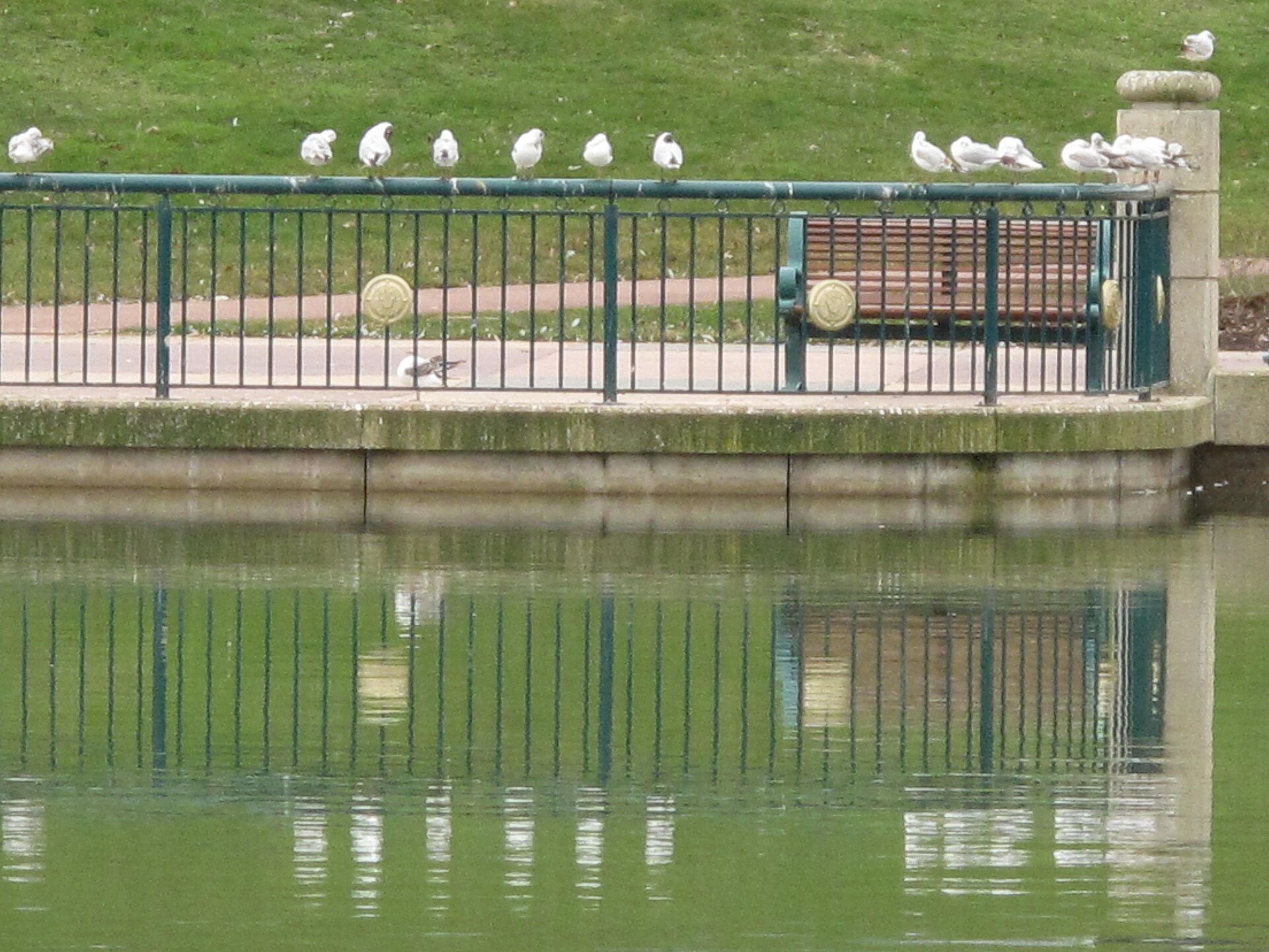
Lake Buena Vista is an artificial lake at the heart of Disneyland Paris, in the town of Chessy in the Seine-et-Marne department, right next to the Disney Village entertainment quarter. Named after the lake at Florida's Walt Disney World, it is an entirely separate stretch of water built specifically for the French resort. Where is the lake located? The lake sits between Disneyland Paris's two theme parks - Disneyland Park and Walt Disney Studios Park - and the resort's Lake Buena Vista hotel district. Its coordinates are 48.868889, 2.7875. A wide pedestrian path circles the water, giving views of the surrounding hotels and the resort's giant tethered balloon. What activities are available on the water? A marina called Marina del Rey rents out a range of watercraft: pedal boats, water bikes, jet-skis, small Optimist-class sailboats, rowboats, and motorboats or electric boats. Visitors who prefer to explore on land can rent Rosalie family quadricycles, pedal cars, or Segways to tour the shoreline instead. What is the balloon floating over the lake? A large helium balloon called PanoraMagique hovers on a tether above the water. It lifts visitors around 100 metres into the air for a panoramic view over the whole Disneyland Paris resort and the surrounding Ile-de-France countryside - one of the few spots in the area offering an aerial view of both parks at once. How does the lake connect to Disney Village? One section of the lake, marked off by a footbridge, extends into Disney Village, the resort's ticket-free entertainment district. Here the water borders the Key West Seafood restaurant and the Hurricanes nightclub. Disney Village itself adds shops, a 16-screen Gaumont cinema, a bowling alley, and free open-air concerts throughout the year to the mix. What is nearby? Lake Buena Vista lies in the commune of Chessy, next to Marne-la-Vallée, roughly 32 km (20 miles) east of central Paris. Unlike its Florida namesake - a small municipality within Walt Disney World - the French lake has no municipal identity of its own; it exists purely as a landscaped, recreational feature of the Disneyland Paris resort. Frequently asked questions Is it free to visit the lake? Yes. The promenade around the lake and views of the PanoraMagique balloon are free, since they sit within Disney Village, which does not require a park ticket. Charges apply only for renting watercraft or riding the balloon. Can you rent a boat on the lake? Yes, the Marina del Rey rents pedal boats, water bikes, Optimist sailboats, rowboats, motorboats, and jet-skis, letting visitors get out on the water independently during their stay at the resort. Where does the name Lake Buena Vista come from? The name references Lake Buena Vista in Florida, known for the Walt Disney World resort, but the French lake is a separate artificial body of water created specifically for Disneyland Paris, sharing only the name with its American counterpart. What can you see from the PanoraMagique balloon? The balloon rises about 100 metres above the lake, offering a panoramic view of both Disneyland Paris theme parks, the resort's hotels, and the surrounding Ile-de-France region. Can you rent a land vehicle instead of a boat near the lake? Yes, alongside watercraft rentals, visitors can rent land vehicles to tour the lakeside area, including Rosalie family quadricycles, pedal cars, and Segways.
-
Lac de l'Eychauda
Vallouise-Pelvoux
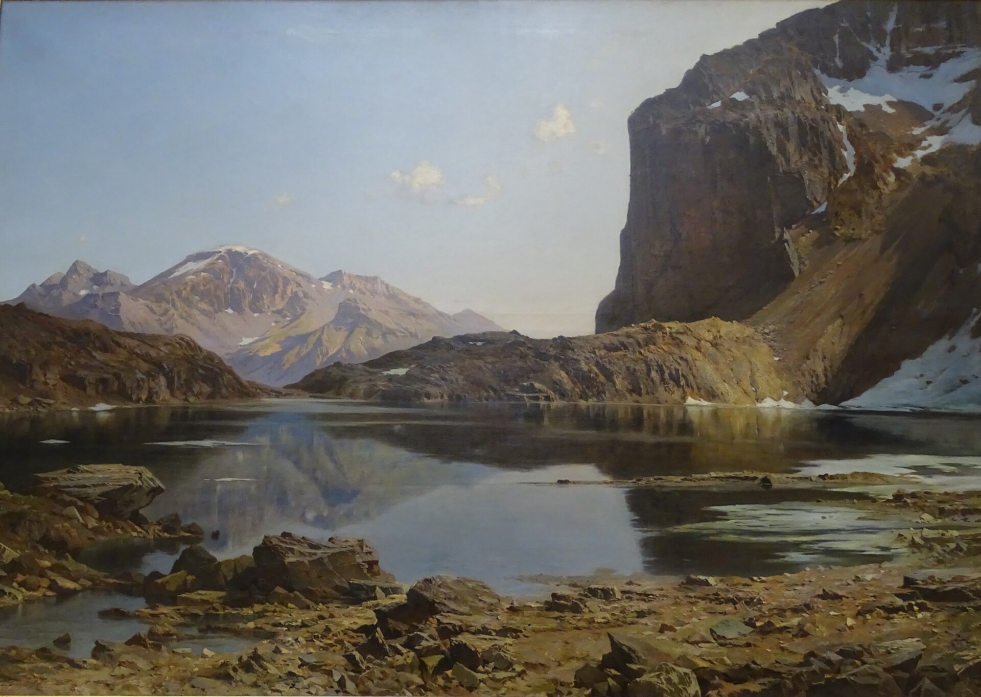
Lac de l'Eychauda is a glacial lake sitting at 2,514 m above sea level, within the commune of Vallouise-Pelvoux in the Hautes-Alpes. It ranks among the three largest lakes in the Écrins massif and is the largest cirque lake in the French Alps, making it a rewarding day-hike destination that pairs glacier scenery with the quiet of a high alpine valley. Where exactly is the lake? Eychauda lies in the core zone of Écrins National Park, in the Briançonnais area, at coordinates 44.932, 6.478. The lake sits at the bottom of a glacial cirque ringed by steep ridges, overlooked from above by the Séguret Foran glacier. The approach passes near the GR 54, the long-distance trail also known as the Tour de l'Oisans, which circles the entire Écrins massif. How do you get there? The usual starting point is the car park at the hamlet of Chambran, at roughly 1,719 m, close to Vallouise. From there the trail climbs steadily through alpine pastures, following the valley upward until a rocky step opens onto the lake basin. The round trip covers about 11 km with roughly 850 m of elevation gain. Depending on fitness and pace, most hikers need the better part of a day — starting early is a good idea, especially in summer, when afternoon thunderstorms are common in this part of the Alps. Why is the water milky blue? The lake is fed by meltwater from the Séguret Foran glacier. Fine rock powder carried by the glacial water — often called glacial flour — gives the lake its distinctive pale, milky-blue color. Because of the altitude and the glacier's proximity, the lake is only ice-free for about three to four months a year, and floating chunks of ice can still appear on the surface even in summer. This short window is essentially the only time any biological activity takes place here; for the rest of the year the surface stays frozen and still. When is the best time to visit? The wider hiking season runs from May to October, but the trail and the lake itself are usually free of significant snow and ice only from July to September. Earlier in the season, snow patches can linger on the higher stretches just below the lake, so it is worth checking recent trail reports before setting out. Frequently asked questions How high up is Lac de l'Eychauda? The lake sits at 2,514 m above sea level, in the Écrins massif. How was the lake formed? It is a cirque lake, carved out by the Séguret Foran glacier during a period of glacial retreat. The glacier still overhangs the lake today and continues to feed it with meltwater. How long does the hike take? From the Chambran car park, the round trip is about 11 km with around 850 m of elevation gain, typically taking five to seven hours depending on pace and stops. Is the trail difficult? It is a demanding but non-technical mountain hike — a long, steady climb through pastureland, best suited to hikers in good condition who are used to high-altitude trails. Is the lake inside a national park? Yes. Lac de l'Eychauda lies in the core zone of Écrins National Park, which means staying on marked trails, avoiding wild camping outside designated areas, and not disturbing wildlife. Can you really see ice on the lake in summer? Yes — due to the altitude and short thaw period, blocks of ice can still float on the surface even in the middle of summer, one of the lake's most distinctive features.
-
Lac de la Plaine
Celles-sur-Plaine
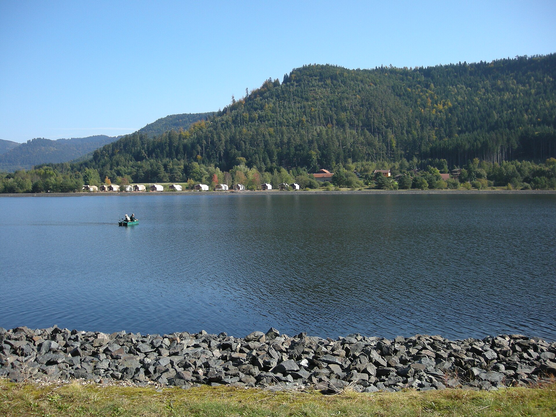
Lac de la Plaine is a man-made reservoir tucked into the Plaine valley, straddling the border between the Vosges and Meurthe-et-Moselle departments in France's Grand Est region. Sitting just below the larger Lac de Pierre-Percée, it forms part of one of the most visited outdoor leisure areas in the Vosges mountains. Where is the lake located? The reservoir lies within the commune of Celles-sur-Plaine, close to the village that gives the lake its name, roughly at coordinates 48.45°N, 6.93°E. Surrounded by the conifer forests typical of the Vosges massif, the lake sits right beside the Vieux Pré dam that created it. Is it a natural lake or a reservoir? Lac de la Plaine is entirely artificial. It was formed after French utility company EDF designed the Vieux Pré dam in 1983, built across a small tributary of the Plaine river. The dam itself was commissioned in 1993 and stands 78 metres high. The reservoir has a practical hydrological role beyond recreation: it helps maintain minimum flow levels on the Meurthe and, further downstream, the Moselle river, offsetting water drawn for cooling at the Cattenom nuclear power plant. Functioning as a lower balancing basin, it feeds into the larger upstream Lac de Pierre-Percée, and together the two reservoirs hold a combined water reserve of around half a million cubic metres. What can visitors do at the lake? Despite its industrial origin, Lac de la Plaine has grown into a well-equipped outdoor recreation hub, run as a "pôle sports nature" leisure base. The site includes a supervised beach with a gentle slope into the water, picnic areas, a children's playground, and a small refreshment stand for snacks and drinks. From April to September, visitors can join water-skiing, canoeing and kayaking, pedal boats, and inflatable water games, while pedal karts and mini-golf are available on dry land nearby. Several of these activities are shared with the neighbouring Lac de Pierre-Percée, so many visitors combine a stop at both lakes in a single day out. Can you swim in the lake? Yes. Supervised swimming is concentrated at the Lac de la Plaine leisure base rather than around Pierre-Percée, making it the designated bathing spot in the area. The gradual, sandy shoreline and lifeguard supervision during summer months make it a practical choice for families travelling with young children. Frequently asked questions Is Lac de la Plaine a natural lake? No. It is an artificial reservoir created by the Vieux Pré dam, which EDF designed in 1983 and put into service in 1993, standing 78 metres tall. What purpose does the reservoir serve besides tourism? It helps regulate low-water flow on the Meurthe and Moselle rivers and compensates for water withdrawals used to cool the Cattenom nuclear power plant, working alongside the larger Pierre-Percée reservoir. What water sports are available in summer? Water-skiing, canoeing, kayaking, pedal boats and inflatable water games, typically available from April through September and partly shared with Lac de Pierre-Percée. Is there a supervised beach? Yes, the leisure base has a lifeguard-supervised beach with a gentle slope, suited to families with children. How do you get to the lake? The reservoir is located in the commune of Celles-sur-Plaine in the Vosges department, within easy reach of the Plaine valley, right next to the Vieux Pré dam.
-
Lac de la Cassière
Aydat
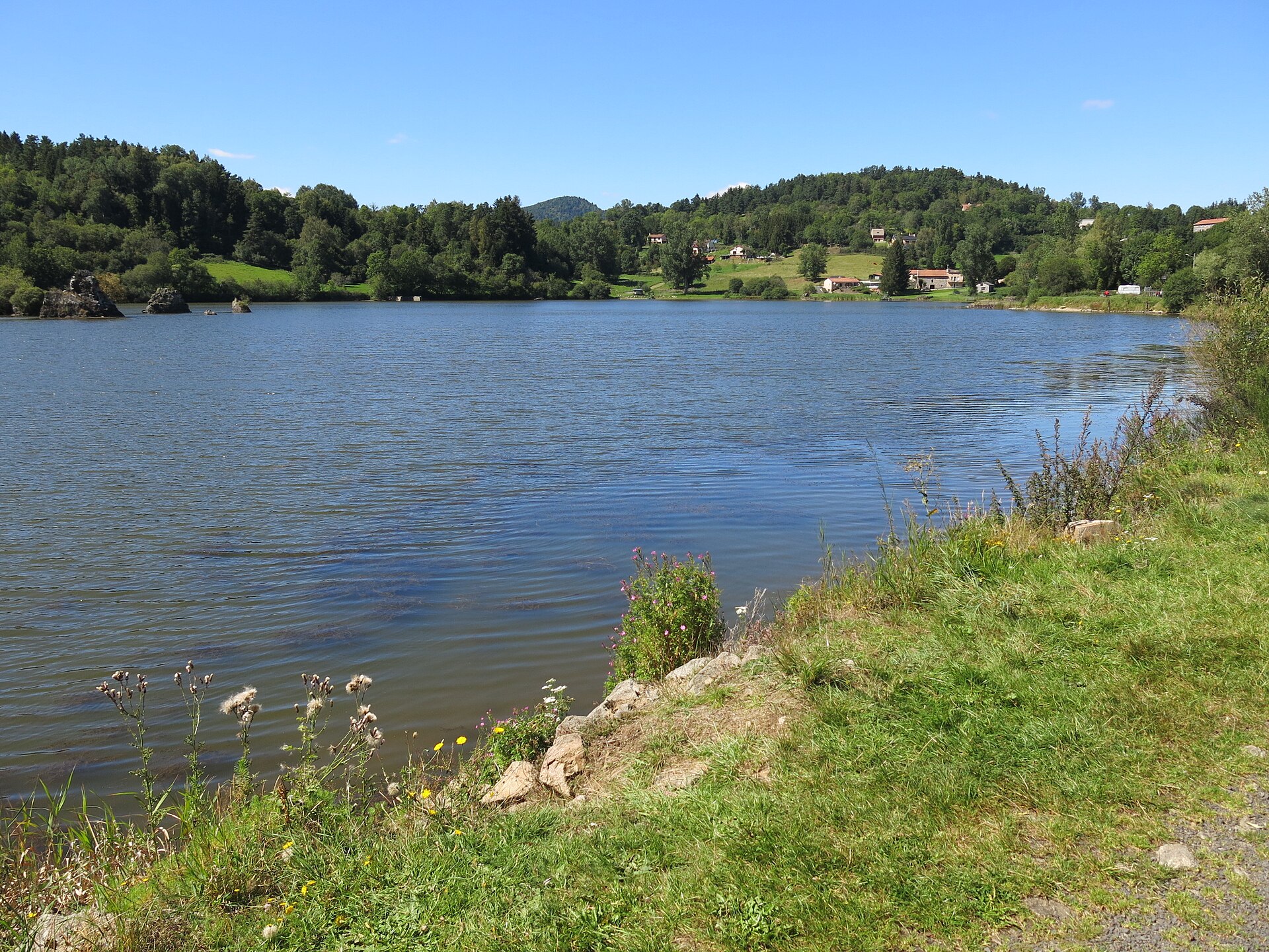
Lac de la Cassière is a small volcanic lake tucked into the hills of the Aydat commune in the heart of Auvergne, roughly 17 kilometers from Clermont-Ferrand. Sitting at 861 meters above sea level, it lies just 3 kilometers north of the much better-known Lac d'Aydat, within the Chaîne des Puys, a volcanic range listed as a UNESCO World Heritage site. For travelers looking for a quieter alternative to the crowded beaches of its neighbor, Cassière is a discovery in its own right: small, calm, ringed by woodland and meadow, with views toward the cones of extinct volcanoes. How did this lake form? Cassière's story goes back to a period of intense volcanic activity in the region. Around 8,400 years ago, Strombolian eruptions from two neighboring volcanoes, puy de la Vache and puy de Lassolas, sent an exceptionally fluid lava flow down the valley of the Veyre river. That lava blocked the valley's main course, damming it to create Lac d'Aydat, today the largest natural lake in Auvergne. The same volcanic episode also blocked a smaller tributary of the Veyre, giving rise to a separate and much more modest body of water: Lac de la Cassière. Both lakes are, in effect, twin outcomes of the same geological event thousands of years ago, even though they differ sharply in scale and character today. How big and how deep is it? Cassière covers about 14 hectares, a fraction of the size of Lac d'Aydat. Its depth is shallow: around 1 meter on average, reaching a maximum of about 5 meters. That shallowness is directly tied to one of the lake's more curious features. Why does the water level change so much? Cassière is known for rare but pronounced and still not fully explained fluctuations in its water level. On occasion, over the course of several months or even years, the lake has dropped to near-total desiccation. Episodes like this were recorded in the interwar period and again in the early 1990s. Researchers link the phenomenon to the porous volcanic bedrock beneath the lake, through which water can seep away via underground channels, though the precise mechanism remains a subject of ongoing interest among scientists and local residents alike. Can you swim or fish here? The lake is privately owned, so swimming is not permitted. Cassière functions instead as a fishery, with organized access for anglers under rules set by the owners. This marks a clear contrast with neighboring Lac d'Aydat, whose beaches draw crowds of swimmers in summer. For visitors, that means Cassière is best approached as a destination for a walk and a viewpoint rather than a place to spend a beach day. What else is there to do nearby? The lake sits along walking routes that connect it to Lac d'Aydat and to the nearby volcanoes puy de la Vache and puy de Lassolas, both of which can be explored along with their craters. A popular trail leads to a viewpoint overlooking both lakes, Aydat and Cassière, set against the volcanic backdrop of the Chaîne des Puys. It's a good choice for anyone wanting to combine a bit of geological sightseeing with a quiet walk away from the busier tourist routes. Frequently asked questions Is Lac de la Cassière the same lake as Lac d'Aydat? No. They are two separate lakes formed by the same volcanic eruption roughly 8,400 years ago, about 3 kilometers apart. Lac d'Aydat is considerably larger and open to the public, while Cassière is smaller and privately owned. Can you swim in Lac de la Cassière? No, the lake is private and swimming is not allowed. Fishing is possible, under rules set by the owners. Why does the lake's water level change? Because of the porous volcanic ground beneath it, water can seep away underground, causing periodic and hard-to-predict drops in the water level, historically recorded several times over the 20th century. How do you get to the lake? Lac de la Cassière is located in the Aydat commune in the Puy-de-Dôme department, about 17 km from Clermont-Ferrand, and can be reached via walking trails from Lac d'Aydat.
-
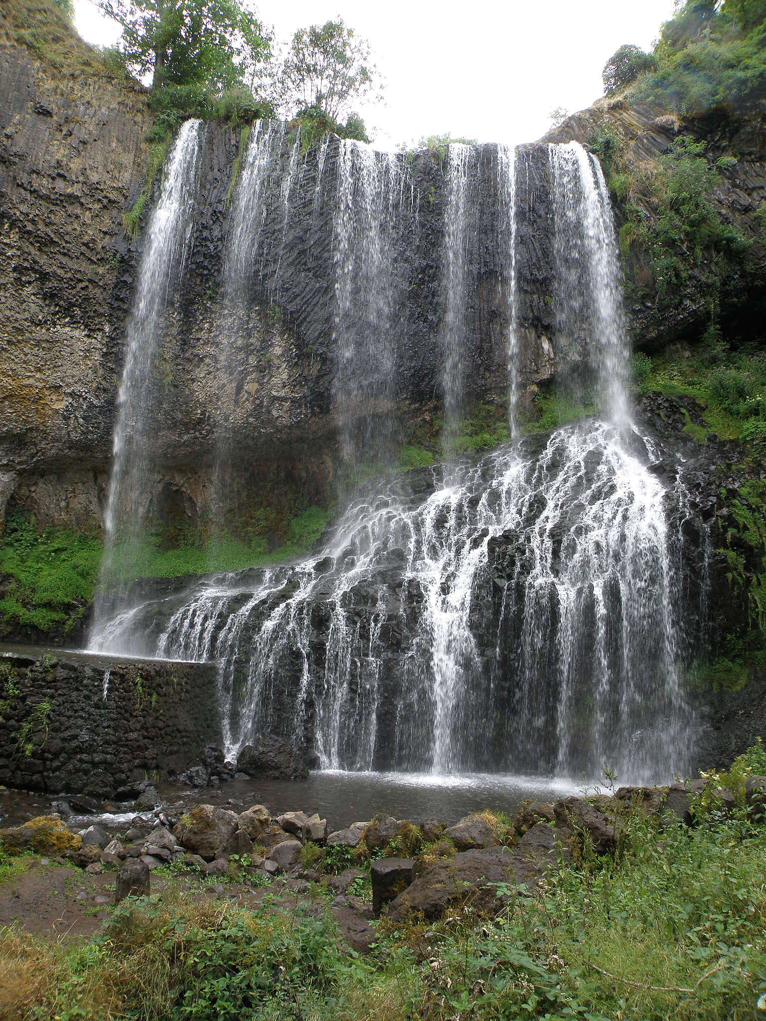
Cascade de la Beaume
Solignac-sur-Loire
Cascade de la Beaume is a waterfall tucked away on the boundary between the villages of Solignac-sur-Loire and Le Brignon, in the Haute-Loire department, in the Auvergne-Rhône-Alpes region of France. It sits close to Le Puy-en-Velay and the small hamlet of Agizoux, at an altitude of roughly 900 metres. The site sums up what makes this part of Auvergne distinctive: a volcanic plateau shaped over millennia by flowing water. Where exactly is the waterfall? The waterfall lies in wooded terrain near Agizoux, between the villages of Le Brignon and Solignac-sur-Loire. The surrounding plateau is volcanic in origin, built from basalt and marked everywhere by the region's ancient eruptions. Signposted access to the site starts from Solignac-sur-Loire. How high is it, and where does the water come from? The waterfall is fed by the Ourzie, a river that has carved its way into the basalt of the plateau over a very long time. At the edge of the cliff, the water drops 27 metres, and it's at the base of this fall that the river takes on a new name: the Beaume, a tributary of the Loire. The rock face behind the falling water exposes basalt columns, the hardened remains of old lava flows, making the geology of the site as much of a draw as the water itself. How do you get there? The easiest approach is to park at the Reynardon car park, from which a marked path leads through the forest down to the base of the waterfall. The walk down takes about 20 minutes, so allow roughly 40 minutes for the round trip. A viewpoint named Belvédère Gilles Delherm sits right at the site. For a longer outing, the PR067 trail is a signposted 10.5-kilometre loop that starts in the village of Solignac-sur-Loire itself. It takes around 2 hours 50 minutes and is rated as a moderate hike. The route crosses the plateau surrounding the village before descending to the waterfall. What should visitors know before going? The final stretch down to the waterfall is steep, and it can get slippery in wet weather, so sturdy hiking shoes with good grip are worth bringing. This is a natural site with no built-up facilities, so pack water and dress for the conditions, especially in autumn and winter. When is the best time to visit? The season changes the character of the waterfall considerably. In spring, snowmelt from the higher plateau feeds the Ourzie and the falls run at their fullest and most dramatic. In summer, the flow calms down, and the shade of the forest along with the cool air near the falling water make for a pleasant break from the heat. In winter, when temperatures drop low enough, Cascade de la Beaume can partly freeze, turning into an ice cascade. Where does the name come from? The name "Beaume" — shared by both the waterfall and the river it feeds — traces back to the Late Latin word "balma," meaning cave. This kind of naming is common across this part of France, where rock shelters and caves have long served as landmarks in the landscape. Frequently asked questions How tall is Cascade de la Beaume? The waterfall drops 27 metres from the top of the basalt cliff. Which river forms the waterfall? The Ourzie river forms the waterfall; below the fall it becomes the Beaume, a tributary of the Loire. How long does it take to reach the waterfall? From the Reynardon car park, it's about a 20-minute walk down and around 40 minutes for the full round trip. The longer PR067 trail from Solignac-sur-Loire is a 10.5-kilometre loop taking about 2 hours 50 minutes. Is the walk difficult? The short route from the car park is easy, but the final descent to the waterfall itself is steep and can be slippery, so proper footwear is recommended. Which commune is the waterfall located in? The waterfall sits on the boundary between the communes of Solignac-sur-Loire and Le Brignon, in the Haute-Loire department.
-
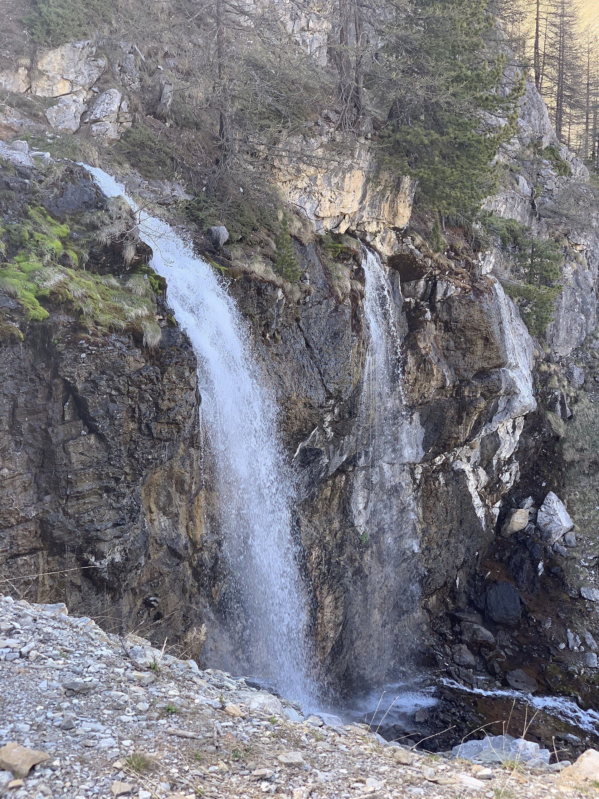
Source de Jérusalem
Les Orres
Source de Jérusalem is a set of karst springs located in the commune of Les Orres, in the Hautes-Alpes department of the Provence-Alpes-Côte d'Azur region. It is a well-known hiking destination in the mountains surrounding the Embrunais valley, valued above all for the abundant spring water and the small waterfall it creates. Where does the name come from? The name predates the 18th century, when the surrounding land — including the area around the springs — belonged to the Order of Saint John of Jerusalem, better known as the Knights of Malta. The name "Jérusalem" attached to the springs comes directly from this historical ownership, even though the site itself has no geographical connection to Jerusalem. How do you get there? Most hikers start from the Pra Paisset car park, following a forest track that leads into the valley. The path passes the Gautier sheepfold (bergerie), crosses a stream, and after roughly 1.8 km reaches a junction with a via ferrata route — walkers continue straight ahead from there, up to the Pré Lapierre clearing, where the trail turns downhill toward the springs. The route is waymarked, which makes it manageable even for less experienced hikers. What will you find at the springs? Water emerges abundantly from between two layers of limestone rock, creating a scenic, cool resting spot surrounded by mountain vegetation. Part of the water is diverted and used to supply the Les Orres ski resort and village. In summer, the springs are a popular stop for hikers looking to cool off, as the chilled water and shaded surroundings offer welcome relief from the heat lower in the valley. How long does the hike take and how difficult is it? Depending on which route variant you choose, the walking time and elevation gain vary considerably. Shorter options can be completed in roughly two to three hours round trip, while longer variants form full loops further into the mountains and take significantly more time. The section leading directly to the springs is generally considered easy to moderate and suitable for families, while the extended loop options call for better fitness and a longer day out. Who is this hike suited for? Thanks to its moderate profile and rewarding destination — the waterfall and the springs themselves — this hike is a popular choice for families and for anyone looking for a satisfying but undemanding walk in the mountains. Sturdy walking shoes, water, and some food are worth bringing along, particularly if you opt for one of the longer route variants. Frequently Asked Questions Where does the trail to Source de Jérusalem start? The most commonly used starting point is the Pra Paisset car park in Les Orres, from which a forest track leads toward the springs. Is the hike difficult? The section leading directly to the springs is generally easy to moderate, while the longer mountain loop variants require more effort and time. Where does the name of the springs come from? The name refers to the Order of Saint John of Jerusalem (the Knights of Malta), which owned the surrounding land until the 18th century. Is it worth visiting in summer? Yes — the cold water flowing from the rock and the shaded surroundings make the springs a popular resting point during summer heat.
-
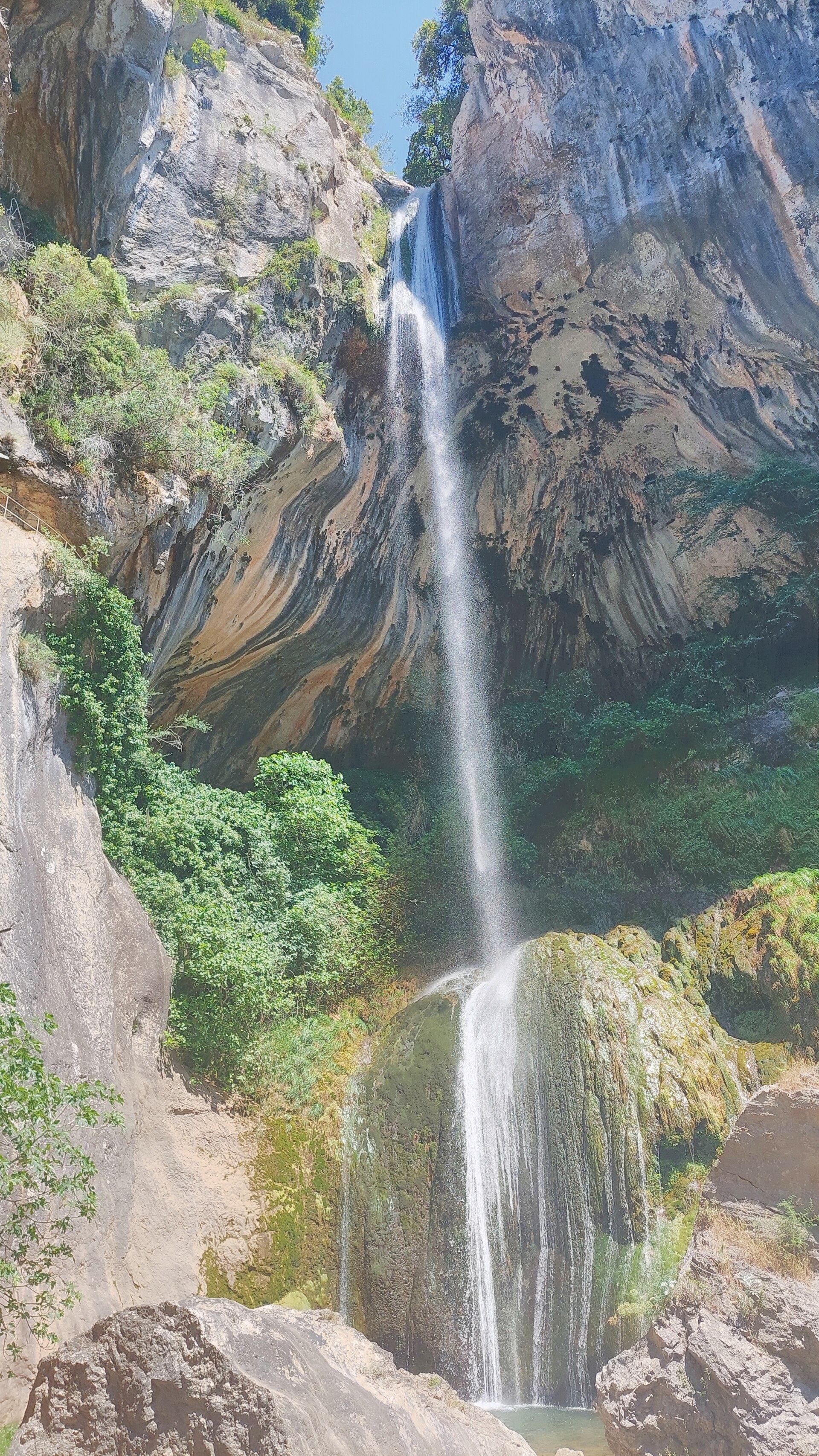
Cascade de Courmes
Courmes
Cascade de Courmes is a waterfall tucked into the Gorges du Loup, a scenic canyon carved by the Loup river in the Alpes-Maritimes department of southeastern France. The falls drop near the small village of Courmes, which clings to a hillside at roughly 620 metres above sea level, and they rank among the natural landmarks of the Parc naturel régional des Préalpes d'Azur. Where exactly is the waterfall? Cascade de Courmes sits on the left bank of the Loup river, close to the village of Courmes and not far from Gourdon, one of the area's best-known hilltop villages. It lies within the Gorges du Loup, the canyon stretching between Gourdon and Tourrettes-sur-Loup. Its approximate coordinates are 43.7419°N, 7.0006°E. How tall is the waterfall, and why does it matter? The falls are counted among the taller cascades in the area, with sources giving a height of roughly 30 to 40 metres as the water plunges into a natural pool at the base of the cliff. The site was listed as a protected historic monument (site et monument historique) as far back as 1913, making it one of the longest-protected natural features in the Gorges du Loup. How do you reach it, and where's the best viewpoint? A path leads out from the village of Courmes to a viewpoint overlooking the falls from above. It's a short, fairly easy walk, popular with visitors who want the view without a long hike. It's worth noting that the Gorges du Loup also contains another well-known spot called Saut du Loup, located further downstream — the two are sometimes confused, though they are separate places. Saut du Loup has paid, timed access, with swimming and riverside parking both prohibited there. The Cascade de Courmes viewpoint reached from the village, by contrast, is freely accessible. What else is worth knowing about the area? The Gorges du Loup is a canyon with steep rock walls and turquoise water, valued for its varied scenery, from narrow rocky passages to wider stretches of valley covered in Mediterranean vegetation. Nearby, mainly around Saut du Loup, guided canyoning descents and aqua-hiking trips let visitors explore the riverbed safely. The village of Courmes itself, perched on the slope in the shadow of the Pic des Courmettes massif, is a small settlement that makes a natural starting point for the walk to the falls. Frequently asked questions Can you swim at Cascade de Courmes? Swimming in the Gorges du Loup waterfalls, including at Saut du Loup, is banned — access to the riverbanks is private, and only the path itself is open to the public. Is there an entrance fee for Cascade de Courmes? The viewpoint over the falls reached from the village of Courmes is freely accessible. Paid, timed entry (roughly 10 a.m. to 7 p.m.) applies instead to the nearby Saut du Loup, a separate spot within the same canyon. How long does the walk to the viewpoint take? The short trail to the viewpoint is rated easy and takes only a modest amount of time — it's a walk, not a full-day trek. What's the difference between Cascade de Courmes and Saut du Loup? They are two distinct spots within the same Gorges du Loup canyon. Cascade de Courmes is the waterfall near the village of Courmes, while Saut du Loup is a lower stretch of the river with pools and a paid access point, popular with canyoning enthusiasts. Can you do water sports in the area? Yes — within the Gorges du Loup canyon, mainly around Saut du Loup, guided canyoning descents and aqua-hiking outings are on offer with certified instructors.
-
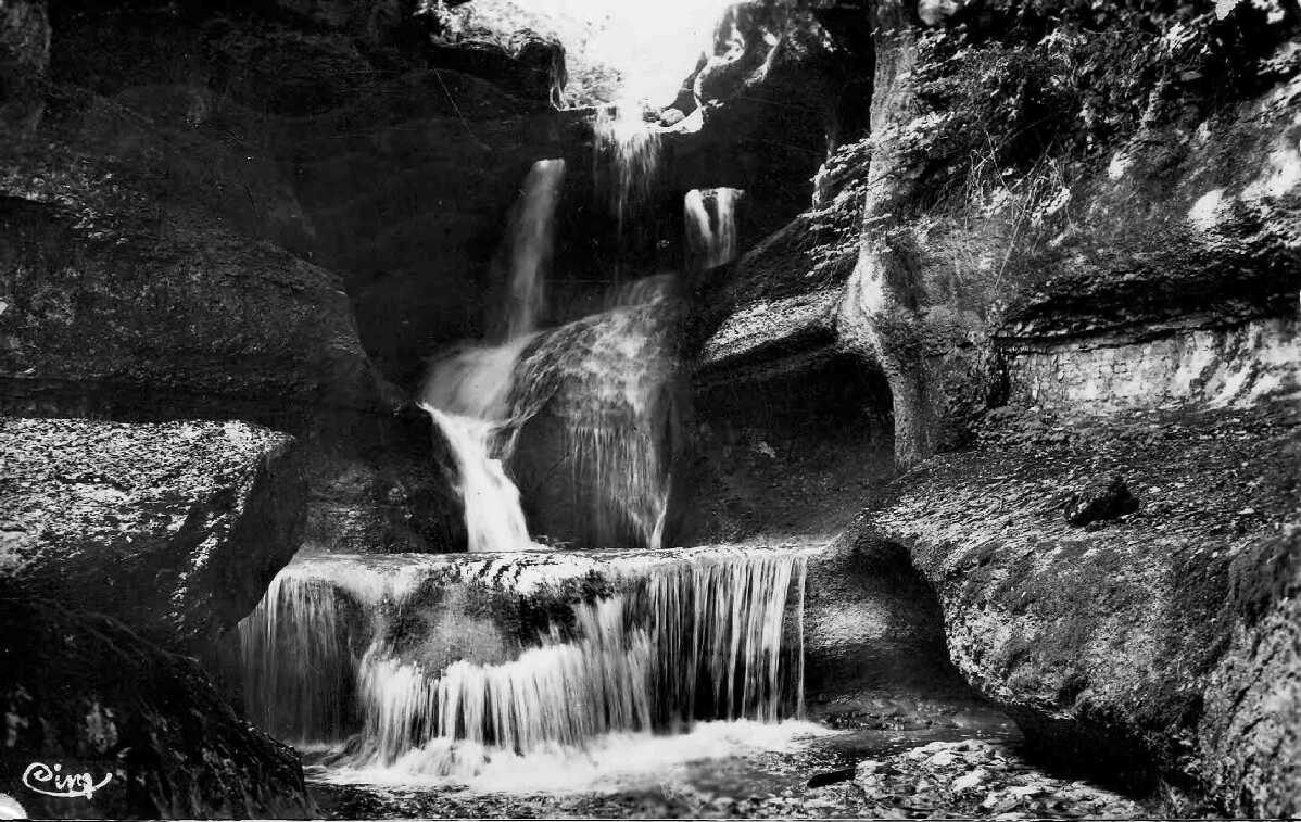
Puits des Tines
Valromey-sur-Séran
Puits des Tines is a striking waterfall on the Séran river, tucked into a rocky gorge between the former villages of Lompnieu and Champagne-en-Valromey, within the commune of Valromey-sur-Séran in the Bugey area of the Ain department, France. It is one of the most distinctive natural landmarks of the Valromey valley, where the river carves through limestone in an unusual and memorable way. What can you see at Puits des Tines? The main draw is the waterfall itself: the Séran drops through a series of natural holes worn into the rock at the top of the fall, splitting the flow into several separate streams as it plunges. At the base, the river has carved out a deep, cauldron-shaped pool — wider at the bottom than at its opening — reaching more than 6 metres in depth. The water inside takes on a striking blue-green colour that stands out against the pale limestone around it. Downstream, the riverbed opens onto broad, flat limestone slabs that warm up in the sun during summer. How do you get to Puits des Tines? The site sits along the road connecting Lompnieu and Sutrieu. Park near the "Puits des Tines" sign and follow a short path down toward the riverbed. The waterfall is also part of a longer walking loop that takes in the Pont des Tines, the Étang des Alliettes pond, and the Belvédère de Châteauneuf viewpoint. The route stays at a moderate altitude, so it can be walked for most of the year. Can you swim at Puits des Tines? No. Swimming and picnicking along this stretch of the Séran are prohibited in order to protect the site's natural character. The path leading down to the edge of the gorge is unsecured, so caution is advised, especially on wet rock. When is the best time to visit Puits des Tines? The waterfall is at its most dramatic in spring, during snowmelt, and after heavy rainfall, when the Séran's flow increases noticeably. During drier spells the flow can be much lighter, though the shape of the rock and the pool remains visible year-round. What is the history behind Puits des Tines? Centuries ago, local residents harnessed the Séran's flow for practical purposes: a water mill was built on the river's right bank near Lompnieu. Part of the current was diverted through a channel to turn the mill wheel, which was used to grind grain into flour for bread. Little remains of the old installation today, but this history explains why the site has long held a place on the map of Valromey. Frequently Asked Questions Is Puits des Tines the same as Cascade de Cerveyrieu? No. They are two separate sites within the same commune of Valromey-sur-Séran — Puits des Tines lies on the Séran between Lompnieu and Champagne-en-Valromey, while Cascade de Cerveyrieu is a different, standalone waterfall. Is the walk to Puits des Tines difficult? The approach from the road is short, but the path down to the waterfall itself can be steep and slippery, particularly after rain — sturdy footwear is recommended. Can you swim in the pool at the base of the waterfall? No, swimming is prohibited for both conservation and safety reasons — the site is neither supervised nor secured. Are there other attractions nearby? Yes — the same walking loop also passes the Pont des Tines, the Étang des Alliettes pond, and the Belvédère de Châteauneuf viewpoint.
-
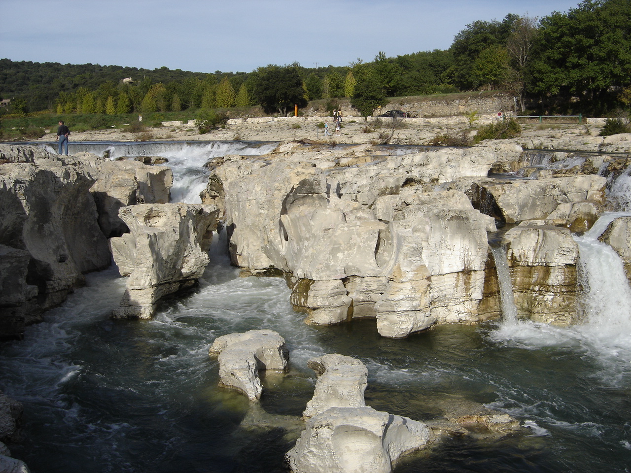
Sautadet Falls
La Roque-sur-Cèze
Sautadet Falls (Cascades du Sautadet) is a stretch of natural rock terraces and cascades on the Cèze river, right next to the village of La Roque-sur-Cèze in the Gard department, Occitanie region of southern France. It sits roughly an hour and twenty minutes by car from both Nîmes and Avignon, making it an easy stop for anyone touring the region. What does the site actually look like? Rather than a single tall drop, the Cèze loses height here through a series of rock steps and channels, with a combined elevation change of around 15 meters over a short distance. The water has carved this limestone riverbed over thousands of years, and the standout feature is a set of giant potholes — round, smoothly worn cavities several meters across, shaped by pebbles and gravel spinning in the current. Even visitors who have no intention of swimming come here specifically to see these almost geometric rock formations. Is it safe to swim here? Not directly at the falls. The uneven riverbed creates strong currents and whirlpools, and swimming right at the cascades is prohibited — it has caused a number of accidents over the years, some fatal. Locally the spot carries a grim nickname, "the devil's leap," along with a saying that in La Roque "the devil devours" careless swimmers. A calmer, supervised bathing area lies a short distance downstream, where the water is just as clear but the current far gentler. How do you get there and where do you park? The most practical approach is to park at the car park by the Pont Charles Martel, a historic stone bridge in La Roque-sur-Cèze, just a few minutes' walk from the falls. Parking is chargeable in summer, capped at around 7 euros per day. The bridge itself also doubles as a good vantage point over the whole cascade system. Worth pairing with the village itself La Roque-sur-Cèze is officially listed among "the Most Beautiful Villages of France" (Les Plus Beaux Villages de France). Its houses climb in a circular pattern up a rocky outcrop, topped by the remains of a castle and a chapel. Wandering its narrow lanes rounds out a visit nicely — a stone village above, a wild, water-carved riverbed below, a combination typical of this part of Gard. When is the best time to visit? Summer brings large crowds, especially on weekends and around midday, since the falls are a well-known stop for travelers exploring Gard and neighboring Ardèche. Outside the summer months the site is far quieter, and water levels in the Cèze vary more, which tends to make the carved rock steps stand out even more clearly. Frequently asked questions Can you swim at Sautadet Falls? Swimming directly in the cascades is dangerous and not allowed, due to strong currents and whirlpools. A safer swimming spot is located downstream from the falls. How far is it from Nîmes or Avignon? About an hour and twenty minutes by car from either city. Where can I park? The nearest car park is by the Pont Charles Martel in La Roque-sur-Cèze; it's chargeable in summer, up to about 7 euros per day. What makes this site distinctive? The giant potholes carved into the limestone by swirling stones, plus a series of natural rock steps with a combined drop of roughly 15 meters.
-
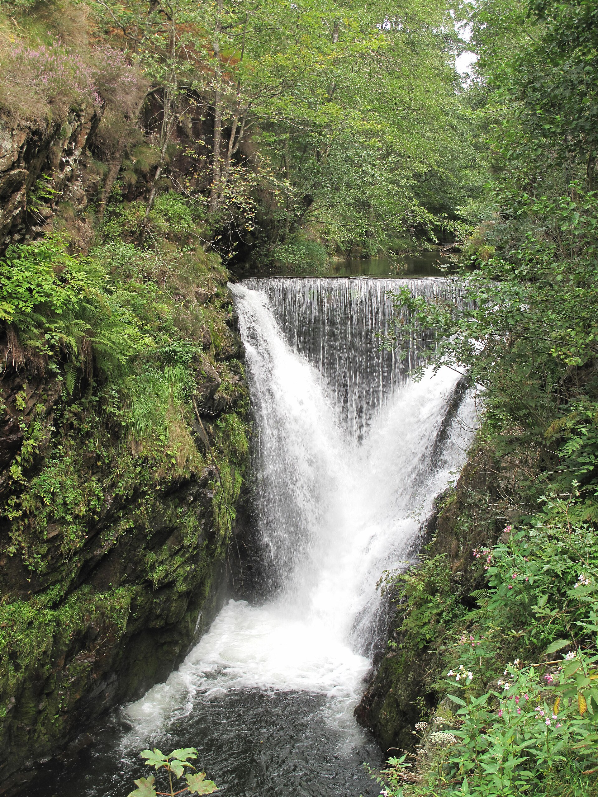
Saut de l'Ognon
Servance-Miellin
Saut de l'Ognon is a small but scenic waterfall on the Ognon river, tucked into the forests of the commune of Servance-Miellin in the Haute-Saône department, on the southwestern edge of the Vosges mountains. It's the kind of spot that rewards travelers looking for an easy nature walk and a quieter alternative to the region's better-known landmarks. Where exactly is Saut de l'Ognon? The waterfall sits within the commune of Servance-Miellin, in the southern Vosges, in the Haute-Saône department. It lies roughly an hour's drive south of Épinal. The Ognon river that forms the falls actually rises much higher up, on the southwestern slope of the Ballon de Servance at around 904 metres of altitude, near the village of Château-Lambert, before eventually flowing more than 215 kilometres to join the Saône. How do you get to the waterfall? One of the main appeals of this site is how accessible it is. A short, well-marked path leads from a small parking area to the cascade itself, covering barely 300 metres. That makes Saut de l'Ognon a realistic destination for almost anyone — families with children, older visitors, or travelers with limited time who still want to see something beyond the passing forests of Haute-Saône. What makes this waterfall distinctive? The cascade drops around 14 metres and is known for the unusual triangular shape of the falling water, which shifts depending on water levels and the season. After heavy rain or during spring snowmelt, the flow becomes noticeably more dramatic than in the drier summer months, when the falls are gentler. An interesting detail is that Saut de l'Ognon is not entirely a natural feature. The rocky breach through which the water now flows was shaped, at least in part, through human intervention. The nearby village of Servance used to suffer repeated flooding from the river, and cutting through the rock barrier helped release floodwaters more safely and reduce the damage to the settlement below. Who is this destination for? Saut de l'Ognon suits visitors who enjoy quiet, low-effort walks through Vosges woodland. It also works well as a stop along a longer route through the Mille Étangs area (the "Thousand Ponds" region), known for its many lakes and rich natural scenery. Given the short walking distance involved, the waterfall can serve either as a standalone destination or as a brief detour during a longer day of exploring the area. Frequently asked questions How do you get to Saut de l'Ognon? The waterfall is located in the commune of Servance-Miellin in Haute-Saône, about an hour's drive south of Épinal. A small parking area near the trailhead gives access to a short path leading to the falls. How far is the walk from the parking area? About 300 metres, meaning the walk typically takes just a few minutes and requires no particular fitness level. How high is the waterfall? The cascade is roughly 14 metres high. Is there a best time of year to visit? The falls look most impressive after heavy rainfall and during spring snowmelt, when water flow is considerably stronger than during the drier summer season. Is this the actual source of the Ognon river? No — the true source of the Ognon lies higher up, on the slope of the Ballon de Servance near Château-Lambert, at around 904 metres of altitude. Saut de l'Ognon is a scenic rocky breach further along the river's course, not its birthplace. Is the trail suitable for children? The short distance and maintained path make the walk manageable for families with children, though normal caution is advised near the rocks and water.
-
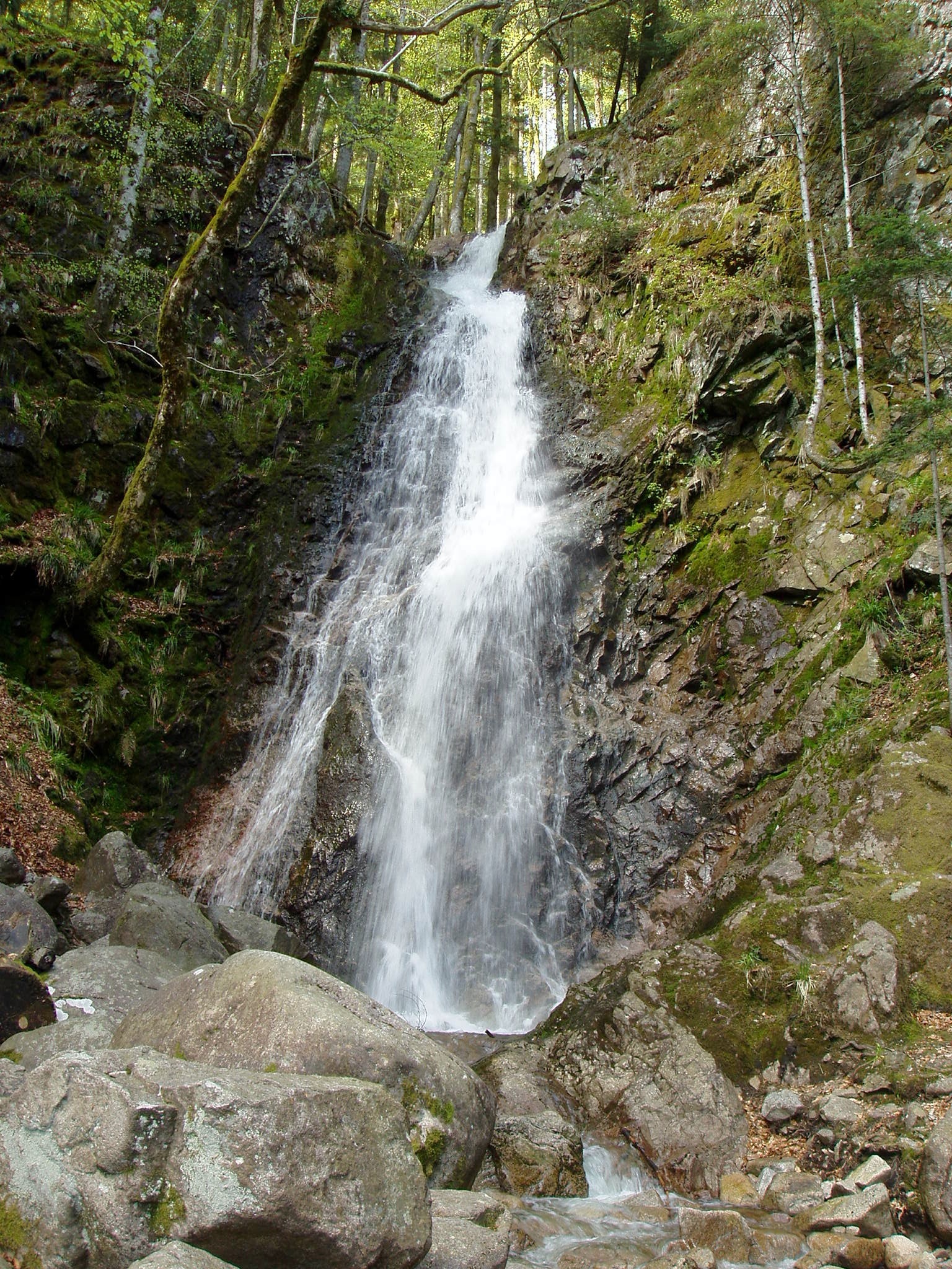
Cascade du Bockloch
Kruth
Cascade du Bockloch is a waterfall in the Vosges mountains, within the municipality of Kruth, in the Haut-Rhin department of the Grand Est region (Alsace, France). It sits on the right bank of Lac de Kruth-Wildenstein, just above the lake's shoreline, and forms one of the recognizable landmarks along the walking routes that circle the reservoir. Where exactly is the waterfall located? Bockloch lies at the upper end of the Hinterbockloch stream valley. This stream rises at around 1,060 metres of altitude on the slopes of the Grand Ventron massif, one of the higher summits of the Hautes-Vosges range. From there it runs down steep, rugged terrain shaped largely by past glacial activity before reaching the valley floor and eventually Lac de Kruth-Wildenstein. What sets this cascade apart is that the water does not fall in a single drop but plunges over two successive steps before settling into the calm surface of the lake. How do you get to the waterfall? The most straightforward approach is by road D13bis toward the village of Kruth, followed by a side road that branches off above the lake. From there the waterfall is reached on foot, via a short stretch of path running along the shoreline or down from the valley's western slope. The area around Lac de Kruth-Wildenstein is well signposted and popular with walkers, so reaching the site does not call for any special equipment or experience. Which hiking routes lead to the Bockloch cascade? The waterfall serves as both a starting point and a highlight for several routes marked by the Club Vosgien, the French association responsible for waymarking hiking trails throughout the Vosges: A circular loop that takes around 1.5 hours to complete, with roughly 360 metres of elevation gain, running through the Hinterbockloch valley and passing the successive drops of the cascade. A longer forest walk of about 11 kilometres along the lake's western slope, following clearly marked paths — a good option for those after a calmer, more scenic outing. A more demanding, sport-oriented loop of about 16.2 kilometres with roughly 780 metres of elevation gain, which passes the Bockloch cascade, the Grand-Ventron and Petit-Ventron summits, and the Chaume du Vinterges pasture before descending back to the lake. When is the best time to visit? The volume of water flowing over the falls changes noticeably with the seasons. In spring, when snow melts on the upper slopes of Grand Ventron, the Hinterbockloch stream carries substantially more water and the cascade is at its most dramatic. By summer the flow drops considerably and the waterfall takes on a quieter, more intimate character. Regardless of season, it remains one of the more visited spots along the walking circuit around Lac de Kruth-Wildenstein. Frequently asked questions Can you drive right up to the waterfall? You can only drive to the vicinity, via the D13bis road and a side road above Lac de Kruth-Wildenstein. The final stretch to the cascade itself has to be covered on foot. How long does it take to reach the cascade? The shortest loop marked by the Club Vosgien, which runs through the Hinterbockloch valley past the waterfall, takes about 1.5 hours and involves around 360 metres of elevation gain. Is the route suitable for families with children? The shorter loop around the stream valley has a moderate profile and is manageable for anyone with average fitness, while the longer 16.2-kilometre route via Grand-Ventron is more sport-oriented and requires better physical preparation. Where does the water in the cascade come from? The waterfall is fed by the Hinterbockloch stream, whose source lies at about 1,060 metres of altitude on the slopes of the Grand Ventron massif. Does the cascade connect to Lac de Kruth-Wildenstein? Yes. After falling over its two steps, the stream's water flows on into Lac de Kruth-Wildenstein, on whose right bank, just above the waterline, the cascade is located.
-
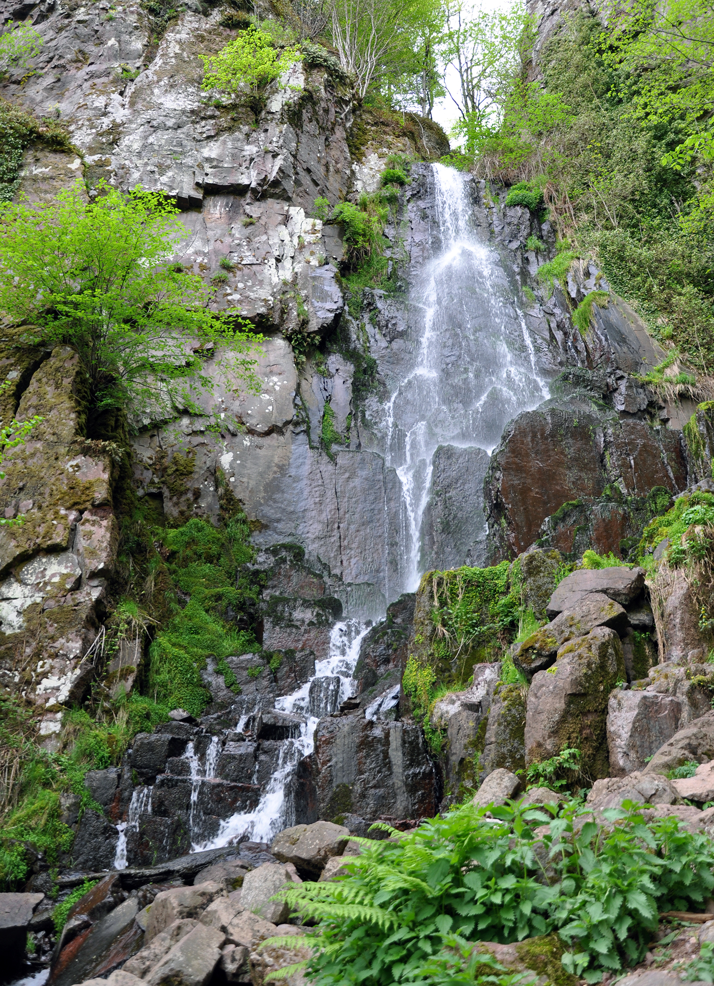
Cascade du Nideck
Oberhaslach
Cascade du Nideck is the highest waterfall in Alsace, tucked into forest at the entrance to the Bruche Valley, in the commune of Oberhaslach in Bas-Rhin. The water drops roughly 25 meters over volcanic rock, and directly above the falls, perched on a rocky outcrop, stand the ruins of the Château du Nideck — one of the more recognizable viewpoints of the Northern Vosges. The site pairs two attractions in a single outing: a striking cascade set in dense woodland and medieval ruins overlooking the valley, which makes it a favorite for family walks and day trips from Strasbourg, about 47 km away. How do you get there and where does the walk start? Most trails begin at the car park by the Auberge de la Cascade in Oberhaslach, from where marked forest paths lead into the woods. Access is via local roads through the Bruche Valley, and the village itself is an easy drive from Strasbourg or Molsheim. How long does it take to reach the waterfall? The shortest, classic loop to the waterfall itself covers about 3.3 km with roughly 190 meters of elevation gain, making for a walk of around an hour and a half on mostly well-maintained paths. Visitors who also want to see the castle ruins should add about 2 km and half an hour of walking one way. Longer variants exist for those wanting more distance, stretching up to 5.8 km with 322 meters of elevation change through the surrounding forest and additional viewpoints. What else is there to see besides the waterfall? The Nideck ruins are what remains of two once-separate strongholds — the upper castle (Obernideck) and the larger, lower castle (Unternideck), which still retains a keep standing around 20 meters tall. The fortress is first recorded in historical sources in 1264. The site is also tied to the legend of the giantess of Nideck, who, according to the tale, came across a tiny man in a field while out walking — a story that later found its way into the Brothers Grimm's collection of legends published in 1816, adding to the romantic reputation of this corner of Alsace. When is the best time to visit? The waterfall and ruins draw large crowds on sunny weekends and during the summer holiday season, when the car park and paths can get busy. Visitors who prefer a quieter experience should aim for weekdays or early mornings. How much water flows over the falls depends on the season — after rain and during spring snowmelt, the cascade is at its most impressive. Who is this trail suited for? The shorter loop to the waterfall is considered easy and manageable for most fitness levels, including families with children, while the longer routes up to the castle ruins and further viewpoints call for a bit more stamina given the elevation gain and uneven forest terrain. Frequently asked questions How high is the Nideck waterfall? The cascade drops about 25 meters, making it the highest waterfall in Alsace. Where does the trail to the waterfall start? Most commonly from the car park at the Auberge de la Cascade in Oberhaslach, from which a marked forest path leads to the falls. Can you combine the waterfall and the castle ruins in one trip? Yes, the classic route links both — reaching the ruins themselves adds about 2 km and half an hour of walking one way. How old are the Nideck castle ruins? The castle was first mentioned in written records in 1264, and its remains include two former strongholds, an upper and a lower one. Is the trail suitable for children? The shorter loop to the waterfall is relatively easy and popular with families, though the forest path underfoot is uneven in places.
-
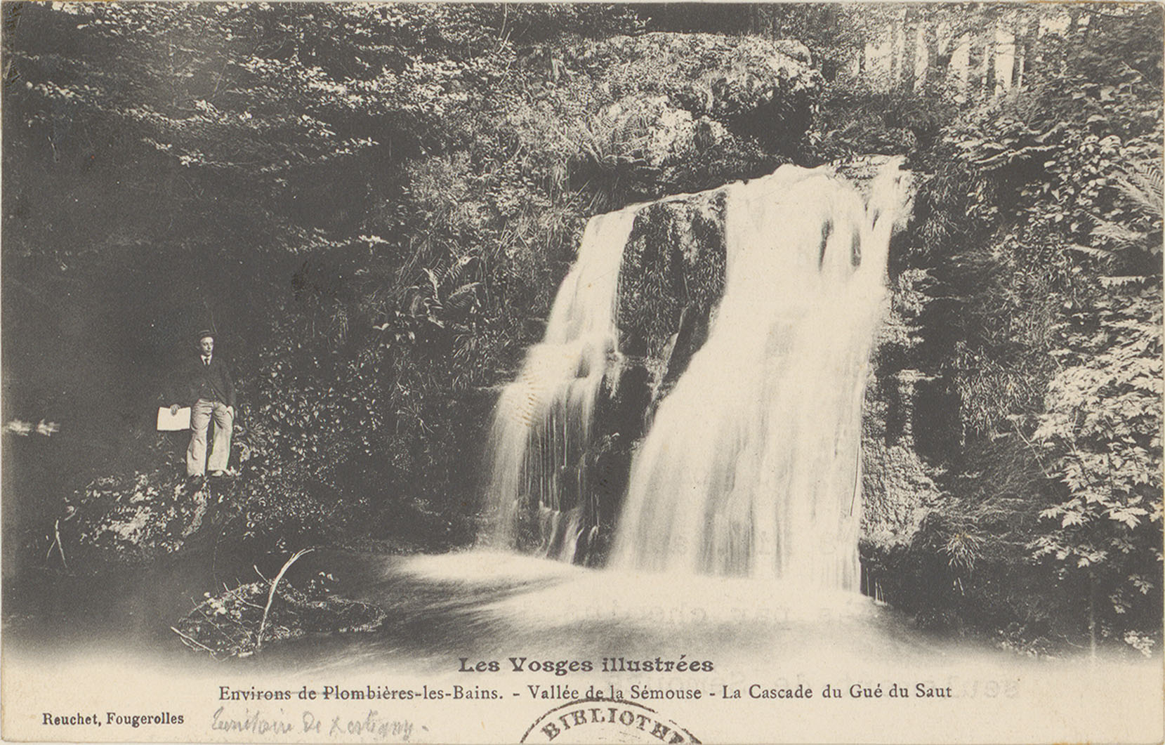
Cascade du Gué du Saut
Xertigny
Cascade du Gué du Saut is a small waterfall in the commune of Xertigny, in the Vosges department in the Grand Est region of France. Dropping around five metres over a rocky ledge in the forest, it has long been a favourite short walk for locals and visitors looking for an easy woodland outing near Xertigny. Where exactly is the waterfall? The cascade sits within the Vosges forest, a short distance from the centre of Xertigny. It is fed by the Rechentreux stream, a tributary of the Semouse, which rises near the Étang des Noëls pond and winds through the woods before tumbling over the small rock step that forms the falls. The setting is a shaded forest clearing, cool and pleasant even in summer. How do you get there? From the centre of Xertigny, the route follows the D434 road before turning onto the D12. Signposts mark the way, so finding the site does not require much more than following the road signs. A picnic area sits right by the falls, making it a natural stopping point for a rest during a longer walk. What hiking trails lead to the cascade? Several looped walking trails of varying length start near the waterfall. One of the shorter options, around 1.3 km long with a modest elevation gain of roughly 40 metres, is easy enough for most visitors, including families with children. Longer circuits continue through a beech forest toward the Blanc Murger crossroads, giving hikers more time among the trees and views over the surrounding Vosges hills. A small wooden footbridge crosses just above the falls, giving a good vantage point over the water. What should you know before visiting? The waterfall looks its best after rain, when the flow is stronger; during dry summer spells the stream can run quite thin. The ground around the site is forested and can be damp or slippery, particularly in autumn and spring, so sturdy footwear is worth bringing. This is not a large or dramatic waterfall by national standards, but it makes for a pleasant stop along a walk, with a picnic spot for a break. Frequently asked questions How high is the Gué du Saut waterfall? The cascade drops roughly five metres, making it a modest, intimate forest waterfall rather than a major natural landmark. How long does it take to reach the waterfall? The shortest loop trail to the cascade is about 1.3 km, an easy walk that typically takes under an hour round trip, including time to rest by the water. Is there anywhere to eat near the waterfall? Yes, a picnic area is set up right next to the cascade, used by hikers taking a longer break on their walk. Which stream feeds the waterfall? The falls are fed by the Rechentreux stream, a tributary of the Semouse river, which originates near the Étang des Noëls pond. Is the trail suitable for children? The shorter loop, with its gentle elevation gain and length of about 1.3 km, suits families with children, though the forest path can be uneven and damp in places. When is the best time to visit the cascade? Water flow is strongest in spring and after autumn rains; in summer, during dry spells, the stream can run noticeably lower.
-
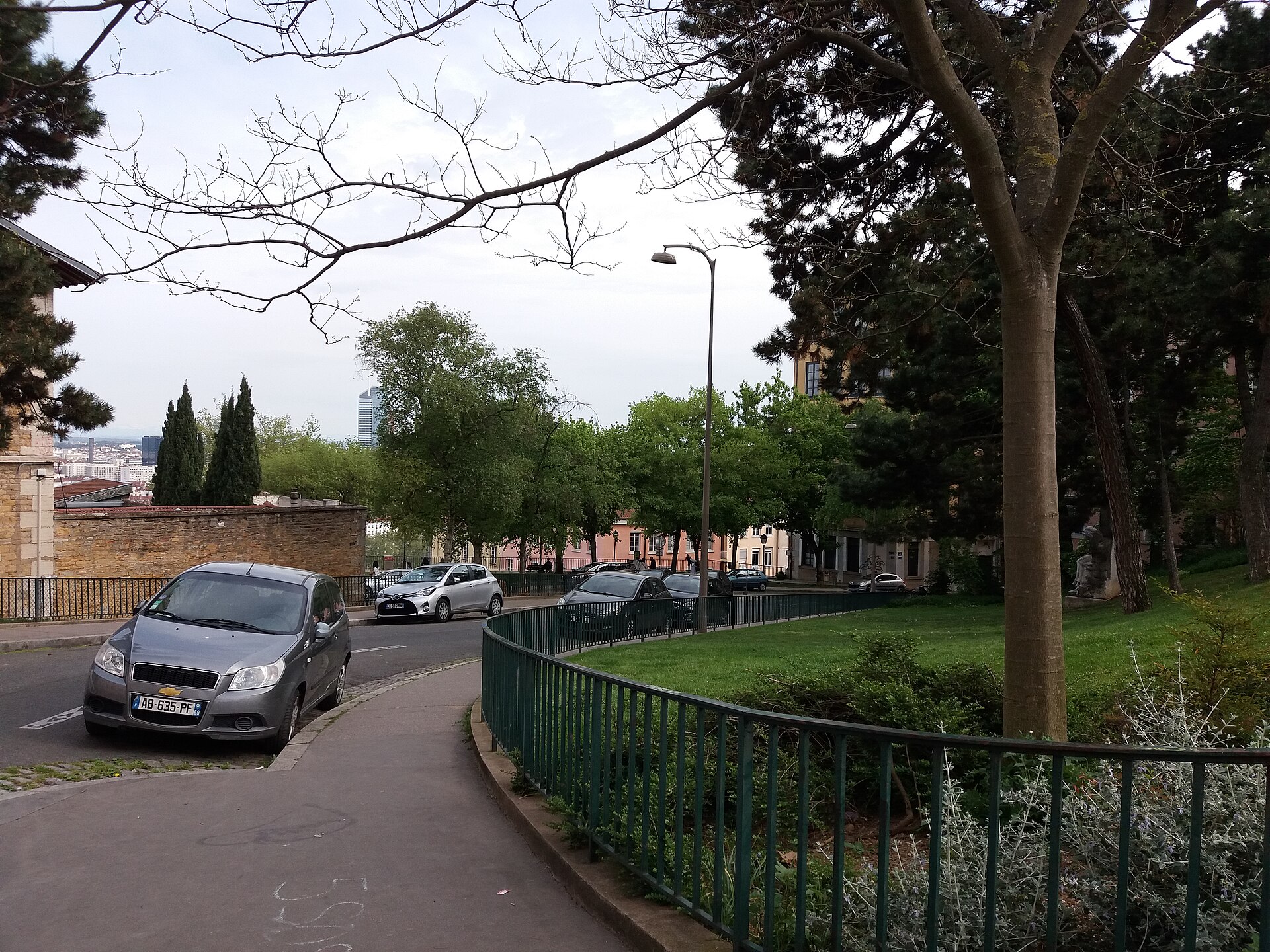
place Bellevue
Lyon
Place Bellevue is a small viewpoint square perched on the Croix-Rousse hill in Lyon, France — the kind of spot locals treasure and visitors often miss, even though it offers one of the best panoramas in the whole city. Where is it and how do you get there? The square sits on the Croix-Rousse plateau, in Lyon's 1st arrondissement, right at the edge of the slope that drops down toward the Rhône. The easiest way in is metro line C to either Croix-Rousse or Hénon station, followed by a short uphill walk through the neighborhood's streets — and that walk is part of the experience, since Croix-Rousse was historically the silk weavers' district, with its own architecture and narrow passageways known as traboules. Buses also serve the area, but approaching on foot from the old Croix-Rousse center gives a much better feel for the place. What is there to see? The square itself works as an open-air viewing terrace, looking out over the Rhône valley, the hills on Lyon's eastern side, and the suburbs beyond. It's a natural vantage point, shaped by the ridge on which Croix-Rousse stands. Within the square stands the former Fort Saint-Laurent, a surviving piece of Lyon's first fortification belt, built starting in 1830. The bastion once marked the end of the Croix-Rousse district's defensive wall running above the Rhône; that wall was torn down in 1865 and replaced by what is now the Boulevard de la Croix-Rousse. The square is bordered by a landscaped garden holding a monument to Sully Prudhomme, a poet who lived in Croix-Rousse and became the first person ever awarded the Nobel Prize in Literature. His statue was unveiled here on 19 July 1914, just weeks before the outbreak of the First World War. The place itself is documented as far back as 1839, but it took its present form during the Second Empire, with development from around 1870 — after the old ramparts came down. Over the following decades it grew by absorbing several neighboring streets and squares, among them the former Rue Colonia (around 1902), Rue Delassalle, and the Place de Brosses and Place Saint-Laurent, all now folded into the current layout. When should you visit? The square rewards a visit at any time of year, but sunset is when it really shines, as the light hits the rooftops of Lyon and the hills across the Rhône. Spring and summer invite a longer stop on a bench in the garden, while autumn and winter often bring clearer air and sharper views. Pair the visit with a wider walk through Croix-Rousse, a district known for its traboules, street art, and old silk-weaving workshops once run by the canuts. How much time should you set aside? Seeing the square itself takes about fifteen minutes, but plan for 30 to 45 minutes to walk around, rest, and take in the view properly. It works best as one stop on a longer walk across the Croix-Rousse hill rather than a destination on its own. Frequently asked questions Is Place Bellevue free to visit? Yes. It's a public city square, open at all times with no entrance fee. Is it accessible for wheelchairs or visitors with limited mobility? The square sits on a hilltop, and reaching it from central Croix-Rousse involves a climb, so travelers with limited mobility should allow extra time. Once you're there, the square itself is flat and easy to move around. What else is worth seeing nearby? Extend the walk to the Boulevard de la Croix-Rousse, the former Fort Saint-Laurent right on the square, and the historic silk-weavers' streets with their traboules. What is the statue on the square? It honors Sully Prudhomme, a French poet linked to Croix-Rousse and the first-ever winner of the Nobel Prize in Literature, unveiled in 1914.
-

Source d'eau chaude d'Incarville
Incarville
The Incarville hot spring (Source d'eau chaude d'Incarville) is a small but unusual natural feature in the commune of Incarville, in the Eure department of Normandy. This mineral-rich warm spring has drawn curiosity from locals and off-the-beaten-path travelers alike, thanks to both its chemistry and the odd story behind how it was found. How was it discovered? Unlike most thermal springs, this one wasn't found by anyone searching for healing waters — it turned up by accident. A priest, Abbé Gilbert Delamare, was drilling in the area in search of petroleum. Instead of striking oil, he tapped into a flow of hot water rising from underground. It's a small but telling geological curiosity for this corner of Normandy, a region better known for farmland than for thermal activity. What kind of spring is it? The spring is classified as an artesian well (puits artésien): water trapped under pressure between impermeable rock layers rises to the surface on its own, without any need for pumping. Wells like this typically form when a confined aquifer finds an outlet through a natural fissure or, as here, through a borehole drilled for another purpose entirely. That the discovery happened during oil exploration explains both the depth of the source and its distinctive mineral content. What's in the water? The water is notable for its ammonia and carbon dioxide content. That combination sets it apart from an ordinary, chemically neutral spring — it points to contact with deeper geological layers, where organic matter breaks down and releases gas. This chemical signature is exactly what makes the site worth a stop for anyone interested in geology or natural curiosities, rather than for visitors chasing a conventional postcard view. How do you get there? Incarville sits in the Eure department, in the Normandy region of northwestern France. The spring is located at approximately 49.2346° N, 1.1808° E, which makes it straightforward to pin down on a map or GPS before setting out. Given how low-key the site is, it's best treated as one stop on a broader route through Eure, paired with other places of interest in the wider Normandy countryside. What should you expect on site? This isn't a developed spa or thermal resort — it's a natural geological phenomenon, a quiet reminder of an unexpected discovery made generations ago. Visitors should come prepared for raw countryside and a bit of local history about petroleum prospecting, not for the visitor infrastructure you'd find at a well-known thermal resort. When should you visit? Because this is a natural feature rather than a seasonal attraction, it can be visited year-round. Normandy's mild oceanic climate makes spring and autumn especially pleasant for a quiet walk in the area, well away from the crowds drawn to the region's more famous sights. Frequently asked questions Who discovered the Incarville spring? Abbé Gilbert Delamare, a priest who was drilling in search of petroleum, discovered the spring instead of the oil he was looking for. What type of spring is it? It's an artesian well — water rises to the surface on its own under the natural pressure of the aquifer, with no pumping required. What is the water's chemical makeup? The water contains ammonia and carbon dioxide, which sets it apart from typical, neutral drinking-water springs and points to contact with deeper geological layers. Where exactly is the spring located? In the commune of Incarville, in the Eure department of Normandy, at approximately 49.2346° N, 1.1808° E.
-
Montmin
Talloires-Montmin
Montmin is a small hillside settlement in the commune of Talloires-Montmin, perched high above Lake Annecy in the Haute-Savoie department of the Auvergne-Rhône-Alpes region. Until 2016 it was its own independent commune with roughly 326 residents, before merging with neighboring Talloires into a single municipality. Today it serves mainly as a launch point for visitors chasing panoramic views, paragliding flights, and mountain hikes above one of the most photographed lakes in the French Alps. What will you see there? Montmin sits on a slope towering over Lake Annecy, and from several spots nearby the views stretch across the full width of the lake and the surrounding peaks and valleys. The village itself has a distinctly alpine character — stone houses, narrow access roads, and open pastureland, typical of Savoyard hamlets sitting well above the busier lakeside towns. It's from here, and specifically from the nearby Col de la Forclaz, that some of France's most famous paragliding flights take off — the aerial view of Lake Annecy from this launch site is one of the most widely shared images of the region. Just next door is the La Sambuy ski area, which doubles as a winter sports base and a summer hub for hikers and mountain bikers. That combination keeps the area around Montmin busy year-round — skiing in winter, trails and flights in summer. How do you get there? Montmin sits above the eastern shore of Lake Annecy, higher up from the town of Talloires. Getting there means driving a winding mountain road that climbs from the lakeshore toward the Col de la Forclaz — the drive itself is scenic, so it's worth allowing extra time, particularly given the number of switchbacks. The nearest larger town is Annecy, only a short distance away in a straight line, though the elevation gain means the drive takes noticeably longer than the raw distance would suggest. When should you visit? Late spring and summer are best for hiking and paragliding, when stable thermal conditions make for safer takeoffs from Col de la Forclaz. Autumn brings smaller crowds and equally striking views of the lake framed by changing foliage on the surrounding slopes. Winter shifts the focus to the La Sambuy ski area and its nearby runs, though snow conditions vary depending on altitude and the season. Who is Montmin for? This is a spot for travelers looking for quiet and views away from the crowded quays of Annecy. It suits couples and families planning a day of hiking, paragliding enthusiasts (both pilots and tandem passengers), and skiers visiting outside the summer lake season. Given its small size, Montmin doesn't offer an extensive tourist infrastructure of its own — it functions more as a base for outdoor activities than a destination in itself, rounding out a stay around Lake Annecy. Frequently asked questions Can you go paragliding in Montmin? Yes — nearby Col de la Forclaz is one of the most recognized paragliding launch sites in France, offering flights with views over Lake Annecy. Is Montmin its own commune? Not since 2016 — it merged with Talloires to form the joint commune of Talloires-Montmin. Is there skiing nearby? Yes, the La Sambuy ski area is close by, offering downhill runs in winter and hiking and biking trails in summer. How far is it from Lake Annecy? Montmin sits high above the eastern shore of the lake, above Talloires — reachable in a short drive along a winding mountain road.
-
Gavarnie-Gèdre
Gavarnie-Gèdre
Gavarnie-Gèdre is a commune in the Hautes-Pyrénées department, in the Occitanie region, right on the border with Spain. It was formed on 1 January 2016 through the merger of two former communes, Gavarnie and Gèdre, and today it's one of the best-known gateways into the French side of the Pyrenees. This is the starting point for trails leading to the Cirque de Gavarnie, part of the "Pyrénées – Mont Perdu" transboundary UNESCO World Heritage site. What can you see in Gavarnie-Gèdre? The main draw is the Cirque de Gavarnie itself — a natural rock amphitheater ringed by cliffs rising above 3,000 meters. Water cascades down the rock ledges in a series of falls, including one of the highest in Europe. The view of the cirque from the village of Gavarnie is the starting point for most day hikes; reaching the base of the cirque typically takes 2–3 hours one way and needs no special equipment in summer. The other half of the commune is Gèdre, a smaller village lower in the valley, with open views toward the Mont Perdu (Monte Perdido) massif on the Spanish side. From Gèdre a road also leads into the Héas valley and up to the Notre-Dame de Héas shrine. In winter, the commune turns into a small ski area — a family-oriented resort with runs set among Pyrenean peaks, popular with visitors looking for a quieter alternative to the bigger Alpine resorts. How do you get to Gavarnie-Gèdre? The nearest larger town is Lourdes, from where the D921 road runs along the Gave de Pau valley. Driving from Lourdes takes about an hour; from Tarbes or Pau, somewhat longer. The closest airport is Tarbes-Lourdes-Pyrénées. Tourist buses connect Lourdes with Gavarnie in the summer season, and the parking area at the village entrance can fill up quickly on peak days, so arriving early is worth it. When should you visit? Summer (June–September) is the best time for hiking to the cirque — trails are snow-free and days are long. Spring and autumn weather in the mountains can shift quickly, so it's worth checking the forecast before setting out. Winter (December–March) is ski season, with fewer visitors than in summer and views over snow-covered peaks. Who is Gavarnie-Gèdre for? It suits mountain walkers of every level, from an easy family stroll to the cirque to longer stretches of the GR10 trail crossing high passes. Nature photographers and travelers looking for a less crowded alternative to France's better-known Alpine resorts will also feel at home here. Frequently asked questions How long does it take to reach the Cirque de Gavarnie? An easy trail runs from the village of Gavarnie to the base of the cirque; in summer it usually takes 2–3 hours round trip, depending on pace and stops. Is Gavarnie-Gèdre suitable for a family trip? Yes — the trail to the cirque needs no mountain experience, and in winter the small local ski area offers slopes for children and beginners. What's the difference between Gavarnie and Gèdre? They were two separate, neighboring communes merged in 2016. Gavarnie sits closer to the cirque and the high-mountain trails, while Gèdre is lower in the valley, nearer the road to Lourdes and the Héas shrine. Do you need a car? A car makes exploring the area much easier, though tourist buses run from Lourdes in summer. In winter, getting there may require winter tires or snow chains.
-
Saint-Hilaire-du-Touvet
Saint-Hilaire
Saint-Hilaire-du-Touvet is a limestone plateau in the commune of Plateau-des-Petites-Roches, perched nearly 900 metres above the Grésivaudan valley in the Chartreuse massif, in the Isère department. Rimmed by cliffs and forest, this rock balcony has for decades drawn free-flight enthusiasts and travelers after an Alpine panorama without a long uphill hike. How do you get up to the plateau? The signature way up is the Saint-Hilaire funicular, one of the steepest funicular railways in Europe. The line covers roughly 1.5 km and climbs more than 800 metres of vertical drop, with the track's steepest section reaching an 83% gradient. Cars run from the valley station in Saint-Hilaire to the plateau in just a few minutes, sparing visitors the long series of switchbacks by car. A paved road also winds up the mountainside for those driving their own vehicle or arriving by coach. What is there to see once you're up there? The Petites Roches plateau is above all a viewing balcony over the valley: from the cliff edge, the panorama sweeps across the Grésivaudan and the Belledonne range on the opposite side. Thanks to steady aerological conditions and open, safe terrain, this exact spot has launched thousands of paragliding and hang-gliding flights, and the site is regarded as one of the best-known free-flight locations in the world. Local schools run tandem flights and graded courses for different skill levels. Outside the flying season, the plateau also serves as a starting point for walking trails along the cliff rim and further into the Chartreuse massif. When should you visit — and what about the Coupe Icare? September is the standout month: Saint-Hilaire, alongside the neighbouring commune of Lumbin, hosts the Coupe Icare, the world's largest free-flight festival. The event draws paraglider and hang-glider pilots from across the globe, with aerial displays, costumed flying parades and a full program of side events. During those days the plateau and the valley below revolve entirely around the festival, and nearby accommodation books out well in advance. Outside September, spring and early summer offer the clearest views and the quietest crowds. Frequently asked questions Do you need experience to fly over the plateau? No — local schools offer tandem flights with an instructor for complete beginners, as well as graded courses for anyone wanting to learn to fly solo. What's the difference between Saint-Hilaire-du-Touvet and Plateau-des-Petites-Roches? On 1 January 2019, the former communes of Saint-Hilaire-du-Touvet, Saint-Pancrasse and Saint-Bernard-du-Touvet merged into a single commune named Plateau-des-Petites-Roches. The name Saint-Hilaire still refers to the plateau itself and to the funicular station. Does the funicular run all year? The line serves tourist and local traffic for most of the year, making the plateau reachable without a car — it's still worth checking the current timetable before visiting, since occasional technical or seasonal closures do occur. Can you visit without taking part in any flying yourself? Yes — the plateau has viewpoints reachable on foot right by the upper funicular station, plus walking trails along the cliff edge from which you can simply watch paragliders take off.
-
Persaxplatten
Fläsch
Persaxplatten is a rock face and mixed natural-historical site on the slopes of the Fläscherberg, directly above the village of Fläsch in the Bündner Herrschaft district of Graubünden, Switzerland. Few places pack three such different identities into one hillside: a protected forest reserve, the remains of a Swiss military stronghold, and an active rock-climbing area — making it an unusual stop for visitors after more than just a scenic walk. What is hidden in the Persaxplatten forest? Persaxplatten holds one of Graubünden's earliest natural forest reserves (Naturwaldreservat), established in 2006 and covering 9 hectares. Fläsch was among the first municipalities in the canton to set aside such a reserve. The ground here is humus-carbonate soil over limestone, a combination that supports the pine and beech woodland typical of these dry, south-facing Alpine slopes. Since then, the municipality has expanded its conservation efforts further, adding a special reserve on the Alp Stürfis and several old-growth forest "islands" designated after 2019. What military traces remain in the rock? Visitors expecting only quiet woodland rarely anticipate stumbling on the remnants of a serious artillery installation. Around 1942, engineers cut an artillery work into the north face of Persaxplatten, code-named "Römerstrasse" (army number A 6212) — part of the wider St. Luzisteig fortress system, one of the anchors of Switzerland's national Réduit during the Second World War. In 1947 the position was fitted with fixed 12-cm howitzers and an observation post, and around 1962 an additional tunnel and command cavern were added. Its firing openings sit below the old fortification track, positioned to cover the approaches while staying partly concealed in the rock; the cavern itself offered little living space, so the gun crews relied on nearby barracks. The installation remained active until around 1971 and was formally decommissioned in 1985 — a span of roughly four decades that carried it from wartime defence into the Cold War. Who is Persaxplatten for — climbers or hikers? Today the cliffs are known among climbers as a sport-climbing area with a number of documented routes across a range of grades, including the 15-metre "Heilandzack," graded 7b, a route favoured by climbing groups from across Graubünden. For hikers, Persaxplatten is typically one stage on a longer route that runs from the St. Luzisteig fortress through Matlusch and Matluschkopf — a hill topped by a prehistoric hillfort — up to the Regitzer Spitz summit. The usual starting point is the car park at St. Luzisteig, from where the trail crosses varied terrain that blends history, nature, and views over the Rhine valley below. How to get there and when to visit Fläsch sits in the Bündner Herrschaft, Graubünden's northernmost wine-growing district, alongside Maienfeld, Jenins and Malans. The easiest approach is by car or train to Maienfeld or Bad Ragaz, then by local transport or on foot to Fläsch and onward toward St. Luzisteig, where the trails up to Persaxplatten begin. Spring and autumn are the best times to visit: temperatures are mild and conditions on both the climbing routes and hiking trails are most comfortable, especially since parts of the terrain run across open, sun-exposed slopes. In summer, an early start is worth planning to avoid the heat building up on the rocky sections. Frequently asked questions What exactly is Persaxplatten? It's a combined rock-and-forest area on the slopes of the Fläscherberg above Fläsch, encompassing a natural forest reserve, a former artillery position from the St. Luzisteig fortress system, and a sport-climbing area. Can you visit the old artillery bunker? The "Römerstrasse" installation is part of the historic St. Luzisteig fortification network; access to the interior is often restricted, but the external traces of the fortifications can be seen while hiking the surrounding trails. Is Persaxplatten suitable for beginner climbers? The area offers routes of varying difficulty, but some, such as "Heilandzack" (7b), are demanding — it's worth checking current route descriptions before setting out. How long does the hike through Persaxplatten take? The stretch from St. Luzisteig through Matlusch and Persaxplatten to the Regitzer Spitz takes several hours and suits hikers with good fitness and sure footing on rocky terrain.
-
Voralpsee
Grabs
Voralpsee is a mountain lake in the municipality of Grabs, in the canton of St. Gallen in eastern Switzerland, sitting at 1,123 m above sea level on the Grabserberg, between the Alviergebiet and Churfirsten ranges. How to get there? The easiest approach is from Buchs or Grabs: from May to October, a PostAuto (Swiss post bus) line runs directly to the area around the lake. Hikers can also reach it on foot — a popular route climbs from Wildhaus Oberdorf via Ölberg and Gamperfin to Voralpsee and on to Voralp. It's an easy trail (T2 grade), roughly 8.2 km long with 332 m of ascent and 336 m of descent, taking about 2 hours 20 minutes — well marked and manageable for reasonably fit walkers. What will you see? Voralpsee is a natural, elongated lake just under 550 m long and about 250 m wide, with a maximum depth of around 12 m. It fills a shallow basin surrounded by meadows and forest, with the peaks of the Churfirsten and the Alvier massif rising in the background — a view that draws hikers and landscape photographers alike. Despite its high altitude, the water warms up to as much as 20°C in summer, making Voralpsee one of the few mountain lakes in the region where swimming is genuinely comfortable. A kiosk with a small restaurant sits on the shore, serving grilled food, snacks, and drinks, with a barbecue spot nearby that's open to visitors. In recent years the municipality has expanded the bathing infrastructure, adding a bathing jetty and a floating platform that make it easier to get into the water and relax on the lake. A short circular walking path (about 35 minutes) runs around the shore, letting visitors pick their own spot — in the woods, on the rocks, or right at the water's edge. Fishing is also permitted, provided visitors hold a valid fishing licence. Who is it for? Voralpsee works well both as a family day-trip destination — thanks to bus access and gentle surroundings — and as a stop along a longer mountain route for more ambitious hikers. The meadows and forests of the Grabserberg are typical Alpine foothill terrain, quieter and less crowded than the well-known trails around Wildhaus or the Churfirsten, which suits travelers looking for some peace. When to visit? The season at Voralpsee effectively runs from June to October, when the trails are passable and the bus line operates regularly. The best swimming conditions come in July and August, when the water reaches its warmest. In spring and early autumn the lake tends to be quieter, with fewer visitors, though the water is cooler and public transport runs less frequently. Frequently asked questions Where exactly is Voralpsee located? The lake sits on the Grabserberg in the municipality of Grabs, canton St. Gallen, at 1,123 m above sea level, between the Alviergebiet and the Churfirsten. Can you swim in Voralpsee? Yes, swimming is allowed, and the water can reach up to 20°C in summer. A bathing jetty and a floating platform are available on the lake. How can you reach Voralpsee without a car? From May to October, a PostAuto line runs there from Buchs and Grabs. It's also reachable on foot via the trail from Wildhaus Oberdorf through Ölberg and Gamperfin (about 8.2 km, 2 hours 20 minutes). Is there anywhere to eat by the lake? Yes, a lakeside kiosk with a restaurant serves grilled dishes, snacks, and drinks, and there's a barbecue area right next to it.
Earn badges for the places you visit
Download NextOnTrip, discover new places and check off your trails.