About this place
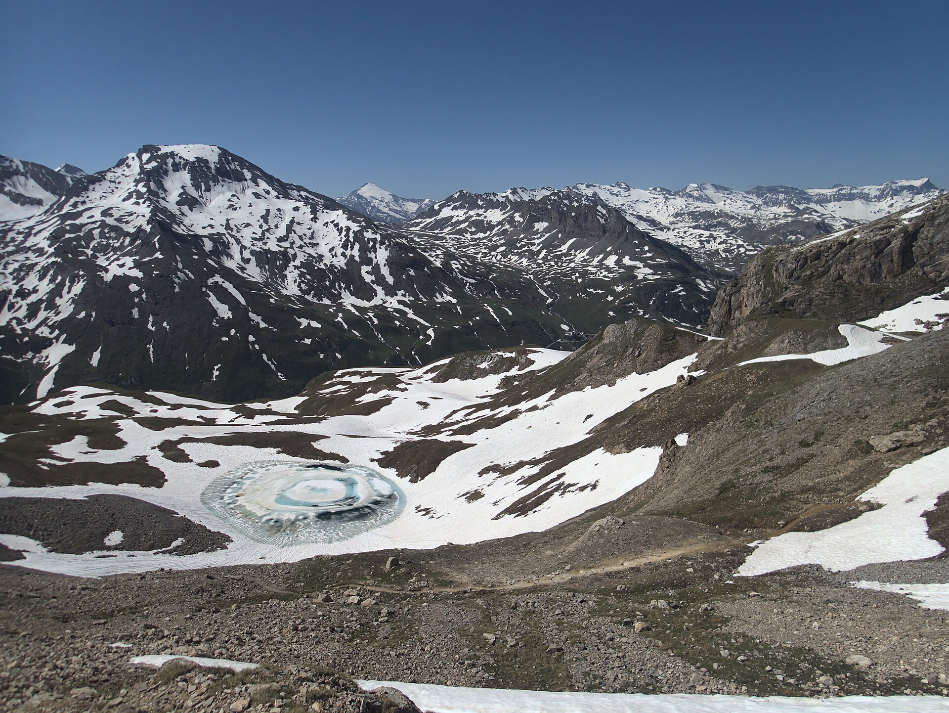
Lac de la Bailletta is a small high-mountain lake sitting at close to 2,800 m altitude in the commune of Val-d'Isère, Savoie, in the Auvergne-Rhône-Alpes region, right on the doorstep of Vanoise National Park. The lake lies inside the La Bailletaz national nature reserve, a protected area of just under 5 km² spanning altitudes from 2,050 m up to 3,602 m at the summit of Tsanteleina, on the right bank of the Isère valley. Its water carries a striking blue-green tint, cradled in a small glacial cirque surrounded by scree slopes and jagged dolomitic rock.
Where exactly is the lake?
Bailletta sits high in the Haute-Tarentaise, within the Graian Alps, close to the Col de la Bailletta at 2,852 m. That pass delivers one of the finest viewpoints in the area, opening onto the Grande Casse, Grande Motte and Mont Pourri — some of the defining summits of the Vanoise massif.
How do you reach the lake?
The most common approach starts from the hamlet of Le Fornet, where a balcony trail climbs steeply straight from the village — a demanding stretch of roughly 4 km gaining about 925 m to the pass. The alternative route begins at the Saut dam: park above Villaret du Nial toward Lac de Tignes, follow the path along the right side of the reservoir rather than the road, head toward the Sassière dam, then climb from there toward the Col de la Bailletta. Along this stretch, once you reach a band of scree, the lake itself comes into view, tucked into a small rocky basin just off the path.
What else is there to see along the way?
The La Bailletaz reserve is an important refuge for alpine wildlife. Its sun-facing southern slopes serve as a wintering and calving ground for chamois and ibex, and the reserve as a whole is a key feeding area for the bearded vulture, particularly through winter and spring. Information panels near the trailhead cover the local flora and geology — dolomitic rock formations are a defining feature of this stretch of the Graian Alps.
Who is this hike suited for?
Given the altitude, steep sections and rocky terrain, the walk up to Bailletta and its namesake pass suits hikers with a reasonable level of fitness who are used to mountain trails. Summer and early autumn are the best windows, once the path has cleared of snow — the upper sections can still hold snow well into late spring.
FAQ
How high up is Lac de la Bailletta? The lake sits at roughly 2,800 m altitude, with the neighboring Col de la Bailletta reaching 2,852 m.
Is the lake inside Vanoise National Park? The lake itself lies within the La Bailletaz nature reserve, directly bordering Vanoise National Park, in the commune of Val-d'Isère.
What's the best starting point for the hike? The two main options are the steep, shorter approach from Le Fornet, or the longer, gentler route from the Saut dam via the Sassière dam.
What wildlife might you see nearby? The area is a refuge for chamois and ibex and an important feeding ground for the bearded vulture, a rare and distinctive raptor most often seen in winter and spring.
What's the view like from the Col de la Bailletta? The pass overlooks major Vanoise summits — Grande Casse, Grande Motte and Mont Pourri — along with the upper stretch of the Tarentaise valley.
Nearby places

Earn badges for the places you visit
Download NextOnTrip, discover new places and check off your trails.