About this place
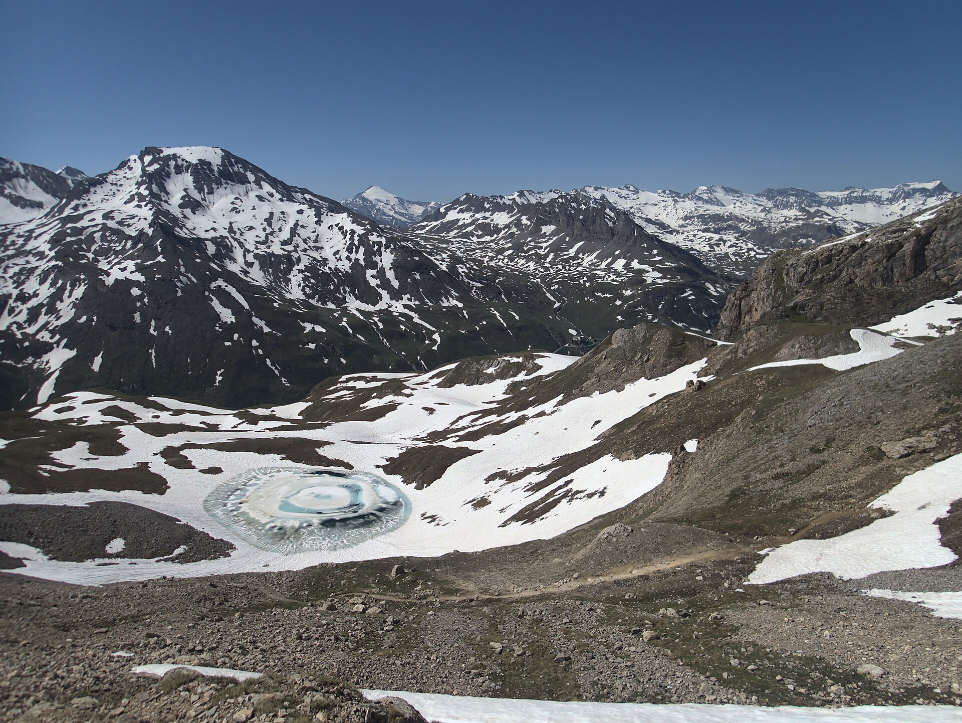
Lac des Évettes is a mountain lake in the Vanoise massif, in the Savoie department of France, within the municipality of Bonneval-sur-Arc. Geologically speaking, it is a very young feature: as recently as the first half of the 20th century, the site was still covered by a glacier, and the lake exists today because that ice retreated.
How did the lake form?
Lac des Évettes took shape between 1939 and 1949, once the glacier that had previously filled this section of the valley melted back and exposed a hollow that filled with meltwater. It is a clear, well-documented example of how quickly alpine landscapes can change as glaciers retreat. Today the glacier's terminus sits roughly one kilometre from the lake's shore — close enough that the ice is still clearly visible from the area around the water, which is part of what draws hikers up here in the first place.
Where exactly is it located?
The lake sits high in the Vanoise massif, close to the Italian border, surrounded by the peaks of Haute Maurienne. Its approximate coordinates are 45.3547°N, 7.1156°E. The surrounding terrain lies within Vanoise National Park, one of France's oldest national parks, known for high-altitude wildlife such as marmots and chamois, along with typical alpine flora.
How do you get there?
Most visitors start from Bonneval-sur-Arc, one of the highest and best-preserved villages in Savoie. From there, a road leads to the small hamlet of L'Écot, where the walking route begins toward the Col des Évettes and the Refuge des Évettes that sits near it. The path climbs through rocky terrain beneath surrounding cliffs, and reaching the refuge typically takes an hour and a half to two hours, with a substantial amount of elevation gain along the way. From the refuge, a gentler, mostly flat path continues to the lake itself, crossing a stone bridge over a mountain stream — adding roughly an hour to the round trip.
What is there to see?
The lake sits inside a rocky glacial cirque, with views toward the nearby glacier and the surrounding Haute Maurienne peaks, including the distinctive Albaron massif. The walk up to the refuge is popular with families, since the climb is manageable rather than technical, and marmots are commonly spotted sunning themselves on the rocks along the way. For more experienced hikers, the lakes and glacier here serve as a starting point for longer routes deeper into the Cirque des Évettes, where the scenery turns increasingly rugged and high-alpine.
When is the best time to visit?
The hiking season in this part of the Vanoise generally runs from June to September, when the trails are clear of snow and the nearby refuge is staffed and open to visitors. In spring and autumn, altitude and snow conditions can make the approach considerably harder, so it is worth checking current conditions before setting out.
FAQ
Is Lac des Évettes a glacial lake? Yes. It formed after the glacier that once filled this part of the valley retreated, a process that was complete between 1939 and 1949.
How close is the glacier to the lake today? The glacier's edge currently lies about one kilometre from the lake's shore.
Do you need mountaineering experience to reach it? The walk up to Refuge des Évettes requires reasonable fitness but is not technically difficult; the final stretch to the lake itself is flat and easy.
Is there anywhere to stay nearby? Yes, the Refuge des Évettes near the Col des Évettes operates seasonally, offering meals and overnight accommodation during the summer.
Is the lake inside a national park? Yes, the area around Lac des Évettes lies within the boundaries of Vanoise National Park.
Nearby places

Earn badges for the places you visit
Download NextOnTrip, discover new places and check off your trails.