About this place
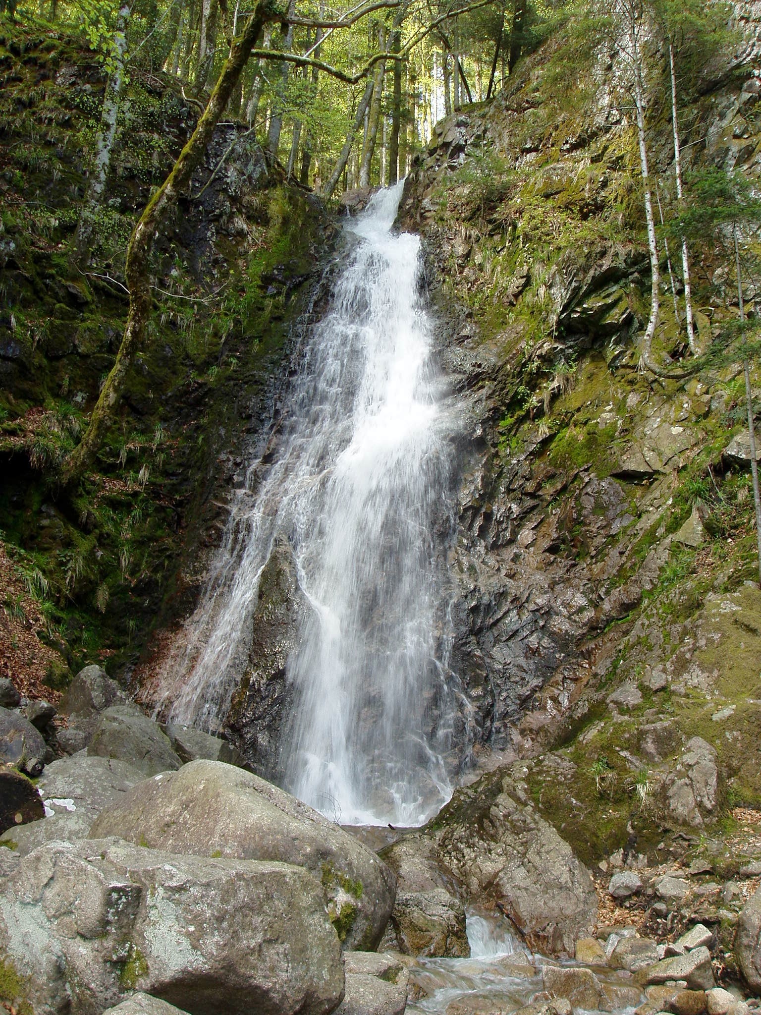
Cascade du Bockloch is a waterfall in the Vosges mountains, within the municipality of Kruth, in the Haut-Rhin department of the Grand Est region (Alsace, France). It sits on the right bank of Lac de Kruth-Wildenstein, just above the lake's shoreline, and forms one of the recognizable landmarks along the walking routes that circle the reservoir.
Where exactly is the waterfall located?
Bockloch lies at the upper end of the Hinterbockloch stream valley. This stream rises at around 1,060 metres of altitude on the slopes of the Grand Ventron massif, one of the higher summits of the Hautes-Vosges range. From there it runs down steep, rugged terrain shaped largely by past glacial activity before reaching the valley floor and eventually Lac de Kruth-Wildenstein. What sets this cascade apart is that the water does not fall in a single drop but plunges over two successive steps before settling into the calm surface of the lake.
How do you get to the waterfall?
The most straightforward approach is by road D13bis toward the village of Kruth, followed by a side road that branches off above the lake. From there the waterfall is reached on foot, via a short stretch of path running along the shoreline or down from the valley's western slope. The area around Lac de Kruth-Wildenstein is well signposted and popular with walkers, so reaching the site does not call for any special equipment or experience.
Which hiking routes lead to the Bockloch cascade?
The waterfall serves as both a starting point and a highlight for several routes marked by the Club Vosgien, the French association responsible for waymarking hiking trails throughout the Vosges:
- A circular loop that takes around 1.5 hours to complete, with roughly 360 metres of elevation gain, running through the Hinterbockloch valley and passing the successive drops of the cascade.
- A longer forest walk of about 11 kilometres along the lake's western slope, following clearly marked paths — a good option for those after a calmer, more scenic outing.
- A more demanding, sport-oriented loop of about 16.2 kilometres with roughly 780 metres of elevation gain, which passes the Bockloch cascade, the Grand-Ventron and Petit-Ventron summits, and the Chaume du Vinterges pasture before descending back to the lake.
When is the best time to visit?
The volume of water flowing over the falls changes noticeably with the seasons. In spring, when snow melts on the upper slopes of Grand Ventron, the Hinterbockloch stream carries substantially more water and the cascade is at its most dramatic. By summer the flow drops considerably and the waterfall takes on a quieter, more intimate character. Regardless of season, it remains one of the more visited spots along the walking circuit around Lac de Kruth-Wildenstein.
Frequently asked questions
Can you drive right up to the waterfall? You can only drive to the vicinity, via the D13bis road and a side road above Lac de Kruth-Wildenstein. The final stretch to the cascade itself has to be covered on foot.
How long does it take to reach the cascade? The shortest loop marked by the Club Vosgien, which runs through the Hinterbockloch valley past the waterfall, takes about 1.5 hours and involves around 360 metres of elevation gain.
Is the route suitable for families with children? The shorter loop around the stream valley has a moderate profile and is manageable for anyone with average fitness, while the longer 16.2-kilometre route via Grand-Ventron is more sport-oriented and requires better physical preparation.
Where does the water in the cascade come from? The waterfall is fed by the Hinterbockloch stream, whose source lies at about 1,060 metres of altitude on the slopes of the Grand Ventron massif.
Does the cascade connect to Lac de Kruth-Wildenstein? Yes. After falling over its two steps, the stream's water flows on into Lac de Kruth-Wildenstein, on whose right bank, just above the waterline, the cascade is located.
Nearby places

Earn badges for the places you visit
Download NextOnTrip, discover new places and check off your trails.