Nature in Croatia
A guide to 136 Nature in Croatia — with descriptions, photos and traveler visits from the NextOnTrip community. Locations spread across 89 cities and towns. Most visited by the community: Dinara Nature Park, Piva Nature Park, Park Narodowy Paklenica.
-
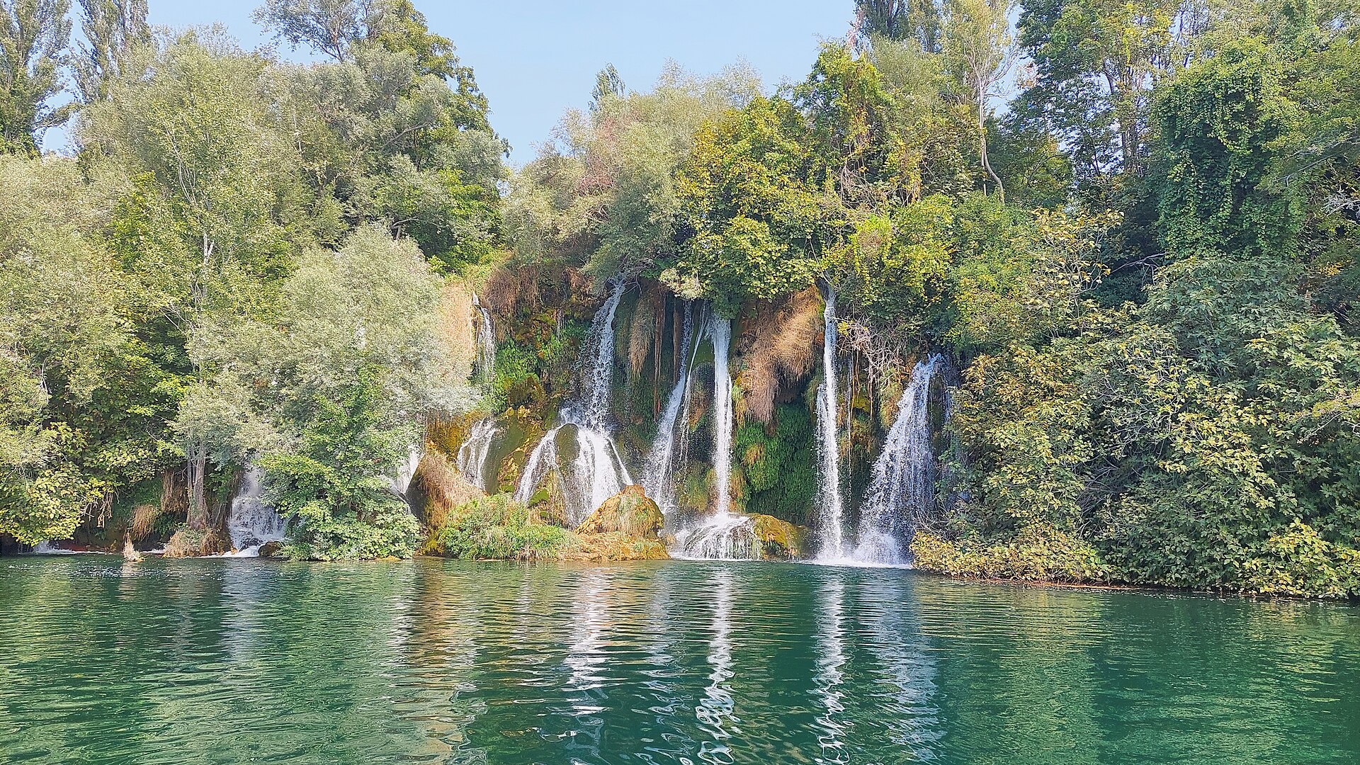
Roški Waterfall
Bogatić
Roški Waterfall (Roški slap) is one of the six major cascades on the Krka River, deep inside Krka National Park in Croatia, close to the village of Bogatić in Šibenik-Knin County. Sitting roughly 36 km downstream from the river's source, it stands out less for sheer height and more for the sprawling network of channels, islets and tufa barriers the water carves as it drops. How do you get there? The Roški slap entrance to the national park has its own parking area and is reached by car, or as part of an organized tour departing from Šibenik, Skradin or Kistanje. It is a separate entry point from the more famous Skradinski slap section, so plan for a distinct ticket or an internal shuttle if you want to see both in one day. From the parking lot, a short, well-marked path and wooden walkways lead down to the falls in well under half an hour. What will you see? The waterfall's main drop measures about 22.5 metres, but that is only part of the picture: the whole system of cascades, backwaters and small islands stretches for close to 650 metres along the river. A signature feature is the so-called "Necklaces" — a chain of small, stepped tufa cascades that form just upstream of the main fall. It's this intricate mosaic of channels and islets, rather than one dramatic plunge, that leaves the strongest impression on most visitors. Along the left bank stand old watermills, several of which have been restored and still operate, offering a glimpse of how local communities harnessed the river's power for generations. On the right bank sits a small hydroelectric power plant, first put into operation in 1910 — one of the earliest facilities of its kind in the region. An ancient road dating back to Roman times runs above the falls, and nearby lies the Oziđana pećina cave, which holds the earliest known traces of human presence in the area. When should you visit? Spring and early summer bring the fullest, most dramatic flow, fed by winter rain and melting snow further upstream. By midsummer the water level typically drops, but visitors gain more reliable weather for walking the surrounding trails at a relaxed pace. Roški slap also tends to draw noticeably smaller crowds than Skradinski slap, which makes it an appealing choice for travelers who prefer a quieter stop within the park. Frequently Asked Questions Is Roški slap part of Krka National Park? Yes, it is one of the six main waterfalls on the Krka River and lies within the national park's boundaries, near the village of Bogatić. How tall is Roški Waterfall? The main drop is about 22.5 metres, and the full cascade system extends nearly 650 metres, with a total elevation difference of roughly 25.5 metres. What else is worth seeing near the waterfall? Restored watermills on the left bank, a historic hydroelectric plant from 1910 on the right bank, remnants of a Roman-era road above the falls, and the Oziđana pećina cave with the region's earliest traces of settlement. Can you reach Roški slap without a car? Yes, organized tours and seasonal transport run from nearby towns, though having your own car gives you the most flexibility for exploring this part of the park at your own pace.
-
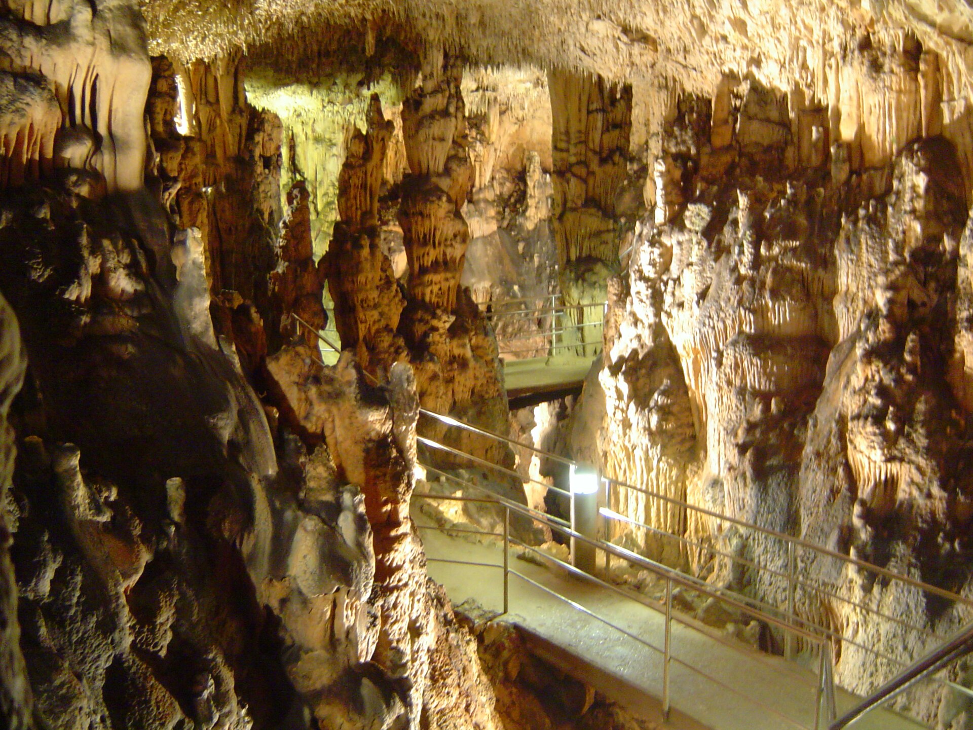
Biserujka cave
Biserujka Cave is a small karst cave on the island of Krk, located roughly 300 meters northwest of the village of Rudine, and it is the only cave on the entire island open to tourists. The site combines a geological curiosity with a local legend about a hidden treasure, which is said to be the source of its name (biser – pearl). How do you get to the cave? The cave sits right by the village of Rudine, in the northern part of Krk, not far from Vrbnik and Dobrinj. Driving is by far the easiest option, since there is a parking area right at the entrance. The surrounding roads are well signposted, and the drive from the island's main routes usually takes no more than fifteen minutes. Travelers without a car may need a taxi or a bicycle, as public transport in this part of the island is limited. What will you see inside? The cave stretches about 110 meters and reaches a depth of up to 15 meters. Despite its modest size, it impresses with a rich collection of speleothems – stalactites, columns and calcite draperies, all lit to highlight their shapes. The visitor route runs through a series of named chambers: the Entrance Hall, the Balcony, the Shaft, the Great Hall, the Northern Channel, the Vaulted Hall and the Cypress Hall. Several endemic species live inside, adapted to darkness and a constant temperature. The cave's recorded history goes back to the 19th century – the first written mention dates from 1834, when court documents described it as a smugglers' hideout. Legend has it that a treasure was hidden inside, though it has never been found. When is the best time to visit? Biserujka Cave is open seasonally, from April to October. Opening hours vary by month: typically 10:00 to 15:00 in April and October, 09:00 to 17:00 in May and June, and 09:00 to 18:00 in July and August. The best time to visit is in the morning during the summer season, when it gets hot outside – the temperature inside the cave stays cool year-round, making it a pleasant escape from the heat. What is the tour like? Visits are guided and last between 25 and 30 minutes. Tours are offered in several languages – Croatian, German, English and Italian – making the cave accessible to visitors from different countries. The path is lit and fitted with handrails, so the walk is safe even for less experienced visitors, though the uneven ground and humid air are worth keeping in mind. Admission costs around €6 for adults and €4 for children aged 5 to 12, while children under 5 enter free of charge. Frequently asked questions How long does a visit to Biserujka Cave take? A standard guided tour lasts between 25 and 30 minutes and covers all the main chambers of the cave. Is the cave open all year round? No, the cave operates seasonally, from April to October, with opening hours that vary depending on the month. Is it cold inside the cave? The inside maintains a constant, cool temperature throughout the year, making it a refreshing spot on hot summer days – it's worth bringing a light jacket or sweater. Where does the name Biserujka come from? The name comes from the word "biser," meaning pearl, and is tied to a legend about a treasure supposedly hidden in the cave that has never been discovered.
-
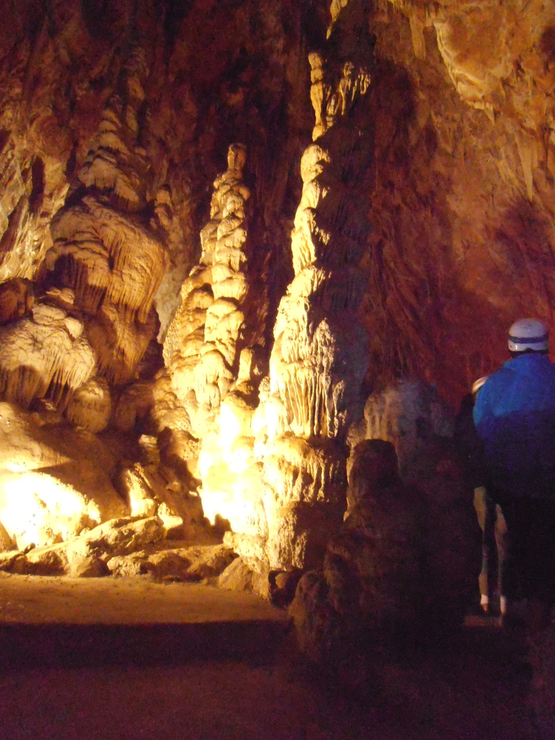
Grotta delle Torri di Slivia / Pejca v Lazcu
Duino Aurisina / Devin - Nabrežina
Grotta delle Torri di Slivia (also known by its Slovenian name Pejca v Lazcu) is a show cave near the hamlet of Slivia, in the municipality of Duino Aurisina / Devin-Nabrežina on the Trieste Karst, a short drive from Trieste. What makes this cave special? The cave descends roughly 101 metres and its entrance sits at 113 metres above sea level. It takes its name from the striking stalagmite "towers" (torri in Italian) noticed by the first explorers back in the late 19th century. The cave was first surveyed in 1885 by engineer Costantino Doria of the Trieste Alpine Society, making it one of the earliest documented caves on the Trieste Karst. What sets it apart nationally: the cave lies beneath land belonging to the Le Torri di Slivia farm, and it is the only show cave in Italy run directly by a working agricultural business rather than a public body or caving club. How do you get there? Slivia sits within the municipality of Duino Aurisina, between Trieste and the Slovenian border. Driving is by far the easiest option — the farm has its own parking area at the entrance. From central Trieste, the drive takes around 20–25 minutes. What will you see inside? An artificial entrance was cut into the cave in 1964, and by 1967 the internal walkway and iron staircase were completed; the first tourist tickets were sold in 1968. Inside, visitors find abundant stalactites and stalagmites, including the tower-shaped formations that gave the cave its name. Visits are guided only, in groups capped at 20 people — independent exploration isn't allowed. A full visit, including the tractor ride across the farm to the cave entrance, takes about 75 minutes. Bring a light jacket: the cave keeps a constant, noticeably cooler temperature than the surface, especially welcome in summer. When should you visit? The cave can be visited year-round, though like most Karst show caves it typically runs on a seasonal or reduced off-season schedule — it's worth checking current opening hours on the farm's own website before setting off. In summer, the cool underground air offers a pleasant break from the heat above ground on the Karst plateau. Who is it for? The site suits families with children and anyone curious about karst geology and the region's underground landscape. Because the cave is run by a working farm, a visit also doubles as a glimpse into local agritourism — an unusual pairing of caving and farm life. Frequently asked questions Can you visit the cave without a guide? No. All visits are guided, in groups of up to 20 people; independent access isn't permitted. How long does a visit take? A complete visit, including the tractor ride across the farm grounds to the cave entrance, lasts about 75 minutes. Where does the cave's name come from? From the stalagmite "towers" (torri) that caught the attention of the cave's first explorers in the late 19th century. What makes this cave unusual compared to other Italian show caves? It's the only tourist cave in Italy managed directly by an agricultural business rather than a public institution or caving club.
-
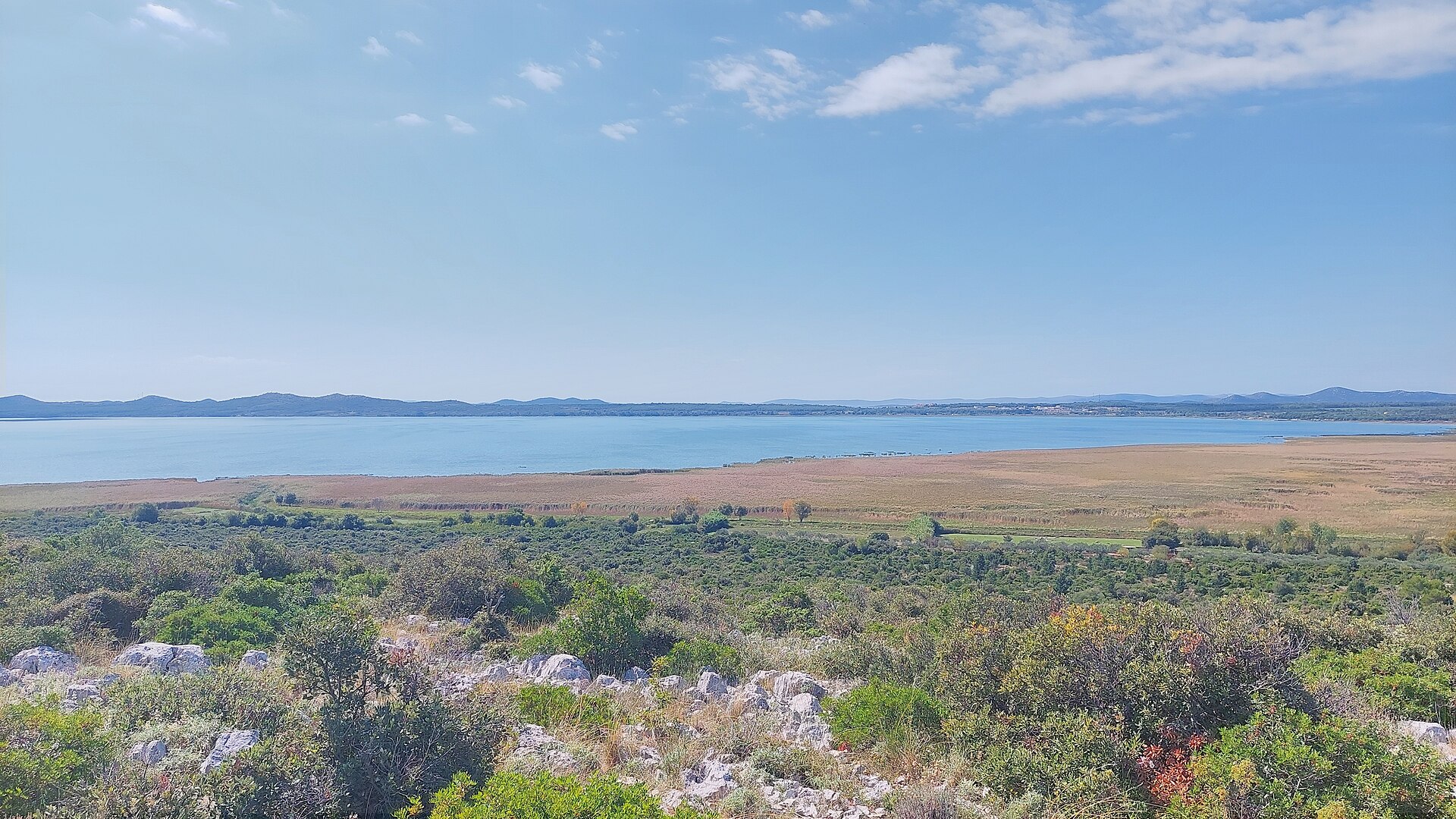
Vransko Lake
Vrana
Vrana Lake (Vransko jezero) is Croatia's largest natural lake, tucked into the Dalmatian coast between Biograd na Moru and Pakoštane. It forms the core of Vrana Lake Nature Park, established in 1999 across 57 km², and ranks among the most important bird reserves on the Adriatic. What makes this lake unusual? Vrana Lake is actually a flooded karst field — a rare example of a cryptodepression, meaning its bed sits below sea level even though the water itself is fresh. The lake stretches northwest to southeast for about 13.6 km, is 1.4 to 3.4 km wide, and covers close to 30 km², making up most of the nature park's total surface. Only a narrow strip of land, cut through by the Prosika channel, separates it from the open sea. What can you see inside the park? The star attraction is the ornithological reserve in the lake's northwest corner, protected since 1983 and spanning 8.83 km². It's one of the most valuable wetland bird breeding grounds in this part of Europe: more than 100 species nest here, close to 90 more spend the winter, and the park's full species count reaches 235. Wooden boardwalks and an educational trail lead visitors to several observation points. Don't miss the viewpoint near Prosika harbor, which overlooks the entire lake, Jugovir hill, and the Babin Škoj peninsula, or the stone birdwatching tower at Majdan. How do you get there and get around? The park spans two counties, Zadar and Šibenik-Knin, covering the town of Benkovac and the municipalities of Pakoštane, Stankovci, Pirovac and Tisno. The easiest approach is from Biograd na Moru or Pakoštane, where signposted roads lead to the park's information points. Once inside, you can explore on two wheels along roughly 50 km of marked cycling trails, or by kayak, rented right at the harbor info point. Gliding along quietly by kayak lets you get far closer to the birds and marsh vegetation than any motorized boat ever could. When should you visit? The best season depends on what you're after. Autumn and winter are prime time for birdwatchers, when wintering species arrive in numbers and the crowds thin out. Summer, on the other hand, is better suited to kayaking and cycling around the shoreline — though it's worth remembering this is a nature reserve first and foremost, not a swimming spot, so don't expect a typical beach experience here. Frequently asked questions Is this the same Vrana Lake found on the island of Cres? No. They're two separate lakes that happen to share a name. The one described here lies on the Dalmatian mainland near Biograd na Moru and is Croatia's largest natural lake. The other, smaller lake on Cres island serves as a drinking-water reservoir. Can you kayak on the lake? Yes — kayaks can be rented at the information point by the harbor. It's the best way to approach the birds and reed beds closely without disturbing them. How many bird species live in the park? The park has recorded 235 bird species overall, with more than 100 nesting here permanently and nearly 90 more spending the winter on the lake. Is the park good for cycling? Definitely — around 50 km of marked cycling trails wind through the park, including routes along the lakeshore and over the surrounding hills.
-
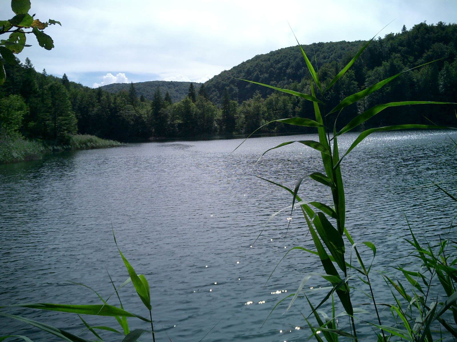
Kozjak
Plitvica Selo
Kozjak is the largest and deepest lake in Plitvice Lakes National Park, located near Plitvica Selo in Croatia. Stretching almost 2.5 km in length, covering roughly 80 hectares and reaching a depth of nearly 47–49 metres, its turquoise surface framed by limestone slopes and dense forest makes it the central and most recognisable feature of the entire sixteen-lake system. Where exactly is Kozjak located? The lake sits at an altitude of about 534 metres above sea level and forms the natural boundary between the Upper Lakes and the Lower Lakes. This is precisely where two different geological eras meet — the Triassic dolomites that shape the Upper Lakes and the Cretaceous limestone typical of the Lower Lakes. Because of this central position, most walking trails through the park pass along or across Kozjak at some point. What can you see around Kozjak? Kozjak is the only lake in the park open to boat traffic — electric ferries shuttle visitors between piers P1, P2 and P3, linking the Upper and Lower Lakes trails. It is also the only Plitvice lake with an island: the small, tree-covered Štefanija's Island, visible from the ferry deck as it crosses the water. A striking piece of hidden geology lies beneath the surface: until roughly 400 years ago, two separate lakes occupied the spot where Kozjak now sits, divided by one of the tufa (travertine) barriers so characteristic of Plitvice. That barrier, once about 400 metres wide and 36 metres tall, now rests some 6 metres below the waterline — a vivid reminder of how actively the landscape here keeps reshaping itself as new tufa deposits form. Where does the name come from? According to local legend, the name Kozjak comes from twelve young goats that drowned while trying to swim across to the far shore. Passed down through generations of residents in the surrounding villages, this story remains the most widely told explanation for the lake's name. When is the best time to visit Kozjak? The lake is striking in every season, though its turquoise colour is most intense in spring and summer, when strong sunlight illuminates the pale limestone lakebed. In autumn, the surrounding forests turn shades of red and gold, creating a vivid contrast with the water. In winter, when temperatures drop below freezing, parts of the lake can partially freeze over and ferry services run on a reduced schedule, so it's worth checking the current sailing times before a winter visit. Frequently asked questions Can you take a boat ride on Lake Kozjak? Yes, Kozjak is the only lake in Plitvice Lakes National Park served by tourist electric ferries, connecting piers between the Upper and Lower Lakes. How big is Lake Kozjak? Kozjak is about 2.5 km long, covers close to 80 hectares and reaches a depth of around 49 metres, making it the largest and deepest lake in the park. Is there an island on the lake? Yes, Kozjak is the only Plitvice lake with an island — Štefanija's Island — visible from the deck of the passing ferries. Where exactly is the boundary between the Upper and Lower Lakes? That boundary runs right through Lake Kozjak, which links both lake systems and marks the meeting point of two distinct geological formations within the park.
-
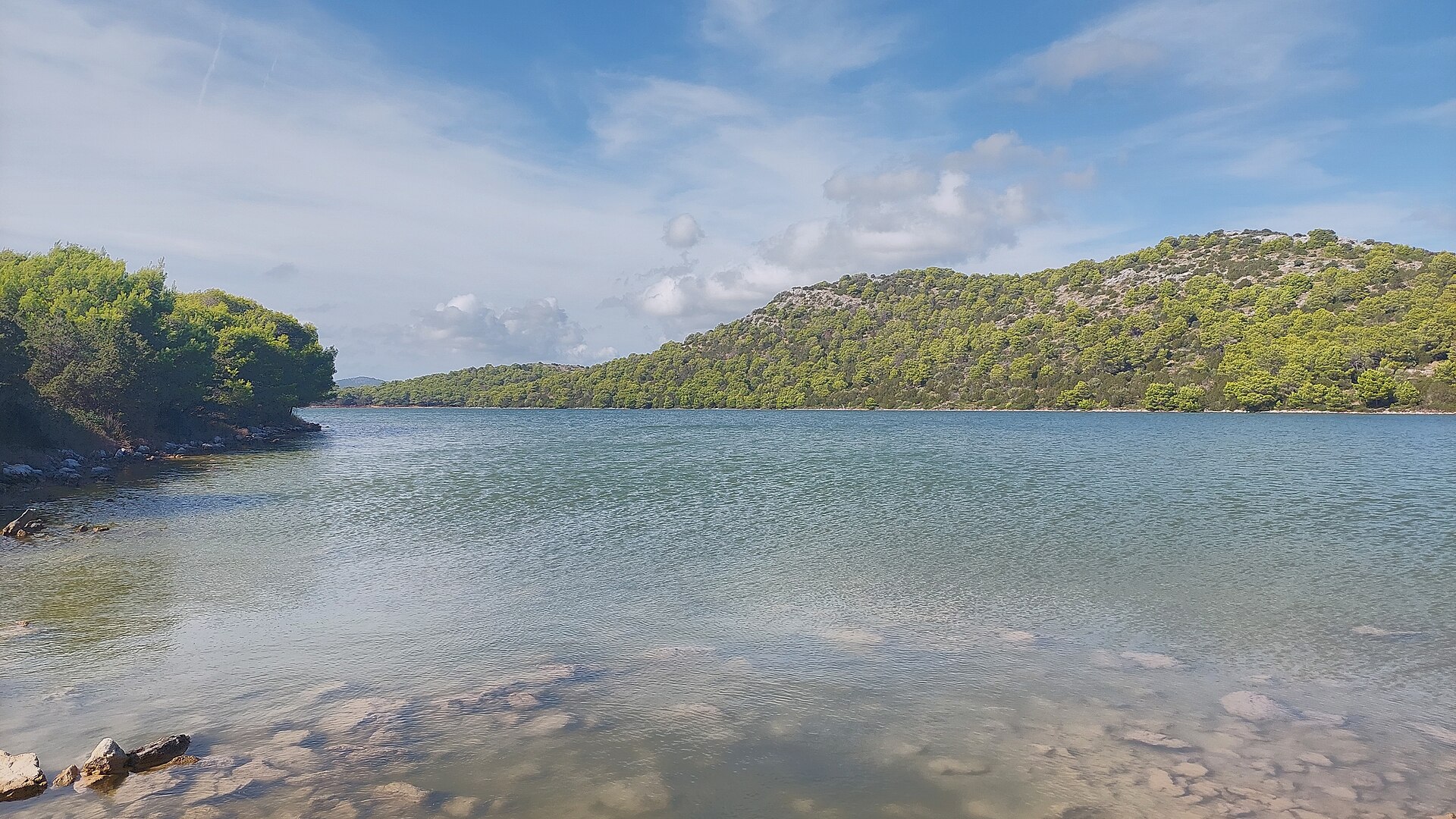
Lake Mir
Općina Sali
Lake Mir is a salt karst lake in Telašćica Nature Park, on the southwestern tip of Dugi Otok island on Croatia's Dalmatian coast. A narrow rocky strip called Priseke separates it from the open sea, while on its landward side it borders Telašćica Bay. It's one of the park's most distinctive attractions, popular with sailors and travelers curious about an unusual natural phenomenon. How did the lake form? Mir formed through geological processes that unfolded over thousands of years. After the last ice age, global sea levels rose by roughly 120 meters, flooding a previously dry karst depression in the landscape. Seawater still seeps into the lake through countless microscopic pores in the surrounding rock, keeping Mir in slow but constant contact with the sea even though there's no direct surface connection. What makes Lake Mir unusual? The lake covers about 0.23 km², stretches close to 900 meters in length, and reaches up to 300 meters at its widest point. Its depth reaches nearly 6 meters. The most striking feature is salinity noticeably higher than the adjacent sea, a result of slow water exchange through the porous rock combined with strong evaporation under the dry Mediterranean sun. In summer, the water inside the lake can run several degrees warmer than the open sea, making it an especially pleasant place to swim. One section of the lakebed holds a fine, grey therapeutic mud that locals have long used for natural mud treatments. Mir is also home to an endemic eel species known locally as "kajman," a creature adapted to thrive in this unusually salty, enclosed environment. What else is there to see nearby? Lake Mir sits within the wider Telašćica Nature Park, home to the famous Stene cliffs that rise up to 200 meters above the sea, the scenic Telašćica Bay dotted with numerous islands and islets, and the peak of Grpašćak. Established in 1988, the park spans roughly 70 km² and also offers dozens of small, secluded beaches perfect for unwinding after a day of exploring. How do you get there? Dugi Otok is reachable by ferry from Zadar or Biograd na Moru, and Telašćica Nature Park occupies the island's southern tip, near the village of Sali. A marked hiking trail leads to the lake itself — the walk from the parking area or nearest viewpoint typically takes anywhere from ten to thirty minutes, depending on the route. Many visitors reach the lake as part of a day boat trip, combining a swim in Mir with a look at the Stene cliffs and the surrounding coves. When is the best time to visit? June through September is the ideal window, when the water is at its warmest and the trails are dry and easy to navigate. Aim for early morning or late afternoon to avoid the midday heat and the peak-season crowds. Frequently asked questions Can you swim in Lake Mir? Yes, swimming is allowed and it's one of the main draws of the site — the warmer, saltier water compared to the open sea attracts visitors looking to relax. Is the lake connected to the sea? Not directly on the surface, but seawater filters through underground pores in the rock, which is why the lake's salinity and temperature differ from the sea outside. Is there an entrance fee? The lake lies within Telašćica Nature Park, so a park entrance fee applies, in line with the current rates set by the park management. How much time should I set aside for a visit? A swim and short walk usually take 1–2 hours, but it's worth planning half a day or a full day to combine the lake with the park's other highlights, including the Stene cliffs.
-
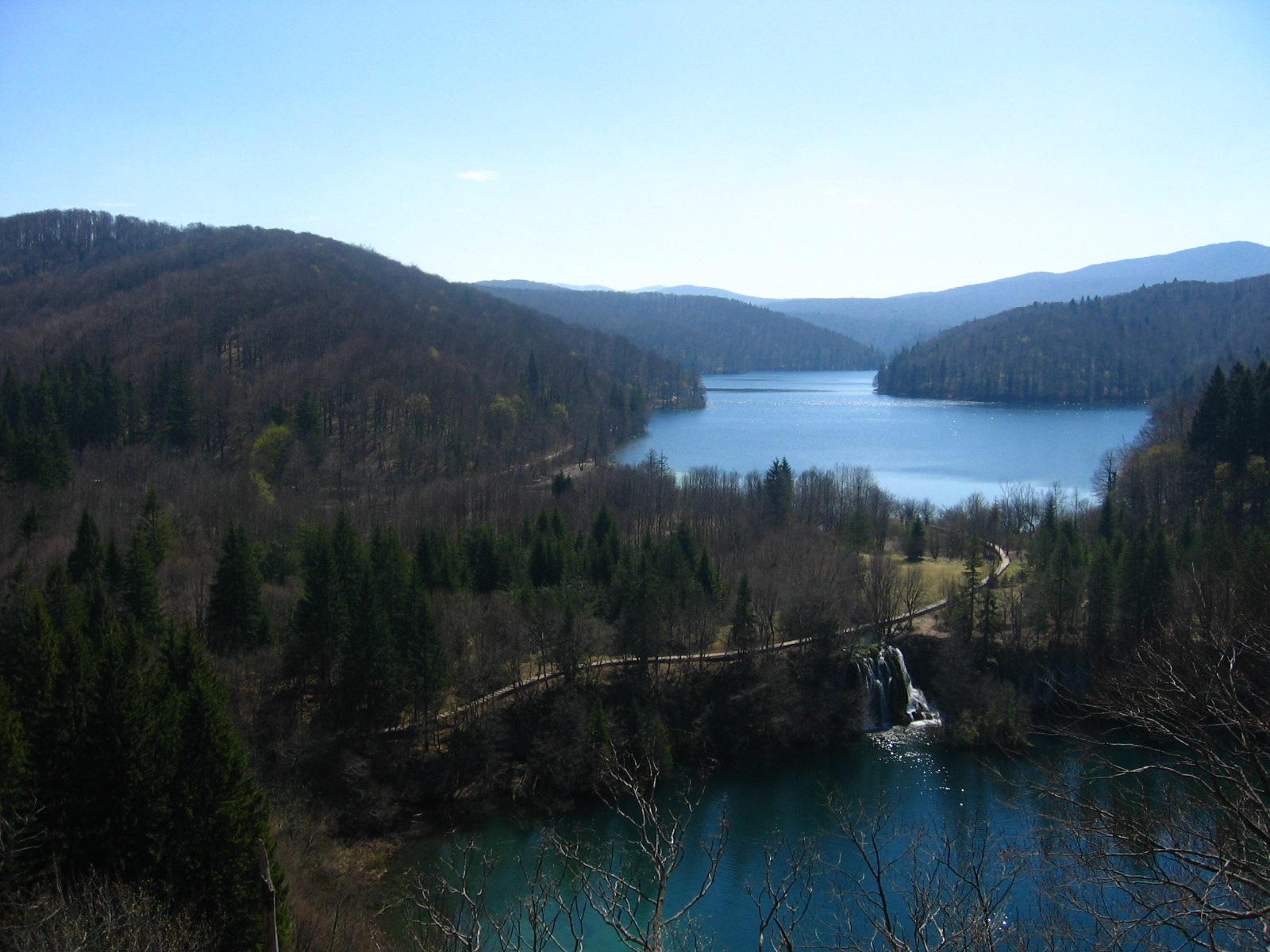
Prošćansko jezero
Plitvički Ljeskovac
Prošćansko Lake is the highest and first of the Upper Lakes in Plitvice Lakes National Park, near the village of Plitvički Ljeskovac in Croatia. While the park is best known for its cascades and turquoise pools, this stretch of water offers a quieter, more open scene — a wide, forest-ringed lake without the crowds that gather near the waterfalls below. Where is it and how big is it? Sitting at roughly 638 metres above sea level, Prošćansko is the second-largest lake in the entire sixteen-lake system, surpassed only by neighbouring Kozjak. It covers about 68 hectares, stretches nearly 2.1 kilometres in length, ranges from 180 to 400 metres in width, and reaches a depth of up to 37 metres. That combination of depth and breadth gives the water a deep, almost inky green tone, distinct from the brighter turquoise typical of the park's lower lakes. What will you see at the lake? Mixed coniferous and deciduous forest lines the shores, and in autumn the trees mirror their colours across the still surface — one of the most photographed views in the Upper Lakes section. Along the trail skirting the eastern bank, hikers pass the Veliki and Mali Prštavci waterfalls (the Great and Small Prštavac falls), smaller and far less crowded than the park's famous Great Waterfall but no less scenic. Unlike the tumbling cascades downstream, the lake itself is calm and wide, making it a natural spot to pause during a longer walk. How do you get to Prošćansko Lake? The most straightforward approach starts at Entrance 2, from which the Upper Lakes trail heads toward Lake Kozjak. The classic route combines a short boat crossing over Kozjak with a walk further upstream to the shores of Prošćansko. The full Upper Lakes loop covers roughly 10–11 kilometres with modest elevation gain and typically takes about 3 to 3.5 hours at an easy pace. A panoramic tourist train can carry visitors back to the starting point. When is the best time to visit? Plitvice Lakes National Park, inscribed on the UNESCO World Heritage List in 1979, draws around 1.2 million visitors a year. The Upper Lakes section, being less crowded than the lower route, is best explored early in the morning or outside the peak summer months. Autumn is widely considered the most photogenic season for Prošćansko itself, when the surrounding forest colours reflect across the lake's surface. Frequently asked questions Is Prošćansko the largest lake in the park? No, it ranks second, just behind Lake Kozjak, which covers about 82 hectares. Together the two lakes account for nearly 80 percent of the park's total water surface. Can you take a boat ride on Prošćansko itself? Boat tours mainly operate on Lake Kozjak; reaching Prošćansko is done on foot along the shoreline trail, which keeps the walk quiet and free of engine noise. How long does it take to reach Prošćansko on the Upper Lakes route? The standard loop, including the boat crossing on Kozjak and the return by tourist train, takes about 3 to 3.5 hours of moderate walking. Is it worth continuing past the lower waterfalls to the Upper Lakes? Yes — the Upper Lakes, including Prošćansko, see far fewer visitors than the popular route around the Great Waterfall, and the forested shoreline and calm water offer a more contemplative side of the park.
-
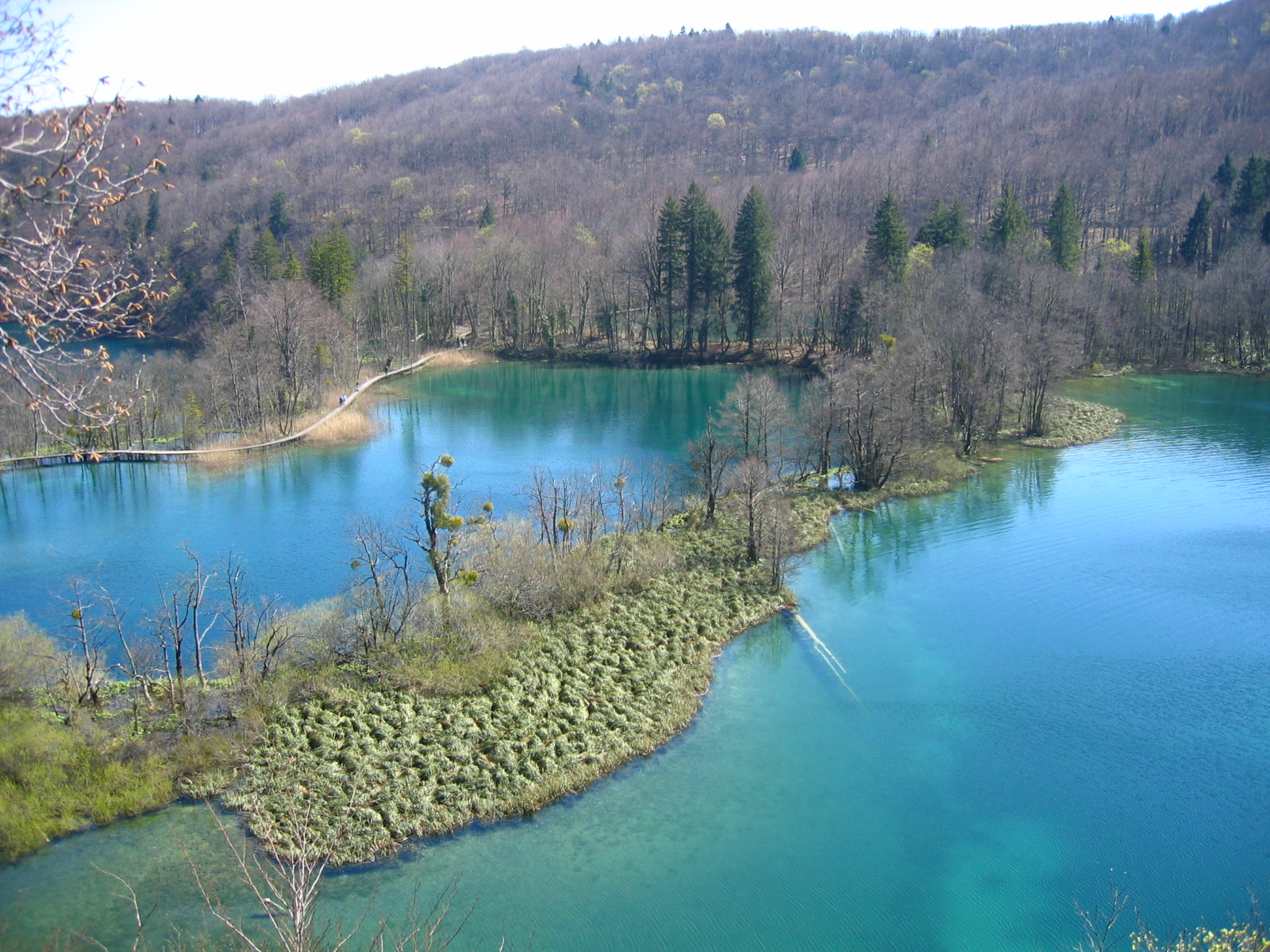
Jezero Vir
Plitvička Jezera
Lake Vir is the smallest of the sixteen lakes in Plitvice Lakes National Park in Croatia, tucked away among the Upper Lakes right beside the path that runs along the southern shore of Veliko Jezero (the Great Lake). Covering barely 0.6 hectares, it's easy to walk past without noticing — yet its vividly green-blue water and fringe of low bushes and trees make it a quiet highlight for anyone taking the time to look closely while touring the park's larger, better-known lakes. Where is Lake Vir located? Vir sits at an elevation of 598 metres within the chain of Upper Lakes, which runs from Prošćansko Lake through Ciginovac, Okrugljak, Batinovac, Veliko Jezero and Malo Jezero, on to Galovac, Milino Jezero, Gradinsko Jezero, Veliki Burget and Kozjak. Water feeding Vir flows down from the neighbouring Great Lake, and like the rest of the Upper Lakes, the lake basin formed in an open valley cut into Triassic dolomite rock. Where does the name come from? The name "Vir" comes from the Croatian word for a whirlpool or vortex (vrtlog/vir), a nod to the way water moves through this small but active lake. Despite its modest size, Vir plays a real part in the chain of connections linking the park's lakes together. What will you see there? Its dimensions are tiny by Plitvice standards — a maximum length of about 47 metres, a width of roughly 56 metres, and a depth that doesn't exceed 4 metres — yet the lake still leaves an impression thanks to the intensity of its colour, with green and blue tones reflecting the surrounding vegetation. Low shrubs and trees line the shore, and the whole scene sits within the classic Plitvice karst landscape, where travertine barriers separate neighbouring lakes and waterfalls link them together. How do you get to Lake Vir? The lake lies directly on the main walking trail that loops around the Upper Lakes, close to the southern edge of the Great Lake. Visitors following this route naturally pass right by Vir — no detour is needed, which makes it an easy stop to take in while exploring the more prominent sights of this section of the park. When is the best time to visit? Plitvice Lakes National Park, inscribed on the UNESCO World Heritage List since 1979 and protected as a national park since 1949, can be visited year-round, though each season shows the landscape differently. Spring and summer bring the most vivid colours to the water and vegetation, autumn adds warm tones to the surrounding foliage, and winter can partially freeze the lakes and waterfalls, creating a quieter, altogether different scene. Given its small size, Lake Vir is best seen as part of a longer walk through the Upper Lakes — plan anywhere from a few hours to a full day for that part of the park. Frequently asked questions Is Lake Vir the park's main attraction? No — it's the smallest lake in the entire Plitvice system, but it makes for an interesting stop along the Upper Lakes trail, especially for visitors curious about the variety within the park's karst landscape. Where does the lake's water come from? Vir is fed by water flowing down from the neighbouring Great Lake, and the whole Upper Lakes chain is in turn fed by the joined flow of the Black and White rivers further upstream. Do you need to leave the main trail to see it? No, the lake sits directly on the popular path that loops around the southern side of the Great Lake, so you'll pass it naturally while touring the Upper Lakes. How much time should I set aside for this part of the park? Walking the Upper Lakes route, including passing Lake Vir, typically takes anywhere from 2–3 hours to a full day, depending on the chosen trail and pace.
-
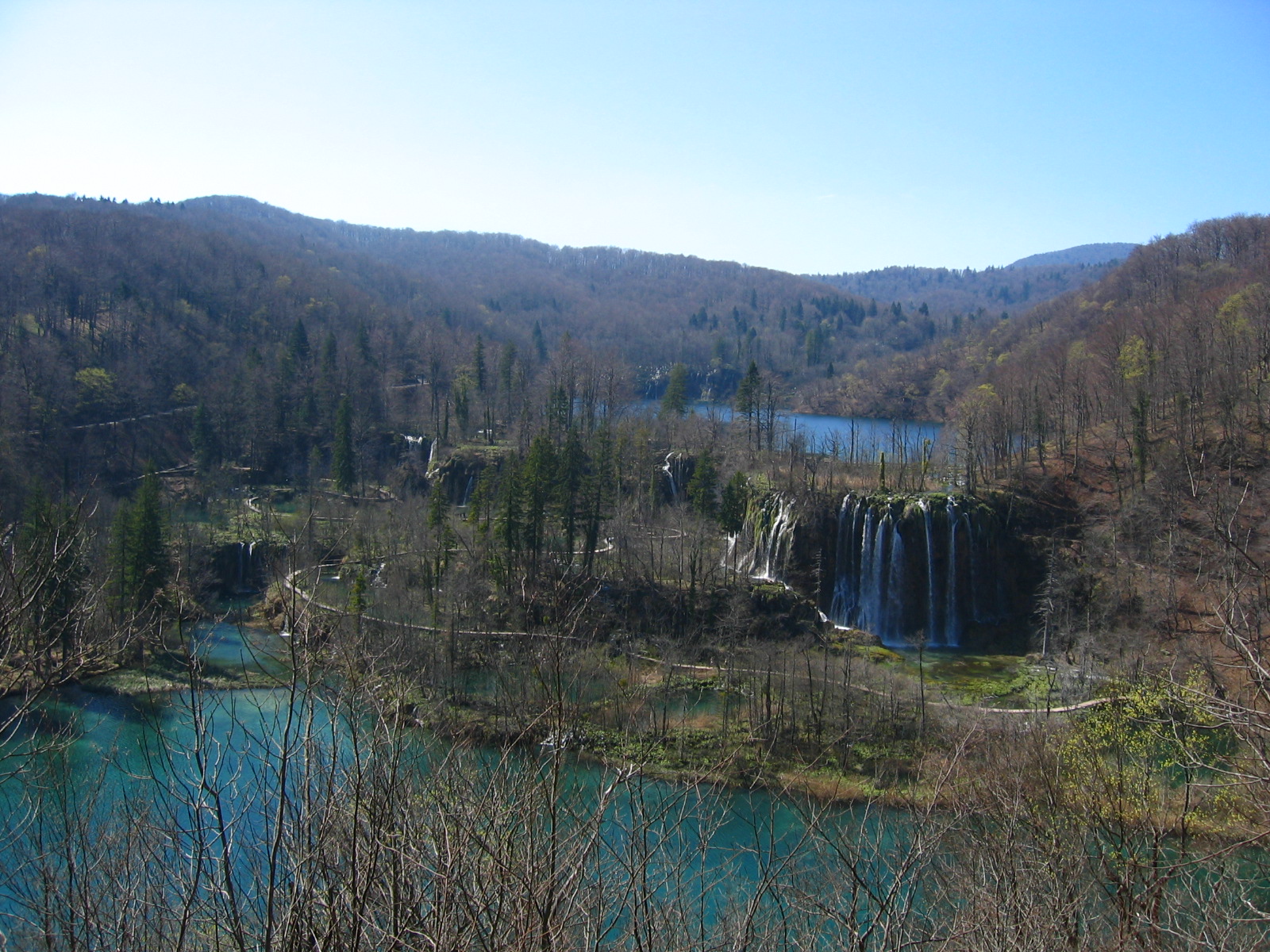
Galovac
Plitvička Jezera
Galovac is one of the Upper Lakes in Plitvice Lakes National Park, sitting at an altitude of 582 metres above sea level. It covers roughly 12.5 hectares and reaches a maximum depth of 24 metres, making it one of the deeper basins in the park's chain of sixteen lakes. Galovac lies right in the middle of the Upper Lakes section, framed by beech and fir forest, and counts among the more picturesque stops along the visitor trail. What can you see at Lake Galovac? The main draw here is the string of waterfalls spilling from the lake's edge down toward the lower basins. Galovački Buk is a cascade system where water tumbles from Galovac over a tufa barrier more than 20 metres high, feeding into Milanovac and Gradina lakes below. Right next to it stands Veliki Prstavac, the second-tallest waterfall in the whole park, known for the force and height of its drop. The lake's own shoreline feels calmer than the crowded viewpoints near the Lower Lakes' big waterfall, so a walk along its wooden boardwalks offers a quieter stretch of the visit. How do you get to Lake Galovac? The easiest approach is from Entrance 2, from where the trail winds through the Upper Lakes, including a short boat crossing over Lake Kozjak. The path connecting Galovac to the neighbouring lakes runs on wooden boardwalks over the water and tufa formations, giving close-up views of the cascades and the lake's clear, turquoise water. This section sees noticeably less foot traffic than the Lower Lakes, making it a good choice for a calmer part of the itinerary. When is the best time to visit? The Upper Lakes area, Galovac included, looks impressive year-round, but the waterfalls carry the most water in spring and early summer, after snowmelt and seasonal rain. In autumn, the beech forest around the lake turns gold, creating a striking contrast with the turquoise water. In winter, parts of the park's walking network may be partially closed, so it's worth checking current conditions before a visit. Frequently asked questions Is Lake Galovac large compared to the other Plitvice lakes? It covers about 12.5 hectares, making it one of the larger basins within the Upper Lakes group, though Kozjak remains the largest lake in the entire park. What waterfalls can you see near Lake Galovac? The best known are Galovački Buk and the neighbouring Veliki Prstavac, considered the second-tallest waterfall in Plitvice Lakes National Park. Which entrance is best for reaching Lake Galovac? The shortest route starts from Entrance 2, with the trail running through the Upper Lakes and a short ferry crossing over Lake Kozjak. Is the trail around Lake Galovac difficult? No — the paths and boardwalks are mostly flat and well marked, suitable for most visitors, though they can get slippery near the waterfall spray in peak season.
-
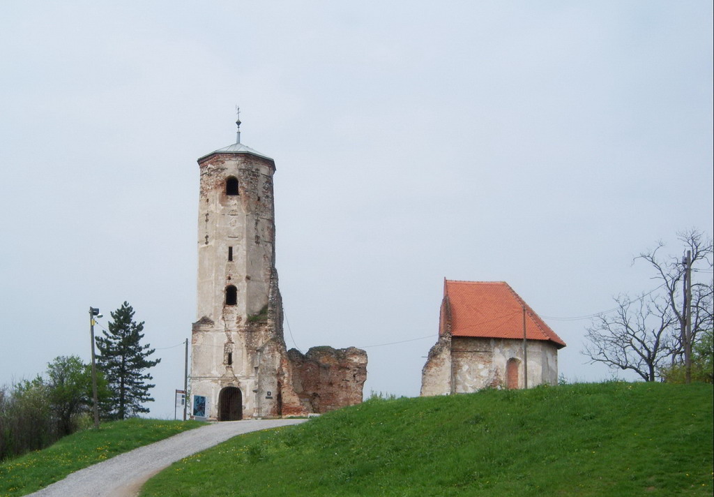
Martin Breg
Dugo Selo
Martin Breg is a small but scenic hill rising above the town center of Dugo Selo in Zagreb County, a favorite spot for both locals and visitors looking for a short walk with a view. The summit reaches about 205 meters above sea level and sits only 1300 meters from the town center, making it an easy destination on foot. The larger, southern slope belongs to Dugo Selo, while the northern slope falls within the neighboring settlement of Prozorje. How do you get to Martin Breg? The hill lies right on the doorstep of Dugo Selo, which is well connected to Zagreb by both road and rail, so the easiest approach is to reach the town first and then continue on foot or by bike up to the summit. Because the climb is short, Martin Breg has long served as the town's everyday recreation spot — residents come here for evening walks, while visitors often add it to a Dugo Selo day trip as a natural viewpoint over the surrounding countryside. What will you see at the top? At the summit stand the ruins of a Baroque-era Church of St. Martin, a zero-category heritage monument whose structure dates to the 16th century, although the site itself is documented as early as 1209. Archaeological finds in the area suggest the church may have been built over the foundations of an older building linked to the Knights Templar. Just below the ruins is St. Martin's Square, home to a wooden statue of the saint created by Croatian sculptor Josip Cikač. The slopes around the hill are covered with vineyards and traditional wine cellars, giving Martin Breg a distinctly rural, wine-growing character typical of the region. What events and attractions happen on Martin Breg? The hill hosts several recurring events tied to Dugo Selo's traditions, since St. Martin is the town's patron saint. The best known are the Martinski Rally car races, the Vincekovo celebration, and Martinje — the traditional "christening" of young wine, which doubles as the town's holiday. Hikers can follow the 4-kilometer "Martin Breg" educational trail, which runs from the hill toward the village of Cerje and continues to the main Zagreb–Bjelovar road at the entrance to Dugo Selo, with 15 information boards placed along the way explaining local history and nature. When is the best time to visit? Given its mix of viewpoint, history, and wine-growing tradition, Martin Breg is most rewarding in spring or autumn, when the weather suits walking and cycling and the vineyards look their best. November, around St. Martin's Day, is a particularly lively time, as the town holds its Martinje celebrations centered on young wine. Frequently asked questions How high is Martin Breg? The hill reaches about 205 meters above sea level, rising directly above the center of Dugo Selo. What can you find at the summit? The ruins of a 16th-century Baroque Church of St. Martin, first documented in 1209, along with a square featuring a wooden statue of the saint. Are there hiking trails on Martin Breg? Yes, a 4-kilometer educational trail leads from the hill to the village of Cerje, marked with 15 information boards. What events take place on the hill? The main ones are the Martinski Rally, Vincekovo, and Martinje — the traditional celebration of young wine held alongside Dugo Selo's town holiday.
-
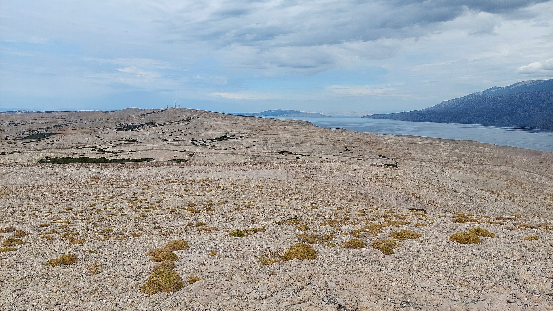
Pag Triangle
Grad Novalja
Pag Triangle is an unusual land formation in Grad Novalja, on the Croatian island of Pag, right next to the village of Caska. It draws attention not because of scale or spectacle, but purely because of the puzzle of its shape — an irregular quadrilateral that stands out clearly from the surrounding terrain. What exactly is it? Pag Triangle is a case of landscape pareidolia — a naturally shaped stretch of ground that the human eye reads as a regular, geometric figure. Here it takes the form of an irregular four-sided shape, best appreciated from above or in satellite imagery. The town of Novalja has officially designated the site a natural landmark, which says a lot about how it's regarded locally — not as a gimmick invented for tourism, but as part of the municipality's landscape heritage. Where does the "Bermuda Triangle of Croatia" nickname come from? The label isn't random. The formation's irregular shape, its mysterious origin, and its location away from the main tourist trails all fed into comparisons with the famous Bermuda Triangle — playfully, not literally. The nickname captures the feel of the place well: something that looks almost otherworldly, despite being an entirely natural geological feature. How do you get there? Pag Triangle sits right next to Novalja, close to the village of Caska, which makes it an easy stop for anyone staying in this part of Pag island. Novalja is the main tourist hub in this stretch of the island and is well connected to the rest of Croatia, so reaching the area takes little logistical effort — get to Novalja, then head toward Caska. What will you actually see? Keep in mind that Pag Triangle is a land formation rather than a single, isolated object like a boulder or a rock outcrop — its geometric outline is best judged from a distance or from a higher vantage point. It's an attraction for travelers who enjoy unusual natural landscapes and appreciate that nature can produce shapes resembling regular geometry without any human intervention. When is the best time to visit? Pag island is known for a long tourist season, and the area around Novalja is at its liveliest from late spring through early autumn. That's a good window to pair a look at Pag Triangle with time on the nearby beaches and in Novalja itself, also known as the island's nightlife hub. Outside the season the surroundings are much quieter, which can suit travelers looking for calm and an unhurried view of the landscape without crowds. Why visit Pag Triangle? This is a site that doesn't need elaborate tourist infrastructure to be interesting. The very fact that Novalja's authorities chose to protect it as a natural landmark shows the local community sees value in it beyond a passing curiosity. For travelers exploring Pag island, it's an extra stop that pairs easily with the island's better-known attractions, without needing to set aside a full day for it. Frequently asked questions Where exactly is Pag Triangle located? The formation lies in Grad Novalja, right next to the village of Caska, on the Croatian island of Pag. Is Pag Triangle a natural formation? Yes, it's a natural land formation — an example of landscape pareidolia, officially recognized as a natural landmark by the town of Novalja. Where does the "Bermuda Triangle of Croatia" nickname come from? It's an informal name referencing the formation's irregular, quadrilateral shape and its mysterious character, which doesn't have a single clear-cut explanation. Is it worth combining a visit with a stay in Novalja? Yes, its proximity to Novalja — the main tourist center in this part of Pag island — makes it easy to fit into a broader itinerary of the area.
-
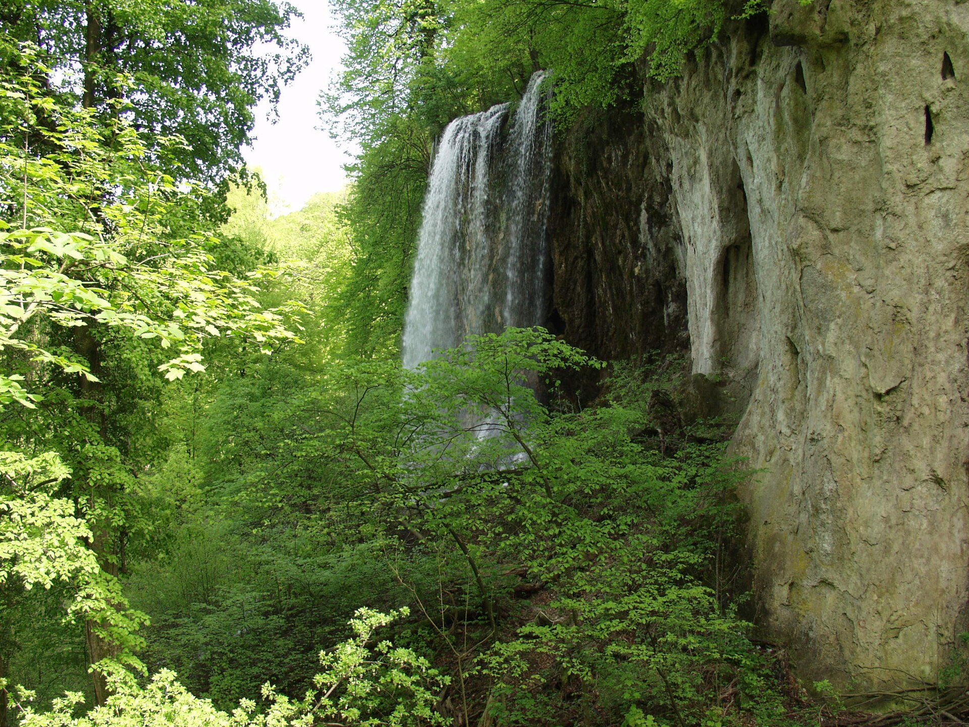
Papuk Nature Park
Slatinski Drenovac
Papuk Nature Park is Central Europe's oldest UNESCO Geopark and the largest mountain range in Slavonia, eastern Croatia, sitting right beside the village of Slatinski Drenovac. Thick beech and oak forests here hide some of the continent's oldest rock formations, while quiet valleys give way to sweeping vineyards and orchards at the foot of the range. Where exactly is Papuk? Papuk stretches across the heart of Slavonia, bordered by the Bilogora hills to the northwest, the Krndija range to the east, and Ravna Gora and Psunj to the southwest. For centuries this cluster of mountains has marked a natural transition between Slavonia's flat lowlands and Croatia's more rugged interior. Slatinski Drenovac, a small village at the base of the massif, makes a practical launch point for exploring the park away from the crowds found at Croatia's better-known coastal destinations. How do you get to Papuk Nature Park? Driving is by far the easiest option — the region connects well to larger Slavonian towns such as Požega and Slatina, from which local roads lead toward the villages ringing the park's edges. Slatinski Drenovac sits on the northern side of the massif, making it a convenient starting point for trails heading up into the hills. It's worth planning ahead, since public transport in this part of Croatia is limited and local bus schedules can be irregular. What is there to see inside the park? Papuk draws geology enthusiasts and hikers above all. Its UNESCO Geopark status comes from an exceptional concentration of rock formations, some hundreds of millions of years old, making it one of the region's key sites for studying deep geological history. Beyond its scientific value, the park offers dense deciduous forest, scenic streams, and viewpoints overlooking the broad Slavonian plains below. Together with the neighboring Psunj and Krndija ranges, Papuk forms part of a larger natural complex well worth exploring over a longer stay. When is the best time to visit? Spring and early autumn are the most rewarding seasons — temperatures suit hiking, and the forest looks its best, with fresh green growth in spring and colorful foliage in autumn. Summers can turn hot, though the thick tree cover keeps most trails shaded. Winters in Papuk can be harsh, with snow settling in the higher sections and limiting access to some routes, but they also bring a quiet, secluded atmosphere for visitors seeking solitude. Who should visit Papuk? The park suits travelers who value quiet nature, hiking, and genuine outdoor immersion away from mass tourism. It's also a strong pick for anyone interested in geology or natural history, and staying near Slatinski Drenovac offers a taste of authentic, rural Slavonian life far from Croatia's main tourist circuits. Frequently asked questions What makes Papuk Nature Park stand out among Croatia's parks? Papuk is the oldest UNESCO Geopark in this part of Europe, owing to the exceptional age and diversity of its rock formations — a rarity among Croatia's other nature parks. How close are the hiking trails to Slatinski Drenovac? The village sits right against the massif's northern slopes, giving quick access to trails and making it a natural starting point for hikes into the park. Is Papuk suitable for a day trip? Yes, shorter trails and viewpoints can be covered in a single day, though fully experiencing the geopark and its neighboring ranges calls for a longer stay. Which mountain ranges border Papuk? The park is flanked by Bilogora to the northwest and Krndija to the east, with Ravna Gora and Psunj to the southwest, together forming a larger mountain system across Slavonia.
-
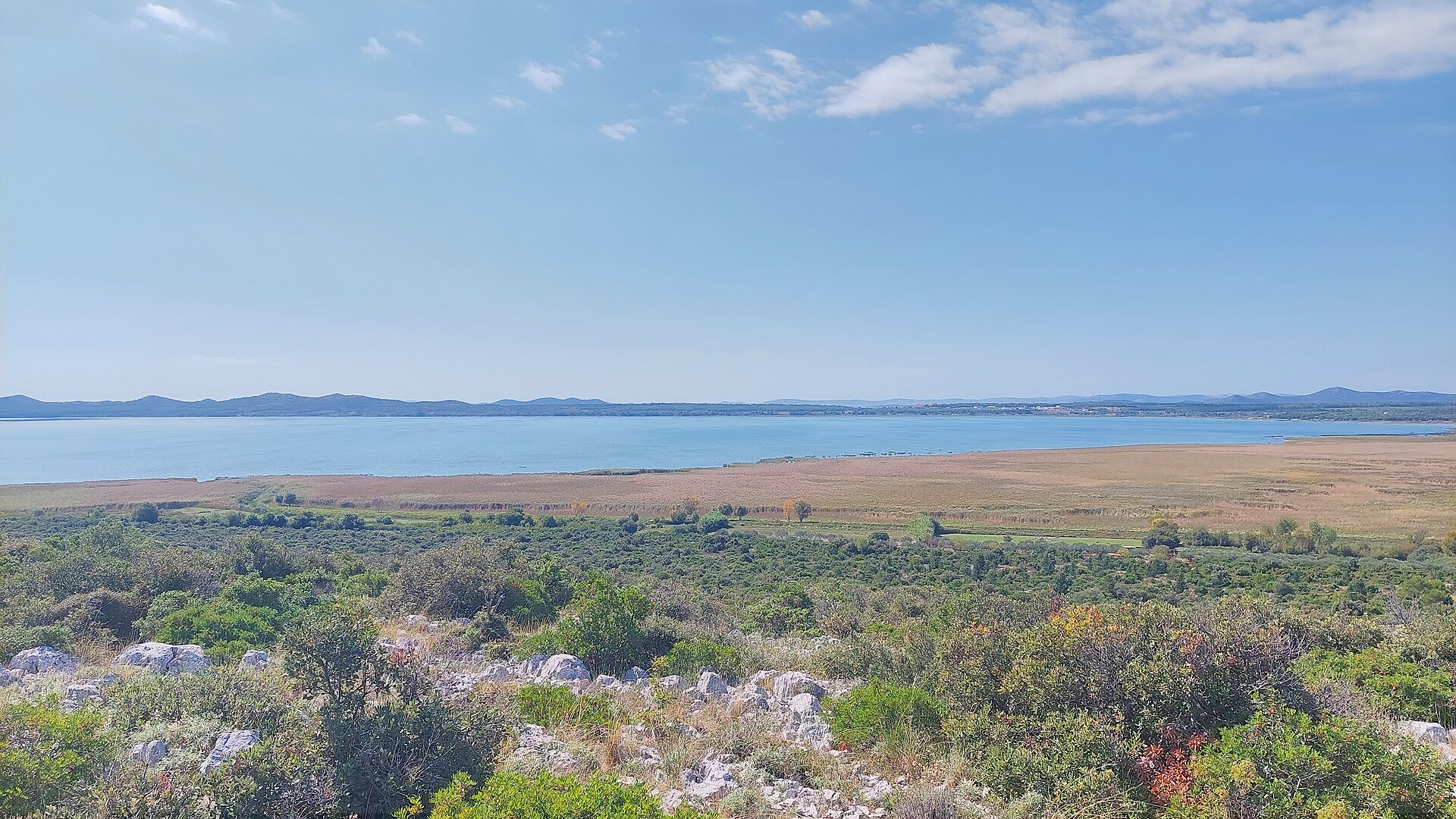
Nature Park Vransko Lake
Vrana
Nature Park Vransko Lake spreads out right next to the village of Vrana in Zadar County, just a short drive from the coastal towns of Pakoštane and Biograd na Moru. It's Croatia's largest natural lake and one of the most important wetlands in the Balkans, offering a walk through reed beds paired with birdwatching opportunities that are hard to find anywhere else in Europe. How do you get there? The park sits along the road connecting Zadar and Biograd na Moru, so driving is the easiest option — under half an hour from either town. The main entry point is the Crkvine Information Centre on the lake's northern side, where the park's famous boardwalk begins. If you're without a car, Pakoštane is a good base — the park entrance is reachable on foot or by bike in about fifteen minutes. What will you see at the lake? The heart of the park is a roughly 600-metre wooden boardwalk that winds over reeds and shallow flooded ground. Low observation towers are placed along the route, letting you watch birds up close without disturbing them. A narrow strip of land separates the lake from the sea, with water exchanged through the Prosika channel — this unusual setup gives the lake slightly brackish water, which draws both freshwater and marine species. The park itself covers around 57 square kilometres, including the lake and the surrounding marshes, meadows and hills. Beyond the boardwalk, it's worth climbing Kamenjak hill for a wide view over the whole lake and the fields around it. When should you visit to spot the most birds? The park is listed as an Important Bird Area (IBA) in Europe, with more than 250 recorded species — around a hundred of which nest here permanently, including the purple heron and pygmy cormorant. April-May and September-October are the best months, when breeding and migration periods overlap. Birds are most active early in the morning and just before sunset, so it's worth timing your visit around those hours and bringing binoculars. How much does entry cost, and what should you bring? Access to the Crkvine boardwalk requires a ticket, priced at a few euros per person and available on-site. The terrain is flat and mostly shaded by reeds, but summers get hot and humid, so bring water, a hat and insect repellent. Sturdy shoes help if you plan to explore beyond the boardwalk, since the park also has marked walking and cycling trails around the lake. Frequently asked questions Is Vransko Lake suitable for families with children? Yes — the boardwalk is flat with no steep sections, and the observation towers impress even young visitors. It's one of the easier nature trails in the region. Can you swim in the lake? The lake is primarily a nature reserve, so swimming isn't the main draw and is restricted in some areas under conservation rules. The sea beaches in Pakoštane and Biograd are just a few minutes away by car. How long does a visit take? Walking the boardwalk with stops for birdwatching takes about 1.5-2 hours. Add the climb to the viewpoint hill and it's worth setting aside half a day. Do you need to book in advance? No, tickets are sold on-site at the information centre. During peak season (July-August), expect more visitors around midday.
-

Galovački buk
Plitvička Jezera
Galovački buk is one of the most recognizable waterfalls in Plitvice Lakes National Park, tucked into the Upper Lakes area near Lake Galovac. The cascade stands roughly 16 meters tall and is fed by water flowing down from Lake Milino and Lake Galovac, which then continues downstream into the lower Lake Gradinsko. How do you get to Galovački buk? The waterfall sits at the heart of the Upper Lakes trail network, so the easiest way to reach it is on foot along the park's well-marked wooden walkways and paths. From Entrance 1, near Lake Galovac, a relaxed walk to the waterfall takes about 40 minutes. Entrance 2 offers a shorter, quicker route, which is a good choice if you want to see the waterfall without committing to a full loop of the park. The trails leading to Galovački buk follow the same style of boardwalks and footpaths found throughout Plitvice, so no special gear is needed beyond comfortable walking shoes. Keep in mind that park routes are often one-way and sections can close seasonally, so it's worth checking the current trail layout at the entrance before setting off. What will you see there? Galovački buk impresses with its stepped, cascading structure — water tumbles down rocky ledges surrounded by dense forest, creating a steady rush of sound and a fine mist that can catch small rainbows on sunny days. The crystal-clear water typical of the entire Plitvice lake system, combined with the lush vegetation framing the falls, makes this one of the more photographed spots in the park. It's worth knowing that the waterfall used to be taller and wider than it appears today. Over time, the buildup of fallen trees and natural sediment has reduced its original scale — a process typical of Plitvice's travertine waterfalls, which are constantly reshaped by the same natural forces that created them. When should you visit? Early morning is the best time to visit Galovački buk, before the trails fill up — the park gets busy around midday, especially during the summer season. The quieter early hours also make for better nature photography, a popular pursuit among visitors drawn to this particular waterfall. The look of the falls also shifts with the seasons: spring and periods right after rainfall usually bring the strongest water flow, which makes the cascade effect more dramatic. Whenever you decide to visit, plan enough time in your schedule, since Galovački buk is just one stop along a longer route through the Upper Lakes. Frequently Asked Questions How tall is Galovački buk? The waterfall is about 16 meters high and sits within the Upper Lakes section of Plitvice Lakes National Park. Which park entrance is closer to the waterfall? Entrance 2 offers a shorter, faster route to Galovački buk, while the walk from Entrance 1, near Lake Galovac, takes about 40 minutes. Where does the water in the waterfall come from? It's fed by inflow from Lake Milino and Lake Galovac, with the water continuing on to Lake Gradinsko below. Has the waterfall always looked the same? No — Galovački buk used to be taller and wider. Over time, fallen trees and natural sediment buildup have changed its shape, which is typical of Plitvice's ever-evolving travertine waterfalls.
-
Miljacka
Ivoševci
Miljacka is one of the most distinctive waterfalls of Krka National Park, located near the village of Ivoševci in Croatia, roughly 21.5 km downstream from the river's source. It is the fifth waterfall along the Krka's course toward the sea, and a rare spot where nature and early industrial history sit side by side. How tall is the Miljacka waterfall? The cascade drops 23.8 meters and stretches 50–60 meters wide. Water tumbles over three larger steps and numerous smaller ones, all formed from tufa (freshwater limestone deposited by the river) — the same geological process responsible for Krka's famous terraced landscape. Can visitors get close to the waterfall? Not really. The left bank, right below the falls, is occupied by the buildings of the HE Miljacka hydroelectric plant, which blocks direct access to the riverbed at the base of the waterfall. That said, hiking paths on the northern (western) side of the river offer clear views over the cascade and the surrounding canyon, so the waterfall is still very much visible — just not walkable up close. What is the power plant next to the falls? HE Miljacka is the oldest and largest hydroelectric plant on the Krka River. Construction began in 1904, the first generating unit went online in April 1906, and the project was completed in full in 1907. Until 1910, it held the record as the most powerful hydroelectric plant in Europe. The plant uses a water head of 102 meters and has a total installed capacity of 24 MW, making it a landmark of early hydropower engineering in this part of the Balkans. What is hidden underground here? Near the waterfall lies Miljacka II, the largest cave within Krka National Park. Its underground passages and springs shelter numerous endemic and protected cave-dwelling species, including the olm (Proteus anguinus) — Europe's only true cave-adapted vertebrate — as well as the long-fingered bat. This makes the Miljacka area one of the more significant biospeleological sites in Croatia. What else is worth seeing nearby? Ivoševci itself sits within the national park's territory, close to Burnum, an important archaeological site with the remains of a Roman military camp and settlement dating from the turn of the era. Combining a stop at the waterfall with a short visit to Burnum makes for a fuller picture of the area's layered history. Miljacka isn't a postcard viewpoint with boardwalks and crowds — it's a rougher, more industrial corner of the park where a century-old power station meets a wild limestone canyon. For visitors interested in both landscape and the history of engineering, it's one of the more unusual stops along the Krka River. Frequently Asked Questions Can you walk right up to the Miljacka waterfall? No, direct access to the riverbed beneath the falls is blocked by the HE Miljacka hydroelectric plant. The cascade can be viewed from footpaths on the opposite side of the river. How high is Miljacka waterfall? It drops 23.8 meters over a width of 50–60 meters, formed by three larger tufa steps and many smaller ones. What is HE Miljacka? It is the oldest and largest hydroelectric plant on the Krka River, operating since 1906, and was Europe's most powerful hydroelectric plant until 1910. What else can you see around Ivoševci? Nearby are the Roman archaeological site of Burnum and the Miljacka II cave, home to protected underground species including the olm.
-
Skradinski buk
Szybenik
Skradinski buk is the most famous waterfall complex in Krka National Park, formed on the Krka River in central Dalmatia, in Šibenik-Knin County, just a few kilometers from Šibenik and directly above the small town of Skradin. What exactly is this place? Skradinski buk is a cascade made up of numerous travertine barriers over which the Krka River tumbles as it reaches the lower part of its course. Travertine is a sedimentary rock that forms in calcium-rich water - over thousands of years, its gradual deposit built up the stepped barriers that the water now spills over. The whole area lies within Krka National Park, the seventh national park established in Croatia, proclaimed in 1985. The park was created to protect the Krka River and its valley, and to serve scientific, educational, cultural, and tourism purposes. How do you get there? Skradinski buk sits right above the town of Skradin, one of the main entry points to the park - visitors typically reach the falls by tourist boat sailing up the river from there. The other well-known entrance, Lozovac, lies closer to the main roads coming from Šibenik. Within Skradinski buk itself, wooden boardwalks and footpaths run along and across the riverbed, letting visitors get close to the cascades without stepping into the water. What will you see? The main draw is the cascade itself - a series of smaller and larger travertine barriers, with water splitting into multiple channels and pooling into basins along the way. Wooden walkways cross and follow the river, offering close-up views of the falling water from many angles. Old watermills still stand nearby, evidence of how the river was once put to practical use by the people of Skradin. The surrounding area is covered in the lush, moisture-loving vegetation typical of karst waterfall ecosystems. One important note for anyone planning a visit: swimming in the waters of Skradinski buk has been prohibited since 2021. The ban was introduced to protect the fragile travertine formations, which had been degraded by years of bathers. When should you visit? Krka National Park sees the largest crowds during the summer months, when Dalmatia draws the most tourists overall, but that is also when the paths and boardwalks around the falls are busiest. Spring and early autumn tend to bring a stronger flow of water in the river while the park itself is noticeably quieter than at the height of the season. Frequently Asked Questions Where is Skradinski buk located? Above the town of Skradin, on the Krka River, inside Krka National Park in central Dalmatia, a few kilometers from Šibenik. Can you swim at Skradinski buk? No - swimming has been banned since 2021 to protect the travertine barriers from further damage. How do you reach the waterfalls? Most commonly by tourist boat from Skradin, or on foot from the Lozovac park entrance. What is the travertine that forms the cascades? It is a sedimentary rock formed from calcium dissolved in the Krka River's water, which, deposited over thousands of years, built up the stepped water barriers visible today.
-
Krčić waterfall
Grad Knin
Krčić Waterfall (also called Topoljski buk or Veliki buk) is a modest but geologically significant cascade at the northern edge of the Kninsko Polje basin, right next to the town of Knin in Croatia. This is the spot where the Krčić stream finishes its course and flows into the Krka — meaning the waterfall effectively marks the source of one of Croatia's most famous rivers, the one behind the cascades and lakes of Krka National Park further downstream. How tall is Krčić Waterfall? The cascade drops roughly 22 meters over a limestone travertine barrier — the same natural process that, further along the Krka river, built the barriers responsible for the park's famous waterfalls. Here, though, the formation is smaller and far less visited. Does the waterfall always have water? This is the key thing to know before visiting: Krčić can run dry for parts of the year. In the late 19th and early 20th centuries, the riverbed was reshaped by engineering works — rock was cleared using explosives, dams were built, a chamber was cut into the travertine barrier, and eventually the small Krčić Hydroelectric Power Plant was constructed, drawing on the stream's flow. As a result, the waterfall's natural water supply was reduced, and today it behaves as an intermittent waterfall. It looks its best in spring and after heavy rain, while in summer — especially during dry spells — the riverbed can be nearly or completely dry. If seeing real water flowing over the falls matters to your trip, aim for early spring (March–May) or autumn after rainfall rather than the height of a Dalmatian summer. How do you get to Krčić Waterfall? The waterfall sits just north of central Knin, within the Kninsko Polje, the wide basin where the Krčić meets the Krka. Knin is a well-connected inland town in the Dalmatian hinterland, with road links to Zadar, Split and Šibenik, which makes the waterfall an easy stop for travelers moving between the coast and the interior. Given its small scale, it's worth pairing a visit with a look at Knin itself — including the hilltop Knin Fortress overlooking the town — and, time permitting, a trip to nearby Krka National Park. What else is there to see nearby? The area around the waterfall is quiet and largely untouristed, a striking contrast to the crowds at Krka National Park's main cascades. It's a good stop for travelers who want a moment of calm and a look at the literal starting point of one of Dalmatia's most important rivers before it flows into the much larger network of waterfalls and lakes further south. Frequently Asked Questions Is Krčić Waterfall part of Krka National Park? No. The waterfall sits outside the park's boundaries, on the Krčić stream, which flows into the Krka right at this point — this is essentially where the Krka river begins. Why does the waterfall sometimes dry up? Engineering works from the late 19th/early 20th century — excavation, damming, a chamber cut into the travertine barrier, and the later construction of the Krčić Hydroelectric Power Plant — reduced the stream's natural flow, turning it into an intermittent waterfall. When is the best time to see water flowing? Spring and periods after heavy rainfall give the best chance of a full flow; in summer, particularly during dry spells, the riverbed can be dry or carry very little water. How tall is Krčić Waterfall? About 22 meters.
-
Veliki slap
Plitvica Selo
Veliki slap (Great Waterfall) is the tallest waterfall inside Plitvice Lakes National Park — and the tallest in all of Croatia — dropping roughly 78 metres into the canyon at the southern end of the Lower Lakes, near the park's Entrance 1, in the Plitvička Jezera area. What makes this waterfall different from the rest of Plitvice? Most of the park's cascades form where water spills from one lake into the next over layers of travertine. Veliki slap works differently: it's fed by the Plitvica stream, which runs on its own course for about 3 kilometres before plunging into the canyon. That independent water source is why the fall appears as one continuous curtain of water rather than a series of smaller steps like the lake-to-lake cascades upstream. Once the water lands at the bottom of the Lower Lakes canyon, it joins the Korana River. Right nearby, on the canyon walls, a cluster of smaller cascades called Sastavci tumbles down a separate 26-metre drop of the Korana itself. Both falls are visible together from the same viewpoints, which is what makes this corner of the park one of its most photographed spots. How do you get to Veliki slap? The easiest approach starts at Entrance 1: the walk to the main viewing platform typically takes about 10–15 minutes along a marked path and boardwalk. From the upper viewpoint you get the full-height view of the falls against the canyon walls — the classic postcard shot of Plitvice. A wooden walkway also lets you continue down closer to the base of the fall, where the spray from the crashing water reaches the path. When should you visit to see it at its best? Water volume shifts noticeably with the seasons. In spring, through April and May, snowmelt from the surrounding hills feeds extra water into the Plitvica stream, and the waterfall runs at its fullest — a wide, thundering sheet of white water with visible mist drifting over the canyon. By summer, as groundwater levels drop, the flow is noticeably calmer, though the fall remains impressive year-round. What else is worth seeing nearby? The path to Veliki slap naturally continues past the Sastavci cascades and the point where the Korana River emerges from beneath them, so it's worth treating the walk as one continuous stretch — from the elevated viewpoint, along the boardwalk over the water, down to the spot where the river flows out of the canyon. Few places in the park let you stand this close to falling water. Frequently Asked Questions How tall is Veliki slap? It drops about 78 metres, making it the tallest waterfall in Plitvice Lakes National Park and the tallest in Croatia. What sets it apart from the other Plitvice waterfalls? Most falls in the park form between the lakes themselves, but Veliki slap is fed by the separate Plitvica stream, which flows for about 3 km before reaching the drop — giving it a single, unbroken curtain of water instead of stepped cascades. How long does it take to walk there? From Entrance 1, reaching the main viewpoint usually takes around 10–15 minutes along an easy path and boardwalk. When is the waterfall most powerful? It carries the most water in spring (April–May), when melting snow feeds the Plitvica stream. Flow is generally lighter during summer.
-
Zarečki krov
Grad Pazin
Zarečki krov is a natural waterfall on the Pazinčica river, tucked into a green canyon just a few kilometers from Pazin in the heart of Istria. The name comes from the wide rock overhang stretching above the falls, which looks like a stone "roof" (krov in Croatian) and shelters a small hollow behind the curtain of falling water. How do you get to Zarečki krov? The waterfall sits roughly 4 km from Pazin, toward the villages of Zarečje and Grdoselo. A local road leads most of the way, and the final stretch is a short walk down a path into the canyon. There is parking near the main road, just a few minutes' walk from the falls themselves. It's a common stop for travelers exploring central Istria by car, and cyclists can also reach it via trails connecting Pazin with the surrounding villages. What will you see there? The Pazinčica river drops from about 10 meters into a small pool, the largest body of water found anywhere along the river's course. Above the cascade, a broad rock ledge juts out, creating the natural "roof" effect that gives the site its name. The pool beneath the falls is deep enough for swimming, and the surrounding rocks draw both cliff jumpers and climbers. The Hyperactive climbing club from Pazin, working with the local tourist office, has set up around 20 climbing routes of varying difficulty here, making Zarečki krov a modest but well-regarded climbing spot in the region. The area is also popular for hiking, fishing, and picnicking in the shade of the trees lining the canyon. When should you visit? Late spring and summer are the best times to come, when water levels make swimming comfortable and warm weather invites a longer stay by the river. In spring, after rain or snowmelt, the waterfall itself tends to run fuller and more dramatic, though the water is usually too cold for a swim. Sturdy footwear is worth packing, since the canyon terrain is rocky and requires some care underfoot. Why visit Zarečki krov? What sets Zarečki krov apart from other Istrian sights is how it combines a natural landscape with active pursuits — swimming, climbing, and hiking — all in one spot far from the crowds on the coast. It makes a good day trip from Pazin or a stop on a route through the peninsula's interior, ideal for anyone looking for a nature fix without heading all the way to the sea. Frequently Asked Questions Is there an entrance fee for Zarečki krov? No, unlike many Croatian attractions, access to the waterfall area is free. Can you swim there? Yes, the pool below the falls is fairly deep and a popular spot for cooling off during the warmer months. How far is Zarečki krov from the coast? The waterfall lies inland, about 40 km from the sea and coastal towns such as Poreč, Rovinj, and Rabac. Is Zarečki krov suitable for children? The ground around the falls is rocky and partly steep, so caution is advised with young children, especially near the rocks and water.
-
Štrbački buk
Štrbački buk is a striking waterfall, roughly 25 meters high, on the Una River, sitting right on the border between Croatia and Bosnia and Herzegovina, next to Una National Park. It is one of the most recognizable landmarks on the Una River and a common stop for anyone exploring the border region between the two countries. What makes Štrbački buk special? The waterfall forms where the Una River drops over a rocky ledge, creating a wide, cascading curtain of water rather than a single narrow plunge. The Una is famous for its remarkably clear, turquoise water, and Štrbački buk has become one of the visual symbols of the river, frequently featured in tourism material about the Una region and its national park. Because it sits directly on the international border, the waterfall is often described as an attraction shared by both Croatia and Bosnia and Herzegovina — the same natural feature belongs to both banks of the river. How do you get to Štrbački buk? The waterfall lies within the wider area of Una National Park, near settlements along the Una River in western Bosnia and Herzegovina and the neighboring Croatian border area. Before planning your trip, it is worth checking current access routes and any entry information directly with the national park's visitor points, since exact roads and seasonal arrangements can change. Allow extra time for the journey, as the surrounding terrain is hilly and borderland in character, with roads passing through scenic countryside. What will you see there? The main draw is the waterfall itself — a broad cascade where the Una's water tumbles down in a foaming, white curtain against the green, forested banks. The area around the waterfall lies within a protected natural zone, which has helped keep the surrounding landscape largely untouched. The Una River here is known for its exceptionally clear water, adding to the scenic appeal of the site. It is a popular spot for nature photographers and for anyone looking to spend time in an unspoiled natural setting. When is the best time to visit? Late spring and summer are generally the best times to visit, when water levels tend to be more stable and conditions are favorable for longer walks around the area. Keep in mind that the flow of karst rivers like the Una can vary with the season and rainfall, which affects how full and powerful the waterfall appears. If you are planning a visit, check current weather and seasonal conditions beforehand, especially for a longer stay in Una National Park. Frequently Asked Questions Where is Štrbački buk located? The waterfall is on the Una River, right on the border between Croatia and Bosnia and Herzegovina, within the area of Una National Park. How tall is the waterfall? Štrbački buk is roughly 25 meters high. Is Štrbački buk inside a national park? Yes, it lies right next to Una National Park, one of the region's most important protected areas. Is Štrbački buk worth visiting? It is one of the most distinctive natural landmarks on the Una River, valued for its scenic cascade and largely unspoiled surroundings — a good choice for travelers seeking nature in this part of the border region.
-
Kraljeva peć
Dugopolje
Kraljeva peć is a small cave located in the municipality of Dugopolje, in the hinterland behind Split, in central Dalmatia, Croatia. It sits within a landscape typical of this whole region — limestone karst hills shaped by water over thousands of years, where caves, sinkholes, and rocky fissures are a common natural feature. The site's coordinates place it at roughly 43.573° N, 16.570° E, right in the vicinity of Dugopolje itself. Where exactly is Kraljeva peć? Dugopolje lies a short distance inland from Split, in the transitional zone between the coastal strip of Dalmatia and its mountainous hinterland, often referred to locally as Zagora. It is precisely this kind of terrain — limestone bedrock carved out over long stretches of geological time — that has produced the karst cave known as Kraljeva peć. The name itself roughly translates to "the king's cave" or "the king's grotto": the word "peć" in regional Dalmatian speech is often used to describe a cave, grotto, or deep rocky depression. What do we actually know about this cave? Kraljeva peć is classified simply as a cave — a natural geological feature, not an archaeological site or man-made structure. The wider area around Dugopolje and the Split hinterland is rich in similar karst formations: beneath the hills surrounding Split lie numerous caves, grottos, and underground passages, only a fraction of which have been formally surveyed, documented, or opened to visitors. Kraljeva peć falls into the category of lesser-known sites — there is no widely available documented history, no confirmed data on passage length, and no verified geological details that can be stated with certainty here. How do you get there? Dugopolje is well connected to Split and lies along the main routes linking the coast with the Dalmatian interior, which makes it an easy destination to reach by car. Because there is no confirmed, detailed route description for reaching the cave entrance itself, anyone planning to visit should seek up-to-date local guidance — for example from the Dugopolje municipal office or from local tourism or speleological groups, who are best placed to advise on current access and terrain conditions. Is the cave open to visitors? Unlike some of Croatia's caves that have been developed into organized tourist attractions with lighting, marked paths, and guided tours, Kraljeva peć has no documented visitor infrastructure. There is no confirmed information about opening hours, entrance fees, or official guided entry. It is best approached as a natural, undeveloped feature of the local karst landscape — of interest to those curious about geology, nature, or caving, but one that calls for personal caution and prior local research rather than a ready-made, signposted attraction. Frequently Asked Questions Where is Kraljeva peć located? In the municipality of Dugopolje, in the hinterland behind Split, within the karst landscape of central Dalmatia. What does the name Kraljeva peć mean? It can be translated as "the king's cave" — the word "peć" in regional Dalmatian usage refers to a cave or a deep rocky depression. Is the cave set up for tourist visits? There is no confirmed information about organized visitor infrastructure — no documented opening hours, tickets, or guided routes. How do you reach Dugopolje? Dugopolje is a short distance from Split and is well connected by road to both the coast and the Dalmatian interior, making it an easy stop for travelers with their own transport.
-
Velebitaška jama
Zagrzeb
Velebitaška jama (also known as Batinova jama or Jama na Jazbinjaku) is a deep pit cave hidden within the Medvednica massif, the wooded hill range that rises just north of Zagreb, Croatia. Where exactly is Velebitaška jama located? The cave sits within Medvednica Nature Park, in a section of the massif known for a dense cluster of pit caves and vertical shafts. Its recorded coordinates (roughly 45.846° N, 15.868° E) place it among the karst terrain running through the hills overlooking the Croatian capital. How deep and how long is the cave? Velebitaška jama reaches a depth of 45 metres, a figure that once made it the deepest known cave anywhere on Medvednica. Today it ranks as the second deepest on the massif, just behind the better-known Veternica cave. Counting all its passages — a mix of vertical drops and horizontal side galleries — the total surveyed length comes to 95 metres. That layered, branching structure is why caving researchers describe it as the most significant pit cave found anywhere on Medvednica. Is it part of a larger cave system? Medvednica is riddled with small pits and shafts, but Velebitaška jama stands out as one of the largest and most notable among them. It is not physically connected to neighbouring caves, though it lies in an area where similar smaller pits are common. Can visitors go inside? No. Velebitaška jama is under formal protection and closed to the public. Unlike Veternica, which has a guided, partially developed section open to tourists, Velebitaška jama has no paths, lighting, or safety installations of any kind. Only trained speleologists carrying out scientific survey or conservation work are permitted entry, and only under strict environmental protection rules. Why does a cave you can't enter still matter to visitors? Even without public access, Velebitaška jama is a useful reference point for understanding the karst landscape hidden beneath Medvednica's forested slopes. It shows how a modest hill range on Zagreb's doorstep can conceal a genuinely complex, multi-level cave system. Medvednica Nature Park itself remains very much open, with an extensive network of hiking and cycling trails; some of these pass near known pit-cave terrain, though the entrances themselves stay hidden and inaccessible from the marked routes. It's worth knowing this before planning a trip into these hills — a place better understood than seen. Frequently Asked Questions Can tourists visit Velebitaška jama? No. It is a protected site closed to the public, accessible only to authorised speleologists conducting research. How deep is Velebitaška jama? It descends 45 metres, with a total passage length of 95 metres, making it one of the largest pit caves on Medvednica. Is it the deepest cave on Medvednica? Not anymore — it now ranks second behind Veternica, though it was once considered the deepest cave known on the massif. Where is Medvednica? It's a hill range immediately north of Zagreb, Croatia, protected as a nature park with a well-developed trail network.
-
Slovačka jama
Stinica
Slovačka jama is a deep karst pit cave located on Mali kuk, inside Northern Velebit National Park, in the Velebit mountain range in Croatia. It's a site known mainly to cavers rather than casual visitors — and understanding that distinction is the key thing before you plan a trip here. What exactly is Slovačka jama? In Croatian karst terminology, a "jama" is a vertical shaft or pit descending into the rock, as opposed to a "špilja," a horizontally-oriented cave. Slovačka jama sits on Mali kuk, within Northern Velebit National Park, one of the wildest and most heavily karstified mountain areas in Croatia. Its coordinates are approximately 44.7481°N, 15.0044°E, placing it deep in the Velebit karst — a region riddled with caves, shafts, and underground passages that has drawn speleological expeditions from Croatia and across Europe for decades. Can you actually visit it as a tourist? No. Slovačka jama isn't set up for tourist visits, and there's no infrastructure at the site — no platforms, stairs, lighting, or marked paths. Entering a pit cave like this requires specialized vertical caving gear (harnesses, ropes, rappelling technique), genuine experience with vertical cave exploration, and usually a permit from the national park authority. This is the domain of organized caving clubs, not a spontaneous side trip. If you're looking for a cave you can walk into without technical training, Slovačka jama isn't it — Croatia has other karst caves developed for tourism that are a better fit. What's worth seeing in Northern Velebit National Park? The park itself, where Slovačka jama is located, is worth the trip regardless of the cave. Northern Velebit is defined by dramatic karst scenery: rocky peaks, deep valleys, dense beech and fir forests, and sweeping viewpoints over the Adriatic. The park forms part of the broader Velebit range, recognized as a UNESCO biosphere reserve. Hikers can explore a network of mountain trails, including the celebrated Premužić Trail (Premužićeva staza) — one of Croatia's most acclaimed trekking routes, tracing the Velebit ridgeline with views stretching toward the sea on one side and the mainland interior on the other. How do you get to Northern Velebit National Park? The main gateway into the park is near the village of Krasno, from which access roads lead into the protected area. Mali kuk itself, and the terrain around Slovačka jama, lie deep within the park's high-mountain zone, reachable in practice only on foot or as part of an organized expedition. If you're planning a visit to the region, check current conditions with the national park's visitor center beforehand — trail availability, weather, and any access restrictions to protected zones can change. Frequently Asked Questions Is Slovačka jama open to tourists? No. It's a vertical karst pit cave, accessible only to trained cavers with the right technical equipment, typically after obtaining permission from the national park administration. Where exactly is the cave located? On Mali kuk, within Northern Velebit National Park, in the Velebit mountains of Croatia. What can I see in this area if I'm not a caver? The national park itself — karst landscapes, hiking trails like the Premužić Trail, Adriatic viewpoints, and the mountain forests typical of the Velebit range. Do I need a guide to explore the surrounding area? A guide isn't mandatory on the park's marked hiking trails, though it's recommended for less experienced hikers. Entering the cave itself requires an experienced caving team and park authorization.
-
Lukina jama–Trojama
Stinica
Lukina jama is the deepest cave in Croatia, hidden in the North Velebit massif near the coastal village of Stinica. It is one of the most striking, though practically inaccessible, speleological sites in Europe. What is Lukina jama? Lukina jama plunges 1431 meters deep, making it the deepest cave in Croatia and one of the deepest in the world. It lies within the Hajdučki i Rožanski kukovi strict nature reserve, part of North Velebit National Park. This section of the Velebit range is known among cavers for hosting cave systems with some of the largest vertical drops found anywhere, placing it among the most important karst areas on the continent. The cave was discovered in 1991 by Slovak cavers. The main exploration campaign took place between 1993 and 1995, carried out by the Speleology Commission of the Croatian Mountaineering Association, with further scientific expeditions returning to the cave in 2010, 2011, and 2013. The name is not incidental: Lukina jama is named after Ozren Lukić, known as "Luka," a caver who died as a Croatian soldier during the war of independence fought on Velebit. Can you actually visit the cave? No. Lukina jama is a purely speleological site that requires multi-day expeditions, specialized rope-climbing equipment, and experience in vertical cave exploration. Descending to a depth of over 1400 meters is comparable in difficulty to a serious mountaineering expedition, and it is only undertaken by organized caving teams with permission from the national park authority. For an ordinary visitor, the cave itself is physically off-limits — it remains primarily a scientific site and a symbol of Velebit's remarkable geology. What else is there to see nearby? While the cave itself cannot be visited, the wider North Velebit region is worth the trip on its own. North Velebit National Park covers a rugged, rocky mountain range with extensive karst terrain, deep valleys, and rich, often endemic flora and fauna typical of the high Dinaric mountains. It's a destination for travelers looking for wild, uncrowded nature, standing in sharp contrast to the busier Adriatic coastline that lies right at the foot of the massif. Stinica itself, as a small coastal settlement, can serve as a convenient jumping-off point toward Velebit while still offering easy access to the sea. When is the best time to go? Conditions in the high-altitude parts of Velebit, including the strict reserve area, are harsh and changeable — snow and low temperatures can linger for much of the year. Summer months tend to offer the most favorable conditions for exploring the national park, when trails and higher terrain are more accessible. That said, any trip into these mountains should be planned with a time buffer and proper preparation, given the wild, largely undeveloped character of the terrain. Frequently Asked Questions How deep is Lukina jama? The cave reaches a depth of 1431 meters, making it the deepest cave in Croatia. Who discovered Lukina jama? It was discovered in 1991 by Slovak cavers, with further exploration led by the Speleology Commission of the Croatian Mountaineering Association. Where does the cave's name come from? The cave is named after Ozren Lukić, nicknamed "Luka," a caver who died as a Croatian soldier during the war of independence on Velebit. Can tourists enter the cave? No — descending into Lukina jama requires specialized equipment and caving experience, so access is limited to organized scientific expeditions.
Earn badges for the places you visit
Download NextOnTrip, discover new places and check off your trails.