Mountains and trails in Portugal
A guide to 31 Mountains and trails in Portugal — with descriptions, photos and traveler visits from the NextOnTrip community. Locations spread across 30 cities and towns. Most visited by the community: Serra de São Mamede, Montemuro, Serra Amarela.
-
Morro Alto
Santa Cruz das Flores
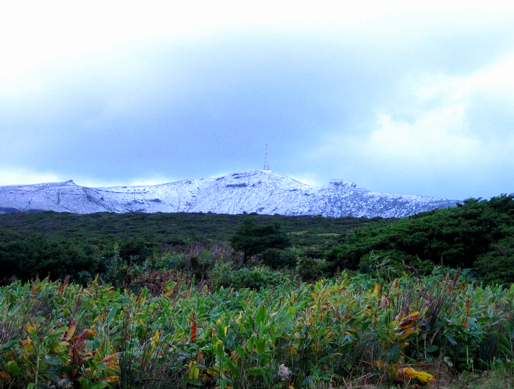
Morro Alto is the highest mountain on Flores, an island in the western group of the Azores, Portugal. It rises to roughly 914 m above sea level in the municipality of Santa Cruz das Flores, and it is the natural goal for anyone who wants to see the island from its highest point. What is Morro Alto? The mountain belongs to a volcanic complex made of trachyte. Together with neighbouring Pico da Sé, it forms an imposing volcanic mass set between two deep erosion valleys. These were carved by the Badanela and Fazenda rivers. The result is a sharp, rugged relief typical of Flores, where steep slopes drop quickly toward the coast. Where is it and what is the surrounding landscape like? The summit lies in the elevated central part of the island. Peat bogs cover the surroundings, and the Azores juniper stands out among the vegetation. The climate is humid and Atlantic, so the top is often wrapped in fog, winds are strong and rainfall can be heavy. The area is protected as the Morro Alto and Pico da Sé forest reserve. What is the hike to Morro Alto like? The trail starts near the Negra and Comprida lagoons. At first it follows dirt tracks between pastures and peat bogs, then climbs gradually but steadily. The route is about 12 km round trip, with roughly 900 m of elevation gain, and usually takes 5.5 to 6 hours. Hiking sites rate it as hard, mainly because of mud and wind on the exposed stretches. Along the way, wide views open up over deep valleys, vegetation-covered craters and the sharply cut line of the coast. A separate route links Morro Alto with Pico da Sé along the ridge. You can walk it or drive it. When is the best time to go up? Choose a day without low cloud, when the views are widest. Bring waterproof boots, a windproof layer and enough water. Because of the fog, check the forecast before setting out and avoid starting a long route late in the afternoon. Frequently asked questions How high is Morro Alto? About 914 m above sea level. Sources give 914 or 915 m. It is the highest point on Flores. Where is Morro Alto? On Flores island in the Azores, in the municipality of Santa Cruz das Flores, Portugal. What is the mountain made of? Trachyte. It is part of a volcanic structure that also includes Pico da Sé. Is the hike difficult? It is considered demanding: it takes several hours, has a large elevation gain, and the terrain can be muddy and windy. Where does the trail start? Near the Negra and Comprida lagoons. Can you get there by car? The route from Morro Alto toward Pico da Sé can be walked or driven. What grows near the summit? Peat bogs, with the Azores juniper the dominant plant. Morro Alto suits anyone who enjoys mountain trails in a raw, damp landscape. The reward is a sweeping panorama of the island and the feeling of standing on its highest point.
-
Pico Alto
Santa Bárbara
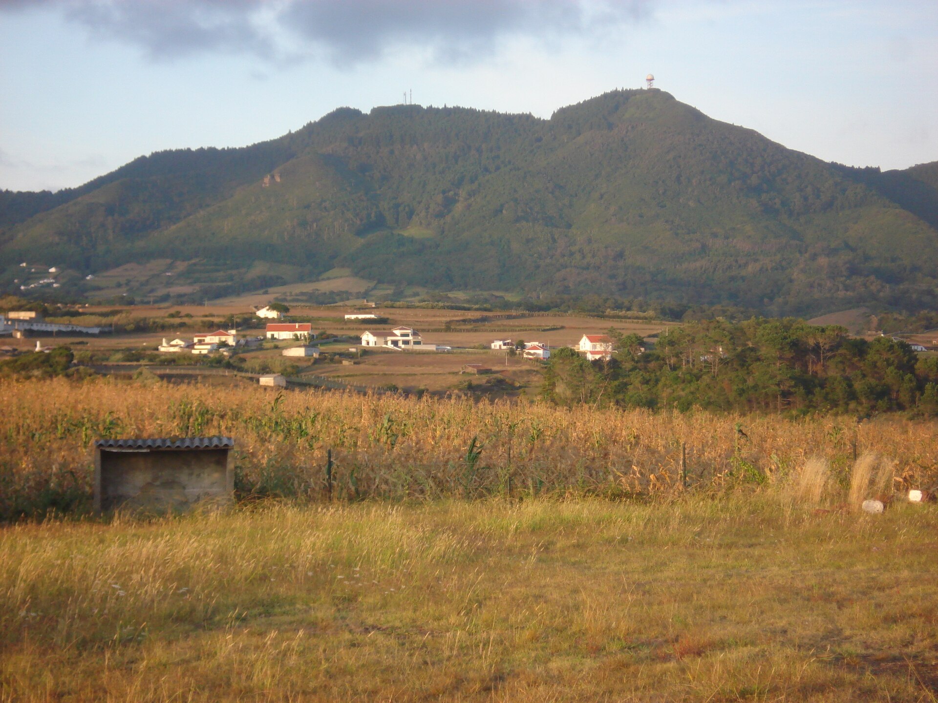
Pico Alto is the highest point on Santa Maria, an island in Portugal's Azores archipelago. It rises to roughly 587 metres above sea level and lies in the parish of Santa Bárbara, in the municipality of Vila do Porto. That is not a dramatic figure by world standards, but on a small island in the middle of the Atlantic it is enough to take in almost the whole landscape from the summit. Where is Pico Alto and how do you recognise it? The peak stands on Santa Maria, the south-easternmost island of the archipelago. Administratively it belongs to the parish of Santa Bárbara in Vila do Porto. A viewpoint, the Miradouro do Pico Alto, has been set up on the hill, and it is the main reason visitors come here. Do not confuse it with other mountains of the same name, such as Pico Alto in the Brazilian state of Ceará; the name is fairly common across the Portuguese-speaking world. What can you see from the top? The viewpoint offers one of the best panoramas of the whole island. You can pick out green pastures, patches of vegetation, small picturesque villages, the coastline and the open Atlantic stretching to the horizon. In clear conditions you can trace the shape of the island and see how different it feels from the other Azorean islands. Keep in mind that Azorean weather changes fast and the summit is sometimes wrapped in cloud, so the view is never guaranteed. Why is Santa Maria geologically special? Santa Maria is the oldest island in the Azores. It was built up from successive layers of volcanic material and marine sediments, and the Pico Alto massif took shape between two and five million years ago. That long history of erosion gave the island gentler relief than the younger islands, where fresh volcanic cones and calderas dominate. Pico Alto is therefore a good place to see the result of millions of years of natural processes. How to plan a visit Pico Alto is part of Santa Maria's tourist offer and is listed as a viewpoint in the official Azores lists of miradouros. The island also has walking trails around the parish of Santa Bárbara, so a visit to the summit can be combined with a hike. Pick a day with good visibility and check the forecast just before setting out, because a change of weather within an hour is nothing unusual in the Azores. Bring a windproof layer, since the hilltop can feel cooler than the coast. Frequently asked questions How tall is Pico Alto? About 587 metres above sea level (586.84 m), making it the highest point on Santa Maria. Which parish is Pico Alto in? Santa Bárbara, in the municipality of Vila do Porto on Santa Maria island. Can you see the whole island from the top? The viewpoint gives one of the best panoramas of the island: pastures, villages, coastline and ocean. Much depends on the weather and cloud cover. How old is Santa Maria island? It is the oldest island in the Azores, and Pico Alto formed between two and five million years ago. Is this the same Pico Alto as the one in Brazil? No. The Brazilian Pico Alto is in the state of Ceará and is an entirely different place with the same name.
-
Serra de Arga
Caminha
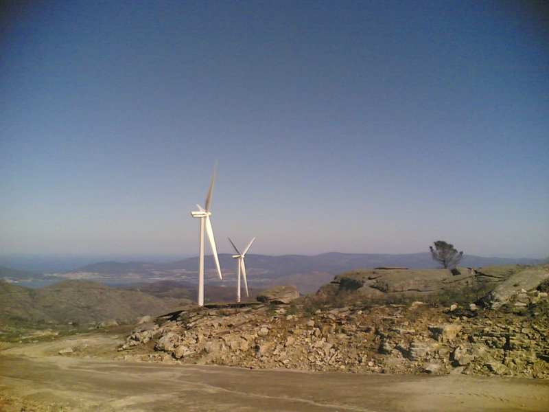
Serra de Arga is a granite mountain range in the Alto Minho region of northern Portugal, partly within the municipality of Caminha. Its coordinates are roughly 41.806 N, 8.714 W, and Wikidata classes it as a protected area. For anyone after views, quiet and walking terrain, it is one of the more rewarding inland destinations in the area, a short drive from the coast. Where is Serra de Arga? The range spans several municipalities: Caminha, Ponte de Lima, Viana do Castelo and Vila Nova de Cerveira. It lies in the Viana do Castelo district in the north-west of the country, close to the Spanish border and the mouth of the Minho River. From the Caminha side, you can approach from around Vila Praia de Âncora, a seaside town in the same municipality. What are the mountains made of, and how high are they? Serra de Arga is formed mainly of granite, and rocky outcrops on the plateau are a typical part of the landscape. The highest point of the whole range is Alto do Espinheiro, at 825 m above sea level. Within Caminha municipality, the highest point sits on the Serra de Arga plateau, at the granite outcrop of Pedra Alçada, 742 m up. Survey data for this summit gives it a prominence of 152 m, making it the third most prominent elevation in Caminha and 27th in the Viana do Castelo district. What is there to see? The main draw is the panorama. From the upper parts of the range you can see the mouth of the Minho River and the slopes dropping toward the valleys. Many visitors come simply to walk the rocky plateau and take in the surroundings from height. A wind farm also stands along the ridge. According to The Wind Power, it consists of 12 Vestas V90/3000 turbines with a combined 36,000 kW and 2 Enercon E92/2350 turbines with a combined 4,700 kW, operated by EDF Renewables. The turbines are visible from far away and form a distinctive part of the mountain skyline. Getting there and when to go A narrow, winding road leads up to the plateau and passes through the wind farm. Because of this access, a visit is best on days with good weather, when visibility is clear and road conditions are safe. In poor weather it is better to postpone the trip. Frequently asked questions How high is Serra de Arga? The highest point of the range, Alto do Espinheiro, is 825 m. Pedra Alçada, the highest point in Caminha municipality, is 742 m. Which municipality is Serra de Arga in? The range covers several municipalities, including Caminha, Ponte de Lima, Viana do Castelo and Vila Nova de Cerveira. Are there wind turbines on Serra de Arga? Yes, a wind farm with 14 turbines operates along the ridge, most of them Vestas V90 units. What is the range made of? Mainly granite, visible in numerous rocky outcrops. Is it worth going in bad weather? It is not recommended, as the road is narrow and winding and the views are the main reward.
-

Serra de Variz
Mogadouro
Serra de Variz is a mountain in north-eastern Portugal, in the municipality of Mogadouro, Bragança district. Its summit reaches 970 metres above sea level, at roughly 41.35° N, 6.62° W. It is one of the highest points in the area and a rewarding goal for anyone after wide views, quiet and traces of prehistory away from the usual tourist trails. Where is Serra de Variz? The range lies on the Mirandese plateau, between the parishes of Vila de Ala and Penas Róias and between the villages of Variz and Santiago. It is less than a kilometre from Santiago, in Vila de Ala parish. Administratively it belongs to Mogadouro, surrounded by the rural landscape of Trás-os-Montes. How high is it? The summit stands at 970 m. Topographic rankings place it second-highest in the municipality of Mogadouro, thirteenth in Bragança district and 148th in mainland Portugal. Its prominence is 163 m and its isolation close to 3.9 km, so it stands clearly apart from its surroundings rather than being just another bump in the terrain. What is there to see at the top? The main point of interest is the Castro de Santiago, also called Castro do Variz. A castro is a fortified pre-Roman settlement, usually built on a hilltop. This one occupies the south-western end of the range, on the highest quartzite summit. It is a medium-sized settlement with an excellent strategic position. Steep slopes, the altitude and the natural wall formed by the quartzite ridge gave it strong defences. Surface finds are mainly hand-made pottery, and two small fields of upright stones are visible on site. Beside the site there is a viewpoint, the Miradouro do Castro de Santiago, at about 956 m. From here you can see the whole municipality of Mogadouro, neighbouring municipalities and, on a clear day, parts of Spain. When to go and what to expect The views are the heart of the trip, so pick a day with good visibility. The summit offers little shelter from the wind, so bring an extra layer. This is a place for landscape and history rather than for developed facilities. Frequently asked questions How tall is Serra de Variz? 970 m above sea level, the second-highest point in the municipality of Mogadouro. What is at the summit? The remains of a castro, a fortified settlement, and a viewpoint with a panorama of the area. Where exactly is it? In Mogadouro municipality, Bragança district, between the villages of Variz and Santiago, near Vila de Ala. Can you see Spain from there? Yes, the view from the viewpoint takes in neighbouring municipalities and land across the Spanish border. Who is it for? Anyone who enjoys landscapes, archaeology and quiet, little-visited corners of northern Portugal.
-
Serra de Ota
Alenquer
Serra de Ota is a modest hill in the municipality of Alenquer, in Portugal's Lisbon District. At roughly 170 m above sea level it is hardly a mountain, yet it makes a fine excuse to leave the busy capital region behind for a day and explore the rocky, rural scenery of the Ota river valley. Where is Serra de Ota? The hill sits in Alenquer, between the villages of Atouguia das Cabras and Ota. Along this stretch a steep escarpment follows the river and defines the local landscape. The area is quiet, agricultural and well away from the standard tourist circuits. How did the landscape form? The escarpment is the product of long erosion. The Ota river cut through Jurassic limestone and carved a karst-style canyon. The river's course ends at a spring area known as "Olhos d'Água". Part of Serra de Ota lies within the Local Natural Monument of the Ota Karst Canyon, regarded as one of the most valuable natural, historical and cultural assets of the Alenquer municipality. Why does it matter for nature? The area falls under the LIFE LxAquila project, which focuses on environmental protection and birds of prey. In September 2025 the Alenquer municipality signed a protocol on conserving Serra de Ota, a sign that the site is seen as something worth looking after. Can you hike here? Yes. Popular hiking platforms describe a loop of about 16 km with around 500 m of total climbing. It is rated hard, but usually not crowded, so it suits anyone who values peace and quiet. Bring sturdy shoes, plenty of water and sun protection, since shade can be scarce on hot days. Planning your visit Spring and autumn offer the most comfortable hiking weather. Start early in the day to keep plenty of time in hand. A car from Alenquer or Lisbon is the easiest way to get there, as public transport nearby is limited. For a loop of this length, allow several hours including breaks. Frequently asked questions How high is Serra de Ota? About 170 m above sea level. Sources give slightly different figures between 167 and 173 m. Is it a mountain in the alpine sense? No. It is a low hill, but steep slopes and the canyon give it real character, and the full route can be demanding. Is the site protected? Yes, partly. It belongs to the Local Natural Monument of the Ota Karst Canyon and is covered by the LIFE LxAquila project. Is there an entrance fee? The sources available mention no fee for accessing the area. Is it suitable for beginners? The whole loop is rated hard, but you can visit selected parts of the valley and escarpment at a relaxed pace. Serra de Ota is a pick for anyone who enjoys nature without the crowds: geology, a river, springs and birds of prey combine into an interesting, little-known corner of Portugal right next to Lisbon.
-
Serra de Leiranco
Boticas
Serra de Leiranco – mountains in the Boticas municipality Serra de Leiranco (also written Serra do Leiranco) is a mountain range in northern Portugal, in the Vila Real district. It stretches from the boundary of Montalegre municipality across almost all of Boticas municipality. Its highest point reaches roughly 1,134 m above sea level, making it a distinctive feature of the Barroso landscape. Where is Serra de Leiranco? The range lies in the north of the country, in Vila Real district, between the municipalities of Boticas and Montalegre. The surroundings are rural, with small villages such as Sapiãos, home to a local association named after the mountains. A car is the most practical way to get here, as public transport in this part of Portugal is limited. Where does the name come from? Local accounts say the name comes from the many "leirões", or large rats, once found in these hills. It is an oral tradition, so it is best read as a curiosity rather than an established fact. What wildlife and plants can you find? The summit is a mountain habitat holding rare protected plants and a few Iberian endemics, including the grass Festuca elegans and the shrub Echinospartum ibericum, known locally as caldoneira. Resident animals include the wild rabbit and the rock bunting. In summer the northern wheatear and the rock thrush arrive, so the area appeals to birdwatchers. The wind farm on the ridge The Parque Eólico da Serra do Leiranco operates here. The first phase has 12 Enercon E92 turbines rated at 2,350 kW each, 28.2 MW in total. A second phase added 2 turbines with a combined 4.7 MW. The farm spans Boticas and Montalegre and is a visible feature on the skyline, worth remembering when you plan photos of the range. Local life In Sapiãos, the Associação Cultural Recreativa e Desportiva da Serra do Leiranco is active. It organises events and keeps local traditions, dances and regional songs alive. The Boticas town council publishes news about these events, so check its calendar before you visit. Frequently asked questions How high is Serra de Leiranco? Its highest point is about 1,134 m above sea level. Which region is it in? Northern Portugal, in Vila Real district, within the municipalities of Boticas and Montalegre. Are there rare plants? Yes, the summit hosts protected species, including Iberian endemics such as Festuca elegans and Echinospartum ibericum. Which birds can I see? Rock bunting year-round, and northern wheatear and rock thrush in summer. Is there a wind farm? Yes, the Parque Eólico da Serra do Leiranco, with Enercon turbines totalling over 32 MW across two phases. Why is it called Leiranco? Local accounts link it to the many "leirões", large rats, said to live there.
-
Pedrada
Arcos de Valdevez
Pedrada is the highest peak of the Serra do Soajo in north-western Portugal. At 1,416 m above sea level, it is the highest point of the Arcos de Valdevez municipality and of the entire Alto Minho region. It lies inside Peneda-Gerês National Park, the only national park in Portugal. On its summit, archaeologists found the remains of a Roman military camp. Where is Pedrada? The peak rises in the mountains between the Lima river valley and the area around Castro Laboreiro. Polish Wikipedia places it in the Serra da Peneda massif, while Portuguese tourism sources call it the top of the Serra do Soajo. Both names describe the same upland area within the national park. Administratively it belongs to the Arcos de Valdevez municipality in the Viana do Castelo district. How high is it and what makes it stand out? At 1,416 m, Pedrada towers over all of Alto Minho. The rocky granite summit is exposed, so walkers get wide views of the mountainous landscape typical of northern Portugal. It is also the highest point of a popular hiking route in the park. Are there Roman remains at the top? Yes. At a spot called Alto da Pedrada on the summit stands a Roman military camp. Its traces show on the ground as a rectangle with rounded corners, which suggests a wall once surrounded it. The camp covers roughly 1 to 1.5 hectares and, by estimate, could have housed about a thousand soldiers. The camp dates to the late 1st century BC, the time of Emperor Augustus's campaigns in the north-west of the Iberian Peninsula. It is regarded as the first confirmed Roman military camp in northern Portugal. How was the camp found? Aerial imagery and LIDAR played the key role, revealing the fine relief of the terrain and structures hidden under vegetation. A research campaign on 3 to 7 August 2020 included geophysical prospecting with a magnetometer and metal detector, plus archaeological excavation. The work was carried out by ERA-Arqueologia. The lead archaeologist admitted that fieldwork alone would not have revealed the site without the aerial data. How to plan a visit Pedrada is a hiking destination. A popular circular route in Peneda-Gerês National Park crosses mountain scenery and reaches its highest point here. Plan carefully: by Portuguese standards this is high mountain terrain, and the weather changes quickly. Bring layers, water and an offline map. Frequently asked questions How tall is Pedrada? 1,416 m above sea level. Is Pedrada the highest point in the region? Yes, it is the highest point of Arcos de Valdevez municipality and of Alto Minho. What is on the summit? The remains of a Roman military camp from the late 1st century BC. Which park is it in? Peneda-Gerês National Park. When was the camp investigated? The main archaeological work took place in August 2020.
-
Serra de Pias
Valongo
Serra de Pias is a hill in northern Portugal, in the municipality of Valongo near Porto. It rises to 385 metres above sea level and serves as one of the green escapes of the Porto metropolitan area. It is also known as Serra do Raio. It suits anyone who wants a walk in the hills without travelling far from the city. Where is Serra de Pias? The summit lies southwest of the parish of Campo in Valongo, close to the boundary with Aguiar de Sousa, a parish in the municipality of Paredes. Its slopes drain in two directions: north toward the Ferreira River and south toward the Sousa River. The result is a rolling, stream-cut landscape with a real mountain feel. What is the Serras do Porto Park? Serra de Pias belongs to Serras do Porto Park, a protected landscape. Locals call it the green lung of the Porto metropolitan area. Together with the neighbouring Santa Justa ridge, it forms a group of hills crossed by a network of trails and paths. Why does the geology matter? Geologists value this place. The rocks date to the Paleozoic era or earlier, with ages beyond 350 million years. A large structure called the Valongo anticline marks the mountain. In 1998 the Paleozoic Park of Valongo was created here to present these formations to visitors and to support education. What is the mining history? Minerals have been extracted here since ancient times, including gold and antimony. Today slate is still quarried at the foot of the mountain, in the Milhária and Vinhas areas of Campo parish. Traces of the old mines also attract mineral collectors. What can you do here? The area is used for hiking, cycling and horse riding. Routes include stairs, boardwalks and viewpoints. The municipality of Valongo also runs educational visits to the Santa Justa and Pias ridges, which makes the site a fit for school groups and families. Frequently asked questions How high is Serra de Pias? It reaches 385 metres. Can families hike here? Yes. There are walking, cycling and horse trails, plus stairs and boardwalks that ease the steeper sections. Are there mines nearby? Gold and antimony were mined historically, and slate extraction continues at the foot of the mountain. Which park does it belong to? Serras do Porto Park, a protected landscape, and the Paleozoic Park of Valongo. When should I go? Spring and autumn offer comfortable temperatures for walking. Check municipal notices before setting out, as controlled burns are sometimes carried out in the area. Serra de Pias combines nature, geology and traces of past industry in one place. If you are visiting Porto and want a few hours outdoors, consider adding it to your itinerary. Bring sturdy shoes, water and a camera, since the upper sections open up views over the surroundings. Half a day is enough for a visit, and getting there from the city takes little time.
-
Serra das Flores
Paredes
Serra das Flores is a hill in the municipality of Paredes, in the Porto district of northern Portugal. Its summit stands at about 320 m above sea level (some sources give 322 m), and it belongs to a group of ridges protected within the Serras do Porto Park. Where is Serra das Flores? The hill lies in Paredes municipality, Porto district. The summit sits at roughly 41.085° N, 8.437° W. It is part of a larger cluster of ridges that shape the landscape of this part of Portugal. Serras do Porto Park Serra das Flores is one of the ridges within the Serras do Porto Park (Parque das Serras do Porto). The park spans three municipalities, Gondomar, Paredes and Valongo, in the Porto metropolitan area. It protects the Santa Justa, Pias, Castiçal, Flores, Santa Iria and Banjas ridges across 5,974 hectares. The area is classified as a regional protected landscape, and its formal creation was published in the Diário da República on 15 March 2017. How high is it, and how does it compare locally? Topographic data puts the summit at about 320 m, with a prominence of around 150 m above the surrounding terrain and an isolation of roughly 2.4 km. Among peaks of mainland Portugal it ranks 300th by prominence. Within the Porto district it is 19th, and within Paredes municipality it ranks second. Name and history The name has been written in different ways over time. Historical material indicates that the old Serra de Sores corresponds to today's Serra das Flores. On a 1947 military chart, the highest point of the ridge still carried the name Açores. These variations show how local place names have shifted over the years. Can you hike to the summit? Yes. A trail leads to the top, making Serra das Flores suitable for a short walk. It is a modest hill, so no special preparation is needed, though comfortable footwear and a check of current trail conditions are sensible. Frequently asked questions How tall is Serra das Flores? About 320 m above sea level (322 m in some sources). Which municipality is it in? Paredes, in the Porto district. Is it in a protected area? Yes, it is part of the Serras do Porto Park, a regional protected landscape. Is there a trail to the top? Yes, a marked path leads to the summit.
-
Serra das Banjas
Gondomar
Serra das Banjas is a hill in the municipality of Gondomar, in the Melres area of northern Portugal. It reaches 371 m above sea level and is one of the six ridges that make up the Parque das Serras do Porto, a mountain park right next to the Porto metropolitan area. Where is Serra das Banjas? The ridge lies in Gondomar municipality, Porto district, in the parish of Melres. The Serras do Porto park covers land in three municipalities: Gondomar, Paredes and Valongo. Besides Banjas, it includes Santa Justa, Pias, Castiçal, Santa Iria and Flores. Banjas is therefore part of a larger, compact upland area rather than an isolated hill. How high is Serra das Banjas? The summit stands at 371 m, with a topographic prominence of 78 m, meaning it rises roughly 78 metres above the lowest saddle linking it to higher ground. Among peaks in mainland Portugal with at least 40 m of prominence, it ranks in the upper half but not near the top. In Porto district it is 51st by prominence, and in Gondomar municipality 5th. Its topographic isolation is about 1.7 km. What can you do here? The area attracts people who enjoy active time in nature. Local tourism sources describe it as a place for outdoor sports and contact with the countryside. The GR 62, the Grande Rota das Serras do Porto, runs for about 59 km through all six ridges of the park. A stretch of the route covers Serra das Banjas, so you can explore it on a longer trek across the whole park or on a shorter section. The September 2024 wildfires Between 16 and 18 September 2024, major wildfires struck Gondomar and Paredes. The Parque das Serras do Porto was badly affected, especially the Banjas and Flores ridges. Before visiting, check the current condition of the trails and any access restrictions on burnt land on the Gondomar municipality website. Frequently asked questions How high is Serra das Banjas? 371 m above sea level, with 78 m of prominence. Which municipality is it in? Gondomar, in the Melres area, Porto district. Is there a hiking trail? Yes, the GR 62, about 59 km long, links the six ridges of the Serras do Porto. Which park does it belong to? The Parque das Serras do Porto, covering parts of Gondomar, Paredes and Valongo. Did the 2024 fires affect the area? Yes, Banjas was among the hardest-hit ridges, so check current trail information before you go. Who is it for? Serra das Banjas suits people living in or visiting the Porto area who want a short escape into the hills. It is not a high summit, but combined with the park's other ridges it lets you plan a route of any length, from a brief walk to several hours along part of the GR 62.
-
Serra da Boneca
Penafiel
Serra da Boneca – a hilltop swing and Douro views near Penafiel Serra da Boneca is a hilly ridge in the municipality of Penafiel in northern Portugal, lying between the Mau and Douro rivers and the villages of Rio Mau, Cabroelo and Sebolido. Its summit reaches roughly 520 m above sea level, and Porto is about 35–40 km away. For visitors it is above all a short walk with a view over the Douro valley. What is there to see? The spot became popular thanks to the Baloiço da Boneca, a swing set against the landscape. The first one was installed in June 2019 by a group of young locals. It was taken down at the end of that year because a wind farm operates nearby and there were safety concerns. Official facilities followed: a miradouro (viewpoint) and a marked path of about one kilometre, opened in October 2020. From the viewpoint you look out over the Douro River and the serra itself. What is the walk like? The trail to the viewpoint and swing starts near the parish council building (Junta de Freguesia) in Sebolido. It is about 500 m to the first viewpoint and another 500 m to the swing, so around 1 km each way and 2 km round trip. The route is signposted. It is for pedestrians only: no vehicles, bicycles included. Serra da Boneca also draws people who prefer longer hikes. Several walking routes in the area link natural viewpoints, streams, waterfalls, old mills and peaks. One documented option is the PR5 trail in Penafiel, which passes the Boneca hilltop, the swing and the Douro. How to get there From Porto, the usual route is the A43 and a short stretch of the A41 to Broalhos, then the N108 to Sebolido. If you are heading straight for the swing, note that access goes through the Boneca wind farm: from Sebolido it is about 4 km to the wind farm entrance, where signs point the way. Park in the designated spots and continue on foot. The trailhead coordinates are 41°03'08.6" N, 8°20'32.7" W. Frequently asked questions How high is Serra da Boneca? About 520 m above sea level. Is it a long walk to the swing? No. From the parking area it is roughly 1 km one way, with the viewpoint after 500 m. Can I cycle up? No, the trail is pedestrian-only. When were the trail and viewpoint created? The path opened in October 2020, after the first swing from 2019 was removed for safety reasons. How far is it from Porto? Around 35–40 km, depending on the route. Who is it for? It works well as a short family outing outside the city and as a starting point for longer walks in the area. Bring comfortable shoes and check the weather, since the hilltop is exposed and the view depends on visibility.
-
Serra do Açor
Piódão
Serra do Açor is a mountain range in central Portugal, in the Centro Region, surrounding the village of Piódão. It is among the highest ranges in mainland Portugal and the country's largest mountain built mainly of schist. Part of it is protected as the Serra do Açor Protected Landscape, one of 30 officially protected areas in Portugal. Where is Serra do Açor? The range lies in central Portugal, at roughly 40.197 N, 7.799 W. It forms the northern part of the area known as Aldeias do Xisto, the Schist Villages. Piódão, set into a steep slope, is one of the most popular bases for exploring the area. How high is Serra do Açor? It is the fifth highest range in mainland Portugal. Its top point, Pico da Cebola, reaches 1,418 m and is the fifth highest point on the Portuguese mainland. Other notable elevations include Cabeço do Gondufo (1,342 m), Alto de São Pedro do Açor (1,341 m) and Monte do Colcurinho (1,242 m). What is the Serra do Açor Protected Landscape? Protection was granted in 1982 for an area of 349 hectares. The main aim was to preserve the Margaraça Forest, one of the most remarkable deciduous forests in Portugal. It offers a glimpse of what the country's ancient woodlands were like. Which villages are in Serra do Açor? Schist is the dominant building material across the region. The schist villages in the range include Aldeia das Dez, Benfeita, Fajão, Sobral de São Miguel and Vila Cova de Alva. Piódão stands out for its schist houses with slate roofs, stacked in an amphitheatre-like layout on the slope, its winding lanes following the rugged terrain. Who is it for? Serra do Açor suits visitors looking for mountain quiet, walking and architecture made from local stone. It works well for a trip combining forest walks, visits to schist villages and views over mountain valleys. Plan more than a day, since distances on winding roads are longer than the map suggests. Frequently asked questions Where is Serra do Açor? In the Centro Region of central Portugal, near the village of Piódão. What is the highest peak? Pico da Cebola, at 1,418 m. Why is the area protected? The 1982 protection aimed to preserve the Margaraça Forest, a valuable deciduous woodland. What are the villages built from? Mainly schist, including the roofs. Is it part of the Aldeias do Xisto network? Yes, the range forms its northern part.
-
Serra de Alvaiázere
Alvaiázere
Serra de Alvaiázere is the highest elevation of the Sicó Massif in central Portugal, in the municipality of Alvaiázere (Leiria district). Its summit rises above 600 m and offers one of the widest views in the region. It is a limestone massif where the rock shapes the whole relief, with scrub, dry-stone walls and old olive groves filling the landscape. What should visitors know about it? The range lies among small villages such as Freixianda and Besteiro, and it belongs to the Natura 2000 network. It suits walkers, landscape photographers and anyone who wants quiet countryside rather than organised tourist infrastructure. What are the geology and wildlife like? Because the massif is limestone, it has classic karst features: algares (natural shafts and sinkholes), lapas (caves and rock shelters) and lapiaz fields, surfaces carved by water dissolving the rock. Vegetation is mostly shrubs: kermes oak (carrasco), mountain rosemary and oregano, and wild orchids appear in spring. What can you see from the top? The panorama is vast. To the west you can see the Aire and Candeeiros limestone massif, the Vale da Mata and the rest of the Serra de Sicó, and on a clear day the sea. To the east lie Avelar, the Serra da Nexebra, Vendas, Maçãs de Caminho, Maçãs de Dona Maria and the Serra de São Neutel. The summit has a viewpoint (miradouro) and a swing that visitors like for photos. Is there any history here? Yes. On the north-eastern summit there is a settlement site occupied from the Chalcolithic through the Late Bronze Age to the Iron Age, commanding the surrounding land. In places you can still see broad stretches of a wall built from limestone blocks, known as the "Carreira dos Cavalos". Where can you hike? The GR 35 (Grande Rota de Alvaiázere) crosses the Sicó Massif as a loop of about 54 km through karst scenery, lapiaz fields and centuries-old olive groves. Shorter options include the Casal de São Simão loop (about 5.5 km) and the route to the Olho de Tordo spring (about 4 km). The Rio dos Couros trail near Freixianda is also popular. Cyclists can climb to the summit by road from Besteiro. Frequently asked questions How high is Serra de Alvaiázere? Just over 600 m above sea level, the highest point of the Sicó Massif. Can you see the sea? Yes, to the west on a clear day, beyond the Aire and Candeeiros massif. Is it a protected area? Yes, it is part of the Natura 2000 network. When is the best time to visit? Spring, when wild orchids bloom and temperatures suit walking. In summer start early and carry water, as the limestone uplands offer little shade. What else is nearby? The karst formations of Buracas do Casmilo in Ansião and the other trails of the Sicó Massif.
-
Serra da Melriça
Vila de Rei
Serra da Melriça is a small mountain range in central Portugal, in the municipality of Vila de Rei, Castelo Branco District. Locally it is called Picoto da Melriça, and it is best known for carrying the geodetic centre of mainland Portugal. Its highest point reaches 592 metres above sea level. Where is Serra da Melriça? The hill rises roughly two to three kilometres north-east of the town of Vila de Rei, beside the national road EN2. The summit lies at about 39.69° N, 8.13° W. The range covers only a modest area, yet it stands clearly above the surrounding landscape, which makes it a natural landmark for the region. Why does it matter for geodesy? The mountain's importance comes from the survey marker placed here, designated TF4. Angular observations for every other triangulation point across mainland Portugal began from this one. The marker itself, popularly called Picoto da Melriça, is a masonry first-order triangulation vertex with a three-metre base and a height of around nine metres, erected in 1802. That gives the place both historical and scientific weight. What can you see at the top? Next to the marker is the Miradouro do Picoto da Melriça viewpoint, at about 580 metres. It offers a full 360-degree outlook over the hills, forests and valleys of the Pinhal Interior area. Close by stands the Geodesy Museum (Museu da Geodesia), opened in 2002. It is devoted to the historical and scientific legacy of the Portuguese scientists who worked to modernise geodesy in the country. How to plan a visit Access by car is easy, since the viewpoint sits right beside the EN2, which crosses the middle of the country. No long hike is needed, so it works well as a short stop on a road trip or as a brief excursion from Vila de Rei. Choose a clear day so the panorama is at its best. Pair the visit to the triangulation marker with the museum to understand how the country was once measured and mapped. Walking routes belonging to the Aldeias do Xisto network run nearby, useful if you plan a longer stay. Frequently asked questions How high is Serra da Melriça? Its highest point is 592 m above sea level, and the viewpoint itself sits at about 580 m. What does Picoto da Melriça mean? It is the local name for the hill and for the geodetic marker standing on its summit. Is this really the centre of Portugal? Yes, the summit holds the geodetic centre of mainland Portugal, the starting point of the national triangulation network. When did the museum open? The Geodesy Museum beside the marker opened in 2002. Do I need to climb? No, the viewpoint is next to the EN2 road and can be reached easily by car.
-
Serra de Nogueira
Bragança
Serra de Nogueira (also written Serra da Nogueira) is a mountain range in north-eastern Portugal, southwest of the city of Bragança. Its summit reaches 1,319 m above sea level, making it one of the highest points in mainland Portugal, yet it sits in the quiet, uncrowded Trás-os-Montes region. Where is Serra de Nogueira? The range lies in Alto Trás-os-Montes and spans the municipalities of Bragança, Macedo de Cavaleiros and Vinhais. It runs north-east to south-west over roughly a dozen kilometres. It is regarded as an offshoot of the Montesinho massif and lies at the foot of Montesinho Natural Park. From Bragança it is a short drive, so it works well as a day trip from the city. What is at the top? The highest point is crowned by the Sanctuary of Nossa Senhora da Serra (Our Lady of the Mountain). It is prized as a viewpoint: in clear weather you can look out over the wide, rolling plateaus of northern Portugal. The mountain has a prominence of about 440 m and rises clearly above its surroundings, so the panorama is broad. A curiosity for rail fans: Rossas station in Santa Comba de Rossas is described as the highest point of Portugal's railway network. Nature and protection Serra de Nogueira belongs to the Natura 2000 network. A Site of Community Importance called "Montesinho – Nogueira" was created here, along with a Special Protection Area for birds. The slopes carry a vast oak forest, described as one of the largest continuous oak woodlands in Portugal and, according to some sources, in Europe. Wildlife includes wolves, foxes, wild boar, wildcats and many bird species. How to explore it Hiking is the main draw. A network of trails crosses the range, popular with trekkers and walkers. Cyclists also treat the climb to the sanctuary as a challenge, since the road rises from Bragança to over 1,300 m. Best time: spring and early autumn, when it is warm but not hot. Winters can be cold and windy at altitude. Clothing: layers and sturdy footwear, as mountain weather changes quickly. Water and food: there is little infrastructure on the trails, so carry supplies. Frequently asked questions How high is Serra de Nogueira? The highest point is 1,319 m above sea level. Can I drive to the summit? A road leads to the sanctuary near the top, and cyclists often ride it. Check current road conditions before you go. Is it a protected area? Yes. It is part of the Natura 2000 network and adjoins Montesinho Natural Park. Who is it for? Walkers, cyclists, birdwatchers and anyone seeking quiet away from Portugal's busier destinations. Should I combine it with Bragança? Yes. The city is the natural base for lodging and meals, and the mountains are right next door, so a half-day or full-day outing is easy to plan. Serra de Nogueira is a good choice if you want to see wild northern Portugal: no crowds, oak forests, wide views and trails for different abilities. Plan at least a few hours to reach the sanctuary at an easy pace, enjoy a picnic with a view and return before dusk. Bring binoculars too, because there is more wildlife here than first appears, and the silence favours observation at dawn and just before sunset.
-
Monge
Colares
Monge (Pico do Monge) – a Sintra Mountains summit with a prehistoric burial dome Monge, also called Pico do Monge or Alto do Monge, is a hilltop in the Sintra-Cascais Natural Park, near Colares in the municipality of Sintra. It rises 491 metres above sea level and is the third highest point of the entire Serra de Sintra range. At the top stand the prehistoric Tholos do Monge tomb and a first-order geodetic marker. What is the Tholos do Monge? It is a collective burial from the Copper Age (Chalcolithic), dated to between 4000 and 3000 BC. The structure resembles a dome built of rough stones and makes use of a natural hollow in the granite. Its entrance faces north. It counts among the oldest traces of human presence in this part of the mountains. What can you see from the top? On a clear day, the area around the Tholos do Monge offers views of Lisbon and the bridges over the Tagus. Distant Cabo Espichel in Sesimbra can also be spotted. The summit lies within the Sintra cultural landscape listed by UNESCO, so a hike here combines scenery with history. How do you get to Monge? A popular route starts at the Convent of Santa Cruz dos Capuchos, founded in the 16th century by Franciscan friars. The trail climbs through mountain woodland and passes the Soldiers' Memorial (Memorial dos Soldados), which commemorates 25 soldiers who died fighting a major fire in 1966. The marked PR11 SNT route (Percurso do Monge) is about 4.5 km long, of low difficulty, and takes around 1 hour 45 minutes. Other trails in the area lead towards Pedra Amarela and the Peninha sanctuary. The region is also valued by mountain bikers; the "Monge" descent is known for banked turns and small drops. Frequently asked questions How high is Monge? 491 metres above sea level, making it the third highest point in the Serra de Sintra. How long does the hike take? The PR11 trail is about 4.5 km and takes roughly 1 hour 45 minutes. What is at the summit? The Copper Age Tholos do Monge tomb and a first-order geodetic marker. Where should I start? At the Santa Cruz dos Capuchos convent, close to the trailhead. Is it a hard walk? No, the difficulty is low, but bring water and comfortable shoes since the route climbs uphill. Good to know Monge combines well into a single outing with the Capuchos convent and the Soldiers' Memorial. Views are best on a clear day, as mist is fairly common in the Sintra Mountains. Plan your hike so you are back before dusk.
-
Serra de Ossa
Estremoz
Serra de Ossa (also written Serra d'Ossa) is a mountain range in Portugal's Alentejo region, set between the towns of Estremoz and Redondo. It is not a tall range, but against the flat Alentejo plain it stands out clearly, and it draws hikers, nature lovers and anyone after quiet countryside away from the coast. Where is Serra de Ossa and how high is it? The range runs northwest to southeast and belongs to the municipalities of Borba, Estremoz and Redondo. It lies roughly 20 km from the historic centre of Estremoz. The highest point, São Gens, is in the Redondo municipality and reaches 653 m above sea level. That makes it the second highest point in the Alentejo and the main elevation of the surrounding plain. From the upper slopes, views open over the rolling landscape of the region. What is the nature like? Gentle hills, green valleys and forests of cork oak and holm oak shape the scenery, typical of southern Portugal. The mountain is rich in water: springs feed both the Guadiana basin and the Tagus basin (through the Sorraia). For such a modest range this is unusual, and the water supports lush vegetation. Also notable is the Portuguese sundew (Drosophyllum lusitanicum), an insect-eating plant. Serra de Ossa holds one of the largest populations of the species in the country. What is there to see in Serra de Ossa? The best-known landmark is the Convento de São Paulo da Serra de Ossa, a former hermit convent dedicated to Saint Paul. It was built between the 16th century and the early 19th century. It is known for baroque blue-and-white azulejo tiles, gardens, fountains and terracotta sculptures. The site is protected as a property of public interest, and its walls blend into the mountain setting to striking effect. Active visitors will find marked walking routes. Popular options climb to the summit via the village of Aldeia da Serra, or link the convent area with the parish church in Aldeia. A walk here makes a good outing of a few hours among oaks and hills. Can you combine it with the surrounding area? Yes. Estremoz and Vila Viçosa, both famous for marble, are close by, and the stone is closely tied to the geology of the area. The region is also known for its wineries, so a day in the hills pairs easily with a tasting of local wines. Frequently asked questions How high is Serra de Ossa? The highest peak, São Gens, is 653 m above sea level. Where exactly is it? In the Alentejo, between Estremoz and Redondo, about 20 km from Estremoz centre. Can you hike there? Yes, there are walking routes to the summit and to the São Paulo convent. What is the main attraction? The São Paulo convent with its azulejos and gardens, plus quiet green nature with cork oak woods. Is it a good day trip from Estremoz? Yes, the drive is short and other regional sights are nearby.
-
Formosinho
Setúbal
Pico do Formosinho is the highest peak of the Serra da Arrábida and the highest point in Arrábida Natural Park, in the Setúbal district of Portugal. It rises to 501 m above sea level and a geodetic marker stands at the summit. The coordinates are 38.48108 N, 9.00057 W. Where is Formosinho and why climb it? The peak sits on the Setúbal Peninsula, in the range that runs along the coast between Setúbal and Sesimbra. Here the Serra da Arrábida drops steeply to the sea, and green vegetation meets pale limestone rock. That makes Formosinho one of the best viewpoints near Lisbon, reachable on foot with no climbing gear. What can you see from the top? The panorama is wide. Below lie the Sado estuary and the Tróia Peninsula, with the Azeitão area and the north bank of the Tagus beyond. In clear weather Lisbon and the Tagus estuary come into view, and on the horizon the Serra de Sintra and Serra de Montejunto. Views in several directions make this a favourite finish to a full day's hike. How do you get to Pico do Formosinho? Several hiking trails lead to the summit, ranging from moderate to hard and differing in length and elevation gain. Popular routes include: the PR2 STB "Alto do Formosinho" trail, a route linking the summit with the Hermitage of São João do Deserto, variants starting near Portinho da Arrábida, including via the Miradouro do Portinho da Arrábida viewpoint, routes from the Casais da Serra side. Check the description of your chosen route before setting out, as distance, climb and difficulty vary widely. Bring water, a hat and sturdy shoes with good grip, since the ground is rocky. Arrábida Natural Park Formosinho lies within Arrábida Natural Park, created by Decree-Law no. 622/76 of 28 July 1976. The park covers roughly 10,800 hectares across the municipalities of Palmela, Setúbal and Sesimbra. It protects Mediterranean maquis vegetation and the limestone landscape above the Atlantic, and holds biogenetic reserve status. Nature protection rules apply, so keep to marked paths and take your litter with you. Frequently asked questions How high is Pico do Formosinho? 501 metres above sea level, the highest point of the Serra da Arrábida. Is there anything at the top besides the views? Yes, a geodetic marker sits on the summit. Is the hike easy? Trails to the summit are moderate to hard depending on the route. Pick one that suits your fitness. What can you see from Formosinho? The Sado estuary, the Tróia Peninsula, Azeitão, the north bank of the Tagus, Lisbon, the Serra de Sintra and the Serra de Montejunto. Which park is the peak in? Arrábida Natural Park, on the Setúbal Peninsula.
-
Picota
Monchique
Picota is a summit in the Serra de Monchique range in Portugal's Algarve, close to the town of Monchique. It rises to 773 metres above sea level and is the second-highest point in these mountains. People mostly come for the view, which on a clear day reaches well beyond the surrounding hills. Where is Picota and what is the Serra de Monchique? The Serra de Monchique is a mountain range in the western Algarve, roughly 20 km inland from the coast. Against the flatter, seaside part of the region it stands out as greener and more rugged. Picota lies in the municipality of Monchique and is one of its best-known viewpoints. What can you see from the top? A viewing point with an observation platform sits at the summit. With good visibility you can take in a panorama of the surrounding mountain slopes and, in the distance, the plains of the Alentejo. Visitors also describe views toward the Algarve coast and the sea shimmering far away. Pick a day without haze or low cloud, since that decides how far you can see. How do you get to Picota? There are three options: Drive to the car park. A paved road leads almost to the top. From the car park it is a short walk, reportedly about 50 metres, to the viewpoint. Drive to the summit. The summit can also be reached by car, although that road is much narrower and calls for extra care. Hike. A hiking trail leads up to the peak. A popular circular walk of about 11 km runs from Monchique to Picota and back. Who is it for? Picota suits both people who want a scenic stop without a long walk and hikers who prefer to earn the summit on foot. It pairs well with a visit to Monchique itself and other places in the Serra de Monchique. Bring an extra layer, as it is cooler up high than on the coast, and water if you plan to hike. Frequently asked questions How high is Picota? It stands at 773 metres and is the second-highest peak of the Serra de Monchique. Can you drive to Picota? Yes. A paved road reaches a car park, followed by a short walk. A narrower road continues to the summit. Is it a hard climb? Not if you park at the car park. If you want to walk up from Monchique, a circular route of around 11 km is available. What can you see from the top? The surrounding mountains, in good conditions the Alentejo plains, and the Algarve coast with the sea in the distance. When is the best time to go? On days with good visibility and no haze, when the view reaches farthest.
-
Serra do Penedo
Góis
Serra do Penedo, also known as Penedos de Góis, is a mountain in the municipality of Góis, in Portugal's Coimbra district. Its summit sits at roughly 1,040-1,050 m above sea level, depending on the source, and the mountain is a striking quartzite rock ridge rising above the slate villages around it. Where is Serra do Penedo? The mountain lies in central Portugal, in the Coimbra district. The municipality of Góis sits where two mountain ranges meet: Serra da Lousã and Serra do Açor. This hilly land, cut by valleys, shapes the scenery: steep slopes, fast streams and waterfalls. It should not be confused with Serra da Peneda, far to the north on the Spanish border, which is an entirely different range. What does it look like, and how did it form? The rock faces of Penedos de Góis are Ordovician quartzite, the remains of very old sediments that were transformed over time and later exposed by erosion. This hard rock resisted weathering better than the surrounding schist, which is why it now stands out so clearly above the terrain. Among the rocks, locals single out a formation called "Penedo Abelha". They see the outline of a stone monster's face in it, one of the more memorable local associations tied to the place. Topographic figures According to OpenStreetMap data, the summit is about 1,048 m high with a prominence of around 155 m. Among mainland Portugal's peaks it ranks 279th by prominence, 20th within the Coimbra district and 3rd in the municipality of Góis. So although it is not the country's highest mountain, it plays a clear role in its own area. What can you see there? From the upper rocks a wide panorama opens up. In good weather you can pick out Serra da Estrela, Serra do Açor and the Trevim massif. The spot suits anyone who enjoys views and walking over rocky ground. Nearby is the schist village of Pena, a typical settlement of the region built from dark local stone. It pairs well with a short walk around the area. Trails and hiking Several trails of varying difficulty cross the Penedos area, so it works for a short stroll as well as a longer hike. The ground can be uneven and stony, so sturdy footwear helps, and it is worth checking the forecast beforehand because conditions above 1,000 m can change faster than in the valley. Frequently asked questions How high is Serra do Penedo? Around 1,040-1,050 m above sea level; sources differ slightly, and OpenStreetMap gives 1,048 m. Where in Portugal is it? In the municipality of Góis, Coimbra district, in the central part of the country. Is it the same as Serra da Peneda? No. Serra da Peneda is in northern Portugal, on the border with Spain. What is the mountain made of? Ordovician quartzite that stands out sharply from the surrounding schist. What else is worth seeing nearby? The schist village of Pena and panoramas over the surrounding mountain ranges. Is it suitable for hiking? Yes, there are trails of different difficulty levels in the area.
-
Pico Fernandes
Calheta
Pico Fernandes is a mountain peak in western Madeira, in the municipality of Calheta, at roughly 1,400 metres above sea level. It sits in the Rabaçal and Paul da Serra area, home to the island's only plateau, and is a favourite hiking goal for its views over deep valleys. Where is Pico Fernandes? The peak lies near Arco da Calheta on Madeira's western side. Its neighbours are Pico da Urze and the Rabaçal area, known for its levadas, the traditional irrigation channels. Coordinates are around 32.75° N, 17.12° W. The land belongs to the Madeira Nature Park and to the Natura 2000 network, and it is designated as an area of rest and silence, so visitors are expected to keep noise and impact low. What can you see from the top? The main reward is the panorama. From Pico Fernandes the view opens over deep valleys, and the scenery turns rockier and more imposing as you approach the summit. Close by, the Rabaçal viewpoint at Pico da Urze looks over the island's largest valley covered in laurissilva, the native laurel forest that UNESCO lists as a World Heritage Site. How do you get to Pico Fernandes? The official route is PR 6.5, Vereda do Pico Fernandes. A popular alternative starts at the Pico da Urze dam: about 7.4 km with around 240 m of climbing, usually 2 to 2.5 hours. Another option is a circular walk combining the Levada das 25 Fontes with several peaks, including Pico Fernandes and Pico da Urze. The trail crosses heather and endemic vegetation, and one stop is the peaceful Lajeado lagoon. When to go and what to bring Conditions on the plateau can change quickly, so pack a warm layer and sturdy shoes. Views are best under clear skies, so check the forecast before setting out. Because this is a protected area, stay on marked paths and take your litter with you. Frequently asked questions Is Pico Fernandes hard to climb? The standard routes involve a moderate climb and take a few hours, so they suit walkers with basic fitness. How high is it? Sources give roughly 1,400 m above sea level, with small differences between websites. Is it a good route for photos? Yes. The summit offers a wide outlook over the valleys, and the trail passes through heather and endemic plants. Are there any restrictions? The area is part of the Madeira Nature Park and Natura 2000, so nature protection rules and quiet apply.
-
Fraga de Brazalite
Lobios
Fraga de Brazalite is a granite peak rising 1,409 m above sea level in the eastern part of Peneda-Gerês National Park in northern Portugal. It lies in the municipality of Montalegre, right next to the village of Pitões das Júnias, and not far in a straight line from the Spanish border and the Galician town of Lobios. Among the park's 121 peaks, it ranks fifteenth by height. Where is Fraga de Brazalite? The mountain stands at roughly 41.87° N, 7.98° W. On the Portuguese side, the starting point is Pitões das Júnias, a small mountain village in Montalegre. Across the border sits Lobios, known as a thermal destination just outside the park's boundaries. For travellers combining both countries, one trip can take in the mountain scenery of Gerês and the spa country of Galicia. What kind of rock formation is it? In Portuguese, "fraga" means a large, bare rock. Geological studies describe Fraga de Brazalite as a granite dome, a "domo misto", a massive rounded form that stands out when viewed from many angles. Rock domes like this are a signature of the Gerês landscape, where granite breaks through the surface and forms steep faces and slabs. The rock also draws climbers. Portuguese climbing blogs describe the area around Pitões das Júnias as home to routes on Fraga da Brazalite. The Chapel of São João da Fraga On a rocky rise at 1,163 m stands the Chapel of São João da Fraga. From around it, a 360-degree view opens over the peaks and slopes of eastern Gerês, making it one of the best viewpoints in this part of the park. The chapel is tied to a living tradition. Every year, on the first Sunday after the feast of St John, most residents of Pitões das Júnias climb to the chapel on a pilgrimage to the saint who protects the village. How do you reach the summit? The trail starts in Pitões das Júnias and leads to the summit of Brazalite, passing the Chapel of São João da Fraga along the way. The route is also listed on popular hiking platforms as the Trilho da Fraga de Brazalite. The walk crosses a landscape typical of eastern Gerês: granite outcrops, open slopes and views across neighbouring ridges. Frequently asked questions How high is Fraga de Brazalite? It stands 1,409 m above sea level and is the fifteenth-highest peak in Peneda-Gerês National Park. Where does the hike begin? In the village of Pitões das Júnias in the municipality of Montalegre. The trail to the summit starts there. Is there anything to see besides the summit? Yes, the Chapel of São João da Fraga at 1,163 m, with views over the surrounding Gerês peaks. When is the pilgrimage to the chapel? On the first Sunday after the feast of St John, when the people of Pitões das Júnias climb to the chapel to honour the village's patron saint. Is the peak in Spain? No. The summit is in Portugal, near the border with Galicia, where Lobios is located. Who is it for? Fraga de Brazalite suits people who enjoy mountain walking, landscape photography and places tied to local customs. The hike combines the nature of a national park, views from a rocky rise and a visit to a chapel where villagers have made their pilgrimage for generations. Plan a full day and explore Pitões das Júnias too, which is the natural base for this part of Gerês.
-
Serra de São Macário
São Pedro do Sul
Serra de São Macário is a mountain range in northern-central Portugal, rising above the municipality of São Pedro do Sul in the Viseu region. Its highest point, Alto de São Macário, stands at about 1,052 m above sea level (sources give 1,052 to 1,054 m). The site combines wide views over several mountain ranges, a religious tradition and a quiet landscape away from the busiest tourist routes. Where is Serra de São Macário? The mountain lies a little over 10 km north of the town of São Pedro do Sul. The summit sits at roughly 40.867° N, 8.067° W. The area is known for its mountain scenery and for the spa tradition of São Pedro do Sul, so a trip up the mountain is easy to combine with a stay in the region. What is there to see at the top? At the highest point, at around 1,050 m, stands the chapel of Saint Macarius (São Macário), surrounded by walls of schist. This simple stone ensemble suits the rugged setting and is the main goal for most visitors. The whole mountain takes its name from the saint, who is linked to a local legend about a hermit living in these hills. What are the views like? Serra de São Macário is regarded as one of the best panoramic viewpoints in the area. From the miradouro you can take in a broad landscape that includes the Montemuro and Caramulo ranges and part of the Vouga river basin. On a clear day it is a good place for photographs and for understanding how this part of Portugal is shaped: rolling hills, valleys and distant ridges layer into one another. When is the pilgrimage? Every July a pilgrimage to São Macário takes place, with people walking up to the chapel at the summit. If you want to see the mountain in its traditional, busy and colourful form, July is a good choice. If you prefer quiet, choose another time of year. How to plan your visit Timing: views are best in good visibility, so check the forecast before you go. Clothing: at over 1,000 m it can be cooler and windier than in the valley, so bring an extra layer. Base: the nearest larger town is São Pedro do Sul, with accommodation and restaurants. Camera: the miradouro is a viewpoint, so have a camera or a charged phone ready. Frequently asked questions How high is Serra de São Macário? The highest point, Alto de São Macário, is about 1,052 m above sea level. What is at the summit? The chapel of Saint Macarius, surrounded by schist walls. Which ranges can be seen from the viewpoint? Montemuro and Caramulo, plus part of the Vouga river basin. When is the pilgrimage? Every July. How far is São Pedro do Sul? A little over 10 km south of the mountain. Serra de São Macário is a good stop for people who enjoy views, quiet places and local traditions. It is not an attraction with extensive facilities, so visitors come for the landscape, the calm and a moment spent high above the surrounding valleys. For anyone exploring central Portugal it makes an interesting addition to the route, especially when São Pedro do Sul and other towns in the Viseu region are on the itinerary.
-
Penha de Águia
Santana
Penha de Águia, meaning "Eagle's Rock", is one of the most recognisable peaks on eastern Madeira. This distinctive flat-topped massif rises roughly 600 metres above sea level between the coastal villages of Faial and Porto da Cruz. It belongs to the area around the municipality of Santana, and its silhouette is visible from many points along the coast. Where is Penha de Águia? The rock stands on the north-eastern coast of Madeira, at about 32.78° N, 16.84° W. Because it sits between Faial and Porto da Cruz, it is easy to combine with a visit to both villages. Wikidata simply lists it as a mountain in Portugal, but locally it is regarded as one of the island's geological landmarks. What does the name mean? The name is Portuguese: "penha" means a rock or crag and "águia" means eagle, so the whole reads as "Eagle's Nest" or "Eagle's Rock". The steep, forbidding profile of the massif suits the image well. Is the climb worth it? The ascent is demanding. The trail, known as Vereda da Penha de Águia, starts at Caminho D. Sebastião in Porto da Cruz. The slope is steep and the surface can be slippery, so it is recommended mainly for fit walkers with some mountain experience. The climb gains around 400 metres. Depending on the variant, expect roughly 2.5 to 3 hours, and the loop version is about 8 kilometres. You have two options: go up and come back the same way on the Porto da Cruz side, or cross over the top of the massif and descend towards Faial. For much of the walk, lush exotic vegetation lines the path. What are the views like? The reward is a panorama over Porto da Cruz and the coastline. In clear weather you can see as far as São Lourenço, the easternmost tip of Madeira. Conditions change quickly here because clouds often drift across the area, so check the forecast before setting off. Frequently asked questions How long does the climb to Penha de Águia take? Typically 2.5 to 3 hours, depending on the variant and your pace. Is the trail difficult? Yes. The steep slope and slippery ground make it a challenge for anyone without good fitness. Where does the trail begin? At Caminho D. Sebastião in Porto da Cruz. What should I bring? Shoes with good grip, water, rain protection and a warm layer for the summit. What can be seen from the top? Porto da Cruz, the coastline and, in good visibility, the São Lourenço peninsula.
Earn badges for the places you visit
Download NextOnTrip, discover new places and check off your trails.