About this place
Serra de Arga is a granite mountain range in the Alto Minho region of northern Portugal, partly within the municipality of Caminha. Its coordinates are roughly 41.806 N, 8.714 W, and Wikidata classes it as a protected area. For anyone after views, quiet and walking terrain, it is one of the more rewarding inland destinations in the area, a short drive from the coast.
Where is Serra de Arga?
The range spans several municipalities: Caminha, Ponte de Lima, Viana do Castelo and Vila Nova de Cerveira. It lies in the Viana do Castelo district in the north-west of the country, close to the Spanish border and the mouth of the Minho River. From the Caminha side, you can approach from around Vila Praia de Âncora, a seaside town in the same municipality.
What are the mountains made of, and how high are they?
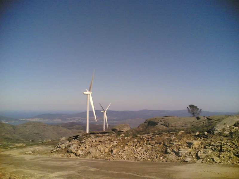
Serra de Arga is formed mainly of granite, and rocky outcrops on the plateau are a typical part of the landscape. The highest point of the whole range is Alto do Espinheiro, at 825 m above sea level.
Within Caminha municipality, the highest point sits on the Serra de Arga plateau, at the granite outcrop of Pedra Alçada, 742 m up. Survey data for this summit gives it a prominence of 152 m, making it the third most prominent elevation in Caminha and 27th in the Viana do Castelo district.
What is there to see?
The main draw is the panorama. From the upper parts of the range you can see the mouth of the Minho River and the slopes dropping toward the valleys. Many visitors come simply to walk the rocky plateau and take in the surroundings from height.
A wind farm also stands along the ridge. According to The Wind Power, it consists of 12 Vestas V90/3000 turbines with a combined 36,000 kW and 2 Enercon E92/2350 turbines with a combined 4,700 kW, operated by EDF Renewables. The turbines are visible from far away and form a distinctive part of the mountain skyline.
Getting there and when to go
A narrow, winding road leads up to the plateau and passes through the wind farm. Because of this access, a visit is best on days with good weather, when visibility is clear and road conditions are safe. In poor weather it is better to postpone the trip.
Frequently asked questions
How high is Serra de Arga? The highest point of the range, Alto do Espinheiro, is 825 m. Pedra Alçada, the highest point in Caminha municipality, is 742 m.
Which municipality is Serra de Arga in? The range covers several municipalities, including Caminha, Ponte de Lima, Viana do Castelo and Vila Nova de Cerveira.
Are there wind turbines on Serra de Arga? Yes, a wind farm with 14 turbines operates along the ridge, most of them Vestas V90 units.
What is the range made of? Mainly granite, visible in numerous rocky outcrops.
Is it worth going in bad weather? It is not recommended, as the road is narrow and winding and the views are the main reward.
Nearby places

Earn badges for the places you visit
Download NextOnTrip, discover new places and check off your trails.