About this place
Pedrada is the highest peak of the Serra do Soajo in north-western Portugal. At 1,416 m above sea level, it is the highest point of the Arcos de Valdevez municipality and of the entire Alto Minho region. It lies inside Peneda-Gerês National Park, the only national park in Portugal. On its summit, archaeologists found the remains of a Roman military camp.
Where is Pedrada?
The peak rises in the mountains between the Lima river valley and the area around Castro Laboreiro. Polish Wikipedia places it in the Serra da Peneda massif, while Portuguese tourism sources call it the top of the Serra do Soajo. Both names describe the same upland area within the national park. Administratively it belongs to the Arcos de Valdevez municipality in the Viana do Castelo district.
How high is it and what makes it stand out?
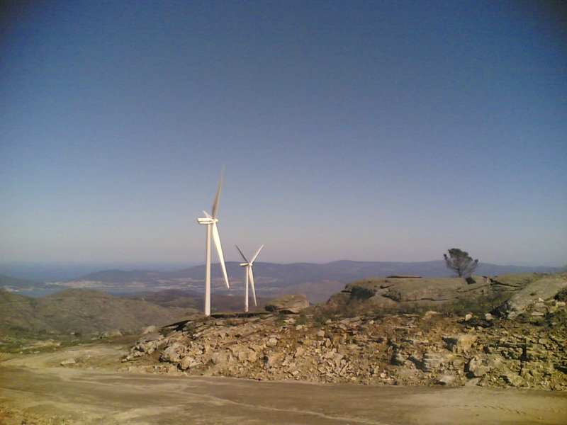
At 1,416 m, Pedrada towers over all of Alto Minho. The rocky granite summit is exposed, so walkers get wide views of the mountainous landscape typical of northern Portugal. It is also the highest point of a popular hiking route in the park.
Are there Roman remains at the top?
Yes. At a spot called Alto da Pedrada on the summit stands a Roman military camp. Its traces show on the ground as a rectangle with rounded corners, which suggests a wall once surrounded it. The camp covers roughly 1 to 1.5 hectares and, by estimate, could have housed about a thousand soldiers.
The camp dates to the late 1st century BC, the time of Emperor Augustus's campaigns in the north-west of the Iberian Peninsula. It is regarded as the first confirmed Roman military camp in northern Portugal.
How was the camp found?
Aerial imagery and LIDAR played the key role, revealing the fine relief of the terrain and structures hidden under vegetation. A research campaign on 3 to 7 August 2020 included geophysical prospecting with a magnetometer and metal detector, plus archaeological excavation. The work was carried out by ERA-Arqueologia. The lead archaeologist admitted that fieldwork alone would not have revealed the site without the aerial data.
How to plan a visit
Pedrada is a hiking destination. A popular circular route in Peneda-Gerês National Park crosses mountain scenery and reaches its highest point here. Plan carefully: by Portuguese standards this is high mountain terrain, and the weather changes quickly. Bring layers, water and an offline map.
Frequently asked questions
How tall is Pedrada? 1,416 m above sea level.
Is Pedrada the highest point in the region? Yes, it is the highest point of Arcos de Valdevez municipality and of Alto Minho.
What is on the summit? The remains of a Roman military camp from the late 1st century BC.
Which park is it in? Peneda-Gerês National Park.
When was the camp investigated? The main archaeological work took place in August 2020.
Nearby places

Earn badges for the places you visit
Download NextOnTrip, discover new places and check off your trails.