About this place
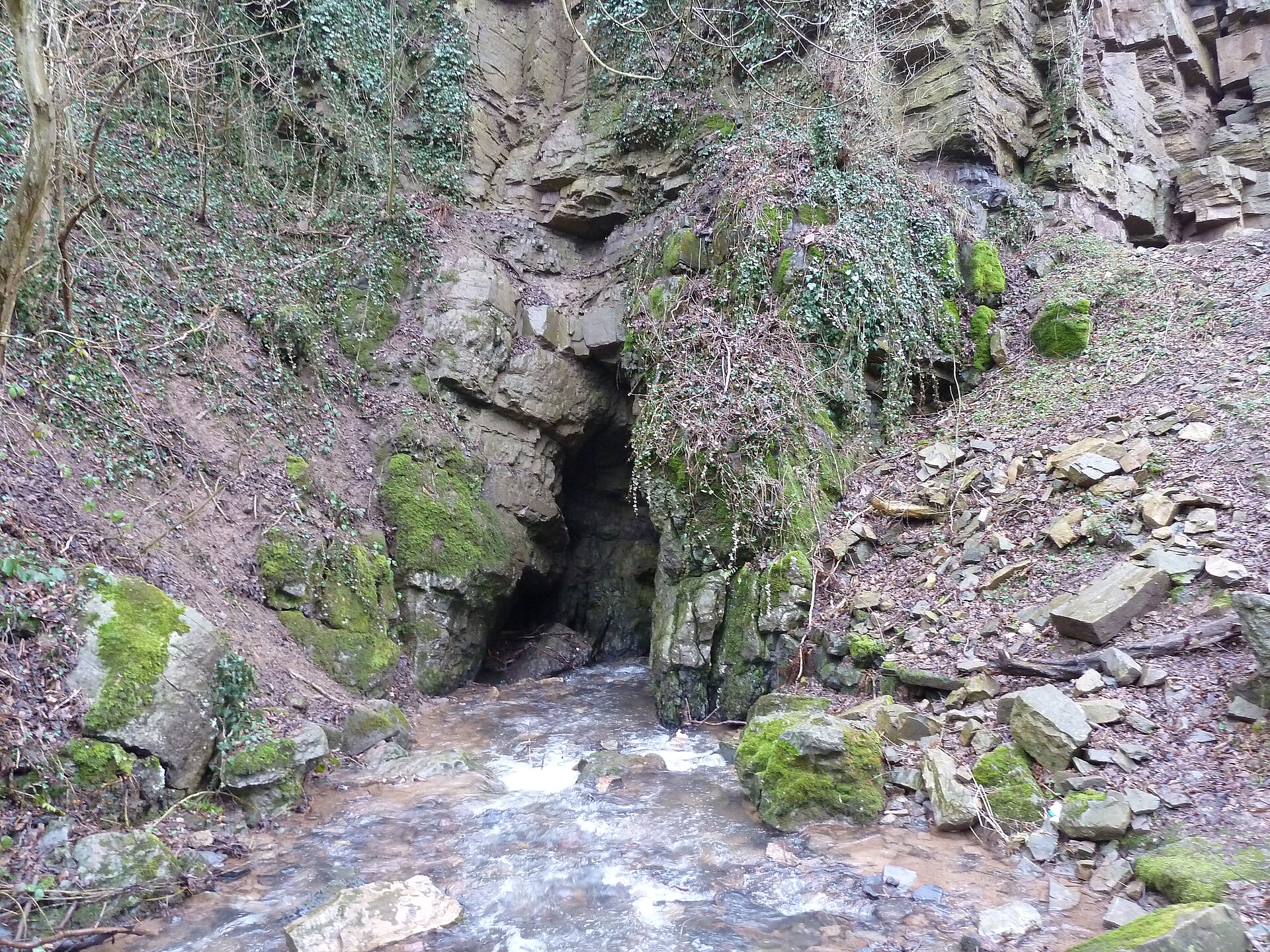
Chantoir de Béron Ry is one of the characteristic karst swallow holes in the Vallon des Chantoirs, a valley stretching across the municipalities of Sprimont and Aywaille in the province of Liège, in Belgium's Walloon Region. It sits close to the small hamlet of Hotchamps, part of the municipality of Sprimont.
What exactly is a chantoir?
The word "chantoir" comes from the Walloon dialect and describes a spot where a surface stream suddenly disappears underground, entering a karst system. The name refers to the sound made by water rushing into the rock — a noise likened to singing ("chant"), especially audible after heavy rainfall when flow increases. Chantoirs are, in essence, natural swallow holes typical of limestone terrain, where surface water meets soluble rock and exploits cracks and fissures to sink into the massif.
Where it lies and its geological setting
Chantoir de Béron Ry is located within the Vallon des Chantoirs, a valley carved into Middle Devonian limestone. It is precisely this type of rock, susceptible to dissolution by water, that allowed an extensive karst system to develop in the area. Around seventy chantoirs have been catalogued across the whole valley, making it one of the most densely packed pockets of karst activity in this part of the Ardennes. The site's approximate coordinates are 50.4999°N, 5.7067°E, with the hamlet of Hotchamps as the nearest reference point.
How the wider system it belongs to works
Water that disappears at Chantoir de Béron Ry does not end its journey there — this is only the start of an underground route. Streams sinking into the various chantoirs of the valley join a common underground collector, which, after travelling through the limestone massif, resurfaces at the Remouchamps caves, one of the region's best-known tourist attractions. This underground river carries its own name, the Rubicon, a detail that reflects how central the whole karst system has become to the local geography and folklore.
Is Chantoir de Béron Ry the only feature of its kind nearby?
No. The Vallon des Chantoirs contains many similar swallow holes, several of which have their own names and some degree of recognition among visitors to the region — among them the Trou-le-Coq chantoir, the Grandchamps chantoir, the Hotchamps chantoir, the Pussin chantoir, and the Rouge-Thier chantoir (also known as Trou du Moulin). One of them, the Sécheval chantoir, has been listed as Exceptional Heritage of Wallonia. Chantoir de Béron Ry belongs to this same family of features, forming together with the others a coherent, if surface-scattered, drainage system for the valley.
Frequently asked questions
What does the word "chantoir" mean? It is a Walloon term for a place where a stream disappears underground into a karst system — the name refers to the sound made by the sinking water.
Where exactly is Chantoir de Béron Ry located? In the Vallon des Chantoirs, near the hamlet of Hotchamps, within the municipality of Sprimont, province of Liège.
Where does the water that vanishes here end up? It joins underground with water from other chantoirs in the area and resurfaces at the Remouchamps caves as an underground river known as the Rubicon.
Are there other similar features nearby? Yes, around seventy chantoirs have been catalogued in the Vallon des Chantoirs, including several other named ones.
What kind of rock forms this landscape? Middle Devonian limestone, which is soluble in water and allowed the karst system to develop over time.
Nearby places

Earn badges for the places you visit
Download NextOnTrip, discover new places and check off your trails.