About this place
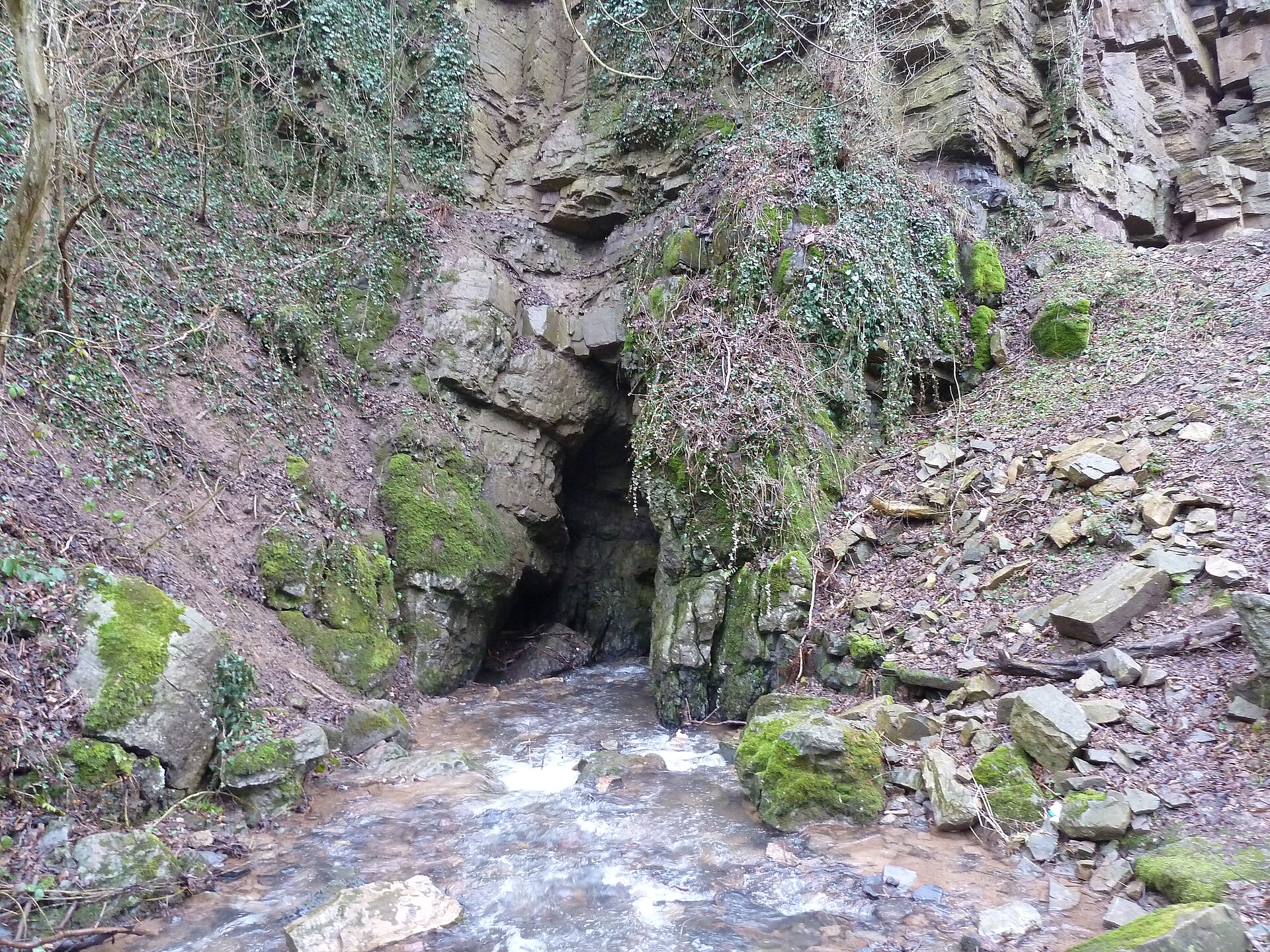
Chantoir de Chefosse is a natural karst feature located near the village of Deigné, in the municipality of Aywaille, Liège Province, Belgium. It belongs to a category of local landforms known as "chantoirs" — points where a permanent or seasonal watercourse disappears underground and continues its journey through a hidden subterranean channel. The site lies within the so-called Vallon des Chantoirs, a valley stretching from north to south between Louveigné (municipality of Sprimont) and Remouchamps (municipality of Aywaille).
What exactly is a chantoir?
The term "chantoir" is regional geological vocabulary used in the Ardennes and the limestone areas of eastern Belgium. It describes a spot where flowing water sinks into a clearly marked depression in the ground and vanishes into an underground karst system, resurfacing elsewhere or feeding a hidden network of channels invisible from the surface. This phenomenon is typical of limestone landscapes, where water gradually dissolves the rock, carving out caves, conduits and sinkholes over long periods of time.
Location and regional context
Chantoir de Chefosse sits close to the village of Deigné, an area well known for a dense concentration of similar landforms. Within the Vallon des Chantoirs, roughly 70 such features have been recorded, making this stretch of countryside one of the richest karst landscapes in Belgium. The abundance of chantoirs and dolines around Deigné has long attracted the attention of geologists as well as local residents, for whom the pockmarked terrain of sinkholes and depressions is a familiar and defining part of the surroundings.
The site's approximate coordinates are 50.508015°N, 5.731913°E, placing it in the scenic, hilly countryside of the Amblève valley, close to the well-known tourist area of Sougné-Remouchamps, home to the famous Remouchamps cave system.
Current condition
Available information indicates that Chantoir de Chefosse has gradually filled in over time — a natural stage in the life cycle of many karst sinkholes, as sediment, debris and plant matter accumulate and close off the original opening where water once disappeared. Even so, the site remains a point of interest for the region's natural heritage and is listed among the landscape features documented by tourism bodies covering the Ourthe-Vesdre-Amblève area.
Landscape and natural significance
Chantoirs, including Chantoir de Chefosse, form an important part of the local ecosystem and the region's geological story. Together they shape a distinctive, uneven landscape where depressions in the ground — sometimes overgrown with vegetation, sometimes exposing bare rock — bear witness to karst processes that have been at work beneath the surface for thousands of years. For visitors interested in geology and natural landscapes, the area around Deigné and the wider Vallon des Chantoirs offers a chance to observe these formations firsthand, within easy reach of the better-known attractions of the Amblève valley.
Frequently asked questions
What is a chantoir? A chantoir is the regional term for a swallow hole — a point where a watercourse disappears underground and continues along a hidden channel, a feature typical of the karst terrain of eastern Belgium.
Where is Chantoir de Chefosse located? Near the village of Deigné, in the municipality of Aywaille, Liège Province, within the valley known as the Vallon des Chantoirs.
Can Chantoir de Chefosse be visited? The feature has gradually filled in over time, but it remains a point of interest along routes exploring the region's natural heritage.
How many similar features exist in the area? Around 70 chantoirs have been recorded within the Vallon des Chantoirs, making it one of the richest concentrations of this karst landform in Belgium.
Nearby places

Earn badges for the places you visit
Download NextOnTrip, discover new places and check off your trails.