Nature in Italy
A guide to 385 Nature in Italy — with descriptions, photos and traveler visits from the NextOnTrip community. Locations spread across 265 cities and towns. Most visited by the community: Felice Celani Park, Parco di Villa Carrara, Giardino Giovanni Andrea Corso.
-
Mater
Cerano d'Intelvi
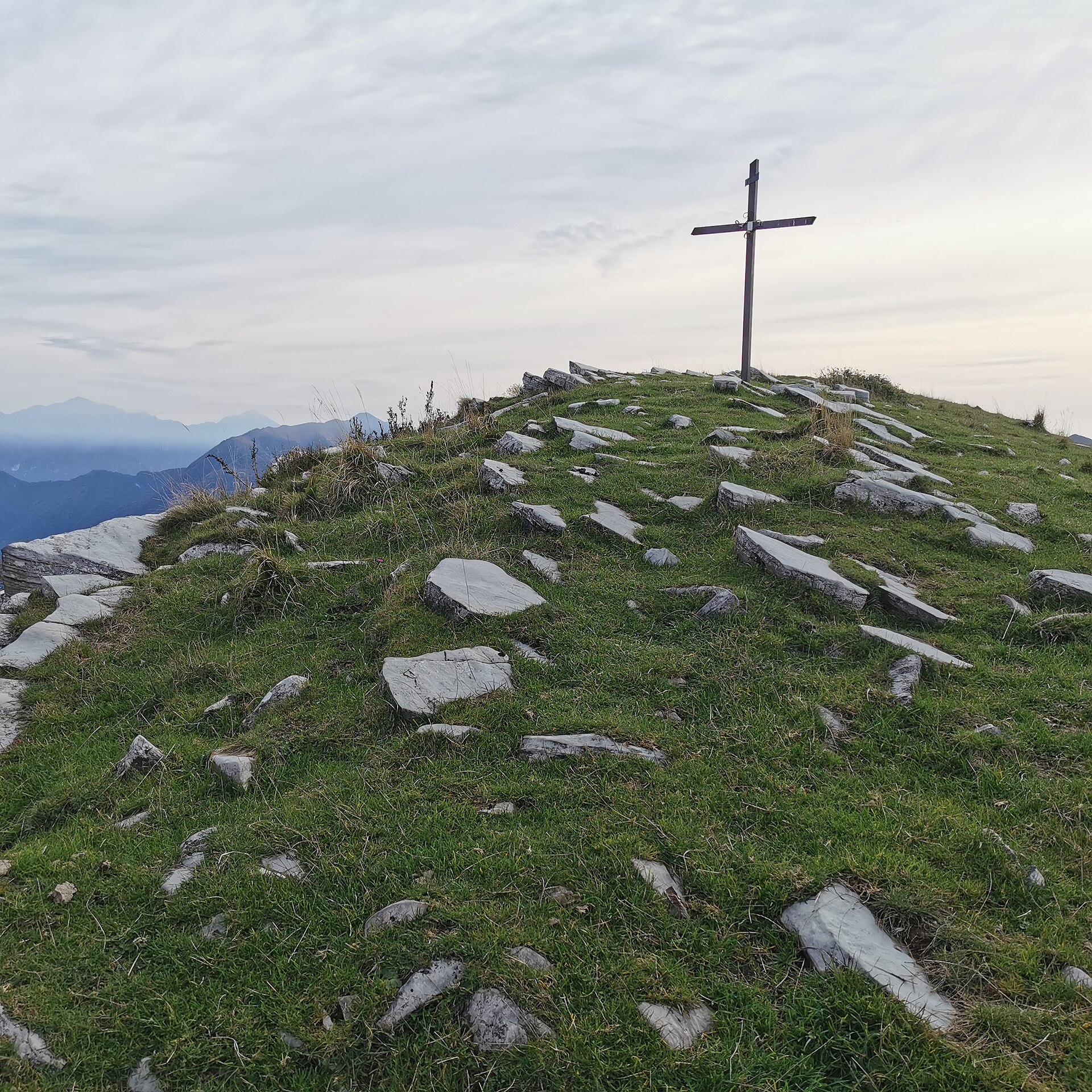
Mater is a scenic mountain pass in the municipality of Cerano d'Intelvi, in the heart of the Valle d'Intelvi in Lombardy, sitting at roughly 1,340 metres above sea level. It's valued mostly by hikers and mountain bikers looking for wide-open views over the surrounding peaks without committing to a full technical high-altitude route. How do you get to Mater? The usual starting point is Cerano d'Intelvi itself, a small village of about 550 residents at 630 metres above sea level. From the village centre, a forest trail climbs the eastern slope of Pizzo della Croce up to the pass. The path follows an old mulattiera — a stone mule track once used to move goods by pack animal — so the climb is steady and occasionally steep but doesn't require any climbing gear. Reaching Mater on foot typically takes one and a half to two hours one way, depending on pace and fitness. Sturdy trekking shoes, poles, and enough water are worth bringing, since there are no reliable water sources along the way. What will you see there? At the pass itself stands a well-known cross that has long served as a landmark for hikers. From here the view opens up in a full 360 degrees — on a clear day you can pick out the ridgelines of the Valle d'Intelvi and, further off, peaks toward Monte Generoso. Mater works well both as a standalone day-trip destination and as a junction point for longer routes linking several summits across the valley. The surrounding slopes are covered in mixed forest typical of these pre-Alpine hills, which keeps most of the climb shaded in summer. The pass also draws mountain bikers: the trail through this stretch forms part of larger loop routes across the Valle d'Intelvi, connecting several villages and viewpoints. Because the surface is uneven with some steep sections, riding it comfortably calls for solid technique and a bike suited to rough terrain. When should you visit? Late spring and early autumn are the best windows for a visit to Mater — temperatures above 1,300 metres stay mild, and visibility tends to be at its clearest. In summer, the forested approach keeps things comfortable even on hot days, though setting out in the morning is still a good idea. In winter, the trail can be snow-covered and icy, so it's best attempted only with proper winter hiking gear and experience. Why is it worth the trip? Mater combines easy access with the authentic feel of a pre-Alpine hike, without the crowds that gather around the better-known peaks near Lake Como. It suits anyone who wants a genuine panorama over the Valle d'Intelvi without planning an entire day around a demanding high-mountain expedition. Frequently asked questions How high is the Mater pass? Mater sits at approximately 1,340 metres above sea level, within the municipality of Cerano d'Intelvi. How long does it take to reach Mater? The forest trail from Cerano d'Intelvi usually takes 1.5 to 2 hours one way, depending on walking pace. Is the trail suitable for mountain biking? Yes, the Mater area is part of popular MTB routes in the Valle d'Intelvi, though the uneven terrain requires solid riding technique. What can you see from the pass? Mater offers a 360-degree panorama over the surrounding peaks of the Valle d'Intelvi, including views toward Monte Generoso.
-
Cascata Fermona
Ferrera di Varese
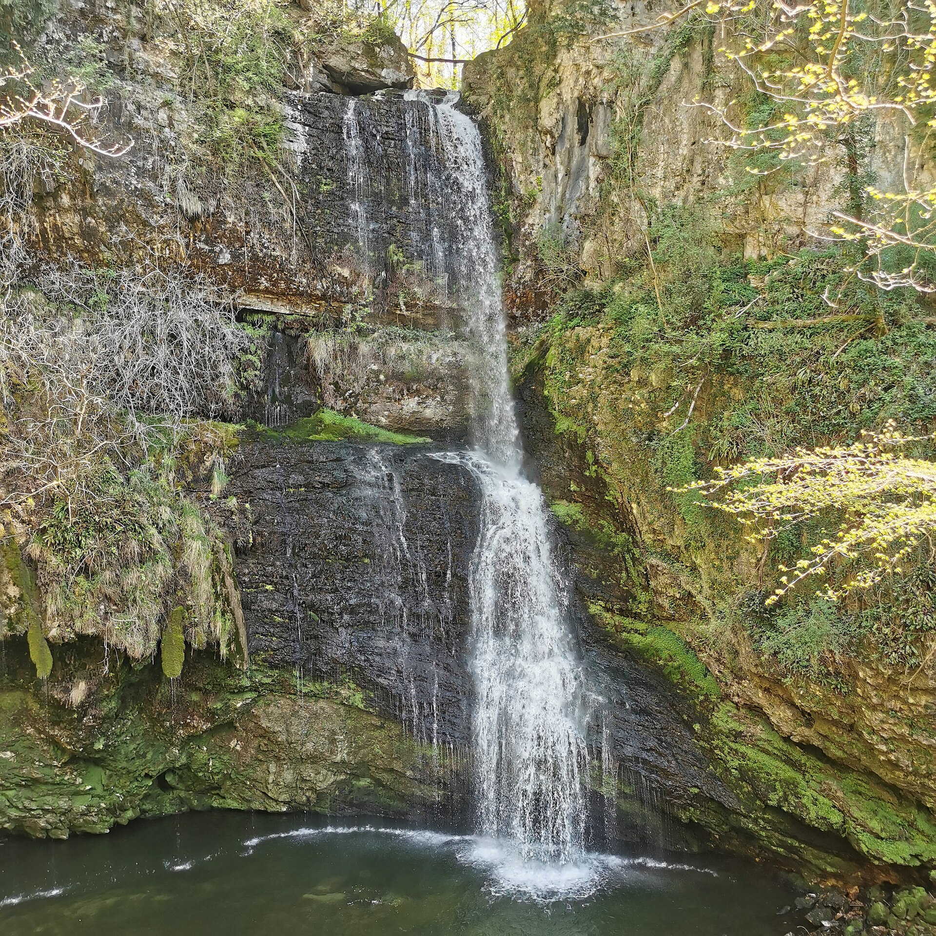
Cascata Fermona is one of the most striking waterfalls in the province of Varese, tucked just below the old centre of Ferrera di Varese in Lombardy, right on the boundary with the neighbouring municipality of Grantola. The Margorabbia stream that feeds it first emerges from the scenic Orrido di Cunardo gorge before plunging roughly 30 metres into an emerald-green pool at the foot of the rocks. Where exactly is the waterfall? Ferrera di Varese is a small village in the hills north of Varese, close to Lake Maggiore and only a few kilometres from the Swiss border. The waterfall sits along the line dividing Ferrera and Grantola, inside a wooded ravine that cars cannot reach. Despite being so close to the houses, the spot keeps a wild, natural feel. How do you get there? The easiest option is to leave the car in the centre of Ferrera, near the kindergarten, where a signposted trail begins. Along the way you first pass a smaller cascade, the Cascata di Ferrera, only about 3 metres high and easy for anyone to reach. From there, after crossing a small bridge and walking down, the main Cascata Fermona is about 10 to 15 minutes away. Between 2021 and 2022 the Comunità Montana Valli del Verbano carried out safety works on the route and installed metal stairs, making the descent far safer. Even so, the final stretch stays steep and rocky, so sturdy shoes are a good idea. What will you see there? The highlight is the tall, narrow jet of water dropping between moss-covered rocks into the emerald pool below. On hot days the spray and the shade of the trees create a naturally cool microclimate. The basin at the base invites a swim, while the surrounding clearings are ideal for a picnic and a rest. It is a popular family outing, though the trickiest part of the descent calls for keeping an eye on children. When is the best time to visit? The waterfall looks most powerful in spring and after heavy rain, when the Margorabbia carries the most water. Summer, on the other hand, is when the cool pool draws visitors looking to refresh. In autumn the surroundings turn warm with falling leaves, and the lower water level reveals the shape of the rocky ledge. Frequently asked questions How tall is Cascata Fermona? The main waterfall is about 30 metres high. The smaller cascade along the way, Cascata di Ferrera, is only around 3 metres. How long does the walk take? From the centre of Ferrera it is a few minutes to the smaller cascade, and around 10 to 15 minutes in total to reach the main waterfall, descending the metal stairs. Can you swim in the pool? There is a natural pool at the base of the waterfall where visitors swim in summer. Take care, though, as the water is cold and the rocks are slippery. Is the trail suitable for children? Yes, it is a popular family destination, but the last part of the descent can be steep and rocky, so children should be supervised at all times.
-
Cascata Lequarci
Ulassa/Ulassai
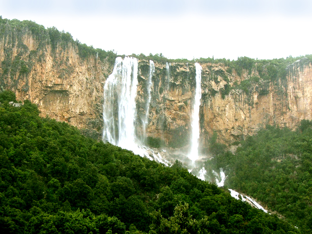
Cascata Lequarci near Ulassai in Ogliastra province is considered the most impressive waterfall on Sardinia. The Rio Lequarci descends from a limestone amphitheatre in the Santa Barbara locality in a main plunge approaching 100 metres, spreading across a width of up to 70 metres, then continues cascading for a further 75 metres of elevation drop before dispersing into a series of small pools. The falls lie 7 kilometres from the village of Ulassai, within a monumental forest, in a landscape defined by the pointed limestone buttes known as Tacchi — named for their resemblance to a shoe heel. How to get there The trail starts from the Church of Santa Barbara in the municipality of Ulassai. The route follows well-marked paths with some rocky and uneven sections, and passes two panoramic viewpoints with open views of the falls. Sturdy footwear is essential; parts of the trail can be wet and slippery. When to visit Lequarci is at its most dramatic in autumn and winter, following significant rainfall, when the full width of the cliff face comes alive with water. In summer the river often runs very low or dries up entirely. For the full effect — a near-100-metre drop across 70 metres of rock — a visit after heavy rains is essential. What else to see in the area A short walk from the trailhead stands a small church with Byzantine-Romanesque architecture. Three kilometres upstream is Ulassai's second waterfall, Lecorci, located at the foot of a Taccu rock face just below the cave of Su Marmuri — the longest cave on the island at nearly a kilometre. The village of Ulassai itself sits above 700 metres and is a magnet for trekkers and free climbers, with over 200 marked and bolt-equipped routes on its dolomitic walls. The surrounding area holds prehistoric nuraghi (Trucculu, Ibbe de su Accili, Pranu; 2nd–1st millennium BC) and the megalithic village of Seddorrulu (3rd millennium BC). Ulassai is also the birthplace of the 20th-century artist Maria Lai; the Stazione dell'Arte museum at the village entrance is dedicated to her work. Frequently asked questions How long is the trail to the waterfall? The path from the Church of Santa Barbara to Cascata Lequarci covers several kilometres. It is also possible to hike up the Rio Lequarci valley to reach the top of the falls. Is the waterfall active in summer? The river typically runs low or dries out in summer. Autumn through spring, after meaningful rainfall, is when the waterfall is at its best. Is there an entrance fee? Access to the trail is free. Is the route suitable for children? The trail has rocky, potentially slippery sections. Good footwear and some experience of mountain paths are recommended.
-
Istrampu de Capu Nieddu
Cùllieri/Cuglieri
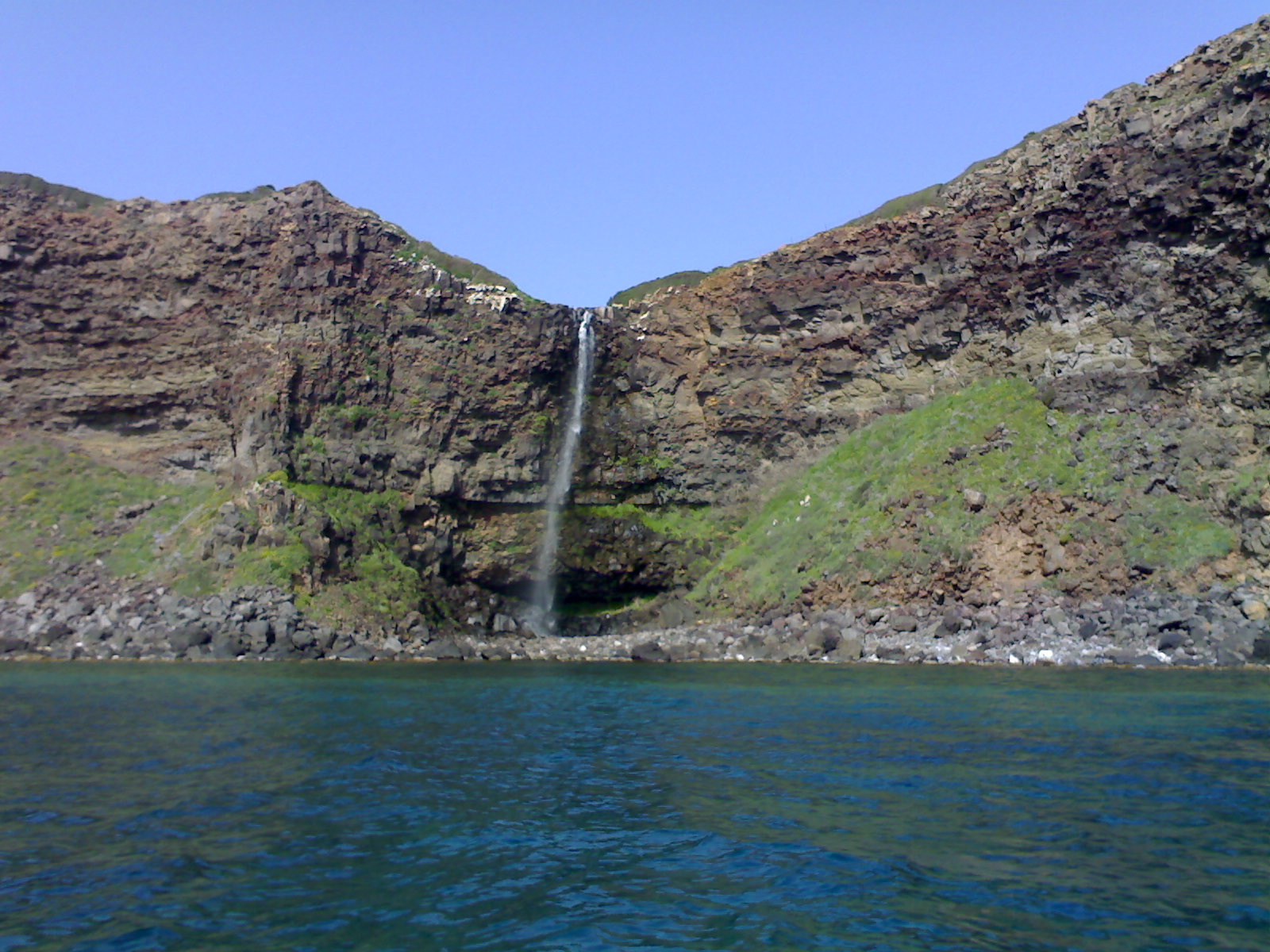
Istrampu de Capu Nieddu in Cuglieri is one of the rarest natural phenomena not just in Sardinia but in all of Italy: a waterfall whose waters fall directly into the sea. The Rio Salighes drops 40 metres off the basalt clifftop straight into the Sardinian Sea, from a natural coastal amphitheatre carved into the high coast between the bay of S'Archittu and the Marina of Tresnuraghes, in the historical region of Montiferru. Why is this waterfall unique? Cabu Nieddu exists because of a geological peculiarity: the Rio Salighes flows across the hard basalt surface of the Campeda plateau all the way to the coastline because, over thousands of years, the river never carved itself an underground channel through the rock. The result is extraordinary — the river literally runs off the cliff edge and plunges into the sea from a height of 40 metres. Places like this can be counted on the fingers of one hand across the whole of Europe. When to visit and how to see it best Cabu Nieddu is not a year-round waterfall. It flows typically from November to May — the wetter the winter, the more powerful the spring display. In summer, the river dries up. The best viewpoint is from the water: boat tours offering a view of the waterfall depart from Santa Caterina di Pittinurri, Bosa, and Oristano. From the sea, the waterfall appears in full scale against the basalt cliffs and green slopes of the Montiferru massif — a setting frequently compared to the Irish Cliffs of Moher. Looking north from the boat, the headland of Capo Marargiu is visible, home to nesting griffon vultures; to the south lie Capo Mannu and the small island of Mal di Ventre. What surrounds the waterfall? The cliffs and slopes around Cabu Nieddu are covered in holm oaks, chestnut trees and strawberry trees, with wild roses, hawthorn and broom growing between the rocks. The scents of thyme and helichrysum accompany every boat excursion. Nearby stands the Spanish watchtower of Capo Nieddu — a remnant of the coastal defence system — and Punta Foghe, guarded by another ancient tower. Frequently asked questions Can you reach the waterfall on foot? The view from land is limited by the terrain. The classic and recommended way to see Cabu Nieddu is by boat from Santa Caterina di Pittinurri, Bosa, or Oristano. When does the waterfall flow? Typically from November to May. During the summer months, the Rio Salighes dries up and the waterfall stops. How far is it from Cuglieri? Cabu Nieddu is on the coast, approximately 10 km west of central Cuglieri. Is this the only waterfall of its kind in Italy? Sea-plunge waterfalls are very rare across Europe — Cabu Nieddu is recognised as one of the few examples of this phenomenon in Italy.
-
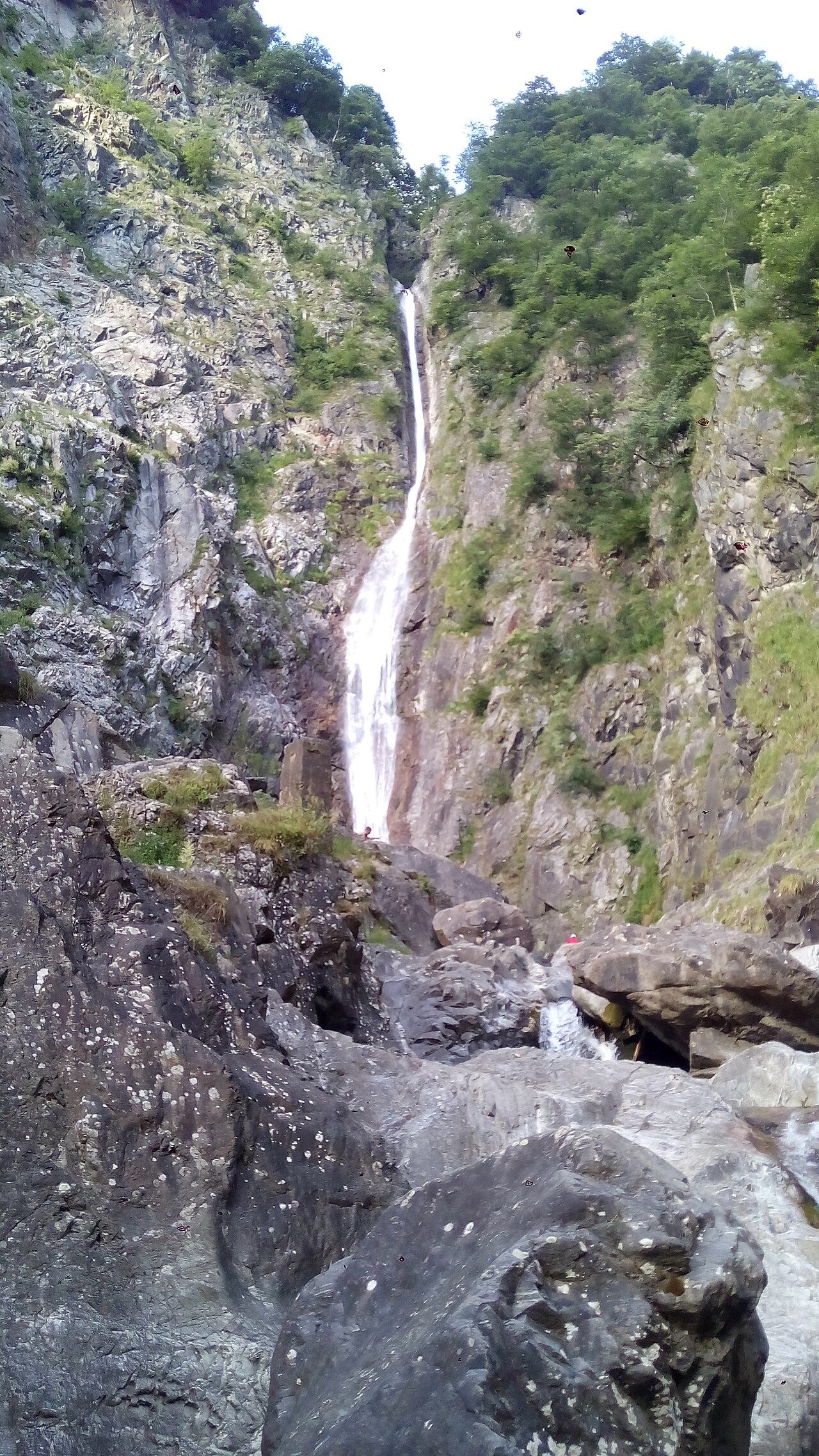
Troggia Falls
Introbio
Troggia Falls in Introbio is a 100-metre waterfall in the Valsassina valley, Lecco province, Lombardy. The Troggia stream originates at Lake Sasso at the foot of Pizzo Tre Signori, flows through the Biandino valley, then plunges vertically into a pool before disappearing underground and rejoining the Pioverna stream. Leonardo da Vinci mentioned the falls in his Codex Atlanticus; in older texts the site was known as 'Dog's Paradise'. The waterfall is visible from the main road; a 1 km path from the Ciresa premises leads to a viewpoint. Direct access to the base is currently restricted due to hydrogeological instability.
-
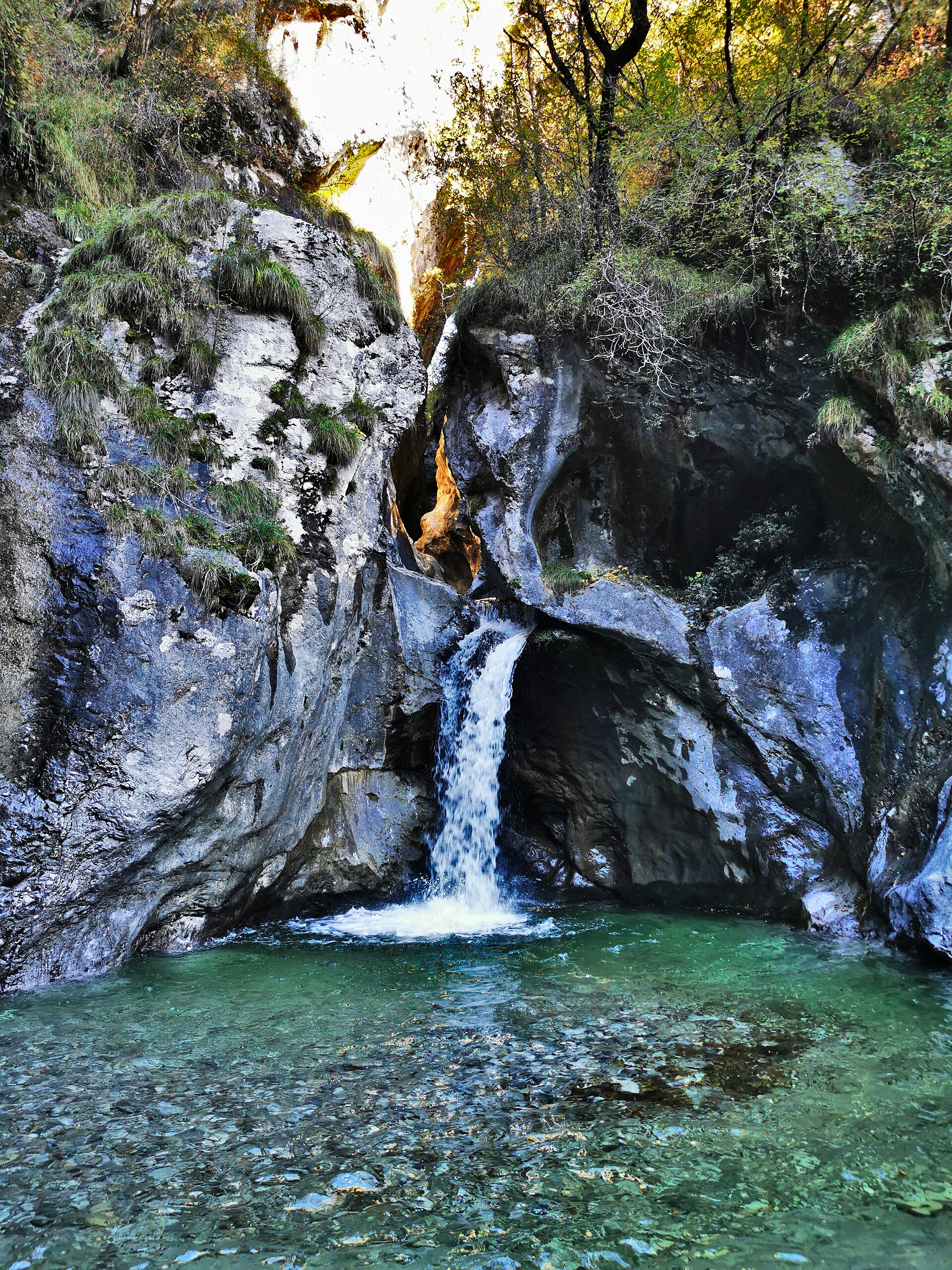
waterfall of Begna
Tavordo
Cascata di Begna (waterfall of Begna) in Tavordo is a waterfall in the Lepontine Alps near Porlezza, Province of Como, Lombardy. The water falls into a natural pool suitable for a cooling dip in summer. The trail starts near the church of San Giuseppe, crosses the Strolech Bridge over the Rezza stream, and reaches the waterfall in about 30 minutes. The loop route (roughly 8 km) is considered challenging due to steep and slippery sections — sturdy footwear is strongly recommended. The waterfall is located close to both Lake Lugano and Lake Como.
-
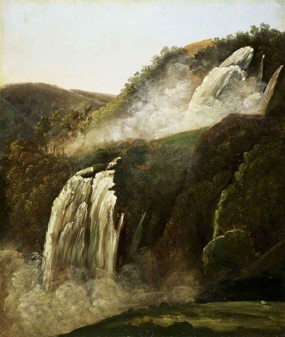
Cascata delle Marmore
Terni
Cascata delle Marmore in Terni is the largest man-made waterfall in the world, standing 165 metres tall. It was created in 271 BC when Roman consul Manius Curius Dentatus ordered a canal (the Curiano Trench) to drain the stagnant Velino River over a cliff into the Nera River below. Today the water feeds the Galleto hydroelectric power plant (approx. 530 MW, operational since 1929), so the falls run on a fixed schedule — typically 12:00-13:00 and 16:00-17:00 daily, with extended hours on public holidays. The falls are located 7.7 km from Terni, in Umbria. Entrance is paid; a tunnel leads to an observatory directly beside the curtain of water.
-
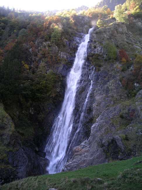
Partschins Waterfall
Partschins - Parcines
Partschins Waterfall (Cascata di Parcines) in Partschins/Parcines is the largest waterfall in South Tyrol. Water plunges freely 97 metres down a freestanding rock face in what locals call a 'liquid curtain'; the total height of the fall is around 130 metres. The waterfall is most powerful during snowmelt (May to June), when flow reaches 4,000 to 10,000 litres per second. It is the landmark of the village and one of the signature natural sights of Trentino-Alto Adige. The falls can be reached by several trails, including routes from the Texelbahn cable car stations.
-
Parco di Villa Carrara
Genua
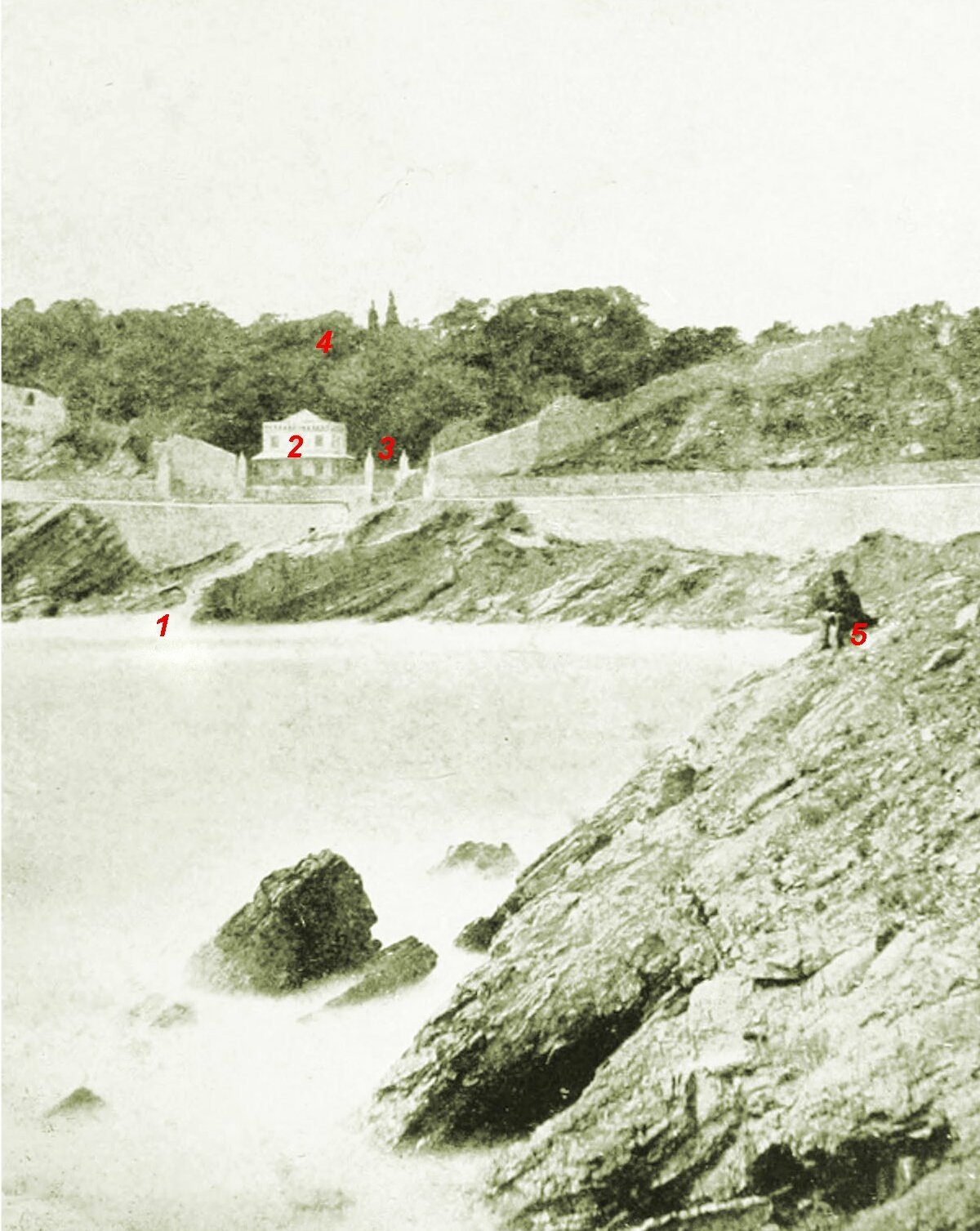
Parco di Villa Carrara is a park in Genoa, Italy, offering a calm green pause within the city. It is a pleasant place to step away from the urban pace and spend a little time outdoors. For visitors exploring Genoa, it works well as a short walk or a quiet break from sightseeing. Na miejscu można liczyć przede wszystkim na: a peaceful setting that brings a bit of nature into Genoa’s urban landscape an easy place for a relaxing stroll without leaving the city a quiet stop for visitors who want to rest between sightseeing spots If you are planning a visit, comfortable shoes are enough for an unhurried walk, and it is best to come when you want a calmer moment in the city. This is a good choice for travelers looking for a simple, low-key outdoor break in Genoa.
-
Andreas Hofer Park
Mantua
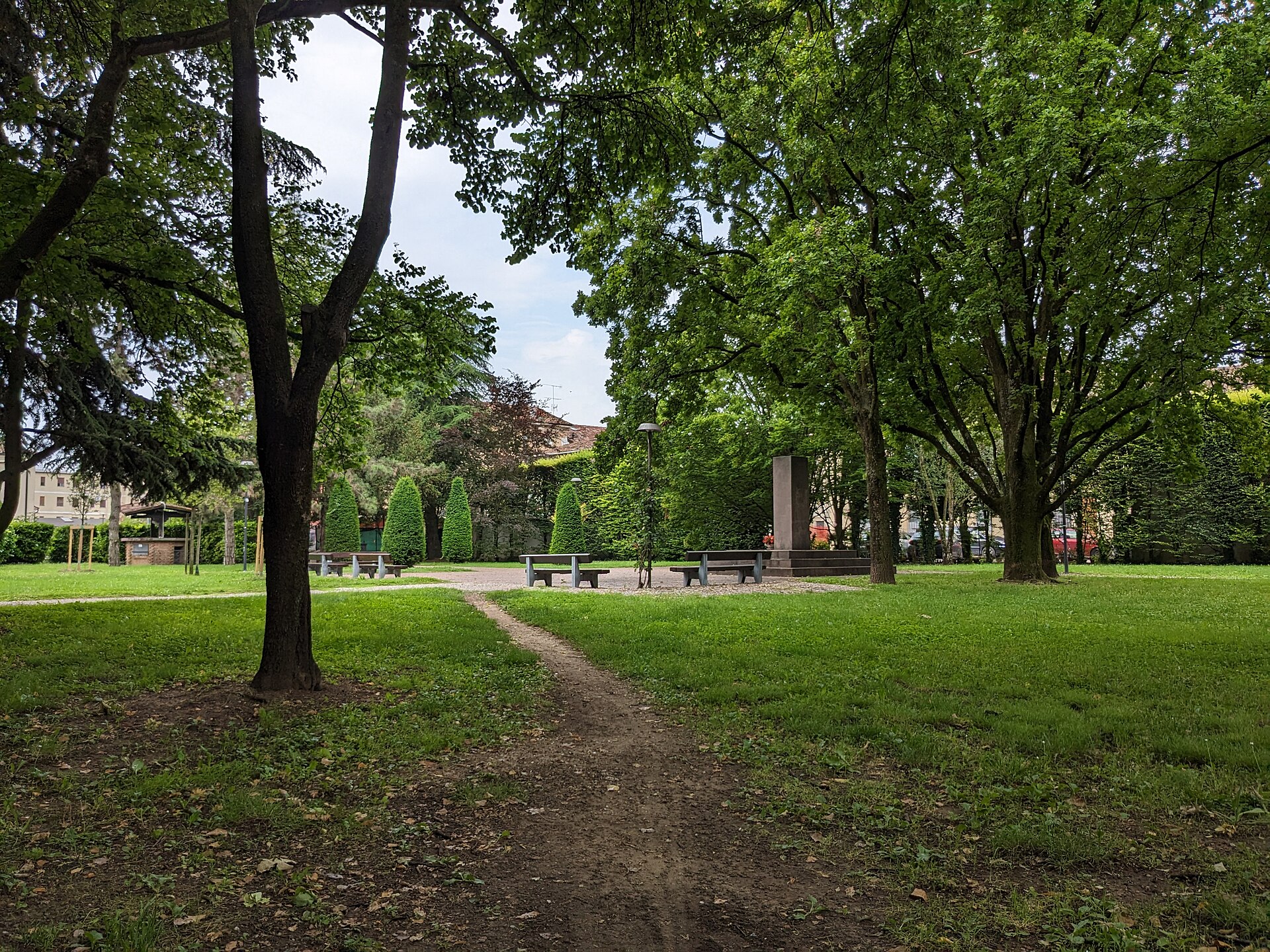
Andreas Hofer Park is a green urban park in Mantua, Italy, set in the city’s historic surroundings. It offers a quiet place to slow down while exploring the area, with a simple, pleasant atmosphere that suits a short break from sightseeing. For travelers, it is a good spot for a relaxed pause in the middle of the city. Na miejscu można liczyć przede wszystkim na: a calm urban setting where you can take a leisurely stroll and enjoy a bit of greenery in Mantua a convenient place to rest between visits to the city’s historic sights a straightforward, low-key stop that lets you experience a quieter side of the city If you are planning a day of sightseeing in Mantua, it is worth stopping here for a short break and a comfortable pair of shoes. This is a good choice for visitors who want a peaceful pause, some fresh air, and an easy walk without leaving the city center.
-
Giardino di Palazzo Milzetti
Faenza
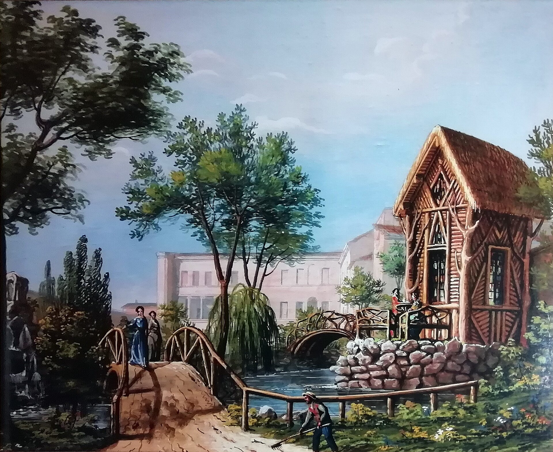
Giardino di Palazzo Milzetti is a historic garden in Faenza, Italy, set beside the elegant Palazzo Milzetti, one of the city’s notable neoclassical landmarks. Located in the heart of Emilia-Romagna, it adds a calm green setting to the palace’s refined architecture and artistic heritage. It is a good choice for a short walk while exploring Faenza’s cultural center. Na miejscu można liczyć przede wszystkim na: a quiet historic garden that works as a green counterpoint to Palazzo Milzetti’s neoclassical setting a chance to appreciate the palace’s elegant architecture and artistic atmosphere from the outside an easy stop within Faenza’s cultural center, where history, architecture, and a more relaxed urban landscape meet For a visit here, comfortable shoes are enough, and it is especially pleasant as part of a slower city stroll. This is a good option for travelers who enjoy heritage sites with a peaceful atmosphere and want a brief break in the middle of sightseeing.
-
Prato della Contessa
Castel del Piano
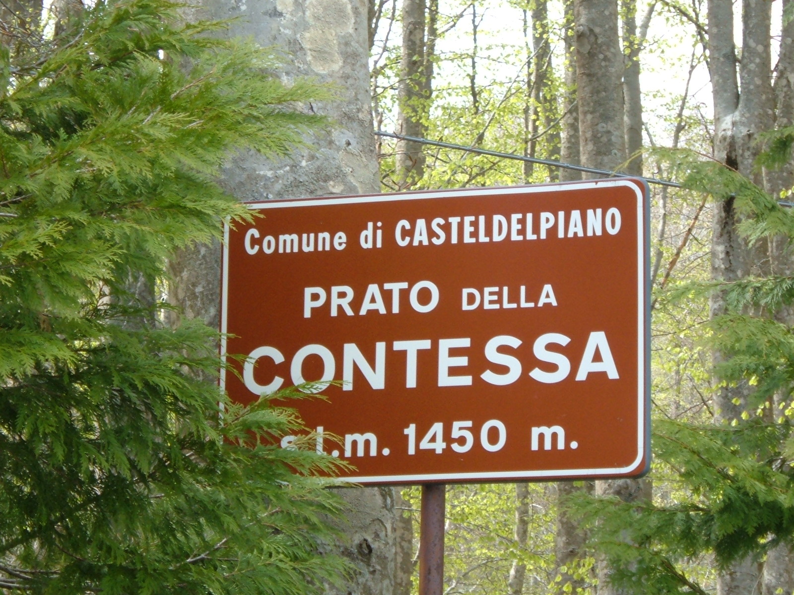
Prato della Contessa is a park in Castel del Piano, Italy, offering a calm green setting right in town. It is a good place to slow down for a while and enjoy a bit of nature without leaving the center of the area. For visitors, it works well as a short walk, a picnic stop, or a quiet break outdoors. Na miejscu można liczyć przede wszystkim na: a pleasant green area where you can take a relaxed stroll and spend time outdoors space suited to a picnic or simply sitting back and unwinding in a natural setting a welcoming town park that adds greenery to Castel del Piano and serves both locals and travelers If you are planning a low-key stop, comfortable shoes and a quick check of the weather are enough. This is a good choice for anyone looking for a peaceful outing, especially if you want something simple, local, and close to nature.
-
Villa Revoltella
Triest
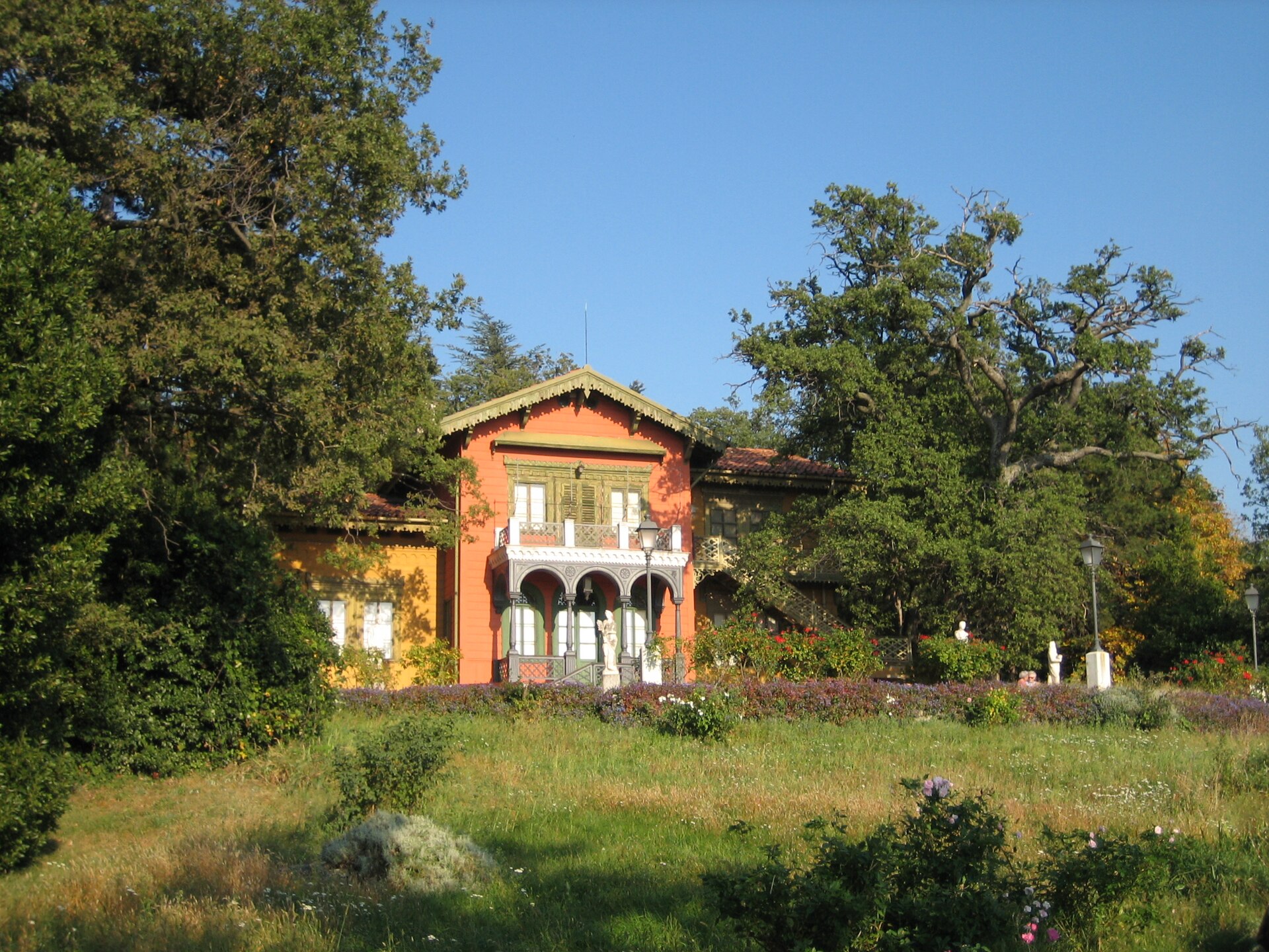
Villa Revoltella is a villa and public park in the Chiadino district of Trieste, Italy. Set on the city’s hillside, it offers a calm green retreat with open views across Trieste and the surrounding area. For visitors, it is a good choice for a short walk, a quiet pause, or a relaxed family outing. Na miejscu można liczyć przede wszystkim na: landscaped grounds and leafy paths that make the park pleasant for an easy stroll the historic villa setting, which gives the visit a more atmospheric feel than an ordinary city park elevated viewpoints over Trieste and the wider surroundings, especially rewarding when exploring beyond the waterfront and historic center If you are planning a visit, comfortable shoes are a good idea, since the park sits on a hillside and is best enjoyed on foot. It suits travelers looking for a peaceful stop close to the city, with a mix of greenery, views, and a quieter pace.
-
Roccolo
Treviglio
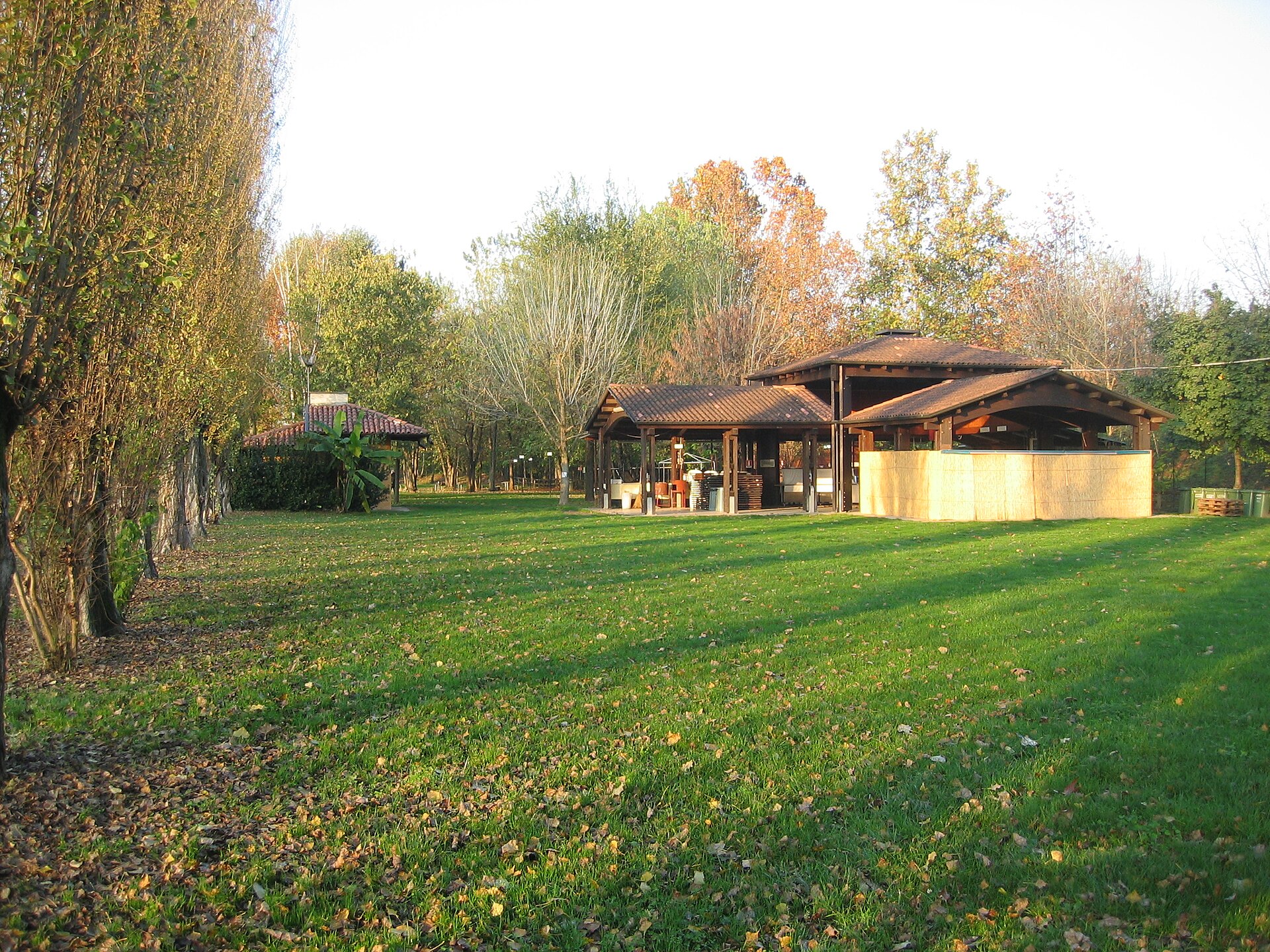
Roccolo is a park in Treviglio, Italy, that offers a pleasant green space right in town. It brings a quieter, more natural feel to the urban landscape and is a good place to slow down for a moment. For visitors, it works well as a short walk, a calm pause, or a family outing. Na miejscu można liczyć przede wszystkim na: an easy stroll through a green setting that offers a break from the bustle of Treviglio’s center a quiet place to sit, unwind, and enjoy a calmer side of the town a simple outdoor stop that suits families and anyone looking for a low-key visit If you are planning a visit, comfortable shoes are enough for an easy walk, and it is worth stopping by when you want a short, relaxed break rather than a full-day outing. Roccolo is a good choice for travelers who want a bit of nature close to the center and a peaceful pause during time in Treviglio.
-
Parco del Cardeto
Ankona
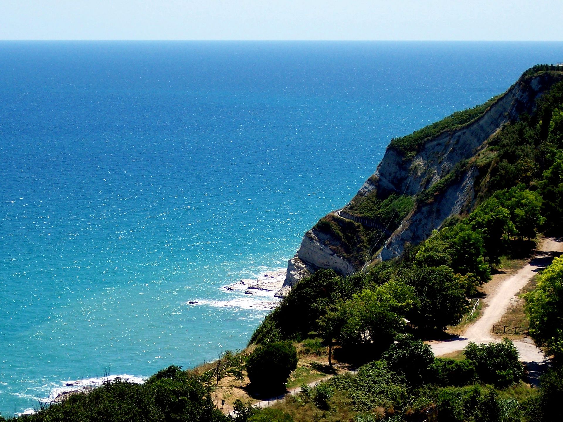
Parco del Cardeto is a scenic public park in Ancona, spread across Cardeto Hill and Cappuccini Hill. Set above the city and the Adriatic Sea, it offers a calm green break with wide views and plenty of space to wander. It is a good place for a short walk and an easy outdoor pause. Na miejscu można liczyć przede wszystkim na: panoramic views over Ancona and the Adriatic Sea, with the elevated setting making the coastline easy to admire; walking paths and open areas that suit a relaxed stroll through a pleasant natural landscape; a quiet spot for watching sunsets and spending time in one of Ancona’s most enjoyable green areas. If you are planning a visit, it is worth wearing comfortable shoes and checking the weather, especially if you want to enjoy the viewpoints at a slower pace. This is a good choice for travelers looking for a peaceful outing, close to nature and with broad city-and-sea views.
-
Orange Garden
Rzym
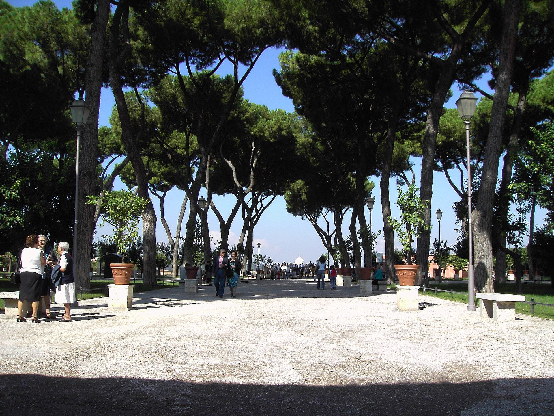
Orange Garden is the name used in Rome for Parco Savello, a small park on the Aventine Hill. Covering about 7,800 square meters, it was designed in 1932 by Raffaele De Vico. It is a good place for a short walk and a wide city view. Na miejscu można liczyć przede wszystkim na: an open lookout over Rome, with the park laid out as a new belvedere on the side of the hill; a compact green space on the Aventine Hill, easy to combine with nearby sightseeing; a design from 1932 by Raffaele De Vico, created to give the public access to this viewpoint alongside the ones on the Pincian Hill and the Janiculum. For the visit, comfortable shoes are a good idea, especially if you plan to walk around the hill and enjoy the viewpoint at an unhurried pace. It is a solid choice for travelers who want a quiet stop with city views rather than a long excursion.
-
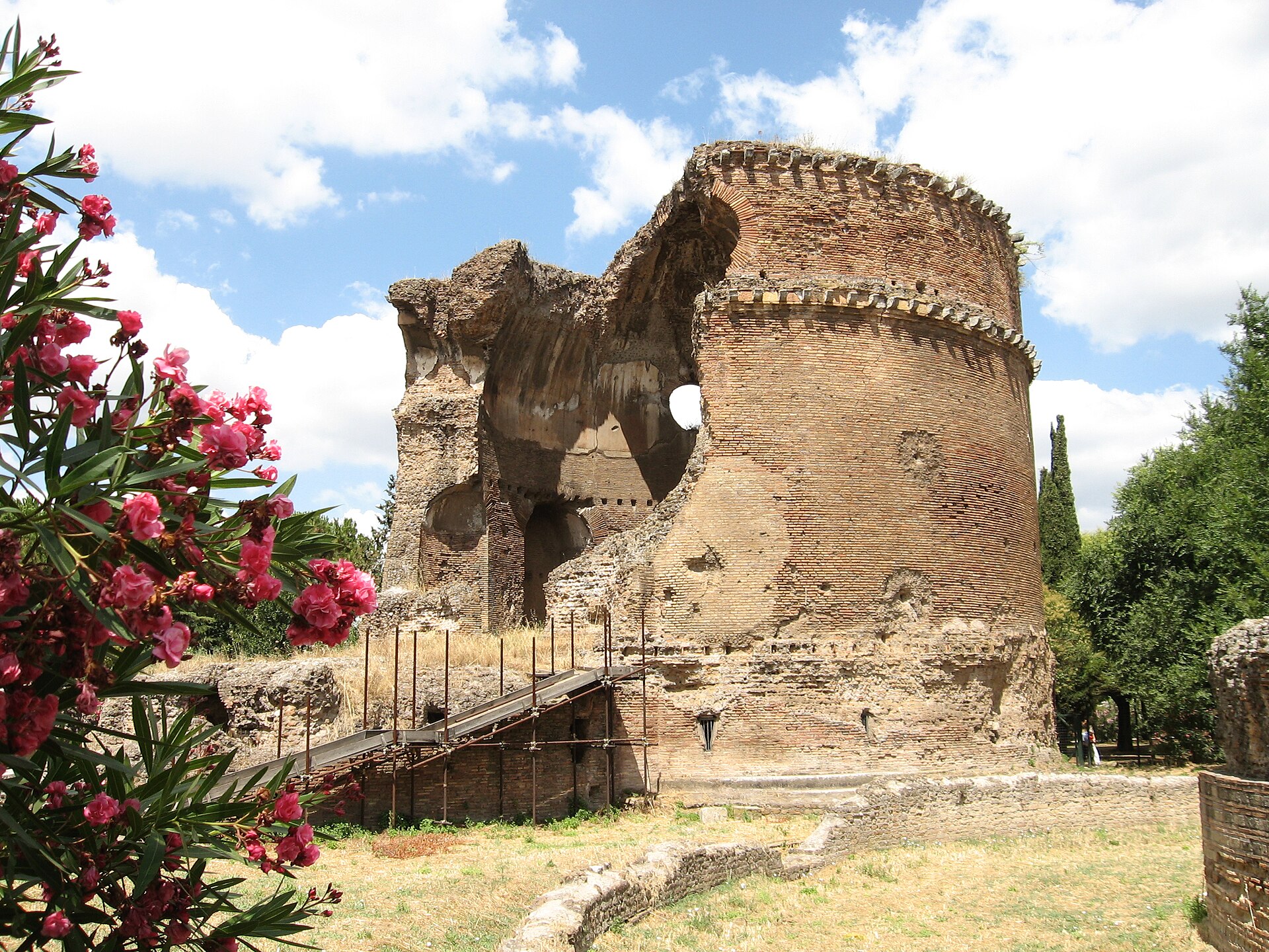
Villa Gordiani
Rzym
Villa Gordiani is a historic site in Rome that preserves several ancient Roman remains. It is traditionally identified with the villa of the Gordian imperial family, giving the place a clear link to the city’s imperial past. For visitors, it offers a short, quiet walk among archaeological traces. Na miejscu można liczyć przede wszystkim na: ancient Roman remains scattered across the site, which let you see the area as an archaeological landscape rather than a single monument the traditional connection with the Gordian imperial family, an important detail for understanding the historical identity of the villa a calm setting in Rome that suits a brief visit focused on history and a gentle stroll If you visit, it is worth wearing comfortable shoes, since this is best enjoyed as an easy walk with time to look around the ruins. It is a good choice for travelers interested in Roman history and for anyone looking for a low-key stop in the city.
-
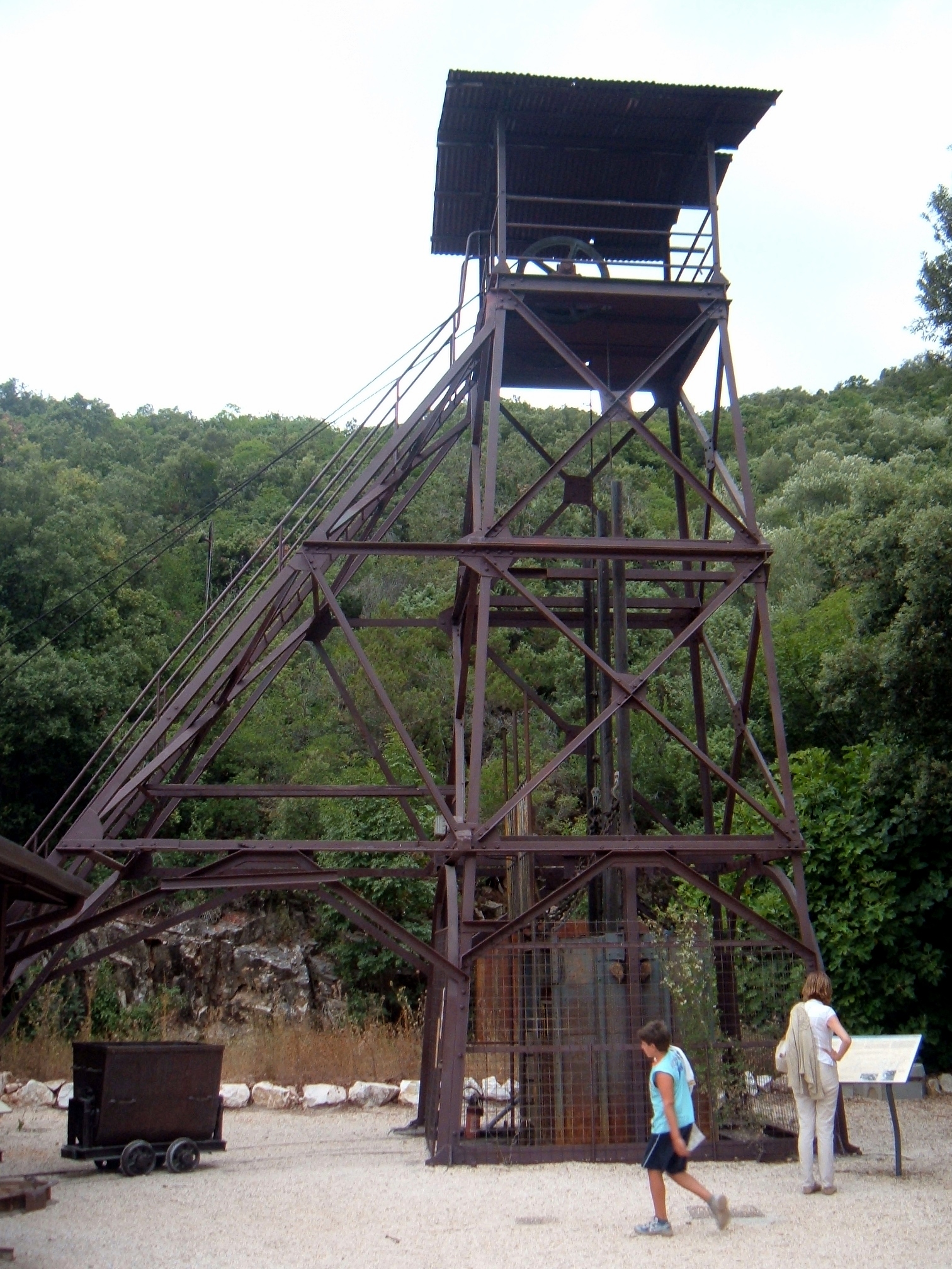
Parco Archeominerario di San Silvestro
Campiglia Marittima
Parco Archeominerario di San Silvestro is a park in Campiglia Marittima, in Tuscany, Italy. It was created after the excavation of the castle of Rocca San Silvestro, and the site includes a protected natural area of local interest in the Tuscany region, established in 1995. It is also part of the Val di Cornia parks, making it a good place for a short visit that combines history and nature. Na miejscu można liczyć przede wszystkim na: the remains connected with the excavations of Rocca San Silvestro, which explain the park’s archaeological background a protected natural area of local interest, established in 1995, where the landscape is part of the experience its role within the Val di Cornia parks, which places it in a wider network of sites to explore in the area For a visit here, comfortable shoes are a good idea, especially if you want to walk around the archaeological and natural areas at an easy pace. It works well as a calm outing for travelers who enjoy places where local history and the surrounding landscape are closely linked.
-
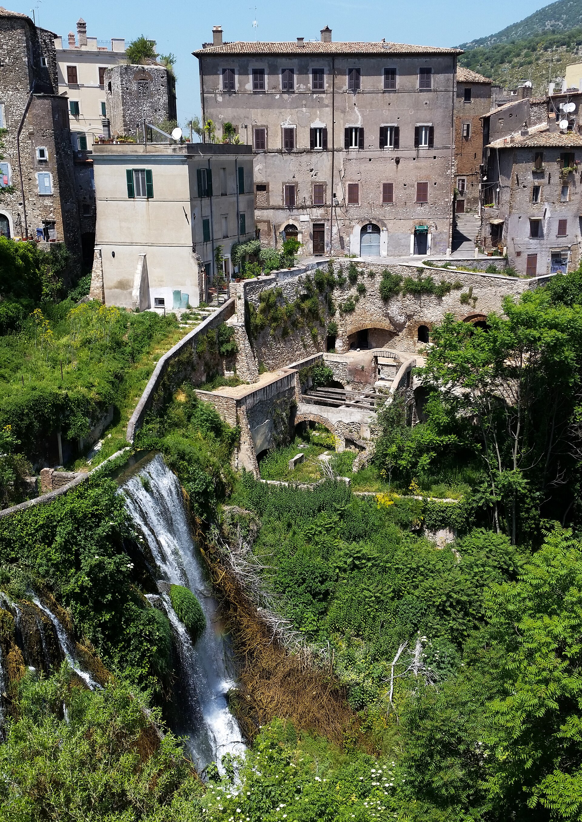
Villa Gregoriana
Tivoli
Villa Gregoriana is a park in Tivoli, Italy, set at the base of the city’s ancient acropolis. It is known for its dense woodland, dramatic gorges, and waterfalls, with paths that make it easy to explore the area on foot. For visitors, it offers a scenic walk through nature and historic landscape. Shaded woodland trails wind through the park and connect its main viewpoints and landmarks. The route leads to the small circular Roman Temple of Vesta, one of the site’s notable historical features. You can also reach the caves of Neptune and the Sirens, as well as the Great Waterfall, all part of the gorge-and-cascade system. Bring comfortable shoes, as the paths invite a proper walk and the terrain is best enjoyed at an unhurried pace. It is a good choice for travelers looking for a calm outing that combines greenery, rock formations, and a touch of ancient history.
-

Cape Miseno
Bacoli
Cape Miseno is the rocky headland closing off the Gulf of Naples to the west, right next to the small town of Bacoli in the Campania region. It marks the southernmost tip of the Campi Flegrei (Phlegraean Fields) area and forms the natural boundary between the Gulf of Naples and the Bay of Pozzuoli. Where exactly is Cape Miseno? The headland sits at the northern edge of the town of Miseno, part of the municipality of Bacoli. On one side lies the open Tyrrhenian Sea, on the other the calmer waters of the Bay of Pozzuoli. This position gave the cape strategic importance since antiquity, as it guarded the entrance to one of the most important ports of the Roman world. Why does this place matter historically? Miseno takes its name from the Classis Misenensis, the Roman imperial war fleet based here — one of only two main fleets of the empire, the other stationed at Ravenna. The harbor at the foot of the cape was a hub of Roman naval power on the Tyrrhenian coast for centuries. It was from this fleet that Pliny the Elder commanded operations in 79 AD, the year Vesuvius erupted; his death while observing the eruption up close, later recorded by his nephew Pliny the Younger, permanently linked these waters to one of antiquity's most famous natural disasters. What will you see on the trail and at the lighthouse? At the very top of the cape stands the Capo Miseno Lighthouse (Faro di Capo Miseno), a landmark visible from a distance that still guides ships along this stretch of coast. The path leading up the headland is one of the more popular walking routes around Bacoli: a rocky ridge, dense Mediterranean scrubland, and steep descents toward the sea. The climb is rewarded with one of the widest panoramas anywhere on the Gulf of Naples — on a clear day you can take in the city of Naples and Vesuvius on one side, and the island of Ischia on the other. When is the best time to visit, and how do you get there? Early morning or late afternoon are the best times for the walk, both for the milder temperatures and for the light, which brings out the colors of the bay and the islands on the horizon at those hours. Bacoli lies within the Campi Flegrei area, well connected to Naples and nearby Pozzuoli, with local roads leading toward the cape. It's worth setting aside a few hours for the visit — the climb, time at the top, and the way down make for a relaxed half-day outing. Frequently Asked Questions What is Cape Miseno? It is a headland at the western edge of the Gulf of Naples, within the municipality of Bacoli, known for its lighthouse and its historical link to the Roman war fleet based in the port of Miseno. Can you hike to the top of the headland? Yes, a popular walking trail leads to the top — rocky and partly steep, but manageable for anyone in reasonable shape, ending in a wide view over the bay. What can you see from the top of Cape Miseno? On a clear day, the panorama takes in the Gulf of Naples, Mount Vesuvius, and the island of Ischia. What is the connection between Cape Miseno and Pliny the Elder? Miseno was home to the Roman fleet commanded by Pliny the Elder at the time of the eruption of Vesuvius in 79 AD, an event later described by his nephew, Pliny the Younger.
-
Cascate Nardis
Giustino
Cascate Nardis is one of the most striking waterfalls in Trentino, tucked into Val di Genova near Giustino. Meltwater from the Presanella glacier plunges over a rock face more than 130 metres high at a steep 55–65 degree angle, drawing hikers and nature photographers alike to this corner of the Italian Alps. Where exactly is the waterfall? Cascate Nardis sits in Val di Genova, a valley adjoining Val Rendena, at an elevation of roughly 921 metres above sea level. It's one of several scenic highlights along a valley shaped by glacial erosion, framed by rocky walls that channel the meltwater flowing down from the Presanella massif. How do you get to Cascate Nardis? The easiest starting point is Giustino, from where a road runs deep into Val di Genova. The valley connects well to Pinzolo and Madonna di Campiglio, both popular bases for visitors exploring the Brenta Dolomites and the Adamello-Presanella group. From the roadside parking area, a short and clearly marked footpath leads to the viewpoints. Sturdy footwear is worth packing — spray from the falling water keeps the nearby rocks damp and slippery. What will you see there? The centrepiece is the fall itself: meltwater from the Presanella glacier breaks over a series of rock steps, producing a churning, foaming cascade visible from several points along the trail. The surroundings are classic glacial-valley scenery — steep slopes, bare rock faces and dense mountain vegetation that turns a vivid green in summer, contrasting sharply with the white spray of the falls. The spot is popular with photographers chasing long-exposure shots and with families looking for a short but rewarding walk. When is the best time to visit? Late spring and summer are the best months, when melting snow and ice from the Presanella glacier keep the waterfall running at full strength. During the winter months access is effectively cut off by the climate conditions in this part of the valley — snow and ice close the trail, and the flow itself weakens as the glacial feed freezes. Flow tapers off again in autumn, so aim for a visit between June and September to catch the falls at their most powerful. Who is this destination for? Cascate Nardis works both as a quick, easy walk with a spectacular payoff and as the first stop on a longer hike deeper into Val di Genova. The valley continues on toward further trails into the Adamello-Presanella massif, so the waterfall can double as a warm-up for a more ambitious day in the mountains. Frequently asked questions How tall is the Cascate Nardis waterfall? The water drops more than 130 metres down a rock face inclined at 55–65 degrees, making it one of the steepest cascades in Val di Genova. Can you drive close to the waterfall? Yes — a road runs from Giustino into Val di Genova to a parking area, from which a short footpath leads to the viewpoints. Can the waterfall be visited in winter? No — winter access is limited or impossible due to snow and ice, and the flow drops significantly during the colder months. Where does the water in the waterfall come from? It's fed by meltwater from the Presanella glacier, so flow is strongest from late spring through early autumn.
-
Panoramic loggia
Ischia
Panoramic Loggia is one of the viewing stops inside Castello Aragonese, the castle perched on its own rocky islet right beside Ischia Ponte. Facing northwest, the loggia opens onto an unbroken view stretching from Ischia Ponte across to the port of Ischia town. On clear days the outline of the mainland mountains is visible far along the horizon. The castle sits on a volcanic outcrop at the northern edge of the Gulf of Naples, linked to the main island of Ischia by a causeway. That elevated, open position is exactly why the lookout points scattered through the complex — the Panoramic Loggia among them — rank among the most visited spots on a walk through the fortress. How do you get to the Panoramic Loggia? The loggia sits inside Castello Aragonese, reached by crossing the causeway that connects the castle islet to Ischia Ponte. Visits follow a marked tour route, and the Panoramic Loggia appears as one of its numbered stops (stop 24 on the official itinerary), so there's no need to hunt for it — just follow the signage laid out across the grounds. Getting around the site involves steep stretches and a good number of steps, so comfortable shoes and an unhurried pace are worth planning for. What will you see from the loggia? The view itself is the main draw. From the terrace, the panorama takes in Ischia Ponte — the town's old fishing quarter with its distinctive waterfront buildings — and the harbour where boats and ferries dock. Because the loggia faces northwest, the light on the water and coastline shifts noticeably through the day, changing the mood of the scene. On days with good visibility, the horizon stretches all the way to the mountains on the mainland, adding depth to the landscape and giving a real sense of the bay's scale. The loggia is one piece of a larger castle complex that also includes a cathedral, a former convent, and other lookout points, so it's worth treating it as one stage in a longer walk across the historic hilltop. When is the best time to visit? Early morning or late afternoon are the most comfortable times to come, with milder temperatures and better light for photos. At midday, especially in summer, the stone grounds of the castle heat up quickly and shade is scarce. Clear, cloudless days offer the best chance of spotting the mainland mountains on the horizon, so it's worth checking the forecast before heading over. Frequently asked questions Is the Panoramic Loggia a separate paid attraction? No — it's a stop along the standard visit to Castello Aragonese, included in the general admission ticket to the castle grounds. Is the view accessible year-round? Yes, the loggia is part of the permanent tour route, though how far you can see toward the mainland mountains depends on the weather and is best on clear days. Is the walk to the loggia difficult? The route crosses uneven ground and stairs, so wear comfortable footwear; visitors with limited mobility should expect some challenges. What else is worth seeing nearby? The loggia sits alongside other stops on the castle tour, including the cathedral and the former convent, making it a natural part of a longer visit to the whole Castello Aragonese complex.
-
Spitzknotto
Gallio
Spitzknotto is a rock outcrop on the edge of Stoccareddo, a small hamlet within the municipality of Gallio on the Asiago plateau (Altopiano di Asiago). Locally the site is also known as Spizegonoto, and it is considered one of three mysterious "altars" scattered across the plateau. What is this place? At the top of the outcrop, the rock splits into flat, stratified layers that form a surface resembling a natural table or altar. According to local researchers, including historian Giancarlo Bortoli, this shape is what led ancient communities living on the plateau to use Spitzknotto for ritual purposes, possibly connected to the worship of a deity with Germanic traits associated with the goddess Freia. This tradition is sometimes linked to the Cimbri, a population that settled the surrounding villages for centuries. Bortoli labeled Spitzknotto the "Third Altar" of the plateau. Together with Altarknotto (above Rotzo, to the west) and Hanepos — also known as the "devil's anvil," located in Marcesina to the north — it forms what locals call a magic triangle of three rock cult sites spread across the Altopiano di Asiago. Spitzknotto occupies the eastern point of this triangle. Legends and local memory For generations of children in Stoccareddo, Spitzknotto has been a place that stirred both fear and fascination. Local stories told of gnomes and other mysterious creatures hiding within the crevices of the rock, giving the site its occasional nickname, the "citadel of gnomes." For decades the place fell into relative obscurity, until local history enthusiasts, Bortoli among them, rediscovered and documented its significance for the surrounding community. How to get there? Spitzknotto sits right next to Stoccareddo, one of the frazioni of the municipality of Gallio, in the heart of the Sette Comuni plateau in the province of Vicenza. The surrounding landscape is typical of the Altopiano — gentle hills, conifer forests and rocky outcrops, well known to hikers, cross-country skiers in winter, and mountain bikers in summer. The site's approximate coordinates are 45.877, 11.617. What else is worth seeing nearby? A visit to Spitzknotto pairs well with a walk through Stoccareddo itself, and — for those interested in the theme of rock altars — with a trip to nearby Altarknotto above Rotzo. The whole Altopiano di Asiago area is known for its history tied to Cimbri settlement as well as numerous First World War remains, making it an interesting destination for visitors combining nature and history. When to visit? The best period to visit runs from late spring to early autumn, when the plateau's trails are dry and easily accessible. In winter the area turns into cross-country skiing terrain, but reaching the rock directly can be more difficult due to snow cover. Frequently asked questions What is Spitzknotto? It is a rock formation in Stoccareddo di Gallio, considered a former natural altar likely used for ritual purposes by communities that once inhabited the Asiago plateau. Where does the name "Third Altar" come from? The label was coined by historian Giancarlo Bortoli, who grouped Spitzknotto with two other rock altars on the plateau, Altarknotto and Hanepos, together forming a so-called magic triangle. Are there any legends tied to Spitzknotto? Yes — local stories told children in Stoccareddo about gnomes hiding in the rock's crevices, which is how the site earned the nickname "citadel of gnomes." How should I plan a visit? Combine a short walk to Spitzknotto with a visit to Stoccareddo and the surrounding trails of the Sette Comuni plateau, ideally between May and October.
-
Lago di Doberdò
Doberdò del Lago / Doberdob
Lago di Doberdò is a small but geologically fascinating karst lake sitting right at Italy's eastern edge, within the municipality of Doberdò del Lago (Doberdob) in the Province of Gorizia, Friuli-Venezia Giulia. It occupies the westernmost rim of the Karst plateau (Carso), just a few kilometers from the Slovenian border. The lake takes its name from the neighboring village, and it stands as one of the more distinctive examples of karst hydrology in this part of Europe. What kind of lake is it? Geologically, Lago di Doberdò is a sinkhole — a depression formed where water has dissolved the limestone bedrock over time. This is a classic feature of the Karst plateau, where water moves freely through fissures and underground channels rather than flowing on the surface. As a result, the water level in lakes like this one can fluctuate depending on rainfall and the behavior of the underground drainage system, making Doberdò as much a subject of scientific curiosity as a scenic stop. How do you get there? The lake sits right next to the village of Doberdò del Lago, a short drive from Gorizia and close to Monfalcone. That makes it a convenient stop for anyone traveling between Trieste and Gorizia, or exploring the Italian-Slovenian border area more broadly. Local roads crossing the Karst plateau connect the area well, and the village itself serves as the natural starting point for visiting the lake and its surroundings. What's there to see? The main draw is the karst landscape itself — the stony, distinctive terrain of the Carso plateau, out of which the lake emerges as an unexpected patch of green and blue. The lake's coordinates (roughly 45.83°N, 13.56°E) place it squarely in the border zone where the Italian landscape blends into the Slovenian Kras. For anyone interested in geology or nature, it's a chance to see a textbook sinkhole lake up close — a phenomenon that's rarely this accessible. When should you visit? Because of its karst nature, the lake's appearance and water level can vary noticeably with the seasons and with rainfall. It's worth planning a visit with that in mind and treating the lake as a living, changing landscape rather than a fixed postcard view. Spring and autumn tend to be the most comfortable times to explore the Italian-Slovenian border region on foot. Frequently asked questions Where exactly is Lago di Doberdò located? In the Province of Gorizia, Friuli-Venezia Giulia, on the western edge of the Karst plateau, within the municipality of Doberdò del Lago, close to the Slovenian border. Where does the lake's name come from? It's named after the nearby village of Doberdò del Lago (Doberdob in Slovenian), next to which it lies. How is a karst lake different from a regular lake? It forms in a sinkhole carved into limestone bedrock, and its water level can change with rainfall and underground channel activity — a typical trait of lakes on karst terrain like the Carso plateau. Can Lago di Doberdò be visited as a day trip? Yes — its proximity to Gorizia, Monfalcone, and the Slovenian border makes it easy to combine with other stops along the Italian-Slovenian borderland.
Earn badges for the places you visit
Download NextOnTrip, discover new places and check off your trails.