About this place
Vlčí hřeben is an elongated mountain ridge in the western Krkonoše (Giant Mountains), rising roughly 3 km east of Rokytnice nad Jizerou on the Czech side of the range. Its highest point reaches close to 1,140 metres above sea level, and the ridge forms a natural landmark separating the valleys around Rokytnice, making it one of the defining features of this part of the Western Sudetes.
What does the ridge look like?
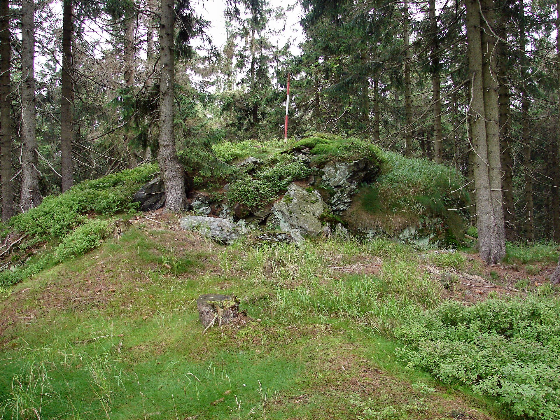
Vlčí hřeben has a distinctly split character. Its southern section is wide and fairly flat, making for easy walking, while further north the terrain narrows and turns rocky, eventually forming a sharp, stony crest. The whole ridge is covered in dense spruce forest, so open views are scarce — the one exception is a small clearing between the northern and middle summits, which is the best (and really the only) spot to stop and take in the surroundings before heading back into the trees.
How do you get there?
Most hikes start from Rokytnice nad Jizerou, with trails heading east into the massif. The northern end of the ridge drops down to a saddle known as Pod Dvoračkami, above which stands the well-known Dvoračky mountain chalet — a popular rest stop and a useful landmark for anyone exploring this part of the Krkonoše. The southern end connects, via another saddle, to Preislerova bouda hill (1,035 m), forming a continuous mountain chain together with the main ridge. Nearby, about 1.7 km northwest of the main summit, sits the Votočka mountain hut, another option for a stopover or an overnight stay while exploring the area.
What should you know before heading out?
Given the forested, uneven nature of the trail, sturdy trekking footwear is a good idea — the rocky, occasionally steep northern crest demands more attention than the gentler southern stretch. The ridge works well as part of a loop connecting several points in the area — Rokytnice, the Dvoračky chalet, and the Votočka hut — which makes it easy to plan a full-day outing without retracing your steps. It's also worth noting that the name "vlčí" (wolf) echoes the ridge's old German name, Wolfskamm, a reminder that this area was once considered wild and rarely visited.
Who is this hike for?
Vlčí hřeben suits hikers looking for a quiet, wooded walk away from the crowds, rather than a trail promising sweeping panoramas at every turn. It's a good pick for anyone who enjoys the calm of a spruce forest and wants to explore a lesser-known corner of the Krkonoše, and who doesn't mind a longer stretch of uneven, rocky terrain along the northern section.
Frequently asked questions
How high is Vlčí hřeben? The ridge's highest point reaches close to 1,140 metres above sea level.
Are there any views from the ridge? Rarely — most of the terrain is covered in dense spruce forest, and the only real opening is a clearing between the northern and middle summits.
Where's the best starting point for the trail? Rokytnice nad Jizerou, about 3 km west of the ridge, is the most convenient starting point.
Is there anywhere to stay nearby? Yes — two mountain chalets serve the area: Dvoračky at the northern end of the ridge, and Votočka northwest of the main summit.
Nearby places

Earn badges for the places you visit
Download NextOnTrip, discover new places and check off your trails.