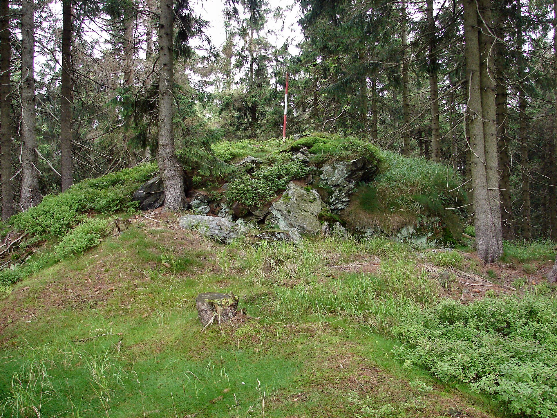
About this place
Preislerův kopec is a summit in the western Giant Mountains (Krkonoše), located within the municipality of Jablonec nad Jizerou, east of the town of Rokytnice nad Jizerou. Standing at 1,035 metres above sea level, it forms the southernmost peak of the Vlčí hřbet ridge.
Where is Preislerův kopec located?
The peak sits roughly 1 km north of the hamlet of Rezek and 3 km east of Rokytnice nad Jizerou, in the Semily district of the Liberec Region. Together with the three-topped Vlčí hřeben further north, it makes up the mountain chain known as Vlčí hřbet. Its approximate coordinates are 50.7134°N, 15.5150°E, and the nearest neighbouring summits — Vlčí hřeben J2 (1,119 m) and Vlčí hřeben J1 (1,124 m) — lie 1.3 km and 1.7 km away along the same ridge.
How do you get there?
Two marked hiking trails circle the entire Vlčí hřbet ridge, including Preislerův kopec, running between the hamlet of Rezek and the saddle below Dvoračky. A yellow-marked path crosses the western slope, while a green-marked one runs along the eastern side. This is a standard hike that requires no special equipment and suits walkers of average fitness, though it is not suitable for wheelchairs or visitors with limited mobility. There is no cable car or lift in the area, so reaching the summit means walking the whole way. Rokytnice nad Jizerou and the Rezek hamlet are the usual starting points for hikers.
What will you find on the summit?
Like the rest of the Vlčí hřbet ridge, Preislerův kopec is covered by dense spruce forest, which means the summit is largely without panoramic views. A geodetic survey point sits on the summit rock — a common feature on many of the Krkonoše's lesser-known peaks that once formed part of the region's triangulation network. There is no mountain hut or catering facility at the top, making it a destination for quiet forest hiking rather than a scenic lookout or a fully serviced tourist stop.
The peak also attracts hikers working through regional peak-bagging lists such as "Tisícovky Krkonoš" (the Krkonoše's thousand-metre summits) and the broader "Sudeten Crown" challenge, which covers the highest points across the entire Sudetes range. For these hikers, Preislerův kopec is simply one checkpoint among many on the way to completing the list.
When is the best time to visit?
The months from May to October are the best window for hiking, when trails are dry and passable and the spruce forest looks at its most attractive. Winter conditions can make the route harder going, with snow cover and shorter daylight hours, though experienced hikers still visit the ridge outside the summer season. Since there are no views to speak of, it makes more sense to treat Preislerův kopec as one stop on a longer route across the Vlčí hřbet ridge rather than a standalone destination.
Frequently asked questions
How high is Preislerův kopec? The summit reaches 1,035 metres above sea level and is the southernmost peak of the Vlčí hřbet ridge in the western Giant Mountains.
Are there views from the top? No — the entire ridge is covered by dense spruce forest, so Preislerův kopec offers little to no panoramic outlook.
Which trails lead to the summit? Two marked trails circle the Vlčí hřbet ridge between the Rezek hamlet and the saddle below Dvoračky — a yellow-marked path on the western slope and a green-marked one on the eastern slope.
Is there any tourist infrastructure on the summit? No, there is no mountain hut or food service on site — the only notable feature is a geodetic survey point on the summit rock.
Nearby places

Earn badges for the places you visit
Download NextOnTrip, discover new places and check off your trails.