About this place
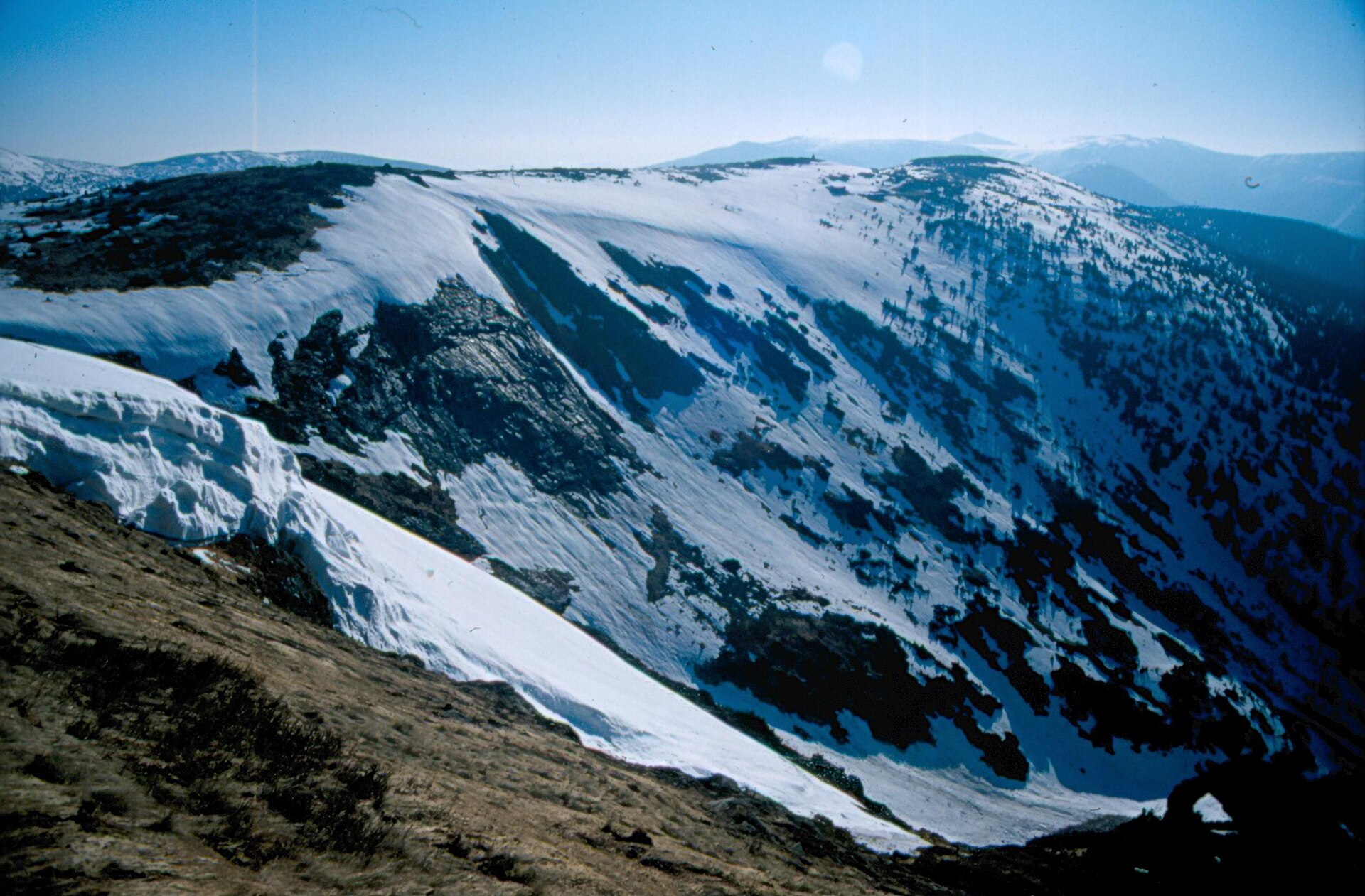
Harrachovy kameny is a rocky ridge in the Krkonoše Mountains near Dolní Mísečky, one of the most distinctive viewpoints on the Czech side of the range. Rising to 1,421 metres above sea level between the Kotel massif and Vrbatovo návrší, it ranks among the ten highest points in the entire Krkonoše.
What will you see there?
Harrachovy kameny isn't a single rock but a row of granite blocks stacked on top of each other, some reaching up to five metres in height. Formations like this appear where a layer of rock proved harder and more resistant to erosion than its surroundings, so it now juts above the ridgeline like a natural lookout tower. It's one of the most recognisable rock formations along the inner ridge of the Krkonoše, and the site sits within Zone I of the Krkonoše National Park (KRNAP) — the park's strictest protection zone.
The summit offers one of the widest panoramas in the whole range. Looking one way you can see the Kotel cirque with its Kotelní jáma hollow, the Jizera Mountains, and Pančavská louka meadow with the springs of the Elbe river, with the Polish mountain hut U Sněžných jam and the Violík peak visible on the horizon. The most impressive view, however, faces east, taking in nearly the full width of the Krkonoše massif: Šišák, Sněžka, Luční hora, Studniční hora, part of the Kozí hřbety ridge, and Černá hora.
How do you get there?
A red-marked trail connects Harrachovy kameny to Zlaté návrší, Kotelské sedlo, and Dvoračky, making it one of the more popular ridge routes in the Krkonoše. No climbing gear is needed — it's a standard hiking trail — but the exposed, high-altitude terrain means strong wind, sudden weather changes, and no shelter from sun or rain are all real possibilities, so proper clothing is worth packing even in summer. The most convenient starting points are around Dolní Mísečky or Vrbatova bouda, from where approach trails lead up toward the ridge.
Where does the name come from?
The name Harrachovy kameny comes from the House of Harrach (Harrach zu Rohrau), an Austrian aristocratic family of Czech origin that owned extensive estates in the Krkonoše for centuries, including forests and land around Harrachov. Like many other places in the region, the rocks take their name from a former landowning family rather than from any legend or feature of the landscape itself.
When is the best time to visit?
Late spring through summer is the best window for a hike to Harrachovy kameny, when the ridge trails are fully accessible and visibility tends to hold longest. Autumn can be just as striking visually, though days are shorter and weather turns more quickly. In winter, the route calls for experience in high-mountain hiking — the ridge is exposed to strong wind and drifting snow, making it unsuitable for beginners during that season.
Frequently asked questions
Is Harrachovy kameny hard to reach? The ridge trail itself requires no climbing skills — it's a regular hiking route. The main challenge is the weather and the exposed, high-altitude character of the terrain, especially outside summer.
How high is Harrachovy kameny? The formation reaches 1,421 metres above sea level, placing it among the ten highest points in the entire Krkonoše range.
Can you see Sněžka from Harrachovy kameny? Yes — the eastward view takes in Sněžka, Luční hora, and Studniční hora among others, making it one of the widest panoramas available from a single point in the Krkonoše.
Is the area protected? Yes, the site lies within Zone I of the Krkonoše National Park, the strictest protection zone, so visitors must stay on the marked trails.
Nearby places

Earn badges for the places you visit
Download NextOnTrip, discover new places and check off your trails.