About this place
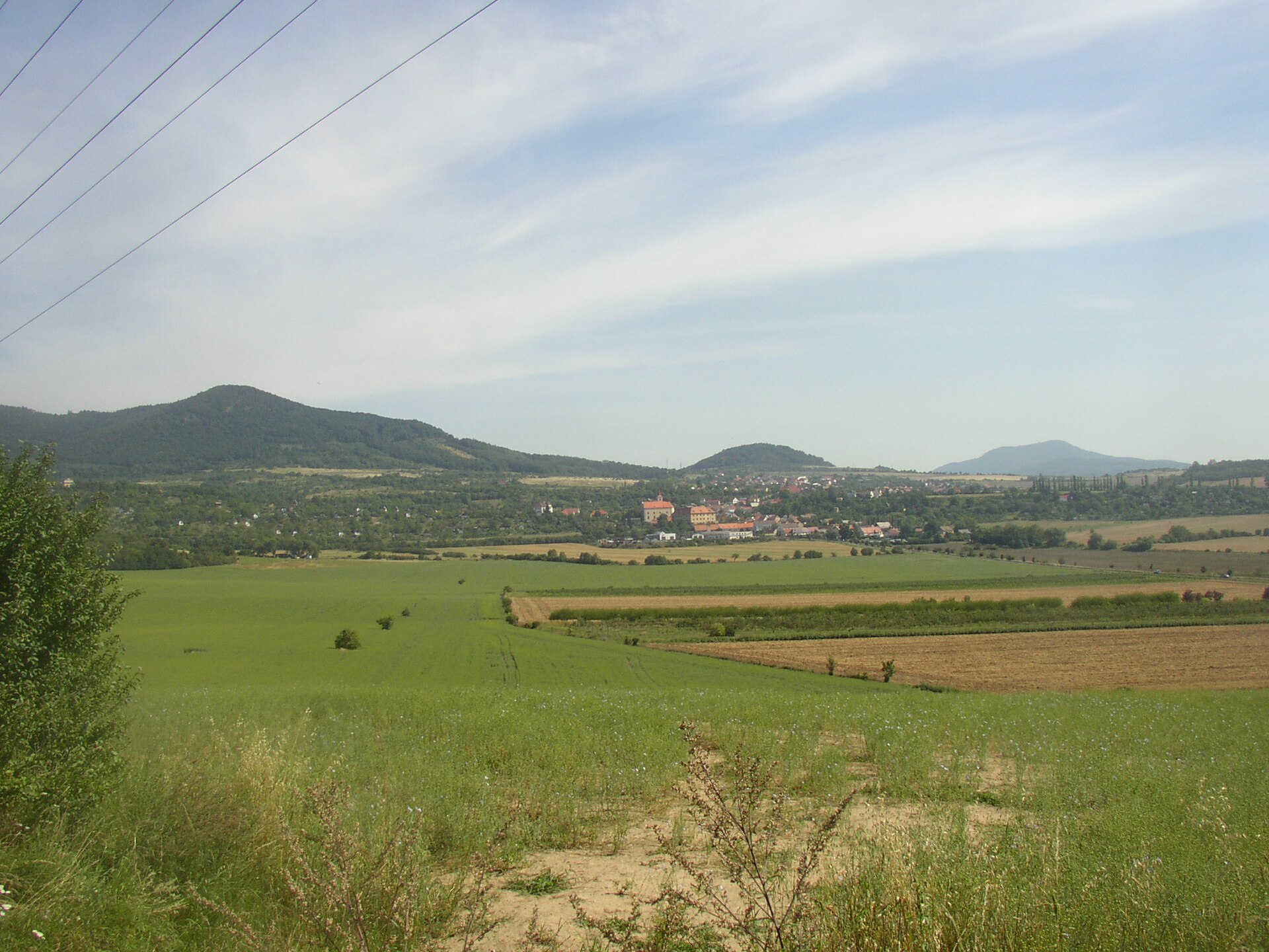
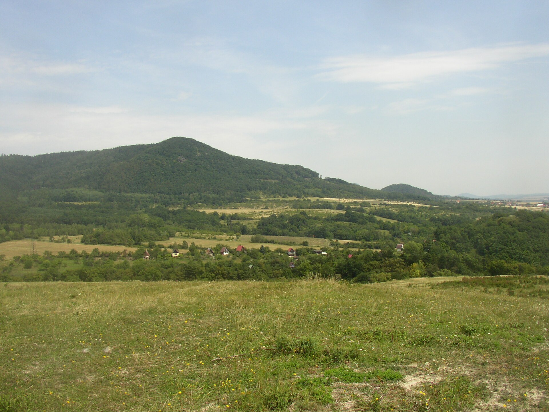
Trojhora is a basalt hill in the village of Chudoslavice, set right in the middle of the Bohemian Central Uplands (Český středohoří) near Litoměřice in northern Czechia. Its rocky summit rises to 451 m above sea level and belongs to the region's typical steep volcanic "islands" — landmarks visible from far away and popular with hikers looking for a big view without a long climb.
What kind of hill is this
Trojhora (German: Dreiberg) is the remnant of a former neo-volcanic magma body that was gradually exposed as the surrounding sedimentary rock eroded away. The higher summit is built of limburgite, while the lower ridge and the slopes below it consist of sodalitic trachyte. This mix of rock types is typical for the Bohemian Central Uplands, a landscape shaped by Tertiary-period volcanic activity, where softer sedimentary rock wore down faster than the harder volcanic cores, leaving behind steep, isolated hills across the countryside.
What the summit looks like
The hill's most recognizable feature is a rocky ridge roughly 150 meters long, whose columnar shapes resemble basalt "organ pipes" — the same kind of vertical rock structures known from other hills in the region (Panská skála being the most famous example). A marked hiking trail leads to the top, but because of the steep, rocky sections it is not recommended for anyone uneasy with heights. The reward is a wide view stretching in nearly every direction; on a clear day it reaches as far as Říp, one of the most recognizable landmark hills in the Czech landscape and a site tied to the legend of the mythical forefather Čech.
Chudoslavice and the surrounding hills
The village of Chudoslavice sits on Trojhora's southern foothills, and most of the hill itself falls administratively within its cadastral area, making the village the natural starting point for the climb. The surrounding countryside is dense with viewpoints and historical traces: to the north rises the hill Panna with the remains of a former castle, to the west stands the Dlouhý vrch massif, to the east Mlýnský vrch, and to the northeast the hill Kalich, topped by the medieval castle of the Hussite leader Jan Žižka. With several viewpoints and castle ruins clustered so close together, Trojhora is often combined into a single day hike with its neighboring summits — a popular loop route runs from Třebušín past two castle sites before finishing on Trojhora.
About 300 meters southwest of the summit, along the forest path toward Chudoslavice, stands a notable old beech tree known locally as "Buk pod Trojhorou" (the Beech under Trojhora) — one more reason to look around on the way up rather than just at the summit itself.
Who this hike suits
Trojhora is a good pick for hikers who like a short but rewarding climb with a real payoff at the top, without needing to set aside a full day. It also works well as one stop on a longer loop through the Bohemian Central Uplands that strings together several hills and castle ruins in a single outing.
Frequently asked questions
How high is Trojhora? The summit reaches 451 m above sea level.
Is climbing Trojhora difficult? The trail is marked, but it crosses rocky, steep sections of the ridge, so the hike is not recommended for anyone with a fear of heights.
What can you see from the top? On a clear day the summit offers a panorama of the Bohemian Central Uplands, with the distinctive hill Říp visible in the distance.
What else is nearby? Neighboring hills include Panna (with castle remains), Dlouhý vrch, and Mlýnský vrch, plus Kalich with Jan Žižka's castle; a notable old beech tree, "Buk pod Trojhorou," grows near the summit as well.
Where's the best place to start the hike? The village of Chudoslavice, on the hill's southern slopes, is the most convenient starting point.
Nearby places

Earn badges for the places you visit
Download NextOnTrip, discover new places and check off your trails.