About this place
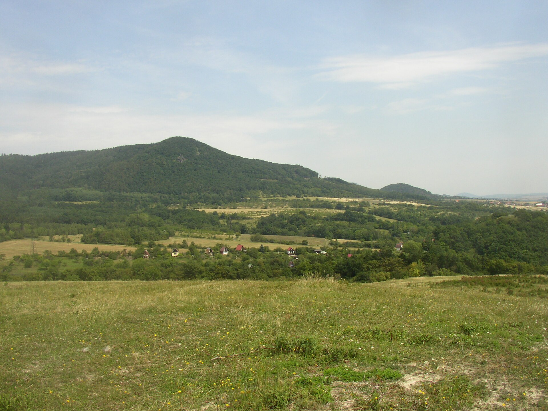
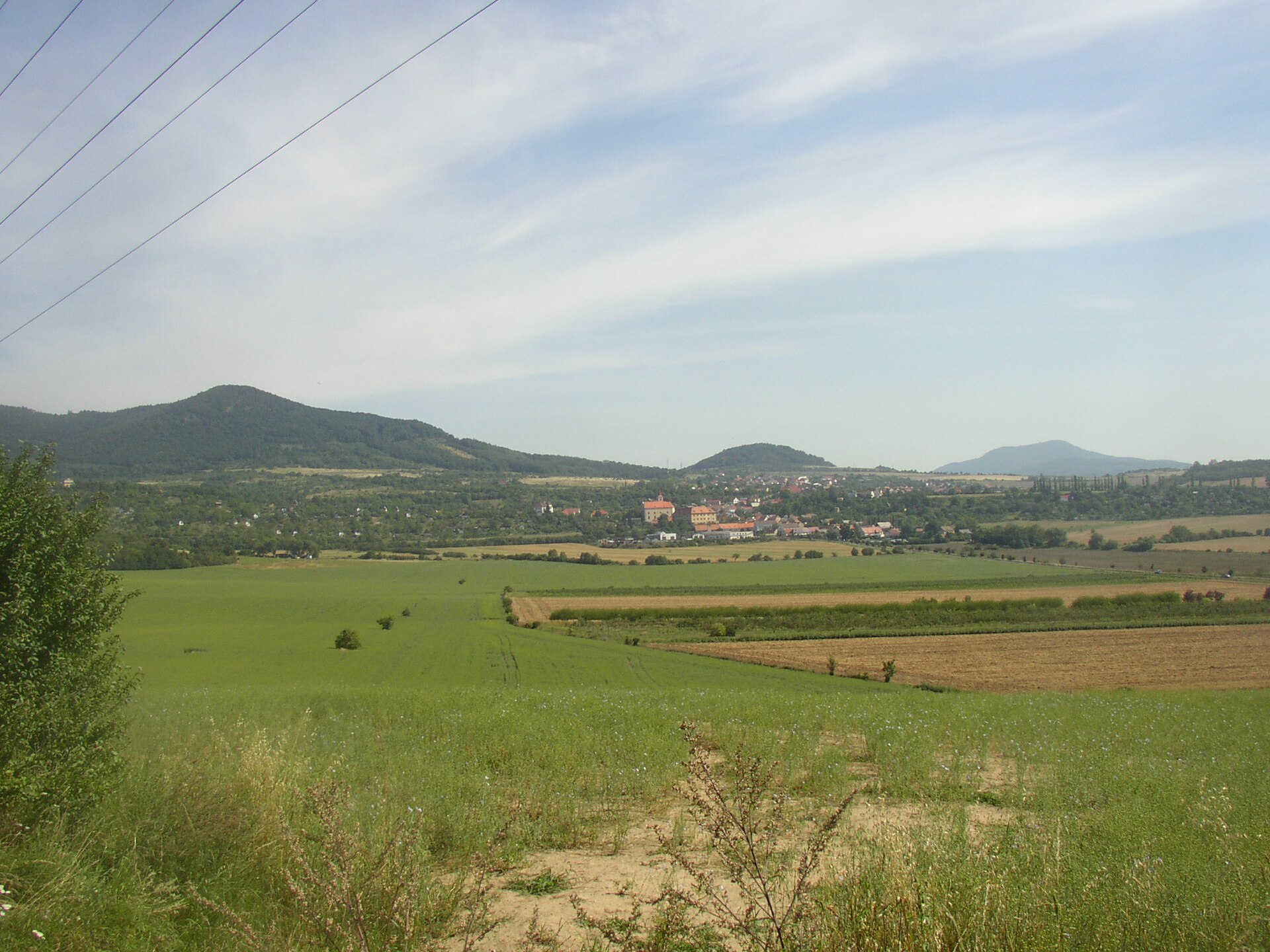
Dlouhý vrch is a large, mostly forested hill in the Czech Central Highlands (České středohoří), its slopes dropping straight down toward the village of Hlinná in the Litoměřice district. It forms one of the biggest rocky massifs in the region — a long north-south ridge that stands out above the surrounding valleys as a solid wall of woodland.
Where exactly is Dlouhý vrch?
The hill rises just a few kilometres north of Litoměřice, directly above Hlinná and its neighbouring hamlet Lbín, which belongs to the same municipality. Hlinná itself sits on the southern slopes of the Central Highlands, tucked below the Lysá hora, Hradiště and Varhošť massifs, in a valley where the Tlučeňský stream rises and carves out the scenic Tlučeňské údolí. The village was first recorded in 1337, and in 2023 it won a national "Village of the Year" award — a decent sign of how well the area has kept its character.
Dlouhý vrch itself isn't a single peak but a whole cluster of summits. The highest point, Vrchovina, reaches 676 metres, while the main summit called Dlouhý vrch sits around 655–658 metres. The complex also includes Špičák (608 m), Babinský (or Rýdecký) vrch (551 m), and the rocky group known as Panenský kámen (607 m). South of the main ridge rises Křížová hora (590 m), next to a distinctive rock spur called Krkavčí (or Kavčí) vrch (500 m).
Why does the terrain look like this?
The massif is built from tephrite and its associated volcanic tuffs, which is why it counts as one of the largest rocky masses of its kind in the whole Central Highlands. Part of the hill is protected as a nature reserve, safeguarding the remains of a sheet of olivine-nephelinite — an alkaline volcanic rock related to basalt. That harder rock resisted erosion better than the material around it, which is exactly why it still towers over the surrounding land today.
How do you get there, and which trails cross it?
No marked trail runs straight to the true summit, but two important routes meet nearby. A blue trail runs from Litoměřice over Dlouhý vrch — roughly 12.5 kilometres — then continues through Lbín and over Křížová hora toward Pohořany. A yellow trail links Proboštov directly across the hill to the Kostelní sedlo saddle, with another stretch running between Staňkovice and Skalice. On the slope, about a kilometre north of Lbín, once stood the isolated settlement of Nový Dvůr (Neuhof) — long abandoned, but still marked on maps as a landmark.
What can you see from the top?
The best view opens up from Krkavčí vrch, the rocky spur on the massif's southern edge. On a clear day it stretches toward Mělník, the Elbe valley and the Polabí lowlands, taking in Soví vrch, Kočičí hrad, Mostka, Litoměřice, Radobýl, Bídnice and Lovoš. Further out, the horizon runs from Košťálov all the way to Milešovka, the highest peak in the entire region.
When is the best time to visit?
Spring and autumn tend to offer the clearest air and the longest views from Krkavčí vrch. In summer, the forest covering most of the slopes keeps the walk shaded and pleasant even on hot days. In winter, snow can make the ridge harder to reach, but that also makes it a favourite for anyone looking for a quiet, uncrowded route.
Frequently asked questions
Is there a trail all the way to the top of Dlouhý vrch? No trail runs precisely to the highest point, but the blue and yellow trails cross close by, so reaching the general area of the summit through the forest is straightforward.
How far is Dlouhý vrch from Hlinná? The hill's slopes border directly on Lbín, part of the Hlinná municipality, so the walk usually takes under an hour on foot.
What's the highlight of a visit? The rocky viewpoint at Krkavčí vrch and the traces of the former Nový Dvůr settlement on the slope; for anyone interested in geology, the tephrite and nephelinite outcrops protected within the nature reserve are worth seeking out.
Is the area suitable for families with children? Yes — most routes follow forest and gravel tracks with gentle gradients and no technically demanding sections.
Nearby places

Earn badges for the places you visit
Download NextOnTrip, discover new places and check off your trails.