About this place
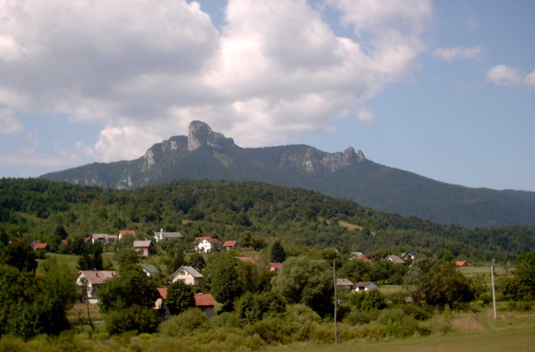
Lovnik is a 902-metre peak rising above the village of Stubica in the Vrbovsko municipality, in Croatia's Primorje-Gorski Kotar County. It draws hikers looking for a short but genuinely steep climb, and remains largely off the radar outside local hiking circles — which is exactly part of its appeal.
How do you get to Lovnik?
The easiest approach is to leave the Zagreb–Rijeka motorway (A6) at the Vrbovsko exit and head toward the village of Hajdine. That's where the only marked trail to the summit on the Vrbovsko side begins. The trailhead sits at roughly 591 metres above sea level, and the climb gains about 333 metres of elevation over the course of roughly 3 kilometres one way. Most hikers cover it in under an hour — around 49 minutes on average — on a route with an average gradient of about 15%.
What does the trail look like?
The path starts on a gravel road running through the settlements that line Lovnik's slopes — the old road to Rijeka once passed through Stubica, Hajdine and Presika right here. Along the way the route passes a telecommunications base station before turning into a proper forest trail, moving through mixed woodland, then coniferous stands, and back into deciduous forest closer to the top. The trail crosses under power lines a couple of times and runs over rocky ground in several stretches. Waymarking is generally reliable, though at a few key junctions hikers need to pause and actively look for the next marker.
What can you see along the way and at the top?
The real payoff isn't the summit itself but the views that open up during the ascent from Hajdine. Before reaching the top, hikers get sightlines to Smolnik, to Mirković with its visible transmitter mast, and to Bijela Kosa, Crna Kosa and Veliki Kozarac. The summit itself, by contrast, is rocky and wooded, so there's no sweeping panorama from the very top. Instead, what awaits is a small ritual familiar to Croatian hikers: a metal tube holding a logbook and a rubber trail stamp, with a second stamp carved directly into the rock beside it.
When is the best time to visit?
Given the short distance and the steep-but-manageable profile, Lovnik works as a half-day outing across most of the year, as long as conditions allow safe footing on the rockier sections. Spring and autumn bring out the most colour in the mixed forest on the slopes, and cooler temperatures make the climb more comfortable over the sustained 15% gradient.
Stubica itself is a small village of a few dozen residents, part of the Vrbovsko municipality and sitting right next to the hamlet of Hajdine — which makes it the natural jumping-off point for the hike.
Frequently asked questions
How high is Lovnik? The summit reaches 902 metres above sea level, and the trailhead sits at 591 metres, meaning the climb covers 333 metres of elevation gain.
Where does the trail to Lovnik start? The only marked route to the summit from the Vrbovsko side starts in the village of Hajdine, reached via the Vrbovsko exit off the Zagreb–Rijeka motorway.
How long does the climb take? The trail is about 3 kilometres one way, typically taking under an hour to complete, with an average gradient of around 15%.
Is there a view from the summit? The top itself is rocky and forested, so there's no panoramic view from the summit — the best sightlines, including toward Mirković's transmitter mast and Veliki Kozarac, come earlier, during the ascent from Hajdine.
Nearby places

Earn badges for the places you visit
Download NextOnTrip, discover new places and check off your trails.