About this place
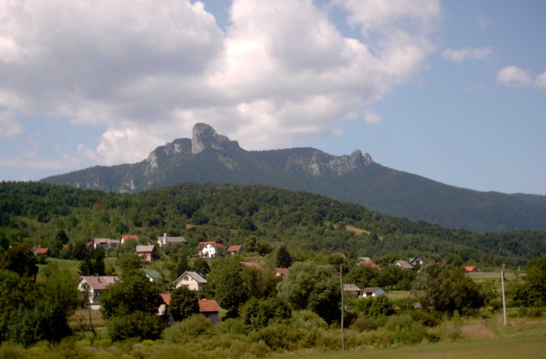
Debela kosa is a forested peak in Gorski Kotar, rising above the village of Stara Sušica in Croatia. The mountain sits on the southern edge of the Vrbovsko municipality, part of a cluster of summits over a thousand metres high that together form one of the most densely wooded corners of the region.
Where is Debela kosa located?
The peak reaches 1169 m above sea level and marks part of the natural border between the Vrbovsko municipality and neighbouring areas of Gorski Kotar. It shares this high ground with several other notable summits of southern Gorski Kotar — Bukovica (1253 m), Bijela kosa (1289 m), Mirkovica (1283 m) and Smolnik (1219 m). The whole ridge is covered in dense mixed forest, characteristic of Gorski Kotar as one of Croatia's greenest regions. Stara Sušica, administratively part of the Ravna Gora municipality, lies a few kilometres east of Ravna Gora itself, along the road connecting Kupjak with Vrbovsko — a route that follows an old 18th-century road whose construction began in 1732.
What is worth seeing nearby?
Stara Sušica carries a long history dating back to the 14th century. It was here that the Frankopan noble family once built a stronghold to defend Gorski Kotar against Ottoman raids — the village was struck three times during these incursions, in 1525, 1578 and 1585. Today the old manor building serves as an educational centre dedicated to Gorski Kotar's three large predators — the wolf, the bear and the lynx — all of which still roam the surrounding forests. Also worth a look is the Chapel of St Anthony of Padua, built in 1874 on the exact spot where an earlier church was burned down during the 1568 Ottoman raid. Debela kosa itself and the ridges around it remain largely untouched by tourist infrastructure, making the area appealing to those who value quiet forests and a chance to spot wildlife rather than marked hiking trails.
How to get there?
The most convenient way to reach Stara Sušica is via the local road connecting Kupjak, on the D3 route, with Vrbovsko, on the D42 — a road known as Ž5034, running through some of Gorski Kotar's most scenic countryside. From Ravna Gora, the municipality's main town, the village is only a few kilometres away. The summit of Debela kosa itself lies deep in the forests to the south, toward Vrbovsko, so a good regional hiking map and cautious route planning are essential given the mountainous, heavily wooded terrain.
When is the best time to visit?
Late spring, summer and early autumn are the best seasons, when the forests of Gorski Kotar are most accessible and daylight hours are long enough for extended walks. The region has a continental mountain climate, with cool nights even in summer, so warm clothing is worth packing regardless of the season. In winter the area can become difficult to access due to snow and a lack of maintained trails.
Frequently asked questions
How high is Debela kosa? The peak stands at 1169 metres above sea level, ranking among the higher summits of southern Gorski Kotar.
Are there marked hiking trails around the peak? The terrain around Debela kosa is densely forested and lacks developed tourist infrastructure, so visitors are advised to carry a map and, ideally, travel with someone familiar with the area.
What can be seen in Stara Sušica itself? The historic Frankopan manor, now an educational centre focused on wolves, bears and lynx, along with the Chapel of St Anthony of Padua from 1874.
Is the area suitable for families with children? The village of Stara Sušica and its educational centre are family-friendly, but venturing into the forest toward the Debela kosa summit requires good fitness and experience in mountainous terrain.
Nearby places

Earn badges for the places you visit
Download NextOnTrip, discover new places and check off your trails.