- Mines
Groeve De Nieuwe Keel
About this place
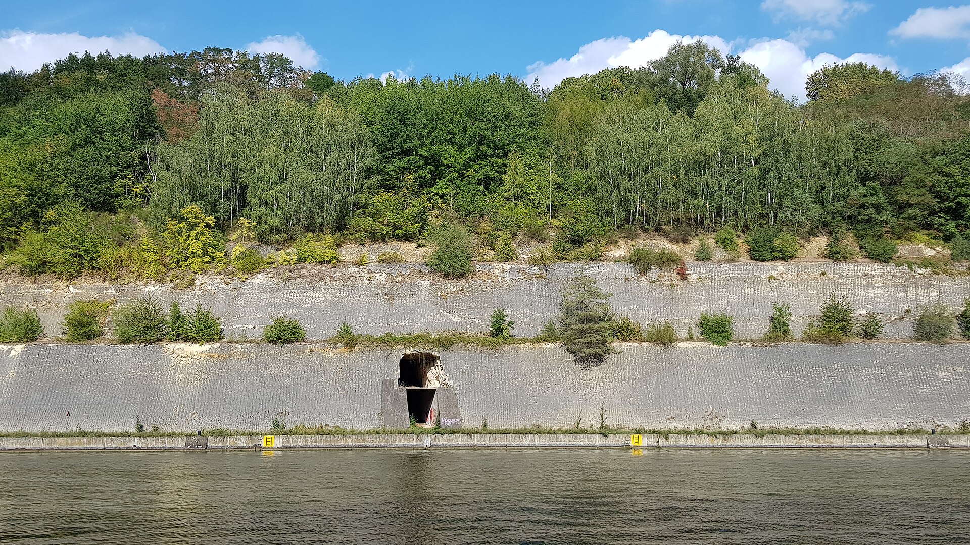
Groeve De Nieuwe Keel is a small, disused marl quarry cut into the flank of the Cannerberg hill next to the Albert Canal, right on the Belgian-Dutch border. Its entrance opens on the canal side near the village of Kanne in the municipality of Riemst, while the underground passages also extend beneath the Dutch municipality of Maastricht on the other side of the border — one of several Limburg quarries where the underground network quietly ignores the national boundary running above it.
What does the quarry look like inside?
The underground network consists of one main passage roughly 250 metres long, winding through several turns and bends as it runs into the hillside, with around ten shorter side passages branching off it, none longer than about 30 metres. That makes De Nieuwe Keel one of the more modest quarries in the region: the total mined area covers only about 0.3 hectares, far smaller than many of the larger marl quarries found nearby.
How did the quarry come about?
The passages were carved out while extracting limestone from the Maastricht Formation, specifically the Nekum Limestone layer, and in doing so the miners cut through the so-called Kanne Horizon, another distinctive geological marker of the area. Compared with older and much larger quarries nearby, De Nieuwe Keel was worked relatively late and stayed small in scale. It was a young quarry primarily mined for lime powder destined for industrial use rather than for large-scale building stone extraction.
A quarry with a military footnote
The tunnels were not originally dug for any military purpose, but their location gave them an unusual second life. The Cannerberg hill in which the quarry sits also houses an underground NATO headquarters, and the passages of Groeve De Nieuwe Keel came to serve that facility in a supporting role — functioning as an emergency exit, part of its drainage system, and a communication route linking to the site above. That combination of an ordinary industrial past and a Cold War-era military connection is what sets this small quarry apart from many of its neighbours.
Who is this place for?
Groeve De Nieuwe Keel appeals most to visitors interested in underground quarries, the history of marl mining in Limburg, or the lesser-known traces of Cold War military infrastructure scattered across the region. Given its modest size and sensitive layout, the quarry is generally visited as part of a guided tour rather than independent exploration, which allows visitors to safely see the passages while learning more about their industrial and military background from a knowledgeable guide.
Frequently asked questions
Where exactly is Groeve De Nieuwe Keel located? On the flank of the Cannerberg hill next to the Albert Canal, straddling the border between Riemst (Belgium) and Maastricht (the Netherlands), near the village of Kanne.
How large is the quarry? It covers about 0.3 hectares, with a main passage around 250 metres long and roughly ten shorter side passages.
What was mined here? Limestone from the Maastricht Formation's Nekum Limestone layer, used to produce lime powder for industry.
What is the quarry's connection to NATO? Its passages served as an emergency exit, drainage route, and communication link for the underground NATO headquarters built into the Cannerberg.
Nearby places

Earn badges for the places you visit
Download NextOnTrip, discover new places and check off your trails.