Coast in Croatia
A guide to 51 Coast in Croatia — with descriptions, photos and traveler visits from the NextOnTrip community. Locations spread across 42 cities and towns. Most visited by the community: Daksa Lighthouse, Lighthouse Vnetak, Oštri rat Lighthouse.
-
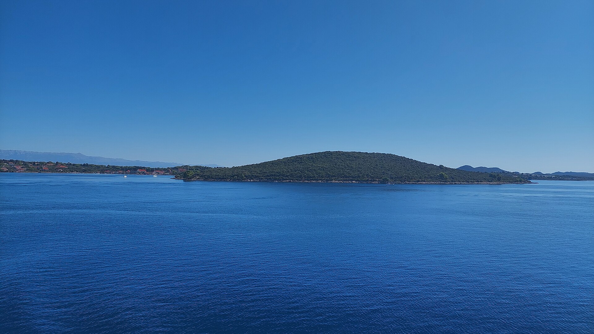
Ovčjak
Ugljan
Ovčjak is a small, wooded peninsula on the western coast of the island of Ugljan in Croatia, right next to Muline — the last village in the Ugljan municipality. It's a spot with two identities: a quiet mooring point for sailors and the starting stretch of a coastal walk leading to one of the island's finest beaches. Where exactly is Ovčjak? The peninsula sits on Ugljan's western shore, immediately adjacent to Muline, at roughly 44.1325°N, 15.0664°E. Muline itself is a small fishing village with a harbour and mooring spots, framed by pebble and gravel beaches and a network of coastal and inland paths used for walking and cycling. How do you get to Ovčjak? The usual route is by ferry or catamaran to Preko, Ugljan's main port with connections to Zadar, then onward by local road or bus to Muline. For sailors, Ovčjak is one of the go-to points along the island's coastline — the headland has long served as a natural shelter for boats looking for a calm spot to anchor. Walkers can pick the longer, scenic coastal route out of Muline, which runs directly across the Ovčjak peninsula; the walk takes around 30 minutes and ends at one of the most beautiful beaches on the island. What will you see there? The scenery is classic Dalmatian coastline: low pine groves reaching almost down to the waterline, small stony coves, and clear turquoise water. The headland itself has no built-up tourist infrastructure — its appeal lies in the quiet and the lack of crowds compared to busier beaches in high season. The seabed around this stretch of Ugljan, near headlands such as Ovčjak, is also valued by locals and divers as one of the more interesting underwater spots close to the island. When should you visit? Late spring (May–June) and early autumn (September to early October) are the best windows — pleasant temperatures, warm enough sea, and noticeably fewer people on the trails and beaches than in July and August. In summer, aim for an early morning or late afternoon walk to avoid the midday heat, since part of the coastal path runs through open, sun-exposed stretches. What else can you combine it with? Ugljan rewards slow travel. On the way from Muline or Preko, it's worth stopping in other coastal villages, trying the island's olive oil (Ugljan is known for its olive groves), and setting aside time for a longer walk or bike ride across the island's inland plateau, which opens up onto views over the Zadar Channel. Frequently asked questions Can you drive right up to Ovčjak? No paved road reaches the tip of the peninsula directly — you drive to Muline and continue on foot along the coast from there. Is it good for swimming? Yes, the area has pebble and gravel beaches with clear, calm water, especially outside the peak summer months. Can you anchor a boat at Ovčjak? Yes, the headland has long been a popular stopping point for sailors cruising along Ugljan's coastline. How long is the walk from Muline to the beach via Ovčjak? About 30 minutes one way, following the coastal path.
-
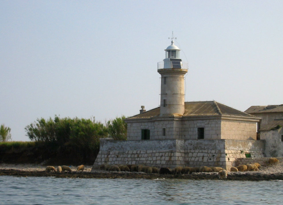
Lighthouse Vnetak
Grad Mali Lošinj
Vnetak Lighthouse stands on a rocky headland on the southern tip of Cres island, within the municipality of Mali Lošinj, right by the narrow channel separating Cres from Lošinj. It's one of the older maritime landmarks in this part of the Kvarner Gulf, a stone tower that has faced the open sea for close to 150 years. Where exactly is Vnetak Lighthouse located? The lighthouse sits on the Cres side of the strait, but administratively it falls within the City of Mali Lošinj, whose territory reaches beyond Lošinj island itself to cover the southern part of neighboring Cres, including the historic town of Osor. That's why a lighthouse geographically on Cres is grouped with Mali Lošinj attractions. Its coordinates are roughly 44.619°N, 14.236°E. When was the lighthouse built and by whom? Vnetak was constructed in 1875, during the period when the eastern Adriatic coast was under Austro-Hungarian administration. At the time, the empire was expanding a chain of lighthouses along the coast to support growing shipping traffic between Trieste, Rijeka, and ports further south. Vnetak served as one of the smaller, local navigation points in that network, guiding vessels through the narrow and often tricky channel between Cres and Lošinj. What does the lighthouse look like today? It's a modest stone structure, with a tower roughly 8 meters tall and a light originally mounted at a focal height of about 12 meters above sea level. The beam had a range of around 3 nautical miles, enough to guide smaller craft through the local strait. The light no longer functions as an active navigational aid, but the building itself has survived in solid condition and still carries the plain, weathered character typical of 19th-century Adriatic lighthouses. Can visitors reach and see the lighthouse? Vnetak sits away from main roads, on a rocky and sparsely populated stretch of coastline, so getting there usually means arriving by boat, kayak, or a longer walk or bike ride along local coastal paths. That isolation is part of the appeal — no crowds, just quiet and open sea views. The building is sometimes used as holiday accommodation, meaning it may be occupied by guests for parts of the year, but the surrounding headland remains open to explore from the outside. Why is this spot worth a visit? Vnetak draws mainly sunset watchers and travelers looking for an alternative to Lošinj's busier beaches. The channel it overlooks is known for clear water and calm conditions, making it popular with sailors and kayakers. It's also a convenient stop for anyone visiting the historic town of Osor on the same side of the channel, known for its ancient roots and its annual summer music festival. What can you combine with a visit to Vnetak? The area works well for a day trip that pairs several nearby highlights: the Osor bridge and old town, quiet coves suitable for swimming, and scenic paths along the southern coast of Cres. For sailors and paddlers, the lighthouse also serves as a natural landmark when entering the channel from the Lošinj side. Frequently asked questions Which island is Vnetak Lighthouse on? Technically on Cres island, but within the administrative boundaries of the City of Mali Lošinj, close to the channel linking the two islands. When was the lighthouse built? In 1875, during the period of Austro-Hungarian rule along the eastern Adriatic coast. Is the lighthouse still an active navigation aid? No, it no longer functions as an active light, though the structure remains in good condition. What's the best way to reach the lighthouse? By boat or kayak is easiest; alternatively, it can be reached on foot or by bike along local coastal roads.
-
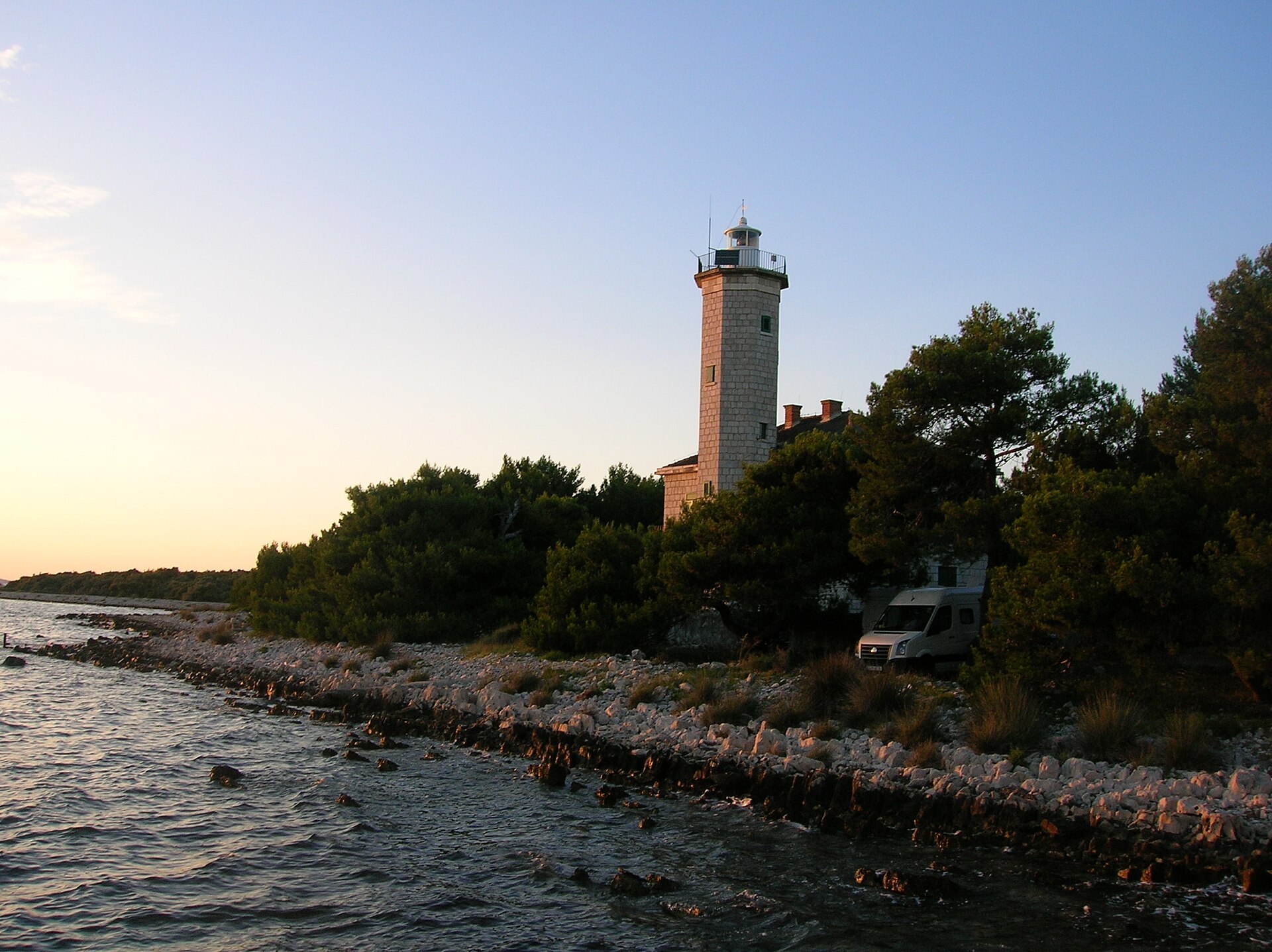
Vir Lighthouse
Općina Vir
Vir Lighthouse (Lanterna) stands on the northwestern tip of Vir island, within the municipality of Općina Vir in the Zadar region. This slender, octagonal stone tower has watched over the waters of the Zadar Channel for more than a century, and today it blends maritime history, distinctive architecture, and upscale accommodation under one roof. How old is the lighthouse? The tower was built in 1881 under Austro-Hungarian administration, at a time when the Dalmatian coast needed a denser network of navigational markers to keep pace with growing maritime traffic. It served for over sixty years before German forces destroyed it in 1944 during their withdrawal at the end of World War II. It was rebuilt in 1950, preserving the original octagonal silhouette that still defines it today. What role did it play during the war? Before its destruction, the lighthouse served a covert wartime purpose. It functioned as a support point for the anti-fascist resistance, helping maintain contact between partisan forces on the mainland and units stationed on the nearby island of Molat. That role is precisely why German troops targeted and destroyed it during their retreat from the region in 1944. What are its technical specifications? The tower itself rises 11 meters, while the light sits at a focal height of 21 meters above sea level. Its nominal range reaches 21 nautical miles, still making it a meaningful landmark for sailors navigating this stretch of the Adriatic coast. The adjoining rectangular building houses a ground floor and an upper floor, together totaling around 180 square meters. Can visitors tour it or stay overnight? The site now holds the status of a first-class cultural monument, reflecting its historical and architectural value. Following a thorough restoration, the building operates as a holiday villa known as Villa Lanterna, sleeping up to eight guests. It's a rare chance to spend the night in a structure that once guided ships safely along the Adriatic, all while enjoying privacy and open sea views from what used to be a working lighthouse. Where exactly is it located? The lighthouse sits on Vir island, which is connected to the mainland by a bridge, making it easy to reach by car, bicycle, or on foot from nearby towns. Its position on the headland gives the surrounding area sweeping sea views and notable sunsets, and walking along the coast toward the lighthouse is a popular activity among visitors to the island. Frequently asked questions When was the lighthouse on Vir built? It was built in 1881 under Austro-Hungarian administration and rebuilt in 1950 after wartime destruction. Can you stay at the lighthouse during a visit to Vir? Yes, after restoration the building now operates as the Villa Lanterna holiday villa, accommodating up to eight guests. What is the lighthouse's light range? Its nominal range is 21 nautical miles, with the light positioned at a focal height of 21 meters above sea level. Why is the lighthouse historically significant? During World War II it served as a communication point for the anti-fascist resistance linking the mainland to the island of Molat, which led German forces to destroy it in 1944; it now holds first-class cultural monument status.
-
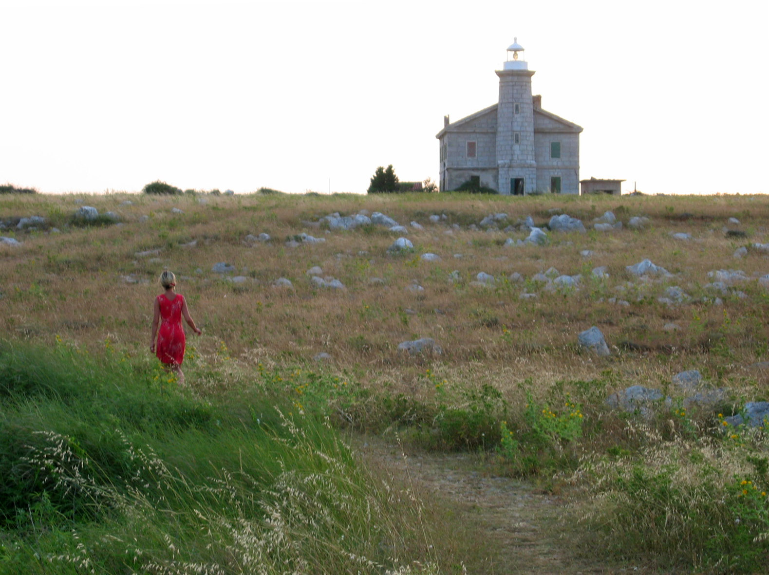
Lighthouse Trstenik
Punta Križa
Trstenik Lighthouse stands on a small islet of the same name in the Kvarnerić channel, close to the village of Punta Križa at the southern tip of the island of Cres in Croatia. Where exactly is Trstenik Lighthouse located? The lighthouse sits on its own islet, roughly midway between the southern tip of Cres and the northern end of the island of Pag, about 4.3 km from the Cres coastline. That central position within the Kvarnerić channel is precisely why the islet was chosen for a navigation light: ships sailing through this stretch of water needed a fixed reference point to warn of shallows and mark a safe course. The lighthouse's coordinates are 44.6686 N, 14.5781 E, placing it on open water well away from the built-up shoreline of Punta Križa. What is the history behind the lighthouse? Trstenik Lighthouse dates back to the Austro-Hungarian era, a period when the Adriatic coast saw systematic expansion of navigation lights to support the growing maritime traffic of the Habsburg monarchy. Like many lighthouses from that time, it was built to secure shipping at a critical point along the route — here, the middle of the Kvarnerić channel, where courses from Cres toward Pag and further south along the Adriatic converge. The lighthouse still performs its original function today, remaining one of the key landmarks for sailors navigating between the islands of the Kvarner region. How does it work and what does it look like? Trstenik Lighthouse emits a white light visible from a distance of 7 to 11 nautical miles, making it one of the farther-reaching navigation lights in this part of the Adriatic. The structure is described as a large, freestanding lighthouse, standing out clearly against the flat, uninhabited islet around it, which makes it easy to spot both by day and at night. Its form is typical of Adriatic lighthouses of the period, pairing a purely functional design with the plain, sturdy aesthetic common to 19th-century maritime structures. How can you reach Trstenik Lighthouse? Because the lighthouse sits on a separate islet, cut off from Cres by open water, there is no way to walk or drive there. The best way to see it up close is by boat or yacht along the Kvarnerić channel — a route popular with sailors exploring the waters around Cres, Lošinj, and Pag. From land, near Punta Križa, the lighthouse can be spotted on the horizon toward the open sea, especially in good visibility conditions. Travellers staying on southern Cres and interested in the region's maritime heritage can treat Trstenik Lighthouse as the destination for a short scenic boat trip, combining it with a visit to Punta Križa itself and the nearby coves. When is the best time to visit? The Adriatic sailing season, running mainly through the summer months, is the natural time to reach the islet by water, as calmer seas and longer daylight hours make organising a boat trip easier. Outside the season, the lighthouse can still be observed from the shore at Punta Križa, although conditions in the open channel tend to be more challenging for smaller boats. Frequently asked questions Can you go inside Trstenik Lighthouse? The lighthouse stands on a separate, uninhabited islet and functions as an active navigation aid, so it is not generally open to visitors — it is best admired from the water. How far is the lighthouse from Punta Križa? The lighthouse sits on an islet in the Kvarnerić channel, about 4.3 km from the Cres coastline, level with the island's southern tip. From which period does the lighthouse date? It was built during the Austro-Hungarian era, when a network of lighthouses was established along the eastern Adriatic to secure maritime traffic. How far can the lighthouse's light be seen? Trstenik Lighthouse emits a white light visible from 7 to 11 nautical miles, making it an important landmark for ships passing through the Kvarnerić channel.
-

Rat
Molunat
Rat (also known as Gora or Crna Gora) is a small, history-layered headland right next to Molunat, the southernmost settlement on Croatia's coast, in the Konavle municipality. Where is it and how do you get there? The headland is tied to the mainland by Metale, a narrow isthmus roughly 300 metres wide, and it separates Molunat's two harbours - the Small Harbour to the southeast and the Large Harbour to the southwest. Molunat itself sits about 40 km southeast of Dubrovnik and 20 km from Cavtat and Čilipi airport. A bus runs three times a day, and by sea it's 12 nautical miles from Cavtat and 18 from Dubrovnik. What will you actually see there? On the flat Metale plateau you can still spot the remains of a Roman-era cistern, uncovered during a 1973 excavation. Archaeologists recovered amphora and plate fragments, a piece of a black glass bracelet and a bronze ring carved with a serpent's head. The same dig exposed a rectangular building with an apse, a red-and-white mosaic floor and traces of a hypocaust (the Roman underfloor heating system) - coins of Marcus Aurelius dated it to the 2nd century AD. A short walk away, at a site called Mirine, ancient wall fragments are still visible, though that spot has never been formally excavated. The second chapter of Rat's history is medieval. The Republic of Dubrovnik bought this stretch of Konavle in 1419, and from 1468 onward - fearing Ottoman raids - it fortified the headland with gates on the east and west sides flanked by semicircular towers, gun ports built into the walls, and lime kilns to supply the construction. As early as 1451, Molunat was already recorded as a refuge for people fleeing the eastern part of Konavle, a place where the sick were quarantined and ships arriving from plague-stricken ports were watched. When should you visit, and what else is there to do? The climate is mild and Mediterranean, with warm summers cooled by the afternoon maestral wind - May to September is the best window. Around the headland, sheltered coves and two small islets offer clear, shallow water favoured by divers and anglers; Molunat has its own fishing cooperative and a diving club. Vegetation is classic Mediterranean maquis, with holm oak, cypress and umbrella pine. Molunat village itself (234 residents at the 2021 census, spread across 5.7 km²) has private apartments, a small pension, a campsite, a shop, a restaurant, two cafés and a slipway with mooring space. Frequently Asked Questions What exactly is Rat? It's a small headland beside Molunat, also known as Gora or Crna Gora, connected to the mainland by the narrow Metale isthmus and carrying traces of both Roman settlement and medieval Republic-of-Dubrovnik fortifications. Can you actually see the ruins? Yes - the remains of the Roman cistern are visible on the Metale plateau, and nearby at Mirine you can still see fragments of ancient walls, although that site hasn't been excavated yet. How do you get to Molunat? Easiest by car from Cavtat or Dubrovnik (about 20 km and 40 km away respectively); there's also a bus three times a day, or you can arrive by boat - it's 12 nautical miles from Cavtat. What can you do in Molunat besides history? Diving, fishing and swimming in the sheltered coves around the two nearby islets - the water is shallow and clear, and the area is served by a local fishing cooperative.
-
Babin kuk
Dubrownik
Babin Kuk is the quiet, pine-covered tip of the Lapad peninsula in Dubrovnik — a favourite base for travellers who want a proper beach-resort setup just a short ride from the medieval Old Town. Where exactly is Babin Kuk? Babin Kuk occupies the northern end of the Lapad peninsula, on Dubrovnik's western side. It's a purpose-built resort area rather than a working neighbourhood, laid out with pine-shaded promenades, a rocky shoreline, and open views toward the island of Koločep. The Old City walls are only a short bus or car ride away. What is there to see and where can you swim? The area's biggest draw is Copacabana Beach, a long, half-moon-shaped stretch that mixes pebbles and concrete sunbathing platforms and ranks among the longest beaches in the city. The water stays shallow close to shore, which is why families gravitate here, and a floating Wibit water park with slides and inflatable obstacles adds an extra draw for kids. A second, quieter option is Cava Beach, smaller in scale, with sun loungers and parasols available to rent alongside open patches for anyone who prefers to lay out their own towel. A coastal path connects the beaches, so it's easy to walk the whole peninsula on foot, stopping at cafés and small restaurants along the way. Where to stay? Babin Kuk is one of the most hotel-dense corners of Dubrovnik, with a mix of five-star resorts, several four-star properties, a couple of three-star hotels, and plenty of apartments and guesthouses. A large share of the offer belongs to the Valamar group: Sunny Dubrovnik by Valamar sits inside Mediterranean gardens just a few minutes' walk from Copacabana Beach, while Valamar Lacroma offers direct sea access and an eco-certified approach to its operations. That combination makes Babin Kuk a practical choice for families and anyone who wants beaches, restaurants, and hotels within easy walking distance of each other. How do you get to Babin Kuk? The easiest option is a taxi or a pre-booked airport transfer — the ride from Čilipi Airport takes roughly 30–40 minutes. Regular city buses also connect central Dubrovnik with Lapad and Babin Kuk. Once you've checked in, the area itself is compact enough that most beaches, restaurants, and bus stops are reachable on foot. When is the best time to visit? The swimming season runs from June through September, but late May/early June and September tend to be the sweet spot, with milder temperatures and noticeably thinner crowds on the beaches compared to peak summer. In winter most hotels scale back or close, though the seafront paths still make for a pleasant, quiet walk. Frequently asked questions Is Babin Kuk a good base for exploring Dubrovnik? Yes — it's one of the city's most established resort areas, with easy transport links to the Old Town and accommodation options across every budget. Which beach on Babin Kuk is best for families? Copacabana, thanks to its shallow water near the shore and the floating Wibit water park with slides for kids. How long is the transfer from the airport to Babin Kuk? Around 30–40 minutes by car or shuttle, depending on traffic. Can you get around Babin Kuk without a car? Yes, the whole area is walkable, and regular city buses run between Babin Kuk and central Dubrovnik.
-
Pelegrin
Hvar town
Pelegrin is a cape and peninsula at the western tip of the island of Hvar, one of the wildest and least populated corners near Hvar town. A rocky headland covered in pine forest, with hidden coves, sea caves and a landmark lighthouse, it draws visitors looking for quiet away from the busy old town. How do you get to Pelegrin? The most common way is on foot or by bike, following the coastal path west from Hvar town through the bays of Zaraće and Dubovica. The hike typically takes one and a half to two hours each way, so bring water and sturdy shoes, since parts of the trail climb over rocky ground. An easier alternative is by boat or rented jet ski — several local operators in the harbor run round-trip excursions along the coast, letting you see the cliffs and grottos from the water without the walk. What is there to see? The main landmark is the Pelegrin lighthouse, built in 1909. Its octagonal stone tower stands 10 meters tall, with the light itself positioned 21 meters above sea level, giving three white flashes every 10 seconds visible from 8 nautical miles away. The lighthouse was automated in the 1990s and still functions as an active navigation aid for boats sailing the Hvar channel. Northeast of the lighthouse lie the remains of a medieval church dedicated to St. Pelegrin, which gave the cape and peninsula their name. A stone cross was placed along the steps leading up from the sea in 2015 to mark the site. Nearby, in Parja bay, sits the well-known Markova cave, a popular diving spot valued for its clear water and underwater rock formations. The peninsula also has several pebble beaches tucked between pine trees, looking out toward the Pakleni Islands and Pribinje bay. It's a crowd-free stretch of coast, good for a quiet swim followed by rest in the shade. When is the best time to visit? Late spring (May–June) and early autumn (September) are ideal — warm enough for a swim, mild enough for the hike, and without the peak heat and crowds of July and August. During those months the trail is quieter, and the cliff views are especially striking at sunset, since Pelegrin, as the westernmost point of the island, is one of the best spots on Hvar to watch the sun go down. Frequently asked questions Can you reach Pelegrin by ferry or water taxi? There's no scheduled ferry service, but in summer local operators from the port in Hvar town run boat trips along the coast that pass by the cape. Is there anywhere to eat near the lighthouse? The lighthouse itself is unmanned and automated, but nearby toward Pribinje bay there's a restaurant with a terrace overlooking the Pakleni Islands — a good stop after the hike. Is the trail to Pelegrin difficult? It's a long walk (several hours round trip) without extreme climbs, but it still calls for reasonable fitness, good footwear, and enough water, especially in summer. Is Markova cave worth diving? Yes, it's one of the more popular dive sites near Hvar, known for its clear water and interesting rock formations inside the cave.
-
Foginovo Beach
Karlovac
Foginovo Beach is a riverside beach and recreation area on the Korana River in Karlovac, Croatia, widely regarded as the country's first officially arranged river beach. It sits just a short walk from the Old Town, making it an easy add-on for anyone exploring the "town of four rivers" who fancies a break by the water. Where does the beach come from? The story goes back to 1928, when Dragutin Fogin bought a plot of land along the Korana and turned it into a public bathing spot. He struck a deal with the Zagreb railway so that every Sunday a train would bring visitors straight from the capital for a day of swimming. That early push to turn the riverbank into a proper leisure destination is still visible in the beach's layout today, and Foginovo remains one of Karlovac's summer landmarks. How do you get there? The beach sits directly on the Korana, close enough to the Old Town to reach on foot along the riverside path, and cycling in is just as easy. Drivers will find free parking right next to the site, and there's no charge to enter the beach itself. What is there to do? Foginovo offers a lot more than a patch of riverbank to lie on. The grounds include courts for beach volleyball and basketball, table tennis tables, an outdoor gym, and a running track, so there's plenty to keep active visitors busy between swims. The centerpiece, though, is the diving structure: the boldest jumpers can take the plunge from the 10-metre platform, nicknamed locally the "Cener," while others can choose the 7, 5, or 3-metre boards instead. The river also has shallower stretches better suited to less confident swimmers and families, and water polo matches are a regular summer sight. Is the beach accessible for everyone? Yes — Foginovo has been set up with visitors of limited mobility in mind, including a water lift and adapted deck chairs that make it easier to get into the river. Changing cabins and toilets are available on site, and lifeguards keep watch over the swimming area, which makes the beach a comfortable choice for families with young children too. When is the best time to visit? The swimming season in Karlovac runs roughly from late spring through early autumn, with July and August drawing the biggest crowds thanks to warm weather that invites long afternoons by the water. On peak summer days it pays to arrive early to grab a spot on the grassy bank before it fills up. Frequently asked questions Is entry to Foginovo Beach free? Yes, both entry to the beach and the nearby parking are free of charge. How far is the beach from central Karlovac? It's about a 10-minute walk from the Old Town, following the bank of the Korana River. Are there lifeguards on duty? Yes, the swimming area is supervised by lifeguards, and there are designated shallow zones for children and less confident swimmers. What else can you do besides swim? Visitors can play beach volleyball, basketball, or table tennis, use the outdoor gym, or try diving from platforms of different heights.
-
Daksa Lighthouse
Dubrownik
Daksa Lighthouse stands on one of the most striking yet least visited spots near Dubrovnik. Perched on a tiny island roughly 1.5 nautical miles offshore, its white tower rises above the treeline and is visible to anyone looking out to sea from the northern part of the old city. Where is Daksa and how big is the island? Daksa belongs to the Elaphiti Islands chain and is one of the smallest in the group, covering an area of only about 0.07 square kilometers, with its highest point reaching just 24 meters above sea level. The islet is almost entirely covered in forest, and the lighthouse's pale tower is the only structure that breaks through the tree canopy at its northern tip, making it the clearest landmark visible from the mainland. When was the lighthouse built? The lighthouse on Daksa is over 150 years old, first erected in 1873 during the period of Austrian rule along this coast. Its distinctive light still guides vessels approaching the port of Dubrovnik today, even though the island itself sits largely outside the tourist flow that fills the nearby old town every year. Why is Daksa linked to a difficult history? The lighthouse is not the only reason this island is remembered. Daksa also carries one of the darker chapters of Dubrovnik's recent past. On 18 October 1944, shortly after partisan forces entered the city, more than 300 Dubrovnik residents arrested on suspicion of collaboration were brought to the island. Of these, 53 men were selected and executed without trial. The event remains one of the most painful episodes in the city's history from the closing months of the Second World War, and it is remembered today as part of the local community's collective memory — recounted factually and with respect for those who died, rather than for shock value. Can visitors reach the island and the lighthouse? Despite its proximity to Dubrovnik and the hundreds of thousands of tourists who visit the city each summer, Daksa remains rarely visited and largely untouched by mass tourism. The island has no permanent residents or developed visitor infrastructure, so reaching it usually means chartering a small boat or joining a private cruise with a local skipper. For travelers looking for something beyond the crowded walls of the old town, a short trip out to Daksa offers quiet, dense Mediterranean greenery, and a view of Dubrovnik itself from an entirely different angle — from the sea. What else is there to see besides the lighthouse? Beyond the lighthouse, the island holds the remains of older structures and a thick, overgrown landscape crossed by unmarked paths. It is a place for quiet reflection rather than typical sightseeing — there are no stalls, cafes, or crowds here, and simply sailing around the island lets visitors appreciate its small size and the isolation that has kept it away from commercialization for decades. Frequently asked questions How far is Daksa from Dubrovnik? The island lies about 1.5 nautical miles from the city, within sight of its northern shoreline. When was the Daksa lighthouse built? It was built in 1873, during the period of Austrian rule along the coast, making it more than 150 years old. What happened on Daksa in 1944? On 18 October 1944, after partisan forces entered Dubrovnik, more than 300 arrested residents were taken to the island, and 53 men among them were executed without trial on accusations of collaboration. Can you get to Daksa on your own? Yes, the island can be reached by chartering a small boat in Dubrovnik or joining a private boat tour — there is no regular ferry service or permanent tourist infrastructure on the island.
-
Oštri rat Lighthouse
Zadar
Oštri Rat Lighthouse (also known as the Puntamika Lighthouse) stands on the headland guarding the entrance to the port of Zadar, on Croatia's Dalmatian coast. It's a rare spot that still does its original navigational job while also becoming one of the city's favorite places to watch the sun go down over the Adriatic. Where exactly is the lighthouse located? Oštri Rat sits on the northern point at the entrance to Zadar's harbor, in the Puntamika district, right next to a popular town beach. From the viewing area around the lighthouse you get open sea on one side and the skyline of Zadar on the other — one reason the spot draws locals and visitors alike who want a quieter alternative to the packed Old Town waterfront. When was it built, and by whom? The lighthouse was built in 1869, commissioned by the Austro-Hungarian Empire. This was a period when the Habsburg monarchy was actively expanding the network of navigational lights along the eastern Adriatic coast, and Oštri Rat was one of roughly fifty lighthouses the empire funded for the Croatian shoreline at the time. Its purpose was straightforward: guide ships safely into the busy port of Zadar. What does the structure look like? The complex consists of a freestanding round tower with an external spiral staircase, plus an adjoining building with a ground floor and first floor, totaling around 220 square meters. The tower itself rises 14 meters, matching its focal height above sea level. The main light has a nominal range of 15 nautical miles, roughly 28 kilometers, so its signal reaches well beyond the bay itself. Can visitors go inside the lighthouse? The building no longer serves a purely technical role. The former keeper's quarters have been converted into a small holiday accommodation, with apartments offering sea views — a rare chance to actually stay the night at the foot of a working lighthouse. The tower and the wall surrounding it are listed as part of Croatia's cultural and historical heritage, which protects the site's original architectural character. What else is worth seeing nearby? Right beside the lighthouse there's a pebble beach, popular with Zadar locals for swimming and evening get-togethers. It's also one of the best spots in the city to watch the sunset — an open horizon over the sea with nothing blocking the view means the evening colors show particularly well here. It's a fair but very walkable distance along the seafront promenade back to central Zadar and its famous Sea Organ and Greeting to the Sun installation. Frequently asked questions Is Oštri Rat Lighthouse still an active navigational aid? Yes. It still functions as a working light guiding ships into Zadar's port, even though part of the building has been converted into guest accommodation. Why does it also go by the name Puntamika? The name comes from Puntamika, the district and headland where the lighthouse stands — Oštri Rat and Puntamika both refer to the same building. Can you stay overnight at the lighthouse? Yes, the former keeper's living quarters have been turned into apartments rented out to travelers, making it an unusual place to spend the night in Zadar. How do you get to the lighthouse from central Zadar? The easiest way is on foot or by bike along the seafront promenade through the Puntamika district — the walk from the Old Town typically takes around 30 to 40 minutes.
-
Stražica Lighthouse
Batomalj
Stražica Lighthouse rises alone on the island of Prvić in the Adriatic Sea, a compact rocky outpost long known as one of Croatia's last untouched islands. It's a destination for travelers drawn to quiet coastal history rather than crowded beaches — a place to see the Adriatic stripped of resorts and marinas. Where is the lighthouse located? The structure sits on Prvić, roughly at 44.93°N, 14.77°E. The site is modest by design: a small stone keeper's house paired with a slender, five-metre tower — a scale typical of 19th-century Adriatic lighthouses, where function mattered far more than grandeur. When was it built, and who lived there? Construction dates to 1875. For nearly a century afterward, lightkeepers occupied the station, tending the beam and living as the island's only permanent residents — Prvić had no other inhabitants during that stretch. Life on the post meant real isolation: supplies, mail, and any contact with the mainland depended entirely on the sea and the weather. That arrangement ended in 1974, when the lighthouse was fully automated and a human presence was no longer required to keep it running. How does the lighthouse operate today? Automation in 1974 wasn't the last upgrade. In 1993, the original gas-powered system was swapped for solar panels, letting the light run without relying on fuel deliveries — a practical fix on an island where every shipment was a logistical hurdle. Today the beam is monitored remotely by Plovput, the state company responsible for Croatia's entire lighthouse network. No staff live on site anymore; the light simply runs on its own, watched from shore. Why is Prvić sometimes called a record-holder? For years, Prvić carried the reputation of being Croatia's largest uninhabited island — a distinction that added to its appeal for travelers chasing genuine wilderness. That status held until 2004, when updated measurements revealed that another island, Žut, was actually larger by about 2 square kilometres. The title changed hands, but Prvić's identity hasn't: for a century, its only residents were the people keeping a light burning for passing ships. What should visitors know before going? Stražica Lighthouse isn't a polished tourist stop with cafés or marked trails — it's a target for maritime history buffs, landscape photographers, and sailors cruising the Adriatic. Reaching Prvić typically means arranging your own boat or chartering one, since the island has little permanent infrastructure or tourist development. Bring water and sun protection, and check the marine forecast beforehand, since the crossing depends on conditions. Frequently asked questions Can visitors go inside Stražica Lighthouse? The lighthouse operates as an automated navigational aid remotely managed by Plovput, so it isn't set up as a museum with regular public access — it's mainly a sight to view from outside or from the water. When did the lighthouse stop having live-in keepers? The keepers left in 1974, when the station was fully automated and constant human presence was no longer needed to run it. What powers the light today? Since 1993, solar panels have supplied the power, replacing the earlier gas-based system — a sensible switch for an isolated island without permanent energy infrastructure. Is Prvić really Croatia's largest uninhabited island? No — that was the long-held belief, but updated measurements in 2004 showed the island of Žut is actually larger, by roughly 2 square kilometres.
-
Lighthouse Zaglav
Grad Cres
Zaglav Lighthouse stands on a lone rock off the coast of the island of Cres, within the town of Grad Cres, and ranks among the most isolated navigational landmarks on the Croatian Adriatic. Where exactly is Zaglav Lighthouse located? The structure rises from a small rocky islet called Zaglav, separated from the main body of Cres by a stretch of open sea. Its coordinates place it at roughly 44.921 N, 14.288 E, off the western side of the island. Because there is no land access, the site remains largely out of reach for casual visitors — the only way to see it is by sea, typically during a sailing trip or a boat excursion along the western coast of Cres. What does the lighthouse look like and when was it built? Zaglav Lighthouse was built in 1876 and has served continuously as a navigational aid ever since, warning ships away from a rocky and hazardous stretch of coastline. The stone tower stands about 15 metres tall, with its light positioned at a focal height of around 20 metres above sea level. The lighthouse has a range of roughly 10 nautical miles, and its signature signal is a white light flashing three times every 15 seconds — a pattern that lets sailors distinguish it clearly from other lights along the Kvarner Gulf. Why does Zaglav Lighthouse matter to the history of Cres? Now well over a century old, the lighthouse bears witness to the heavy maritime traffic that has moved along the western shores of Cres and through the Kvarner straits for generations. It is listed in Croatia's Register of Cultural Goods as a heritage structure, confirming its historical and architectural value. Lighthouses of this kind were built in the 19th century at the most exposed and dangerous points of the coastline, with thick stone walls designed to withstand the powerful bura winds that regularly sweep across the Kvarner region. What is worth seeing around Zaglav Lighthouse? The waters surrounding the Zaglav rock are among the wildest stretches of sea around Cres. The area is known for its rich marine life, with dolphins occasionally spotted nearby and, less often, sea turtles — making it an appealing stop for nature lovers and underwater photographers alike. Cres itself is famous for its population of griffon vultures nesting on cliffs elsewhere on the island, so a trip out to Zaglav often becomes part of a broader excursion through the island's wild natural landscape. Sailing routes and boat tours along the western coast regularly pass close to the lighthouse, giving visitors a chance to admire it up close and photograph it against the open sea. How can you get to Zaglav Lighthouse? There is no road connection to the lighthouse — the only way to see it is by chartering a boat or joining an organised excursion departing from the town of Cres or another marina on the island. It is worth planning the visit as part of a longer boat trip along the western coastline, combining the lighthouse with nearby coves and cliffs. Frequently asked questions Can visitors go inside Zaglav Lighthouse? The lighthouse remains an active navigational structure and is not officially open to the public for interior visits — travelers view it from the outside, usually from a boat. What is the best way to reach the lighthouse? The best option is a boat or sailing trip along the western coast of Cres, offered through local sea excursions. What sets Zaglav Lighthouse apart from other lighthouses on Cres? Its isolated position on a rocky islet and its distinctive light pattern — three white flashes every 15 seconds — make it unique among the lighthouses of the Kvarner Gulf. Is wildlife visible around the lighthouse? Yes, the waters around Zaglav are known for dolphins and occasional sea turtles, while the island of Cres itself is famous for its griffon vulture colonies.
-
Peneda Lighthouse
Pula
Peneda Lighthouse stands on the southern tip of Veli Brijun, the largest of the fourteen islands making up the Brijuni archipelago, right beside the main shipping route into Pula on the southern coast of Istria. It's a modest stone structure that has quietly guarded this stretch of the Adriatic for well over a century. Where exactly is Peneda Lighthouse located? The lighthouse sits on Cape Peneda, at the edge of Veli Brijun, only about 20 meters from the water's edge. From here it commands a clear view over the open sea and the route ships have followed into the port of Pula for generations. Brijuni itself holds a special status as a national park with restricted access, which means the lighthouse is rarely visited on foot but remains a familiar landmark for anyone approaching by boat. When was the lighthouse built and what does it look like? The lighthouse was built in 1877. It consists of a square stone tower 15 meters tall, attached to a keeper's building with a ground floor and first floor, together covering roughly 160 square meters. This combination of tower and dwelling was typical of Adriatic lighthouses built under Austro-Hungarian rule, a period when the empire methodically marked out the key shipping lanes along the Istrian coast. Does the lighthouse have any historical significance? The area around Cape Peneda has witnessed its share of turbulent history, from shifting borders to the conflicts that periodically swept through the northern Adriatic. It's also worth noting that at the turn of the 19th and 20th centuries, a small weather station operated near the lighthouse, underlining how strategically important the site was — not just for shipping, but for monitoring conditions relevant to the port of Pula. Is Peneda Lighthouse still operating today? Yes, the lighthouse remains active, though like most lighthouses in Croatia it is now fully automated. There is no resident keeper; instead, it is supervised remotely as part of a monitoring network that covers navigation lights along the entire coast. Despite the absence of on-site staff, it still performs its original job — warning vessels heading toward Pula of shallow waters and marking a safe course. How can visitors see Peneda Lighthouse from Pula? Since Brijuni is a national park with limited access, the best way to see Peneda Lighthouse is from the water — either on a boat trip along the island's coastline or as part of an organized excursion to the archipelago that departs from Pula's harbor. The stone tower set against sea and cliffs is one of the recognizable sights of this part of Istria, and it draws particular interest from travelers curious about maritime history and lighthouse architecture. Frequently asked questions Where is Peneda Lighthouse located? It stands on Cape Peneda, at the southern tip of Veli Brijun island within the Brijuni archipelago, near Pula in southern Istria. When was Peneda Lighthouse built? It was constructed in 1877, during a period of active lighthouse building along the Istrian coastline. Can visitors tour Peneda Lighthouse? Veli Brijun is part of a national park with restricted access, so the lighthouse is usually viewed from a boat or coastal cruise rather than visited on land. Is Peneda Lighthouse still staffed by a keeper? No, it is fully automated and monitored remotely, as is the case with most modern lighthouses in Croatia.
-
Lighthouse Prestenice
Grad Cres
Prestenice Lighthouse stands on the western coast of Cres Island in the Kvarner Gulf, a short distance from the villages of Dragozetići and Stara Porozina. It rarely makes it into standard guidebooks, yet it's worth the detour — both for the structure itself and for the setting: a steep, rocky shoreline, open sea views, and a quiet broken only by the occasional cry of a griffon vulture circling above the cliffs. Where did the lighthouse come from? The lighthouse was built in 1872, when Cres and the wider Istrian region were under Austro-Hungarian administration. At the time, the empire was expanding its network of navigational markers along the eastern Adriatic coast to support merchant and military shipping between the ports of Trieste, Rijeka, and Pula. Prestenice was meant to secure one of the trickier stretches near the channel between Cres and the mainland. What does the lighthouse look like and how does it work? The tower rises 13 meters, with the light itself mounted at a focal height of 17 meters above sea level — enough to make it visible from a considerable distance despite the structure's modest size. The nominal range of the light is about 10 nautical miles, roughly 19 kilometers, giving passing vessels ample warning before they reach the rocky shore. Where exactly is it located? The lighthouse sits about 2 km southwest of Stara Porozina, a small settlement on Cres best known for the ferry crossing linking the island to Istria. Its coordinates are approximately 45.120°N, 14.273°E. A local road gets you most of the way there, but the final stretch to the cliff edge is best covered on foot — the terrain is rocky and uneven, so sturdy shoes are a good idea. Why is it worth visiting? Prestenice Lighthouse isn't a museum-style attraction — there's no exhibition or visitor center on site. Its appeal lies in the location: open views across the Kvarner Gulf and proximity to nesting grounds of griffon vultures, a signature species of Cres's western cliffs. For landscape photographers and birdwatchers, it's a spot that combines a maritime atmosphere with the island's wilder side. How do you get there? The easiest approach is from the town of Cres or the village of Valun, heading toward Stara Porozina, where a side road branches off to Dragozetići. From there, only a short but demanding walk remains to reach the lighthouse. Bring water and sun protection — this stretch of coastline offers little shade. Frequently asked questions Can you go inside Prestenice Lighthouse? No — it's an active navigational aid and not open for interior visits. You can view it from the outside and take in the surrounding coastal scenery. When is the best time to visit? Spring and early autumn offer the mildest temperatures and better odds of spotting griffon vultures than during the peak heat of summer. Can you drive all the way to the lighthouse? Not quite — the final section of the route has to be covered on foot over uneven, rocky ground. What else is worth seeing nearby? The Stara Porozina ferry crossing and the griffon vulture observation areas along Cres's western coast are both close by.
-
Split breakwater lighthouse
Split
Split Breakwater Lighthouse is a small but distinctive landmark guarding the harbor entrance of Croatia's second-largest city. It stands at the tip of the breakwater sheltering the city port, just a few hundred meters from the UNESCO-listed Diocletian's Palace and close to Bačvice beach. Where exactly is the lighthouse located? The lighthouse sits at the end of the breakwater in Split's city harbor, roughly 1.2 km from the city center and Riva Square (Radić Brothers Square). Its coordinates are approximately 43.501 N, 16.436 E. The easiest way to reach it on foot is a walk along the harbor promenade from the old town, which takes about fifteen to twenty minutes; a bus or taxi to the port area is also an option. What is the history behind it? The lighthouse was built in 1888, at a time when Split was part of the Austro-Hungarian Empire. The monarchy was expanding its network of navigational aids along the entire eastern Adriatic coast, and Split's harbor — already an important shipping hub for Dalmatia — needed a reliable marker for vessels entering and leaving port. The structure has survived largely intact and still performs its original navigational role, even though the lighting technology itself has been upgraded several times over the decades. How is the lighthouse built? The lighthouse consists of an octagonal metal tower set on a small single-story building of about 30 square meters. That ground-floor structure was never intended for living quarters — it has always served as a depot for equipment and technical supplies. The tower itself stands 10 meters tall, with the light mounted at a focal height of 11 meters above sea level. Its nominal range is 10 nautical miles, meaning ships can spot the beam well before they reach the harbor entrance. What role does it play today? The lighthouse remains an active navigational aid, guiding passenger ships, ferries, and recreational boats safely into Split's harbor. This is also where Jadrolinija ferries depart for the surrounding islands, including Brač, so the flashing light at the end of the breakwater is a familiar sight for anyone sailing in or out of the port. For visitors strolling the waterfront, the lighthouse doubles as a popular sunset viewpoint, offering views back toward the city, Marjan hill, and the islands on the horizon. Is it worth visiting? Yes, especially if you enjoy waterfront walks and photography — the spot offers one of the best views of Split's skyline from the sea. The walk along the breakwater is free and open to everyone, though the lighthouse building itself is not open for interior visits, since it remains part of the active port infrastructure. Frequently asked questions Can you go inside the lighthouse? No, the lighthouse is an active navigational structure and technical building, not a museum with public access to its interior. You can, however, view and photograph it freely from the breakwater and the harbor promenade. How do you get to the lighthouse from central Split? The simplest route is a walk along the harbor promenade from Diocletian's Palace toward the breakwater, which takes about fifteen to twenty minutes on foot. A city bus or taxi to the port area is also a convenient option. When was the lighthouse built? It was built in 1888, during the period when Split was under Austro-Hungarian administration, as part of a broader expansion of navigational markers along the Adriatic coast. Are there other attractions nearby? Yes — Bačvice beach, Riva Square, and the historic old town with Diocletian's Palace are all within easy walking distance, making it simple to combine a visit to the lighthouse with sightseeing in the old city center.
-
Mlaka Lighthouse
Grad Rijeka
Mlaka Lighthouse stands close to the heart of Rijeka, Croatia, and its story is less about staying in one place than about repeatedly moving along the Kvarner Gulf shoreline. Where did the lighthouse originally stand? The first iron structure went up in 1884 at the tip of Rijeka's harbor breakwater, then known as the Maria Theresa breakwater. The ground beneath the breakwater began to subside, threatening the stability of the light, so toward the end of the 19th century engineers relocated it to firmer ground at Mlaka — the site that gave the lighthouse its current name. That relocation is why locals still refer to it, half-jokingly, as the "walking lighthouse." Why has it moved so many times? The shift to Mlaka wasn't the final one. In 1933 the structure was rebuilt for a third time: a sturdy, reinforced-concrete building went up, topped with a tall octagonal stone tower. The building itself covers a basement, ground floor and three upper floors, roughly 720 square meters in total. The most recent change came in 2002, when an extra floor was added to house a coastal radio station, giving the building a dual role — guiding ships visually and keeping them in radio contact. How does the light itself work? The optical apparatus uses eight lenses and completes a full rotation every two minutes, sending out an alternating red and white flash every 15 seconds. The signal carries roughly 33 kilometers, or close to 18 nautical miles, out to sea. The station runs fully automated today, with no permanent keeper on site — everything is monitored remotely. Can you actually see it from the water? That's a common question among sailors approaching Rijeka's port, and the honest answer is: less easily than before. The city has grown up around Mlaka, and modern buildings plus urban lighting now make the lighthouse harder to pick out against the waterfront skyline. Even so, it remains an active piece of maritime infrastructure, still doing the job it was built for — steering vessels safely into port. What should visitors expect on site? Unlike an isolated tower on a remote cape, Mlaka Lighthouse sits fully integrated into Rijeka's urban fabric, which makes it an unusual but rewarding stop for anyone interested in maritime history or industrial-era architecture. It's a compact reminder of how 19th- and 20th-century engineering shaped the coastal cities of Croatia, and it pairs well with a walk along Rijeka's waterfront promenade. Frequently asked questions When was Mlaka Lighthouse built? The original structure dates to 1884, installed on Rijeka's harbor breakwater; the building seen today took shape after a 1933 reconstruction. Why is it called the "walking lighthouse"? Because over several decades it was relocated three times — first from the Maria Theresa breakwater to Mlaka, then rebuilt on reinforced foundations at the same site. What does the light signal look like? An eight-lens optical apparatus rotates every two minutes, producing an alternating white and red flash every 15 seconds, visible from about 33 kilometers away. Is the interior open to visitors? No — the lighthouse is an active navigation and radio-communication facility, so access is restricted. It's best appreciated from outside while strolling along Rijeka's waterfront.
-
Glavat Lighthouse
Općina Lastovo
Glavat Lighthouse sits on a tiny islet just off the southern edge of Lastovo, deep within a Croatian archipelago known for its nature park status and unusually clear water. It ranks among the most recognizable navigational landmarks on this stretch of the Adriatic — a solitary tower rising from bare rock, surrounded on every side by open sea. Where exactly is the lighthouse located? The islet of Glavat lies south of the main island of Lastovo, within the municipality of Općina Lastovo. It's a genuinely remote spot, reachable only by boat — sailboat, motor cruiser, or a charter from one of the nearby harbors. The lighthouse sits at roughly 42.77°N, 17.15°E, right along the shipping route connecting Lastovo with Korčula and Mljet. When was it built and what does it look like? The lighthouse dates back to 1884, built under the Austro-Hungarian Empire during a period when the monarchy was actively expanding its network of navigational lights along the eastern Adriatic coast. The tower itself stands 19 meters tall, with the light mounted at a focal height of 45 meters above sea level, giving it a nominal range of 22 nautical miles. The building is notably large for a Croatian lighthouse — around 220 square meters of floor space, including a spacious 60-square-meter attic once used by the keepers who lived and worked there. Why are the waters around Glavat considered dangerous? The seabed around the islet is scattered with submerged rocks and reefs, forcing sailors to navigate the area with real caution. That hazard is exactly why the lighthouse matters so much: without its beam, crossing this part of the Lastovo archipelago at night or in rough weather would carry considerably more risk. What legend is tied to the island of Glavat? The islet carries its own story rooted in Greek mythology. According to local legend, Poseidon once sent a messenger to settle a dispute over which nearby island — Korčula, Mljet, or Lastovo — deserved to be called the most beautiful. Unable to decide, the messenger was turned to stone as punishment for his indecision, and that stone became the islet of Glavat. Locals still refer to it as a monument to indecision. Can visitors tour the lighthouse? Glavat Lighthouse remains an active navigational aid, and its interior isn't set up as a guided tourist attraction. Even so, the islet and its tower are a favorite subject for photos among sailors and passengers on cruises along the Lastovo coastline — the sight of the lone tower against open water has become one of the region's visual symbols. The best way to see it up close is from a boat or yacht passing between Lastovo, Korčula, and Mljet. What else is worth seeing nearby? Lastovo itself is an island and nature park prized for its clean water, light tourist traffic, and largely undeveloped landscape. A trip past Glavat pairs naturally with exploring the archipelago's other islets and the historic town of Lastovo, recognizable for its distinctive rooftop chimneys. It's a rewarding stop for sailors looking to get away from the busier Adriatic routes. Frequently asked questions Where is Glavat Lighthouse located? On a small islet just south of Lastovo, part of the archipelago surrounding this Croatian island and nature park. When was Glavat Lighthouse built? In 1884, during the Austro-Hungarian era of lighthouse construction along the eastern Adriatic coast. How tall is the lighthouse, and how far can its light be seen? The tower is 19 meters tall, the light sits at a focal height of 45 meters above sea level, and it's visible from up to 22 nautical miles away. What legend is associated with the islet of Glavat? Greek mythology tells of a messenger sent by Poseidon who couldn't decide which island — Korčula, Mljet, or Lastovo — was the most beautiful, and was turned to stone as punishment; that stone became Glavat.
-
Marlera Lighthouse
Općina Ližnjan
Marlera Lighthouse stands on the southeasternmost cape of the Istrian peninsula, within the municipality of Ližnjan in Croatia. It rises above a rocky shoreline, surrounded by lavender and rosemary shrubs, just a short walk from the water's edge. Where exactly is Marlera Lighthouse located? The lighthouse sits roughly 4 km from the village of Ližnjan and just under 10 km from Pula, the largest city in southern Istria. The cape it occupies marks the boundary between the Bay of Pula and the open Adriatic, which is why it has long served as a key landmark for ships sailing along Croatia's western coast. What is the history behind the lighthouse? Marlera was built in 1880, at a time when this stretch of coastline needed reliable marking because of strong currents and rough winter conditions at sea. For nearly a century, until the 1970s, the cape was home to lighthouse keepers and their families, who tended the light by hand every night. Today the lighthouse operates fully automatically under remote control, while the former keeper's house has been given a new purpose as tourist accommodation. What can visitors see on site? The complex consists of a separate light tower and a single-storey building that once housed the keepers. From the terrace and the surrounding rocks, the view stretches over open sea, nearby islets, and — on a clear day — the distant Velebit mountain range across the Adriatic. A garden planted with lavender and Mediterranean herbs softens the otherwise rugged, stony landscape of the cape. Can you go inside the lighthouse? The tower itself is not open to visitors, since Marlera remains an active navigational aid managed by Croatia's maritime authority. Coastal footpaths around the cape, however, are freely accessible, winding past rocky coves and lookout points. It's a popular spot for a quiet walk, a swim off the pebble shore, or watching the sunset away from the crowds of nearby resorts. Is it possible to stay overnight at the lighthouse? The former keeper's house has been converted into holiday accommodation and typically sleeps six to eight guests. It offers a rare chance to spend the night right beside a working lighthouse, surrounded by bare rock, greenery, and the sound of the sea, far from the nearest settlement. How do you get to Marlera Lighthouse? The easiest approach is by car from Pula or Ližnjan, followed by a short stretch on foot or by bike along local dirt tracks leading out to the cape. There is little tourist infrastructure in the immediate area, so visitors should bring water and sun protection, especially in summer. Frequently asked questions Is Marlera Lighthouse open to the public? No, the tower's interior is closed to visitors because the lighthouse still functions as an active navigational aid. The surrounding coastal paths and viewpoints, however, are open to everyone. How old is Marlera Lighthouse? It was built in 1880, making it a coastal landmark of more than 140 years on the southern tip of Istria. Can you stay overnight at the lighthouse? Yes, the former keeper's residence now operates as holiday accommodation for small groups. How far is the lighthouse from Pula? It lies about 10 km from central Pula and about 4 km from Ližnjan, making it an easy day trip destination.
-
Jadrija Lighthouse
Šibenik
Jadrija Lighthouse stands at the tip of a narrow, partly man-made peninsula in Šibenik, right where St. Anthony's Channel opens toward the open sea. It's one of the most recognizable landmarks marking the seaward entrance to the city and, at the same time, a favorite spot among locals for walks and swimming. Where exactly is the lighthouse located? Jadrija sits on the headland that closes off the western side of the channel leading into Šibenik's bay. The peninsula took its current shape partly through engineering work carried out to regulate the channel entrance, and today it doubles as one of the most loved local beaches — a pebbly shore framed by pine trees, with open views toward the sea and the islands beyond. When was the lighthouse built, and what does it look like? The lighthouse dates back to 1871 and belongs to a wider program of lighthouse construction along the eastern Adriatic coast, launched by the Austro-Hungarian authorities in the early decades of the 19th century to make merchant shipping routes along the Dalmatian coast safer. It takes the form of an octagonal stone tower roughly 11 meters tall, attached to a two-story service building with a combined floor area of about 210 square meters. The light's range reaches around 9 nautical miles, enough to safely guide vessels into the channel leading to the port of Šibenik. The lighthouse is still active today, functioning as a navigational light that regulates maritime traffic through the channel. What makes Jadrija different from other lighthouses on the coast? The building's biggest curiosity is its eastern wall, decorated with carved stone busts portraying medieval Šibenik noblemen. These sculptures originally adorned St. James's Cathedral in Šibenik; during one of the cathedral's restoration campaigns, several original stone elements were removed and later mounted on the lighthouse wall at Jadrija, where they can still be seen today. It's an unusual case of an architectural detail taken from a UNESCO-listed monument finding a new home on a working building with an entirely different purpose. What else is worth seeing nearby? From the Jadrija headland there's a clear view of St. Nicholas Fortress, built between 1535 and 1550 on a small islet guarding the channel entrance. The fortress, together with other Venetian defensive works along the eastern Adriatic, is inscribed on the UNESCO World Heritage list. The best way to take in both landmarks — the lighthouse and the fortress — is from the deck of a boat entering the channel or from the promenade running along the headland. Jadrija also serves as a starting point for coastal walks toward the center of Šibenik, and thanks to its pine grove and rocky swimming spots, the area gets lively in summer while staying noticeably less crowded than the beaches closer to downtown. Frequently asked questions Can visitors go inside Jadrija Lighthouse? The lighthouse is an active navigational facility, so its interior isn't open to the public. Visitors can freely view it from the outside while walking along the headland and beach. How do you get to the Jadrija headland? Jadrija lies a short distance from central Šibenik and can be reached on foot along the waterfront, by car, or via local public transport that stops near the beach. Why are there cathedral sculptures on the lighthouse wall? During restoration work on St. James's Cathedral, some of the original stonework was removed and later fitted onto the eastern wall of the lighthouse building instead of being kept in storage, which is why the carvings remain publicly visible today. Is swimming possible near the lighthouse? Yes, the Jadrija headland is a popular pebble beach among Šibenik locals, shaded by pine trees and offering views over the channel and passing boats.
-
Babac Lighthouse
Babac
Babac Lighthouse stands on the tiny islet of Babac in the middle of the Pašman Channel, between Pašman Island and the mainland near Zadar, Croatia. Where exactly is the lighthouse located? The lighthouse sits on the western edge of the small islet of Babac, part of the Zadar archipelago. Its coordinates are roughly 43.957 N, 15.395 E. The Pašman Channel where the islet lies is one of the busiest shipping routes along this stretch of the Adriatic, which is why the light has played a key navigational role here for well over a century. What does the lighthouse look like, and when was it built? The lighthouse was built in 1874, during the Austro-Hungarian era. It is a fairly modest structure: the tower stands 6 meters tall, with the light itself mounted at a focal height of 7 meters above sea level. Its nominal range reaches 10 nautical miles, roughly 19 kilometers, letting ships spot the signal from a considerable distance even in poorer visibility. The site consists of a freestanding light tower and a separate ground-level building covering about 70 square meters, which once served as living quarters for the lighthouse keepers. Is the lighthouse still staffed? A keeper crew lived on the islet until the end of November 2019, when the station was switched over to automated operation. Babac Lighthouse is classified as a Category I safety-of-navigation facility, meaning any fault in the main light must be repaired within 24 hours. Together with seven other light signals in the area, it marks a safe passage through the channel. What else is there to know about Babac Island itself? Babac is a tiny, largely uninhabited island — only a handful of people live there year-round, and there is no regular ferry service, so reaching it requires a private boat or chartered water transport. Public street lighting only arrived on the island fairly recently. Besides the lighthouse, the islet holds the small Church of St. Andrew, dating back to the 13th century, and the remains of a 15th-century fortification, making Babac an interesting stop for history lovers and anyone after a quiet, off-the-beaten-path sailing destination. Who is this destination for? Given the lack of regular transport links and minimal infrastructure, Babac mostly draws sailors passing through the Pašman Channel and travelers looking for solitude away from the crowds. The sight of the solitary lighthouse against the backdrop of the water and the neighboring islands of Pašman and Ugljan is a favorite subject for photographers and kayakers exploring the Zadar archipelago. Frequently asked questions When was Babac Lighthouse built? It was built in 1874, during the period when the eastern Adriatic coast was under Austro-Hungarian rule. Does a keeper still live on Babac Island? No. The keeper crew was replaced by an automated control system at the end of November 2019. How do you get to Babac Island? There is no regular ferry service — the island can only be reached by private boat, kayak, or chartered water transport from Pašman, Zadar, or nearby towns. Can you go inside the lighthouse? The lighthouse is an active navigational facility operated by Croatia's maritime authorities, so interior access is restricted; visitors can view and photograph it from outside and from the water.
-
Sestrica Vela Lighthouse
Općina Sali
Sestrica Vela Lighthouse stands on a tiny islet off the coast near Sali, a small town on the island of Dugi Otok in the Zadar region of Croatia. Aside from the lighthouse compound, the islet is uninhabited, and the only way to reach it is by boat, usually departing from Sali. Where exactly is the lighthouse located? The islet of Sestrica Vela sits in the waters between Dugi Otok and the Kornati archipelago, a short crossing from Sali. It's a bare rock outcrop with nothing on it besides the lighthouse and the old keeper's quarters — no village, no shops, just open sea and wind. For sailors crossing between Zadar and the Kornati islands, the tower is one of the recognizable landmarks along the route. Why was this lighthouse built here? The tower was erected in 1876, during the period when this stretch of the Adriatic coast belonged to the Austro-Hungarian Empire. One detail that surprises most visitors is where the structure itself came from: its prefabricated iron body was manufactured in France and shipped to the site. It remains the only iron-framed lighthouse anywhere on the Adriatic, setting it apart from the dozens of stone-built towers that line the Croatian coast. How tall is the tower and how far does its light reach? The tower itself rises 26 meters, while the light sits at a focal height of 47 meters above sea level, thanks to the rocky base it's built on. The light's nominal range is 20 nautical miles, roughly 37 kilometers — a signal strong enough to guide ships at night through this stretch of coast, which is scattered with small islands and reefs. Is the lighthouse still operational, and can visitors go there? The lighthouse is fully automated and connected to a remote monitoring system, so it no longer needs a keeper in the traditional sense. Even so, the small living quarters once used by lighthouse keepers are still standing, and they're occasionally rented out to travelers looking for genuine isolation. It's one of the handful of Croatian lighthouses where an overnight stay is possible, provided you value silence, off-grid living, and open sea views over hotel-style comfort. Why do people come here? Sestrica Vela mainly draws sailors and travelers chasing the wilder, sparsely populated corners of the Adriatic. The surrounding waters rank among the cleanest in this part of the Mediterranean, and the islet's proximity to Kornati National Park and Telašćica Nature Park means a stop at the lighthouse often fits naturally into a longer sailing itinerary. There are no real beaches here — it's more of a scenic waypoint and photo stop than a spot for a full day by the water. Frequently asked questions How do you get to Sestrica Vela Lighthouse? The simplest option is chartering a boat or arranging a local transfer from Sali — there's no scheduled ferry service, and the islet is reachable only by water. Is the lighthouse permanently staffed? No, not in the traditional sense. It runs automatically today, though the former keeper's quarters are sometimes rented out to visitors for short stays. What makes Sestrica Vela different from other Adriatic lighthouses? Its tower was built from iron in France, making it the only iron-framed lighthouse on the entire Croatian coast, where stone construction is the norm. Are there beaches or other attractions nearby? The islet itself has no beaches, but it lies close to Kornati National Park and Telašćica Nature Park, both popular with sailors and divers.
-
Blitvenica Lighthouse
Szybenik
Blitvenica Lighthouse sits on a tiny islet of the same name, at the far edge of the Šibenik archipelago near the Croatian city of Šibenik. It's the kind of Adriatic landmark that rarely makes it into standard guidebooks, yet it has plenty to offer anyone drawn to sailing routes and the quiet of open water. Where exactly is the lighthouse located? The islet of Blitvenica lies southwest of the larger island of Žirje, right at the outer boundary of the Šibenik archipelago. Its coordinates are roughly 43.625 N, 15.575 E — a spot where the open Adriatic meets the dense scatter of islands and islets typical of central Dalmatia. The islet itself is tiny and effectively uninhabited; the lighthouse is its only permanent structure. Is the lighthouse still operational? Yes, Blitvenica is an active lighthouse. Its job is to warn vessels away from the rocky, westernmost tip of the Šibenik archipelago — a stretch of water where boats arriving from the open sea need to navigate carefully. For many sailors and yacht skippers, the light at Blitvenica serves as a night-time reference point on the route between Šibenik and Žirje island. How do you get to the Blitvenica islet? There's no road or public transport option here — reaching the islet is only possible by boat. In practice this means chartering a boat or yacht, or joining a sailing trip out of Šibenik, the nearest major town and the natural starting point for exploring this part of the archipelago. Keep in mind that the lighthouse isn't set up as a conventional tourist attraction with facilities; it's primarily a navigational structure, and the surrounding waters are appreciated mostly by sailors and travelers who enjoy the Adriatic's wilder, less-visited corners. What else is worth seeing nearby? The Šibenik archipelago is known for its scattered islets, clear water, and views that shift with every nautical mile. If you're sailing out toward Blitvenica, it's worth routing past Žirje, the largest island in this stretch of the archipelago, known for its sandy coves and relaxed pace. Šibenik itself, where most trips into the area begin, is a historic town with an old core and fortresses on the UNESCO World Heritage list, so a day on the water can easily be paired with time exploring the town on land. Who is this trip suited for? A trip out toward Blitvenica appeals to sailors, landscape photographers, and anyone keen to see places off the well-trodden tourist path. It's not a stop for travelers looking for a beach with sunbeds or a waterfront restaurant — it's better suited to those who want to see a solitary lighthouse standing in open water and get a feel for sailing along the Dalmatian coast. Frequently asked questions Can you go inside Blitvenica Lighthouse? The lighthouse is an active navigational structure and isn't set up for visits in the usual tourist sense. The best way to see it is by sailing or boating past it. How far is Blitvenica from Šibenik? The islet sits at the western edge of the Šibenik archipelago, a reasonable boat trip from town, heading toward Žirje island and on to the open sea. Are there beaches or swimming spots nearby? The Blitvenica islet itself has no beach facilities, but the nearby island of Žirje has coves suitable for swimming, making it a natural stop on the way. When is the best time to sail out this way? The Adriatic sailing season generally runs from late spring through early autumn, when weather conditions and water temperature favor longer trips out on open water.
-
Sveti Nikola Lighthouse
Općina Pučišća
Sveti Nikola Lighthouse stands above the bay of Pučišća, on the northern coast of the Croatian island of Brač. Perched on a headland on the western side of the bay, it has guided ships along this stretch of coastline for well over a century. Where exactly is the lighthouse located? The lighthouse sits in the central part of Brač's north coast, right above the entrance to the bay of Pučišća — a town best known for its quarries of white stone, the famous "brački kamen." From its position on the elevated headland, the lighthouse commands a view over the open waters of the Brač Channel and the neighboring islands. When was it built, and what's its history? Sveti Nikola was constructed in 1882, during the period when the Dalmatian coast fell under Austro-Hungarian administration. Interestingly, the warning light did not always shine from the lighthouse tower itself — the signal was originally housed in the bell tower of a nearby church. The ruins of that church still stand next to the lighthouse today, a reminder of the site's earlier role as a navigational marker before the dedicated tower was built. What does the lighthouse look like and how does it work? The tower rises 15 meters, while the light itself sits at a focal height of 23 meters above sea level, giving it a nominal range of 8 nautical miles, or roughly 15 kilometers. That range mattered a great deal to sailors navigating the Brač Channel, where a rocky coastline and numerous small coves demanded careful orientation, especially after dark. Can visitors tour or stay at the lighthouse today? Following a full renovation completed in 2019, Sveti Nikola Lighthouse now operates as holiday accommodation. With around 70 square meters of living space, it sleeps up to six guests. Staying here is a rare chance to spend the night in a historic seaside building, away from the busier resort areas, while still enjoying a fully modernized interior. The lighthouse is officially listed as a 19th-century historic monument. Why is this spot worth a visit? The location combines three things travelers value most: genuine history, quiet surroundings, and a striking view. The headland offers a sweeping panorama over the Brač Channel and the coastline beyond, and its proximity to Pučišća — a town with a deep-rooted stonemasonry tradition — makes it easy to pair a visit here with exploring local craftsmanship. The area is also a solid base for sailing trips and coastal walks along Brač's northern shore. How do you get to Sveti Nikola Lighthouse? The easiest way to reach it is by car or scooter from Pučišća, though a walk or bike ride along the coast lets you take in the headland scenery properly. Given the terrain — rocky ground with limited tourist infrastructure — sturdy footwear and water are worth packing, especially in summer. Frequently asked questions Can you stay overnight at Sveti Nikola Lighthouse? Yes. Following its 2019 renovation, the lighthouse operates as holiday rental accommodation of about 70 square meters, sleeping up to six people. When was the lighthouse built? It was built in 1882, during the Austro-Hungarian administration of the Dalmatian coast. How far can the lighthouse's light be seen? Positioned at a focal height of 23 meters above sea level, the light has a nominal range of up to 8 nautical miles (about 15 km). Are there other historic remains near the lighthouse? Yes — the ruins of a church stand nearby, whose bell tower originally held the light signal for sailors before the lighthouse itself was constructed.
-
Savudrija Lighthouse
Bašanija
Savudrija Lighthouse rises on the very tip of Istria, right beside the village of Bašanija, just a few kilometers from the Slovenian border. As the oldest working lighthouse in Croatia, it has guided ships into the Gulf of Trieste for generations and remains one of the most recognizable landmarks along the peninsula's northern coast. Where exactly does the lighthouse stand? The tower sits at the end of a narrow point of land jutting into the sea, marking the northernmost edge of the Istrian peninsula. Land ends abruptly here, opening onto wide water stretching toward Italy and Slovenia. Bašanija, the closest settlement, lies only a short walk from the lighthouse's base, while Savudrija itself — the village that gave the lighthouse its name — sits just across the small bay. Why was it once called Punta Salvore? Before the Second World War, when the region fell under Italian administration, the lighthouse was known as Punta Salvore, using the Italian name for the cape. Savudrija is simply the Croatian name for the same headland. This dual naming reflects Istria's turbulent twentieth-century history, when the peninsula changed hands more than once. Both names still turn up on older maps and in historical accounts, so it helps to recognize them as referring to the same spot. What makes it the oldest lighthouse in the country? The lighthouse's claim to being Croatia's oldest working navigational light comes from its deep roots in Adriatic shipping history. Long before modern positioning systems existed, its beam warned captains of shallow water and rocky shoreline at the entrance to the Gulf of Trieste. The structure has been updated and modernized over time, but its role as sentinel of Istria's northern tip has never changed. What is there to see on site? The lighthouse itself is a tall white tower, visible from a distance against the dark rock and turquoise water surrounding it. The point is a favorite spot for a walk, especially near sunset, when the beam starts flashing against a coloring sky. The area around the tower stays undeveloped and wild — a contrast to the busier resorts elsewhere on the Istrian coast, which is exactly what draws visitors looking for quiet. How do you get there from nearby towns? Bašanija and Savudrija sit close to larger tourist hubs in northern Istria, such as Umag, usually a drive of just fifteen to twenty minutes. The coastal road itself is part of the appeal, winding past small coves, pebble beaches, and open sea views along the way. Travelers without a car should plan on a longer walk or a bike ride, since public transport doesn't reach the point directly. Can visitors go inside the lighthouse? Adriatic lighthouses are often still active navigational aids, so interior access is usually restricted or needs to be arranged in advance. The grounds around the point and the view of the tower, however, stay open year-round, free of charge and without restrictions. Frequently asked questions Is Savudrija Lighthouse really the oldest in Croatia? Yes, it holds the record as the country's oldest continuously operating lighthouse, guarding the Istrian side of the entrance to the Gulf of Trieste. Why was the lighthouse once called Punta Salvore? That was the Italian name for the cape, used before World War Two when the region was under Italian administration. How close is the lighthouse to the Slovenian border? The headland lies just a few kilometers from Slovenia, at the very northern tip of Istria. Is swimming possible near the lighthouse? The shoreline around the point is rocky and pebbly, better suited to walking and taking in the view than to typical beach swimming.
Earn badges for the places you visit
Download NextOnTrip, discover new places and check off your trails.