Recreation and entertainment in Norway
A guide to 44 Recreation and entertainment in Norway — with descriptions, photos and traveler visits from the NextOnTrip community. Locations spread across 11 cities and towns. Most visited by the community: Sofienbergparken, St. Hanshaugen Park, Voldsløkka.
-
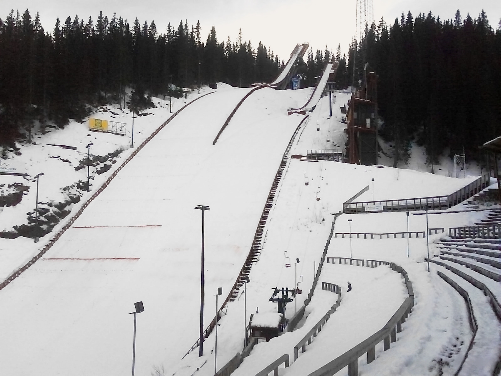
Granåsen
Trondheim
Granåsen is a ski jumping complex on the slope of the hill of the same name in Trondheim, central Norway. It ranks among the country's key ski jumping venues, in a nation where the sport is part of the national tradition. Two hills stand here: a large hill with a K-point of 124 and a smaller, normal hill at K94 (some sources list K93). What is Granåsen? It is a sports centre built around ski jumping, set on the edge of the city. The venue is equipped for top-level competition and also serves day-to-day training. The natural slope of the Granåsen hill shapes the profile of the jumps, and the surroundings open onto views over Trondheim. What is the history of the hill? The first ski jump at Granåsen was inaugurated in 1940. In the following decades, including the 1950s, the facility was rebuilt and resized to meet the growing demands of the sport. The current hills were built for the 1997 World Championships, and the venue has hosted international events regularly ever since. It was later expanded; after the 2008 upgrade the large hill has its K-point at 124 metres. Which competitions take place at Granåsen? The hill frequently hosts World Cup and Continental Cup events organised by FIS. In 1997 it staged the FIS Nordic World Ski Championships. It also hosted the 2025 World Championships, confirming its place among the leading venues for ski jumping and Nordic combined. What is the hill record? The large hill record stands at 146 metres. Kamil Stoch of Poland set it in March 2018 during a World Cup competition. For Polish visitors, that is a particular reason to stop by. Can you visit Granåsen? Granåsen is more than a competition arena. It is a sports park (Granåsen idrettspark) run by the municipality. During major events, such as the 2025 World Championships, the hill is closed to ordinary training, so check the park's current information before you go. On competition days the atmosphere in the stands and around the outrun is memorable, with fans travelling to Trondheim from across Scandinavia and Europe. Frequently asked questions Where is Granåsen? On the slope of the Granåsen hill in Trondheim, Norway. The coordinates are roughly 63.38° N, 10.31° E. Which hills make up the complex? A large hill (K124) and a smaller normal hill (K94). Has it hosted World Championships? Yes, in 1997 and 2025. Who holds the large hill record? Kamil Stoch, who flew 146 metres in March 2018. When did the first jump open? In 1940. The present layout of the complex is tied to the preparations for the 1997 World Championships. Is the hill always open? No. During major competitions and the preparations for them, it can be closed to regular training.
-
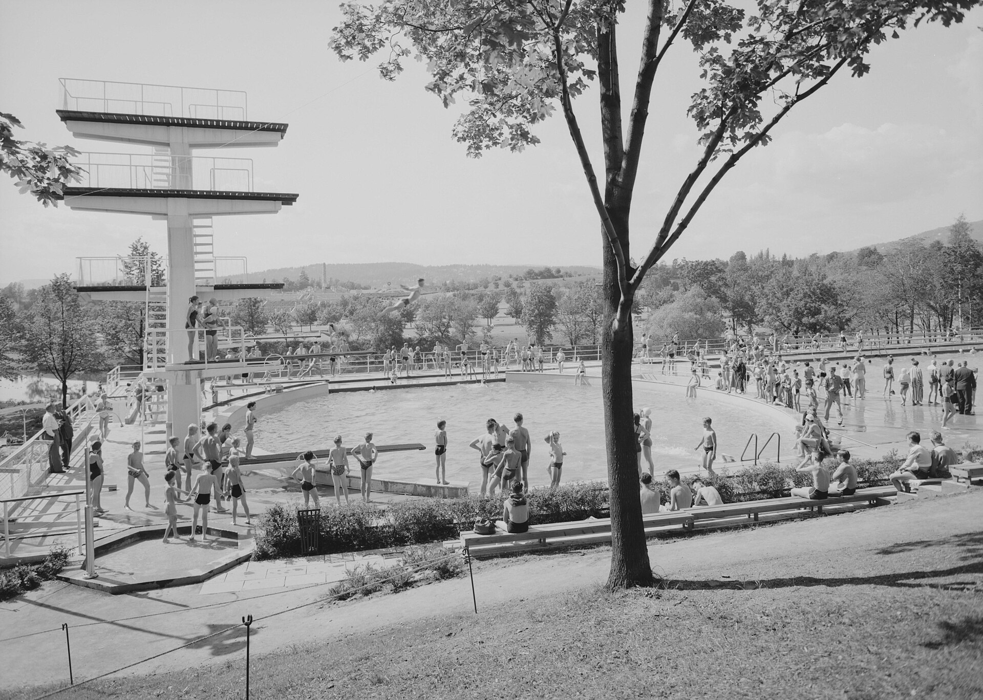
Frognerbadet
Oslo
Frognerbadet is an open-air pool complex in the Frogner borough of Oslo, designed by the Norwegian architect Frode Rinnan. Built in the 1950s, it has long been one of the best-known summer gathering spots in the Norwegian capital. What is Frognerbadet? It is a public outdoor swimming facility where Oslo residents spend warm days. The complex sits in Frogner, an affluent western part of the city, close to parkland and some of the district's best-known cultural addresses. Its designer, Frode Rinnan, is associated with Norwegian functionalism and postwar public architecture. Olav Tveten is also named as a co-architect. What can you see here? The main draw is the diving pool, with springboards and platforms at 1, 3, 5, 7 and 10 metres. The diving tower stands out across the site and serves as its visual trademark. Beyond diving, there are swimming pools, and the whole facility is laid out for families, children, casual swimmers and anyone who simply wants to lie in the sun. Why is Frognerbadet known beyond Oslo? The pool is tied to the origins of "death diving", a playful, spectacular style of jumping in which showmanship and creativity count for more than classical technique. The annual Døds Diving World Championship is held here. If your visit coincides with the event, it is a memorable reason to come. Frognerbadet and architecture For architecture fans, the complex is an example of postwar modernist public building in Norway. Its simple forms, open layout and prominent diving tower show how city recreation facilities were conceived in that period. Renovation and planning your visit The complex is undergoing rehabilitation led by the City of Oslo and, according to municipal information, is closed to visitors while the work continues. Before you travel, check the current status on the Oslo municipality website or on Visit Oslo, since the planned reopening concerns upcoming summer seasons. Frequently asked questions Where is Frognerbadet? In the Frogner borough of Oslo, in the western part of the city. Who designed it? The architect Frode Rinnan. What diving heights are available? Springboards and platforms at 1, 3, 5, 7 and 10 metres. Is Frognerbadet open? It is being rehabilitated and is closed during the works; current details are published by the City of Oslo and Visit Oslo. What is Døds Diving? A competition of spectacular, showy dives held at Frognerbadet every year. Is it a good place for families? Yes, it is a public recreation facility intended for a wide range of visitors, from children to adults.
-
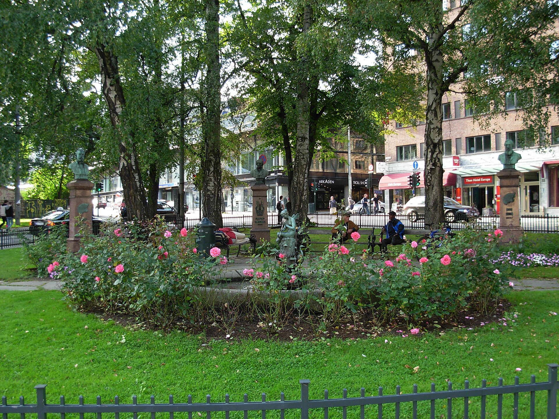
Halfdan Kjerulfs plass
Oslo
Halfdan Kjerulfs plass is a small, park-like square in central Oslo, at the junction of St. Olavs gate, Frederiks gate and Kristian Augusts gate. A patch of green among city streets, it makes an easy stop for a short rest while walking through the Norwegian capital. Who is the square named after? The square honours Halfdan Kjerulf (1815–1868), a Norwegian composer best known for his songs and short piano pieces. The name was given in 1870, a couple of years after his death. Kjerulf is counted among the figures who shaped Norwegian Romantic music, and his songs still turn up in concert programmes. What is there to see? The main interest lies in the busts of four figures from nineteenth-century Norwegian culture: Halfdan Kjerulf, the composer and namesake (bust unveiled in 1874), Andreas Munch, a poet, Adolph Tidemand, a painter, Hans Gude, a painter. The monuments to Munch, Tidemand and Gude were added in 1912. The choice of these four is deliberate: they are linked by a shared work, "Brudeferden i Hardanger" (The Bridal Procession on the Hardangerfjord). Tidemand and Gude painted the picture, Munch wrote the poetic text, and Kjerulf's music helped popularise the theme. The square is therefore a small tribute to collaboration between artists of different disciplines. How to visit The square is compact, so a visit takes only ten to fifteen minutes. It fits well into a walk through the surrounding streets of central Oslo. Entry is free and the place is open all year, since it is public space. Frequently asked questions Where is Halfdan Kjerulfs plass? In central Oslo, at the crossing of St. Olavs gate, Frederiks gate and Kristian Augusts gate, at roughly 59.918 N, 10.735 E. Is there an entrance fee? No, it is a public city square. Who was Halfdan Kjerulf? A nineteenth-century Norwegian composer of songs and piano works who lived from 1815 to 1868. How long should I plan for? Usually 10–15 minutes, ideally as part of a longer stroll through the city centre. Is it the same as Frogner plass? No. Frogner plass is a separate square in another part of the city. The square is not a headline attraction, but for anyone interested in Norwegian cultural history it is a calm and rewarding spot. The four busts recall a time when music, poetry and painting together built the national identity of a young, developing state. Pause for a moment, read the plaques by the monuments and look at the sculptural details that are easy to miss when hurrying past. It also works well as a coffee break using something bought nearby, especially on warm days when the trees give pleasant shade. Photographers will find quiet, intimate frames with greenery and bronze sculpture in the foreground.
-
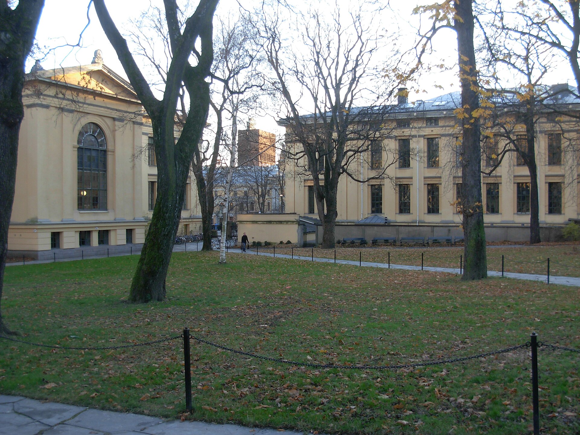
Universitetshagen
Oslo
Universitetshagen is a fenced public park in the heart of Oslo, tucked behind the historic buildings of the University of Oslo. It covers roughly one hectare (10 decares) and is one of the quieter green corners near Karl Johans gate. Where is Universitetshagen? The park lies behind Domus Media, Domus Academica (also known as Urbygningen) and Domus Bibliotheca. It is bounded by Universitetsgata, Kristian IVs gate and Frederiks gate. Its coordinates are about 59.9157° N, 10.7355° E, in the central city, a few minutes' walk from the capital's main avenue. How did the park come about? The park already appears in Christian Heinrich Grosch's 1841 drawings, when construction of the university complex began. The complex was finished in 1852. It is not known exactly in which year the park was laid out. The university owns the grounds. What is the history of the place? The Oseberg ship. From 1904 to 1926 a temporary shed in the park housed the famous Viking ship from Oseberg, before it moved to the Viking Ship Museum on Bygdøy. The fence. The fence originally surrounded a block of Empire-style buildings. When that block was demolished in 1954, the fence was moved to its present position. Restoration. The park was rehabilitated in 1996–2002. In 2015 it was returned to its 1955 appearance, including paving with stone slabs. Protection. In 2001 the university complex and the park were protected by Riksantikvaren, Norway's Directorate for Cultural Heritage. Sculpture. A portrait bust of Fridtjof Nansen by Kai Nielsen, dated 1920, stands in the park. Is it free to enter? Yes. The park is fenced but open to the public. It is a good spot for a short break while exploring the centre, especially for visitors interested in Oslo's history and nineteenth-century architecture. Frequently asked questions Do I need a ticket for Universitetshagen? No, the park is open to everyone. Who owns the park? The University of Oslo. Was a Viking ship once kept here? Yes. From 1904 to 1926 the Oseberg ship stood in a temporary shed in the park before moving to Bygdøy. How big is the park? About one hectare. Is the park protected? The university complex and the park were protected in 2001. Who designed the complex the park belongs to? Christian Heinrich Grosch, whose 1841 drawings included the garden. Universitetshagen is a small but rewarding stop for anyone who likes to combine a stroll with layers of city history: from nineteenth-century neoclassicism, through the era of Viking archaeology, to the park's modern renewal. When you visit, take a look at the stone-slab paving and at how the fence separates the calm interior from the traffic of the surrounding streets.
-
Sommerfrydhagen
Oslo
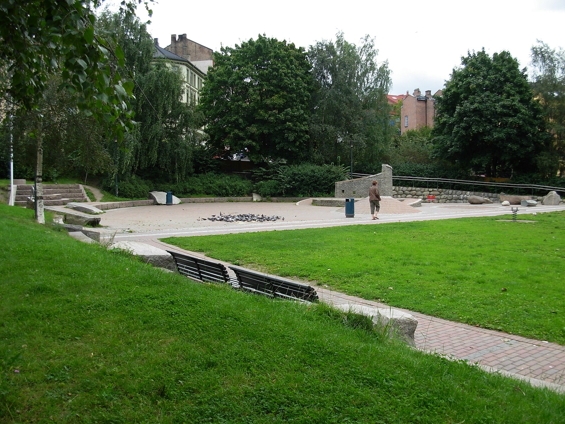
Sommerfrydhagen is a small city park in the Tøyen district of Oslo, just east of the Norwegian capital's centre. It covers roughly 5.1 decares, a little over half a hectare, and despite its modest size it serves as an important green space for people living in the surrounding apartment blocks. The park was designed to be shared by children, teenagers and adults, including visitors with mobility impairments. Where is Sommerfrydhagen and how do you find it? The park sits in Tøyen and is bounded by four streets: Sverres gate, Bisp Nikolas' gate, Kjølberggata and Jens Bjelkes gate. On a map it reads as a compact block of greenery among city buildings. Other green spaces lie nearby, including Klosterenga park and the park in the Grønland area, so a visit combines easily with a walk through this part of town. Where does the name come from, and what is the park's history? The park opened in 1995 on land that once belonged to the garden of the Sommerfryd farm. That farm stood here in the 1800s, and the park most likely takes its name from it. Today's Sommerfrydhagen is a good example of a former garden area being turned into public space for a growing neighbourhood at the end of the twentieth century. What makes the design special? The most interesting feature is accessibility. The park was designed so that people with difficulty moving around can use it. Its wavy ground is intended to challenge young wheelchair users rather than offering only a flat, dull surface. Durable materials such as brick and granite were used throughout. For children there are stones to climb and explore, and a water channel with a hand pump for experimenting with water. What can you do here? According to the City of Oslo, the park has a playground, basketball courts, outdoor exercise equipment, benches and bike racks. That makes it suitable for a short break during the day as well as a longer afternoon with kids or friends. Is Sommerfrydhagen known to skateboarders? Yes. Among skaters the park is known for a central brick structure nicknamed "Tøyenpuppen". The place has hosted skateboarding events, including a best-trick contest in 2011. If you are curious about local skate culture, it is worth a look, as long as you stay considerate of other park users. Frequently asked questions Is Sommerfrydhagen large? No, it is a small park of about 5.1 decares. Treat it as a stop while exploring the district rather than a full-day destination. Is the park accessible for wheelchair users? Yes. It was designed with accessibility for people with limited mobility in mind, and its wavy terrain is meant to challenge young wheelchair users too. Is there a playground? Yes. The park has a playground, plus stones for children to explore and a water channel with a hand pump. When was the park created? It opened in 1995 on the site of the former garden of the Sommerfryd farm. What else is nearby? Klosterenga and Grønland parks are close by, and Tøyen itself is one of Oslo's distinctive districts that is pleasant to explore on foot. Sommerfrydhagen is a good example of a pocket park: small but thoughtfully planned, open to many kinds of users and tied to the history of its neighbourhood. Stop by and you will see how Oslo combines recreation, play and inclusion in just a few thousand square metres.
-
Langaardsløkken
Oslo
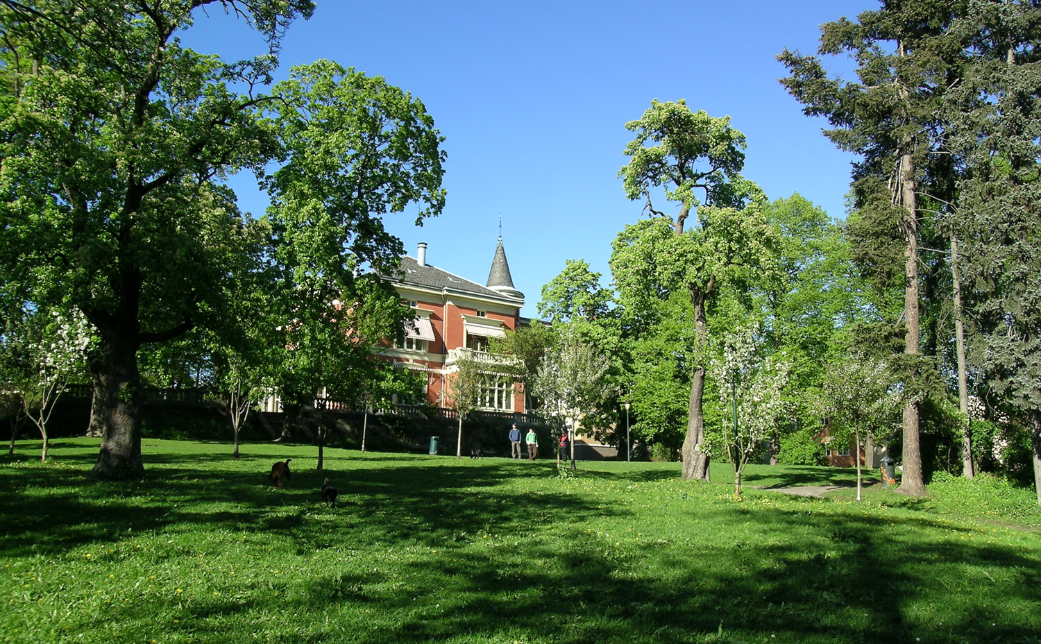
Langaardsløkken is a small public park in Oslo, set in the Briskeby district close to the dense city-centre streets. It covers roughly 6 decares (about 0.6 hectares) and is the kind of green corner you stumble on during a neighbourhood walk rather than find in a typical guidebook. For anyone who likes quiet, lesser-known places, it makes a rewarding stop. Where is Langaardsløkken? The park lies in Briskeby, bordered by Professor Dahls gate, Industrigata, Briskebyveien and Schives gate. It was laid out in the garden of Professor Dahls gate 32, on the grounds of the former Rolighed estate. Its position inside a built-up district makes it more of a neighbourhood oasis than a large recreational park. Where does the name come from? The name honours Mads Ellef Langaard, a brewery owner who inherited the Rolighed estate in 1874. Locals also call the park Youngsparken or Youngs hage, after the last private owner before the municipality took over the property in 1964. You may also see the spelling Langgaardsløkken, which the City of Oslo itself uses. What does the park look like? The park has two clearly different halves. The northern part is a Renaissance-style garden with roots in the 1700s. The southern part is a landscape-style park with large mature trees. That contrast makes it a neat example of how garden fashions changed within one small plot. A historic bowling alley building also stands on the grounds. It is the only preserved bowling alley of its period in Oslo, which adds real heritage value to the site. How was the park saved? In the late 1980s the area was threatened by development. After a conservation plan in 1987 it was restored and opened to the public. The park itself opened in 1994 and is maintained today as public green space. Who is it for? people interested in Oslo's history and its old estates, garden lovers who enjoy old trees and calm walks, anyone wanting a break from the traffic on nearby Briskeby streets. Frequently asked questions Is Langaardsløkken a large park? No. At about 6 decares it is a small neighbourhood park. Is there an entrance fee? It is a municipal park, open to the public since 1994. Why does the park have several names? The official name comes from brewery owner Mads Ellef Langaard, while the local nickname, Youngsparken, refers to the last private owner of the property. What is worth seeing there? The Renaissance-style garden in the north, the landscape section with large trees in the south, and the historic bowling alley. Since when has the land belonged to the city? The municipality took over the property in 1964.
-
Skarpsnoparken
Oslo
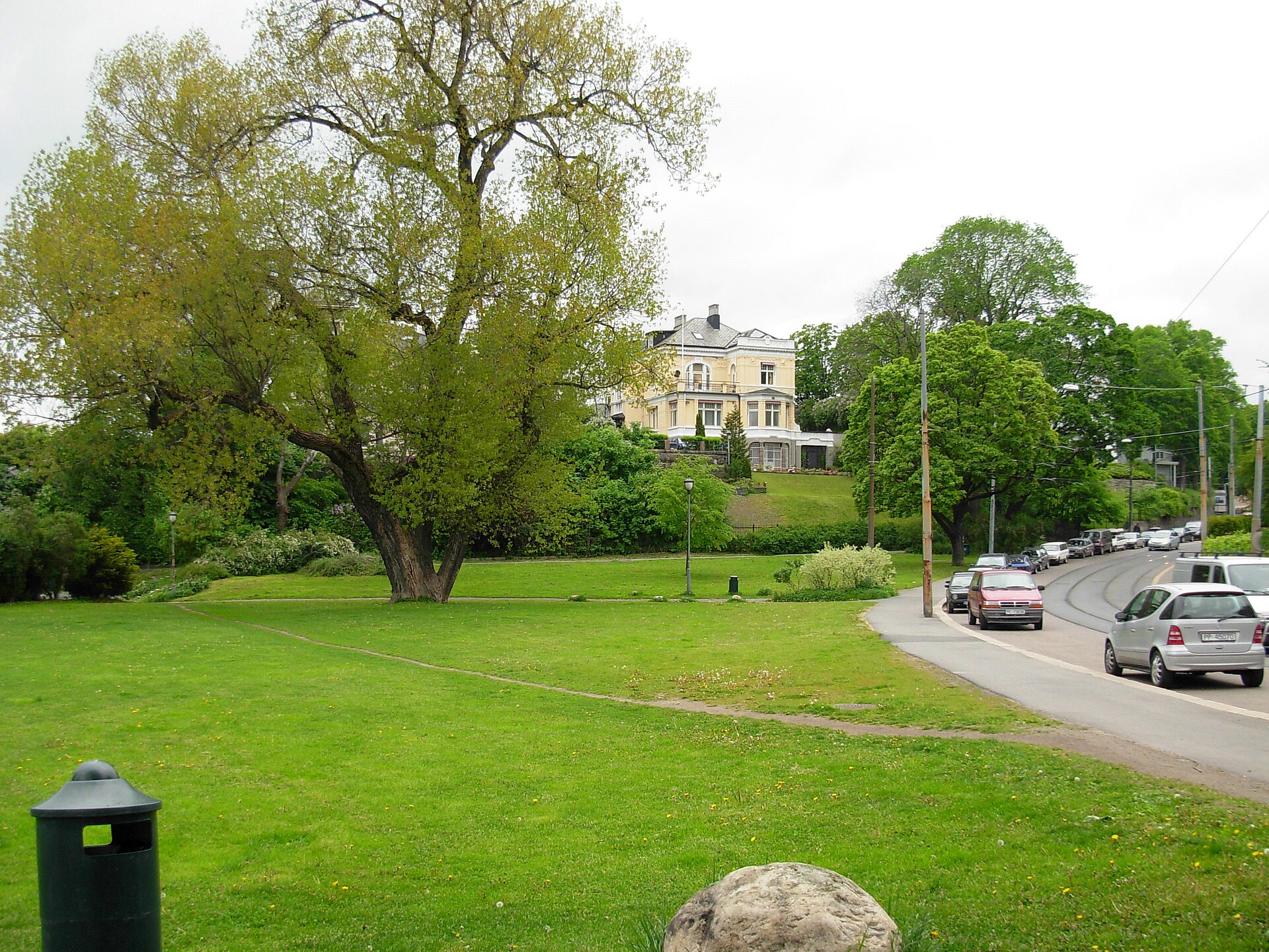
Skarpsnoparken is a small city park in Oslo's Frogner district, set just behind the boat harbour at Frognerkilen. It lies between Drammensveien and the Drammen railway line, with the rise of Gimlehøyden behind it to the northeast. It is a calm spot for a short break, a playground visit or a stroll by the fjord. What is there to see in Skarpsnoparken? The most striking feature is a large poplar in the western part of the park. It stands about 23 metres tall, and its crown spreads roughly 30 metres across. A bench in front of the tree makes a pleasant place to sit in the shade. The park also has a playground with room for ball games, which makes it a handy stop for families. In the southwest corner, a passage runs under the railway, connecting the park with the waterfront. How did the park come about? The story begins in 1889, when the municipality of Oslo bought the property at Drammensveien 88 along with the Skarpsno ferry landing. The following year the neighbouring plot at number 84 was acquired, and the city decided to lay the land out as a park. Design work started in 1910, the park was established between 1930 and 1934, and it received the name Skarpsno in 1934. The ferry landing and the old station The name is tied to a former crossing to the Bygdøy peninsula. For many years the ferry, at first rowed by hand, was run by Elias Skarpsno and his sons. A steam ferry arrived only in 1896, and a floating pier was built for it. Nearby, Skarpsno station on the Drammen railway was in service from 1882 to 1973. In 1914 the area also hosted the maritime section of the Jubilee Exhibition, open to visitors from 15 May to 11 October. Frequently asked questions Where is Skarpsnoparken? In the Frogner district of Oslo, between Drammensveien and the Drammen railway line, behind the harbour at Frognerkilen. What is the main attraction? An impressive poplar about 23 metres tall with a crown around 30 metres wide. The park also has a playground. When was the park created? The land was bought in 1889, design began in 1910, the park was established in 1930–1934, and it was named in 1934. Are there other green spaces nearby? Yes, the neighbouring Frøyas have park is close, and the waterfront makes it easy to extend the visit into a longer walk. Is there an entrance fee? No, it is a public city park.
-
Klosterenga
Oslo
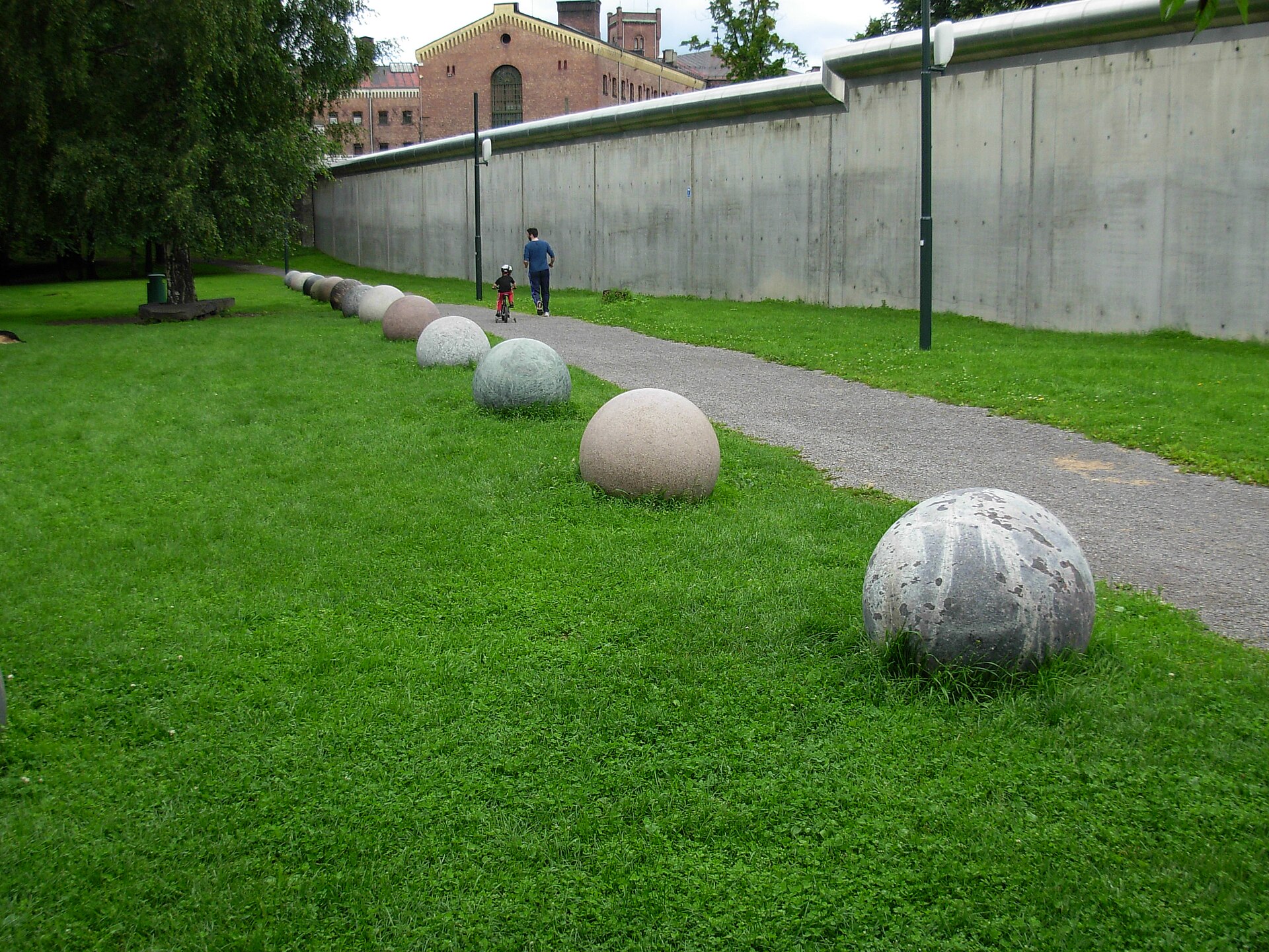
Klosterenga is a park in Oslo, set between two neighbourhoods: Gamlebyen (the Old Town) and Grønland. It blends greenery, sculpture and traces of urban history, and it is only a short walk from the city centre. Where is Klosterenga and how do you find it? The park runs along a strip of land between Grønlands park (Botsparken) in the west and the Galgeberg hill in the east. Oslo Prison's wall marks its northern edge, while Nonnegata and the buildings on the north side of Schweigaards gate lie to the south. The approximate coordinates are 59.908° N, 10.776° E. It is an easy walk from the centre, and public transport serves the area well. Why was it created? The park was developed as part of a housing project and a wider neighbourhood renewal effort. In the early 1990s, this part of inner-east Oslo struggled with heavy traffic, drug and violence problems, a shrinking population and the closure of the local school. The "Miljøbyen Gamle Oslo" initiative aimed to improve everyday life for residents, and green space and public art became a key part of it. What can you see in the park? Sculpture park. Much of the park is shaped by works from Norwegian artist Bård Breivik, created in cooperation with the Gamle Oslo district administration. The pieces are placed along the paths, so the park feels like an open-air gallery. The Hovinbekken stream. It was piped underground in the 1920s and brought back to the surface in summer 2023, returning running water to the landscape. Sports ground. The eastern part was known as Oslo Sportsplads from 1894 to 1917, and international athletics meetings were held there in 1894 and 1895. Today it is called Klosterengen idrettsplass. Galgeberg. The hill at the eastern end of the park route, a handy goal for a longer walk. Frequently asked questions Is entry free? Yes, it is a public city park. How long does a visit take? Usually 30 to 60 minutes at an easy pace, longer if you want to look at every sculpture. Is it a good place to relax? Yes, it is a green strip for locals and visitors who want a break from central Oslo traffic. What else is nearby? Gamlebyen, the oldest part of Oslo, and multicultural Grønland with its shops and cafés. Who is this park for? It suits fans of public art, urban history and walks off the main tourist trail. Klosterenga shows how a neglected corner of a city can gain new life through greenery, sculpture and careful planning. It is worth a stop on the way between Grønland and Gamlebyen, especially on a warm day when the park fills with walkers, joggers and families. You will see a more everyday side of Oslo, away from the waterfront and main promenades. It fits well into a day plan covering the Old Town and the eastern districts of the Norwegian capital, and it makes a pleasant backdrop for photos, particularly in spring and early autumn when the trees are at their most colourful.
-
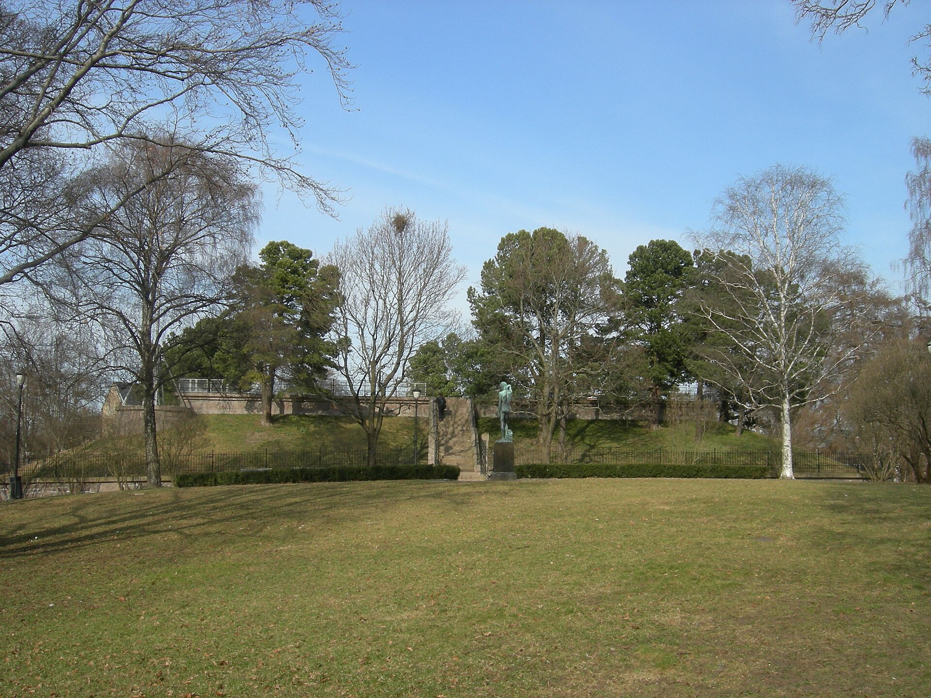
Kampen park
Oslo
Kampen park is a city park on a hill in Oslo's Kampen district, in the older eastern part of the Norwegian capital. It occupies the steep, highest part of the neighbourhood, around 77 metres above sea level, and covers roughly 36 decares (a little under 4 hectares). It works as a green lookout above Kampen's wooden houses and suits a quiet stroll away from the busy centre. Where is Kampen park and what does it look like? The park is framed by Økernveien and Ensjøveien to the north, the railway line to the east, Sons gate to the south and Brinken to the west. It is laid out in the landscape style typical of late-19th-century urban parks, with winding paths, terraces and natural contours that make use of the steep slope instead of fighting it. What is the history of the park? The land once belonged to the Udsikten property, which was part of the medieval farm Bergsløkken. From 1780 the hill served as a drill ground for Christiania's civic militia (Christiania being the old name of Oslo). In 1795 that role passed to Etterstad and St. Hanshaugen. After the city expanded in 1878, the area filled with housing quickly. By 1885 buildings had reached the park, which was laid out around the same time. A water reservoir was completed in 1886, and in 1890 a Swiss-style house for the pond keeper was built, nicknamed "Alpehytta" (the alpine cabin) by locals. The park was later extended to the Gjøvik railway line, and in 1937-38 a playground, a shelter, a paddling pool and a rest area were added. What is there to see in Kampen park? The sculpture "Svømmeren" ("The Swimmer") by Anders Svor, one of the park's ornaments. The former pond keeper's house, "Alpehytta", which has housed a kindergarten since 1990, so it can be lively with children during the day. The lower terrace and children's park, with a playground and a grotto with running water. Views over the rooftops and streets of Kampen, especially from the higher parts of the park. Who is Kampen park for? It suits families with children best, since the playground, the water grotto and the lower terrace form a sizeable play area. It also appeals to visitors who want to see everyday Oslo beyond the headline sights: Kampen is known for its low wooden houses and local feel. The park combines well with a walk around the district and the neighbouring Tøyen and Grünerløkka. Frequently asked questions How much does it cost to enter Kampen park? Nothing. It is a public park with no tickets. It is managed by the city agency Bymiljøetaten, which also lets out outdoor areas for events. Is Kampen park good for children? Yes. There is a playground, a grotto with running water and a children's park on the lower terrace, and a kindergarten operates in the former pond keeper's house. How big is the park? About 36 decares (around 3.6 hectares). It takes little time to walk around, though the sloping layout can make it more strenuous than the size suggests. How old is the park? It was laid out in the 1880s, during the rapid building boom after the 1878 city expansion. Before that, from 1780, the hill served as a drill ground for the civic militia. Why is the house called "Alpehytta"? Built in 1890 for the pond keeper, it is in a Swiss style, which reminded locals of an alpine cabin. Is it a good spot for a short break while sightseeing in Oslo? Yes. The park offers greenery, places to rest and a view of a local neighbourhood, and it lies within the city, so no trip out of town is needed.
-
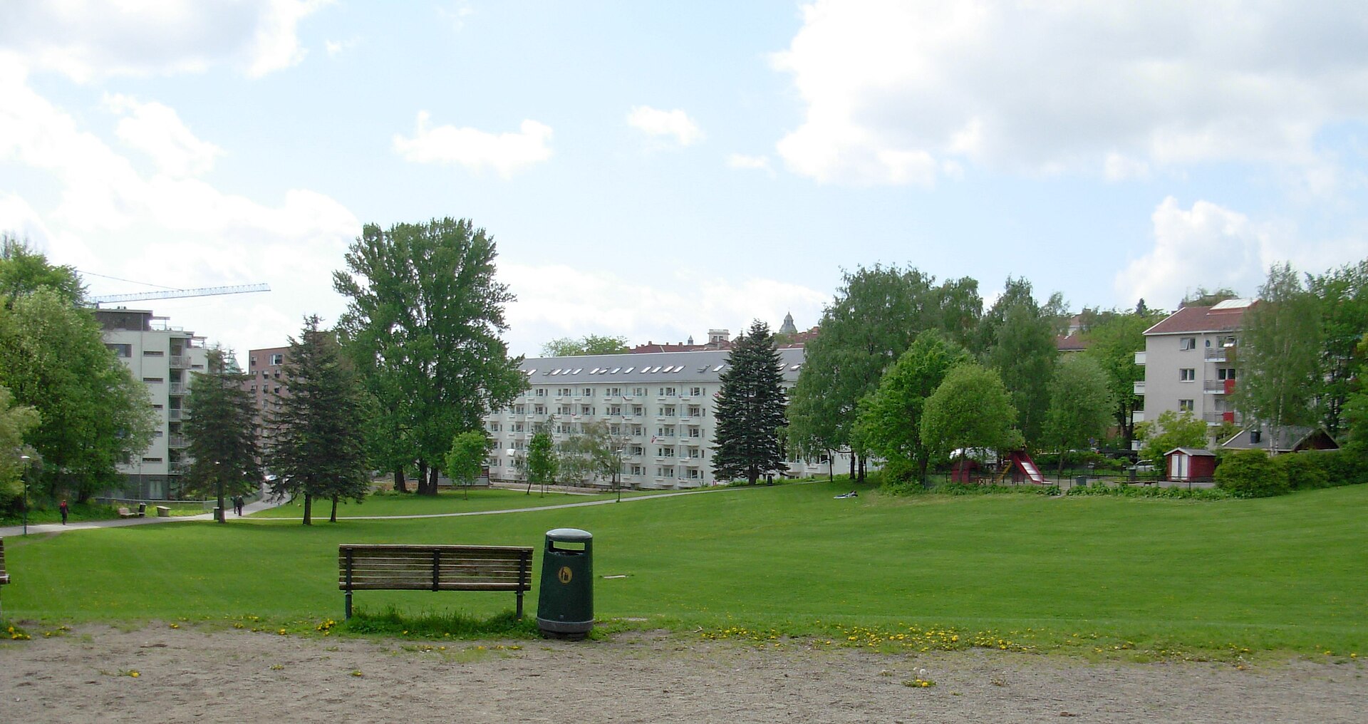
Iladalen Park
Oslo
Iladalen Park is a park in the Iladalen neighbourhood of the Sagene district in Oslo, Norway. It covers about 27.9 acres (just over 11 hectares) and was established in 1948. It is regarded as the city's best-preserved park in the functionalist style. What makes Iladalen Park special? The park is the centrepiece of the planned residential area in Iladalen. Its design is marked by simplicity and objectivity: a clear layout that serves residents takes precedence over ornamental flourishes. That consistency is why the place is valued as an example of functionalism in Norwegian landscape design. How did the area come about? The municipality began buying land in the 1920s and commissioned a comprehensive plan from Harald Hals, architect and the city's planning chief. The plan was adopted in 1929 and fed into the Greater Oslo general plan. Earlier, from the 1860s, the site held Nord's ice ponds, which from 1912 were run by a coal and firewood company. They closed around 1930. How are the park and buildings laid out? The housing and park were designed as an axial complex extending Stockfleths gate. The long blocks along Griffenfeldts gate and Colletts gate illustrate the concept. The apartment blocks around the park were built between 1931 and 1958. At the northern end of the park stands Iladalen Church, dating from 1941 and designed by Ragnar Nilsen. What to see and do A walk among greenery. The park is a calm place to rest within a built-up part of the city. Playground. A playground in the northern part makes it a practical stop when visiting with children. The sculpture "Kalv". Near the playground stands the bronze sculpture "Kalv" (Calf) by Ørnulf Bast, added in 1957. Architecture. Look beyond the lawns to the surrounding 1930s to 1950s buildings and the church at the park's edge. Frequently asked questions Where is Iladalen Park? In the Iladalen neighbourhood, Sagene district, Oslo, Norway. Coordinates are roughly 59.9315 N, 10.7519 E. When was the park established? In 1948, as part of the planned residential area in Iladalen, whose plan was adopted in 1929. Why is it considered notable? It is regarded as Oslo's best-preserved functionalist park, with a simple and objective design. Is there a playground? Yes, in the northern part of the park, together with Ørnulf Bast's 1957 sculpture "Kalv". Which church stands by the park? Iladalen Church, from 1941, by Ragnar Nilsen, at the park's northern end. Is there an entrance fee? It is a public neighbourhood park, and the sources mention no admission charge. In short Iladalen Park is a good stop for anyone interested in urban planning history and landscape architecture. It shows how Oslo realised the idea of a functionalist housing district with a green heart, where park and buildings form one thoughtfully planned whole.
-
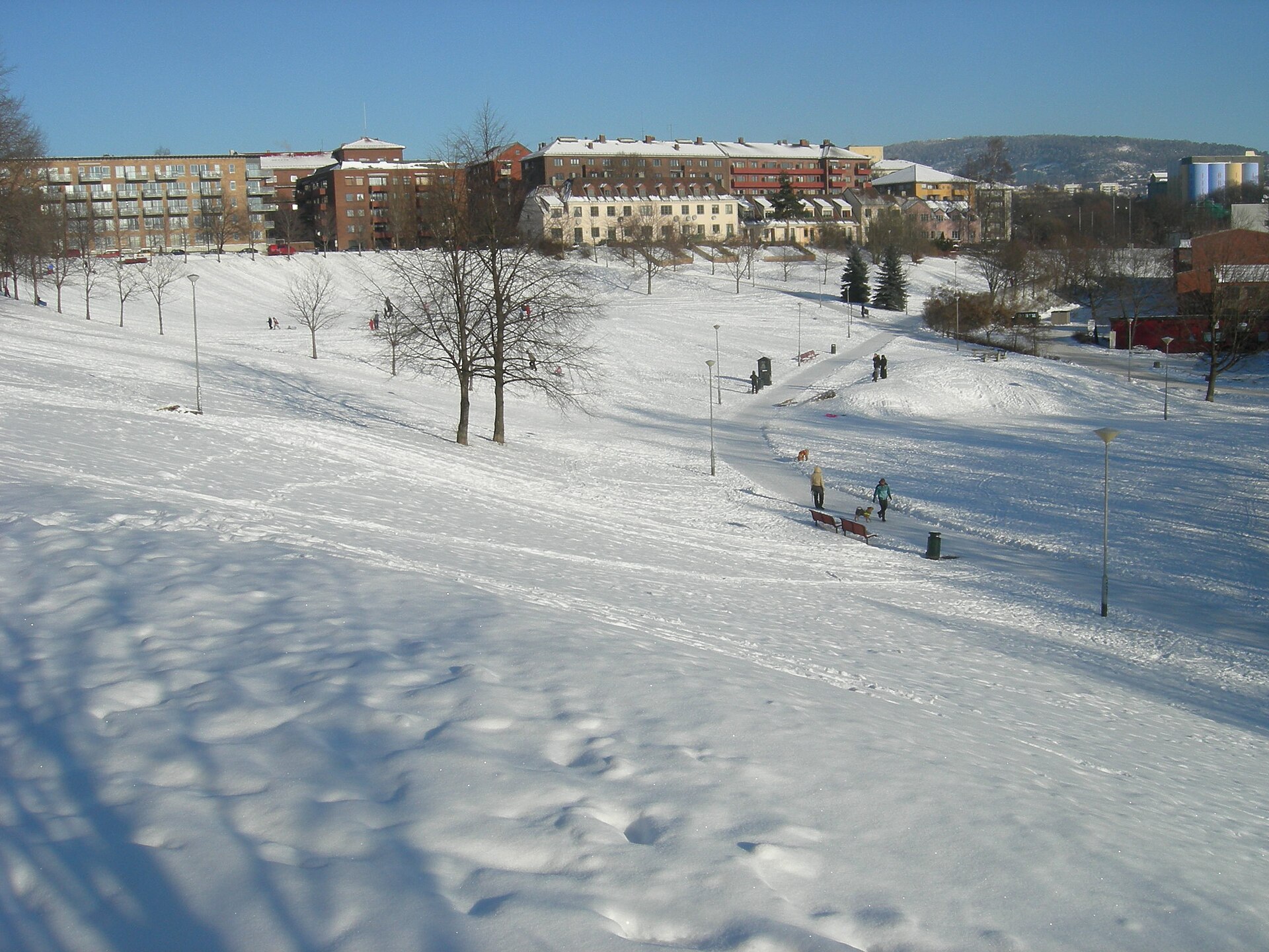
Myraløkka
Oslo
Myraløkka is a park in the Sagene district of Oslo, set in a hollow shaped like an amphitheatre. From its upper parts you can look out over the city centre and the fjord. It is a quiet green spot close to the Akerselva river, and its landscape has clearly industrial roots. What is Myraløkka? Myraløkka is a city park within Oslo municipality, in the northern part of town. Together with Torshovparken, it is one of the green spaces in Sagene offering views towards the centre and the fjord. The terrain is no accident: the valley is amphitheatre-shaped because huge amounts of clay were dug out here to make bricks. Why is the valley shaped like this? Many brickworks once operated along the Akerselva, and their work was seasonal. The clay extracted here left a depression that now serves as a park. For visitors it is a small lesson in local history: the gentle slopes where people sit today are what remains of an earlier industry. The Myrens verksted workshop The site is also tied to the story of Myrens verksted. The firm moved to this spot in Sagene and operated here from 1854 until 1988, when all activity was relocated to Lier. For well over a century it was part of the industrial landscape of the river valley. Housing at the top of the park At the top of Myraløkka stand English-style workers' houses completed in 1914. Together with the greenery they form a distinctive backdrop to the park and recall a time when the neighbourhood lived off work in the factories along the Akerselva. What to do here Myraløkka has long been a popular place for children to play, and in the past they also liked to swim here. Today it is mainly a park for strolling, resting on the grass and enjoying the view of the city. It pairs well with a walk along the Akerselva, a 9.8 km river running from the lake Maridalsvannet to Bjørvika. Its valley has been landscaped to protect both the river and the traces of early Norwegian industrial development. How to get there According to Oslo municipality, you can reach Sagene by bus 54 from the city centre. The Arendalsgata stop is right next to Myraløkka. The park is also close to Grünerløkka, the district on the east side of the river, known for small shops, parks and nightlife. Frequently asked questions Where is Myraløkka? In the Sagene district of Oslo, near the Akerselva river. Are there views of the city? Yes, from Myraløkka you can see the centre of Oslo and the fjord. Does the place have a connection to industrial history? Yes. The amphitheatre-shaped valley came from clay extraction for bricks, and the Myrens verksted workshop operated nearby from 1854 to 1988. How do I get there by public transport? Take bus 54 to the Arendalsgata stop. Can children play in the park? Myraløkka has long been a popular place for children to play.
-
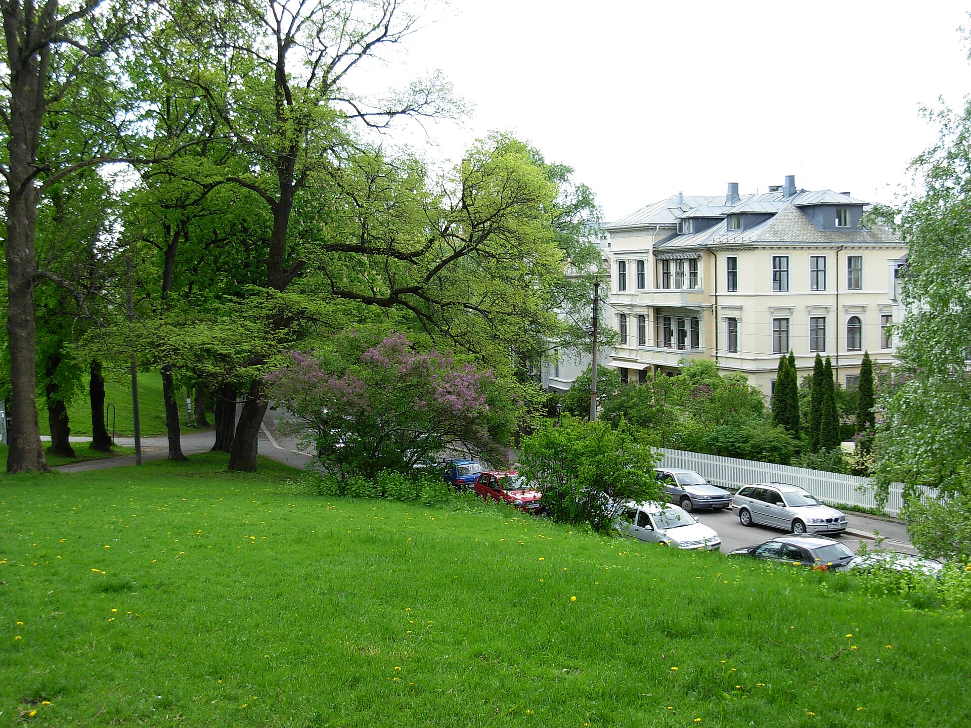
Stensparken
Oslo
Stensparken is a park in Oslo, laid out on a limestone ridge close to Fagerborg church. The rise is formed by two hills, Korpehaugen and Blåsen, and the history of the ground is far livelier than the calm green space you see today. Where is Stensparken? The park sits in Oslo next to Fagerborg church, on a limestone hill. It should not be confused with the much better-known St. Hanshaugen park. They are two separate places, though both belong to the green network of the Norwegian capital. Stensparken is the smaller, more local spot, best suited to visitors who want a short break from city traffic or an interest in the history of Oslo's neighbourhoods. How did it get its name? The hill received the name Stensparken in 1891, taken from the farm Sten that once stood here. Before that the place was called Natmandshaugen. The older name referred to a night-soil worker who settled on the hill in the 1820s. The change of name in the late nineteenth century went hand in hand with turning the area into public greenery. What is the history of the site? According to the City of Oslo, the land was in turn a farm, a match factory, a burial ground and a waste site for the capital. Only afterwards was it developed as a park. The first landscaping work began around 1890 and was financed by Kristiania Brændevinssamlag. It was wrapped up around 1900, although the project was not fully completed at that point. The park reached its final form in the 1930s. This changing past makes Stensparken a good example of how Oslo spent decades turning industrial and utility land into open spaces for recreation. The limestone bedrock and the two-hill landform still set the place apart from the flatter parts of the surrounding district. What to know before you go The park is municipal green space maintained by the City of Oslo, so check the city's website for current rules on use. It combines well with a walk around Fagerborg church. If you want a longer stay in green surroundings, St. Hanshaugen, the oldest municipal park in Oslo, lies nearby and fits into the same outing. Frequently asked questions Is Stensparken the same as St. Hanshaugen? No. They are two separate parks in Oslo. St. Hanshaugen is larger and older, while Stensparken lies on a limestone hill by Fagerborg church. Where does the name come from? From the farm Sten. The name came into use in 1891, and the hill was previously known as Natmandshaugen. What stood here before the park? According to the City of Oslo, in turn a farm, a match factory, a burial ground and a waste site. When was the park completed? Work began around 1890 and ended around 1900, without the project being fully finished. The park took its final shape in the 1930s. Which hills make up the ridge? Korpehaugen and Blåsen, on a limestone ridge. Stensparken is for those who enjoy discovering less obvious corners of a city and learning how an ordinary neighbourhood hill travelled from waste site to park.
-

Birkebeineren Ski Stadium
Lillehammer
Birkebeineren Ski Stadium is a cross-country skiing and biathlon venue in the hills above Lillehammer, Norway. It was built for the 1994 Winter Olympics and remains one of the key winter sports sites in the region. It lies about 3 km from the town centre, at 485 metres above sea level. Why visit? The stadium is a living piece of Olympic history, and ordinary visitors can ski the same ground where athletes once competed. The mood is distinctly Norwegian: open space, forest, and people on skis in winter or on rollerblades and bikes in summer. What does the venue look like? The complex has two separate arenas, one for cross-country and one for biathlon. The cross-country stadium can hold 31,000 spectators and the biathlon one 13,500. Construction for the Games cost NOK 83.6 million. After the Olympics the venue also hosted the 1994 Winter Paralympics, with Paralympic Nordic skiing and biathlon. What events have taken place here? After the Games, ownership passed to the municipal Lillehammer Olympiapark. Since then the stadium has staged one Biathlon World Cup, three FIS Cross-Country World Cup rounds and nine FIS Nordic Combined World Cup events, with the ski jumping part held at the nearby Lysgårdsbakkene arena. In 2016 it was a venue of the Winter Youth Olympics. What can you do here? In winter the highlight is a floodlit loop of roughly 5 km, usually open in the evenings until about 10 pm. Check the hours before you go. The stadium connects to a very large network of cross-country trails, and experienced skiers can take on the demanding Olympic 50 km route. Beginners will find flat terrain close to the stadium. Summer is no off-season. The venue has a year-round biathlon facility, and a 6.3 km asphalt rollerski track is used for training and competitions. The surroundings are popular for walking, jogging, mountain biking and ball games. Frequently asked questions Where is the stadium and how do I get there? The address is Sjøsetervegen 29, 2618 Lillehammer, about 3 km from the centre. Follow Sjøsetervegen and look for the signs to the stadium. Is it open in summer? Yes. The grounds and trails are accessible all year for walking, running, biking and rollerskiing. Do I need to be a pro to ski here? No. Flat, easy terrain lies next to the stadium for beginners, while stronger skiers can pick longer routes. What events were held here? The 1994 Olympic and Paralympic Games, World Cup events in biathlon, cross-country and Nordic combined, and the 2016 Winter Youth Olympics. Who runs the venue? After the 1994 Games ownership passed to the municipal Lillehammer Olympiapark.
-
Holmenkollen National Arena
Oslo
Holmenkollen National Arena is a Nordic skiing complex in Oslo, set in the Holmenkollen district on the hills above the city. It brings ski jumping hills, a cross-country stadium and a biathlon shooting range together in one place, and its history reaches back to the late 19th century. It is among the most important winter sports venues in Norway and a must-see for anyone interested in skiing. What is on the site? The arena has several parts. The largest is the big ski jumping hill, Holmenkollbakken, which can be seen from many points around Oslo. Next to it stands the normal hill, Midtstubakken. A cross-country stadium and a shooting range for biathlon complete the venue. That means ski jumping, cross-country, Nordic combined and biathlon can all be staged here. Why is it so famous? The annual Holmenkollen Ski Festival has been held here since 1892. It is part of the World Cup circuits in ski jumping, cross-country skiing and Nordic combined, and the arena also hosts Biathlon World Cup races every year. For Norwegian fans it is a traditional winter celebration that fills the stands and lines the trails. The venue has also hosted events at the very top level. The 1952 Winter Olympics took place here, and the FIS Nordic World Ski Championships were held in 1930, 1966, 1982 and 2011. Few sports venues anywhere can match that record. A museum inside the jump The Holmenkollen Ski Museum, founded in 1923, sits within the structure of the jump and is described as the oldest ski museum in the world. It covers roughly four thousand years of skiing history, and its collection also includes items linked to polar expeditions. A visit helps explain why skiing in Norway is about far more than sport. Planning your visit Holmenkollen lies on the edge of the capital, higher up than the centre, so plan to use public transport and allow for a short uphill walk. The area around the jump offers views over Oslo and the fjord, and a clear day is best for photos. In winter you may catch competitions or training, while in summer the site is a popular excursion. Check the official website for current opening hours, ticket prices and the competition calendar before you go. Frequently asked questions Where is Holmenkollen National Arena? In Oslo, in the Holmenkollen district, on a hill above the city centre. Did the Olympic Games take place here? Yes, the Winter Olympics in 1952. When is the Holmenkollen Ski Festival held? Every year, and the tradition goes back to 1892. The competitions count towards the World Cup in jumping, cross-country and Nordic combined. Is there a museum on site? Yes, the Holmenkollen Ski Museum, founded in 1923, is located within the jump. Which sports can be watched here? Ski jumping, cross-country skiing, Nordic combined and biathlon.
-
Østfoldbadet
Askim
Østfoldbadet is an indoor water park in Askim, in south-eastern Norway, within Indre Østfold municipality. It officially opened on 16 December 2000 and has served families looking for play in the water, as well as swimmers and people who simply want a sauna and some quiet time. It is one of the main recreation venues in the Østfold region. What is this place and how did it come about? Construction began on 31 August 1999 and finished in December 2000, so the whole complex went up in a little over a year. It stands in the middle of Askim, which makes it easy to combine a swim with a short walk around town. Askim is a small town on the Glomma river, roughly 40 kilometres south-east of Oslo, and the nearby railway station on the Østfoldbanen line makes the trip possible without a car. Which pools and attractions can you expect? The complex holds more than a dozen water areas. There are two 25-metre competition pools, a wave pool with waves of about 80 centimetres, and a current channel described as one of the most intense in Norway. Thrill seekers get three water slides measuring 30, 62 and 76 metres. A climbing wall is installed in one of the pools, and there is also a diving tower. The relaxation side includes two pools heated to 34 degrees, therapy pools, a jacuzzi, saunas and a steam room. An outdoor massage pool sits on the roof, and in summer two outdoor pools open to guests. Is it a good place for children? Yes. Little ones have their own children's pool, while the wave pool and the slides suit older kids and teenagers. The venue also offers birthday packages, so it is a popular choice for children's parties. Where can you eat, and what else is there? A cafeteria on site serves food after your swim. There is also a gym, so some visitors combine a workout with their time in the water. What should you know before you go? Visitor reviews are mixed: some mention that the slides are sometimes closed and that cleaning could be better. It is worth checking which attractions are running before you travel. Frequently asked questions When did Østfoldbadet open? It officially opened on 16 December 2000. Does it have water slides? Yes, three of them, at 30, 62 and 76 metres. Is there a relaxation area? Yes: saunas, a steam room, a jacuzzi, warm pools and an outdoor massage pool on the roof. Is it suitable for small children? Yes, there is a separate children's pool. Where is it? In central Askim, Indre Østfold municipality, Norway. Check the official website for current opening hours and prices before visiting.
-
Svinviks arboretum
Surnadal
Svinviks arboretum is a botanical garden in Surnadal municipality, in Møre og Romsdal county, Norway. It sits in a sheltered spot beside Todalsfjorden, hemmed in by steep mountains, and is best known for its rhododendrons and conifers. Today it is a museum garden that welcomes visitors during the summer season. How did the garden at Svinvik begin? It started in 1943, when Anne and Halvor Svinvik began turning their small farm, Gjengstøa in Svinvika, into a garden of unusual plants. Halvor Svinvik (1894-1976) was a fruit grower with a long-standing interest in plants from other parts of the world, especially rhododendrons and conifers. He raised most of them from seed sent by contacts abroad. Anne Svinvik, originally from Bjugn, was also closely involved in running the garden. By the 1960s the collection counted among the largest private plant collections in Norway. In 1971 the couple donated the garden and its plants to the science museum in Trondheim (Vitenskapsmuseet). Since 2010 Surnadal municipality has owned the site, and Nordmøre museum runs it as a museum garden. It also serves as a memorial to its two founders. What plants can you see here? Depending on the source, the collection includes about 200 conifer species and cultivars and several hundred rhododendron species and cultivars. The figures vary, with one source giving about 450 and another about 375 rhododendron varieties, so treat them as approximate. Beyond these, the garden has many broadleaf trees, ornamental shrubs, perennial beds and fruit trees. The old orchard belongs to the former farm. One curiosity is the hardy Rhododendron brachycarpum Tiegerstedtii Group. It thrives so well here that seedlings pop up on tree stumps and moss-covered stones. When is the best time to visit? Spring and early summer, when the rhododendrons bloom and the garden is at its busiest. It is open to the public in the summer season, roughly from May to early August. Dates can change, so check the current details with Nordmøre museum before you travel. What else should you know? During the season there are guided tours, plus a cafe with outdoor seating. The garden lies along national road 671 toward the Todalen valley, in the interior of Nordmøre. It makes a good stop on a trip through the Sunndalen valley and around Surnadal, especially for anyone who enjoys botany, plant photography or quiet walks among greenery. Frequently asked questions Where is Svinviks arboretum? In Surnadal municipality, beside Todalsfjorden, in Møre og Romsdal, Norway. Who created the garden? Anne and Halvor Svinvik, who began building it in 1943 on their farm. Who runs it today? Surnadal municipality owns it, and Nordmøre museum operates it. Is it open all year? No, it is open in the summer season, roughly May to August. What is the main attraction? The rhododendron collection, especially in bloom, along with the conifers.
-
Bergen Museum Garden
Bergen
Bergen Museum Garden (Muséhagen) is a botanical garden in the centre of Bergen, right beside the University Museum buildings. It is one of three botanical gardens run by the University of Bergen, and one of the calmest green spots downtown. Entry is free. How did the garden come about? The garden opened to the public on 4 May 1898. It was meant as a living extension of the museum's indoor exhibitions: what the halls showed in display cases, visitors could see growing here. The design is credited to Jørgen Brunchorst, the first botanist at Bergen Museum, who wanted a collection of Norwegian species along with a general display of plants grouped systematically by family. Plantings follow organic, flowing shapes in the style of an English landscape garden, with beds edged by gently curving paths. The original plan has not survived, but the overall layout appears on a map in the museum's anniversary book from 1900. The garden was listed as protected in 2013. What is there to see? The Old Garden (Gamlehagen) – the part that keeps the most of the original character, with winding paths and systematically arranged plant groups. Conifers – the systematic collection opens with conifers, among them monkey puzzle tree, dawn redwood, Japanese cedar and two very old yews. Rock garden – home to heat-loving plants and camellias, which stand out in the mild, damp climate of western Norway. Water garden – built in 1931 under the botanist R. Nordhagen, and clearly different from the garden's original plan. Palm house – the greenhouse was bought as a construction kit from Brzeg (then in Germany, now in Poland). It was a gift from Bergen merchant Conrad Mohr and opened in 1901. Is it worth a visit? Yes, especially if you enjoy a mix of history and nature. It suits an hour's stroll while exploring the centre, and works well as a pause between museums. It pairs naturally with the neighbouring University Museum, to which it has been linked from the start. Frequently asked questions Is entry free? Yes, the garden can be visited free of charge. Where is it? In central Bergen, next to the University Museum, in the Muséplass area. When did it open? On 4 May 1898. Is it the university's only botanical garden? No. The University of Bergen runs three. The others are the Arboretum and Botanical Garden at Milde, about 23 km south of the city centre. Is the garden protected? Yes, it was listed as protected in 2013. Who is it for? Plant lovers, photographers and anyone wanting a quiet break in the city. Families with children will also find plenty of room for an easy walk among trees, water and old greenhouses. Spring and summer are the best times, when the beds and rock garden look their finest, though the garden can be visited all year round.
-
Arctic-alpine Botanic Garden
Tromsø
Arctic-alpine Botanic Garden in Tromsø is widely described as the northernmost botanic garden in the world. It sits in northern Norway and is run by the Tromsø University Museum. The garden opened in 1994, and entry is free. What is this place? The garden occupies a site where an old farmhouse once stood. Today it shows Arctic and alpine plants gathered from across the Northern Hemisphere and beyond. They are arranged in dozens of themed collections, organised by cold regions of the world, including Svalbard, the Himalayas and South America. Sources give different counts for the collections, but all agree on thousands of plant species. Because the garden belongs to the university museum, it serves both researchers and ordinary visitors. It is striking to see so many species from distant mountain ranges growing this far north. What should you see? One of the best-known highlights is the Tibetan blue poppy, grown in the Himalayan section, which blooms in late June. The South American beds and the plants from Svalbard are also worth seeking out, since they show how very different species cope with cold. There is also a café in a reconstruction of the Hansine Hansen farmhouse, a pleasant place to rest after walking the paths. When should you go? The growing season is the best time. According to VisitNorway the garden is normally open from May to October, depending on snow conditions, and closed in winter. Atlas Obscura describes it as a place without a gate or barrier. Because the sources differ, check the current situation before a winter visit. How do you get there? From the centre of Tromsø, take bus 20 to the Northern Lights Planetarium. From there it is a short, pleasant walk through the woods to the garden. Walking all the way from the city centre takes about 40 minutes. Frequently asked questions Is it really the northernmost botanic garden? Yes, it is widely described as the northernmost botanic garden in the world, at roughly 69.7 degrees north. Who runs the garden? The Tromsø University Museum. Is there an entrance fee? No, entry is free. When does the Tibetan blue poppy bloom? Usually in late June. Is there somewhere to eat? Yes, a café operates in a reconstruction of the Hansine Hansen farmhouse. Is the garden open in winter? It may be closed in winter. The most reliable time to visit is from May to October.
-
Bergen Arboretum and Botanical Garden, Milde
Bergen
The Arboretum and Bergen Botanical Garden are two neighbouring gardens at Milde, about 23 km south of Bergen city centre in the Ytrebygda district. Both are part of the University of Bergen's university gardens, and you can easily visit them on a single trip. Is admission free, and when can I visit? Admission to both gardens is free. The outdoor areas are open all year, so a walk is possible in any season, though the gardens change a great deal through the year. Flowering makes the biggest impression, including the large peony display in the botanical garden and the rhododendrons in the arboretum. What is there to see in the Arboretum? The Arboretum officially opened in 1971, when Crown Prince Harald planted a "royal oak" on 27 May. Today it is a large living collection of trees and shrubs from Norway and from other parts of the world. It is known for its rhododendrons, a heather garden and the Rosarium, Norway's largest rose collection. It is a good place for a long walk among plants you rarely see gathered together. What is there to see in the Botanical Garden? The University of Bergen's botanical garden was established at Milde in 1996 and covers roughly 7 hectares. It consists mainly of herbaceous plants, with collections arranged in themed sections. These include the Useful Plants Garden, the Japanese Garden and the Alpine Garden. The garden serves research and education and works to conserve endangered plant species, so beyond its scenery it has a real scientific role. How do I get there from Bergen? Bus 53 runs from central Bergen via the Bybanen light rail and Birkelandsskiftet. For the Botanical Garden get off at Milde snuplass; for the Arboretum, at Fana folkehøgskole. If you drive, free parking is available at Dalsmyra, Mildevågen and by Vågelva. Frequently asked questions Do I need a ticket? No, admission to the Arboretum and the Botanical Garden is free. Are the gardens open in winter? The outdoor areas are open all year round. Can I see both gardens in one day? Yes, they lie side by side at Milde, so combining them in one visit is easy. Where can I park? Free parking is at Dalsmyra, Mildevågen and by Vågelva. How do I get there without a car? Take bus 53 from Bergen, with stops at Milde snuplass (botanical garden) and Fana folkehøgskole (arboretum). What should I look for first? If you like flowers, look for the peonies, the roses in the Rosarium and the rhododendrons. If you are curious about plants from other countries, visit the Japanese Garden and the Alpine Garden. Who is this place for? The gardens at Milde suit anyone who enjoys a quiet walk, plant lovers, photographers and families looking for a free attraction outside the city. Because part of the collections is scientific in nature, it is also a chance to see how a university combines research, education and conservation with opening its grounds to visitors. Plan a few hours so you can walk both gardens at an easy pace, especially in the flowering season, when the colours are most intense and the stroll between the two gardens becomes a real pleasure.
-
Oslo Botanical Garden
Oslo
Oslo Botanical Garden (Botanisk hage) is a university garden and arboretum in the Tøyen district, a short distance from the centre of Norway's capital. It was established in 1814 and is regarded as the oldest botanical garden in the country. It is run by the University of Oslo and has been part of the Natural History Museum since 1999. How did the Tøyen garden begin? The Tøyen estate had several earlier owners. In 1812 the Danish-Norwegian king handed it over to the university, and the botanical garden was laid out two years later. Only a small share of the old estate was set aside for the garden at first, and the grounds have been expanded since. Today the place serves both as a research collection and as a green park where locals and visitors stroll. What is there to see in the garden? The collection holds around 35,000 plants belonging to roughly 7,500 species. Plants from many climate zones are grouped thematically in separate sections of the garden. It is a good place to see how many species can be grown in a cool, northern climate. The greenhouses are a major draw. The Palm House dates from 1868 and the Victoria House from 1876, and both hold exotic plants from distant parts of the world. The Palm House also contains an Evolution Room, which shows how plant species have changed over time. According to available information, entry to both greenhouses is free, and their opening hours broadly follow those of the garden itself. Is there a museum or historic building on site? Tøyen Manor stands in the grounds and is the oldest building owned by the university. Its main wing is probably the oldest wooden building in the wider Oslo area. Today it houses a café and temporary exhibitions. The garden also sits beside the Natural History Museum complex. The Botanical Museum, founded in 1863, was merged into the garden in 1975, and in 1999 the garden was combined with several museum institutes into a single institution. Who is it for? The garden suits a short, quiet walk between city sights, as well as a longer visit for anyone interested in botany. It works well for families with children, plant photographers and visitors who want to pair a garden stroll with a natural history museum. Tøyen lies east of the centre and can be reached on foot or by public transport. Frequently asked questions When was Oslo Botanical Garden founded? In 1814. It is the oldest botanical garden in Norway. How many plants grow there? About 35,000 plants from around 7,500 species. Is entry to the greenhouses paid? According to available information, the Palm House and Victoria House are free. Check current opening hours on the museum website before you go. What else is in the grounds? The historic Tøyen Manor with a café and temporary exhibitions, plus the neighbouring Natural History Museum. Who runs the garden? The University of Oslo, as part of the Natural History Museum.
-
Oslo Spektrum
Oslo
Oslo Spektrum is a multi-purpose indoor arena in the heart of Oslo. Since December 1990 it has hosted concerts, sports events, fairs and conferences, and for many visitors it is the first major building they notice after stepping out of the main railway station. Where is Oslo Spektrum and how do you get there? The arena sits in east central Oslo, right beside the Central Station (Oslo S). Nearby are the long- and medium-haul bus terminal, the Jernbanetorget public transport hub and the international ferry terminals. That means you can arrive by train, bus, tram, metro or ferry without a car and without a long walk. The venue lies at roughly 59.913 N, 10.755 E. When was it built and what was it meant for? The arena opened in December 1990 under the ownership and operation of Nova Spektrum, formerly known as Norges Varemesse, the Norwegian trade fair organisation. It was originally intended to be the home hall of the ice hockey clubs Vålerenga and Furuset, but both stopped using it after a few years. The building was designed as a flexible venue from the start, so the absence of permanent tenants did not change its role in city life. What events take place at Oslo Spektrum? The hall welcomes concerts by Norwegian and international artists, musicals, sports events, conferences and trade fairs. It is also known as a host of the annual Nobel Peace Prize Concert, held in connection with the award in Oslo. In 1996 the arena staged the Eurovision Song Contest. This mix of cultural, sporting and business events makes the calendar varied, so it pays to check the programme before you plan a visit. How many people does it hold? Figures differ slightly by source and by hall layout. In concert mode with seating, the arena holds roughly 9,700 to 10,000 people. With part of the audience standing, capacity reaches about 11,500. For sports the number of seats is lower, at around 6,500. The exact layout depends on the event, so check the organiser's or ticket seller's page. Is the arena being rebuilt? The operator has announced an expansion that includes a new congress and cultural stage. According to the owner, work should finish at the end of 2028. An earlier rebuild in 2018 and 2019 added about 1,500 places. Before travelling for an event, look for current notices, as construction may affect entrances and the area around the building. Frequently asked questions Is Oslo Spektrum easy to reach from the airport? Yes. The hall stands next to the Central Station, a key interchange in the city, so public transport from many parts of Oslo is straightforward. Is it just a sports hall? No. Although it was planned with ice hockey in mind, today it works mainly as a concert arena and a venue for conferences, fairs and other large events. Can you visit it outside events? The building is aimed mainly at ticketed or registered events. Information about any access outside them comes from the operator. How early should you arrive for a concert? Because the arena is in a busy central spot beside a transport hub, leave some extra time for the journey and entry, especially for big shows. Are there other sights nearby? Yes. Central Oslo has plenty to see within a short distance, and the closeness of the station makes it easy to combine an event with sightseeing.
-
Byparken
Ålesund
Byparken is the town park in central Ålesund, Norway, set at the foot of Aksla hill. It is a patch of green right beside the downtown streets, and the easiest starting point for one of the best-known viewpoints in the country. What is the history of Byparken? Ålesund municipality created the park in 1885 on the western slope of Aksla, with a gardener laying out the grounds. The section facing the street was added in 1921-23. The park therefore predates the Art Nouveau town centre that rose after the great fire of 1904. Its design follows the English landscape garden idea: gentle paths, trees and lawns form a calm backdrop to the town around it. What is there to see? Two statues stand out: The statue of Kaiser Wilhelm II. It was given to the town in thanks for the help Germany provided after the 1904 fire, a reminder of the part he played in the rebuilding of Ålesund. The statue of Rollo (Gange-Rolf). This bronze figure shows the Viking said to have come from the island of Giske, not far from Ålesund. It was a gift from Rouen in 1911, and copies of the statue also stand in Ålesund and in Fargo in the United States. How do you reach Aksla from Byparken? This is the main reason visitors stop here. The 418-step staircase up Aksla begins in the park. At the top you get a view over the town, the islands and the sea. A steady climb usually takes some ten to fifteen minutes. For a more adventurous option, a via ferrata route also climbs Aksla from the park. Guided options are available, so you do not need your own climbing experience. Is it a good stop with children? Yes. The park has a playground for small children, and it is compact and easy to walk around. It makes a handy rest stop before or after the climb, or during a stroll through the centre. Frequently asked questions Where is Byparken? In the centre of Ålesund, at the foot of Aksla, a few minutes on foot from the harbour and the Art Nouveau buildings. Is entry free? Yes. It is a public town park. Is it the same as Byparken in Roskilde? No. "Byparken" simply means town park and is a common name in Scandinavia. The Roskilde park in Denmark is a different place. How many steps lead up Aksla? 418, and the staircase starts in the park. What else is nearby? The Art Nouveau town centre, rebuilt after the 1904 fire, and the viewpoint at the top of Aksla, which the stairs from the park lead to. Byparken brings together town history, two interesting statues, quiet greenery and the start of Ålesund's most popular walk. It is worth a stop even for a short stroll.
-
Peetri park
Peetri alevik
Peetri park is a recreation park in the centre of Peetri alevik in Rae Parish, Estonia, right next to the Tallinn city border. It was created as a modern shared space for a fast-growing community, and its first phase was opened in September 2020. What can you do in Peetri park? The park was designed for active leisure across generations. It has children's playgrounds, a skate park, a parkour course, outdoor gym equipment and ball courts. For a quieter visit, there is a resting area by a pond. With this mix in one place, families with small children, teenagers on skateboards and bikes, and adults looking for a walk or an outdoor workout all share the same grounds. Where is the park and how do you get there? The park sits in the centre of Peetri alevik, in Rae Parish in Harju County. Because Peetri borders Tallinn, it makes an easy short trip from the Estonian capital, especially if you travel with children. The park runs its own website, which is worth checking for current details before you go. Note that sources disagree on the size of the grounds, and an older area called Vana Peetri park also exists nearby, so confirm which park you are heading to when planning your route. Events and local life Peetri park is a gathering place for residents. Since 2011 an annual Peetri fair (Peetri laat) has been held here on a Saturday in August, organised by the Peetri Selts association. It is a good chance to see everyday local life, try regional products and soak up the atmosphere of an Estonian suburb. Park expansion Rae Parish is building a second phase. Construction began on 13 October 2025 and includes an ice rink with a service building. Completion is scheduled for autumn 2026. This should make the park attractive in winter too, when Estonian days are short and outdoor activity needs an extra draw. A few words about Peetri Peetri was first mentioned in 1631. In 2011 the Rae council decided to give the settlement alevik status, meaning a small town, which took effect on 1 January 2012. The population has grown strongly since then, and according to English Wikipedia it stood at 6,502 at the start of 2025. Today the park acts as the central point of this young, modern community. Frequently asked questions What is in Peetri park? Playgrounds, a skate park, a parkour course, outdoor gym equipment, ball courts and a rest area by a pond. When did the park open? The first phase was finished in late August 2020, and the official opening took place on 20 September. Will there be an ice rink? Yes, it is part of the second phase, planned for completion in autumn 2026. Is the park close to Tallinn? Yes, Peetri lies on the border of the Estonian capital and is easy to reach from the city. Are events held here? Yes, the Peetri fair takes place every August.
-
Verdensparken
Oslo
Verdensparken is a 5.2-hectare park in the Furuset district on the eastern side of Oslo, Norway. It opened in 2013 and was completed in 2014. The name means "the World Park" in Norwegian, and it fits: the park was created as a green space for one of the capital's most diverse communities. Why is it called the World Park? Furuset is among the most multicultural parts of Oslo. In 2009, 63% of residents had an ethnic background other than Norwegian, with newcomers arriving from around 140 countries. The park was designed to reflect that mix and to serve as a shared meeting place for people of many origins, languages and traditions. What can you do here? The city describes Verdensparken as a small oasis for socialising, exercise, play and new experiences. You will find: seven gathering spots with seating groups, grills and large fire pits, ideal for a family picnic or an evening with friends, a pond and a small stream running through the middle of the park, a lit area, so the park remains usable after dark, a fruit and berry garden on the south side, a large play landscape with equipment meant for both summer and winter. Parkour in Verdensparken Movement fans will want to know about the parkour area. According to the city, it is Norway's first facility of its kind, completed in 2012. It is open to everyone and free to use, so beginners and experienced traceurs alike can train without paying. Who is it for? Verdensparken suits families with children who will enjoy a playground that works in every season, people looking for a place to grill in the city, and urban sports enthusiasts. It is also an interesting stop for anyone curious about how public space design can support integration in a diverse neighbourhood. It is not a classic tourist sight, but it shows an everyday side of Oslo far from the city centre and waterfront. Getting there The easiest way is to take the metro to Furuset station. Alternatively, take a bus to the Gransletta stop. The district lies on the eastern edge of the city, a short public-transport ride from the centre. Frequently asked questions Is Verdensparken free to enter? Yes. It is a public city park, and the parkour area is free and open to all. Can I barbecue here? The park has meeting spots equipped with grills and large fire pits. Always follow current Oslo rules and on-site signs. When did the park open? It opened in 2013 and was completed in 2014. Is it a good place for kids? Yes. There is a large play area, a pond, a stream and a fruit garden, with equipment designed for summer and winter. Where is Verdensparken? In the Furuset district of Oslo, Norway.
Earn badges for the places you visit
Download NextOnTrip, discover new places and check off your trails.