Mountains and trails in France
A guide to 157 Mountains and trails in France — with descriptions, photos and traveler visits from the NextOnTrip community. Locations spread across 138 cities and towns. Most visited by the community: Nid d'Aigle, Rocher de Mutzig, Mont Fier.
-
Grand Massif
Flaine
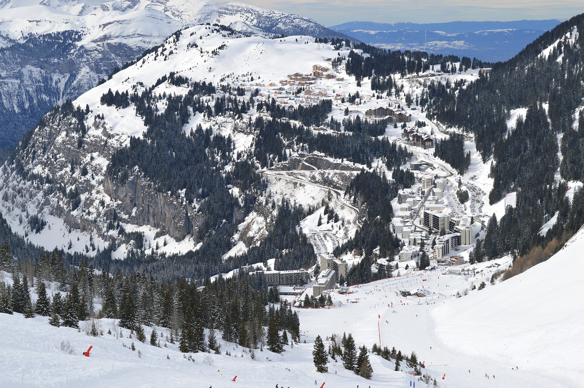
Grand Massif is one of the largest linked ski areas in Haute-Savoie, bringing together five resorts — Flaine, Les Carroz d'Arâches, Morillon, Samoëns and Sixt-Fer-à-Cheval — under a single lift pass. That connectivity makes it one of the go-to winter destinations in the French Alps for skiers who want variety without switching resorts. How big is the ski area? Grand Massif spans 265 km of pistes across 146 runs: 20 green, 64 blue, 49 red and 13 black. A network of 71 lifts moves skiers and snowboarders between the five resorts, and the terrain ranges from 697 m up to 2,480 m in altitude — a wide enough spread to cover very different snow conditions depending on where you ride. What's the standout run? The area's signature feature is the Grandes Platières summit station, starting point of the Piste des Cascades — a run of roughly 14 km with a vertical drop of nearly 1,700 m, descending all the way down to Sixt-Fer-à-Cheval. It ranks among the longest ski runs in the Alps and is a natural target for skiers after one long, continuous descent through changing terrain, from high alpine bowls near Platières to the valley approach into Sixt. The five resorts each bring their own flavor to the domain: Flaine sits highest and offers wide, open slopes; Samoëns and Sixt lie lower and keep a quieter, village feel; Les Carroz and Morillon act as convenient bases for reaching the central part of the area. How do you get there? The Grand Massif resorts are linked by road through the Arve valley, and the nearest major airport is Geneva, typically an hour to an hour and a half away depending on which resort you're headed to. Once on site, skiers can move between resorts directly on snow via the connected pistes, and winter shuttle buses also run between the villages. When should you visit? The ski season in Grand Massif generally runs from December to April. Snow reliability tends to hold longest at the higher elevations around Flaine and Grandes Platières, given the area tops out at 2,480 m, while the lower runs near Samoëns and Sixt depend more on recent snowfall. Frequently asked questions How many pistes does Grand Massif have? The area has 146 marked runs totaling 265 km, split across green, blue, red and black difficulty levels, served by 71 lifts. Which resorts make up Grand Massif? Flaine, Les Carroz d'Arâches, Morillon, Samoëns and Sixt-Fer-à-Cheval — all linked by a shared piste network and a single ski pass. What is the Piste des Cascades? It's the area's longest run, about 14 km with nearly 1,700 m of vertical descent, starting at the Grandes Platières station and finishing down in Sixt-Fer-à-Cheval. Is Grand Massif suitable for beginners? Yes — there are 20 green and 64 blue runs for newer skiers, though a large share of the terrain (red and black runs) is aimed at more advanced riders.
-
Artouste
Laruns
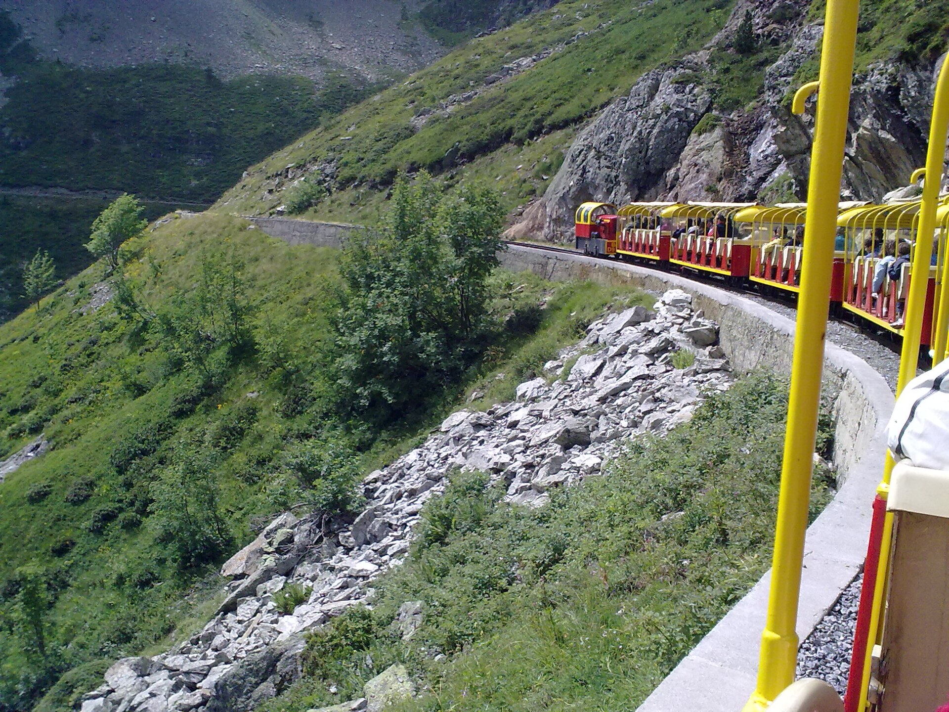
Artouste (Artouste-Fabrèges) is a winter sports resort in the commune of Laruns, deep in the French Pyrenees, in the Pyrénées-Atlantiques department (Nouvelle-Aquitaine region). The place leads a double life: a compact ski area in winter, and a summer destination built around one of the region's most distinctive rides — a high-altitude mountain train. What can you see in Artouste? The main draw is the Petit train d'Artouste, a narrow-gauge tourist train that runs at high elevation through the Pyrenean peaks. The line crosses open, rugged mountain terrain — valleys, ridgelines and rocky outcrops — heading toward a high mountain lake area. It's one of the few ways in the Pyrenees to reach genuine high-altitude scenery without a long hike, though the exposed route means fog, wind and shifting weather are common even in summer. Beyond the train itself, Artouste works well as a base for exploring the surrounding Ossau valley — an area favored by travelers looking for quiet, close contact with nature, and a calmer alternative to the busier Pyrenean resorts. How do you get to Artouste? Artouste sits within the commune of Laruns, one of the gateway towns to the Pyrénées-Atlantiques and the Ossau valley. Access is via local mountain roads leading up from Pau, the nearest larger city with rail links and an airport. Because the approach is mountainous, it's worth building extra time into the trip, especially outside summer, when weather can affect road conditions. When should you visit Artouste? Winter is ski season — Artouste runs as a small, low-key ski station, quieter and less crowded than the bigger Pyrenean resorts. In summer the character shifts entirely: the Petit train d'Artouste starts operating, and the area draws hikers and anyone chasing mountain views. Facing climate change and increasingly unreliable snowfall, the resort has been developing non-winter activities to keep drawing visitors outside the ski season — a shift now common across many Pyrenean and Alpine resorts. If the mountain train is the goal, summer is the time to come, when the line is running and views over the peaks and valleys are at their best. For a winter trip, check current snow conditions before setting out, since snowfall in the Pyrenees can be inconsistent from year to year. Frequently asked questions What is the Petit train d'Artouste? A high-altitude tourist train running near Artouste, one of the signature attractions of this part of the Pyrenees. It carries visitors into mountain terrain without requiring a long trek on foot. Which commune is Artouste part of? Artouste administratively belongs to the commune of Laruns, in the Pyrénées-Atlantiques department, Nouvelle-Aquitaine region. Is Artouste only a ski resort? No — while it started as a winter station, it now operates year-round: skiing in winter, and in summer a destination built around the mountain train and the surrounding Ossau valley. Is it worth visiting Artouste in summer if it's a ski resort? Yes — summer is exactly when the Petit train d'Artouste operates, and the mountain trails and views are fully accessible without needing any ski gear.
-
Les Arcs
Bourg-Saint-Maurice
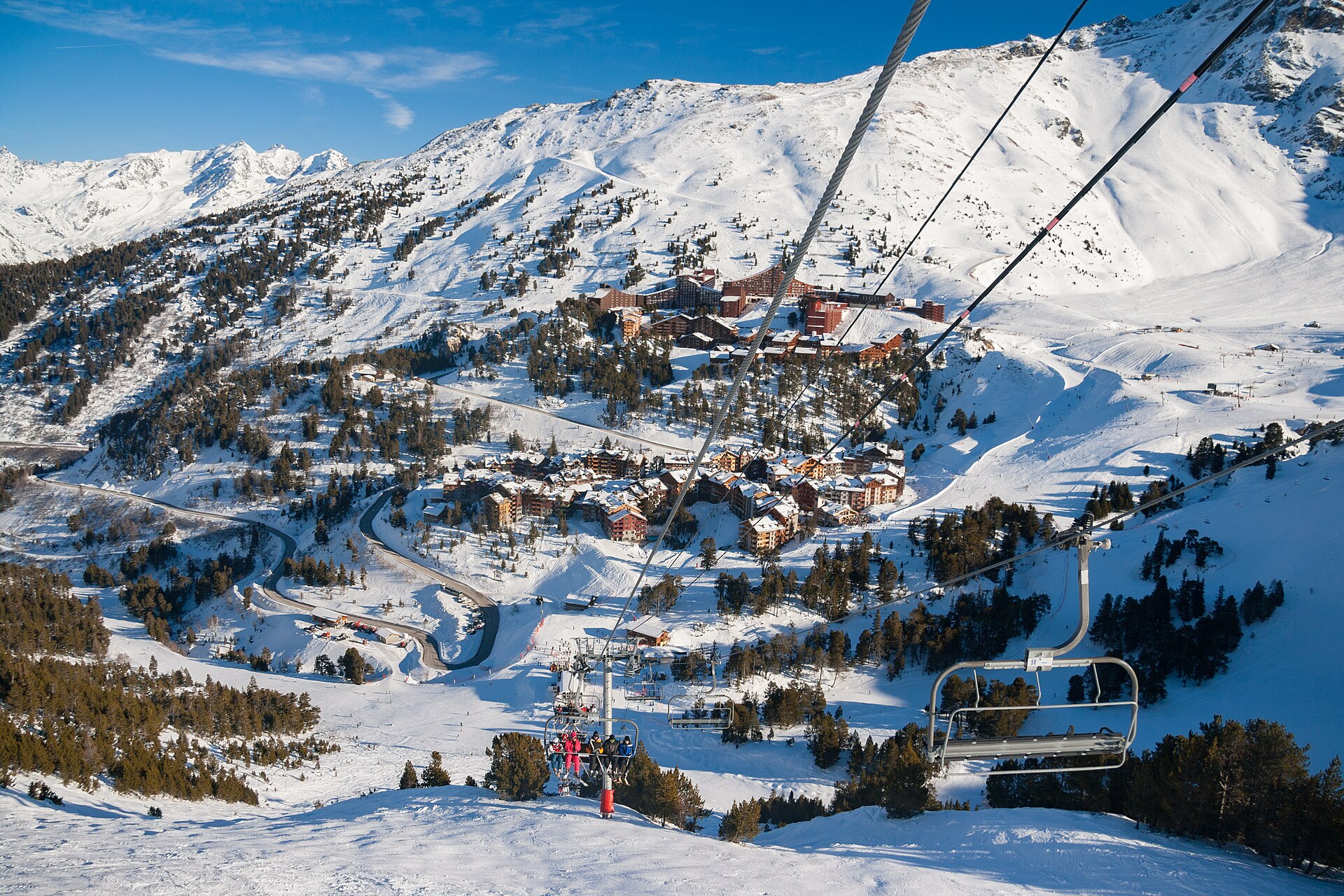
Les Arcs is a ski resort in the town of Bourg-Saint-Maurice, in the Tarentaise Valley, in the Savoie department of the French Alps. The resort was founded by Robert Blanc and Roger Godino and today forms part of the huge Paradiski ski area, operated by Compagnie des Alpes, a French publicly listed company that also owns several other ski resorts and theme parks. Where is Les Arcs located? The resort sits in the Tarentaise Valley, one of France's best-known winter sports regions, within the municipality of Bourg-Saint-Maurice in Savoie. Like many high-altitude Alpine resorts, it is set among peaks and side valleys that have drawn winter sports visitors from across Europe for decades. Bourg-Saint-Maurice itself acts as the gateway to the resort and the natural starting point for anyone heading up. Who built Les Arcs? Les Arcs was created by Robert Blanc and Roger Godino, who initiated the resort from scratch. Their project was part of a broader wave of purpose-built, master-planned ski resorts that spread across the French Alps in the second half of the 20th century — unlike older mountain villages that only gradually adapted to skiing tourism, resorts of this kind were designed from the outset with skiing as their main purpose. What is the Paradiski system? Les Arcs is one component of the vast Paradiski ski area, one of the larger interconnected lift-and-piste networks in the Alps. The whole system is owned by Compagnie des Alpes, a French-listed company that, alongside its ski resorts, also runs theme parks. That ownership structure means the resort's lifts, runs and related services belong to a larger, professionally managed network rather than operating as a stand-alone, independent resort. When should you visit? Like most resorts in the Tarentaise Valley, Les Arcs is primarily a winter destination — its lifts and pistes are geared toward the ski season, when they draw the bulk of the resort's visitors: skiers and snowboarders looking for a large, well-connected terrain within the Paradiski system. How do you get to Les Arcs? The starting point is Bourg-Saint-Maurice, the town at the foot of the resort, well connected to the rest of Savoie and onward to other parts of France. From there, roads and transport links lead up to the resort itself. For travelers planning a visit, Bourg-Saint-Maurice remains the natural reference point and base. Frequently asked questions Where exactly is Les Arcs? In the town of Bourg-Saint-Maurice, in the Tarentaise Valley, in the Savoie department of the French Alps. Who founded Les Arcs? The resort was created by Robert Blanc and Roger Godino. Who owns Les Arcs? It is part of the Paradiski ski area, operated by Compagnie des Alpes — a French publicly listed company that also owns other ski resorts and theme parks. When is the best time to visit Les Arcs? Mainly in winter, when the lifts run and the pistes are prepared for skiing.
-
La Croix de Bauzon
Borne
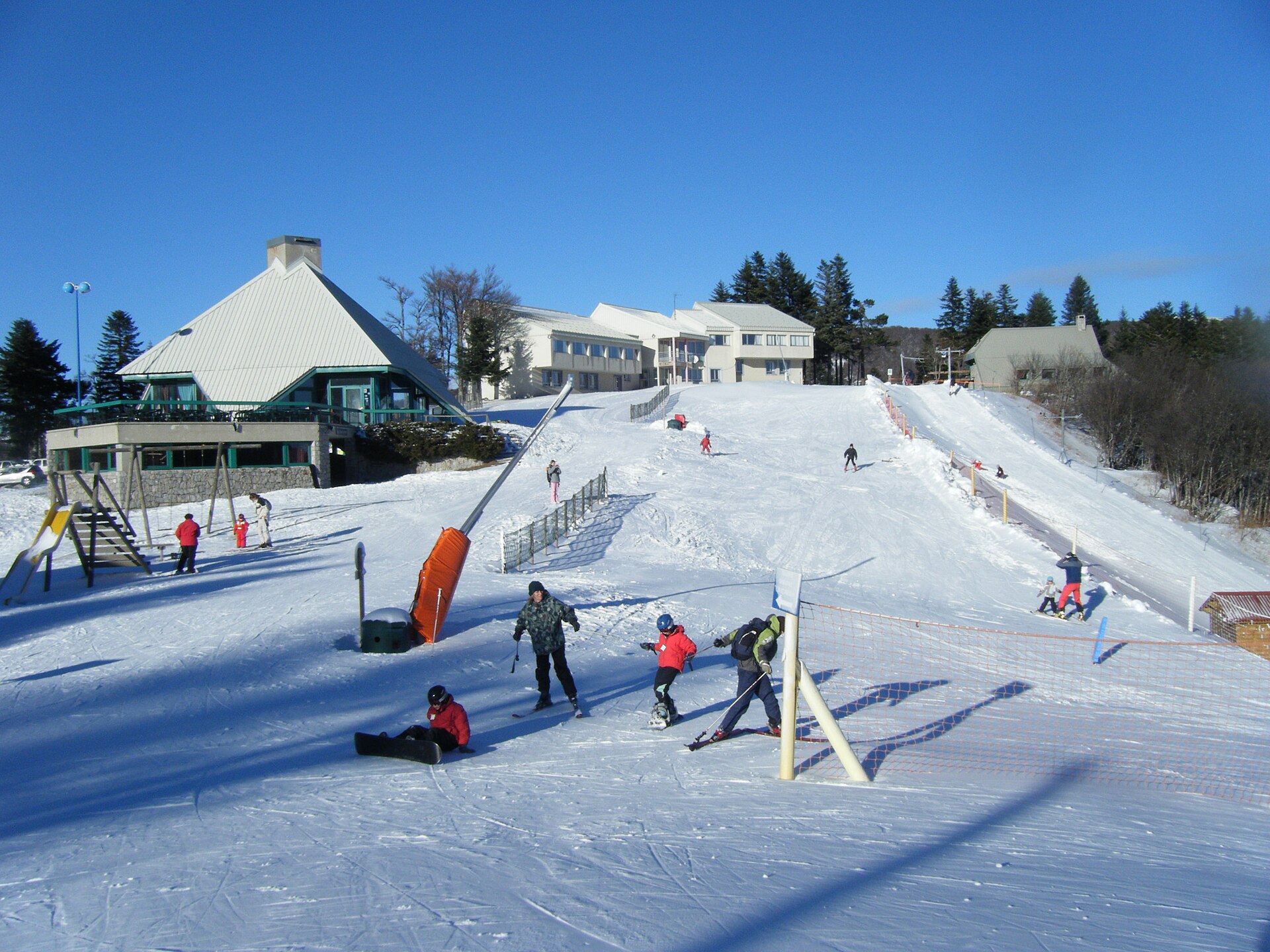
La Croix de Bauzon is a ski resort in the commune of Borne, in the Ardèche department, right in the heart of France's Massif Central. It holds a distinction that sets it apart in a region better known for gorges and vineyards than for skiing: it's the only operating alpine ski station in the entire department. How do you get there? The resort is reached exclusively via the departmental road D19, and the approach depends on which direction you're coming from. From the west, access runs through Borne via the Col du Bez. From the east, the road comes through La Souche via the Col de la Croix de Bauzon — the very pass the station is named after. It's worth planning the drive ahead of time: this is a mountain road, narrow in places, and winter conditions call for checking the forecast before setting out. What will you find there? The ski area spans an altitude range of 1,250 to 1,511 metres — relatively modest for an alpine resort, which means snow conditions here can vary noticeably from one season to the next. Skiers have eleven downhill runs to choose from: three green, six blue, one red and one black. The lift infrastructure includes five ski lifts, a moving carpet for beginners and children, and a rope tow (button lift). The resort also has a small cross-country skiing area — two trails covering 14.5 kilometres in total. The good news for budget-conscious families: access to the cross-country trails is free, which sets La Croix de Bauzon apart from most larger resorts in the Alps or Pyrenees, where a cross-country pass is typically a separate expense. The overall feel is low-key. This isn't a large resort with an extensive apres-ski scene — it's a local station used mainly by residents of the region and by visitors looking for a simple, affordable day of skiing without the crowds typical of major alpine destinations. When should you visit? The ski season here depends heavily on snowfall. Because of its moderate altitude (topping out at 1,511 metres), the resort is more sensitive to weather swings than high-mountain stations. It's worth checking the resort's current snow report before heading out, especially at the start and end of the season (December and March), when snow cover can be unreliable. In the depths of winter, with good snowfall, conditions can be genuinely rewarding, and the resort remains one of the few skiing options for many kilometres around. Outside the winter season, the area still has plenty to offer. The Col du Bez and Col de la Croix de Bauzon passes serve as starting points for hiking trips across the Massif Central, with views typical of Ardèche's volcanic landscape. Frequently asked questions Is La Croix de Bauzon a large ski resort? No — it's a small, low-key station, the only one currently operating in the whole of Ardèche. It offers eleven downhill runs and a modest cross-country area, without the scale of major alpine resorts. How do you reach the resort? Only via the D19 road, from the west through the Col du Bez (from Borne) or from the east through the Col de la Croix de Bauzon (from La Souche). Is cross-country skiing free? Yes, access to the two cross-country trails, totalling 14.5 km, is free of charge. What altitude do the downhill runs cover? The alpine ski area spans from 1,250 to 1,511 metres, which means snow conditions depend heavily on the weather in a given season.
-
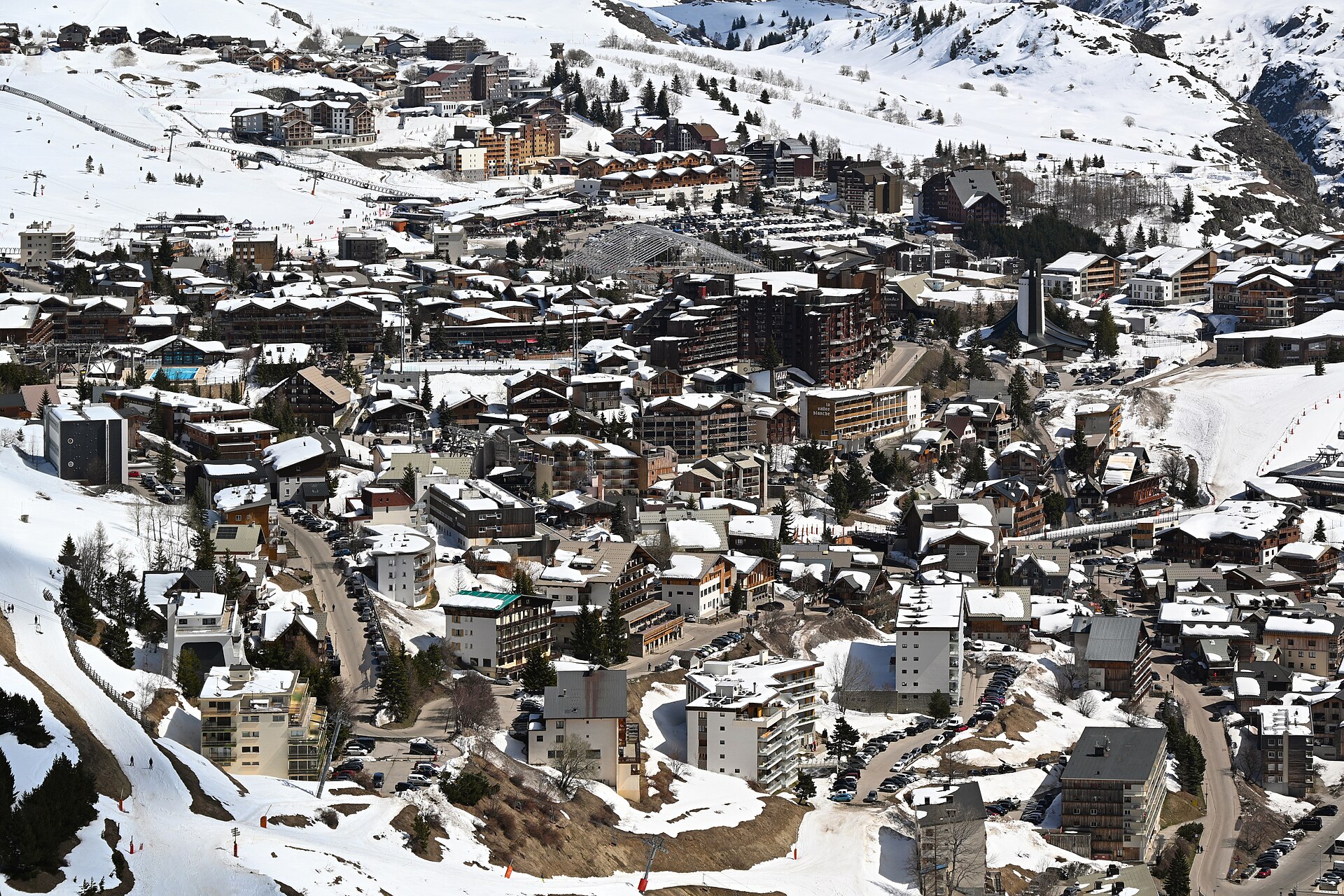
Alpe d'Huez
L'Alpe d'Huez
L'Alpe d'Huez is a mountain resort town in the commune of Huez, in the Isère department, in the Auvergne-Rhône-Alpes region of France. It sits in the central French Western Alps, with ski terrain ranging from 1,250 to 3,330 metres, close to the Écrins and Grandes Rousses mountain massifs. Where is L'Alpe d'Huez located? The resort sits on a sunny mountain terrace above the Romanche valley, in the heart of the French Alps. It is flanked by two major massifs: Écrins to the south and Grandes Rousses to the north. This open, high-altitude plateau setting, ringed by peaks, has made the area a natural draw for mountain tourism and winter sports. How big is the ski area? L'Alpe d'Huez ranks among the largest ski resorts in the northern French Alps, alongside Val d'Isère, Tignes, Courchevel, and Les Arcs. Its vertical range, from 1,250 up to 3,330 metres, is one of the most significant in the region, supporting a long season and a wide variety of runs — from gentle beginner slopes to demanding high-altitude terrain. How did the resort develop? L'Alpe d'Huez belongs to what's known as the second generation of ski resorts: destinations that grew gradually around small existing mountain villages, as opposed to third-generation resorts such as Courchevel, which were purpose-built from scratch as large-scale tourist complexes with extensive hotel capacity. A major boost to the resort's growth came from the Winter Olympic Games held in nearby Grenoble, which spurred substantial expansion of tourist and sporting infrastructure across the region. What should you know before visiting? Given the altitude of its upper slopes (up to 3,330 metres) and its proximity to major mountain massifs, L'Alpe d'Huez offers reliable ski conditions for most of the winter season. The resort falls administratively under the commune of Huez, which is worth knowing when planning travel or searching for local listings — some accommodation and services may appear under the commune's name rather than the resort name itself. Who is L'Alpe d'Huez suited for? The scale of the resort and its wide altitude range mean it appeals both to families looking for gentler slopes lower down and to more experienced skiers drawn to the higher terrain. Its position next to the Écrins and Grandes Rousses massifs also widens the options for visitors planning excursions beyond the resort itself. Frequently asked questions Where exactly is L'Alpe d'Huez? In the central French Western Alps, in the commune of Huez, Isère department, Auvergne-Rhône-Alpes region. What is the altitude range of the ski area? The slopes run from 1,250 up to 3,330 metres above sea level. Which mountain massifs are nearby? The Écrins and Grandes Rousses massifs. Is it a large ski resort? Yes — L'Alpe d'Huez is regularly listed alongside Val d'Isère, Tignes, Courchevel, and Les Arcs as one of the largest ski resorts in the northern French Alps.
-
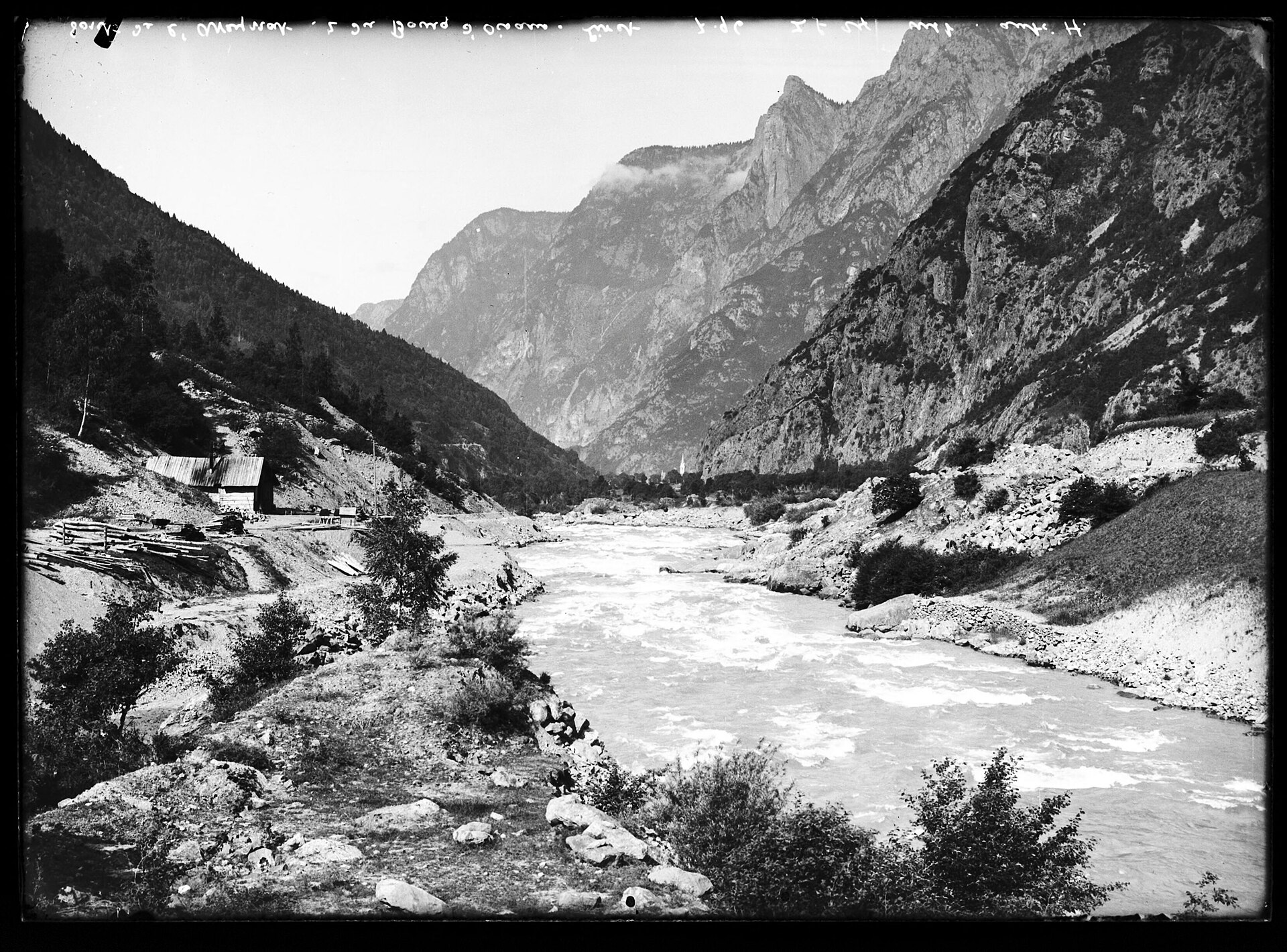
Rocher de l'Homme
Chamrousse
Rocher de l'Homme is a rocky summit reaching 1803 metres above sea level, rising above the resort of Chamrousse in the Belledonne mountain range, in the Isère department of southeastern France, not far from Grenoble. The name translates roughly as "the Man's Rock," a nod to the steep cliff face that has long stood out against the ridgeline above the Romanche valley. Where is Rocher de l'Homme located? The summit sits on the eastern rim of the Chamrousse plateau, exactly where the resort's gentle, forested slopes give way to sheer rock walls dropping toward the Romanche valley and the village of Livet-et-Gavet. Its neighbours include Grand Galbert and Cime du Cornillon, while a shallow col separates Rocher de l'Homme from the adjacent Cime des Fraches. How do you get there? The usual approach follows the D111 road from Vaulnavey-le-Haut toward Chamrousse, passing the former Chartreuse de Prémol monastery and the Lac Luitel nature reserve, known for its peat bogs and alpine flora. Around 1650 metres, a side road branches off to the Arselle plateau, a broad wetland area used as a Nordic ski centre in winter and as the main trailhead for this part of Belledonne in summer. Parking is available near the ski lodge at Arselle, and this is where most hikes to Rocher de l'Homme begin. What does the hike involve? From Arselle, the route climbs along a ridge toward the summit, staying away from the busier path to Lac Achard and offering a quieter alternative despite its scenic rewards. The descent follows a steep north-facing trail down to the col between Rocher de l'Homme and Cime des Fraches, and the loop closes near Pont de la Salinière before returning to the starting point. It is a short outing overall, but a demanding one, with real elevation change and a few exposed sections close to the cliff edge. What is the view like from the top? The main appeal of Rocher de l'Homme is the panorama. Standing above the vertical drop toward the Romanche valley, the summit offers a wide view of the eastern edge of the Vercors range, with the Taillefer massif in the foreground and, on clear days, the Grandes Rousses visible to the north. The sudden contrast between the calm Arselle plateau behind and the abrupt cliff in front is what draws both hikers and climbers to this particular spot. Is it also used for rock climbing? Yes. The cliffs below the summit host several established climbing routes of varying difficulty, making Rocher de l'Homme a popular training ground for climbers based around Grenoble who want quality rock without driving deep into the high Alps. Frequently asked questions How high is Rocher de l'Homme? The summit stands at 1803 metres above sea level. Where does the hike start? Most routes begin at the Arselle plateau, reached via the D111 from Vaulnavey-le-Haut, past Prémol and Lac Luitel. Is the trail difficult? It is short but demanding, with a steep descent and exposed stretches near the cliff edge, so previous mountain hiking experience is recommended. What can you see from the summit? Views extend over the Romanche valley toward the Vercors and Taillefer massifs, with the Grandes Rousses visible in good conditions to the north. Can you go rock climbing there? Yes, the rock face below the summit offers multiple climbing routes for different skill levels.
-
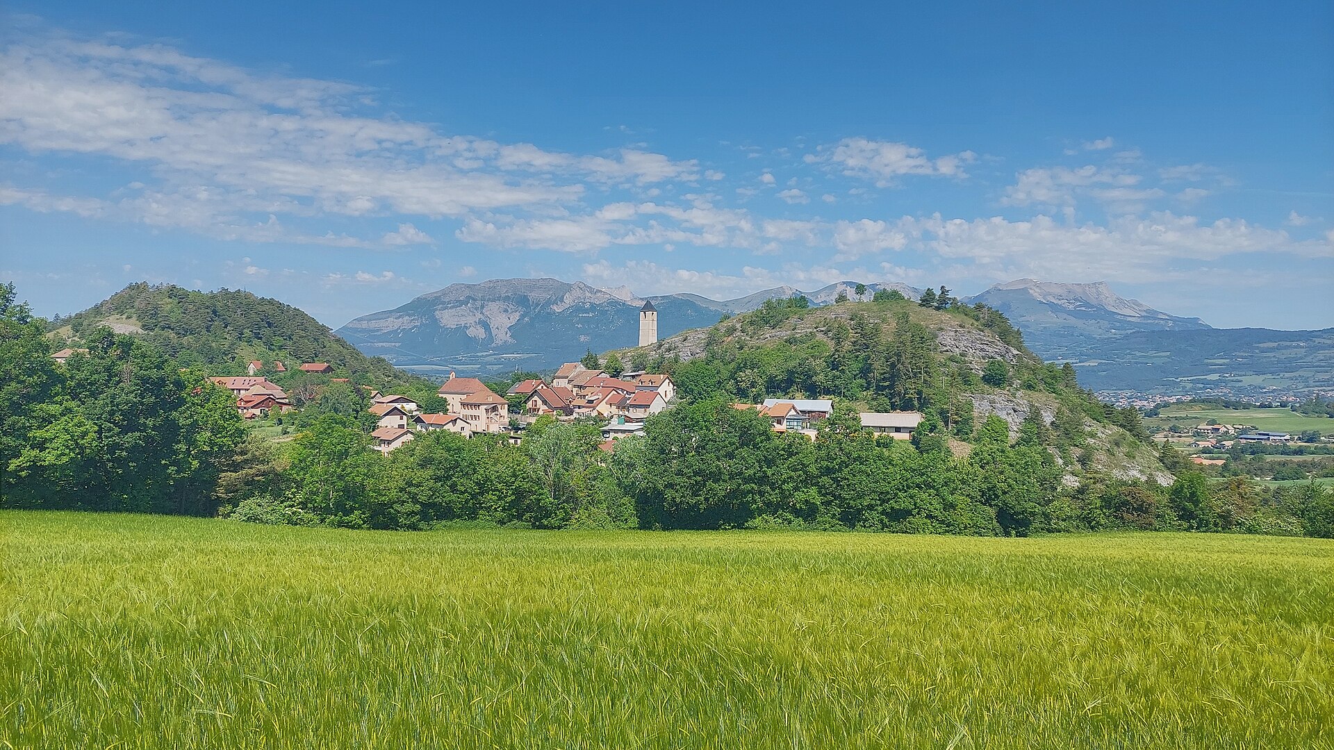
Le Couchon
Ancelle
Le Couchon is a mountain summit rising above the village of Ancelle in the Hautes-Alpes, at the heart of the Champsaur massif. Reaching 2,002 m, it is one of the region's most recognizable viewpoints, sitting on the edge of the Écrins National Park. Where exactly is it? Le Couchon rises directly above Ancelle, a small resort village about 17 km from Gap and 100 km from Grenoble. The summit also overlooks the neighboring Saint-Léger-les-Mélèzes ski resort, whose upper lift stations end right at its base — making the peak a natural landmark for the entire Champsaur valley. What will you see on the trail? The route up Le Couchon passes through coniferous forest and alpine pastureland typical of the high meadows around the Écrins massif. The loop trail covers roughly 12 km and is rated moderately challenging — suitable for hikers with average fitness who already have some mountain-walking experience. Along the way, the path opens onto views of the Rouanne valley and the Drac river. The real reward, though, is the summit panorama. On a clear day it stretches from the Gapençais to the Vercors, taking in the Écrins massif and the Monges massif, along with the full sweep of the Champsaur valley and the Dévoluy range. It's the kind of vantage point that captures the scale and variety of the Dauphiné Alps in a single view. When should you go? The best window for the climb is April through October, when the trail is free of snow and passable without winter gear. In summer the summit pasture is busy — it's a popular day hike for people based in Gap and visitors staying in Ancelle. In spring and autumn, expect a cooler wind along the ridge, so check the forecast before setting out. What are the rules inside the national park? Because the summit lies within the Écrins National Park zone, standard park restrictions apply: dogs must be kept on a leash (or are restricted in some areas), picking plants, minerals or fossils is forbidden, hunting and campfires are banned, and motorized aircraft — including paragliding in certain zones — are not permitted. There are no bins along the trail, so all rubbish must be carried back out. Frequently asked questions How high is Le Couchon? The summit reaches 2,002 m, making it a relatively gentle but clearly visible high point above the Champsaur valley. How long does the hike to the top take? The loop trail is about 12 km and rated moderately challenging — most hikers need roughly half a day depending on fitness. Is the trail suitable for beginners? Yes, with reasonable fitness and proper footwear the trail is accessible to most hikers, though some prior mountain-walking experience helps. Can you hike it in winter? The recommended season is April to October. Outside that window the trail is often snow-covered and requires winter equipment and mountain experience.
-
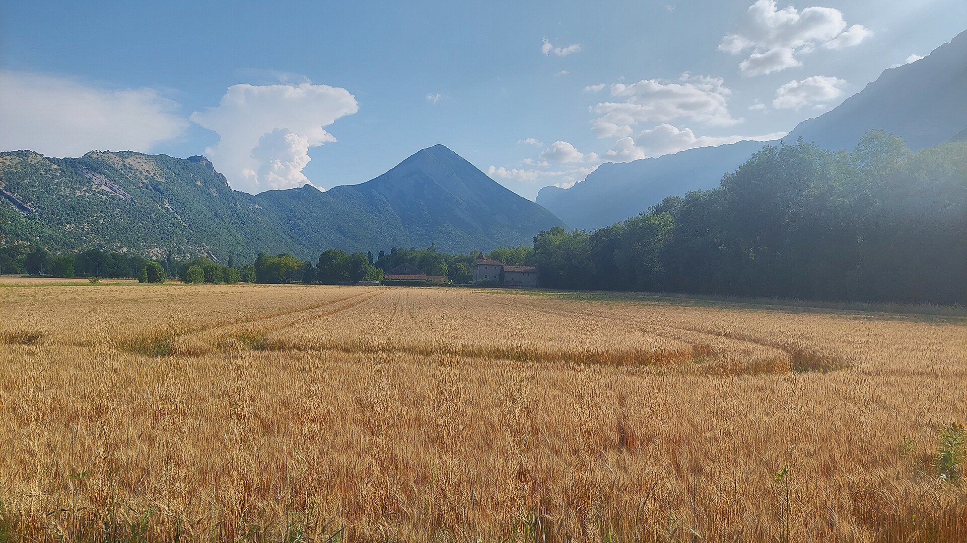
Le Pieu
Saint-Paul-de-Varces
Le Pieu is a 1,270-metre summit and the highest point of the Montagne d'Uriol, straddling the border between the communes of Saint-Paul-de-Varces and Vif on the eastern edge of the Vercors massif. Locally also known as "le Bémont," it is the culminating point of the whole Saint-Paul-de-Varces commune. How do you get there? The classic starting point is the Pont du Batou bridge over the Lavanchon stream, reached via the D107 road from Varces-Allières. The trailhead is also served by public transport, making it a practical car-free day out from the Grenoble area. Saint-Paul-de-Varces itself sits in a valley at the foot of Pic Saint-Michel, on the eastern flank of the Vercors plateau. What will you see on the trail? The loop around the summit, known as the Tour du Pieu, takes roughly 5 hours and winds through dense forest covering the mountain's slopes. The toughest section is the final 250 metres of ascent — a steep, wooded stretch where the path is sometimes faint, so sturdy footwear and attention are needed. The rest of the route follows gentler, scenic forest tracks. From the top, the panorama opens wide: the Grenoble conurbation and the Drac plain, the Vercors massif with its distinctive rocky "barrier," the Chartreuse range, the Belledonne chain, the Grandes Rousses, and Taillefer peak are all visible. Pic Saint-Michel (1,966 m) rises nearby, dominating the surrounding landscape. When should you visit? Spring and summer are the best times to climb, when the trails are dry and the views are clearest. In autumn the Vercors forests turn colourful, though the path can get slippery after rain. In winter, the steep wooded final stretch can be difficult or hazardous without proper gear, so it's worth checking snow conditions before setting out. Who is this trail suited for? Given the full loop's length (about 5 hours) and the steep, occasionally indistinct final climb, Le Pieu suits hikers with some basic mountain experience who are comfortable on uneven forest terrain. It remains fairly under the radar compared with the Vercors' better-known peaks, so visitors can expect a quieter, low-key atmosphere even in season. Frequently Asked Questions How high is Le Pieu? The summit reaches 1,270 metres and is the highest point of both the Montagne d'Uriol and the Saint-Paul-de-Varces commune. How long does the climb take? The full loop, known as the Tour du Pieu, takes about 5 hours, with the toughest stretch on the last 250 metres of ascent. Where's the best place to start the hike? The classic starting point is the Pont du Batou bridge over the Lavanchon stream, reached via the D107 from Varces-Allières; the trailhead is also accessible by public transport. What can you see from the summit? A wide panorama over Grenoble, the Drac plain, the Vercors massif, the Chartreuse and Belledonne ranges, the Grandes Rousses, Taillefer, and the nearby Pic Saint-Michel (1,966 m).
-
Charmant Som
Saint-Pierre-de-Chartreuse
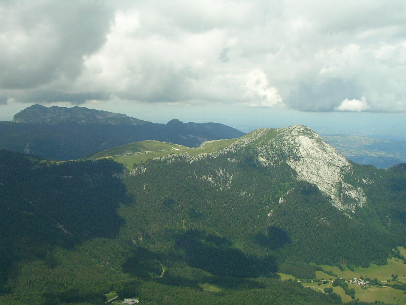
Charmant Som rises above Saint-Pierre-de-Chartreuse, right in the heart of the Chartreuse Mountains in the French Alps (Auvergne-Rhône-Alpes region, Isère department). At 1,867 metres, it's one of the gentler yet still striking summits of this limestone massif. What makes Charmant Som distinctive? Like the rest of the Chartreuse range, the mountain is built of limestone, but its relief is noticeably softer than the surrounding, sharper peaks. That gentleness is exactly what allowed broad alpine meadows to develop across its slopes — meadows that gave the mountain its name, evoking the charm of these high pastures. Shepherds have grazed sheep and cattle here since the Middle Ages, and that pastoral tradition still shapes the landscape today. How do you get to Charmant Som? A road built between the two world wars climbs to the mountain from Col de Porte, one of the main gateway passes into the Chartreuse Mountains. The road stops about 200 metres below the summit, so the final stretch has to be covered on foot. For most visitors this is a short but rewarding walk, manageable without technical mountain gear during the summer season. What will you find at the top? Near where the road ends, two buildings await: an inn and a cheese dairy (fruitière). This is where cheese has been made for generations from the milk of animals grazed on the surrounding alpine meadows — a good reason to stop for a taste after coming down from the summit. The open, sunlit pastures here contrast with the more rugged, rocky character of the rest of the Chartreuse Mountains, making Charmant Som an approachable outing for families and less experienced hikers alike. When is the best time to visit? Summer is the ideal season: the access road and paths are fully open, the meadows are green, and the inn near the summit is running. Mountain conditions in the Chartreuse can shift quickly, so it's worth checking the weather and road status before heading out, especially outside summer, when the upper slopes can hold snow. Who is this trip for? Charmant Som suits both hikers looking for an easy climb with a rewarding view and anyone keen to pair a walk with a taste of local mountain cheese straight from the producer. With Col de Porte as its starting point, it also makes a convenient day trip from Saint-Pierre-de-Chartreuse. Frequently asked questions How high is the summit of Charmant Som? The summit stands at 1,867 metres above sea level, in the Chartreuse Mountains in the Isère department. Can you drive almost all the way to the top? Yes. The road built between the world wars runs from Col de Porte and ends about 200 metres below the summit — the rest is on foot. What can you eat or buy on site? Near the end of the road there's an inn and a cheese dairy (fruitière), where you can try cheeses made from milk of animals grazed on the surrounding meadows. Why does Charmant Som look different from other Chartreuse peaks? It's built of limestone like its neighbours, but its relief is gentler, letting broad alpine meadows cover its slopes instead of bare rock.
-
Puy Ferrand
Chambon-sur-Lac
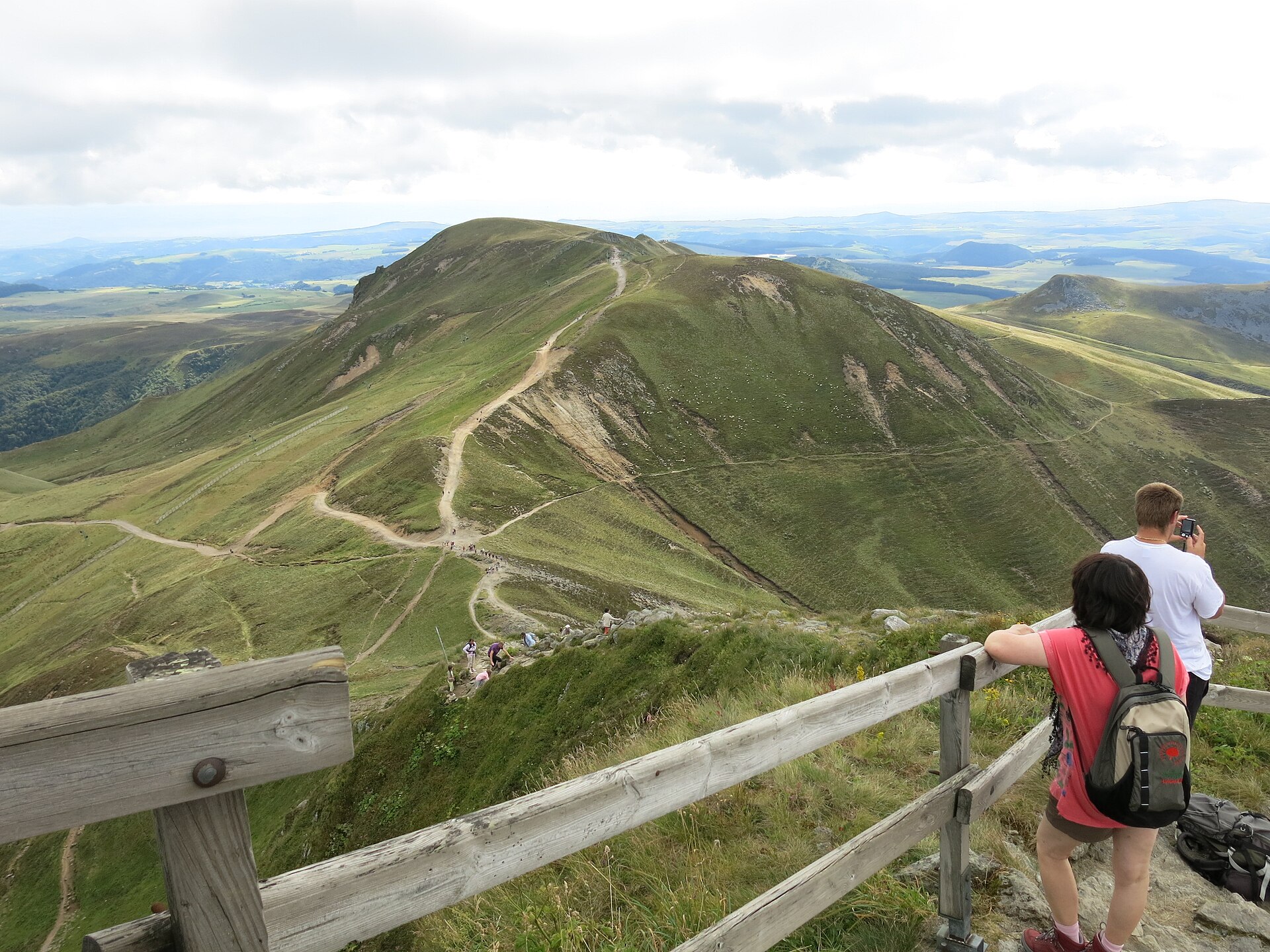
Puy Ferrand rises above Chambon-sur-Lac, at the heart of the Sancy massif in Auvergne. It reaches 1,854 metres, making it the second-highest summit of the massif after Puy de Sancy (1,885 m). Together with neighbouring peaks it forms a volcanic ridge overlooking the Chaudefour valley. What makes this summit worth knowing about? Puy Ferrand is a product of the same volcanic activity that shaped the whole Monts Dore range. Its eastern face drops steeply toward the Chaudefour valley and has long drawn climbers — it's one of the key alpine climbing sites in Auvergne, alongside the north face of Puy de Sancy. In winter, snow and ice fill the couloirs on that face, drawing ice climbers looking for technical routes; in summer the same rock offers harder scrambling and climbing lines for more experienced visitors. How do you get there and what does the approach involve? The starting point is the D36 road linking Mont-Dore and Chambon-sur-Lac, where a car park sits next to the Maison de la Réserve Naturelle Nationale de la Vallée de Chaudefour. From there, trails climb toward the summit, including a route along the ridge known as the crête du Moine. Another option is descending from Puy de Sancy itself — leaving the GR4 and GR30 trails to follow the ridge across to Puy Ferrand. Hikers after a wilder approach can take the path passing near the Cascade de l'Aigle waterfall, where mouflon and chamois are often spotted. What will you see along the way and from the top? The whole area lies within the Chaudefour Valley Nature Reserve, one of the most valuable natural sites in the Auvergne Volcanoes Regional Nature Park. Wild mouflon and chamois roam the slopes, and birds of prey can often be seen circling above the rock faces. From the summit of Puy Ferrand, the view takes in the neighbouring peaks of the Sancy massif, including Puy Gros and Puy de Sancy, along with the broad sweep of the Chaudefour valley below. When is the best time to visit? Summer and early autumn bring dry trails and the clearest views, making this the easiest window for a walking ascent without specialist gear. In winter, the eastern face turns into a destination for experienced alpinists chasing ice and snow couloirs — a serious undertaking that calls for proper equipment and preparation. In spring, after the snow melts, it's worth checking trail conditions, since the steeper sections can stay slippery. Who is this route suited for? The classic walking routes up Puy Ferrand suit hikers with good fitness who are used to mountain terrain — no climbing gear is needed, but the steep sections and the Sancy massif's changeable weather call for caution and good judgment. The eastern face is a different matter altogether, aimed at climbers looking for technical routes, especially in winter conditions. Frequently asked questions How high is Puy Ferrand? The summit reaches 1,854 metres, making it the second-highest peak in the Sancy massif after Puy de Sancy (1,885 m). Where's the best place to start the hike? Most hikers start from the car park on the D36 road between Mont-Dore and Chambon-sur-Lac, next to the Maison de la Réserve Naturelle de la Vallée de Chaudefour. Can you see wildlife on the trail? Yes — the Chaudefour valley nature reserve is home to mouflon and chamois, and birds of prey are frequently seen above the summit's rock faces. Is the eastern face of Puy Ferrand suitable for beginner climbers? No — it's terrain for experienced climbers, especially in winter, when the couloirs fill with the snow and ice conditions favoured by alpinists.
-
Ménez-Hom
Dinéault
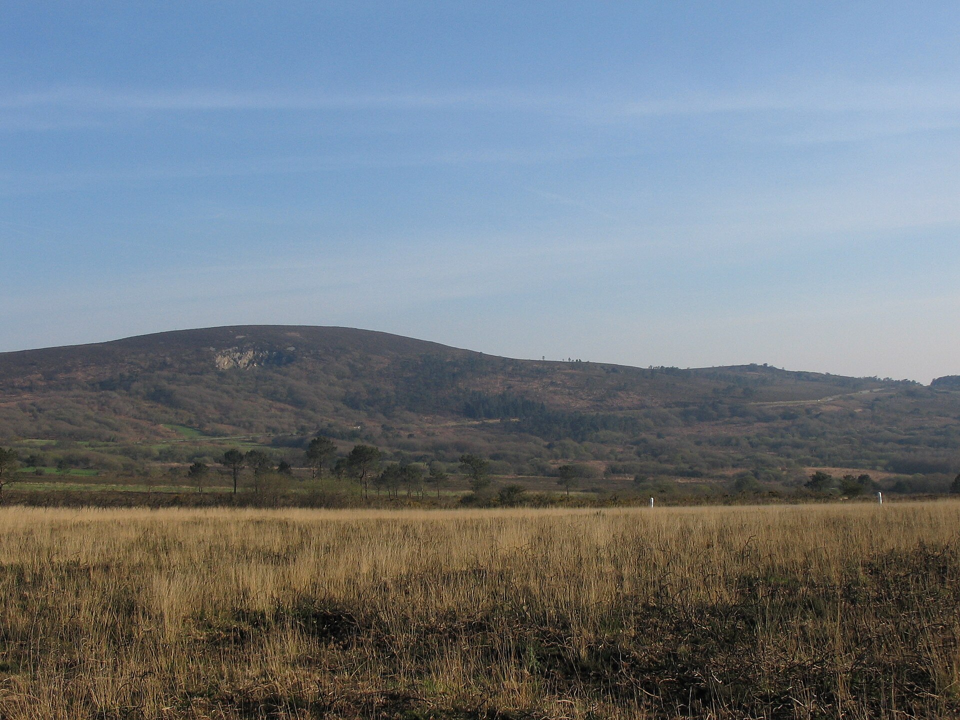
Ménez-Hom is one of Brittany's most recognizable summits, rising above the commune of Dinéault in the Finistère department. Its modest height of 330 meters hardly suggests it, but the view from the top ranks among the finest in the entire region. The hill closes off the Montagnes Noires range and overlooks Douarnenez Bay, forming a natural gateway to the Crozon peninsula. How do you get to Ménez-Hom? The easiest approach is from Châteaulin along the D887 toward Crozon. After roughly 11 kilometers you reach the Sainte-Marie-du-Ménez-Hom chapel; 1.5 kilometers further, a road branches off to the right and climbs another 2 kilometers to the parking area just below the summit. From there, the orientation table and viewpoint are only a few minutes' walk away, making the summit accessible even to casual visitors. The massif spans four communes — Plomodiern, Saint-Nic, Dinéault and Trégarvan — so hikers can start from several different sides of the hill. What will you see at the top? The short climb rewards visitors with a 360-degree panorama, one of the widest in the region. On a clear day, more than 50 church spires are visible to the naked eye, with sightlines stretching from the Crozon peninsula all the way to the Monts d'Arrée. In a single sweep you can take in the sea, heathland, river valleys and hill ranges — an unusually complete view for such a modest elevation. Just below the peak, an orientation table helps visitors identify what they're looking at, from Douarnenez Bay to the Brest roadstead and the Crozon peninsula itself. The hill's history runs deep. Prehistoric communities practiced religious rites here, leaving behind megaliths and stone cairns still scattered across the slopes. In 1913, a farmer working land at Kerguilly, in Dinéault, uncovered a small bronze head of a helmeted Gallo-Roman goddess — evidence of how long this place has drawn people to it. During the Second World War, German forces used the summit as an observation post; it was retaken by force by the French Forces of the Interior (FFI) in 1944. A local legend also clings to the hill: it tells of King Marc'h, ruler of Breton Cornouaille, said to have been cursed with a horse's ears. At the foot of the hill stands the Sainte-Marie-du-Ménez-Hom chapel, set against the bare heathland covering the southern slope. Every year, on the second Sunday of May, the chapel hosts a traditional pardon (religious pilgrimage) that draws visitors from the surrounding communes. When should you visit, and what is there to do? Ménez-Hom draws outdoor enthusiasts year-round. The hill and its network of trails are used for walking and horseback riding, mountain biking, and paragliding — strong winds coming off the bay make it one of the region's favorite paragliding launch points. The best time to climb is on a clear day, when the panorama reaches its full extent; foggy mornings, more common in winter, are best avoided. Spring and early summer also bring the heathland into bloom, adding extra color to the views from the slopes. Frequently asked questions How long does it take to reach the summit of Ménez-Hom? From the upper car park it only takes a few minutes to reach the viewpoint and orientation table, so the visit itself is short — getting there is the main part of the trip. Is Ménez-Hom suitable for families with children? Yes. The short stretch from the parking area to the summit is gentle and manageable for most visitors, regardless of fitness level. What can you see from the top on a clear day? On good visibility days you can spot more than 50 church spires, the Crozon peninsula, Douarnenez Bay, and the Monts d'Arrée range. Is there anything else worth visiting nearby? Yes — at the foot of the hill sits the Sainte-Marie-du-Ménez-Hom chapel, especially worth a visit during the May pardon.
-

Portes du Soleil
Saint-Jean-d'Aulps
Portes du Soleil is one of the largest ski areas on the planet, straddling the French-Swiss border between the Mont Blanc massif and Lake Geneva. The name covers a network of twelve linked resorts, including Morzine and Saint-Jean-d'Aulps on the French side and Champéry or Les Crosets on the Swiss side. Together they spread across roughly 1,000 km² and 14 valleys, putting Portes du Soleil among the two biggest ski regions in the world. How big is the ski area, really? Skiers get access to more than 650 km of marked pistes served by close to 200 lifts. The highest runs sit at 2,260 m, the lowest at 930 m — a spread that keeps skiing possible from early winter well into spring. Almost all the resorts are directly lift-linked, so a single lift pass lets you ski from France into Switzerland and back without ever taking your skis off. Only a handful of the more outlying villages are reached solely by the free local buses that circulate around the area. How do you get there? Morzine is the usual base on the French side, well connected to Geneva (the nearest major airport, roughly an hour's drive away) and to Chamonix and the Mont Blanc valley. Saint-Jean-d'Aulps sits a few kilometres further into the same valley, offering a quieter, less crowded base with direct access into the Portes du Soleil piste network. On the Swiss side, Champéry is a convenient entry point reachable by train from Aigle. Once inside the region, moving between resorts is done on skis, via the lift network, or on the local shuttle buses. What will you actually see? The scenery is classic Alpine valley terrain, ringed by mid-height peaks with the Mont Blanc massif visible in the distance and Lake Geneva glinting on the far side of the region. Lower runs cut through spruce forest, while higher pistes open onto exposed, rocky ridgelines — several of them sitting right on the France-Switzerland border, so a single run can mean crossing countries. Snow-making equipment covers the lower slopes, stretching the season beyond what natural snowfall alone would allow. When should you visit? The ski season typically runs from December through April, peaking in February and March when snow cover is most reliable across all elevations. For fewer crowds, January or early April tend to work well, with quieter slopes and still-decent conditions thanks to snow-making lower down. In summer the area shifts to hiking and mountain biking, including downhill trails, but winter remains the main draw. Frequently asked questions Does one lift pass cover both the French and Swiss resorts? Yes — the Portes du Soleil pass covers all twelve linked resorts on both sides of the border, and you cross between countries directly on skis. Are Morzine and Saint-Jean-d'Aulps connected to each other? Both towns sit in the same valley and share access to the Portes du Soleil piste network, though it's worth checking locally which links require the regional shuttle bus. What's the elevation range on the slopes? Runs span from 930 m up to 2,260 m, giving a wide range of snow conditions depending on the point in the season. Do you need the bus to see the whole area? Mostly not — lifts and pistes connect nearly everything — but a few of the more remote villages are served only by the free regional buses.
-
La Quillane
La Llagonne
La Quillane is a small ski resort in the commune of La Llagonne, right at the gateway to Capcir in the heart of the Pyrénées-Orientales, between Font-Romeu and Les Angles. It is the smallest alpine ski station in the French Pyrenees, part of the Neiges Catalanes (Catalan Snow) network, spread across an altitude of 1,710 to 1,810 metres. How do you get there? La Quillane sits within the commune of La Llagonne, in the Cerdagne-Capcir area, reachable by road from Perpignan heading toward Font-Romeu. The larger neighbouring resorts of Font-Romeu and Les Angles are close by, making La Quillane a convenient stop for visitors combining a broader tour of the region with a day on the snow. The nearby Col de la Quillane (1,713 m) connects the resort well to the wider Capcir plateau. What will you see? Despite its modest scale — around 2 kilometres of pistes, five runs in total (four green and one blue) served by a handful of lifts — La Quillane stands out for its intimate atmosphere and strong focus on families with children. The resort offers some of the longest skiing hours of any station in the Pyrénées-Orientales department, running from 9 a.m. to 8 p.m. Beyond conventional downhill skiing, La Quillane offers activities rarely found at larger resorts: driving vehicles on a snow-packed circuit (ice driving), husky sledding, pony sledding and pony rides, horse-drawn ski-joering, electric off-road scooters, and snow tubing runs. It's a destination built for families looking for varied winter experiences rather than for advanced skiers chasing long, demanding descents. Right next door, on the plateau and in the forests surrounding the Col de la Quillane, a 27-kilometre network of cross-country trails extends across the terrain as part of the broader Capcir Nordic domain. This makes a natural complement for cross-country skiers wanting to pair a visit to La Quillane with routes across the open plateau. When should you visit? The ski season at La Quillane typically runs from December through March or April, depending on snow conditions above 1,700 metres. Given the resort's family-oriented character and extended opening hours, winter school holidays or off-peak weekends are worth planning for — the slopes are quieter, and add-on activities like husky sledding are easier to book in advance. Frequently asked questions Is La Quillane suitable for beginners and children? Yes — this is one of the resort's main strengths. Four of its five runs are green, and its activity offering (pony rides, husky sledding, ice driving) is designed specifically with young children and families in mind. How many pistes does the resort have? Five downhill runs covering about 2 kilometres in total, including four green and one blue, spread between 1,710 and 1,810 metres altitude. Can you cross-country ski at La Quillane? Yes — right next to the resort, on the plateau and forest around the Col de la Quillane, there are 27 kilometres of cross-country trails that form part of the Capcir Nordic network. What sets La Quillane apart from larger resorts nearby, like Font-Romeu or Les Angles? Its scale and character. La Quillane is the smallest alpine ski station in the French Pyrenees, built around an intimate, family-friendly experience and long daily skiing hours (9 a.m.–8 p.m.), rather than an extensive terrain aimed at advanced skiers.
-
Station de Camurac
Montaillou
Station de Camurac is the only ski resort in the Aude department, straddling the border between the Pyrénées Audoises and Ariège, across the villages of Camurac and Montaillou. Its small scale and family-friendly feel set it apart from the bigger Pyrenean resorts — this is a place for skiers who want slopes without the crowds and lift queues. Where exactly is the resort? The chalets and tourist facilities cluster around Camurac, in the Pays de Sault, while most of the ski runs actually lie across the departmental boundary, on the territory of neighboring Montaillou in Ariège. The ski area sits between 1,550 and 1,800 meters of altitude, which keeps snow cover reliable through most of the winter season. How do you get to Camurac? Camurac can only be reached by road — there is no direct rail line into the resort. From Carcassonne the drive takes about 1 hour 30 minutes, and from Toulouse around 1 hour 45 minutes. The nearest train stations are in Foix and Ax-les-Thermes, from where you'll need a rental car or taxi to finish the journey. What will you find on the slopes in winter? In winter, skiers have 11 downhill runs served by 4 lifts: 2 green, 5 blue, 2 red and 2 black. Beginners get a dedicated learning area with a rope tow, plus a ski and snowboard school with a snow garden for young children. A network of 25 snow cannons keeps the pistes covered, and there's a toboggan run for anyone after a faster descent without skis. Beyond classic alpine skiing, the resort runs a broad menu of winter activities: dog-sled rides, cani-kart and cani-rando (running with a dog), rental of both classic and electric-assist mountain bikes, guided outings paired with themed workshops, and even a night in an igloo or an evening around the fire in a tipi. And in summer? Camurac has steadily reinvented itself as a year-round destination. In summer the terrain becomes a Bike Park with marked mountain-biking trails, and the surrounding forests and pastures make it a genuine hiking and MTB paradise — kilometers of trails wind through the varied high-mountain landscape of the Pays de Sault. Who runs the resort? Since 2014 the resort has been managed by the Communauté de communes des Pyrénées audoises, a joint-municipality body that has helped standardize investment in infrastructure and push forward the four-season strategy. When should you visit? The ski season generally runs from December to March, depending on snowfall — artificial snowmaking helps extend it in leaner years. Hikers and mountain bikers are best served between June and September, when the trails are fully open and temperatures favor outdoor activity. Frequently Asked Questions Is Camurac a large ski resort? No — it's the smallest and only ski resort in the Aude department, with 11 runs and 4 lifts. Its appeal lies in its intimate scale, not its size. Can you reach Camurac by train? There's no direct rail connection. The closest stations are Foix and Ax-les-Thermes, and you'll need to continue by car or taxi from there. Is Camurac suitable for children? Yes — the resort runs a ski and snowboard school with a snow garden for young kids, plus a separate gentle learning zone for beginners. What can you do in Camurac outside the winter season? In summer the resort operates a Bike Park and offers a dense network of hiking and cycling trails through the forests and pastures of the Pays de Sault.
-
Chézery-Menthières Area
Chézery-Forens
Chézery-Menthières is a small ski station located in the commune of Chézery-Forens, tucked into the Jura massif in the Ain department, right at the foot of the Crêt d'Eau peak. The Menthières resort is part of the Monts Jura ski area and draws mainly families looking for a quieter alternative to the bigger, busier Alpine resorts. How do you get to Menthières? The resort sits at Stade de neige de Menthières, 01410 Chézery-Forens, in the heart of the Ain Jura, close to the Swiss border. The nearest major airport is Geneva, roughly 60 km away, while Lyon-Saint-Exupéry airport is about 90 km away — around a 1.5-hour drive. Thanks to its proximity to Geneva, Menthières is a popular easy day-trip destination for skiers based in the Geneva region. What does the ski area offer? The alpine ski domain at Menthières covers around 8 km of runs, spread between 1,050 and 1,534 metres in altitude. Skiers have 9 downhill runs to choose from, spanning a range of difficulty levels: 2 green runs, 2 blue runs, 4 red runs, and 1 black run. That mix makes the station particularly welcoming for beginners and families with children, while more experienced skiers can still test themselves on the black run. Beyond the downhill slopes, Menthières also has a dedicated sledging slope, a cross-country skiing area, and marked snowshoeing trails — making it a well-rounded destination for both fast-paced skiing and calmer winter activities. Who is this resort best suited for? Menthières is above all a place to learn and discover winter sports. Its compact scale, the gentle profile of most runs, and the magic carpet lift for younger children make it an ideal spot for a first encounter with skiing — without the crowds and long lift queues typical of larger resorts. How much does a lift pass cost? A day pass costs 19 € per person, while a pass limited to the magic carpet lift costs 12 € per person. Children under 5 get free access upon presenting ID at the ticket office. When is the best time to visit? The ski season at Menthières generally runs from December to March, depending on snow conditions in this part of the Jura. Given the resort's moderate altitude (topping out at 1,534 m), it's worth checking current snow reports before heading out, especially early and late in the season. Frequently asked questions Is Menthières suitable for beginner skiers? Yes — that's one of the resort's main strengths. The predominance of green and blue runs, plus the magic carpet lift for children, make it a popular choice for first ski lessons. How far is Menthières from Geneva? About 60 km, making it one of the closer ski options for people living in the Geneva area. Can you go cross-country skiing at Menthières? Yes, alongside the downhill runs the resort also has a cross-country skiing area and marked snowshoeing trails. What is the highest point of the ski area? The slopes reach up to 1,534 metres, and with the base at 1,050 metres, that vertical drop allows for varied runs despite the domain's relatively small overall size.
-
Paradiski
Peisey-Nancroix
Paradiski is a large linked ski area in the Tarentaise Valley, with Peisey-Nancroix serving as one of its main gateway villages in the heart of the French Alps. What exactly is Paradiski? Paradiski isn't a single resort but a network tying together three ski areas: La Plagne, Les Arcs, and Peisey-Vallandry. The link between them is the Vanoise Express, a double-decker cable car that opened in December 2003. It crosses the valley separating the La Plagne and Les Arcs massifs in just a few minutes, letting skiers ride one side of the valley in the morning and switch to the other resort's slopes in the afternoon without ever taking off their skis or relying on road transport. How big is the ski area? The scale of Paradiski is one of its main selling points: across the three linked resorts there are 425 km of pistes served by 160 lifts. The mix leans toward easier terrain — 152 green and blue runs make up the bulk of the network, making the area welcoming for beginners and families. On top of that there are 79 red runs for intermediate skiers and 22 black runs for those chasing steeper, more technical terrain. With that range, a week-long stay can easily be filled without skiing the same run twice. How do you get to Peisey-Nancroix? Peisey-Nancroix sits in the Tarentaise Valley, in the Savoie region, directly adjacent to Les Arcs. That position makes it a convenient base for reaching both the Les Arcs and Peisey-Vallandry slopes, and — thanks to the Vanoise Express — La Plagne as well. For visitors who prefer a quieter base than the larger Les Arcs resort villages, Peisey-Nancroix offers a calmer alternative with direct access to the same connected ski area. What should you know before visiting? The Vanoise Express ride itself is worth experiencing as an attraction in its own right, not just a means of transport. The cabin climbs high above the valley floor, giving passengers sweeping views of the surrounding peaks and glaciers. When it opened, this cable car was a genuine breakthrough — it was the first time two large, previously separate ski areas were joined this efficiently without requiring a descent into the valley in between. Building a day around a Vanoise Express crossing is a good way to make the most of a Paradiski stay. Frequently asked questions What is the Vanoise Express cable car? It's a double-decker aerial lift that opened in December 2003, connecting the La Plagne and Les Arcs ski areas by crossing the valley between them in a matter of minutes, without the need for road transfers. How many pistes does Paradiski have? The combined ski area totals 425 km of pistes served by 160 lifts, broken down into 152 green/blue runs, 79 red runs, and 22 black runs. Who is this ski area best suited for? With a strong majority of easy and intermediate runs, Paradiski works well for families and beginner-to-intermediate skiers, while its 22 black runs still give more advanced skiers plenty to work with. Where exactly is Peisey-Nancroix relative to Paradiski? Peisey-Nancroix is a village in the Tarentaise Valley next to Les Arcs, functioning as one of the gateway bases into the wider Paradiski ski area, including La Plagne via the Vanoise Express.
-
Glières Plateau
Glières-Val-de-Borne
Plateau des Glières is a limestone upland in the Bornes Massif, part of the commune of Glières-Val-de-Borne in Haute-Savoie — a place that carries both the weight of French Resistance history and a reputation as one of the region's best cross-country skiing grounds. What is this place? Sitting at roughly 1,400–1,500 meters and ringed by the ridgelines of the Bornes Massif, the plateau lies about 15 km from Thorens-Glières and just under 30 km from La Roche-sur-Foron. It's a wide, open highland basin — summer pasture and meadow, winter snowfield — that has become one of Haute-Savoie's signature spots for cross-country skiing. Historically, Glières is a name tied directly to the French Resistance during the Second World War. In spring 1944, several hundred Maquisards gathered on the plateau, hoping to receive Allied arms drops and organize resistance against Vichy and German forces. The confrontation that followed ended badly for the Resistance fighters on the ground, but it left the plateau permanently etched into French national memory as one of the enduring symbols of wartime resistance. How do you get there? Access is by road from the valley floor, with parking at the main entry points onto the plateau — typically approached via Petit-Bornand-les-Glières or Thorens-Glières. In winter, access can depend on snow conditions, and some approach roads are specifically maintained for ski traffic. The nearest larger towns are Annecy and La Roche-sur-Foron, both connected by local roads running up toward the Bornes Massif. What will you see up there? The historical heart of the plateau is the National Necropolis (Nécropole Nationale des Glières), anchored by a striking memorial monument sculpted by Émile Gilioli in tribute to the fallen Resistance fighters. A small museum or memorial house nearby fills in the story of the 1944 events for visitors. Beyond the history, the plateau is above all an open-air playground: an extensive network of groomed cross-country ski trails in winter, and in the warmer months, hiking and cycling routes that climb toward the surrounding peaks and passes of the Bornes Massif, opening up views over the Savoy Alps and the Arve valley. When should you visit? Winter (December to March) is cross-country ski season — the plateau has a well-established trail network spanning difficulty levels, appealing to beginners and seasoned skiers alike. In summer (June to September), it becomes a hiking destination in its own right: the open terrain and moderate elevation gain make it a more accessible alternative to the region's higher, more demanding alpine routes, and a solid option for families. Frequently asked questions What's the historical significance of Glières? In spring 1944, several hundred Maquisards — French Resistance fighters — gathered on the plateau, clashing with German and Vichy forces. The National Necropolis, with its Émile Gilioli monument, commemorates the event today. Can you go cross-country skiing here? Yes — the plateau is one of Haute-Savoie's recognized cross-country skiing centers, with a groomed trail network covering multiple difficulty levels. Are the hiking trails suitable for families? Yes, many routes across the open plateau have gentle gradients and don't require high-mountain experience, though checking current weather conditions before setting out is always a good idea. What's the best way to plan the drive there? The easiest approach is from Annecy or La Roche-sur-Foron toward Thorens-Glières or Petit-Bornand-les-Glières, from where signed access roads lead up onto the plateau with marked parking areas.
-
Gourette
Gourette
Gourette is a ski resort in Eaux-Bonnes, tucked into the French Pyrenees. Sitting at 1,400 m altitude in the Pyrénées-Atlantiques department, Nouvelle-Aquitaine region, it lies right on the D918 road that climbs over the Col d'Aubisque mountain pass. Gourette belongs to the N'PY group, a network of ski resorts on the French side of the Pyrenees. How do you get to Gourette? The nearest airport is Pau-Pyrénées, connected to the resort by a drive through the scenic valleys of the Béarn region. The village itself sits directly on the D918 — the same road famous among cycling fans as one of the classic, punishing climbs of the Tour de France over the Col d'Aubisque. Winter access calls for caution, since the route winds through mountain switchbacks, and local authorities regularly post updates on road conditions and snow-chain requirements. What is there to see, and what kind of resort is it? Gourette is first and foremost a ski destination — the ski area spans altitudes from 1,350 to 2,450 m and covers 140 hectares with 42 km of marked slopes. That range suits both families looking for gentler runs and stronger skiers who'll appreciate the vertical variety. The setting is classic high-Pyrenean scenery: steep ridgelines, open valleys, and views stretching toward the Spanish border. Outside the ski season, the area around Gourette and the Aubisque pass turns into a draw for hikers and cyclists — the same slopes that carry skiers in winter become walking trails and a road-cycling pilgrimage site in summer, tracing the route of legendary mountain stages. When is the best time to visit? The ski season in Gourette typically runs from December to April, depending on snow conditions — as a resort at a relatively low altitude compared to Alpine counterparts, it's sensitive to weather swings, so it's worth checking current slope conditions before heading out. Spring and summer, by contrast, are the season for hiking and cycling over the Aubisque pass, when the road is fully clear and snow-free. Who is Gourette good for? The resort works well as a short getaway for families and groups of friends looking for an alternative to bigger, busier Alpine destinations. Its proximity to Pau and the Béarn region also makes it easy to combine with a broader Pyrenean trip without a long haul deep into the mountains. Frequently asked questions How big is the ski area in Gourette? The ski area covers 140 hectares with 42 km of marked slopes, spanning altitudes from 1,350 to 2,450 m. What's the nearest airport? The closest airport is Pau-Pyrénées. Does Gourette sit on a famous cycling route? Yes — the D918 road leading to the resort crosses the Col d'Aubisque, one of the Tour de France's classic mountain stages. Which resort group does Gourette belong to? Gourette is part of the N'PY group of ski resorts on the French side of the Pyrenees.
-
La Pierre-Saint-Martin
Arette
La Pierre-Saint-Martin is a ski resort and summer mountain destination in the commune of Arette, in the Pyrénées-Atlantiques department of the Nouvelle-Aquitaine region. Set in Béarn, at the western edge of the French Pyrenees, it is the first alpine ski station travelers reach when approaching the range from the west. The resort has two very different sides: in winter it's a small, family-oriented ski village tucked into a pine forest, and in summer it becomes a gateway to one of the largest karst massifs in Europe. How do you get there? The resort sits in the mountains above the village of Arette, reached via a local access road. The nearest larger town is Oloron-Sainte-Marie, seat of the arrondissement to which Arette belongs. Driving from Pau or Oloron typically takes around an hour, depending on mountain road conditions — in winter it's worth checking whether the route is clear or requires snow chains. During the ski season, organized shuttle transport also runs from nearby towns. What will you see there? The ski domain climbs to roughly 2,200 meters and includes several dozen pistes totaling more than 30 kilometers, spread across multiple sectors of varying difficulty — from gentle beginner runs to more demanding descents for advanced skiers. The resort village, a cluster of chalets set among pine trees, has a compact, family-friendly feel that sets it apart from larger, busier Pyrenean resorts. Outside the winter season, the biggest draw is the massif itself. La Pierre-Saint-Martin sits on one of the most extensive karst areas in Europe, well known among speleologists worldwide. Deep underground, the massif hides famous cave systems that have drawn cavers for decades to explore its shafts and branching passages. For regular visitors, the nearby Verna cave — about 20 minutes from the resort — offers a way to experience this underground world without any caving equipment; it's one of the few large karst caves in the region open to the public. In summer the massif turns into hiking territory, with trails crossing pastures, limestone outcrops, and viewpoints over the surrounding peaks of Béarn. When should you visit? The ski season generally runs from December through late March or early April, depending on snow cover — as a family-oriented resort, La Pierre-Saint-Martin tends to be quieter than larger stations, which suits families with children and skiers looking to avoid crowded slopes. Summer (June to September) is the best time to visit the Verna cave and hike the karst massif, when mountain weather is at its most stable. Spring and autumn are quieter transitional periods, less visited but appealing for those seeking mountain scenery without the crowds. Frequently asked questions Is La Pierre-Saint-Martin suitable for families with children? Yes, the resort is known as a family-friendly station — its compact village, gentler runs, and ski school make it a good choice for beginners and families alike. Can you visit the caves without caving experience? Yes, the Verna cave, about 20 minutes from the resort, is set up for tourist visits and doesn't require specialized caving equipment. How long are the ski runs? The domain offers several dozen pistes totaling more than 30 kilometers, spread across multiple sectors up to about 2,200 meters in altitude. Does the resort operate in summer too? Yes, outside the winter season the karst massif offers hiking trails, viewpoints, and cave access, making La Pierre-Saint-Martin a year-round destination.
-
Mouthe
Mouthe
Mouthe is a small commune in the Doubs department, in the Bourgogne-Franche-Comté region of eastern France, best known for two things: holding the record for the coldest temperature ever measured in France, and being the source of the Doubs river. Set high in the Jura mountains, it has long, snow-reliable winters that turned it into one of the region's main cross-country skiing hubs. Where is Mouthe located? The village sits deep in the French Jura, close to the Swiss border, surrounded by spruce forests and the wide limestone plateaus typical of the area. The landscape of valleys, springs, and rolling highlands has made it a quiet destination for travelers looking for nature away from crowded resort towns. Why is Mouthe called the coldest place in France? Mouthe regularly comes up in discussions of French temperature records because it recorded the lowest temperature ever measured in the country. The reason lies in its position inside a mountain basin in the Jura: cold, dense air sinks down the surrounding slopes and pools in the low ground, creating what's often called a "cold air lake" effect. This makes winters here notably harsher than in much of the rest of mountainous France. The source of the Doubs river Just outside the village, the Doubs river begins its course. From this source it winds through a large stretch of eastern France, carving scenic loops and gorges before eventually joining the Saône. For visitors interested in the region's geography, the river's source point makes a natural short walking destination and a easy way to connect the village to the wider landscape it feeds. Cross-country skiing and winter sports Thanks to its dependably long snow season, Mouthe developed into one of the Jura's cross-country skiing centers. The trail network around the village makes use of the gentle slopes, open clearings, and conifer forest typical of the plateau, offering routes suited to beginners as well as more demanding terrain for experienced skiers. In winter, the area serves as a base for visitors seeking an alternative to the busier Alpine resorts further south and east. How to get to Mouthe? Because the village lies well inside the Jura massif, driving is the most practical option — roads from Pontarlier or Besançon wind through hilly terrain to reach it. It's worth allowing extra travel time, especially in winter, when road conditions in the higher parts of the Jura can be demanding. When to visit? Winter is the obvious season for cross-country skiing and snow-covered scenery, though visitors should be prepared for the low temperatures the area is known for. In summer, the surrounding countryside offers quieter hiking and cycling, with milder weather and noticeably fewer visitors than during the ski season. Frequently asked questions Did Mouthe really record the coldest temperature in France? Yes, the village is widely known for the lowest temperature ever measured in the country, a result of its location within a mountain basin that traps cold air. Is Mouthe suitable for beginner cross-country skiers? Yes, the surrounding trail network includes gentle sections for beginners alongside more challenging terrain for experienced skiers. Where does the Doubs river begin? The Doubs river rises just outside Mouthe, from where it flows across a large part of eastern France. Is Mouthe worth visiting outside winter? Yes, in summer the area offers quiet hiking and cycling through Jura forests and plateaus, with far fewer visitors than in the ski season.
-
Les Fourgs
Les Fourgs
Les Fourgs is a small commune in the Doubs department, in the Bourgogne-Franche-Comté region, tucked into the Jura mountains right on the border with Switzerland. The village is best known as a cross-country skiing station, one of the places that gives the whole border area of Doubs its distinctive winter character. Where is Les Fourgs? The village sits on a high, gently rolling plateau of the Jura range, directly against the French-Swiss border. That proximity has earned Les Fourgs something of a reputation as a "gateway" to Switzerland — the border crossing is only a few minutes' drive from the village center. This position makes it a convenient base both for travelers exploring the French side of the Jura and for those who want to slip across into Switzerland for a day. What draws visitors to Les Fourgs? Cross-country skiing is the main draw. The landscape around the village — soft, undulating Jura hills covered in conifer forest and open pastureland — lends itself naturally to nordic ski trails, and locals and visitors alike have used the terrain for this purpose for a long time. In winter, Les Fourgs becomes a starting point for outings across the network of trails linking neighboring Jura villages, and the atmosphere is typical of small mountain ski communities in the region — quiet, close to nature, and built around trails rather than large-scale downhill infrastructure. Outside the snow season, the surroundings of Les Fourgs remain appealing to hikers and cyclists. The same corridors used for skiing in winter turn into walking and biking routes in summer, running through the forests, pastures, and limestone hills that define the Jura landscape. How to get to Les Fourgs? Les Fourgs sits at the heart of the Jura, in the Doubs department, reached by car via local roads that climb into the mountains from the larger towns of the Bourgogne-Franche-Comté region. Thanks to its border location, travelers coming from the Swiss side — around the Vallée de Joux and canton of Vaud — find the village just as easy to reach as those arriving from France. Given the mountainous terrain, it's worth planning the drive in advance, especially in winter, when road conditions in the Jura can be demanding. When is the best time to visit? Winter, from December through March, is when Les Fourgs shows its most distinctive side as a cross-country skiing station. This is when the surrounding trails see the most activity and the village takes on the rhythm of winter sports. In summer and early autumn, the area offers a quieter but equally worthwhile experience, suited to travelers looking for mountain calm away from crowded tourist routes. Frequently asked questions Is Les Fourgs a large ski resort? No — Les Fourgs is primarily a cross-country skiing station, not a large downhill resort. The village has a small-scale, close-to-nature character built around trails through the Jura's forests and pastures. How close is it to Switzerland? Very close — Les Fourgs lies right on the French-Swiss border, making it a convenient base for exploring both sides. Is there anything to do outside ski season? Yes. In summer, the same terrain used for cross-country skiing becomes a network of hiking and cycling routes, well suited to visitors seeking a quiet mountain getaway. Which region of France is Les Fourgs in? The village belongs administratively to the Doubs department, in the Bourgogne-Franche-Comté region of eastern France, within the Jura mountain range.
-
Lélex-Crozet Area
Lélex
Lélex-Crozet (Monts Jura) is the main ski area of the larger Monts Jura resort, located in the village of Lélex in the Jura mountain range, Ain department, France. Where is it located? Lélex-Crozet sits in the heart of the Jura Mountains, with the ski area spanning altitudes from 900 m to 1,680 m. It lies beside Crêt de la Neige, the highest summit of the French Jura. The runs on the Lélex side are the longest in the whole resort, offering a vertical drop of up to 800 metres — the biggest in the entire Jura massif. What will you find on the slopes? The resort offers 20 km of marked pistes: 7 green, 6 blue, 6 red and 2 black runs. Ten lifts serve the terrain — 2 gondolas, 1 combined chair-gondola lift (télécombi), 1 chairlift, 5 button lifts and 1 rope tow. With 140 snow-making machines, the slopes stay rideable even when natural snowfall is scarce, while the off-piste zones draw freeriders, telemark skiers and snowboarders looking for untouched terrain. Who is this resort for? Lélex-Crozet has a reputation as the technical, challenging side of Monts Jura — steep, long runs and wild off-piste areas make it a favourite among experienced skiers looking to sharpen their skills. That said, the green and blue runs make the area accessible to beginners and families too, so there is something here both for confident skiers and for those just starting out. When to visit? The ski season typically runs from December to early April, depending on snow cover. Snow-making equipment extends the season and guarantees skiable conditions even in years with modest natural snowfall. The best conditions on the higher slopes (up to 1,680 m) are usually found in January and February. How to get there? Lélex-Crozet is located in the commune of Lélex, in the Ain department, close to the Swiss border and Geneva. The resort is reached via local departmental roads through the Pays de Gex area, making it a convenient winter destination for visitors from the Geneva region and from Lyon. Frequently asked questions What is the vertical drop at Lélex-Crozet? The ski area ranges from 900 m to 1,680 m, with the Lélex side offering a vertical drop of up to 800 m — the largest in the Jura massif. How many ski runs are there? There are 20 km of pistes: 7 green, 6 blue, 6 red and 2 black, served by 10 lifts, including 2 gondolas and a télécombi. Is the resort suitable for beginners? Yes. Despite its reputation for advanced terrain, the green and blue runs suit less experienced skiers and families with children well. Does the resort have snow-making? Yes, 140 snow-making machines keep the slopes covered even when natural snowfall is limited, which extends the ski season.
-
Le Somport-Candanchu
Aísa
Le Somport-Candanchú is a cross-border ski area straddling the Somport Pass in the Pyrenees — the Spanish side (Candanchú, in the municipality of Aísa, Aragon) sits barely a kilometre from its French counterpart, Somport. Few places in Europe let you ski two countries in a single day the way this one does. How do you get there? Candanchú lies roughly 28 km from Jaca, the main town of the Aragonese Pyrenees, reached via the well-maintained N-330 road that runs straight up to the Somport Pass. From the French side, access is via Oloron-Sainte-Marie and Pau along the D934. The pass itself, at 1,632 m, has served as a natural border gateway for centuries — today open and unguarded, but historically significant as a crossing point on the Camino de Santiago. What will you find there? Candanchú is Spain's oldest ski resort, running since 1928. Slopes climb to 2,400 m, with 51 pistes across all difficulty levels and 23 lifts capable of moving up to 22,000 skiers per hour — making it one of the larger resorts in the Pyrenees. A joint lift pass with the neighbouring Astún resort extends the terrain even further. On the French side of the pass sits the smaller, quieter Somport resort, known mainly for cross-country skiing. The two share a 35-km network of cross-country trails — a rare example of ski infrastructure that operates seamlessly across a national border. The area's history runs deep: near the pass once stood the Santa Cristina de Somport monastery hospital, one of the three most important pilgrim hospitals in medieval Europe, serving pilgrims travelling to Santiago de Compostela along the Aragonese route. When should you visit? The ski season typically runs from December to April, depending on snowfall — the Aragonese Pyrenees can see substantial snow as early as late November. Peak crowds hit during the Christmas holidays and February; travellers looking for quieter slopes should aim for January outside weekends. In summer, the character shifts entirely — the Somport Pass and surrounding trails become a popular base for mountain hiking and cycling. Frequently asked questions Can you actually ski both countries in one day? Yes — Candanchú and Somport sit right across the pass from each other, and skiers move between Spain and France with no border formalities. Who is Candanchú suited for? The resort covers a wide range of difficulty levels, from gentle beginner slopes to more demanding runs, and the shared pass with Astún adds considerably more terrain to explore. Is cross-country skiing available here? Yes, the French side of the pass offers a 35-km cross-country network shared between both resorts. What's the historical significance of the area? Candanchú is Spain's oldest ski resort, dating to 1928, and the Somport Pass itself has been a key waypoint on the Camino de Santiago since the Middle Ages, with the Santa Cristina de Somport monastery hospital once standing nearby.
-
Métabief
Métabief
Métabief is a small commune in the Doubs department, in the Bourgogne-Franche-Comté region of eastern France. The village sits within the Jura mountain range, close to the Swiss border, and makes a convenient base for walking trips among the surrounding hills. How to get there? A GR long-distance trail runs through Métabief, leading to the summit of Le Morond in less than half a kilometre — one of the area's most recognisable landmarks. The same trail, roughly 4 km away, passes the local tourist office (OT Métabief), a useful stop for up-to-date information on trail conditions and seasonal activities. The village itself is compact, so moving on foot between viewpoints and the centre is straightforward. What will you see? Just 0.7 km from the centre stands the Belvédère des Chamois, a viewpoint named after the chamois that live on the surrounding slopes. It draws visitors keen to take in the Jura landscape from above without committing to a long climb. Within about 2 km of the village rises Mont d'Or, one of the more prominent peaks in this stretch of the French Jura. For hikers, it makes a natural target for a day trip, while Le Morond itself serves as a landmark visible from many points in the area. As a commune set in the French Jura, Métabief is above all about the mountain scenery — gentle, wooded ridges, open pastures, and viewpoints scattered along the marked trails. It suits travellers who prefer quiet walking country over crowded resorts. When to visit? Given that the main draws here are trails leading up to summits and viewpoints, Métabief is best visited when hiking paths are fully accessible and visibility across the terrain is good. Before setting off, it's worth checking with the OT Métabief tourist office, which holds current information on trail and local conditions. Frequently asked questions How far is it to the summit of Le Morond? A GR trail leads there directly from the village centre, covering a distance of about 0.4 km. Where can I find tourist information on site? The OT Métabief tourist office sits along the same GR trail, about 4 km from the village centre. What's worth seeing close to the village centre? The nearest attraction is the Belvédère des Chamois, a viewpoint just 0.7 km away, named after the chamois found in the surrounding hills. Are there other peaks worth visiting nearby? Yes — Mont d'Or, one of the notable summits of the French Jura in this part of the Doubs department, lies about 1.9 km from the village.
Earn badges for the places you visit
Download NextOnTrip, discover new places and check off your trails.