About this place
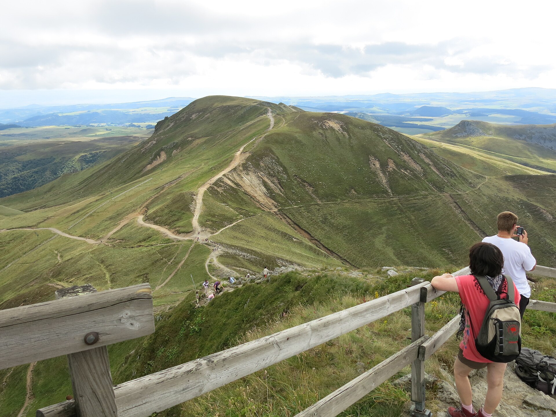
Puy Ferrand rises above Chambon-sur-Lac, at the heart of the Sancy massif in Auvergne. It reaches 1,854 metres, making it the second-highest summit of the massif after Puy de Sancy (1,885 m). Together with neighbouring peaks it forms a volcanic ridge overlooking the Chaudefour valley.
What makes this summit worth knowing about?
Puy Ferrand is a product of the same volcanic activity that shaped the whole Monts Dore range. Its eastern face drops steeply toward the Chaudefour valley and has long drawn climbers — it's one of the key alpine climbing sites in Auvergne, alongside the north face of Puy de Sancy. In winter, snow and ice fill the couloirs on that face, drawing ice climbers looking for technical routes; in summer the same rock offers harder scrambling and climbing lines for more experienced visitors.
How do you get there and what does the approach involve?
The starting point is the D36 road linking Mont-Dore and Chambon-sur-Lac, where a car park sits next to the Maison de la Réserve Naturelle Nationale de la Vallée de Chaudefour. From there, trails climb toward the summit, including a route along the ridge known as the crête du Moine. Another option is descending from Puy de Sancy itself — leaving the GR4 and GR30 trails to follow the ridge across to Puy Ferrand. Hikers after a wilder approach can take the path passing near the Cascade de l'Aigle waterfall, where mouflon and chamois are often spotted.
What will you see along the way and from the top?
The whole area lies within the Chaudefour Valley Nature Reserve, one of the most valuable natural sites in the Auvergne Volcanoes Regional Nature Park. Wild mouflon and chamois roam the slopes, and birds of prey can often be seen circling above the rock faces. From the summit of Puy Ferrand, the view takes in the neighbouring peaks of the Sancy massif, including Puy Gros and Puy de Sancy, along with the broad sweep of the Chaudefour valley below.
When is the best time to visit?
Summer and early autumn bring dry trails and the clearest views, making this the easiest window for a walking ascent without specialist gear. In winter, the eastern face turns into a destination for experienced alpinists chasing ice and snow couloirs — a serious undertaking that calls for proper equipment and preparation. In spring, after the snow melts, it's worth checking trail conditions, since the steeper sections can stay slippery.
Who is this route suited for?
The classic walking routes up Puy Ferrand suit hikers with good fitness who are used to mountain terrain — no climbing gear is needed, but the steep sections and the Sancy massif's changeable weather call for caution and good judgment. The eastern face is a different matter altogether, aimed at climbers looking for technical routes, especially in winter conditions.
Frequently asked questions
How high is Puy Ferrand? The summit reaches 1,854 metres, making it the second-highest peak in the Sancy massif after Puy de Sancy (1,885 m).
Where's the best place to start the hike? Most hikers start from the car park on the D36 road between Mont-Dore and Chambon-sur-Lac, next to the Maison de la Réserve Naturelle de la Vallée de Chaudefour.
Can you see wildlife on the trail? Yes — the Chaudefour valley nature reserve is home to mouflon and chamois, and birds of prey are frequently seen above the summit's rock faces.
Is the eastern face of Puy Ferrand suitable for beginner climbers? No — it's terrain for experienced climbers, especially in winter, when the couloirs fill with the snow and ice conditions favoured by alpinists.
Nearby places

Earn badges for the places you visit
Download NextOnTrip, discover new places and check off your trails.