About this place
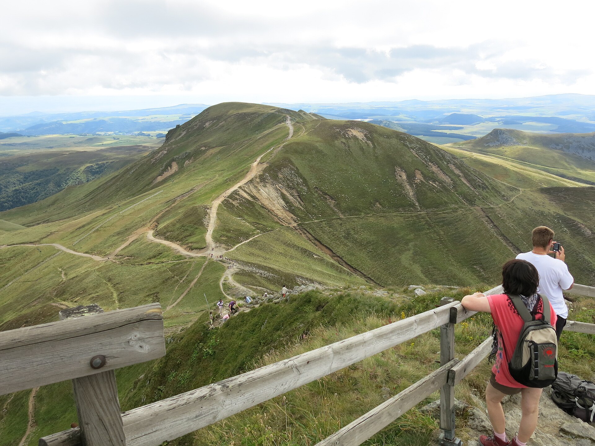
Puy de Cliergue is a volcanic peak in the Massif du Sancy, rising above the spa town of Mont-Dore in the Puy-de-Dôme department, in the heart of the Auvergne region. The word "puy" refers to the eroded volcanic domes and cones scattered across this part of France, and Cliergue is one of several such summits ringing Mont-Dore, right next to Puy de Sancy, the highest point of the entire Massif Central.
How do you get there?
Most hikers start from the Parking des Longes, the trailhead for a route that links Puy de Cliergue with the neighboring peak of Le Capucin (also called Pic du Capucin). The full loop, known locally as "Le Capucin et le Puy de Cliergue," covers roughly 11 kilometers and takes about 4 hours to complete, with the ridge section leading to Cliergue itself forming a demanding but shorter part of the walk — often described as a 3.5-hour loop for fit walkers. From Clermont-Ferrand, driving to Mont-Dore takes around an hour, and the trailhead parking lot is just a short drive further into the mountains.
What will you see?
The path runs along an open ridge with wide views over the Dordogne valley and toward Puy de Sancy itself. The landscape is unmistakably volcanic: rounded, gently sloping domes cut by deep valleys, the eroded remains of Auvergne's ancient stratovolcanoes. Walkers who want to extend the outing can continue from the Cliergue ridge to the nearby summit of Le Capucin in about half an hour, gaining an even broader panorama over the Massif du Sancy. In summer the ridge is covered with the grasses and wildflowers typical of Auvergne's high mountain pastures, and on clear days further peaks toward Super Besse come into view.
When should you visit?
The best time to hike Puy de Cliergue is between June and September, once the trails have dried out, snow has melted, and mountain temperatures are comfortable enough for a long walk. Spring and autumn weather in the Massif du Sancy can change quickly, so it is worth checking the forecast before setting out — the exposed ridge is prone to strong wind and sudden cloud cover. In winter the surrounding slopes turn into ski terrain, and the hiking route to Cliergue is not practical without proper winter equipment.
Frequently asked questions
How long does it take to hike Puy de Cliergue? The ridge section itself, as part of the loop with Le Capucin, takes about 3.5 hours, while the full loop connecting both summits usually takes around 4 hours.
Is the trail difficult? Yes, it is described as a demanding loop that calls for good fitness, sturdy hiking boots, and enough water, especially on sunny days since the open ridge offers little shade.
Where is the best starting point? The Parking des Longes near Mont-Dore is the most convenient trailhead, with the path leading directly toward the Cliergue and Capucin ridge.
What can you see from the summit? The ridge offers views over the Dordogne valley and Puy de Sancy, and on clear days you can also make out further peaks of the Massif du Sancy toward Super Besse.
Nearby places

Earn badges for the places you visit
Download NextOnTrip, discover new places and check off your trails.