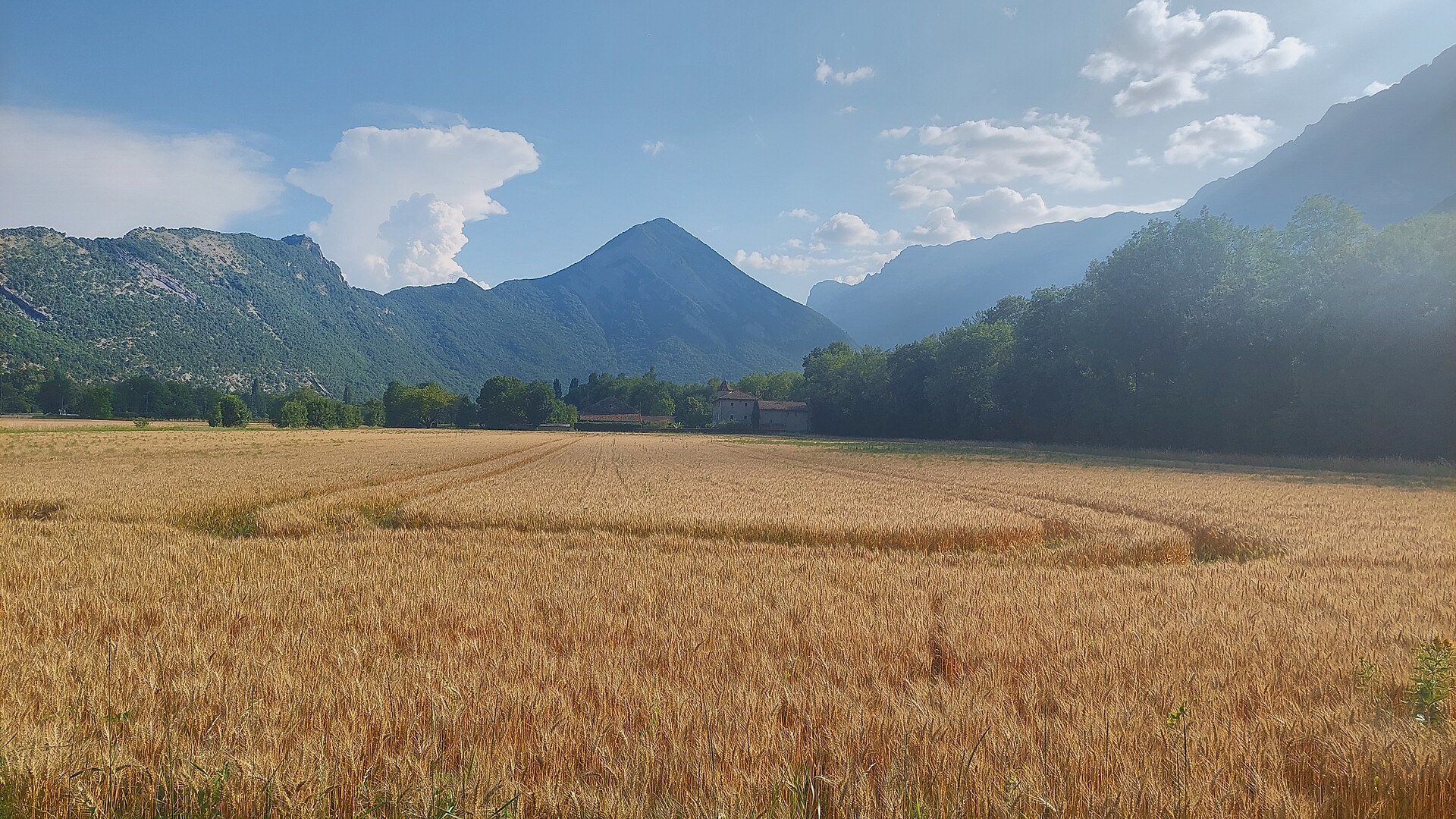
About this place
Le Pieu is a 1,270-metre summit and the highest point of the Montagne d'Uriol, straddling the border between the communes of Saint-Paul-de-Varces and Vif on the eastern edge of the Vercors massif. Locally also known as "le Bémont," it is the culminating point of the whole Saint-Paul-de-Varces commune.
How do you get there?
The classic starting point is the Pont du Batou bridge over the Lavanchon stream, reached via the D107 road from Varces-Allières. The trailhead is also served by public transport, making it a practical car-free day out from the Grenoble area. Saint-Paul-de-Varces itself sits in a valley at the foot of Pic Saint-Michel, on the eastern flank of the Vercors plateau.
What will you see on the trail?
The loop around the summit, known as the Tour du Pieu, takes roughly 5 hours and winds through dense forest covering the mountain's slopes. The toughest section is the final 250 metres of ascent — a steep, wooded stretch where the path is sometimes faint, so sturdy footwear and attention are needed. The rest of the route follows gentler, scenic forest tracks.
From the top, the panorama opens wide: the Grenoble conurbation and the Drac plain, the Vercors massif with its distinctive rocky "barrier," the Chartreuse range, the Belledonne chain, the Grandes Rousses, and Taillefer peak are all visible. Pic Saint-Michel (1,966 m) rises nearby, dominating the surrounding landscape.
When should you visit?
Spring and summer are the best times to climb, when the trails are dry and the views are clearest. In autumn the Vercors forests turn colourful, though the path can get slippery after rain. In winter, the steep wooded final stretch can be difficult or hazardous without proper gear, so it's worth checking snow conditions before setting out.
Who is this trail suited for?
Given the full loop's length (about 5 hours) and the steep, occasionally indistinct final climb, Le Pieu suits hikers with some basic mountain experience who are comfortable on uneven forest terrain. It remains fairly under the radar compared with the Vercors' better-known peaks, so visitors can expect a quieter, low-key atmosphere even in season.
Frequently Asked Questions
How high is Le Pieu? The summit reaches 1,270 metres and is the highest point of both the Montagne d'Uriol and the Saint-Paul-de-Varces commune.
How long does the climb take? The full loop, known as the Tour du Pieu, takes about 5 hours, with the toughest stretch on the last 250 metres of ascent.
Where's the best place to start the hike? The classic starting point is the Pont du Batou bridge over the Lavanchon stream, reached via the D107 from Varces-Allières; the trailhead is also accessible by public transport.
What can you see from the summit? A wide panorama over Grenoble, the Drac plain, the Vercors massif, the Chartreuse and Belledonne ranges, the Grandes Rousses, Taillefer, and the nearby Pic Saint-Michel (1,966 m).
Nearby places

Earn badges for the places you visit
Download NextOnTrip, discover new places and check off your trails.