About this place
Zwercheck (Czech: Svaroh) is one of the higher summits shared by the Bavarian Forest and the Bohemian Forest, sitting squarely on the border between Germany and the Czech Republic near Železná Ruda, in the Klatovy district. At 1,333 metres, its ridge has long divided two different worlds — an open, waymarked German side and a strictly protected Czech flank inside Šumava National Park.
Where is Zwercheck and how high is it?
The mountain rises exactly on the German-Czech frontier, within the Bavarian Forest (Bayerischer Wald) and Bohemian Forest (Šumava) mountain system, close to Železná Ruda in the Klatovy district. Its summit reaches 1,333 metres above sea level, placing it among the taller peaks of this border range, alongside neighbouring Jezerní hora and Ostrý. The top itself is rocky and forested, with the state border effectively running across its highest point.
Why does the mountain have two different names?
On the Czech side it is known as Svaroh, on the German side as Zwercheck — two names for the same summit, a pattern common to peaks straddling the old Královský hvozd (Royal Forest), the historic belt of woodland that once shielded Bohemia's western frontier. The dual naming reflects centuries of this range serving as a natural, hard-to-cross boundary between the two lands.
Why can the summit only be reached from the German side?
The Czech slope of Zwercheck/Svaroh lies within the strict protection zone of Šumava National Park, so no marked trails climb it from that side — the summit can only be reached from Bavaria. A popular route starts at the Scheibensattel car park (around 1,050 m) and follows the waymarked LO5 trail, known as the Zwerchecker Steig, along the ridge of the Künisches Gebirge. On the German side lies the Bavarian Forest National Park, one of Germany's oldest national parks, known for its extensive, partly untouched spruce-fir forests.
What views does the Zwercheck ridge offer?
Among hikers, Zwercheck is considered something of an underrated viewpoint. Along its ridge sits a lookout nicknamed the "Naturkino" — a natural amphitheatre with roughly twenty seating spots where visitors watch the sunset over the Lamer Winkel valley, with views toward Hohen Bogen, Ostrý (Osser) and the Große Arber. On clear days, the summit itself offers views across the Bohemian and Bavarian forests, and occasionally even a distant glimpse of the Alps. On the Czech side, the outlook opens toward Černé jezero (Black Lake), one of the best-known glacial lakes of the Šumava.
What is the mountain's tourist history?
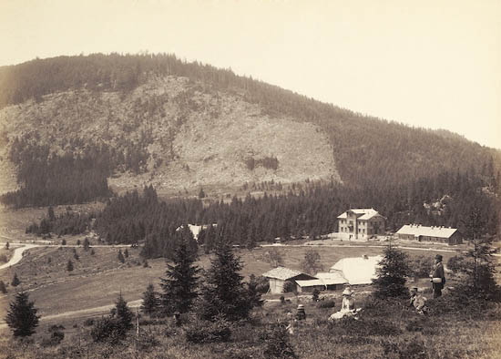
Zwercheck/Svaroh has a long history as a hiking destination. According to accounts from the late 19th century, a wooden lookout tower once stood just below the summit, offering views of Black Lake. In 1932, a fifty-bed mountain lodge called Juránkova chata was built in the saddle between Svaroh and neighbouring Jezerní hora. The lodge later burned down and was never fully rebuilt — today only its foundations remain, a quiet trace of the tourism that once thrived along this stretch of the border.
Frequently asked questions
How high is Zwercheck? The summit reaches 1,333 metres above sea level.
Are Zwercheck and Svaroh the same mountain? Yes — Zwercheck is the German name and Svaroh the Czech name for the same border summit.
Can you hike up from the Czech side? No. The Czech slope lies within the protected zone of Šumava National Park and has no marked trails; the summit is only accessible from Bavaria.
Which trail leads to the top? The popular LO5 route, the Zwerchecker Steig, starts at the Scheibensattel car park at roughly 1,050 metres.
What is worth seeing along the ridge? The "Naturkino" viewpoint, with views toward the Lamer Winkel, Hohen Bogen, Ostrý and the Große Arber, and on clear days a distant view of the Alps.
Nearby places

Earn badges for the places you visit
Download NextOnTrip, discover new places and check off your trails.