About this place
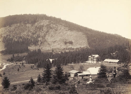
Jezerní hora rises above Železná Ruda, a small town in the Bohemian Forest (Šumava) near the Czech-Bavarian border. At 1,344 m, it is the highest peak of the Královský hvozd (Royal Forest) range and of the entire Železnorudské hory, sitting almost exactly on the main European watershed.
Where is Jezerní hora located?
The mountain stands roughly 5 km northwest of Železná Ruda, deep in the northwestern Šumava, right along the border area with Bavaria. Its German name, Seewand ("lake wall"), points to the steep rock faces that drop toward two glacial lakes below. The upper part of the massif is unusually flat, while the lower slopes fall away sharply into a pair of glacial cirques.
What will you see there?
The real draw isn't the summit itself but the lakes carved into its flanks. On the northern side lies Černé jezero (Black Lake), the largest and deepest natural glacial lake in the Czech Republic, sitting at 1,008 m. On the eastern side is Čertovo jezero (Devil's Lake). Above Black Lake rises Jezerní stěna, a dramatic rock wall that dominates the view from several lookout points in the area.
The main summit (1,344 m) itself lies inside the Černé and Čertovo Lake National Nature Reserve, and no marked trail leads to it - the area is strictly protected. Instead, hikers head for what's known as Jezerní hora's "S peak" (south peak), about 2 km north of the true summit, on a southeastern spur on the far side of Black Lake, reaching 1,093 m. From there you get open views over both lakes and the surrounding Šumava ridgelines.
How do you get there?
Železná Ruda is the natural starting point, with marked trails leading toward Black Lake through forest and along streams flowing down from the massif. From the lakeside viewpoints, the trail continues up to the S peak. Expect a demanding stretch of elevation gain and steep sections near the lakes, so plan for a full day and sturdy hiking boots.
When should you visit?
Late spring through early autumn (May-October) is the best window, when trails are dry and the views over the lakes and rock face are at their most striking. Summer weekends bring crowds to Black Lake, so an early start pays off. In winter the region turns into a cross-country skiing area, but pushing higher toward the massif demands experience and proper gear because of snow and ice.
Frequently asked questions
Can you hike to the actual summit of Jezerní hora? No - the main peak (1,344 m) lies inside the Černé and Čertovo Lake National Nature Reserve and has no trail. Hikers instead reach the accessible "S peak" nearby, at 1,093 m.
What else is worth seeing nearby? Černé jezero (Black Lake), the Czech Republic's largest natural glacial lake, Čertovo jezero on the other side of the massif, and the Jezerní stěna rock wall above Black Lake.
How far is it from Železná Ruda? The summit sits about 5 km northwest of town, while Black Lake - the main hiking destination - is around 6 km away.
Is the trail difficult? The route runs mostly through forest paths with steep sections near the lakes. It demands decent fitness but no technical climbing skills.
Nearby places

Earn badges for the places you visit
Download NextOnTrip, discover new places and check off your trails.