About this place
Můstek is a summit in the northern part of the Šumava (Bohemian Forest) range, the highest point of the Pancíř ridge (Pancířský hřbet), rising to roughly 1,234–1,235 metres above sea level. It sits about 8 km north of Železná Ruda, near the village of Prášily, right on the edge of Šumava National Park. This is a destination for hikers who prefer a quiet, forested route away from the crowds found on some of the region's more famous peaks.
How do you get to Můstek?
The most common approach starts from Špičácké sedlo, the saddle known for the nearby Špičák ski resort. From there a red-marked trail runs along the ridge toward the Pancíř peak and then continues north to Můstek. An alternative route passes through the crossroads known as "Pod Habrem," at around 1,148 metres, where blue and yellow trails meet before leading to another junction, "Pod Můstkem," just below the actual summit. The hike doesn't demand special fitness, but plan for several hours round trip if you're starting from the valley floor.
What will you see at the top?
The spot most hikers associate with Můstek is a wooden signpost and three crosses, where the majority stop to take photos and consider the climb complete. What's less obvious is that the true, highest point of the mountain lies about 150 metres further south, tucked into dense forest and marked only by a small geodetic survey point measuring 1,234.54 metres — a marker that barely rises above the surrounding ground, easy to miss unless you're specifically looking for it.
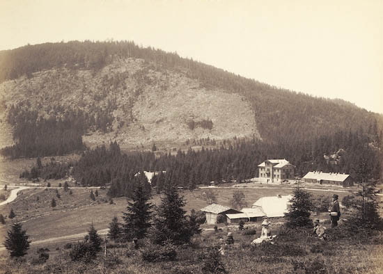
North of the summit, in an area now reclaimed by forest, a mountain hut once stood. It burned down completely in 1995, and today nothing remains to suggest it was ever there except mentions in older guidebooks and hikers' accounts. Unlike the neighbouring Pancíř, Můstek itself doesn't open up into a wide panorama — it's covered in the dense forest typical of this stretch of the Šumava, which makes it more of a quiet forest summit than a scenic viewpoint.
When should you visit?
The best window for hiking runs from May through October, when trails are dry and the forest is at its greenest. Autumn, especially October, brings out the characteristic colours of the beech and spruce woods covering this part of the Šumava, adding some visual variety to an otherwise shaded route. In winter, the area around Špičák turns into a ski resort, and the trail to Můstek sees some use from snowshoers and winter hikers, though that requires proper gear and preparation.
Frequently asked questions
Is there a marked trail to Můstek? Yes — a red-marked trail runs across the summit and its approaches, with blue and yellow trails crossing it lower down, giving hikers a few route options.
Can you see a panoramic view from Můstek? Not really — the peak is forested, so open views are better found along the approach or from the neighbouring Pancíř, which sits on the same ridge.
Where exactly is the mountain's highest point? Not at the signpost and crosses where most hikers stop, but about 150 metres further south in the forest, marked by a small geodetic survey point.
Is there anywhere to rest near the summit? There used to be a mountain hut, but it burned down in 1995 and nothing has replaced it — it's worth planning rest stops earlier, for example at one of the trail junctions.
Nearby places

Earn badges for the places you visit
Download NextOnTrip, discover new places and check off your trails.