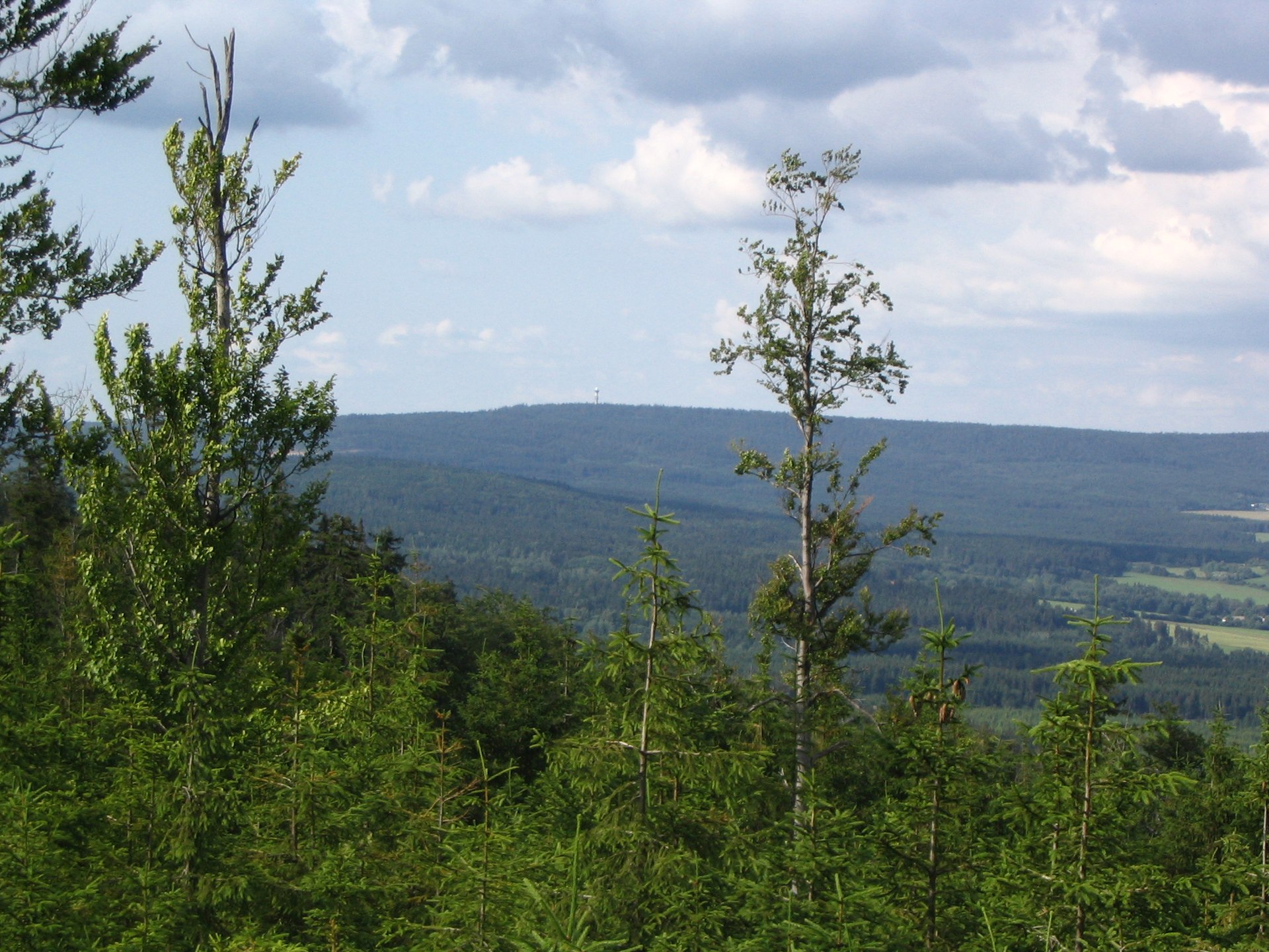
About this place
Praha is a hill in the Brdy mountains, one of the highest summits in the range, rising just outside the village of Nepomuk near Rožmitál pod Třemšínem. Despite the name, it has nothing to do with the Czech capital — this Praha sits less than 2 kilometers from Nepomuk, deep inside the Brdy Protected Landscape Area, one of the wildest and least populated corners of central Bohemia.
Why is a hill called Prague?
The name sounds like a mix-up, but it has a genuine historical explanation. During the Czech National Revival, some hills and localities across Bohemia and Moravia were named after significant Czech and Moravian towns — which is how a small "Praha" ended up sitting in the middle of the Brdy forests, far from the real capital. It's a fun detail for visitors checking the map: the actual Prague lies dozens of kilometers to the north.
What will you see at the summit?
Praha rises to roughly 863 meters above sea level, making it the second-highest peak in the entire Brdy range. The summit is topped by a distinctive, roughly 60-meter tower that houses a meteorological radar and once also served as a television transmitter. The viewing platform on the tower, at around 916 meters elevation, offers a panorama that reaches the Šumava mountains, the Ore Mountains (Krušné hory), and the Krkonoše range on clear days — and, according to local accounts, even the Alps under exceptional visibility.
The tower itself has a layered history. During World War II, Nazi Germany built a Luftwaffe navigation radar station on the summit, used to guide aircraft. After the war, the Czechoslovak army took over the facility, and since 2000 it has been operated by the Czech Hydrometeorological Institute (ČHMÚ) — which is why the hill still plays an active role in weather monitoring for a large part of the country.
How do you get to Praha?
The easiest starting point is the village of Nepomuk, from where a blue-marked hiking trail leads directly to the summit. You can park in the village and walk up — the route is short but crosses land that was once part of a military training area, so it's best to stick to the marked path. The whole area belongs to the Brdy Protected Landscape Area, protected for its forests, peat bogs, and rare wildlife that survived here thanks to decades of restricted public access.
When is the best time to visit?
Spring and summer are the most reliable seasons for the Brdy hills, with dry trails and the clearest views from the tower. Autumn brings striking forest colors visible from the viewpoint, while winter can make the higher parts of Brdy harder to access due to snow and the fog typical of the range's upper elevations — though the hike remains doable for well-prepared visitors.
Frequently asked questions
Does the Praha hill have any connection to the Czech capital? No, it's purely a naming coincidence. The hill got its name during the Czech National Revival, when some elevations were named after well-known cities.
How high is Praha hill? About 863 meters above sea level, making it the second-highest summit in the whole Brdy range.
Can you climb the observation tower? The tower functions as a ČHMÚ weather station, so access to the structure itself is restricted, but the nearby viewpoint is open to hikers.
Where's the best place to start the hike? From the village of Nepomuk, where a blue-marked trail leads straight to the summit.
Nearby places

Earn badges for the places you visit
Download NextOnTrip, discover new places and check off your trails.