About this place
Černá skála is a small but geologically notable nature reserve in the Žďárské vrchy hills, located within the cadastral area of Sněžné, roughly one and a half kilometers south of the village of Křižánky. The rock formation rises on the northeastern slope of Suchý vrch at an elevation of 774 meters above sea level, tucked into the forested highlands of the Bohemian-Moravian Highlands.
What kind of rock formation is this?
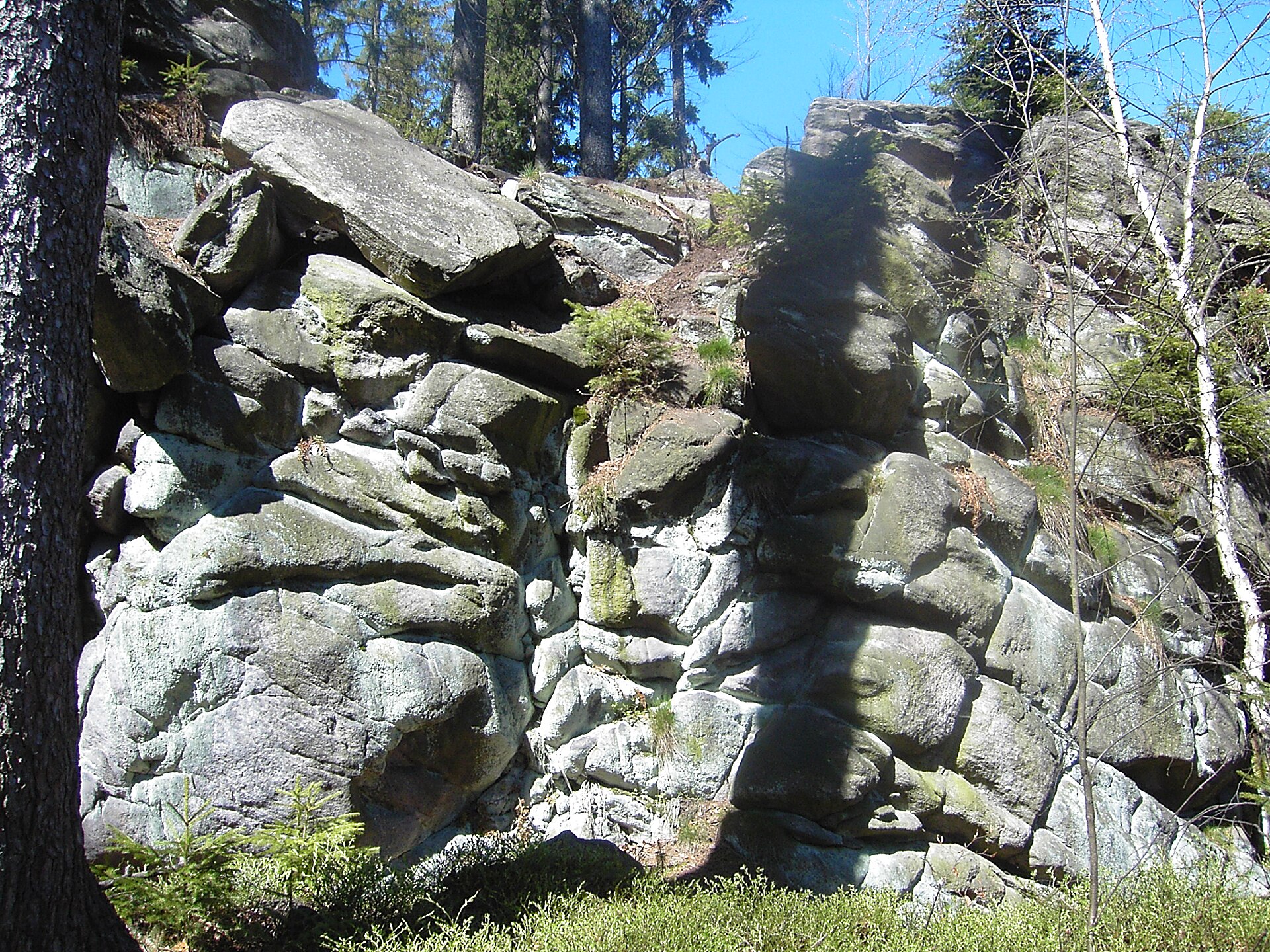
Černá skála is a gneiss rocky ridge stretching about seventy meters in length. Its eastern wall, fifteen meters long, overhangs noticeably, giving the outcrop its distinctive silhouette within this part of the Žďárské vrchy. Geomorphologically, it is classified as a frost scarp — a formation shaped by frost weathering, a process typical of the highland terrain of central Bohemia and Moravia. The rock block itself measures roughly 20 by 10 by 10 meters.
Why is this site protected?
Protection here centers on the gneiss rock formation as a textbook example of a frost scarp created through physical weathering, along with the vegetation growing on the surrounding silicate rock and the forest stands that surround it. The protected area covers 3 hectares in total and was granted legal protection in 1979. It falls under the management of the Nature Conservation Agency of the Czech Republic (AOPK ČR), specifically the regional office overseeing the Žďárské vrchy Protected Landscape Area, within whose boundaries the reserve lies.
How accessible is the reserve?
Unlike many other similar nature reserves in the region, Černá skála has no marked hiking trail leading to it. This keeps the site considerably less visited than the better-known lookout points of the Žďárské vrchy, and it also explains why the formation has retained its wild, untouched character over the decades.
Where exactly is Černá skála located?
The reserve's coordinates are approximately 49.6677 N, 16.0626 E. It sits at the heart of the Žďárské vrchy, a hilly region straddling the border between Bohemia and Moravia, known for its granite and gneiss rock outcrops, extensive forests, and scenic river valleys. The area around Suchý vrch, on whose slope the rock stands, is typical of the Vysočina highland landscape: mixed forests, gentle hills, and scattered rocky formations.
Frequently asked questions
Can you hike to Černá skála? Because there is no marked trail and the site holds nature reserve status, it is not set up for mass tourism — visiting requires caution and respect for the applicable nature protection rules.
What sets Černá skála apart from other rock formations in Žďárské vrchy? Its origin is the key distinction — a classic frost scarp shaped by frost weathering rather than, say, water erosion — combined with the complete lack of tourist infrastructure, which sets it apart from the region's better-known and more accessible sites.
Since when has the area been protected? Černá skála received formal legal protection in 1979 and is managed by AOPK ČR as part of the Žďárské vrchy Protected Landscape Area.
How large is the reserve? The protected area covers 3 hectares, encompassing the rock formation itself along with the adjacent forest and the rock-dwelling vegetation growing on it.
Nearby places

Earn badges for the places you visit
Download NextOnTrip, discover new places and check off your trails.