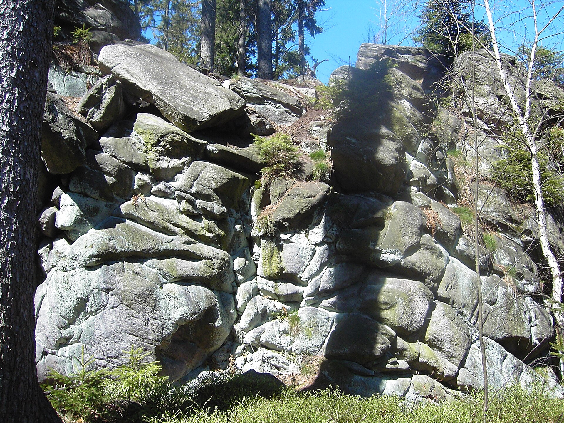
About this place
Milovské Perničky is a small but geologically remarkable nature reserve in the Žďár Hills, roughly two kilometers northeast of the village of Křižánky, straddling the cadastral boundary between Křižánky and Milovy in the Vysočina Region. The rocky summit rises to 757 meters above sea level and is protected across an area of 10.4 hectares, with an additional 50-meter buffer zone around it.
How did these rocks form?
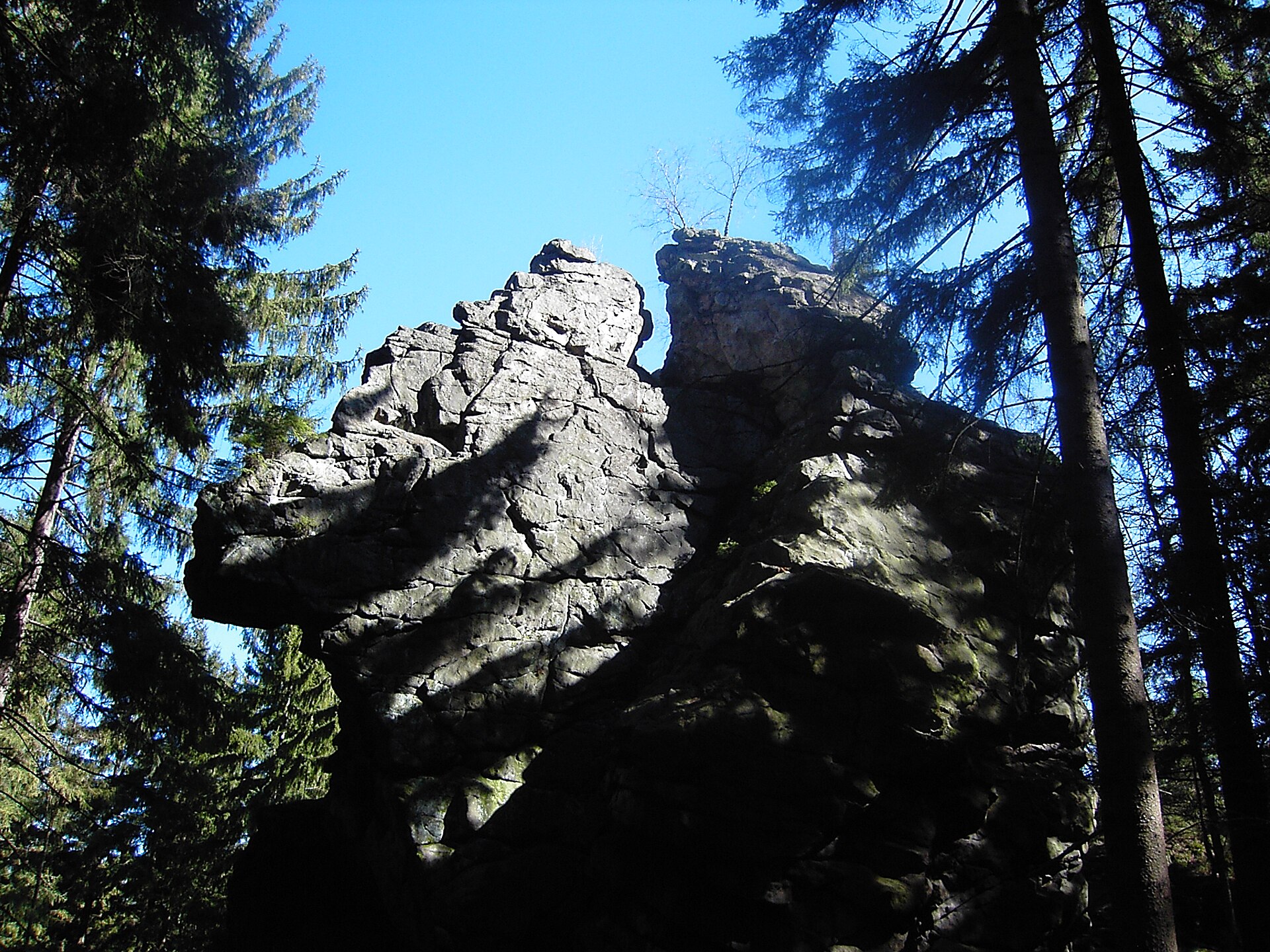
The distinctive outcrop is made of migmatite, a hard metamorphic rock that survived while the softer surrounding material eroded away. This process unfolded throughout the Quaternary period and was driven mainly by frost weathering — repeated freezing and thawing of water inside rock fissures gradually widened cracks and carved the mass into its current shape. The tallest section of the rock ridge rises about 25 meters above the trail, forming a striking, steep wall visible from a distance.
Where does the name come from?
On the flat top of the rock ridge sit eight naturally formed, rounded hollows carved into the stone — so-called weathering pans. The largest measures about 87 centimeters across and 30 centimeters deep. Local folk tradition likened these bowl-shaped depressions to gingerbread molds, which is how the site got its name — "Perničky" means roughly "little gingerbreads" in Czech. These erosional features are the reserve's core natural value and the main reason for its protection.
Since when has the site been protected?
The rock formation was declared a nature reserve in 1977. The goal of the protection is to preserve the unique frost-weathering forms along with the rocky landscape itself, which stands as a valuable example of the geomorphological processes typical of the upland terrain of the Žďár Hills.
How do you get there?
A marked hiking trail leads to the summit from Křižánky, passing through a point known as Čtyři palice ("Four Clubs"). From the rocky top, a designated viewpoint opens onto the surrounding rolling landscape of the Žďár Hills — the round trip usually takes no more than an hour, making it an easy destination for a short outing.
Frequently asked questions
How large is the Milovské Perničky reserve? The protected area covers 10.4 hectares, surrounded by an additional 50-meter buffer zone.
How tall is the rock formation at Milovské Perničky? The highest part of the outcrop rises about 25 meters above the trail, with the summit itself sitting at 757 meters above sea level.
Where does the name "Perničky" come from? From eight round erosional hollows on top of the rock that resemble gingerbread molds in shape — the largest is 87 cm across.
When was the reserve established? The area was protected in 1977 because of its exceptional frost-weathering formations in migmatite rock.
How do you reach Milovské Perničky? Via a marked hiking trail from Křižánky through the Čtyři palice waypoint — the route is short and requires no special fitness preparation.
Nearby places

Earn badges for the places you visit
Download NextOnTrip, discover new places and check off your trails.