About this place
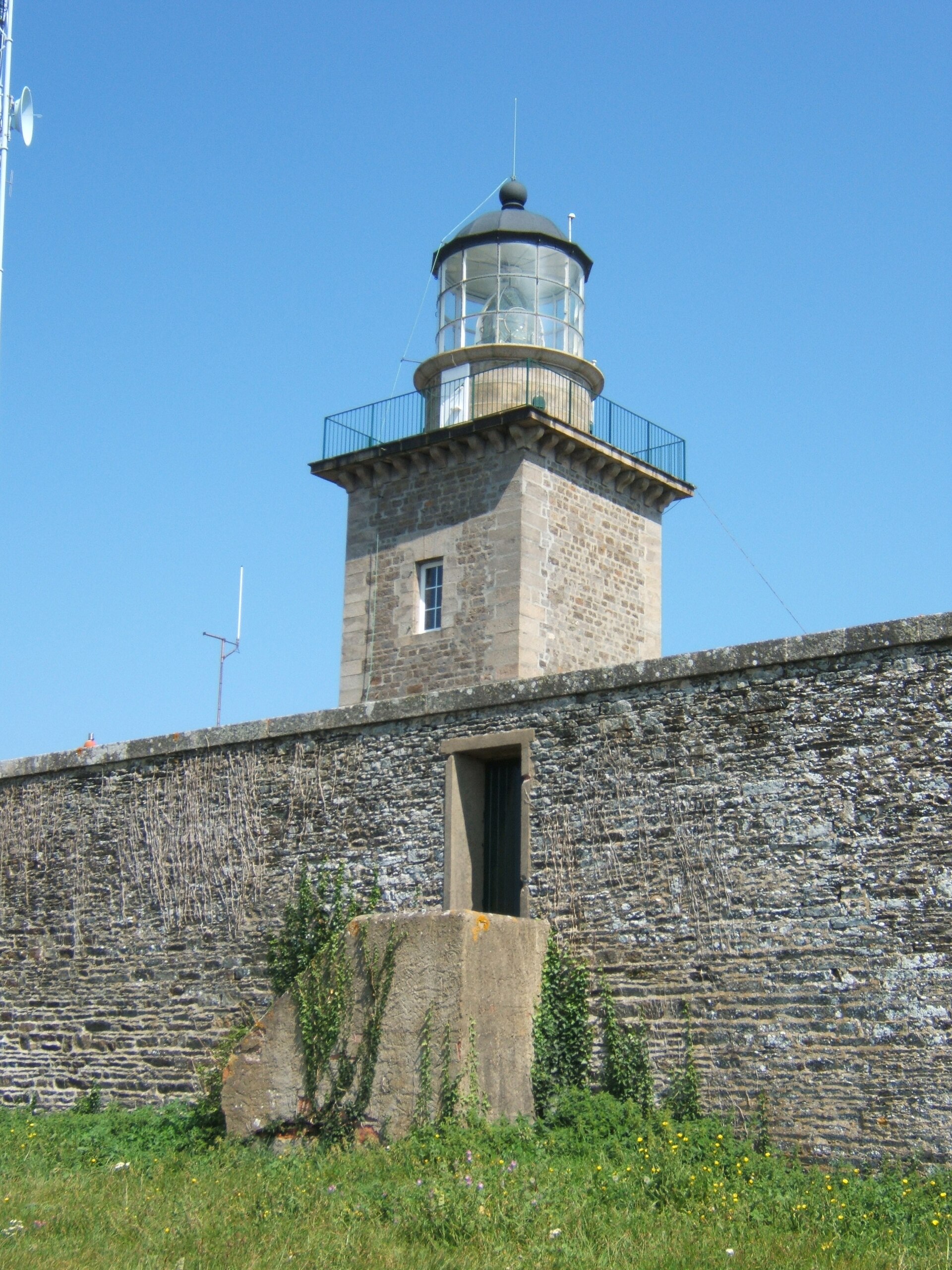
Phare du Cap Lévi is a lighthouse standing on the rocky Cap Lévi headland in Fermanville, in the Manche department, between Gatteville-le-Phare and Cherbourg. It's one of the recognizable landmarks of the Cotentin coast — a square, pink-granite tower rising above the sea and coastal heathland.
How do you get to Cap Lévi?
Fermanville sits on the northern coast of the Cotentin peninsula, a short drive from Cherbourg. A local road leads to the headland, where there's a small car park; from there it's just a brief walk to the tower. The cape also lies on the coastal footpath (sentier des douaniers, part of the GR223), so it's easy to reach on foot from nearby beaches and villages as part of a longer clifftop walk.
What's the history behind the lighthouse?
Construction was approved in March 1851, after a string of shipwrecks off this treacherous cape — including the frigate La Résolue, wrecked in June 1833. Work began in 1854, but a dispute between the state and contractor Lévesque over costs led to the contract being cancelled in 1856. The job was handed to contractor Baude, and the lighthouse was first lit on 31 December 1858. It was built from pink granite quarried at Fermanville and Montfarville, the same stone used in many buildings along this stretch of coast.
In 1901 the lighthouse was upgraded: a mercury float was installed to let the optic rotate more easily, and the fixed white light was replaced with a red flashing light with a range of 30 km in clear weather and 12 km in fog. The fuel source changed over time — from vegetable oil to mineral oil, then to vaporized petroleum — before the lighthouse was finally electrified in 1937.
The Second World War cut its working life short: in 1941 the Germans removed the optic and shipped it to Paris, then blew up the tower on 28 June 1944. Reconstruction ran from 31 March 1947 to 14 June 1948, and the light was relit in July 1948. The lighthouse was automated in the mid-1970s.
What will you see on site?
Today's tower stands 28 metres tall with 113 steps, built on a square plan with rounded corners and a plain but striking pink-granite finish. The lighthouse runs automatically and isn't open for interior visits, but the headland itself — rocks, heathland, and open views across the English Channel — makes for a worthwhile stop. Right next to the tower stands the Fort Napoléonien du Cap Lévi, a Napoleonic-era coastal defence work that adds another layer of interest to a walk around the cape.
When's the best time to visit?
Spring and summer are the best seasons, when the clifftop paths are dry and the views are at their widest — sunsets over the water here are particularly striking. In autumn and winter the headland is heavily exposed to wind and rain, which gives it a rawer character but makes a longer walk less comfortable.
Frequently asked questions
Can you go inside the lighthouse? No — it's an automated lighthouse and isn't open for interior visits. You can view and photograph it from outside.
How tall is the Cap Lévi lighthouse? The tower is 28 metres high, with 113 steps inside.
Why was the lighthouse built here? Cap Lévi was the site of frequent shipwrecks, including the frigate La Résolue in 1833, which pushed authorities to approve construction of a lighthouse in 1851.
What else is there to see nearby? The Fort Napoléonien du Cap Lévi stands right beside the lighthouse, and the headland lies on a coastal footpath running along the Cotentin cliffs.
Nearby places

Earn badges for the places you visit
Download NextOnTrip, discover new places and check off your trails.