About this place
Izera (also known as Jizera) is a 1,122-metre summit rising directly above the Czech town of Hejnice in the Jizera Mountains. Built from coarse-grained, porphyritic Variscan-age granite with notably large feldspar crystals, this dome-shaped peak is the highest point of the Hejnice Ridge and of the entire Jizera Highlands — surpassed in the whole range only by Wysoka Kopa (1,126 m) on the Polish side.
What makes the Izera summit distinctive?
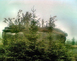
The top of the mountain is crowned by two clusters of enormous granite boulders and tors, clearly visible from a distance against an open, treeless summit clearing. A small viewing platform with a railing and a cross has been built on the largest boulder, reached by short ladders and steps cut into the rock. The summit itself lies inside the Prales Jizera nature reserve, a 92.44-hectare protected area on the cadastral territory of Hejnice that preserves near-natural forest stands and rock formations.
The name is no coincidence: the surrounding high plateau of the Jizera Mountains is where the Jizera River rises before flowing through the Liberec region and joining the Elbe as its right tributary.
How do you get to the top from Hejnice?
The shortest route starts at the Smědava pass, on the road connecting Hejnice with Harrachov, where hikers can park before following red and then yellow trail markers for roughly 2.5 km to the summit. A longer alternative begins right in the centre of Hejnice and loops via Ořešník, the Štolpich waterfalls (Štolpišský vodopád), the Izera summit itself, the Polední kameny rocks and the dramatic Frýdlantské cimbuří ridge — a full-day circuit that takes in the most scenic corners of this part of the range. The summit can only be reached from the northeast, via a yellow-marked path branching off the main red trail at the Pod Jizerou junction, in the saddle between Izera and Smědavská hora.
What can you see from the top?
The peak rises 120 to 230 metres above the surrounding leveled plateau, and on a clear day the panorama takes in nearly all of the Jizera Mountains, the wetland meadows of Klečové louky at its foot, the Krkonoše (Giant Mountains) to the east, and the distinctive cone of Ještěd to the west, roughly 22 km away as the crow flies.
When is the best time to visit?
Because the exposed, treeless summit and its rocky viewing platform offer little shelter, calm and clear days give the best experience — summer, when the trails are dry and easy to follow, or autumn, when visibility is often at its sharpest. In winter, the final approach can be tricky due to ice on the summit boulder and platform, so extra caution is worth taking before climbing up for the view.
Frequently asked questions
How high is Izera? The summit stands at 1,122 metres above sea level, making it one of the highest points in the Jizera Mountains, just behind Wysoka Kopa (1,126 m) on the Polish side.
How long does the hike from Hejnice take? The shortest approach from the Smědava pass covers about 2.5 km, which usually means roughly 1–1.5 hours one way depending on fitness and conditions.
Is there a viewing point at the top? Yes — the largest summit boulder carries a small platform with a railing and a cross, reached via short ladders, with views stretching toward the Krkonoše and Ještěd.
Is the area around the summit protected? Yes, the peak lies within the Prales Jizera nature reserve (92.44 ha) on the territory of Hejnice, which protects old forest stands and rock formations around the summit.
Nearby places

Earn badges for the places you visit
Download NextOnTrip, discover new places and check off your trails.