About this place
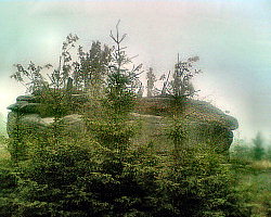
Čihadlo is a quiet, forested peak rising above the village of Albrechtice v Jizerských horách, deep in the Jizera Mountains of northern Czechia. Reaching 967 metres above sea level, it marks the western boundary of the municipality — a low-key but locally well-known landmark for hikers moving through this part of the range.
Where exactly is Čihadlo?
The peak sits right by a crossroads known locally as Na Knajpě (also spelled Na kneipě in some sources), a familiar orientation point for anyone hiking the Jizera Mountains. Below its northern slope runs the Štolpišská silnice, a road connecting the surrounding hamlets. Čihadlo itself is far from dramatic — its prominence is a mere 14 metres, and the nearest named summit, Na kneipě, lies just half a kilometre away. That modesty is typical of the Jizera Mountains as a whole: a landscape of gentle, wooded rises rather than jagged peaks.
How do you get to Čihadlo?
No marked trail runs directly over the summit, which is worth knowing before setting out. A blue-marked trail passes about 300 metres northwest of the top, heading toward Josefův Důl, while a red-marked route loops around the peak's western side without ever crossing it. Reaching the actual summit means a short detour off the marked path through the forest — a common situation for many of the Jizera Mountains' lower, less prominent peaks, which tend to draw hikers looking for quiet woodland walks rather than sweeping views.
What else is worth knowing about the area?
Two memorial crosses stand near Čihadlo, quiet markers of local history. Pařízkův kříž commemorates a young man killed in a truck accident in 1989. Tischerův kříž marks the spot where a skier died of a heart attack in 2004. Both crosses are understated but meaningful points on the map of this stretch of the Jizera Mountains — reminders that even gentle, unassuming terrain has its own stories.
Who is this spot for?
Čihadlo suits hikers who appreciate the calmer, less-trodden corners of the Jizera Mountains and don't need a dramatic viewpoint to enjoy a walk. It pairs naturally with a longer route through the Albrechtice v Jizerských horách area toward Josefův Důl, offering a short detour to break up the main trail. The dense coniferous forest covering its slopes provides shade even on warmer days, and the low foot traffic here means plenty of quiet and a close feel for the surrounding nature.
Frequently asked questions
How high is Čihadlo? The peak reaches 967 metres above sea level and forms the western boundary of the Albrechtice v Jizerských horách municipality.
Is there a marked trail to the summit? No trail crosses the top directly. A blue trail passes about 300 m to the northwest (toward Josefův Důl), and a red trail loops around the peak from the west.
What do the crosses near the summit commemorate? They are Pařízkův kříž and Tischerův kříž, memorials to two tragic deaths — a 1989 truck accident and a skier's fatal heart attack in 2004.
Are there views from the top? Čihadlo is a forested, low-relief summit without notable viewpoints — its appeal lies in a peaceful woodland walk rather than a panorama.
Nearby places

Earn badges for the places you visit
Download NextOnTrip, discover new places and check off your trails.