Save this place and discover nearby attractions with NextOnTrip
In the app you can add it to your favorites, see what else is worth visiting nearby on the map, and earn a badge for your visit.
The app is available for iPhone and Android.
About this place
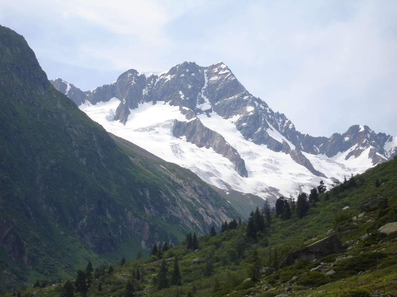
Gwächtenhorn (3,420 m) is a glaciated summit in the Urner Alps on the border of the Swiss cantons of Bern and Uri. Innertkirchen, in the Haslital valley, is the nearest village on the Bern side, and the road from there climbs towards the Susten Pass beneath the mountain.
Where is the Gwächtenhorn?
The peak sits on the main ridge, with Bern to the north and Uri to the south. Its northern slopes drop to the Stein Glacier and the Susten Pass area, while the southern side faces the Chelen Glacier in Uri. Coordinates are roughly 46.69° N, 8.41° E. A few sources quote a slightly lower height of 3,404 m, so guidebooks may differ.
How do you climb it?
This is a high-alpine objective that calls for glacier gear and experience. The base is the SAC Tierberglihütte near the Susten Pass. Two main lines lead up from there:
- Glaciated east flank – the normal route, described by SAC as easy and frequently climbed.
- Rocky west ridge – more interesting but harder; it can be combined with a traverse from the Tierberglimi and a descent via the Rotstock to the Sustenlimi pass.
In summer the east ridge (grade AD) is also recommended. From the saddle near the hut the summit takes about 3 hours, and one tour listing gives around 5 hours of ascent and about 1,560 m of climbing for the full day (figures vary with the starting point).
What will you see?
The mountain is climbed less often than its better-known neighbours, so the route is often quiet. From the top you look across the glacier basins on both sides of the ridge, the Stein Glacier and the switchbacks of the Susten road. Do not confuse it with another peak of the same name near the Triftkessel and Gelmer area.
When should you go?
The mountaineering season runs mainly from summer into early autumn, when the hut is staffed and glacier conditions are easiest to read. Check current conditions with the SAC and use a forecast for 3,400 m. With open crevasses or fresh snow, hire a mountain guide.
Frequently asked questions
How high is the Gwächtenhorn?
Usually given as 3,420 m, though 3,404 m also appears.
Which hut is the starting point?
The SAC Tierberglihütte, close to the Susten Pass.
Is the route difficult?
The normal glacier route is rated easy, but roped glacier travel is needed. The west ridge is harder.
Which mountains is it part of?
The Urner Alps, on the Bern–Uri cantonal border.
Nearby places

Earn badges for the places you visit
Download NextOnTrip, discover new places and check off your trails.